95820c8fab42553474d6d3c8d56f01ec.ppt
- Количество слайдов: 29
 Weather Reports and Forecasts
 METAR • METAR is the scheduled observation taken at the end of each hour.
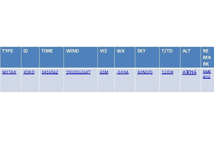 TYPE ID TIME WIND VIS WX SKY T/TD ALT RE MA RK METAR KORD 041656 Z 19020 G 26 KT 6 SM -SHRA BKN 070 12/08 A 3016 RMK AO 2
 Type • 2 Different Types: – 1. ) METAR, Standard Observation every hour – 2. ) SPECI is an observation taken at an unscheduled time due to certain criteria that is met such as low visibility, low clouds, frozen precipitation, or thunderstorms.
 ID • Station identifier. • KFNL • KDIA
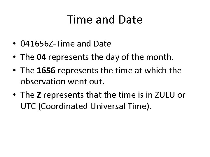 Time and Date • 041656 Z-Time and Date • The 04 represents the day of the month. • The 1656 represents the time at which the observation went out. • The Z represents that the time is in ZULU or UTC (Coordinated Universal Time).
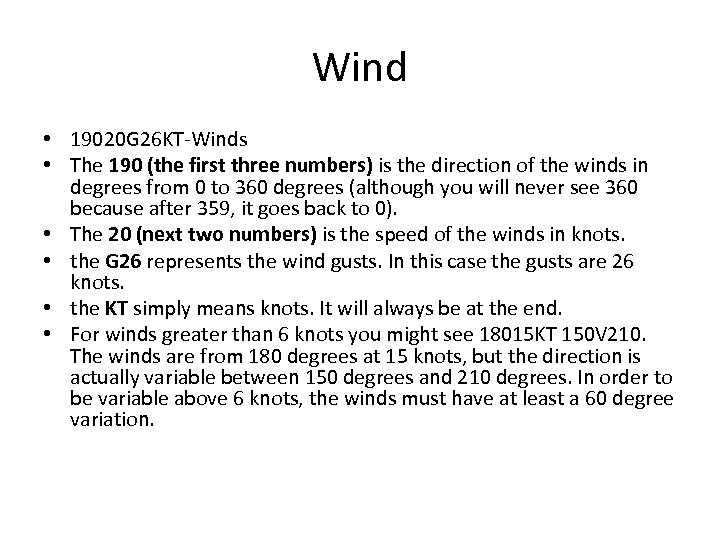 Wind • 19020 G 26 KT-Winds • The 190 (the first three numbers) is the direction of the winds in degrees from 0 to 360 degrees (although you will never see 360 because after 359, it goes back to 0). • The 20 (next two numbers) is the speed of the winds in knots. • the G 26 represents the wind gusts. In this case the gusts are 26 knots. • the KT simply means knots. It will always be at the end. • For winds greater than 6 knots you might see 18015 KT 150 V 210. The winds are from 180 degrees at 15 knots, but the direction is actually variable between 150 degrees and 210 degrees. In order to be variable above 6 knots, the winds must have at least a 60 degree variation.
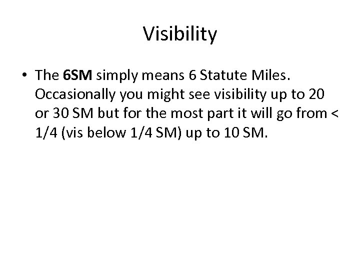 Visibility • The 6 SM simply means 6 Statute Miles. Occasionally you might see visibility up to 20 or 30 SM but for the most part it will go from < 1/4 (vis below 1/4 SM) up to 10 SM.
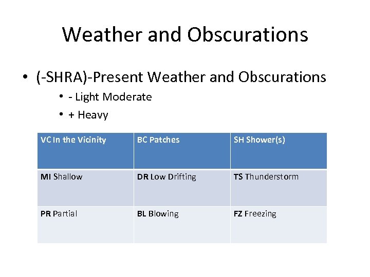 Weather and Obscurations • (-SHRA)-Present Weather and Obscurations • - Light Moderate • + Heavy VC In the Vicinity BC Patches SH Shower(s) MI Shallow DR Low Drifting TS Thunderstorm PR Partial BL Blowing FZ Freezing
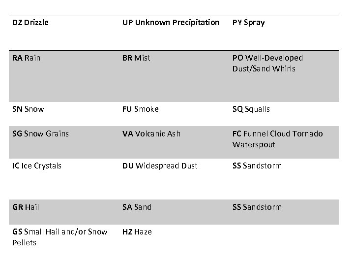 DZ Drizzle UP Unknown Precipitation PY Spray RA Rain BR Mist PO Well-Developed Dust/Sand Whirls SN Snow FU Smoke SQ Squalls SG Snow Grains VA Volcanic Ash FC Funnel Cloud Tornado Waterspout IC Ice Crystals DU Widespread Dust SS Sandstorm GR Hail SA Sand SS Sandstorm GS Small Hail and/or Snow Pellets HZ Haze
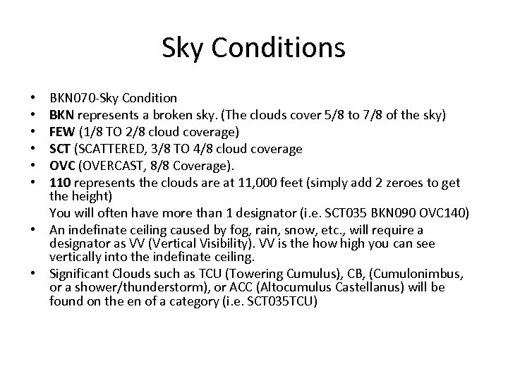 Sky Conditions BKN 070 -Sky Condition BKN represents a broken sky. (The clouds cover 5/8 to 7/8 of the sky) FEW (1/8 TO 2/8 cloud coverage) SCT (SCATTERED, 3/8 TO 4/8 cloud coverage OVC (OVERCAST, 8/8 Coverage). 110 represents the clouds are at 11, 000 feet (simply add 2 zeroes to get the height) You will often have more than 1 designator (i. e. SCT 035 BKN 090 OVC 140) • An indefinate ceiling caused by fog, rain, snow, etc. , will require a designator as VV (Vertical Visibility). VV is the how high you can see vertically into the indefinate ceiling. • Significant Clouds such as TCU (Towering Cumulus), CB, (Cumulonimbus, or a shower/thunderstorm), or ACC (Altocumulus Castellanus) will be found on the en of a category (i. e. SCT 035 TCU) • • •
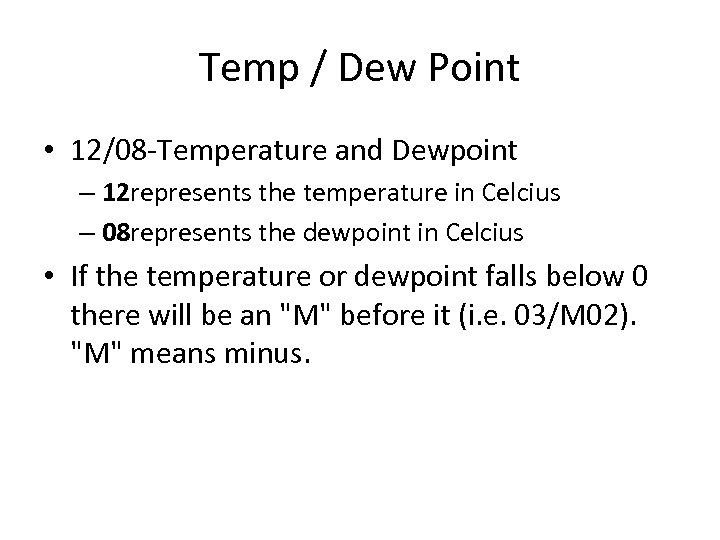 Temp / Dew Point • 12/08 -Temperature and Dewpoint – 12 represents the temperature in Celcius – 08 represents the dewpoint in Celcius • If the temperature or dewpoint falls below 0 there will be an "M" before it (i. e. 03/M 02). "M" means minus.
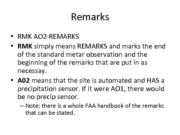 Remarks • RMK AO 2 -REMARKS • RMK simply means REMARKS and marks the end of the standard metar observation and the beginning of the remarks that are put in as necessay. • A 02 means that the site is automated and HAS a precipitation sensor. If it were AO 1, there would be no precip sensor. – Note: there is a whole FAA handbook of the remarks that can be stated.
 TAF
TAF
 Terminal Aedrome Forecast • TAFs apply to a 5 statute mile radius from the center of the airport complex • TAFs complement and use similar encoding to METAR • Routine TAFs are valid for 24 -hours. • TAFs are scheduled for issuance 4 times daily at 0000 Z, 0600 Z, 1200 Z, and 1800 Z.
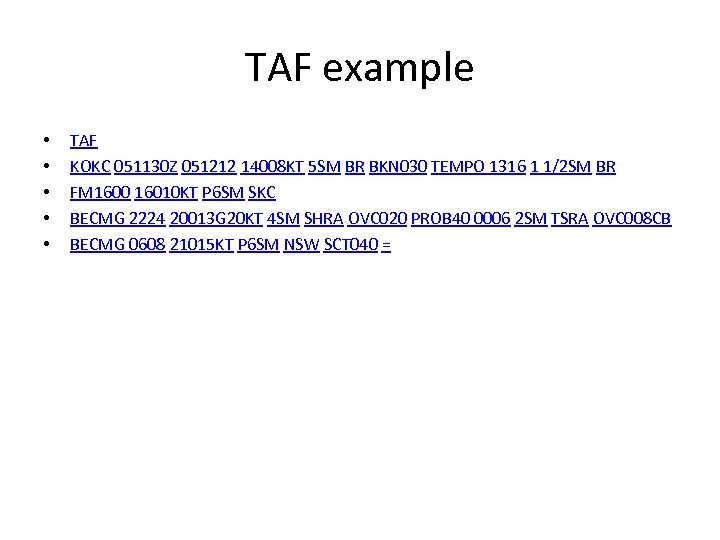 TAF example • • • TAF KOKC 051130 Z 051212 14008 KT 5 SM BR BKN 030 TEMPO 1316 1 1/2 SM BR FM 1600 16010 KT P 6 SM SKC BECMG 2224 20013 G 20 KT 4 SM SHRA OVC 020 PROB 40 0006 2 SM TSRA OVC 008 CB BECMG 0608 21015 KT P 6 SM NSW SCT 040 =
 • A TAF report contains the following sequence of elements in the following order: • 1. Type of Report • 2. ICAO Station Identifier • 3. Date and Time of Origin • 4. Valid Period Date and Time • 5. Forecast Meteorological Conditions
 Type • There are 2 types of reports: – 1. ) TAF, standard – 2. ) TAF AMD, an amended TAF
 Station Identifier • The ICAO four letter station identifier. • KOKC • KSEA
 Date and Time • (051130 Z) – This element is the UTC date and time the forecast is actually prepared. The format is a two-digit date and four-digit time followed, without a space, by the letter Z. Routine TAFs are prepared and filed approximately one-half hour prior to scheduled issuance times. TAFs are scheduled for issuance foure times daily at 0000 Z, 0600 Z, 1200 Z, and 1800 Z.
 Valid Period • (051212) • The UTC valid period of the forecast is a two-digit date followed by the two-digit beginning hour and two-digit ending hour. Routine TAFs are valid for 24 -hours. Valid periods beginning at 0000 Z shall be indicated as 00. Valid periods ending at 0000 Z shall be indicated as 24. The 24 indication applies to all time group ending times. – 091212 - Forecast valid from the ninth at 1200 Z til the tenth at 1200 Z.
 Probability Forecast • (PROB 40 0006) – The probability or chance of thunderstorms or other precipitation events occuring, along with associated weather conditions (wind, visibility, and sky conditions). • Examples: PROB 40 = 40% chance – PROB 40 2102 1/2 SM +TSRA - Chance between 2100 Z and 0200 Z of visibility one-half thunderstorm, heavy rain. – PROB 40 1014 1 SM RASN - Chance between 1000 Z and 1400 Z of visibility one rain and snow. – PROB 40 2024 2 SM FZRA - Chance between 2000 Z and 0000 Z of visibility two freezing rain.
 From Group • (FM 1600) – The FM group is used when a rapid change, usually occuring in less than one hour, in prevailing conditions is expected. • Examples: – FM 0100 SKC - After 0100 Z sky clear – FM 1430 OVC 020 - After 1430 Z ceiling two thousand overcast
 Becoming Group • The BECMG group is used when a gradual change in conditions is expected over a longer time period, usually two hours. • Example: – OVC 012 BECMG 1416 BKN 020 - Ceiling one thousand two hundred overcast. Then a gradual change to ceiling two thousand broken between 1400 Z and 1600 Z.
 Temporary Group • The TEMPO group is used for any conditions in wind, visibility, weather, or sky condition which are expected to last for generally less than an hour at a time • Examples: – SCT 030 TEMPO 1923 BKN 030 - Three thousand scattered with occasional ceilings three thousand broken between 1900 Z and 2300 Z. – 4 SM HZ TEMPO 0006 2 SM BR HZ - Visibility four in haze with occasional visibility two in mist and haze between 0000 Z and 0600 Z.
 AWOS • Automated Weather Observing System – is a highly sophisticated data sensing, processing and dissemination system. – Updated weather reports are produced once each minute, however, observations are only transmitted every 20 minutes to the Flight Service and NWS. Other ways of receiving the information are over a radio frequency or by phone.
 ASOS • Automated Surface Observing System – Designed to support weather forecast activities and aviation operations – ASOS works non-stop, updating observations every minute, 24 hours a day, every day of the year. – The ASOS reporting is available through the aircraft radio and Over the telephone.
 RVR • The horizontal distance a pilot may see down the runway. • RVR is measured in increments of 100 feet up to 1, 000 feet, increments of 200 feet from 1, 000 feet to 3, 000 feet, and increments of 500 feet above 3, 000 feet to 6, 000 feet


