

2fe2685d04c2704cfd456ac996671a13.ppt
- Количество слайдов: 80
 Vespucci Summer School 2010 Modelling Human-Environment Interactions: Theories and Tools Gilberto Câmara Licence: Creative Commons By Attribution Non Commercial Share Alike http: //creativecommons. org/licenses/by-nc-sa/2. 5/
 By the Year 2050… 9 billion people: 6 billion tons of GHG and 60 million tons of urban pollutants. Resource-hungry: We will withdraw 30% of available fresh water. Risky living: 80% urban areas, 25% near earthquake faults, 2% in coast lines less than 1 m above sea level.
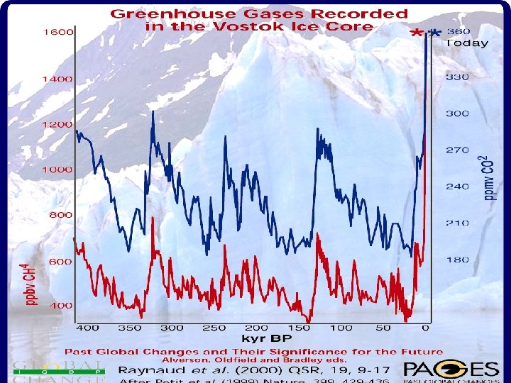
 The fundamental question of our time How is the Earth’s environment changing, and what are the consequences for human civilization? fonte: IGBP
") from Jackie Mc. Glade (EEA)
from Jackie Mc. Glade (EEA)
") Can we avoid that this…. Source: Carlos Nobre (INPE)
Can we avoid that this…. Source: Carlos Nobre (INPE)
") Fire. . . …. becomes this? Source: Carlos Nobre (INPE)
Fire. . . …. becomes this? Source: Carlos Nobre (INPE)
") source: Global Land Project Science Plan (IGBP)
source: Global Land Project Science Plan (IGBP)
 Global Land Project • What are the drivers and dynamics of variability and change in terrestrial humanenvironment systems? • How is the provision of environmental goods and services affected by changes in terrestrial humanenvironment systems? • What are the characteristics and dynamics of vulnerability in terrestrial humanenvironment systems?
 Impacts of global land change More vulnerable communities are those most at risk
 Human actions and global change photo: C. Nobre Global Change Where are changes taking place? How much change is happening? Who is being impacted by the change? What is causing change? photo: A. Reenberg
 ~230 scenes Landsat/year Deforestation in Amazonia
 What is a Model? Deforestation in Amazonia in 2020? simplified representation of a process Model = entities + relations + attributes + rules
 Computational models Connect expertise from different fields Make the different conceptions explicit If (. . . ? ) then. . . Desforestation?
") Computational models Connect expertise from different fields Make the different conceptions explicit Territory (Geography) Money (Economy) Modelling (GIScience) Culture (Antropology)
Computational models Connect expertise from different fields Make the different conceptions explicit Territory (Geography) Money (Economy) Modelling (GIScience) Culture (Antropology)
 Modelling and Public Policy External Influences System Ecology Economy Politics Scenarios Policy Options Decision Maker Desired System State
 Earth as a system
 images: USGS Slides from LANDSAT Modelling Human-Environment Interactions How do we decide on the use of natural resources? 1973 1987 2000 Aral Sea Can we describe and predict changes resulting from human decisions? What computational tools are needed to model humanenvironment decision making?
 We need spatially explicit models to understand human-environment interactions Nature: Physical equations Describe processes Society: Decisions on how to Use Earth´s resources
 f (It+1) F f (It+2) F f ( It+n") Dynamic Spatial Models f (It) f (It+1) F f (It+2) F f ( It+n ) . . “A dynamical spatial model is a computational representation of a real-world process where a location on the earth’s surface changes in response to variations on external and internal dynamics” (Peter Burrough)
Dynamic Spatial Models f (It) f (It+1) F f (It+2) F f ( It+n ) . . “A dynamical spatial model is a computational representation of a real-world process where a location on the earth’s surface changes in response to variations on external and internal dynamics” (Peter Burrough)
 Dynamic Spatial Models Forecast tp - 20 tp - 10 tp Calibration Source: Cláudia Almeida Calibration tp + 10
 Which is the better model?
 Uncertainty on basic equations Limits for Models Social and Economic Systems Quantum Gravity Particle Physics Living Systems Global Change Chemical Reactions Hydrological Models Solar System Dynamics Complexity of the phenomenon Meteorology source: John Barrow (after David Ruelle)
 How do we decide on the use of natural resources? Soybeans Loggers Competition for Space Small-scale Farming Source: Dan Nepstad (Woods Hole) Ranchers
![Human-enviromental systems [Ostrom, Science, 2005]](https://present5.com/presentation/2fe2685d04c2704cfd456ac996671a13/image-25.jpg "Human-enviromental systems [Ostrom, Science, 2005]") Human-enviromental systems [Ostrom, Science, 2005]
Human-enviromental systems [Ostrom, Science, 2005]
") Types of goods Source: E Ostrom (2005)
Types of goods Source: E Ostrom (2005)
 Institutional analysis Identify different actors and try to model their actions Farms Settlements 10 to 20 anos Recent Settlements (less than 4 years) Source: Escada, 2003 Old Settlements (more than 20 years)
 Institutional arrangements in Amazonia
 are required for human-environment") Question #1 for human-environment models What ontological kinds (data types) are required for human-environment models? Fields Cells (objects)
Question #1 for human-environment models What ontological kinds (data types) are required for human-environment models? Fields Cells (objects)
 Concepts for spatial dynamical models Events and processes Resilience
 Concepts for spatial dynamical models vulnerability degradation
 Concepts for spatial dynamical models biodiversity sustainability and much more… Human-environmental models need to describe complex concepts (and store their attributes in a database)
 Question #2 for human-environment models What models are needed to describe human actions?
 Clouds: statistical distributions Clocks, clouds or ants? Clocks: deterministic equations Ants: emerging behaviour
 Statistics: Humans as clouds y=a 0 + a 1 x 1 + a 2 x 2 +. . . +aixi +E Establishes statistical relationship with variables that are related to the phenomena under study Basic hypothesis: stationary processes Example: CLUE Model (University of Wageningen) Fonte: Verburg et al, Env. Man. , Vol. 30, No. 3, pp. 391– 405
 Spatially-explicit LUCC models n n n Explain past changes, through the identification of determining factors of land use change; Envision which changes will happen, and their intensity, location and time; Assess how choices in public policy can influence change, by building different scenarios considering different policy options.
 What Drives Tropical Deforestation? % of the cases 5% 10% 50% Underlying Factors driving proximate causes Causative interlinkages at proximate/underlying levels Internal drivers *If less than 5%of cases, not depicted here. source: Geist &Lambin (Université Louvain)
 source: Aguiar (2006)") Driving factors of change (deforestation) source: Aguiar (2006)
Driving factors of change (deforestation) source: Aguiar (2006)
 vector") Linear and spatial lag regression models where: Y is an (n x 1) vector of observations on a dependent variable taken at each of n locations, X is an (n x k) matrix of exogenous variables, is an (k x 1) vector of parameters (estimated regression coefficients), and is (n x 1) an vector of disturbances. W is the spatial weights matrix, the product WY expresses the spatial dependence on Y (neighbors), is the spatial autoregressive coefficient.
Linear and spatial lag regression models where: Y is an (n x 1) vector of observations on a dependent variable taken at each of n locations, X is an (n x k) matrix of exogenous variables, is an (k x 1) vector of parameters (estimated regression coefficients), and is (n x 1) an vector of disturbances. W is the spatial weights matrix, the product WY expresses the spatial dependence on Y (neighbors), is the spatial autoregressive coefficient.
 Statistical analysis of deforestation") Statistics: Humans as clouds source: Aguiar (2006) Statistical analysis of deforestation
Statistics: Humans as clouds source: Aguiar (2006) Statistical analysis of deforestation
 CLUE modeling framework 100 x 100 km 2 25 x 25 km 2
 Scenario exploration: linking to process knowledge Manaus. Boa Vista. Santarém Cellular database construction Exploratory analysis and selection of subset of variables Porto Velho- São Felix/ Manaus Iriri Humaitá BR 163 Apuí Boca do Cuiabá-Santarém Acre Aripuanã Scenario exploration
") Scenarios for deforestation in Amazonia (2020)
Scenarios for deforestation in Amazonia (2020)
 Agents as basis for complex systems An agent is any actor within an environment, any entity that can affect itself, the environment and other agents. Agent: flexible, interacting and autonomous
 Agent-Based Modelling Representations Goal Communication Perception Action Environment source: Nigel Gilbert
 Agents: autonomy, flexibility, interaction Synchronization of fireflies
 Bird Flocking No central authority: Each bird reacts to its neighbour Not possible to model the flock in a global manner. Need to necessary to simulate the INTERACTION between the individuals
 and") Requirement #2 for human-environment models Models need to support both statistical relations (clouds) and agents (ants)
Requirement #2 for human-environment models Models need to support both statistical relations (clouds) and agents (ants)
 Question #3 for human-environment models What types of spatial relations exist in nature-society models?
 isotropic Societal space is mostly anisotropic 1975 Rondonia 1986") Natural space is (usually) isotropic Societal space is mostly anisotropic 1975 Rondonia 1986
Natural space is (usually) isotropic Societal space is mostly anisotropic 1975 Rondonia 1986
 Societal spaces are anisotropic Which spatial objects are closer? Which cells are closer? [Aguiar et al. , 2003]
 Requirement #3 for human-environment models: express anisotropy explicitly Euclidean space Closed network Open network D 1 D 2 [Aguiar et al. , 2003]
 Question #4 for human-environment models How do we combine independent multi-scale models with feedback?
") Models: From Global to Local Athmosphere, ocean, chemistry climate model (200 x 200 km) Atmosphere only global climate model (50 x 50 km) Regional climate model (10 x 10 km) Hydrology, Vegetation Soil Topography (1 x 1 km) Regional land use change Socio-economic adaptation (e. g. , 100 x 100 m)
Models: From Global to Local Athmosphere, ocean, chemistry climate model (200 x 200 km) Atmosphere only global climate model (50 x 50 km) Regional climate model (10 x 10 km) Hydrology, Vegetation Soil Topography (1 x 1 km) Regional land use change Socio-economic adaptation (e. g. , 100 x 100 m)
 Human-enviroment models should be multi-scale, multi-approach 25 x 25 km 2 1 x 1 km 2 National level - the main markets for Amazonia products (Northeast and São Paulo) and the roads infrastructure network; Regional level - for the whole Brazilian Amazonia, 4 million km 2; Local level - for a hot-spot of deforestation in Central Amazonia, the Iriri region, in São Felix do Xingu, Pará State [Moreira et al. , 2008]
 Multi-scale modelling: hierarchical relations need to be described Environmental Modeler [Engelen, White and Nijs, 2003] CLUE model [Veldkamp and Fresco, 1996] Nested grids are not enough!
 Requirement #4 for human-environment models: support multi-scale modelling using explicit relationships Express explicit spatial relationships between individual objects in different scales [Moreira et al. , 2008] [Carneiro et al. , 2008]
 Question #5 for human-environment models photos: Isabel Escada How can we express behavioural changes in human societies? Small Farmers When a small farmer becomes a medium-sized one, his behaviour changes Medium-Sized Farmers
 Societal systems undergo phase transitions Isabel Escada, 2003 Farms Settlements 10 to 20 anos Recent Settlements (less than 4 years) Old Settlements (more than 20 years) [Escada, 2003]
 Requirement #5 for human-environment models: Capture phase transitions latency > 6 years Deforesting Newly implanted Year of creation Iddle Small Farmers Deforestation > 80% Slowing down Deforestation = 100% photos: Isabel Escada Deforesting Deforestation > 60% Year of creation Iddle Slowing down Deforestation = 100% Medium-Sized Farmers
 Terra. ME: Computational environment for developing human-environment models Cell Spaces Support for cellular automata and agents Modular modelling tool [Carneiro, 2006]
 Spatial structure in Terra. ME: Cell Spaces integrated with databases
![Terra. ME´s approach: Modular components [Carneiro, 2006] 1. Get first pair 2. Execute the](https://present5.com/presentation/2fe2685d04c2704cfd456ac996671a13/image-63.jpg "Terra. ME´s approach: Modular components [Carneiro, 2006] 1. Get first pair 2. Execute the") Terra. ME´s approach: Modular components [Carneiro, 2006] 1. Get first pair 2. Execute the ACTION 1. return value true Describe spatial structure latency > 6 years Mens. 1 2. 1: 32: 10 Mens. 3 3. 1: 38: 07 Mens. 2 4. 3. Timer =EVENT 1: 32: 00 1: 42: 00 Mens. 4. . . 4. time. To. Happen += period Describe temporal structure Deforesting Newly implanted Year of creation Iddle Slowing down Deforestation = 100% Describe rules of behaviour Describe spatial relations
Terra. ME´s approach: Modular components [Carneiro, 2006] 1. Get first pair 2. Execute the ACTION 1. return value true Describe spatial structure latency > 6 years Mens. 1 2. 1: 32: 10 Mens. 3 3. 1: 38: 07 Mens. 2 4. 3. Timer =EVENT 1: 32: 00 1: 42: 00 Mens. 4. . . 4. time. To. Happen += period Describe temporal structure Deforesting Newly implanted Year of creation Iddle Slowing down Deforestation = 100% Describe rules of behaviour Describe spatial relations
 Spatial Relations in Terra. ME Spatial relations between entities in a nature-societal model are expressed by a generalized proximity matrix (GPM) [Moreira et al. , 2008]
![Terra. ME: multi-scale modelling using explicit relationships [Moreira et al. , 2008] [Carneiro et](https://present5.com/presentation/2fe2685d04c2704cfd456ac996671a13/image-65.jpg "Terra. ME: multi-scale modelling using explicit relationships [Moreira et al. , 2008] [Carneiro et") Terra. ME: multi-scale modelling using explicit relationships [Moreira et al. , 2008] [Carneiro et al. , 2008] Scale 1 father up-scaling Scale 2 children Generalized proximity matrices express explicit spatial relationships between individual objects in different scales
Terra. ME: multi-scale modelling using explicit relationships [Moreira et al. , 2008] [Carneiro et al. , 2008] Scale 1 father up-scaling Scale 2 children Generalized proximity matrices express explicit spatial relationships between individual objects in different scales
 GPM: Relations between cells and agents a From Cell Agent To Cell a [Andrade-Neto et al. , 2008] b c
 Terra. ME uses hybrid automata to represent phase transitions A hybrid automaton is a formal model for a mixed discrete continuous system (Henzinger, 1996) Hybrid Automata = state machine + dynamical systems State A Flow Condition Jump condition State B Flow Condition
 Hybrid automata: simple land tenure model Farmer gets parcel SUBSISTENCE deforest>=60% CATTLE Deforest 20%/year Extensive cattle raising LAND REFORM redistribution Land exhaustion Land revision ABANDONMENT RECLAIM Land registration Public repossession Regrowth STATE Flow Condition Jump Condition Transition SUBSISTENCE Deforest 10% of land/year Deforest > 60% CATTLE Extensive cattle raising Land exhaustion ABANDONMENT Forest regrowth Land revision RECLAIM Public repossession Land registration LAND REFORM Land distribution Farmer gets parcels SUBSISTENCE
 Terra. ME Software Architecture Rondônia. Model São Felix Model Amazon Model Hydro Model Terra. ME Language Terra. ME Compiler Terra. ME Virtual Machine Terra. Lib Terra. ME Framework C++ Signal Processing librarys C++ Mathematical librarys C++ Statistical librarys Terra. Lib [Carneiro, 2006]
 Where is Lua? n Inside Brazil Petrobras, the Brazilian Oil Company ¨ Embratel (the main telecommunication company in Brazil) Terra. ME Programming Language: Extension of LUA ¨ many other companies ¨ LUA is the language of choice for computer games n Outside Brazil Lua is used in hundreds of projects, both commercial and academic ¨ CGILua still in restricted use ¨ n until recently all documentation was in Portuguese source: the LUA team Lua[Ierusalimschy et al, 1996] and the Web
![Terra. ME programming environment [Carneiro, 2006]](https://present5.com/presentation/2fe2685d04c2704cfd456ac996671a13/image-71.jpg "Terra. ME programming environment [Carneiro, 2006]") Terra. ME programming environment [Carneiro, 2006]
Terra. ME programming environment [Carneiro, 2006]
 Amazonia: multiscale analysis of land change and beef and milk market chains with Terra. ME São Felix do Xingu INPE/PRODES 2003/2004: Deforestation Forest Non-forest Clouds/no data
 Change 1997 -2006: deforestation and cattle Forest River Deforest Not Forest
") Agents example: small farmers in Amazonia Settlement/ invaded land Sustainability path (alternative uses, technology) Diversify use money surplus Subsistence agriculture Create pasture/ Deforest Manage cattle bad land management Move towards the frontier Sustainability path (technology) Abandon/Sell the property Buy new land Speculator/ large/small
Agents example: small farmers in Amazonia Settlement/ invaded land Sustainability path (alternative uses, technology) Diversify use money surplus Subsistence agriculture Create pasture/ Deforest Manage cattle bad land management Move towards the frontier Sustainability path (technology) Abandon/Sell the property Buy new land Speculator/ large/small
 Agents example: large farmers in Amazonia Diversify use money surplus/bank loan Buy land from small farmers Create pasture/ plantation/ deforest Manage cattle/ plantation Buy new land Buy calves from small Speculator/ large/small
 Observed deforestation from 1997 to 2006 Forest River Deforest Not Forest
 Regional scale Frontier INDIVIDUAL AGENTS Large and small farmers Local scale SCENARIOS LANDSCAPE DYNAMICS MODEL - Front - Medium - Rear Local farmers Region CATTLE CHAIN MODEL Flows: goods, information, etc. . Connections: Agents
 Landscape model: different rules for two main types of actors Beef and milk market chain model Land use Change model Small farmers Medium and large farmers Landscape metrics model Pasture degradation model Several workshops in 2007 to define model rules and variables
 Landscape model: different rules of behavior at different partitions which also change in time SÃO FÉLIX DO XINGU - 2006 FRONT FRENTE MIDDLE MEIO BACK RETAGUARDA Forest River Deforest Not Forest
 Modeling results 97 to 2006 Observed 97 to 2006