

979c8f080c806c32d1978ce25a666a43.ppt
- Количество слайдов: 29
 U. S. Virgin Islands “Tsunami Ready” Jacqueline J. Heyliger Deputy Director Virgin Islands Territorial Emergency Management Agency (VITEMA) National Tsunami Hazard Mitigation Program Waikiki Beach Marriott Honolulu, Hawaii October 31, 2007
 USVI Primary Hazards Hurricanes l Earthquakes l Tsunamis l
 Tsunamis impacting the USVI 1867 1868 1918 1946
 Frederiksted, St. Croix 1867
 Charlotte Amalie, St. Thomas 1867 The tsunami followed a devastating hurricane by two weeks. The La Plata takes the wave.
 Risk HOVENSA Oil Refinery l Ports l Hotels l Businesses l Residents l
 U. S. Virgin Islands
 Transportation Between Islands l Air l Sea Plane l Shuttle Flights l Boat l Ferry Services
 Sea Plane Primary transportation between St. Croix / St. Thomas
 Sea Plane
 Ferry Service Transportation between St. John and St. Thomas
 Ferry Service – Red Hook
 USVI “Tsunami Ready” Pilot Communities l St. Croix l Frederiksted l St. Thomas l Brewers l Bay St. John l Coral Bay – Waterfront
 towns l Christiansted l Frederiksted") St. Croix l Two (2) towns l Christiansted l Frederiksted
St. Croix l Two (2) towns l Christiansted l Frederiksted
 Christiansted, St. Croix
 Frederiksted, St. Croix
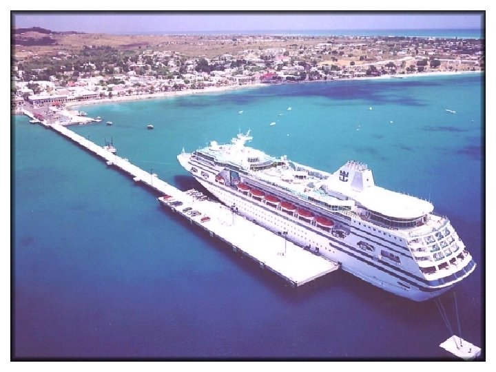
 St. Thomas – Major Cruise Port
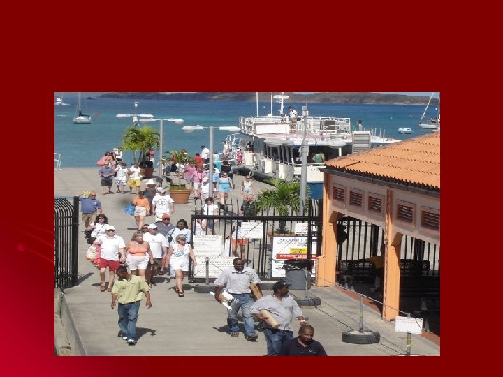
 St. Thomas - Waterfront
 Magens Bay, St. Thomas Magens Bay Authority Where should beach-goers run? How would you inform them?
 Brewers Bay St. Thomas
 Cruz Bay – St. John
 Coral Bay – St. John
 NTHMP - Support
 VITEMA Partners l University l Roy l of the Virgin Islands Watlington Puerto Rico Seismic Network l Christa von Hillebrandt
 BUDGET 2008 l Task I l l INUNDATION MODELING & MAPPING: $20, 000 Task III l l $60, 000 Task II l l MITIGATION/PREPAREDNESS: Tsunami Notification $200, 000 Task IV l $20, 000 TSUNAMI READY: Total $300, 000
 USVI Actions/Proposals towards “Tsunami Readiness” l l l Educate EMC, etc. on tsunami warning and response Develop team on each Island to organize development of “tsunami ready” communities while educating public Identify 24/7 tsunami alert system Utilize expertise available for inundation mapping and modeling Identify locations and place tsunami warning systems
 Thank You