Topic 5 Elevation reference system. Cruising altitude. NATIONAL

14098-topic_5_2.ppt
- Количество слайдов: 30
 Topic 5 Elevation reference system. Cruising altitude. NATIONAL AVIATION UNIVERSITY KIROVOGRAD FLIGHT ACADEMY OF UKRAINE KIROVOGRAD - 2013 Total - 12 hours. Lectures -4 h, Practical work - 4 h, Independent work - 4 h
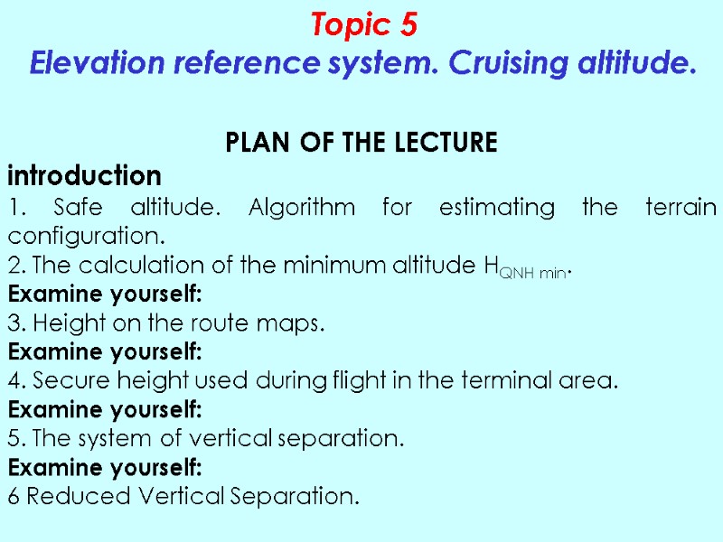
 Topic 5 Elevation reference system. Cruising altitude. PLAN OF THE LECTURE introduction 1. Safe altitude. Algorithm for estimating the terrain configuration. 2. The calculation of the minimum altitude HQNH min. Examine yourself: 3. Height on the route maps. Examine yourself: 4. Secure height used during flight in the terminal area. Examine yourself: 5. The system of vertical separation. Examine yourself: 6 Reduced Vertical Separation.
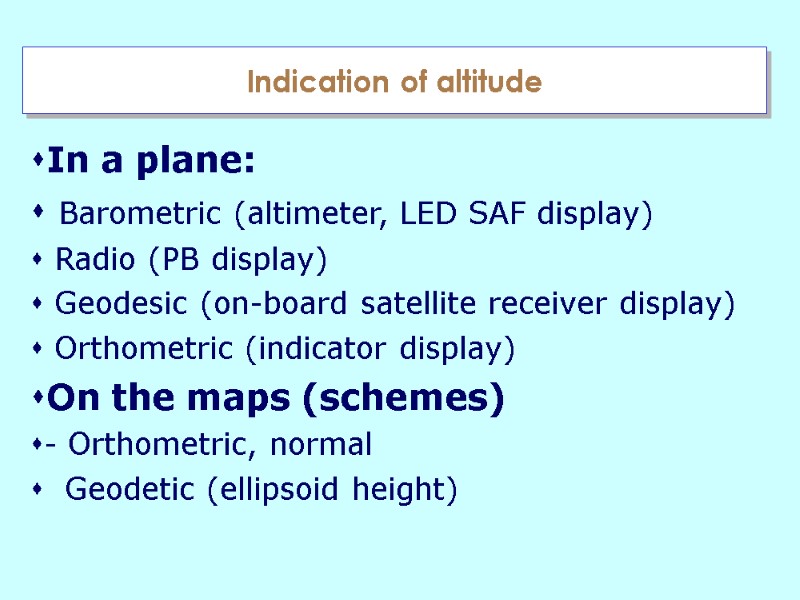
 Indication of altitude In a plane: Barometric (altimeter, LED SAF display) Radio (PB display) Geodesic (on-board satellite receiver display) Orthometric (indicator display) On the maps (schemes) - Orthometric, normal Geodetic (ellipsoid height)
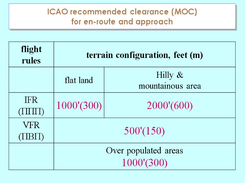
 ICAO recommended clearance (MOC) for en-route and approach
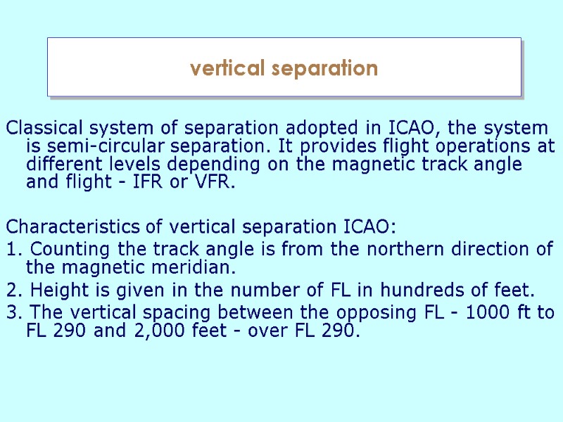
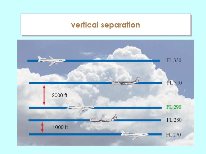
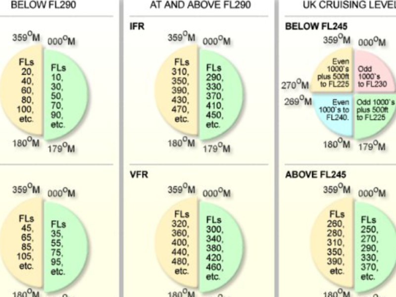
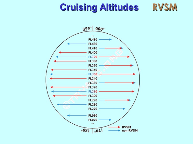
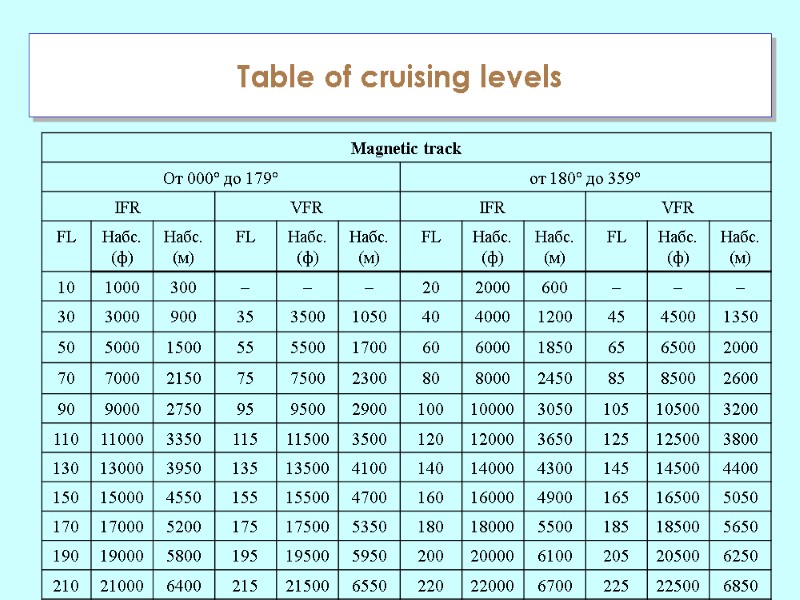
 vertical separation Classical system of separation adopted in ICAO, the system is semi-circular separation. It provides flight operations at different levels depending on the magnetic track angle and flight - IFR or VFR. Characteristics of vertical separation ICAO: 1. Counting the track angle is from the northern direction of the magnetic meridian. 2. Height is given in the number of FL in hundreds of feet. 3. The vertical spacing between the opposing FL - 1000 ft to FL 290 and 2,000 feet - over FL 290.
 vertical separation

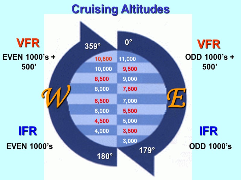
 359° 180° 179° 0° 3,000 3,500 4,000 4,500 5,000 5,500 6,000 6,500 7,000 7,500 8,000 8,500 9,000 9,500 10,000 10,500 11,000 Cruising Altitudes EVEN 1000’s IFR VFR VFR EVEN 1000’s + 500’ ODD 1000’s + 500’ ODD 1000’s IFR E W
 Cruising Altitudes RVSM
 Table of cruising levels
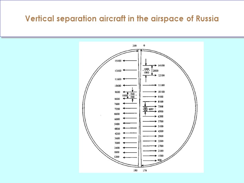
 Vertical separation aircraft in the airspace of Russia
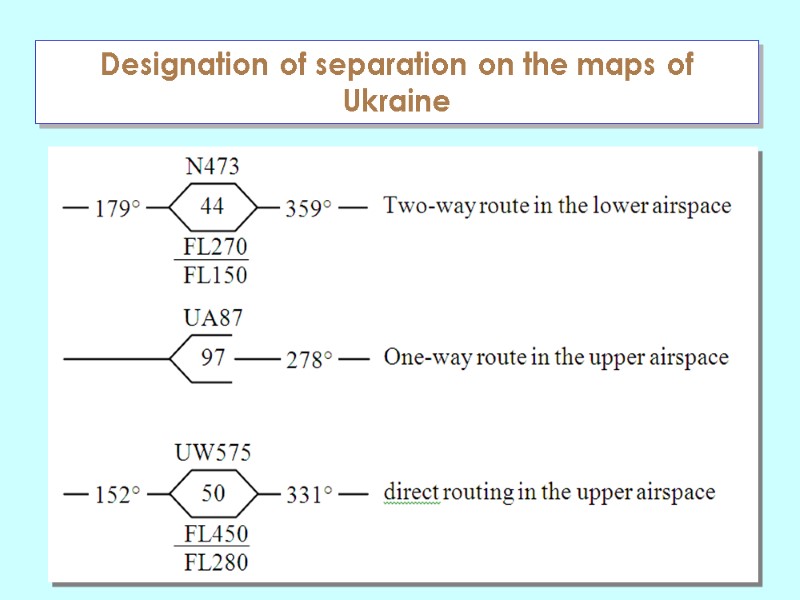
 Designation of separation on the maps of Ukraine
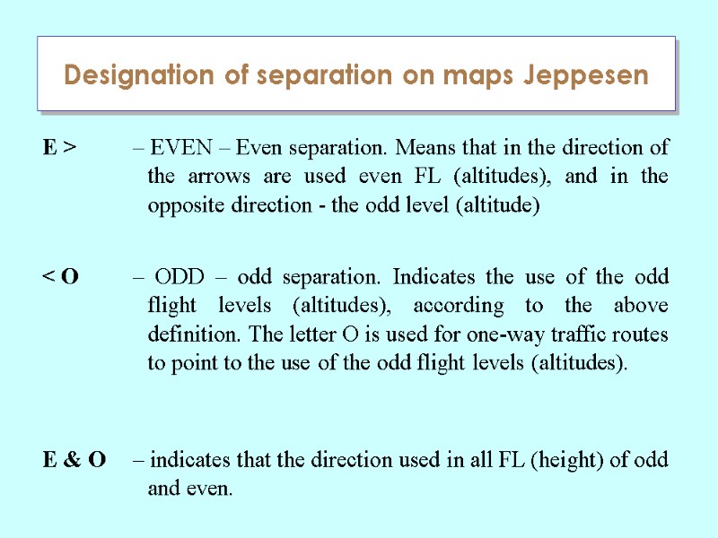
 Designation of separation on maps Jeppesen
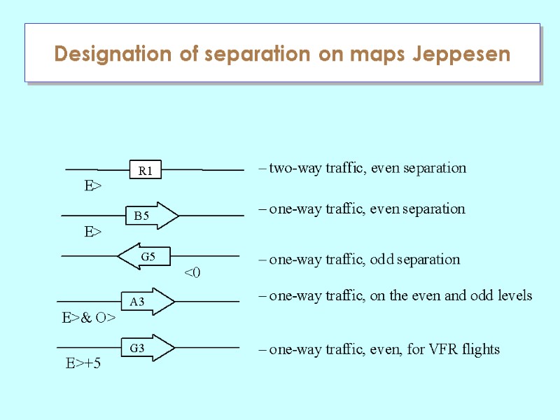
 Designation of separation on maps Jeppesen
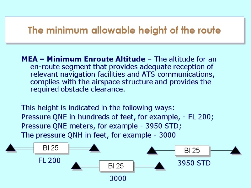
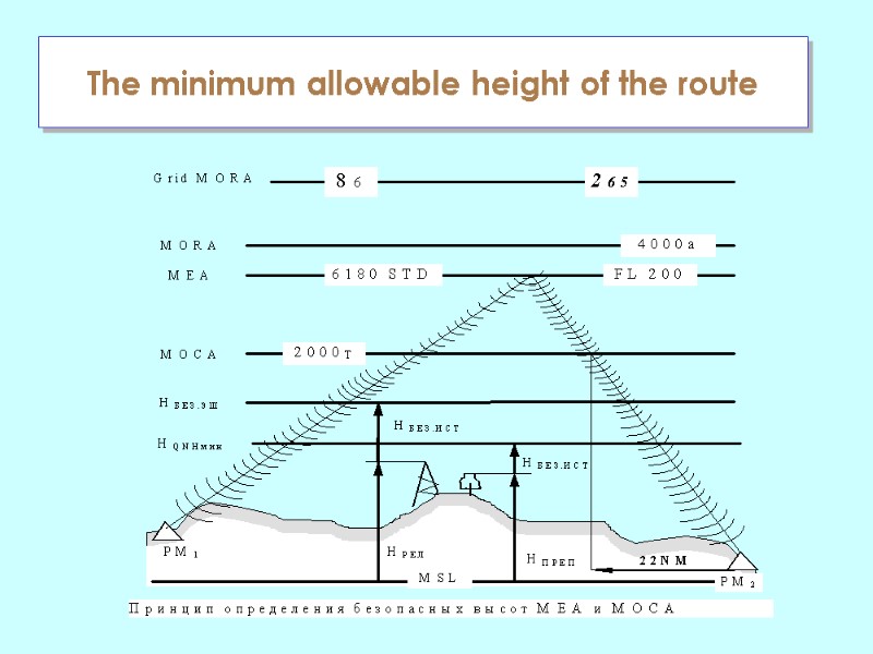
 The minimum allowable height of the route MEA – Minimum Enroute Altitude – The altitude for an en-route segment that provides adequate reception of relevant navigation facilities and ATS communications, complies with the airspace structure and provides the required obstacle clearance. This height is indicated in the following ways: Pressure QNE in hundreds of feet, for example, - FL 200; Pressure QNE meters, for example - 3950 STD; The pressure QNH in feet, for example - 3000 BI 25 FL 200 BI 25 3950 STD BI 25 3000
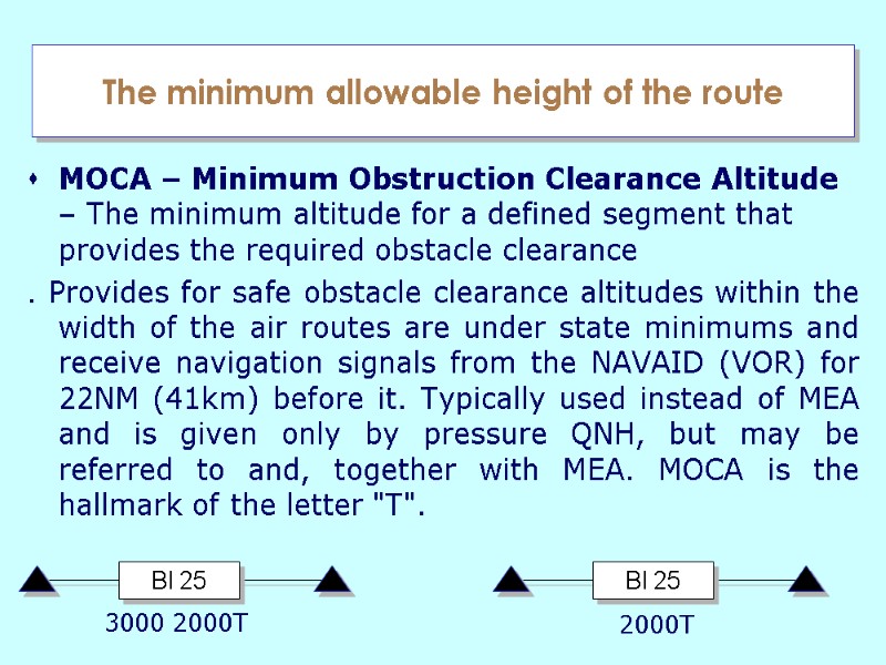
 The minimum allowable height of the route MOCA – Minimum Obstruction Clearance Altitude – The minimum altitude for a defined segment that provides the required obstacle clearance . Provides for safe obstacle clearance altitudes within the width of the air routes are under state minimums and receive navigation signals from the NAVAID (VOR) for 22NM (41km) before it. Typically used instead of MEA and is given only by pressure QNH, but may be referred to and, together with MEA. MOCA is the hallmark of the letter "T". BI 25 BI 25 3000 2000T 2000T
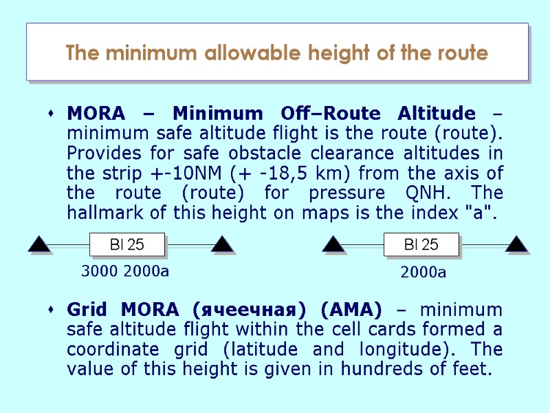
 The minimum allowable height of the route MORA – Minimum Off–Route Altitude – minimum safe altitude flight is the route (route). Provides for safe obstacle clearance altitudes in the strip +-10NM (+ -18,5 km) from the axis of the route (route) for pressure QNH. The hallmark of this height on maps is the index "a". Grid МORA (ячеечная) (АМА) – minimum safe altitude flight within the cell cards formed a coordinate grid (latitude and longitude). The value of this height is given in hundreds of feet. BI 25 BI 25 3000 2000a 2000a
 The minimum allowable height of the route
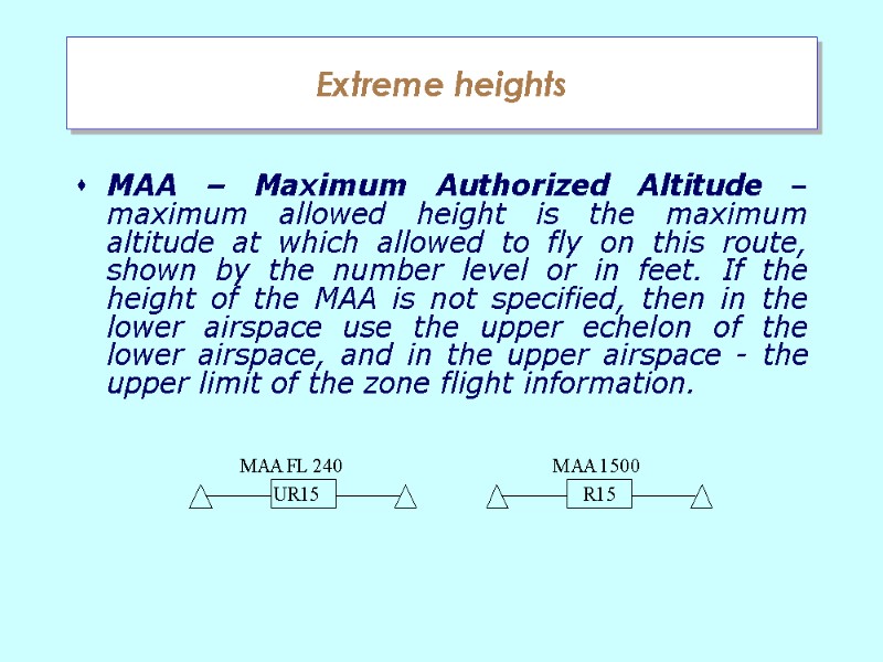
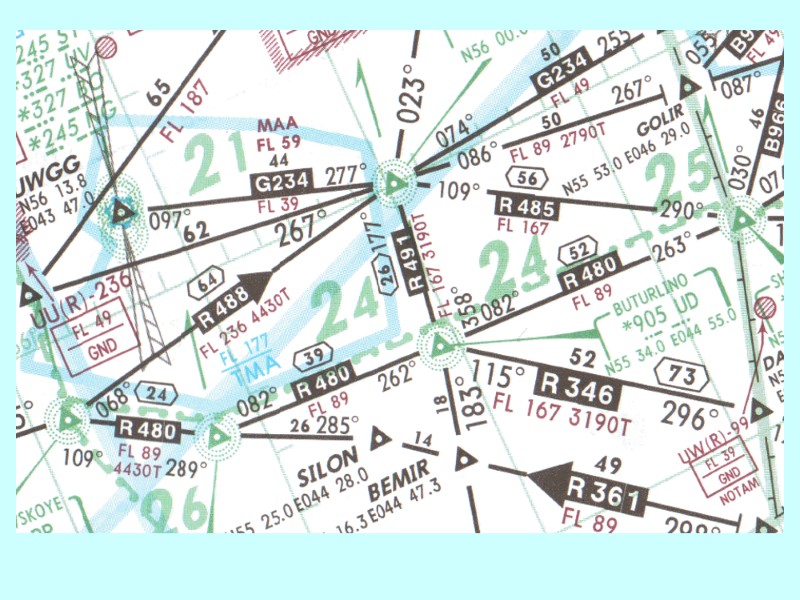
 Extreme heights MAA – Maximum Authorized Altitude – maximum allowed height is the maximum altitude at which allowed to fly on this route, shown by the number level or in feet. If the height of the MAA is not specified, then in the lower airspace use the upper echelon of the lower airspace, and in the upper airspace - the upper limit of the zone flight information.

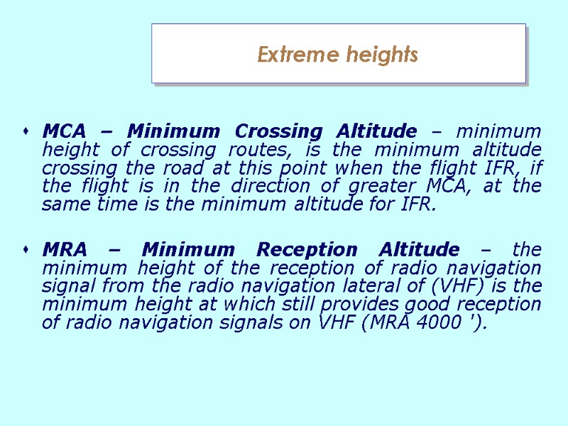
 Extreme heights MCA – Minimum Crossing Altitude – minimum height of crossing routes, is the minimum altitude crossing the road at this point when the flight IFR, if the flight is in the direction of greater MCA, at the same time is the minimum altitude for IFR. MRA – Minimum Reception Altitude – the minimum height of the reception of radio navigation signal from the radio navigation lateral of (VHF) is the minimum height at which still provides good reception of radio navigation signals on VHF (MRA 4000 ').
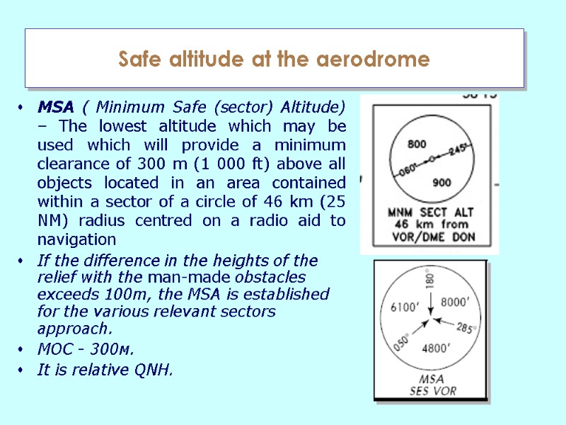
 Safe altitude at the aerodrome MSA ( Minimum Safe (sector) Altitude) – The lowest altitude which may be used which will provide a minimum clearance of 300 m (1 000 ft) above all objects located in an area contained within a sector of a circle of 46 km (25 NM) radius centred on a radio aid to navigation If the difference in the heights of the relief with the man-made obstacles exceeds 100m, the MSA is established for the various relevant sectors approach. МОС - 300м. It is relative QNH.
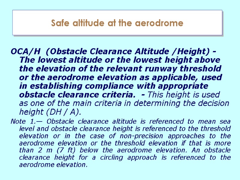
 Safe altitude at the aerodrome ОСА/Н (Obstacle Clearance Altitude /Height) - The lowest altitude or the lowest height above the elevation of the relevant runway threshold or the aerodrome elevation as applicable, used in establishing compliance with appropriate obstacle clearance criteria. - This height is used as one of the main criteria in determining the decision height (DH / A). Note 1.— Obstacle clearance altitude is referenced to mean sea level and obstacle clearance height is referenced to the threshold elevation or in the case of non-precision approaches to the aerodrome elevation or the threshold elevation if that is more than 2 m (7 ft) below the aerodrome elevation. An obstacle clearance height for a circling approach is referenced to the aerodrome elevation.
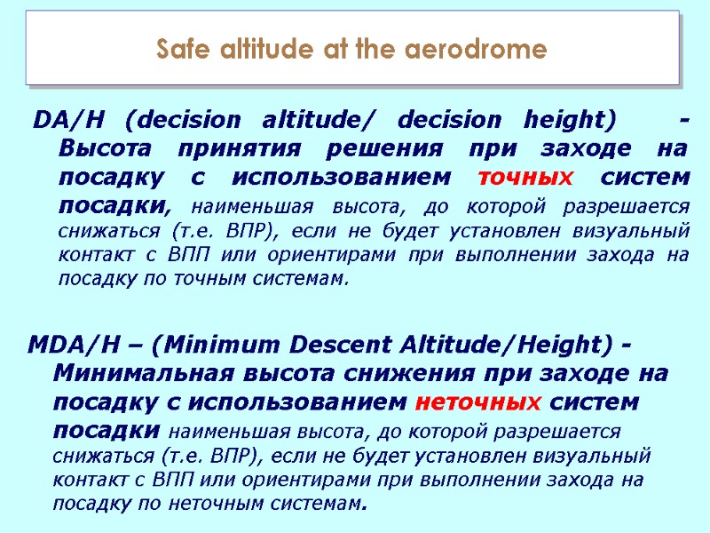
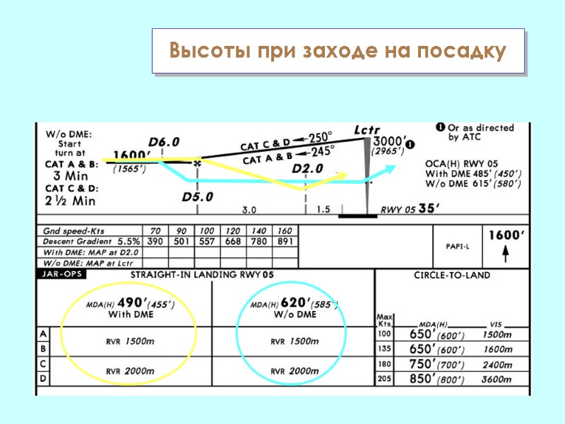
 Safe altitude at the aerodrome DA/H (decision altitude/ decision height) - Высота принятия решения при заходе на посадку с использованием точных систем посадки, наименьшая высота, до которой разрешается снижаться (т.е. ВПР), если не будет установлен визуальный контакт с ВПП или ориентирами при выполнении захода на посадку по точным системам. MDA/H – (Minimum Descent Altitude/Height) - Минимальная высота снижения при заходе на посадку с использованием неточных систем посадки наименьшая высота, до которой разрешается снижаться (т.е. ВПР), если не будет установлен визуальный контакт с ВПП или ориентирами при выполнении захода на посадку по неточным системам.
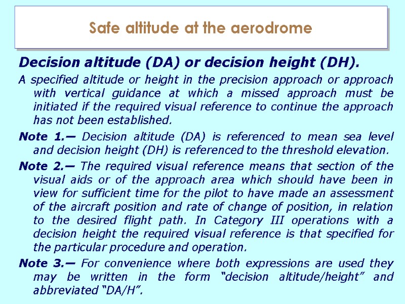
 Safe altitude at the aerodrome Decision altitude (DA) or decision height (DH). A specified altitude or height in the precision approach or approach with vertical guidance at which a missed approach must be initiated if the required visual reference to continue the approach has not been established. Note 1.— Decision altitude (DA) is referenced to mean sea level and decision height (DH) is referenced to the threshold elevation. Note 2.— The required visual reference means that section of the visual aids or of the approach area which should have been in view for sufficient time for the pilot to have made an assessment of the aircraft position and rate of change of position, in relation to the desired flight path. In Category III operations with a decision height the required visual reference is that specified for the particular procedure and operation. Note 3.— For convenience where both expressions are used they may be written in the form “decision altitude/height” and abbreviated “DA/H”.
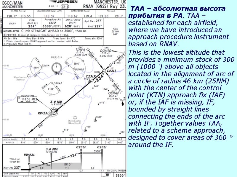
 TAA – абсолютная высота прибытия в РА. TAA – established for each airfield, where we have introduced an approach procedure instrument based on RNAV. This is the lowest altitude that provides a minimum stock of 300 m (1000 ') above all objects located in the alignment of arc of a circle of radius 46 km (25NM) with the center of the control point (KTN) approach fix (IAF) or, if the IAF is missing, IF, bounded by straight lines connecting the ends of the arc with IF. Together values TAA, related to a scheme approach, designed to cover areas of 360 ° around the IF.
 Высоты при заходе на посадку
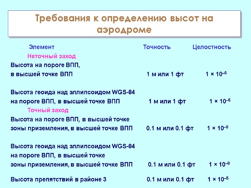
 Элемент Точность Целостность Неточный заход Высота на пороге ВПП, в высшей точке ВПП 1 м или 1 фт 1 × 10⁻⁵ Высота геоида над эллипсоидом WGS-84 на пороге ВПП, в высшей точке ВПП 1 м или 1 фт 1 × 10⁻⁵ Точный заход Высота на пороге ВПП, в высшей точке зоны приземления, в высшей точке ВПП 0.1 м или 0.1 фт 1 × 10⁻⁸ Высота геоида над эллипсоидом WGS-84 на пороге ВПП, в высшей точке зоны приземления, в высшей точке ВПП 0.1 м или 0.1 фт 1 × 10⁻⁸ Высота препятствий в районе 3 0.1 м или 0.1 фт 1 × 10⁻⁵ Требования к определению высот на аэродроме
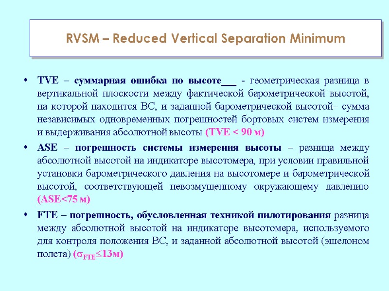
 TVE – суммарная ошибка по высоте - геометрическая разница в вертикальной плоскости между фактической барометрической высотой, на которой находится ВС, и заданной барометрической высотой– сумма независимых одновременных погрешностей бортовых систем измерения и выдерживания абсолютной высоты (TVE < 90 м) ASE – погрешность системы измерения высоты – разница между абсолютной высотой на индикаторе высотомера, при условии правильной установки барометрического давления на высотомере и барометрической высотой, соответствующей невозмущенному окружающему давлению (ASE<75 м) FTE – погрешность, обусловленная техникой пилотирования разница между абсолютной высотой на индикаторе высотомера, используемого для контроля положения ВС, и заданной абсолютной высотой (эшелоном полета) (FTE13м) RVSM – Reduced Vertical Separation Minimum
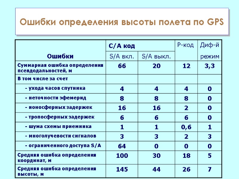
 Ошибки определения высоты полета по GPS

