

22abc8edf0b684920bba23bca7ae0f52.ppt
- Количество слайдов: 32
 Topic 1: Geography - Middle East
 What is the Middle East? And Central Asia? n What’s wrong with these names? Near East/Levant “Middle East”/”Greater & Central Southwest Asia Maghrib n n n “Never mind what the fact is, it depends what it is called. ”
 Intercontinental—Europe,") Facts n n n Vast -Region stretching from Rabat to Tehran (3400 miles) Intercontinental—Europe, Africa, and Asia-”Crossroads” “Greater Middle East” - Equal to U. S. in size. 20 independent states 3 Sub-regions: North Africa, Arab land, Highlands of Turkey and Iran Land of the 7 Seas
Facts n n n Vast -Region stretching from Rabat to Tehran (3400 miles) Intercontinental—Europe, Africa, and Asia-”Crossroads” “Greater Middle East” - Equal to U. S. in size. 20 independent states 3 Sub-regions: North Africa, Arab land, Highlands of Turkey and Iran Land of the 7 Seas
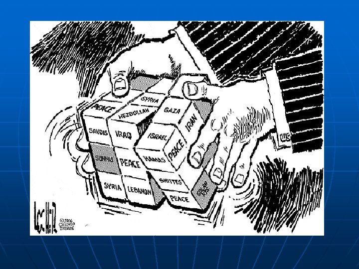
![Middle East = Arab, Muslim, Oil-producing? n Middle East includes non-Arab states [Iran, Israel]](https://present5.com/presentation/22abc8edf0b684920bba23bca7ae0f52/image-5.jpg "Middle East = Arab, Muslim, Oil-producing? n Middle East includes non-Arab states [Iran, Israel]") Middle East = Arab, Muslim, Oil-producing? n Middle East includes non-Arab states [Iran, Israel] and is also ethnically diverse [Kurds, Assyrians, Armenians, Turkomans] n Middle East is religiously diverse [Islam, Judaism, Christianity] n Sunni and Shia and other sects. n Not all Middle Eastern countries have oil • OIL: S. A. , Iraq, U. A. E. , Kuwait, Iran, Syria • No OIL: Israel, Egypt, Turkey, Jordan, Lebanon • 30% of the world’s oil production from M. E.
Middle East = Arab, Muslim, Oil-producing? n Middle East includes non-Arab states [Iran, Israel] and is also ethnically diverse [Kurds, Assyrians, Armenians, Turkomans] n Middle East is religiously diverse [Islam, Judaism, Christianity] n Sunni and Shia and other sects. n Not all Middle Eastern countries have oil • OIL: S. A. , Iraq, U. A. E. , Kuwait, Iran, Syria • No OIL: Israel, Egypt, Turkey, Jordan, Lebanon • 30% of the world’s oil production from M. E.
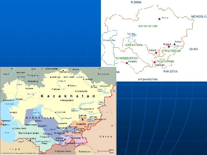
 Central Asia n 5 former Soviet states of: • Uzbekistan • Turkmenistan • Tajikistan • Kyrgyzstan • Kazakstan Why neglected in historical study? What is the “double periphery? ”
 Central Asia

 http: //www. mideastweb. org/maps. htm MAP EXERCISE
 Middle East - 5 Key Themes n Old Civilizations, New States n Cultural Heterogeneity n Institutional Weaknesses n External Influences n Role of Religion – Extremism, Fundamentalism?
 http: //www. mideastweb. org/maps. htm
 United Nations Partition Plan, 1947 Tan: Jewish state Grey: Arab state White: International zone
 Holy City of Jerusalem The Western Wall Dome of the Rock Church of the Holy Sepulcher
 Before 1967 After 1967
 Egypt-Nasser, Sadat, Mubarak – Arab Socialism and Pan-Arabism Iraq - Hussein-Baathist Socialism Syria – Asad – Baathist Socialism Libya – Qadafi – Green Socialism Turkey - Secular Republic Iran – Shah, Khomeini, Ahmadinejad –Islamism Saudi Arabia – “Family w/ Flags”, Wahabi Islam http: //www. mideastweb. org/maps. htm
 Afghanistan Form of government: Islamic emirate. Head of state and government: Leader of the faithful. Population (1998): 24, 792, 000. Population projection: (2000) 26, 668, 000; (2010) 34, 098, 000. Natural increase rate per 1, 000 population (1997): 25. 0 (world avg. 15. 7). Gross national product (1996): U. S. $5, 666, 000 (U. S. $250 per capita). Land use (1994): forested 2. 9%; meadows and pastures 46. 0%; agricultural and under permanent cultivation 12. 4%; other 38. 7%.
") North Africa—”the Magrib” (the West)
North Africa—”the Magrib” (the West)
 http: //www. pbs. org/wgbh/globalconnections/mideast/maps/topo. html
 Note green vegetation areas in Israel on the Eastern coast of the Mediterranean sea, and along the Nile river and delta. See night view of same region below.
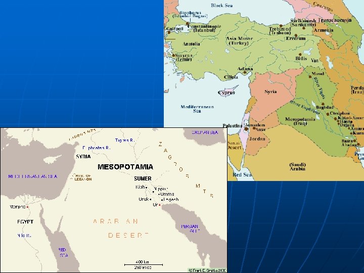
 Physical map of northern Middle East - north to south includes Black Sea, Turkey, Cyprus, Syria, Iraq, Lebanon, Israel and Jordan
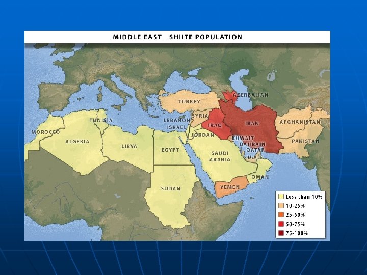
 For an interactive map of Sunni-Shia Populations http: //www. pbs. org/wnet/wideangle/shows/iran/map. html
 KURDISH AREAS
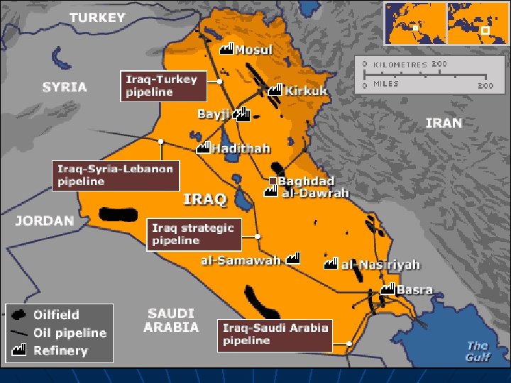
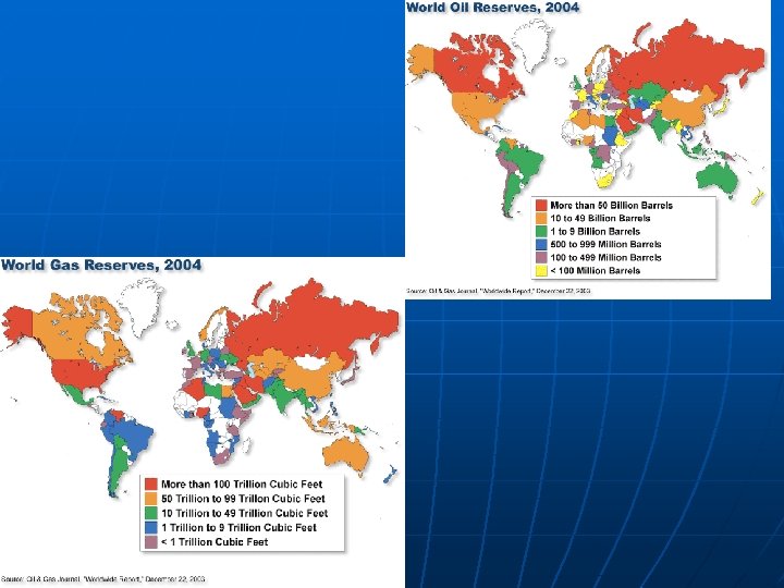
 Good Interactive map – Where is the oil? Who has what for how long? : http: //wolf. readinglitho. co. uk/mainpages/oilmap. html
 Crude Oil Imports to US Top 10 Countries, February 2006
 Oil Consumption Greenhouse Gas Emissions