

b8b2c9d219c3c62cb7663937dffd1204.ppt
- Количество слайдов: 52
 The Use of Ground Penetrating Radar Data in the Development of Facies-Based Hydrogeologic Models Rosemary Knight, Elliot Grunewald, Richelle Allen-King, Stephen Moysey, David Gaylord
 Groundwater flow & transport models: – Evaluate/manage drinking water supply – Evaluate groundwater susceptibility to contamination – Estimate societal/ecological impacts of contamination – Assign risk to prioritize remediation needs
 Groundwater flow & transport models: – Evaluate/manage drinking water supply – Evaluate groundwater susceptibility to contamination – Estimate societal/ecological impacts of contamination – Assign risk to prioritize remediation needs Incorporating heterogeneous distributions of subsurface properties authentically will reduce uncertainty for all of these!
 Groundwater flow & transport models: – Evaluate/manage drinking water supply – Evaluate groundwater susceptibility to contamination – Estimate societal/ecological impacts of contamination – Assign risk to prioritize remediation needs but we should do so in a way that allows us to quantify uncertainty
 10’s of cm’s to 100’s of meters ?
 ? ?
? ?
 ?
?
") 12 m 10 m 52 m Knoll et al. (1988)
12 m 10 m 52 m Knoll et al. (1988)
 geophysical properties
 geophysical properties transform hydrogeologic information
 Develop a model of large-scale architecture.
 depth 20 meters Tx k 1 k 2 Rx change in dielectric properties
") Sandy Point spit, Alberta (Smith and Jol, 1992)
Sandy Point spit, Alberta (Smith and Jol, 1992)
 Develop a large-scale model using radar facies. Sandy Point spit, Alberta (Smith and Jol, 1992)
 Radar facies are") Develop a large-scale model using radar facies. Smith and Jol (1992) Radar facies are defined by patterns shapes, bounding surfaces internal “texture”
Develop a large-scale model using radar facies. Smith and Jol (1992) Radar facies are defined by patterns shapes, bounding surfaces internal “texture”
 radar facies 1 radar facies 2") Sandy Point spit, Alberta (Smith and Jol, 1992) radar facies 1 radar facies 2 radar facies 3
Sandy Point spit, Alberta (Smith and Jol, 1992) radar facies 1 radar facies 2 radar facies 3
 radar facies 1 radar facies 2") Sandy Point spit, Alberta (Smith and Jol, 1992) radar facies 1 radar facies 2 radar facies 3 Radar facies = lithofacies/hydrofacies?
Sandy Point spit, Alberta (Smith and Jol, 1992) radar facies 1 radar facies 2 radar facies 3 Radar facies = lithofacies/hydrofacies?
 Radar facies are defined by: patterns Use neural networks for pattern recognition.
 Radar facies are defined by: patterns Use neural networks for pattern recognition. More efficient Allows us to generate stochastic models & quantify uncertainty. Moysey, Knight, Caers, Allen-King, 2002 Moysey, Knight, Jol, 2005
 with a known") Neural Networks: Lithofacies Recognition Step #1 - training (i. e. calibration) with a known data set: wells, cores
Neural Networks: Lithofacies Recognition Step #1 - training (i. e. calibration) with a known data set: wells, cores
 with a known") Neural Networks: Lithofacies Recognition Step #1 - training (i. e. calibration) with a known data set: wells, cores radar attributes (e. g. , reflection dip, continuity) facies probabilities P(F=f 1) = 0 P(F=f 2) = 1 P(F=f 3) = 0 Inputs Weights and combinations
Neural Networks: Lithofacies Recognition Step #1 - training (i. e. calibration) with a known data set: wells, cores radar attributes (e. g. , reflection dip, continuity) facies probabilities P(F=f 1) = 0 P(F=f 2) = 1 P(F=f 3) = 0 Inputs Weights and combinations
 Neural Networks: Lithofacies Estimation Neural network used to assign facies probabilities at each location based on local patterns. radar attributes (e. g. , reflection dip, continuity) facies probabilities P(F=f 1)=. 7 P(F=f 2)=. 2 P(F=f 3)=. 1
 Lithofacies Probabilities 0 1 Facies 2 Facies 3 Facies 4 Probabilities allow us to include uncertainty in modeling
 Use neural net to interpret facies assuming that training remains valid for all other data sets
 Use neural net to interpret facies assuming that training remains valid for all other data sets Can we develop training (classification schemes) that are transferable?
 Use neural net to interpret facies assuming that training remains valid for all other data sets Can we develop training (classification schemes) that are transferable? Is there a characteristic radar signature associated with specific depositional environments?
 Use direct observations + radar data to develop models of large-scale architecture. Direct Facies Observations (e. g. , well data) Facies 1 Facies 2 Radar Data Facies (NN) 0 GEOSTATISTICS Conditional Facies Realizations 1
 Application - Borden Groundwater Research Site
 ? ? ? ?
 Can we use radar data to fill in between and beyond core samples? 0 50 100 150 ? 200 250 m
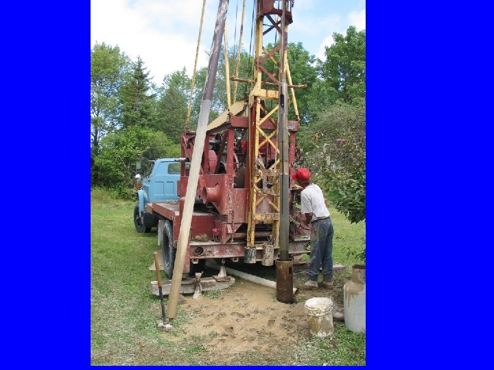
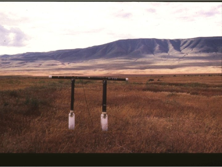
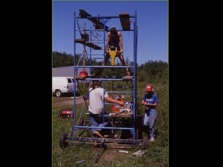
 450 MHz radar data: 17 NS lines, 17 EW lines; depth ~3 m 12 core samples in top 1. 5 m
, Distinct Plane Laminated (DPL), Massive Coarse-Grained (MCG), Massive") Lithofacies: Soil, Fine-Grained Planar Cross-Stratified (FPXS), Distinct Plane Laminated (DPL), Massive Coarse-Grained (MCG), Massive Fine-Grained (MFG), Faint Plane Laminated (FPL), Low-Angle Planar Cross-Stratified (LPXS), High-Angle Planar Cross-Stratified (HPXS), Deformed Sand (DS), Cross-Stratified Sand (XSS), Complexly Cross-Stratified Sand (CPXS), Laminated Silt (ZM).
Lithofacies: Soil, Fine-Grained Planar Cross-Stratified (FPXS), Distinct Plane Laminated (DPL), Massive Coarse-Grained (MCG), Massive Fine-Grained (MFG), Faint Plane Laminated (FPL), Low-Angle Planar Cross-Stratified (LPXS), High-Angle Planar Cross-Stratified (HPXS), Deformed Sand (DS), Cross-Stratified Sand (XSS), Complexly Cross-Stratified Sand (CPXS), Laminated Silt (ZM).
 Radar Data and Cores Visualized with Geoprobe® To explore the 3 D continuity of core lithologies and radar horizons To correlate lithological data with radar reflections
 Distance (m) N Core depth converted to time using") Core Data Only Time (ns) Distance (m) N Core depth converted to time using velocity of 0. 69 m/ns
Core Data Only Time (ns) Distance (m) N Core depth converted to time using velocity of 0. 69 m/ns
 Radar Data with Cores 17 north-south GPR lines imported as data cube Frequency: 450 MHz Length: 20 m Spacing: 1/8 m
 Moving through the 3 D Volume
 Moving through the 3 D Volume
 Moving through the 3 D Volume
 Ez.") Identifying and Tracking Horizons “Seed point” specified on potential horizon (max or min) Ez. Tracker tool explores away from seed for similar waveform
Identifying and Tracking Horizons “Seed point” specified on potential horizon (max or min) Ez. Tracker tool explores away from seed for similar waveform
 Identifying and Tracking Horizons
 Three Main Horizons Identified 1 2 3 Horizon 1 interpreted as base of soil layer Horizon 2 interpreted as base of X-bedded sand Horizon 3 interpreted as base of massive/laminated zone
 Training the Neural Network Chose four descriptive facies based on core data and horizons Trained neural net using facies map for a single profile After training neural net used to classify entire set of radar data
 Neural Network Classification Results maximum likelihood Geoprobe Horizons Substantial agreement of classifications with cores and horizons Soil layer and Cross-stratified units particularly well-identified Less continuous classifications of the deep half of the image may reflect lateral variation observed in cores at depth
 Neural Network Classification Results maximum likelihood Geoprobe Horizons Substantial agreement of classifications with cores and horizons Soil layer and Cross-stratified units particularly well-identified Less continuous classifications of the deep half of the image may reflect lateral variation observed in cores at depth
") 12 m 10 m 52 m Knoll et al. (1988)
12 m 10 m 52 m Knoll et al. (1988)