

c133f8edf614cc4bd855f14bb82a976e.ppt
- Количество слайдов: 124
 The Influence American Indian Pathways had on Connecticut Transportation Systems & Settlements
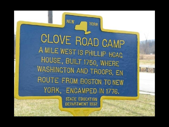
 How this all got started… • “For many years before Connecticut was settled, there was a traveled way leading up from the shores of the sound east of the Norwalk River. Passing through Georgetown then heading due North to the land of Pahquio-que (Danbury) the dwelling place of the southern tribe of the Schaticoke Indians…” ~Wilbur F. Thompson, April 1919 “The Old Indian Trail”
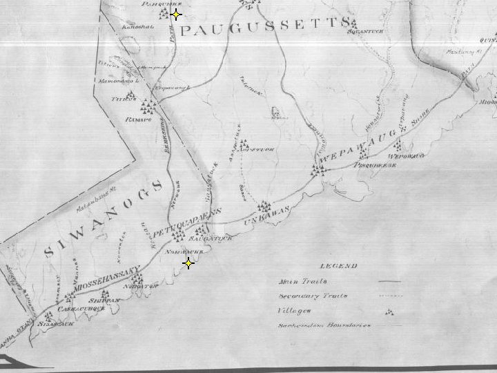
 How this all got started… • The Indians living inland often made excursions to the salt water. The inhabitants of Ridgefield of a century ago have handed down stories of seeing families of Indians passing along, returning from the shores of Long Island Sound, with long strings of clams, dried and cured ready for use. -History of Ridgefield, George L. Rockwell 1869.
 And these are only the main foot paths!!
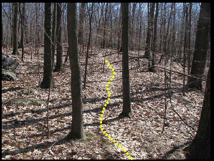
 Indian Foot Paths • Laid & developed through ages of Indian use with an eye to the easiest & quickest topographical [route], many of these ancient Indian foot paths were [later] adopted and enlarged into the bridle paths [by] the early pioneers, and eventually [became] the modern highways of today. ~Leaman F. Hallett, “Indian Trails and Their Importance to Early Colonists
 East-West Path Routes 112, 183, 20, 219, 190 North-South Path Routes 7, 202, 126 East-West Path Routes 6, 317, 67 North-South Path Route 5 Albany Turnpike
 Access to our State… Englishmen of Boston Asked to Travel to Connecticut via Indian Pathways
 Paths to Connecticut • On April 4, 1631, John Winthrop, Jr. recorded in his Journal that “Wahginnacut, a Podunk Sachem on the River Quonehtacut…came to Boston and said he was very desirous to have some Englishmen come plant (settle) in his country…which is not above 5 days journey from us [Boston] by land. ” ~Winthrop Journal, I: 223
 Springfield, MA Ludlow’s Routes 44, 197, 198 Hartford
 Indian Paths become modern highways Springfield, MA Route 190 Route 197 Route 5 Route 140 I-84 384 Route 44 Route 6 Hartford Route 2 Route 198
 Pequot War Results in Coastal Settlements
 Pequot War opens Coastal Settlements • In 1636 trader John Oldham was killed on Block Island. To avenge his death the Bay Colony set out to attack the Narragansetts for the murder and the Pequots for their lands. The Pequots had nothing to do with the murder. • By this time there were two settlement areas in CT, Hartford & Saybrook. In response to the Bay Colony’s attack, the Pequots attacked Saybrook & Wethersfield, killing settlers in Wethersfield. Thus began the Pequot War.
 Pequot retaliation starts a war Wethersfield Saybrook
 Pequot War opens Coastal Settlements • Ludlow declared an “offensive war” on the Pequots & with the help of Uncas’ Mohegans and soldiers from Massachusetts Bay they chased the Pequots all over CT, until they finally cornered them in a swamp at modern day Southport where it all ended horribly for the Pequot tribe.
 1639 1649 1650 1639 Coastal Settlements Quickly follow the Pequot War 1641 1640 *Roger Ludlow purchased land in Saugatuck & Norwalk (1640) but it wasn’t settled until later.
 Land “Sales” Cause Confusion • Indians did not understand land ownership the way the English and their future generations viewed it: in their culture, no tribe nor Indian had exclusive, permanent rights to specific parcels of land, "different groups of people could have different claims on the same tract of land depending on how they used it. " By ignoring the Indian’s provisions within the land deeds, the settlers were exceeding the usage rights the Indians were granting them.
 Land Sales… Oversight or Misunderstanding? • European settlers continually ignored important text in the Indian‘s portion of the deeds: • "Reserving in the whole of the same, liberty for myself and my heirs to hunt, fish, and fowl upon the land in the waters, and further reserving for myself, my children, and grand children…the use of so much land by my present dwelling house or wigwam as the General Assembly of the Colony … shall judge necessary for my or their personal improvement. . . ”
 Different Viewpoints • “What the Indians owned or had claim to- was not the land but the things that were on the land during various seasons of the year…In nothing is this more clear than in the names they attached to their landscape, the great bulk of which related to usage not possession. ” ~William Cronon, Changes in the Land
 Meanings of Indian Names • • • Pok-a-no-ket: “at or near the cleared lands. ” A-bess-ah: “clam bake place” Mitt-in-eag: “abandoned fields” Eack-honk: “the end of the fishing place” Simpaug: “beaver pond” Aspetuck: “at the high place. ” Ousatonic: “land beyond the mountains” Waramaug: “good fishing place” Pequonnock: “a small plantation” Mash-an-tucket: “in the little place of much wood”
 Oyster Shell Pile! And down here, by the shore…You can see why coastal tribes would not want to leave their lands!!
 Indians Pushed Inland as Settlers Take Over Their Coastal Villages
 As Interior Lands are Purchased Many Connecticut tribes move to the Northwest Corner
 Wequadnack Kenunckpacook Scatacook Displaced Connecticut tribes move to the Northwest Corner
 Relocation after Land Sales • Paugassett Land sales start in 1638, end in 1750’s • Pequannock Land sales start in 1638, end in 1714 • Potatuck Land sales start in 1668, end in 1730’s • Weantinock Lands sales start in 1670’s, end in 1730’s • There is evidence that Naugatuck Valley Indians also moved to our area.
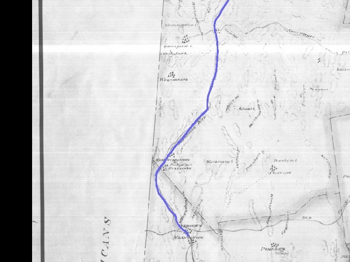
 Evidence of Local Indian Settlements • From an account written by Robert R. Livingston in 1707. He was surveying his Manor purchased in 1686. With three Indian guides he visits many local areas via the pathways his guides take him on. He mentions Won-on-pa-kook here: “we come by ye way of two lakes called Wan-a-pa-kook, where a great Indian house was, belonging to Corlaer ye Indian, where Pot-cchay lives …”
 Falls Village Hotchkiss
 They call it Indian Mnt for a reason! x
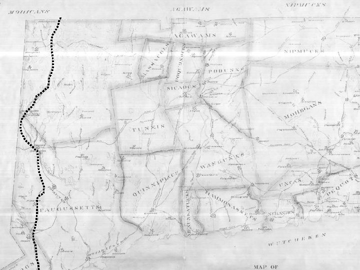
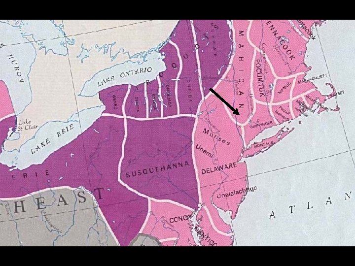
 The Question is… are there one group of Indians or several different groups of Indians living here prior to European settlement?
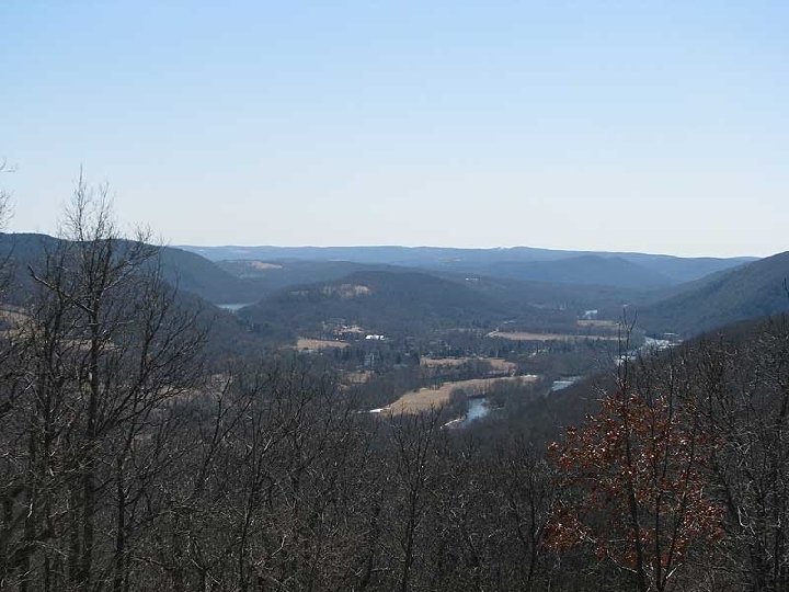
 Was Western Connecticut a Hunting Ground? • In Western Connecticut site digs very few agricultural tools are being found. If that trend continues it would give weight to theory that these settlements were Hunting and Fishing Camps. We have the ponds, the rivers, the forests and the hunting tool artifacts to back this theory.
 CT River Hudson River
 Was Western Connecticut a Hunting Ground? • Using controlled fires in the woodlands surrounding their villages Indians encouraged trees and plants that game animals found alluring to become more abundant. Strawberries, blackberries, raspberries, grasses, and nut bearing trees…attracted both deer and their predators in to these Indian “game farms”. “The now wooded slopes in the narrow Wassaic valley were so bare "that wild deer were clearly seen from the valleys below, " according to Newton Reed in his 1875 "Early History of Amenia. "
 Was Western Connecticut a Hunting Ground? • According to John De. Forest “He (Gideon Mauwehu) beheld the river running through the fertile valley, shut in by mountains …the streams stocked with fish, the wooded hills plentiful with game…” and knew he’d found home. -John De. Forest in his "History the Indians of Connecticut. "
 American Indian Pathways & Early Access to the Interior Lands
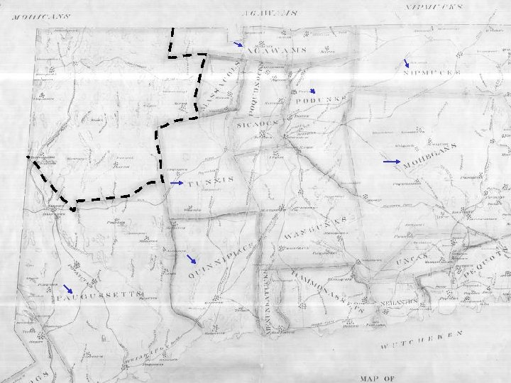
 Early Interior Settlement From 1639 to 1651 there are no English settlements in the Western interior of Connecticut…at least that I am aware of…That changes once Derby, Woodbury & Danbury are settled. • Derby is settled in 1651. Indian Trails and a Ford where the Naugatuck meets the Housatonic. • Woodbury is settled in 1672. Indian Trails lead these coastal settlers to the interior. • Settlers make their way from Norwalk to Danbury in 1684 to establish a town. Indian Trails lead these coastal settlers to the interior.
 1672 1684 1651 Indian trails used in all these migrations
 Why Indian Paths were important
 Indian Guides Were Essential • In finding their way inland, settlers needed Indian guides to find where the Indian paths were and where they went. One writer noted: “they (the English) sadly search up and down for a known way, the Indian paths not being above a one foot road. So that a man may travel many days and never find one. ” The use of guides would continue into the 1800’s. i. e. Lewis and Clark Expedition.
 From these Pathways Begins the Progression of our Transportation Systems
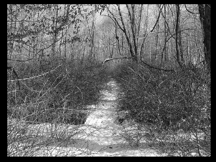
 The simplest early roads were described as “paths cut out” i. e. brush was cut out along the Indian pathways and trees were marked with an ax…
 Later these paths were made “passable for horses” by cutting tree limbs high enough to permit the passage of a horse and rider. For many years this was the method of travel throughout our state. Pack horses became common and goods were often transported by packhorse trains…
 The next progression, which proves to be an important one, was the widening of bridle paths to accommodate Ox Carts. Oxen were strong and capable of travel over terrain that would be impassable for a horse-drawn cart…
 Packhorse lobbyists protested heavily, claiming the construction of wider roads was a waste of taxpayers’ money but they lost and as a direct result of these new Ox Cart paths, inland settlements in our State increased quickly.
 Ox Carts headed to a Ferry…no bridges back then!
 Ox Cart Paths Improve Travel & Access to the Interior Lands This Assembly doth free the town of Danbury from paying country rates this present year (1702), They paying their deputies salary and all other Public charges amongst themselves, and they making a sufficient cart-way from their town and through their bounds and the country lands, for transportation of what they raise to the sea (i. e. the ports of Fairfield and Norwalk).
 Woodbury New Milford Waterbury Southbury Naugatuck Brookfield Pioneer Settlements resulting from success of & improvements by pioneer towns Ridgefield Danbury Seymour Newtown Ansonia Bethel Redding Derby
 settlement was") Indian Paths Noted in Many Town Histories • The first (New Fairfield) settlement was established in a small valley… Paths, later roads, radiated out from this central settlement to outlying lands taken by settlers • An extensive network of trails interlaced Newtown’s interior area and connected to the Housatonic River at numerous points. • Early (Bridgewater) roads followed paths and later evolved into the irregular topography-dominated network which exists today.
Indian Paths Noted in Many Town Histories • The first (New Fairfield) settlement was established in a small valley… Paths, later roads, radiated out from this central settlement to outlying lands taken by settlers • An extensive network of trails interlaced Newtown’s interior area and connected to the Housatonic River at numerous points. • Early (Bridgewater) roads followed paths and later evolved into the irregular topography-dominated network which exists today.
 We had Paths which shows our area was active in the Pre-settlement period.
 American Indian Pathways as Post Roads
 Colonial Postal Route • Indian Paths played a major role in the establishment of the postal system in this country. The first colonial postal route was started by a single rider, in the winter of 1673, who rode between New York and Boston with a horse change in Hartford, his route traveled was over the old Indian trails between these points. • Travel time? 3 weeks!
 Colonial Postal Route • The three major alignments of this “The Boston Post Road” were the Lower Post Road (now U. S. Route 1 along the shore and through Providence, Rhode Island), the Upper Post Road (now US 5 and US 20 from New Haven, Connecticut via Springfield, Massachusetts), and the Middle Post Road (now Route 44 which split from Hartford, Connecticut, and ran diagonally to Boston via Pomfret, Connecticut).
 Route 44 Middle Post Road Upper Post Road Route 5 Lower Post Road Route 1
 The Early Postal System • By 1717 mail was being carried from Boston to Virginia. Travel time? One month in Summer; Two months in Winter. • Philadelphia was added in 1720, receiving mail from New York once a week. • 1754 - Benjamin Franklin named Colonial Postmaster. Reduces trip from New York to Philly from 3 days to a 1 day and a half.
 The Early Postal System • By 1765 the postal system of the colonies had grown from a single post rider to about 60 post offices, almost all of which were on the coasts or not more than 60 miles inland. • Ben Franklin stated: ". . . The posts only go along the sea coasts; they do not, except in a few instances, go back into the country. . . "
 Colonial Postal Route • Franklin likely noted this because Inland roads in the colonial period were poor, as colonists did not have modern conveniences such as bulldozers and excavators to clear pathways for their travels. Trees and bushes were cut back with hand-tools and oxen teams were harnessed to remove stumps and boulders in order to widen the existing footpaths.
 Colonial Postal Route • Once mail reached a point on the "coastal" Post Road close to its destination, it would be sent inland via post rider, or it would wait for someone who was traveling in the direction of the addressee to pick it up and carry it the rest of the way inland. And, old Indian Trails were the influence of many of these inland routes.
 Inland Post Roads
 1820 Post Road to Dover, NY 1810 Post Road to New Milford 1814 Post Route to Litchfield
 The Post Rider • The Post Rider was a man of importance in our rural communities, delivering the weekly newspaper and some letters. He traveled on horseback, and was often accompanied by one or two pack horses. He acted as a middleman between local farmers and city dealers, taking the smaller products of the farms - butter, cheese, honey, beeswax, woolens, yarn, flax, etc. , to the larger towns - selling them, and bringing back dyestuffs, calicos, needles, pins and other articles used in the rural homes of that day.
 The Post Rider • Postmasters and post riders were exempt from military duties so as not to interrupt service. These post-riders were allowed the exclusive privilege of carrying letters, papers and packages on their respective routes, and any person who infringed upon their rights was subject to a fine. So in addition to their $100 a year salary, many Post Riders operated side-businesses along their “exclusive routes. ”
 Many of these Post Roads were used during the American Revolution
 To Bo s to n High Road to Albany Hartford Albany Turnpike New Haven New London To Providence Post Road
 The High Road to Albany • The “high road to Albany”, ran from Hartford to Farmington, Harwinton, Litchfield, Goshen, Cornwall, Canaan, Salisbury and on into New York. Another East-West route ran from Waterbury, Woodbury, through New Milford and on into New York.
 After the Revolution Turnpikes Replace Existing Cart Paths & Horse Paths
 The Turnpikes • From 1792 to 1810 a large number of turnpike companies were being chartered by the General Assembly in towns and cities throughout Connecticut. The turnpikes were very superior to the old cart paths, generally having straighter alignments, lesser grades, bridges instead of fords, and graveled surfaces.
 Apparently Our Roads Were in Need of Some Improvement… Dr. Samuel Holton in June, 1778, went from Boston to Philadelphia. The only route he describes as “very good, ” was the one from Springfield to Hartford. From Hartford to Litchfield the roads were “very bad, ” while the roads from Litchfield to the New York Line were the “worst he had ever seen!” Count Chastellux who went through Connecticut in 1780 remarked that in going from Canaan to Norfolk “you mount for 4 or 5 miles continually bounding from one large stone to another, which cross the road & give it a resemblance of stairs. ”
 Some Indian Paths just weren’t made for Turnpikes
 The Turnpikes • Most turnpikes were two-way thorough-fares, about twenty-four feet wide and relatively straight. In New England, in order to avoid muddiness and road erosion, drainage was provided by giving the road a convex surface to shed the water. Connecticut companies tended to spend less money for turnpikes than those in states such as Massachusetts, since many turnpike corporations simply improved existing roads and therefore avoided heavy expenditures for rights of way.
 The Sharon-Goshen Turnpike • The success of the “high road to Albany” and a bridge near West Cornwall make a Turnpike from Sharon to Goshen an appealing venture. The bridge was added in 1770 and later was converted into the Covered Bridge…the Toll House is still there to this day. • The Sharon Goshen was a section of the Poughkeepsie to Hartford Turnpike.
 Hartford to Poughkeepsie Stage Route Marker
 Jackson Hill Sharon Goshen Turnpike
 Early Turnpikes of Connecticut • Other Local Turnpikes of interest… Running North-South, The Waterbury River Turnpike was chartered in 1801 -02. It ran from Naugatuck to Waterbury, then north through. Thomaston, Torrington, Winchester, West Windsor, Colebrook and then crossed the border to connect to the Massachusetts 15 th Turnpike. Very similar to what we know today as Route 8.
 Stage Coaches • With the *improvement of roads, stage coaches appear in the early 1800 s. Advertisement by the New Post-Coach Line Dispatch: “ 6 hours from Hartford to New Haven, leave Hartford at 11 am and arrive in New Haven at 5 pm. ” …and you thought your commute was bad!
 Stage Coaches • *Road Improvement wasn’t always a given… “In some of these ancient roads the passenger was jolted and distressed going down hill as well as up. In one case an occupant of the Stage Coach called out to the driver- ‘Are you going down any further? For if you are…I must get out, for I do want to remain on this earth a little longer. ’
 No Fear here! 3 Stacked three levels high 2 1
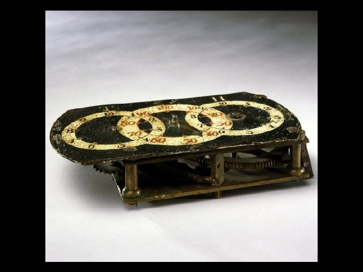
 Turnpikes & Milestones • In the summer of 1763, Ben Franklin completed a five-month carriage tour to inspect post offices. On that tour, he utilized an odometer. The Institute News describing the action of his odometer noted: "When actuated from a carriage wheel having a circumference of thirteen and one-fifth feet, a mile was registered in each four hundred revolutions. If wired to the top of the front axle at the right hand side it was easily set in operation by a hub-type projection on a hub or spoke and the dials were readily visible to both driver and rider. "
 to NW (Norwalk) 1786 On South Street in Danbury, there is") 12 MS (Miles) to NW (Norwalk) 1786 On South Street in Danbury, there is a milestone bearing the date of 1787, "67 miles to New York, 67 miles to Hartford"
12 MS (Miles) to NW (Norwalk) 1786 On South Street in Danbury, there is a milestone bearing the date of 1787, "67 miles to New York, 67 miles to Hartford"
 Taverns & Postmasters • Taverns were often Post Offices. Why? Stagecoaches were used to carry mail because they stopped regularly at Taverns, which in the time period were the social center of most communities. In 1845, Congress abandoned its preference for stagecoaches in an effort to reduce mail transportation costs, opting to use the railroad.
,") Taverns & Post Offices Sharon, Connecticut October 10, 1842 Dear Sir (Hon. E. Whitteley), Having once given an unsuccessful opinion respecting the Post Office in this village, a sense of self-respect would ordinarily prevent me from obtruding further advice upon the Department. But understanding that another removal is contemplated I cannot refrain from observing that if adopted, the Office would thereby be brought closer to my door, it would also be brought into a rum-selling tavern! - an arrangement which in my judgment, can at this day be justified under no regular government whatever. ~John Cotton Smith
Taverns & Post Offices Sharon, Connecticut October 10, 1842 Dear Sir (Hon. E. Whitteley), Having once given an unsuccessful opinion respecting the Post Office in this village, a sense of self-respect would ordinarily prevent me from obtruding further advice upon the Department. But understanding that another removal is contemplated I cannot refrain from observing that if adopted, the Office would thereby be brought closer to my door, it would also be brought into a rum-selling tavern! - an arrangement which in my judgment, can at this day be justified under no regular government whatever. ~John Cotton Smith
 Many of these turnpikes doubled as freight roads too
 Too Slow and Too Expensive • Average freight costs in 1820 were about 15 cents a mile per ton, more than twice as much as water transportation. By 1825 more than half of the turnpike ventures in the country had been either partially or totally abandoned. A contributing factor to the failure of these internal overland routes was the emergence of the canal.
 Canals… “a method of transportation superior to any previously known. ” ~Charles R. Harte, Connecticut’s Canals
 Efforts to Establish a Connecticut Canal System Extending from Albany to Buffalo, the Erie Canal was completed on November 4, 1825 and soon became a great commercial success. Before its completion the cost of shipping 1 ton of cargo between Buffalo & NYC ranged from $90 to $125. Within 10 years of the Erie Canal’s completion, the cost had dropped to $4 per ton.
 Efforts to Establish a Connecticut Canal System The wave of enthusiasm that followed the success of the Erie and other canals did not escape the entrepreneurs viewing the productivity & transportation needs of Connecticut. By the early 1820 s a total of six (6) canals were proposed for Connecticut. Two (2) would be constructed and placed into service: The Farmington and Enfield Canals.
 1 2 6 4 5 3 All six follow old Indian pathways
 Connecticut’s Proposed Canal System 1. 2. 3. 4. 5. 6. New York and Sharon Canal Ousatonic Canal Saugatuck & New Milford Canal Farmington Canal Enfield Canal Quinebaug Canal
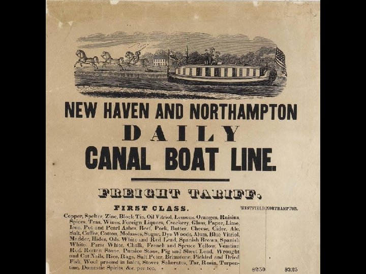
 Impressive Numbers! Four million pounds of merchandise were shipped every month from New Haven. At three every afternoon, packet boats left the Elm City docks in New Haven, making the trip to Northampton in the unheard-of time of twentyfour hours. The age of canals had arrived in Connecticut.
 Water Issues, Debt and the Railroad From 1835 to 1847 the canal suffered extraordinary damages from flooding. Repairs were constant and debt ran high. 1845 looked to be the year they turned the corner but it turned out to be their most disastrous as a drought interrupted service from mid-July to late September. The Company turned its attention to the practicability of building a railroad. After 1847, the Farmington Canal was never operated through its total length again.
 Railroads Replace Turnpikes/Stage Routes and Canals
 Housatonic Railroad Originally chartered as the "Ousatonic" Railroad in 1836, the charter allowed the company to build either north towards Massachusetts, or west towards New York City. The Housatonic Railroad began construction in 1837, the task was to convert miles of rugged landscape along the Housatonic River into an iron trail that could not exceed a 1% grade…via human labor. There was not any specialized equipment, hardy souls and hand tools would be the only tools employed in the railroad's construction.
 Housatonic RR Early Indian Trails later used as “Iron Trails” a. k. a Railroads
 Southwestern Railroad Lines in 1860
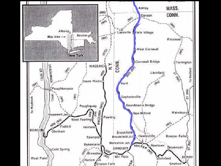
 Canaan Falls Village West Cornwall Housatonic Railroad Kent New Milford
 Housatonic RR completed 1841 By February 1840 rails stretched from Bridgeport, CT to New Milford, CT. In December of 1841, rails reached to Canaan, CT. Ten years later, the railroad had reached into Massachusetts and had forged links with the Western Railroad of Massachusetts. Major freight commodities on the Housatonic in this period were lime & limestone, marble, iron railcar wheels, coal, tobacco and tools, as well as many agricultural products. And it carried another very important product -- milk…the Housatonic RR was the very first run a scheduled milk train.
 Housatonic RR completed 1841 Newly immigrated, enduring prejudices, and in need of work, the Irish were the hardy souls that manned the pick axes and accomplished the arduous task in an astonishingly short timeframe. Much of the rail-line was laid either on or close to the ancient Indian pathways.
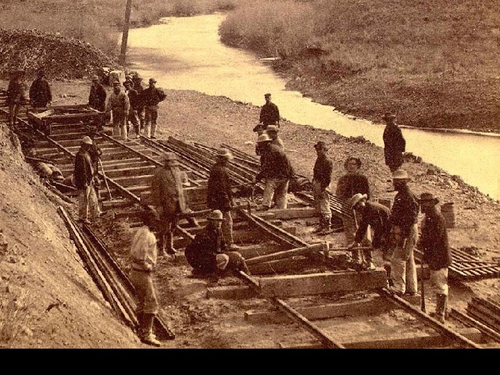
 Railroad Workers Pay- 1851 Name Days Wages Board Take-Home Pay John Mc. Cauliff 21. 75 $0. 00 $21. 75 Thomas Corcey 19. 75 $14. 81 $8. 70 $6. 11 Timothy Sullivan 19. 25 $14. 44 $10. 00 $4. 44 Andrew Sullivan 22. 00 $16. 50 $10. 00 $6. 50 John Brody 9. 75 $6. 17 $7. 50 -$1. 58
 Commodities came into Connecticut via the Railroad too Pounds Commodity & Destination 1880 750 200 1050 4800 900 1800 Groceries- Litchfield Salt and Cod- Redding Tea- Derby Soap and Starch- Ansonia Tobacco- Danbury Rags- New Haven Eggs- Bridgeport
 In addition to products, immigrants found their way to Connecticut via the railways.
 Routes 112, 126, 63 Route 5 I-84 What is amazing is that Indian Path played a major role in all these transportation systems Routes 41, 7, 202, 35 384 Canal Route 44 & 198 Route 6 Route 2 Route 5 Route 32 Routes 67, 317, 6 I-395 Routes 119, 34, 25, and RR Line Route 15 Routes 7, 33, and RR Line Route 25 Route 1
 The Progression…
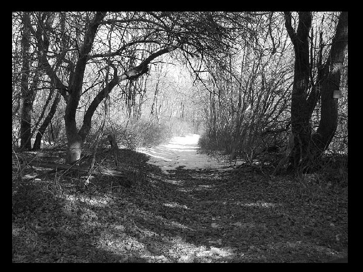
 From Pathways
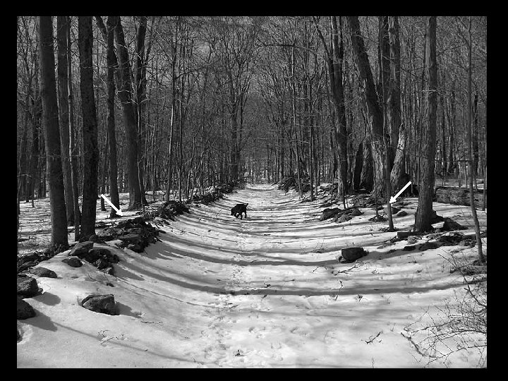
 To Bridle Paths
 To Cart Paths
 Turnpikes
 Modern Highways
 And Railways
 The Influence American Indians had on Connecticut is Extensive & Deserves Recognition
 It has been my pleasure to share this with you tonight. Thank you all for coming.