77073578c6da135adf0bf9bea104cf90.ppt
- Количество слайдов: 57

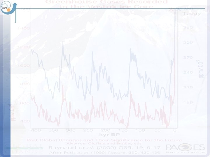
 The fundamental question of our time How is the Earth’s environment changing, and what are the consequences for human civilization?
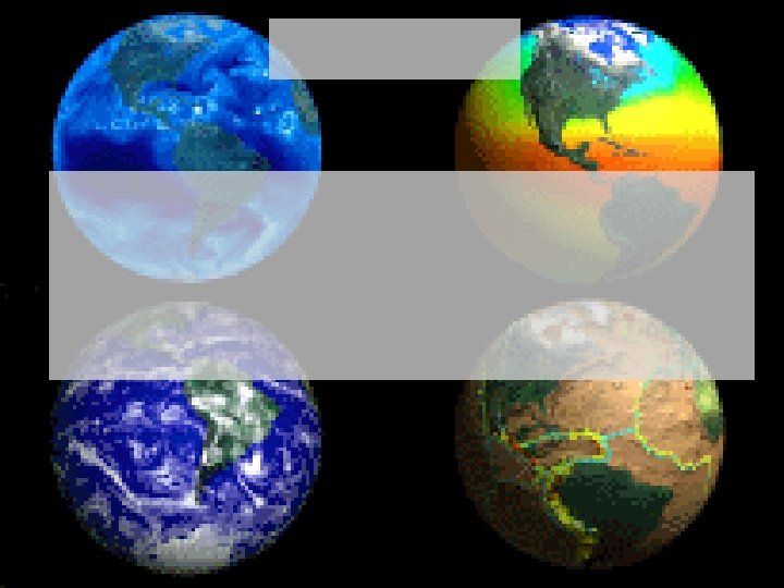
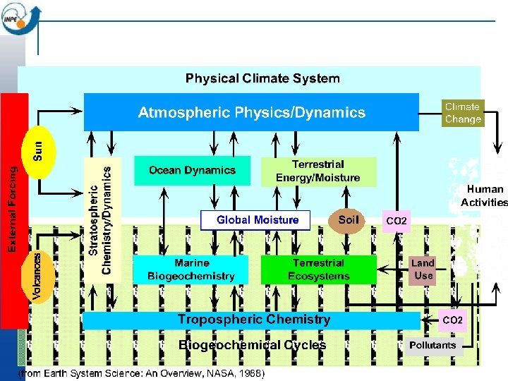
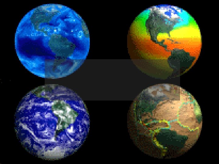
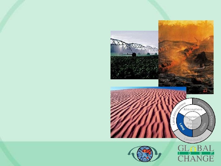
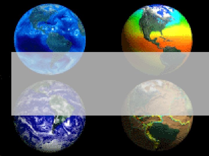
 Earth is a system of systems
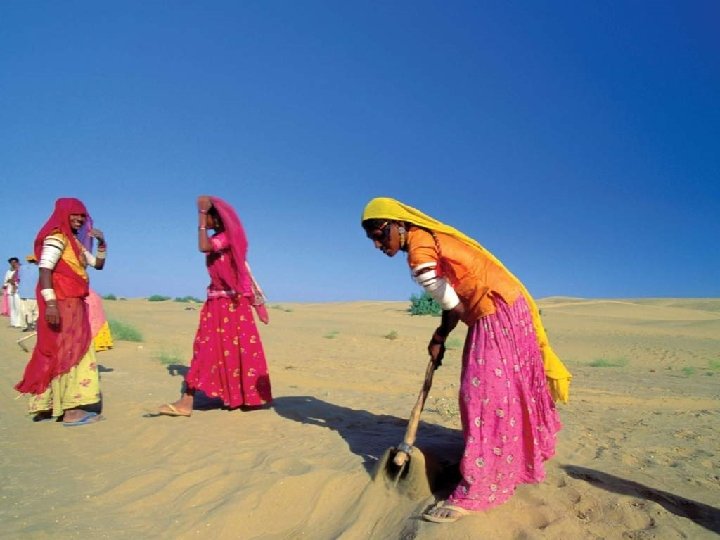
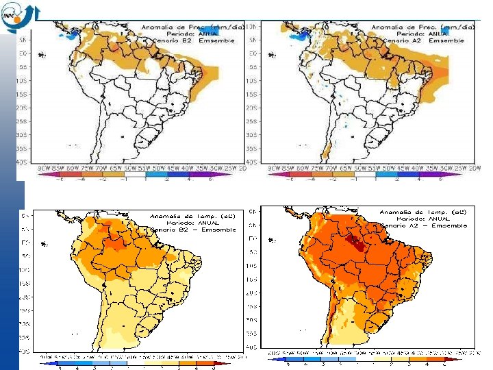
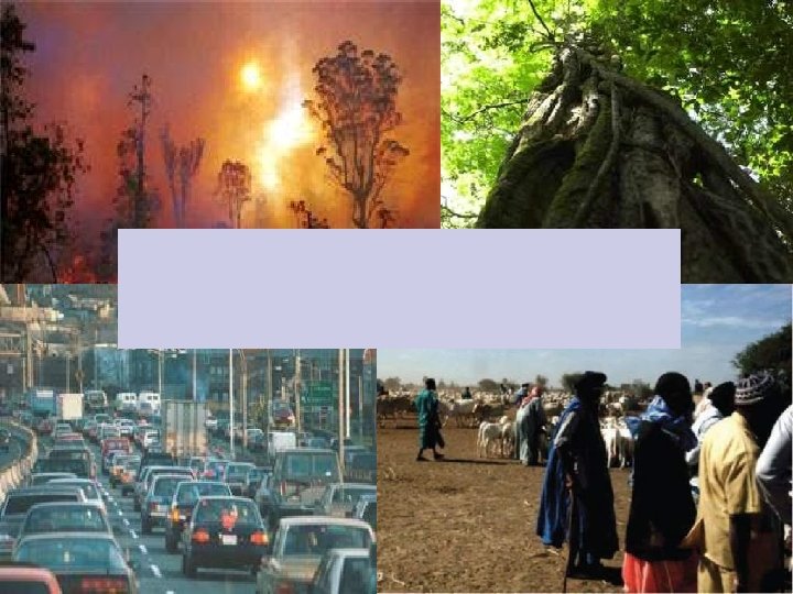
 Impacts on Agriculture
 Collapse of Amazon Rain Forest?
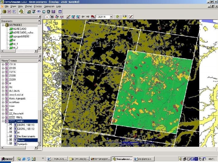
 Amazônia in 2005
 Amazônia in 2015?
 INPE´s supercomputers and world´s TOP 500
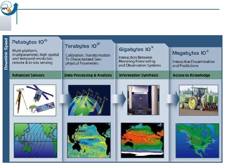
 Earth System Science Data Handling
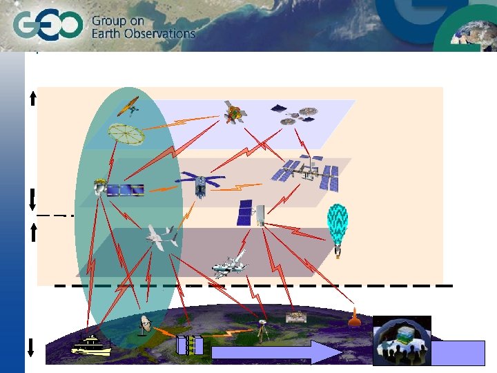
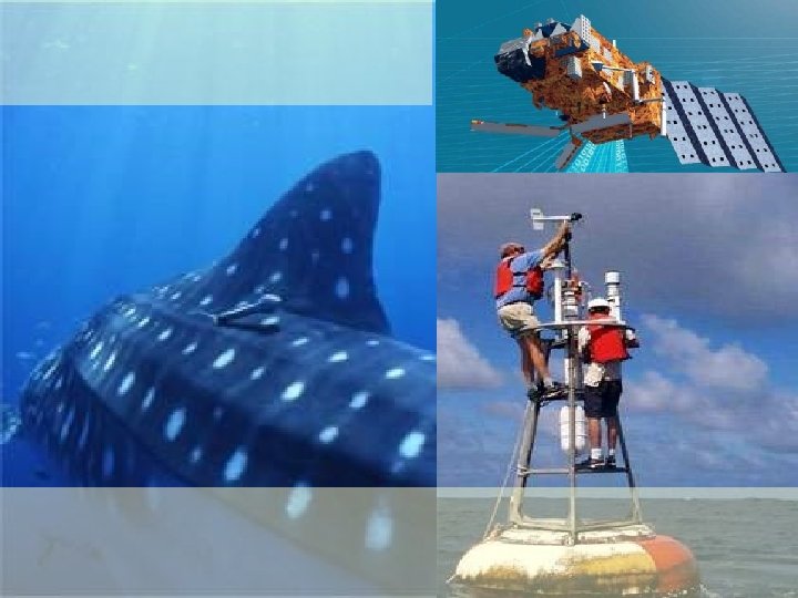
 Weather and climate
") ARGOS Data Collection System (16000 plats)
ARGOS Data Collection System (16000 plats)
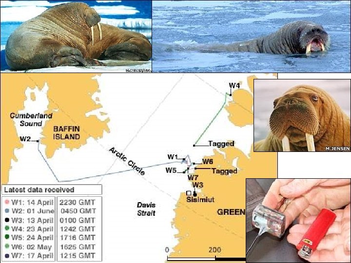
 Argo bouy network
 Models: From Global to Local
 Data integration enables crucial links between nature and society Nature: Physical equations Describe processes Society: Decisions on how to Use Earth´s resources
 mobile devices augmented reality Data-centered, mobile-enabled, contribution-based, field-based modelling sensor networks ubiquitous images and maps
 Slides from LANDSAT Aral Sea Bolivia
 Identity conditions on ST data Average temp for IPCC scenarios Continuous fields (x, y, z, t)
 Identity conditions on ST data land_cover cells in 1985 land_cover cells in 2000 Individual objects (id, {t, {(x, y, z)}})
 Identity conditions on ST data: Images
 Identity conditions on ST data: Images
 Identity conditions on ST data: Images
 Identity conditions on ST data: Images
 Identity conditions have uncertain cases!
 Outiline of a theory for change modelling in spatio-temporal data
 What is a geo-sensor?
 What is a geo-sensor?
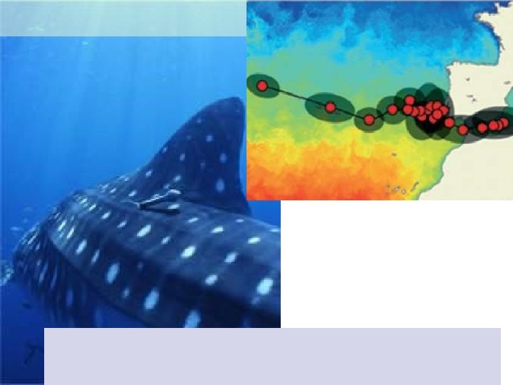
 Aral Sea Slides from LANDSAT Bolivia
 Sensors: sources of continuous information
 Sensors: water monitoring in Brazilian Cerrado
") Fixed sensors: time series (histories)
Fixed sensors: time series (histories)
 object") Evolving (modifiable) object
Evolving (modifiable) object
 Which objects are alive at time T and where are they?
 Models: From Global to Local
 A model for time-varying geospatial data. .
 Modelling (Terra. ME)") ST DBMS as a basis for data integration Visualization (Terra. View) Modelling (Terra. ME) Spatio-temporal Database (Terra. Lib) Statistics (a. RT) Data Mining(Geo. DMA)
ST DBMS as a basis for data integration Visualization (Terra. View) Modelling (Terra. ME) Spatio-temporal Database (Terra. Lib) Statistics (a. RT) Data Mining(Geo. DMA)
 GIS-21: Dynamical modelling integrated in a spatio-temporal database Spatio-temporal database
 GIS-21: Dynamical modelling integrated in a spatio-temporal database
 GIE-21: Network-based analysis Modelling beef chains in Amazonia
 GIS-21: Dynamical spatial modelling with Agents in Cell Spaces Terra. ME: Based on functional programming concepts (second-order functions) to develop dynamical models
 R-Terralib interface