bfaffe83361cb0582768c2080afdd17e.ppt
- Количество слайдов: 63
 Teaching Soaring Weather Soaring Safety Foundation FIRC Rich Carlson
 Basic Principles • Obtain the basic weather data • Know how the atmosphere works • Use some simple calculations to see if soaring is possible • Graphs and pictures improve student understanding • Weather analysis continues throughout the flight
 Obtaining Weather Data • • Look Outside Local sounding Flight Service Station (1 -800 -WXBrief) National Weather Service Duat 3 rd party service provider Internet (email and Web)
 Atmospheric Assumptions • • Pressure lapse rate Dry adiabatic lapse rate Wet adiabatic lapse rate Dew point decreases 1” hg/1000 ft 5. 4 o (3 c)/1000 ft less than dry 1 o / 1000 ft
 Soaring Calculations • Thermal Index (TI) – measured - adiabatic (minus is better) • Cloud base – (max surface - dewpoint)/4 (in 1000’s of ft)
 Obtaining a Weather Briefing • FSS call 1 -800 -992 -7433 (WXBrief) – Identify yourself as a glider pilot – Give Aircraft ‘N’ number – Say type of flight and location – Ask for standard briefing – Ask for surface reports – Ask for winds aloft forecast – Ask for Soaring forecast – Ask for other pertinent data (Notams, TFR’s)
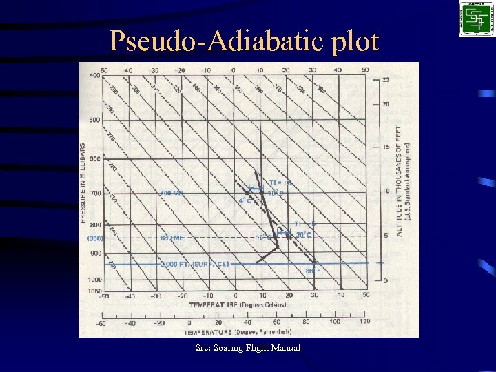 Pseudo-Adiabatic plot Src: Soaring Flight Manual
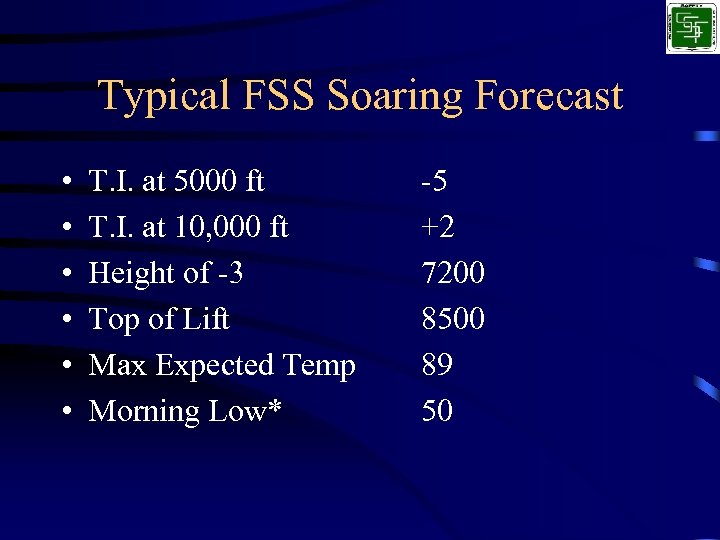 Typical FSS Soaring Forecast • • • T. I. at 5000 ft T. I. at 10, 000 ft Height of -3 Top of Lift Max Expected Temp Morning Low* -5 +2 7200 8500 89 50
 Step 1, draw the adiabatic line
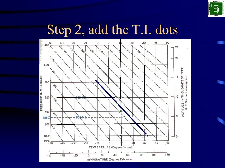 Step 2, add the T. I. dots
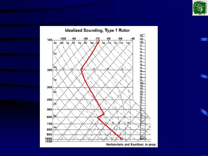
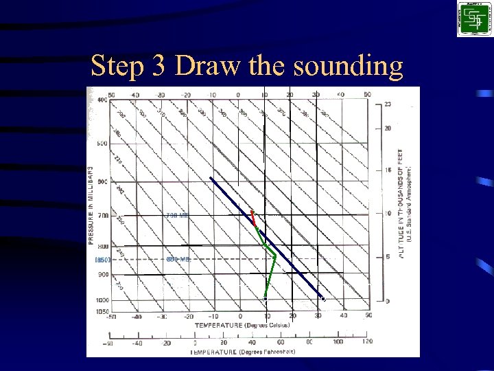 Step 3 Draw the sounding
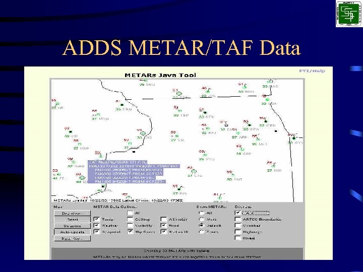
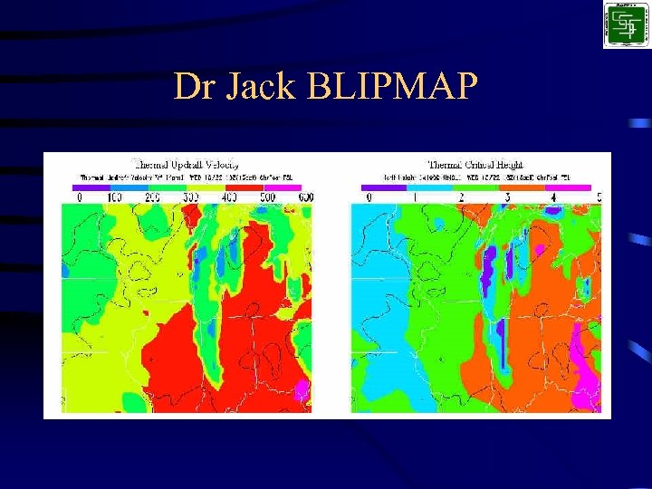
 Internet Sources • Kevin Ford - http: //www. soarforecast. com • NOAA-FSL, Forecast Systems Laboratory http: //www-frd. fsl. noaa. gov/mab/soundings/java/ • Aviation Digital Data Service http: //adds. aviationweather. noaa. gov • Dr Jack BLIPMAP http: //www. drjack. info/BLIP/index. html
 Kevin Ford Plots • • • • • • === Interpolations (temps MSL *TI* Wdir@kts trig ----- ---10000 12. 4 40 9500 11. 6 39 9000 10. 7 280 27 37 8500 9. 8 35 8000 8. 8 290 25 34 7500 7. 9 32 7000 6. 9 295 24 30 6500 6. 0 29 6000 3. 7 300 27 25 5500 3. 6 24 5000 3. 5 24 4500 3. 3 24 4000 2. 1 22 3500 0. 8 19 3000 -0. 5 18 2500 -1. 8 16 2000 -2. 1 15 1500 -2. 1 15 1000 -2. 1 15 in deg. F, altitudes in feet MSL) === Vir. T 1. 2 degrees/division ("`": Dry Adiabatic). ----------------------| -9. 8 ` : | -8. 6 ` : | -7. 5 ` : | -6. 5 ` : | -5. 5 ` : | -4. 5 ` : | -3. 5 ` : | -2. 6 ` : | -4. 0 ` : | -1. 5 ` : | 0. 9 ` : | 3. 3 ` : | 3. 7 ` : | 4. 1 `: | 4. 4 : ` | 4. 8 : ` | 7. 0 : ` | 9. 7 : ` | 12. 3 : `
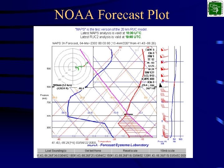 NOAA Forecast Plot
 ADDS METAR/TAF Data
 Dr Jack BLIPMAP
 Local factors • Terrain features – Ridges – Mountains – Rivers – Lakes – Towns
 Local factors • Ridge conditions – Calculations – Predictions • 90 O +/- 30 O to ridge line • 10 - 15 kts – Ridges • Lift extends 2 – 3 times the ridge height • Ridge length should be several miles
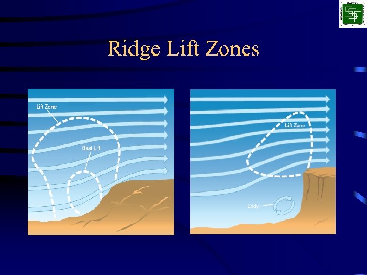 Ridge Lift Zones
 Local factors • Wave conditions – Calculations – Predictions • Wind at peak – 15 – 20 kts • Wind 2000 m above peak – Same direction – 20 – 25 kts higher
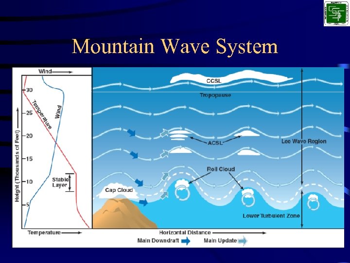 Mountain Wave System
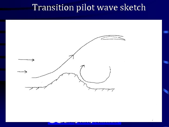 Transition pilot wave sketch 3/15/2018
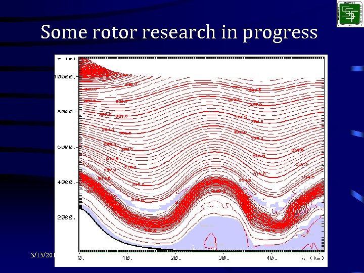 Some rotor research in progress 3/15/2018
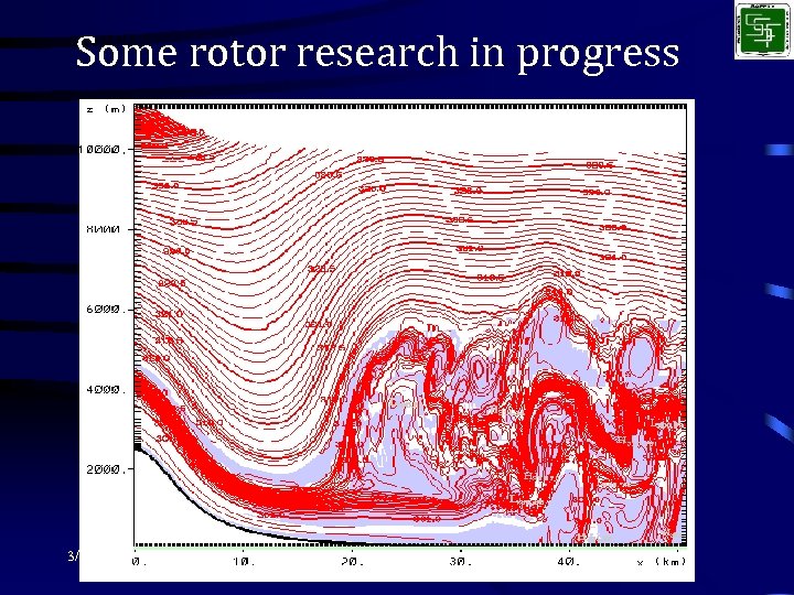 Some rotor research in progress 3/15/2018


 Thermal Predictors/Indicators • • • Negative Thermal Index values at alt. Forecast plots Clouds Birds/Gliders circling Dirt, crops, houses, animals rising before your eyes
 Go/No-Go Decision Making • Use realistic scenarios – Storms forecast for later in the day/evening – Effect of strong x-wind – Local vs X-C flight – Pilot experience level
 Continuing Weather Analysis • Obtaining enroute weather data – Flight Watch (122. 0 Mhz) – Airport automated weather services • Obtaining end-of-flight weather data – Wind direction for landing – Current Altimeter setting
 En Route Flight Advisory Service (Flight Watch) • • • AIM section 7 -1 -5 Real-time weather advisories National coverage above 5000 ft on 122. 0 Available 6: 00 am to 10: 00 pm State ARTCC facility, N number, & nearest VOR name
 Types of Fronts • Cold + Good soaring conditions – squall lines 50 - 300 miles ahead • Warm – temperature inversion – broad cloud system precedes front • Occluded – both warm & cold cloud patterns
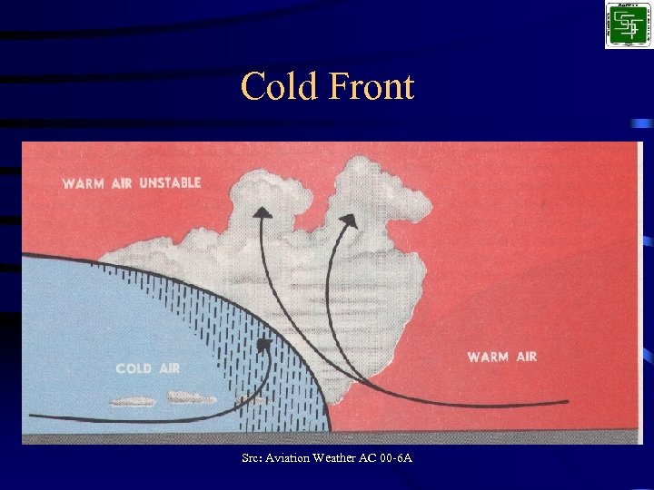 Cold Front Src: Aviation Weather AC 00 -6 A
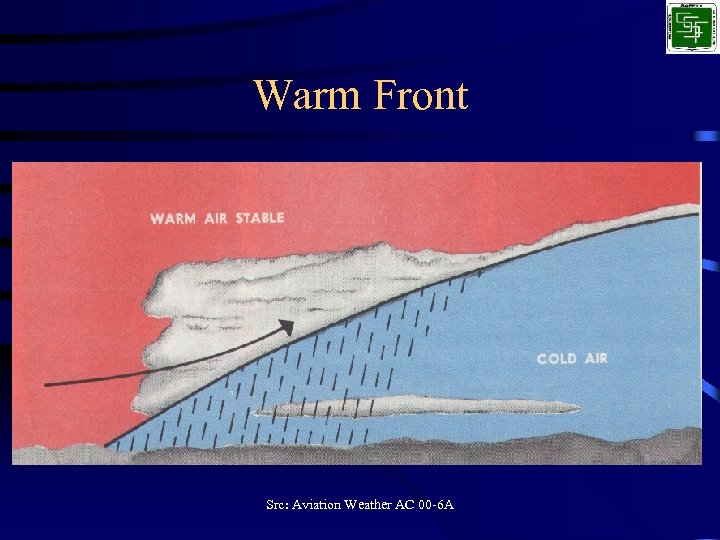 Warm Front Src: Aviation Weather AC 00 -6 A
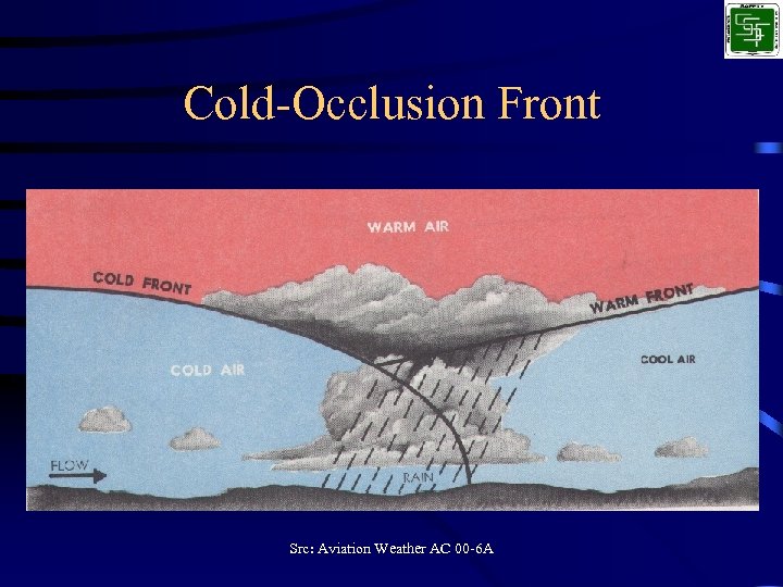 Cold-Occlusion Front Src: Aviation Weather AC 00 -6 A
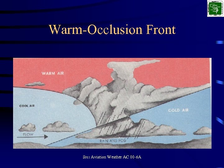 Warm-Occlusion Front Src: Aviation Weather AC 00 -6 A
 Seasonal Weather Operations • • • Density Altitude Thunderstorms Frost, Snow Ice Temperature extremes Wind shear Microbursts
 Determining When to Land • What effect does the wind have on landing?
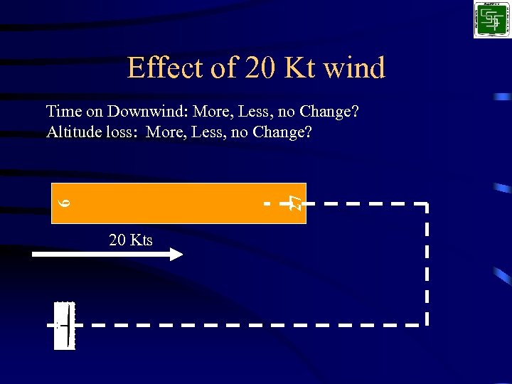 Effect of 20 Kt wind 9 27 Time on Downwind: More, Less, no Change? Altitude loss: More, Less, no Change? 20 Kts
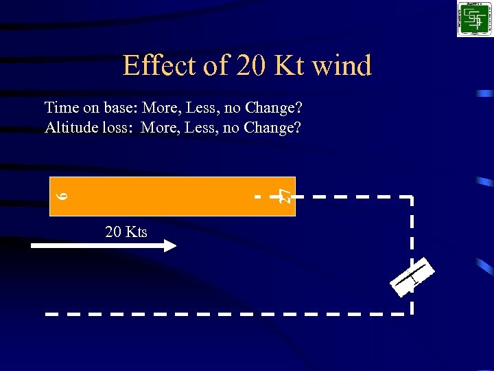 Effect of 20 Kt wind 9 27 Time on base: More, Less, no Change? Altitude loss: More, Less, no Change? 20 Kts
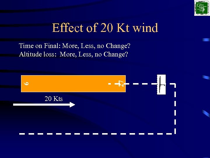 Effect of 20 Kt wind 9 27 Time on Final: More, Less, no Change? Altitude loss: More, Less, no Change? 20 Kts
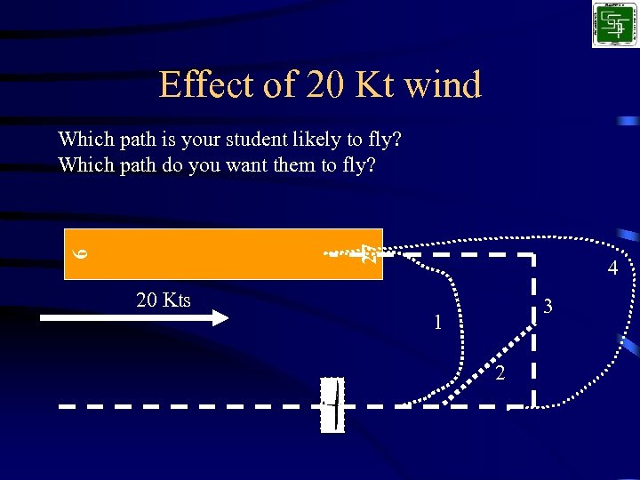 Effect of 20 Kt wind 9 27 Which path is your student likely to fly? Which path do you want them to fly? 20 Kts 4 3 1 2
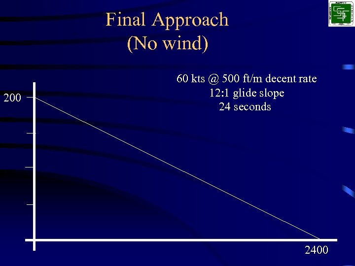 Final Approach (No wind) 200 60 kts @ 500 ft/m decent rate 12: 1 glide slope 24 seconds 2400
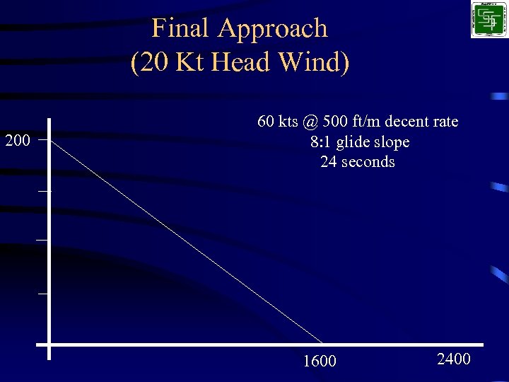 Final Approach (20 Kt Head Wind) 200 60 kts @ 500 ft/m decent rate 8: 1 glide slope 24 seconds 1600 2400
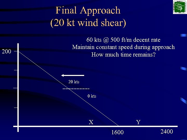 Final Approach (20 kt wind shear) 200 60 kts @ 500 ft/m decent rate Maintain constant speed during approach How much time remains? 20 kts X Y 1600 2400
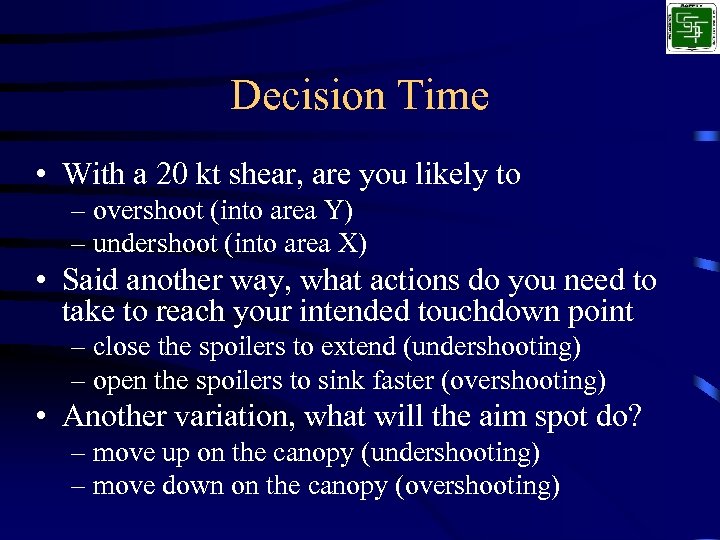 Decision Time • With a 20 kt shear, are you likely to – overshoot (into area Y) – undershoot (into area X) • Said another way, what actions do you need to take to reach your intended touchdown point – close the spoilers to extend (undershooting) – open the spoilers to sink faster (overshooting) • Another variation, what will the aim spot do? – move up on the canopy (undershooting) – move down on the canopy (overshooting)
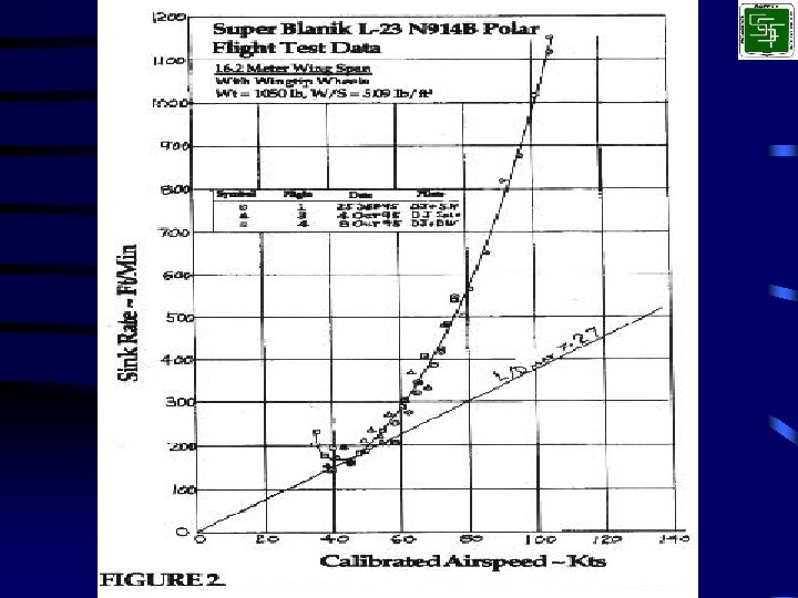
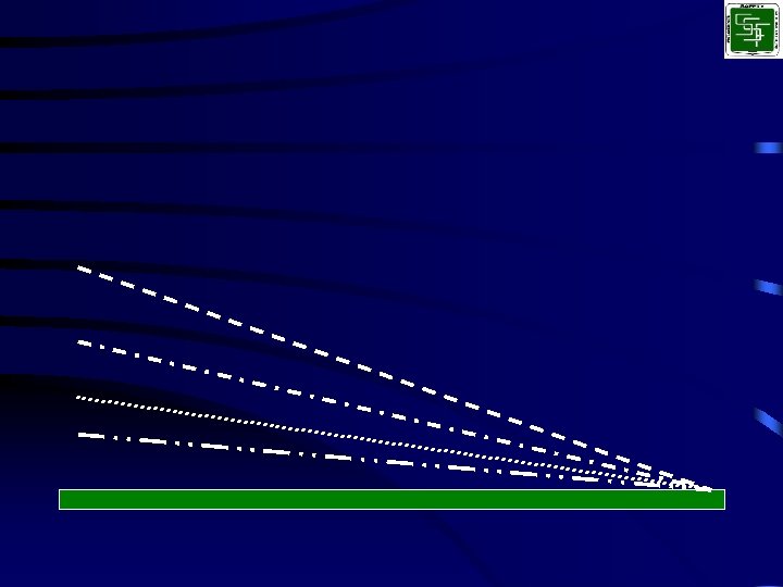
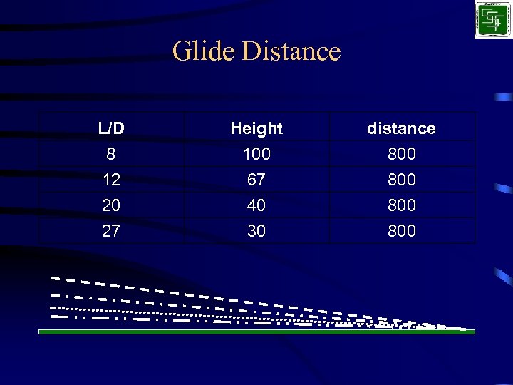 Glide Distance L/D 8 12 20 Height 100 67 40 distance 800 800 27 30 800
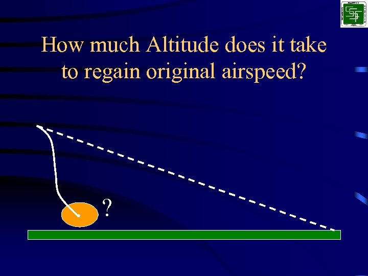 How much Altitude does it take to regain original airspeed? ?
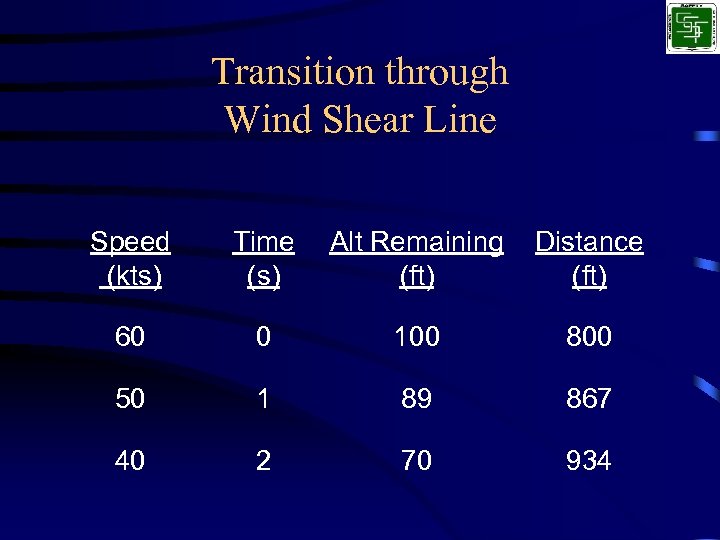 Transition through Wind Shear Line Speed (kts) Time (s) Alt Remaining (ft) Distance (ft) 60 0 100 800 50 1 89 867 40 2 70 934
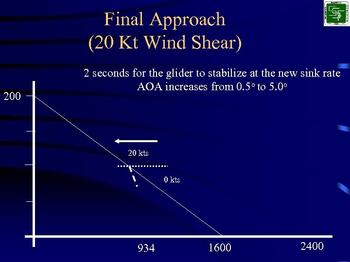 Final Approach (20 Kt Wind Shear) 200 2 seconds for the glider to stabilize at the new sink rate AOA increases from 0. 5 o to 5. 0 o 20 kts 934 1600 2400
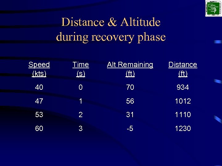 Distance & Altitude during recovery phase Speed (kts) Time (s) Alt Remaining (ft) Distance (ft) 40 0 70 934 47 1 56 1012 53 2 31 1110 60 3 -5 1230
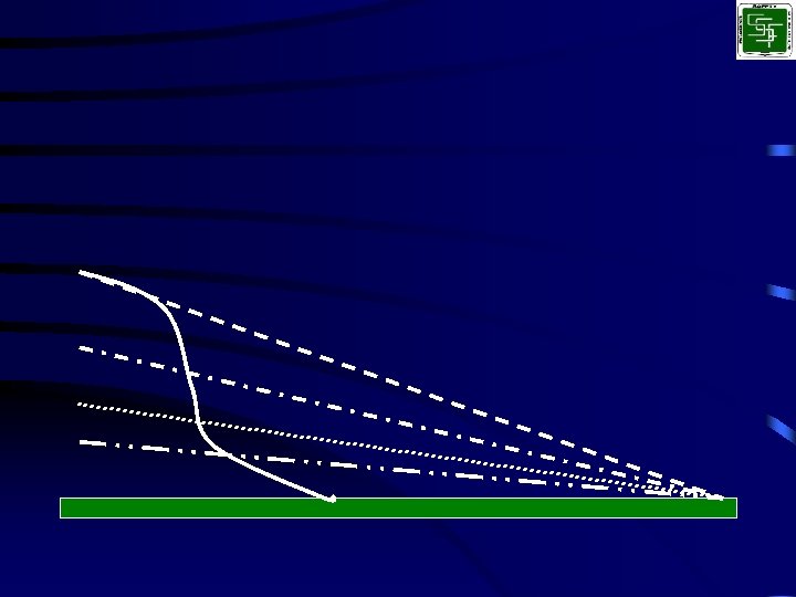
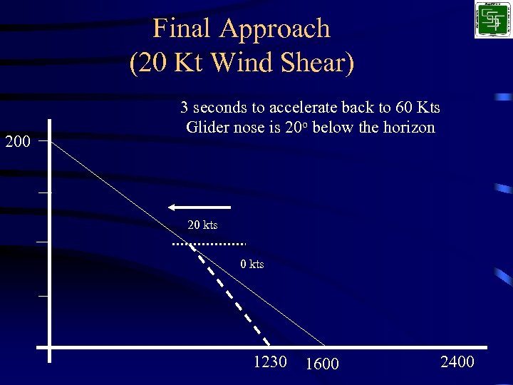 Final Approach (20 Kt Wind Shear) 200 3 seconds to accelerate back to 60 Kts Glider nose is 20 o below the horizon 20 kts 1230 1600 2400
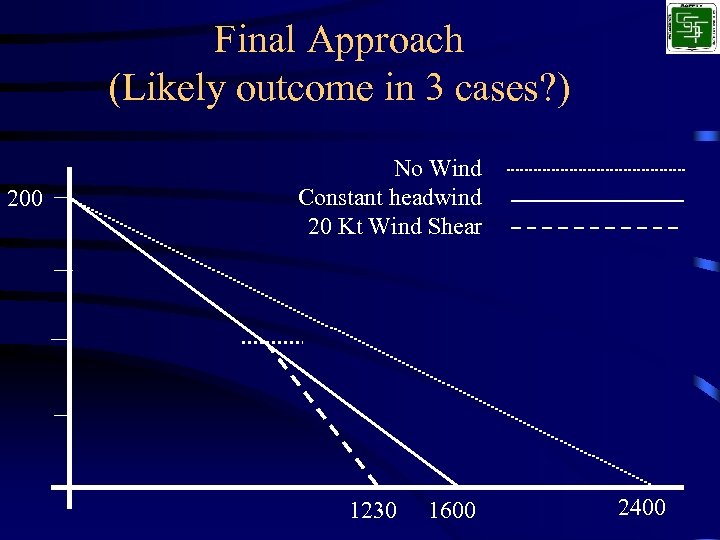 Final Approach (Likely outcome in 3 cases? ) 200 No Wind Constant headwind 20 Kt Wind Shear 1230 1600 2400
 Preliminary Analytical Results • No Wind – Distance is X • Steady 20 Kt head wind – Distance is X * 0. 67 (33% shorter) • Wind Gradient Case – Distance is X * 0. 47 (53% shorter)
 Shear Encounters • When can this happen? – Landing in gusty conditions – Landing area shielded by obstructions – During good thermal conditions
 Recommendations • Plan for this loss of energy – Pick an approach speed that will allow for some loss – Move base leg closer to runway edge – Be higher turning Final – Be prepared to close the spoilers – Be prepared to pitch forward to maintain/recover airspeed
 Conclusions • Shear line causes loss of Total Energy • Large Pitch change required to rapidly recover lost energy • Large amount of Time ‘lost’ while total energy changes • Immediate action is required to reach original touchdown point!
 Effects on Landing • Steady wind requires more energy – 800 feet closer or 100 ft higher for 20 kt wind • Changing wind requires more energy • Sink requires more energy • Ask yourself “Are you more likely to wind up getting low or high on final? ”

