

ae447f7399bb9d6e48c97b7d5a53dbc4.ppt
- Количество слайдов: 8
 Strategies and Implications for Integrating Geo. Spatial Technologies in Emergency Management Education Programs National Emergency Management Institute Higher Education Conference June 2, 2009 Dr. Jamie D. Mitchem Associate Professor of Geography/GIS Institute for Environmental and Spatial Analysis, Gainesville State College, Gainesville, GA 678 -717 -3927 jmitchem@gsc. edu
 Service and Teaching Opportunities and Strategies
, founded in 2001, is a") ► The Institute for Environmental and Spatial Analysis (IESA), founded in 2001, is a teaching, research, and public service resource whose focus is the characterization and management of environmental concerns in Northeast Georgia. ► Certificate Program and B. S. Degree in Applied Environmental Spatial Analysis ► Information Technology, Environmental Science, and Environmental Studies tracks
► The Institute for Environmental and Spatial Analysis (IESA), founded in 2001, is a teaching, research, and public service resource whose focus is the characterization and management of environmental concerns in Northeast Georgia. ► Certificate Program and B. S. Degree in Applied Environmental Spatial Analysis ► Information Technology, Environmental Science, and Environmental Studies tracks
 § GISC 2011 Introduction to Geographic Information Science") Certificate ► Required Courses (15 hours) § GISC 2011 Introduction to Geographic Information Science w/ Lab § GISC 4470 K Spatial Analysis in GIS with Lab § GISC 3011 K Fundamentals of Cartography and Earth Measurement § GISC 4011 K Data Acquisition and Conversion in GIS § GISC 4350 K Fundamentals of Remote Sensing ► Select 3 hours from the following courses: § GISC 2903 Special Topics in GIS § GISC 2963 Service Learning in GIS § GISC 2983 Internship in GIS
Certificate ► Required Courses (15 hours) § GISC 2011 Introduction to Geographic Information Science w/ Lab § GISC 4470 K Spatial Analysis in GIS with Lab § GISC 3011 K Fundamentals of Cartography and Earth Measurement § GISC 4011 K Data Acquisition and Conversion in GIS § GISC 4350 K Fundamentals of Remote Sensing ► Select 3 hours from the following courses: § GISC 2903 Special Topics in GIS § GISC 2963 Service Learning in GIS § GISC 2983 Internship in GIS
 ► Partners § Del Mar College (TX) § Southwestern College") Geo. Tech Center (NSF) ► Partners § Del Mar College (TX) § Southwestern College (CA) § KY Community Technical College System § Lake Land College (IL) § Gainesville State College (GA) § Central Piedmont Community College (NC) § Pennsylvania State University § South Carolina Advanced Technology Center of Excellence § Central New Mexico College § National Geospatial Technology Center and C 3 GIS (CA) § San Diego State University (CA) § Cayuga Community College (NY) § Century College (MN)
Geo. Tech Center (NSF) ► Partners § Del Mar College (TX) § Southwestern College (CA) § KY Community Technical College System § Lake Land College (IL) § Gainesville State College (GA) § Central Piedmont Community College (NC) § Pennsylvania State University § South Carolina Advanced Technology Center of Excellence § Central New Mexico College § National Geospatial Technology Center and C 3 GIS (CA) § San Diego State University (CA) § Cayuga Community College (NY) § Century College (MN)
 E 911 Map
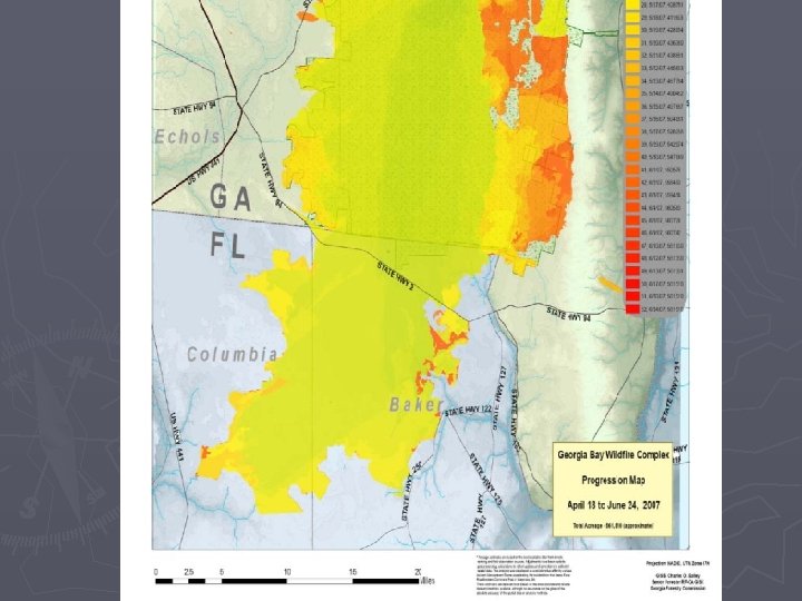
 Georgia Bay Complex Wildfire