

6197cc0ff4167f04579635a9757439b7.ppt
- Количество слайдов: 17
 Statistical Spatial Framework Increasing the Relevance of Statistics GRAPHC Ben Searle September 2012
 Growing Demand • Expectation for information in a geographic context – Google Maps has made ‘location information a commodity’ • Spatial technology is also a commodity – Desktop maps, phones, i. Pads, mobile devices etc • Increasing understanding of the value of applying a location to any information
 International Need The UN Economic and Social Council says “The work on global geospatial information management over the past two to three years has confirmed that one of the key challenges is a better integration of geospatial and statistical information as a basis for sound and evidence-based decision-making. ” Secretary-General, UN Economic and Social Council (2012)
 What is the Spatial Community Doing? • Spatial Data Infrastructure development – Australian Government – APS 200 Location – States and Territories – Research Community – CRC SI – Many countries – EU INSPIRE – International – UN Global Geographic Information Management
 and built environments. 3 D Models") SDI focus on the physical (natural) and built environments. 3 D Models
SDI focus on the physical (natural) and built environments. 3 D Models
 Statistical Spatial Framework Linking the spatial and statistical communities Spatial Community Statistical Spatial Framework Statistical Community
 Statistical Spatial Framework A statistical framework will establish another series of layers on top of spatial infrastructures
 Statistical Spatial Framework – Providing the statistical equivalent of topography, roads, rivers and boundaries – Providing a social, economic and environmental statistics context ‘layer’ – Providing a consistent approach to ‘people-centric decision making and service delivery focussed activities. – Adding value to agencies’ administrative data by enabling linkages through a common spatial framework Providing a common location based methodology
 ew or k ra m l. F tia ica l. S pa ist St at Best Practice Metadata Common geographic boundaries Data management: geo-referenced unit record data Agreed and authoritative geocoding
 ABS Governance And External Linkages Statistical Community Spatial Community Australian Government ASAC AGSF National STSS Research Community International UN-GGIM Australian Government APS 200 OSP ABS Statistical Spatial Framework Steering Committee National ANZLIC SIBA CRC SI International OGC
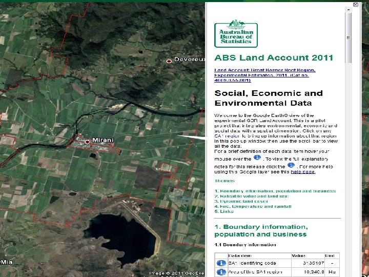
 What Might the SSF Look Like? Experimental Example from DSE Victoria Energy Usage
 Zoom to council boundary SA 2 view
 Zoom to SA 1 view
 Zoom to Meshblock plus time-series popup
 Conclusion • Statistical Spatial Framework offers a common approach to spatially enabling ‘people’ focussed statistical and administration information – Right time, right concept
 QUESTIONS