ea8baa5c3ac549c881f52c90259d798e.ppt
- Количество слайдов: 30
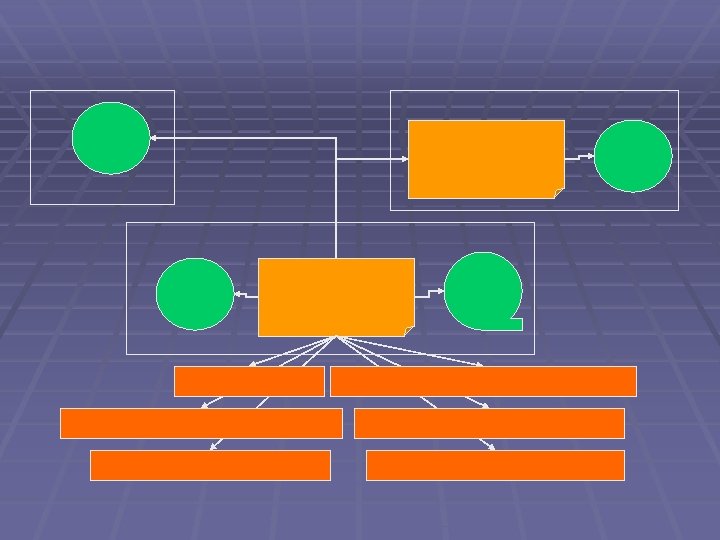

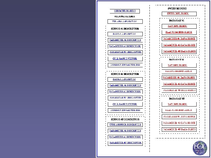
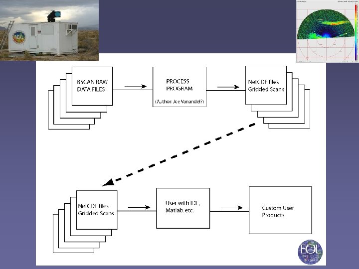
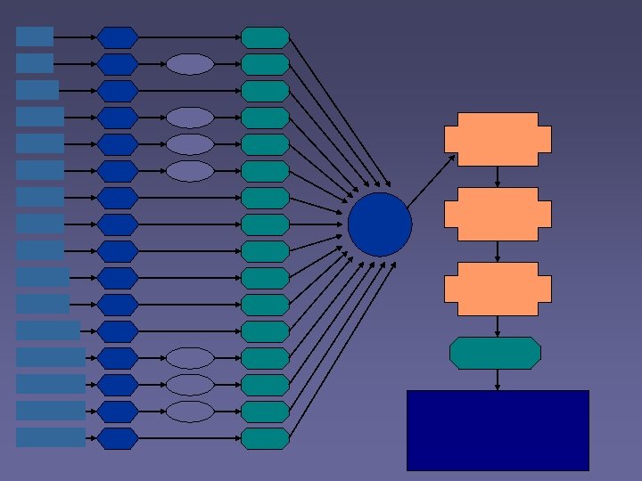
 S-Pol. Ka Data Flow
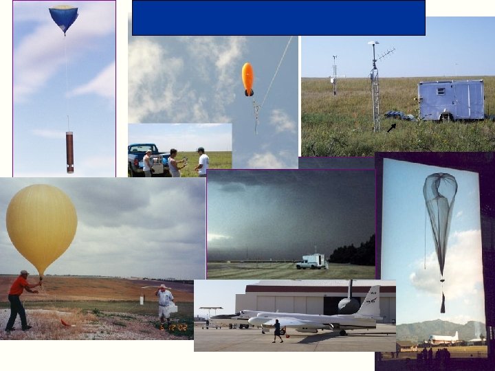
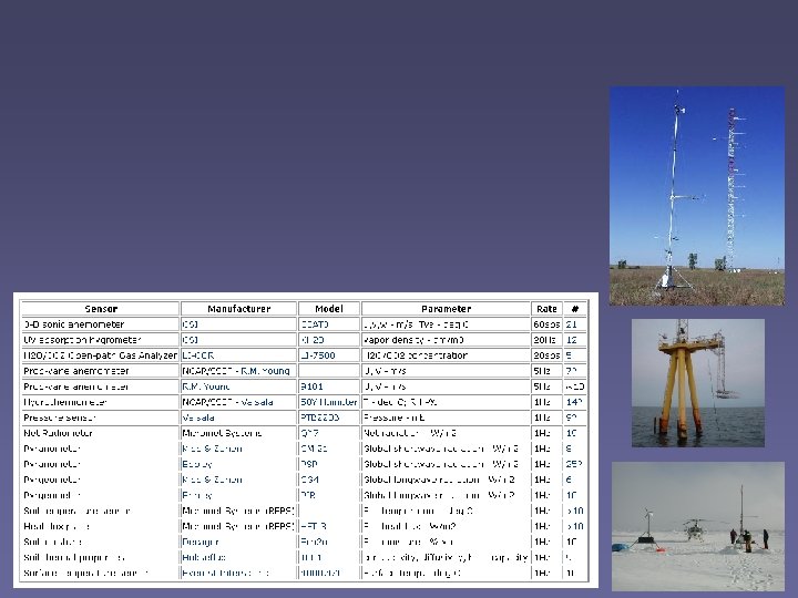
 Suites of instruments to profile the lower atmosphere Standard instruments : wind profiler radar, RASS, radiosondes (GAUS), surface met tower, solar radiation Optional Extras: MAPR, sodar, ceilometer, lidar, snow gauges, stabilized platform for ship operations, Mobile ISS (MISS), and more.
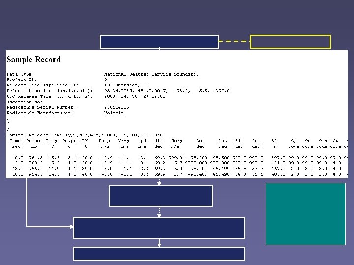
 Final Archive is Primarily net. CDF, some ascii and binary Data rate depends on config: 50 MB to 30 GB per day Preliminary data products back to Boulder via satellite Archive using CDs, DVDs, RAID, Super. DLT, Mass Store Radiosondes: QC processing using ASPEN Wind Profiler: QC processing using NIMA
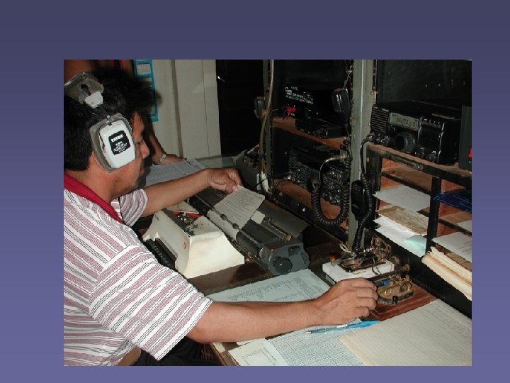
 SATELLITE DATA COLLECTION AND ARCHIVE
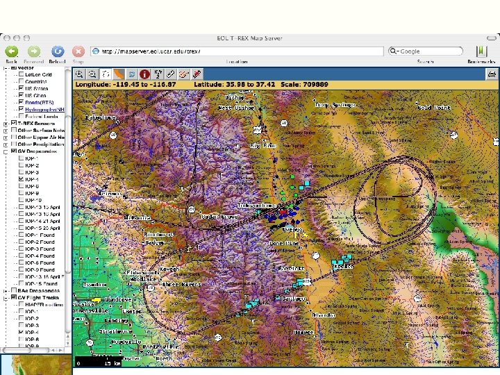
 T-REX SATELLITE DATA ARCHIVED BY EOL Instrument Channel/ Product Archived Units Resolution File Format Comments GOES-10 1 1, 4 km Albedo Net. CDF, TDF 2 4 km Temp(C) Net. CDF, TDF 3 4 km Temp(C) Net. CDF, TDF Raw data is not saved from GOES, only calibrated units. 4 4 km Temp(C) Net. CDF, TDF 6 4 km Temp(C) Net. CDF, TDF 15 min res, nominal True Color 250 m Imagery JPG As Available Vapor 1000 m Imagery JPG As Available COAMPS Winds (TC) 250 m Imagery JPG As Available 1 -5 1 km Raw Level 1 B As Available MODIS AVHRR
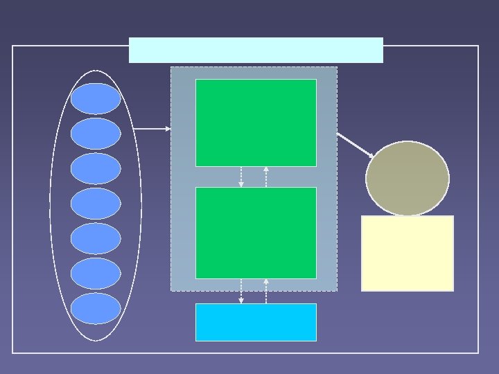
 NAME Data Flow

 REFERENCE SITE FLUX DATA SET FORMAT
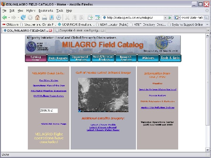
 NAME 2004 Field Catalog Statistics http: //www. joss. ucar. edu/name/catalog/
 Surface (Individual Networks and Composites) ASCII, Net. CDF") Upper Air (Individual Networks and Composites) Surface (Individual Networks and Composites) ASCII, Net. CDF Aircraft Oceanography Net. CDF, Binary, ASCII GRIB, Binary, Net. CDF ASCII, Imagery Radar Binary, Imagery Field Catalog Imagery, Text Mapserver Binary Model Output ASCII, Net. CDF
Upper Air (Individual Networks and Composites) Surface (Individual Networks and Composites) ASCII, Net. CDF Aircraft Oceanography Net. CDF, Binary, ASCII GRIB, Binary, Net. CDF ASCII, Imagery Radar Binary, Imagery Field Catalog Imagery, Text Mapserver Binary Model Output ASCII, Net. CDF