 Recent and Planned Updates to the NCAR Auto-Nowcast (ANC) System Thomas Saxen, Rita Roberts, Huaqing Cai, Eric Nelson, Dan Breed National Center for Atmospheric Research 5 th International Conference on Mesoscale Meteorology and Typhoon Boulder, Colorado October 31 th, 2006 saxen@ucar. edu
 Outline • • • Intro on ANC system Addition of multiple convective regimes Predicting elevated convection Transitioning output to probabilities Future work
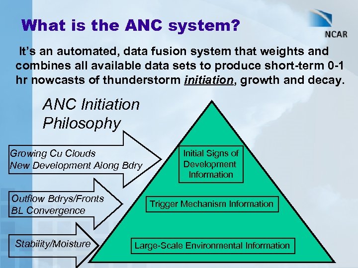 What is the ANC system? It’s an automated, data fusion system that weights and combines all available data sets to produce short-term 0 -1 hr nowcasts of thunderstorm initiation, growth and decay. ANC Initiation Philosophy Growing Cu Clouds New Development Along Bdry Outflow Bdrys/Fronts BL Convergence Stability/Moisture Initial Signs of Development Information Trigger Mechanism Information Large-Scale Environmental Information
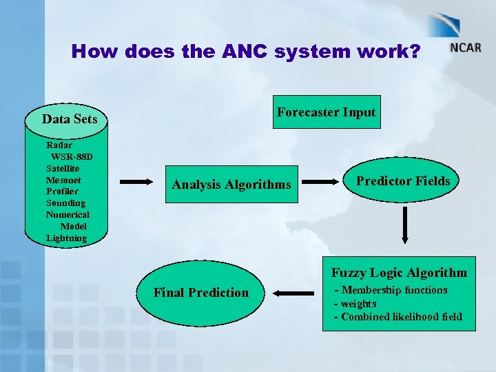 How does the ANC system work? Forecaster Input Data Sets Radar WSR-88 D Satellite Mesonet Profiler Sounding Numerical Model Lightning Analysis Algorithms Predictor Fields Fuzzy Logic Algorithm Final Prediction - Membership functions - weights - Combined likelihood field
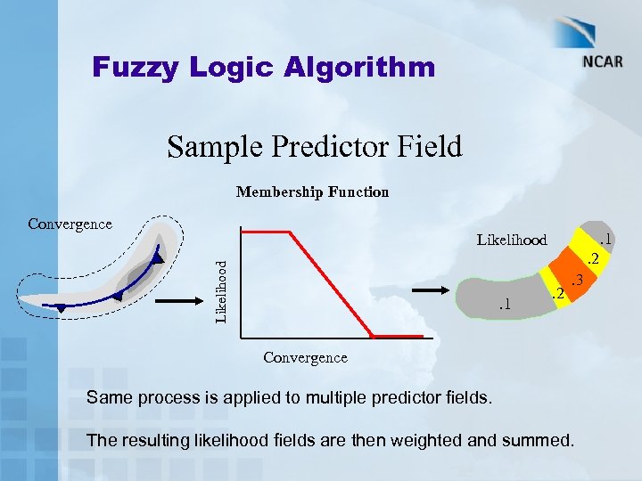 Fuzzy Logic Algorithm Sample Predictor Field Membership Function Convergence . 1 Likelihood . 2. 1 . 2 . 3 Convergence Same process is applied to multiple predictor fields. The resulting likelihood fields are then weighted and summed.
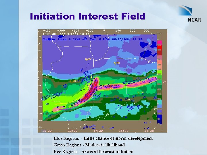 Initiation Interest Field Blue Regions - Little chance of storm development Green Regions - Moderate likelihood Regions - Areas of forecast initiation
 Convective Regimes • Some predictor fields work well in certain situations, but not so well in others. • Users set the expected convective regime to use forecast logic tailored for that situation. • Current regimes: – – – – Cold front Warm/Stationary front Dry line Advecting MCS Air-mass Mixed No storms expected
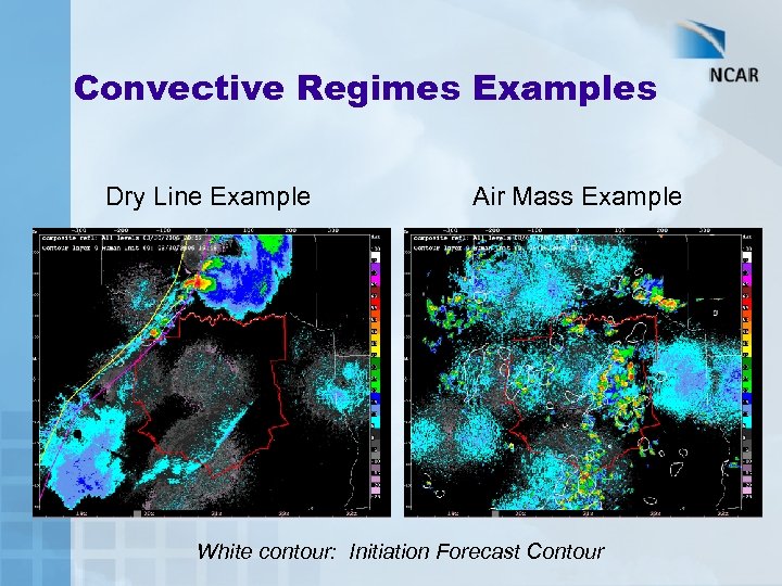 Convective Regimes Examples Dry Line Example Initiation CAPE Interest Air Mass Example Bdry Characteristics White contour: Initiation Forecast Contour Initiation IR Rate of Interest Change
 Elevated Convection • Original ANC system focused on surface based convection. • Consensus in the research community that ~ 50% of convective storms originate above the surface, based on Eta model diagnoses (Kain et al. 2003) and IHOP field experiment (Wilson and Roberts, 2005). • Approach is to use similar predictor fields (CAPE, CIN, Frontal Features, etc), but look at elevated levels.
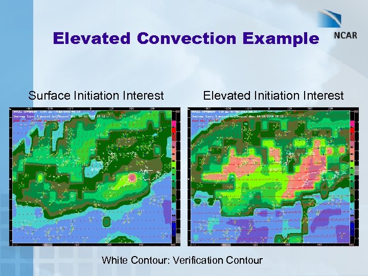 Elevated Convection Example Surface Initiation Interest Elevated Initiation Interest White Contour: Verification Contour
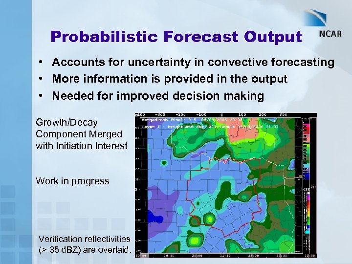 Probabilistic Forecast Output • Accounts for uncertainty in convective forecasting • More information is provided in the output • Needed for improved decision making Growth/Decay Component Merged with Initiation Interest Work in progress Verification reflectivities (> 35 d. BZ) are overlaid.
 Future Work Directions • Explore use of total lightning data in ANC system • Explore several statistical based forecast tuning algorithms
 Thank you. Questions?