4993190e9fdfbccbc99a2e18485adb0d.ppt
- Количество слайдов: 26
 Real-time Doppler Wind Quality Control and Analysis Qin Xu National Severe Storms Laboratory/NOAA Pengfei Zhang, Shun Liu, and Liping Liu CIMMS/University of Oklahoma
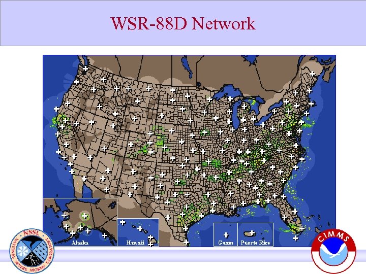 WSR-88 D Network
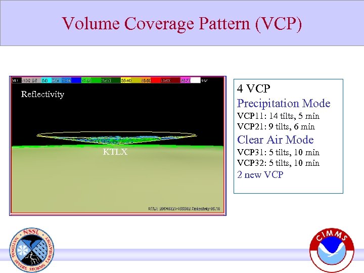 Volume Coverage Pattern (VCP) 4 VCP Precipitation Mode Reflectivity VCP 11: 14 tilts, 5 min VCP 21: 9 tilts, 6 min Clear Air Mode KTLX VCP 31: 5 tilts, 10 min VCP 32: 5 tilts, 10 min 2 new VCP
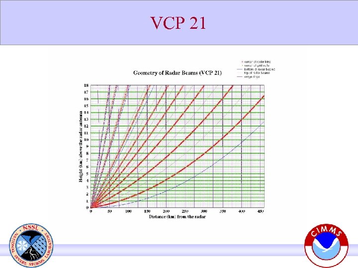 VCP 21
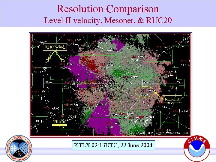 Resolution Comparison Level II velocity, Mesonet, & RUC 20 RUC Wind Mesonet 20 km KTLX 02: 13 UTC, 22 June 2004
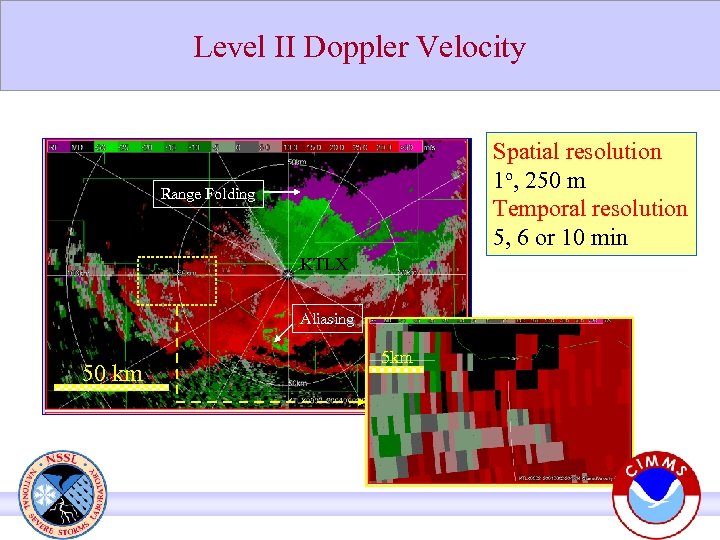 Level II Doppler Velocity Spatial resolution 1 o, 250 m Temporal resolution 5, 6 or 10 min Range Folding KTLX Aliasing 50 km 5 km
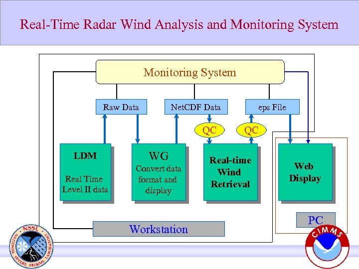 Real-Time Radar Wind Analysis and Monitoring System Raw Data Net. CDF Data QC LDM WG Real Time Level II data Convert data format and display Workstation eps File QC Real-time Wind Retrieval Web Display PC
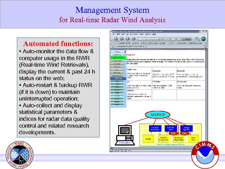 Management System for Real-time Radar Wind Analysis Automated functions: • Auto-monitor the data flow & computer usage in the RWR (Real-time Wind Retrievals), display the current & past 24 h status on the web; • Auto-restart & backup RWR (if it is down) to maintain uninterrupted operation; • Auto-collect and display statistical parameters & indices for radar data quality control and related research developments. QC QC
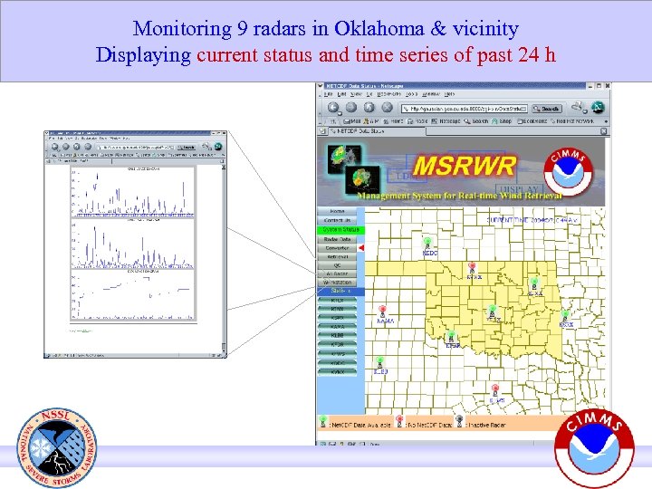 Monitoring 9 radars in Oklahoma & vicinity Displaying current status and time series of past 24 h
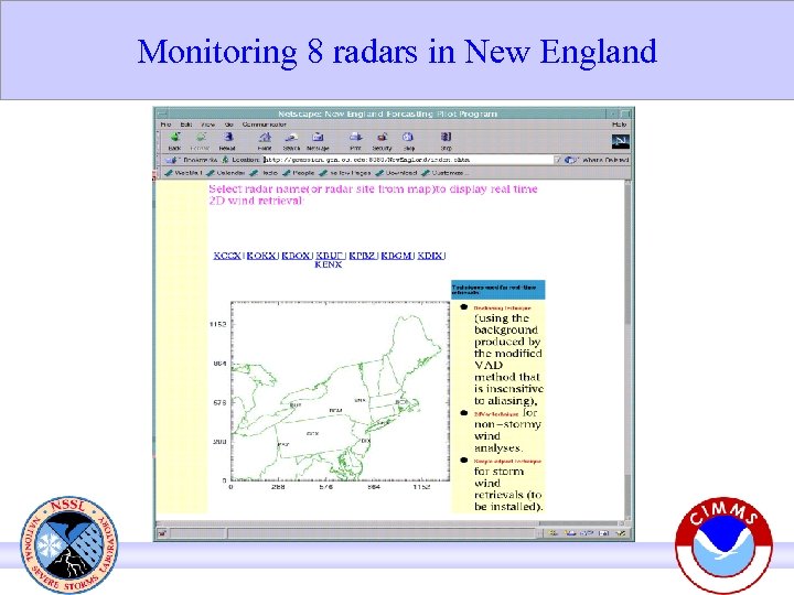 Monitoring 8 radars in New England
 Doppler velocity quality problems 1) Bird contamination 2) Noisy velocity field 3) Anomalous propagation (AP) caused ground clutter 4) Doppler velocity aliasing and range folding
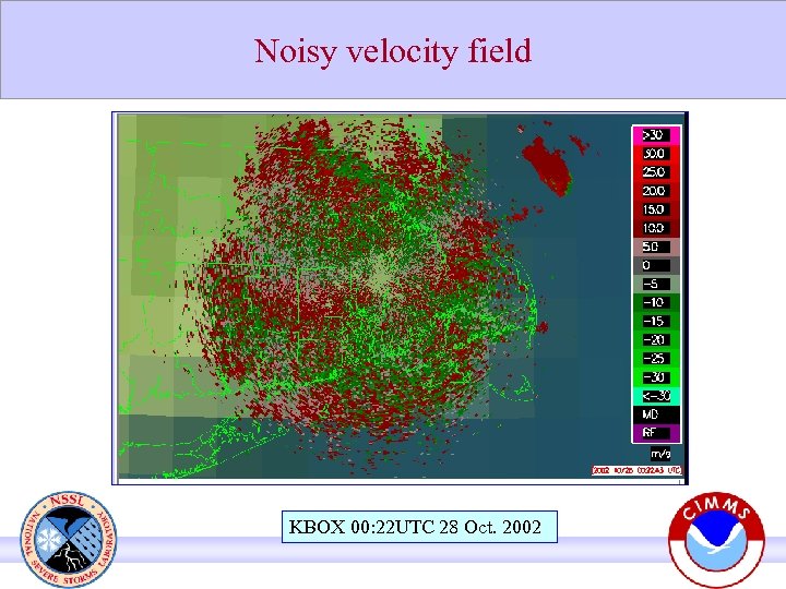 Noisy velocity field KBOX 00: 22 UTC 28 Oct. 2002
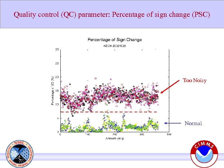 Quality control (QC) parameter: Percentage of sign change (PSC) Too Noisy Normal
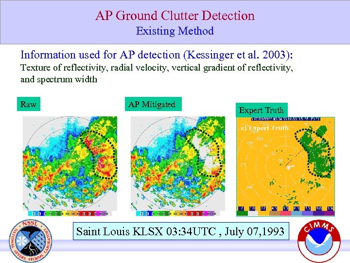 AP Ground Clutter Detection Existing Method Information used for AP detection (Kessinger et al. 2003): Texture of reflectivity, radial velocity, vertical gradient of reflectivity, and spectrum width Raw AP Mitigated Expert Truth Saint Louis KLSX 03: 34 UTC , July 07, 1993
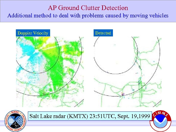 AP Ground Clutter Detection Additional method to deal with problems caused by moving vehicles Doppler Velocity Detected Salt Lake radar (KMTX) 23: 51 UTC, Sept. 19, 1999
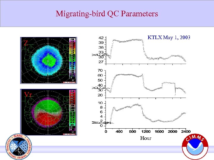 Migrating-bird QC Parameters Z KTLX May 1, 2003 Vr Hour
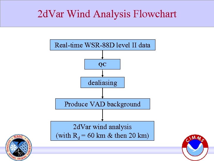 2 d. Var Wind Analysis Flowchart Real-time WSR-88 D level II data QC dealiasing Produce VAD background 2 d. Var wind analysis (with Rd = 60 km & then 20 km)
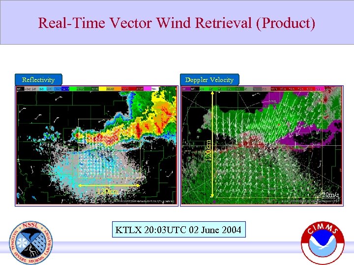 Real-Time Vector Wind Retrieval (Product) Doppler Velocity 120 km Reflectivity 120 km KTLX 20: 03 UTC 02 June 2004 20 m/s
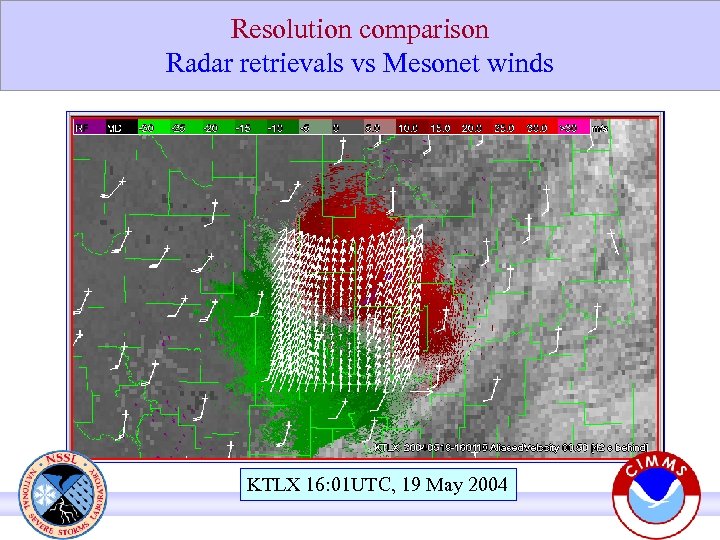 Resolution comparison Radar retrievals vs Mesonet winds KTLX 16: 01 UTC, 19 May 2004
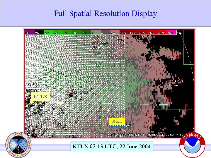 Full Spatial Resolution Display KTLX 10 km KTLX 02: 13 UTC, 22 June 2004
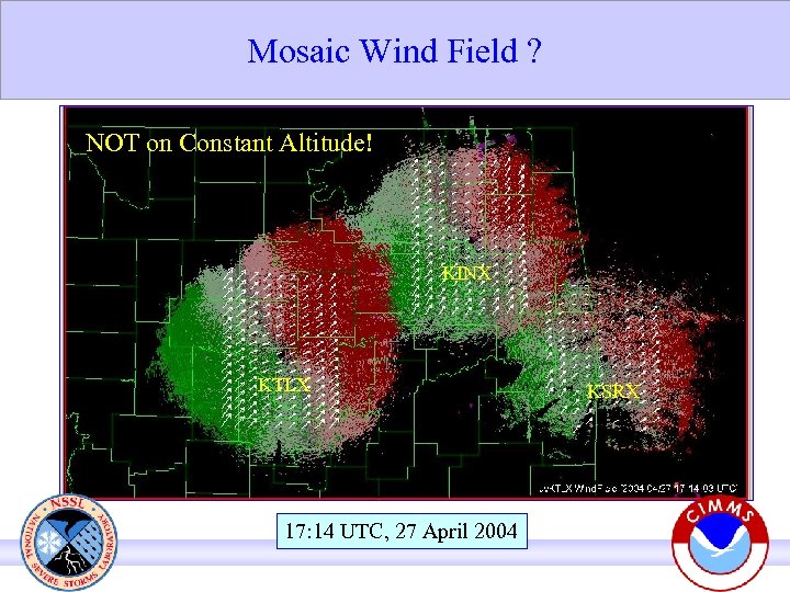 Mosaic Wind Field ? NOT on Constant Altitude! KINX KTLX 17: 14 UTC, 27 April 2004 KSRX
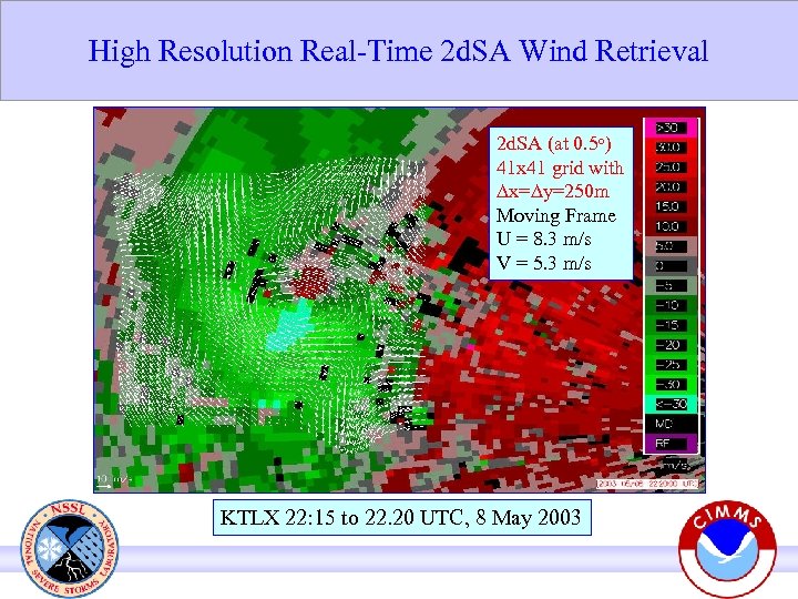 High Resolution Real-Time 2 d. SA Wind Retrieval 2 d. SA (at 0. 5 o) 41 x 41 grid with ∆x=∆y=250 m Moving Frame U = 8. 3 m/s V = 5. 3 m/s KTLX 22: 15 to 22. 20 UTC, 8 May 2003
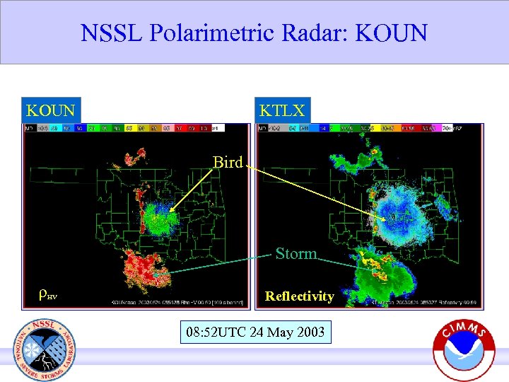 NSSL Polarimetric Radar: KOUN KTLX Bird Storm r HV Reflectivity 08: 52 UTC 24 May 2003
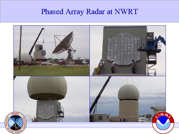 Phased Array Radar at NWRT
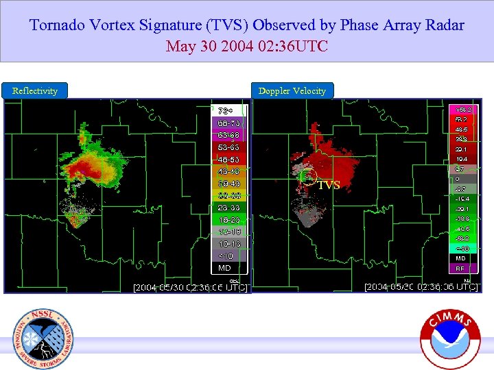 Tornado Vortex Signature (TVS) Observed by Phase Array Radar May 30 2004 02: 36 UTC Reflectivity Doppler Velocity TVS
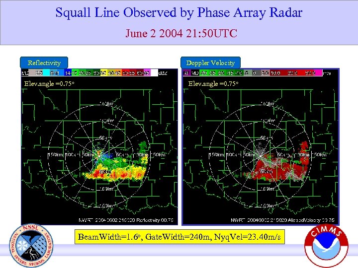 Squall Line Observed by Phase Array Radar June 2 2004 21: 50 UTC Reflectivity Elev. angle =0. 75 o Doppler Velocity Elev. angle =0. 75 o Beam. Width=1. 6 o, Gate. Width=240 m, Nyq. Vel=23. 40 m/s


