

fda8ca7c97ff4b9b1b19e45c17b83a2c.ppt
- Количество слайдов: 73
 PLASH: A Platform for Location Aware Service -- with human computation • • Ling-Jyh Chen(陳伶志), Meng Chang Chen(陳孟彰), Sheng-Wei Chen陳昇瑋, Jan-Ming Ho(何建明), Wang-Chien Lee(李旺謙), De-Nian Yang(楊得年), Mi-Yen Yeh(葉彌妍) • Research Center for Information Technology Innovation • & Institute of Information Science • Academia Sinica
 • To provide a platform to allow voluntary users via") Goals of PLASH (I) • To provide a platform to allow voluntary users via “human computation” to contribute their location-based observations/efforts so as to facilitate some difficult location aware tasks. – (Difficult location aware tasks) City profiling ( surface traffic estimation, telecommunication network performance monitoring, city trend analysis), trip planning, spot locating, etc. • To explore novel technologies to support the location aware platform and applications. – massive data processing and mining, geo-query process, trajectory mining, city route guidance, privacy preserving, etc. 2
Goals of PLASH (I) • To provide a platform to allow voluntary users via “human computation” to contribute their location-based observations/efforts so as to facilitate some difficult location aware tasks. – (Difficult location aware tasks) City profiling ( surface traffic estimation, telecommunication network performance monitoring, city trend analysis), trip planning, spot locating, etc. • To explore novel technologies to support the location aware platform and applications. – massive data processing and mining, geo-query process, trajectory mining, city route guidance, privacy preserving, etc. 2
 • To design a layered architecture to allow application builders") Goals of PLASH (II) • To design a layered architecture to allow application builders to conveniently create their systems. • To provide a location-based dataset benchmark for various research • To build and transfer prototype to potential receivers. • To promote the use of wireless communications. 3
Goals of PLASH (II) • To design a layered architecture to allow application builders to conveniently create their systems. • To provide a location-based dataset benchmark for various research • To build and transfer prototype to potential receivers. • To promote the use of wireless communications. 3
 Project PLASH Reality Mining Geo. Life Who CITI, Academia Sinica MIT") Related Work (I) Project PLASH Reality Mining Geo. Life Who CITI, Academia Sinica MIT Media Lab MS Research Asia PI(s) Meng Chang Chen Sandy Pentland Xing Xie and Yu Zheng Data Collection Mobile Phone w/ GPS and 3 G Mobile phone w/ Bluetooth Mobile phone w/ GPS /3 G Data Source Human Computation and Volunteering Contribution with Location Aware Applications Monitor 100 mobile phones over 9 months Upload by users Data Process Real-time / Post Real-time Data Representation Mobile Phone/Web None Mobile Phone/Web Objective • Build a platform for Location Aware Service with layered architecture. • Provide a standard AIP for other application builder. • Create City Profiling for traffic estimation, network performance monitoring, city trend analysis, etc. Mining human • Support location award applications with novel relationships and behavior technologies – e. g. , massive data mining, image-assisting positioning. • Provide a location-based dataset benchmark for various research. Social Networking Service 4
Related Work (I) Project PLASH Reality Mining Geo. Life Who CITI, Academia Sinica MIT Media Lab MS Research Asia PI(s) Meng Chang Chen Sandy Pentland Xing Xie and Yu Zheng Data Collection Mobile Phone w/ GPS and 3 G Mobile phone w/ Bluetooth Mobile phone w/ GPS /3 G Data Source Human Computation and Volunteering Contribution with Location Aware Applications Monitor 100 mobile phones over 9 months Upload by users Data Process Real-time / Post Real-time Data Representation Mobile Phone/Web None Mobile Phone/Web Objective • Build a platform for Location Aware Service with layered architecture. • Provide a standard AIP for other application builder. • Create City Profiling for traffic estimation, network performance monitoring, city trend analysis, etc. Mining human • Support location award applications with novel relationships and behavior technologies – e. g. , massive data mining, image-assisting positioning. • Provide a location-based dataset benchmark for various research. Social Networking Service 4
 Project PLASH Car. Tel Multmodal Daily Life Patterns Who CITI, Academia") Related Work (II) Project PLASH Car. Tel Multmodal Daily Life Patterns Who CITI, Academia Sinica MIT EPFL, Switzerland PI(s) Meng Chang Chen H. Balakrishnan, et al. K. Farrahi and D. Gatica. Perez Data Collection Mobile Phone w/ GPS and 3 G Sensors on Vehicles / Wi. Fi Mobile Phone Data Source Human Computation and Volunteering Contribution with Location Aware Applications Collected from sensors on 27 vehicles Monitor 97 users over 10 months Data Process Real-time / Post Processing Post Process Data Representation Mobile Phone/Web None Objective • Build a platform for Location Aware Service with layered architecture. • Provide a standard AIP for other application builder. • Create City Profiling for traffic estimation, network performance monitoring, city trend analysis, etc. Mobile Sensor Networks • Support location award applications with novel technologies – e. g. , massive data mining, image-assisting positioning. • Provide a location-based dataset benchmark for various research. Daily Life Patterns 5
Related Work (II) Project PLASH Car. Tel Multmodal Daily Life Patterns Who CITI, Academia Sinica MIT EPFL, Switzerland PI(s) Meng Chang Chen H. Balakrishnan, et al. K. Farrahi and D. Gatica. Perez Data Collection Mobile Phone w/ GPS and 3 G Sensors on Vehicles / Wi. Fi Mobile Phone Data Source Human Computation and Volunteering Contribution with Location Aware Applications Collected from sensors on 27 vehicles Monitor 97 users over 10 months Data Process Real-time / Post Processing Post Process Data Representation Mobile Phone/Web None Objective • Build a platform for Location Aware Service with layered architecture. • Provide a standard AIP for other application builder. • Create City Profiling for traffic estimation, network performance monitoring, city trend analysis, etc. Mobile Sensor Networks • Support location award applications with novel technologies – e. g. , massive data mining, image-assisting positioning. • Provide a location-based dataset benchmark for various research. Daily Life Patterns 5
 PLASH Layered Architecture Applications Map N’ Track Itinerary recomm endation Friend compa ss Enabling Technologies Massive data mining Service layer Data layer City Profiling Communication layer Fundamental services Literacy Enabling Service Data representation, storage and access Geolocation query V 2 I, V 2 V Localized data assimilation 6
 PLASH Scalable Operation Model
 for PLASH Service • Goal: To reuse the fundamental services") Application Specification Language (ASL) for PLASH Service • Goal: To reuse the fundamental services provided by voluntary users • Description File – Service Usage Declaration – Database Definition – Application Description • Construction File – Input Parameters – Mash-up services provided by others – Output Parameters
Application Specification Language (ASL) for PLASH Service • Goal: To reuse the fundamental services provided by voluntary users • Description File – Service Usage Declaration – Database Definition – Application Description • Construction File – Input Parameters – Mash-up services provided by others – Output Parameters
 Description File • Service Usage Declaration – Geo-query and personal information query are used in this e-Coupon service • Database Definition – Defines a schema of the private database used by the service • Application Description – General information of the service – Definition of shared service that other application can mash it up with own service 1 2 3 4 5 6 7 20 21 22 23 25 34 54 58 59 60 61 62 63 64 65 66 67 69 70 71 75 76 77 78 79 81 82 83 87 88 89 90
 Service 2 • Accept a set of input parameters • Return a set of output parameters as defined in the ASL Description. • Meshed-up Services Service 1 Construction File 1 2 3 4 5 6 8 9 10 11 12 13 14 15 20 21 22 23 24 25 26 27 28 33 34 35 36 37 38 39 40 46 47 48 57 58 59
 GUI for Server Application Construction 11
 GUI for Client Application Construction 12
 Urban Data Collection, Storage and Analysis • Urban Traffic is complicated – Massive real-time traffic collection to predict current traffic condition • Data Sources – Participatory Urban Sensing • Taipei e-bus GPS data • GPS data from Taxi fleet • From voluntary users 13
") Inter-Frame Coding (IFC)
Inter-Frame Coding (IFC)
 • Objectives – Facilitate large-scale location-based applications/systems with lossless compression •") Inter-Frame Coding (IFC) • Objectives – Facilitate large-scale location-based applications/systems with lossless compression • Technical Issues – Trajectory compression • Has to be lossless and representative • Support data queries and calculations on the compressed data
Inter-Frame Coding (IFC) • Objectives – Facilitate large-scale location-based applications/systems with lossless compression • Technical Issues – Trajectory compression • Has to be lossless and representative • Support data queries and calculations on the compressed data
 Inter-Frame Coding Algorithm Compression Ratio
 Results: IFC Compression Ratio Range Query TPE dataset Geo. Life dataset
 Spatial Query with Road Networks
 – A fundamental data access operations in LBSs") Introduction • Location-dependent spatial queries (LDSQs) – A fundamental data access operations in LBSs – Two common LDSQs • k-nearest neighbor (k. NN) Search -- Find the nearest bus station to the conference venue • Range search -- Find hotels within 10 -minutes walk from the conference venue • The-state-of-the-art LDSQ works – Cannot effectively support different distance metrics, e. g. , road distance or travel time • Efficient solutions are only designed based on the Euclidean Distance. Commercial tools, including Garmin, Tom, and Papago, all use the Euclidean distance as their LDSQ metric • Extensions of the Dijkstra’s algorithm were devised in the research literature, but all such solutions inevitably face performance impact due to the large search space
Introduction • Location-dependent spatial queries (LDSQs) – A fundamental data access operations in LBSs – Two common LDSQs • k-nearest neighbor (k. NN) Search -- Find the nearest bus station to the conference venue • Range search -- Find hotels within 10 -minutes walk from the conference venue • The-state-of-the-art LDSQ works – Cannot effectively support different distance metrics, e. g. , road distance or travel time • Efficient solutions are only designed based on the Euclidean Distance. Commercial tools, including Garmin, Tom, and Papago, all use the Euclidean distance as their LDSQ metric • Extensions of the Dijkstra’s algorithm were devised in the research literature, but all such solutions inevitably face performance impact due to the large search space
 Proposed system • Our Idea: a level-wise structure – Hierarchically segment the geo-graphical region into disjoint subregions – Transform each sub-regions to a connected structure, called Rnet. – A high-level Rnet encloses a set of small regional Rnets – We propose Rnet to prune search space effectively • Rnet contains some pre-determined shortest paths which will be reused when we search data in the corresponding region • Rnet can help to skip some search subspaces that do not contain any object • Rnet can be updated efficiently when the ROAD data is changed (e. g. , traffic information)
 Implementation • We have completed the server-side function – Effectively support different distance metrics – Support efficient update of ROAD metric data Rnet Hierarchy Road Database Association Directory Data Preprocessing KNN Search/ Range Search Data Collection Core Components UI candidat e objects Client side Server side K. Lee, W. Lee, B. Zheng, and Y. Tian, “ROAD: A New Spatial Object Search Framework for Road Networks, ” accepted by IEEE Trans. on Knowledge and Data Engineering.
 Mining Trajectory Data
 Mining Trajectory Data • Trajectory – A consecutive points with position and timestamp of a moving object • A huge amount of trajectory data can be collected anytime and anywhere nowadays. – Common use of tracking and positioning systems such as GPS devices – Advance of mobile communication technologies • Opportunity of discovering usable knowledge on moving behavior, which gives rise to novel mobile applications and location-based services.
 Trajectory Mining: Profiling by spatiotemporal trajectory dividing and clustering • Given a set of historical trajectories of moving objects, we want to group the similar parts and to separate the dissimilar ones. – Clustering is first adopted. • Trajectories are sequence of points with both position and timestamp information – Spatiotemporal mining techniques are needed.
 Profiling by Spatiotemporal Dividing and Clustering 1. Whole trajectory clustering? 2. Spatial only clustering? No, because… Trajectories are not uniform: 1. Trajectories may be similar only in some parts. 2. Not only the spatial information (displacement) but also the temporal information (speed) are important.
 Spatiotemporal Dividing Trajectory Data Divides trajectory according to the spatial and temporal criteria raw GPS data Trans. ID Longitude Latitude Date. Time 436 -FA 121. 459854 24. 993862 2010/2/28 23: 58: 18 343 -FG 121. 459801 24. 99386 2010/2/28 23: 58: 09 452 -FE 121. 746635 25. 025433 2010/2/28 23: 58: 17 037 -FP 121. 55394 25. 082588 2010/2/28 23: 58: 22 …………… …. ………… ……. ………………. . g idin tion/ Div nta on) ti me eg xima (s ro p ap
 Spatiotemporal Clustering the Trajectory Data Clustering trajectory segments 3 cluster centers Consider the Speed distance and Shift distance
 Bus Trajectories in Taipei City") Outline Map with Bus Data (by PLASH) Bus Trajectories in Taipei City
Outline Map with Bus Data (by PLASH) Bus Trajectories in Taipei City
 Our Results of the Spatiotemporal Dividing and Clustering on the Bus Trajectory Data
 Real-time Urban Traffic Visualization
 Problem Description • Traffic Visualization in Real-time • Traffic data from transportation bureau of each local government arrives periodically, e. g. , every 30 seconds • A user-request arrives randomly for the picture of traffic at a specified geo-tile, i. e. , a traf-tile • One wants to design the server such that it returns the requested traf-tile timely – Response time – Data freshness 31
 Timeout = 3 min 32") Real-time e-Bus Visualization(I) Timeout = 3 min 32
Real-time e-Bus Visualization(I) Timeout = 3 min 32
 Timeout = 3 min 33") Real-time e-Bus Visualization(II) Timeout = 3 min 33
Real-time e-Bus Visualization(II) Timeout = 3 min 33
 Vprobe
 Vprobe • Objectives – Facilitate urban profiling via participatory phone sensing • Technical Issues – Comfort Measurement of Transportation Experience • Participatory phone sensing • Emphasize real-world applications/services
 VProbe http: //VProbe. org/ Available on Android Market The current Version: 1. 10. 2 Snapshot on Android Snapshot on Browse System Architecture
 Results: Comfort Measurement Systems l l TPE-CMS Website: http: //VProbe. org/TPE-CMS/ 4, 028 buses 287 routes 15 agencies 1 sample per minute l l 931 buses 122 routes 10 agencies 1 sample per minute Using VProbe as the sensing tool, we used the proposed trajectory matching algorithm to find out the bus which participators took in a trip and evaluate comfort of the bus in the trip. We are now working with the e-bus systems (TPE and N-TPE cities) and the taxi company (great TPE area), and the system can be applied to other public transportation
 Itinerary suggestions with human computation
 Introduction – Problem: Trajectory clustering: Given a set of moving objects O together with their associated location sequence data set S , the moving object clustering problem is to partition O into non-overlapped groups such that the number of groups is minimized. – Application • Hot path recommendation • Social relationship analysis • Consuming behavior analysis – Expected Delivery • A scheme for trajectory data collection and cleaning • A similarity comparison function • A trajectory clustering algorithm
 Proposed architecture – Our Approach • A new similarity function • A distributed mining architecture phase 1: local mining phase 2: global ensembling Higher efficiency and discriminability Hsiao-Ping Tsai, De-Nian Yang, and Ming-Syan Chen, “Mining Group Movement Patterns for Tracking Moving Objects Efficiently, ” IEEE Trans. On TKDE, vol. 23, no. 2, Feb. , 2011.
 Implementation – We have completed the server-side function and client-side UI in Android User trajectories Clustering result
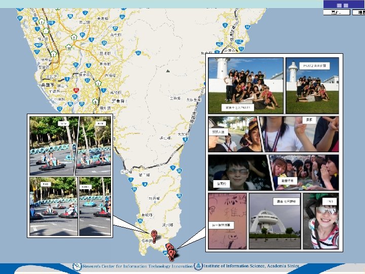
 Location-Aware Travel and Life Experience Summarization and Sharing System • Sheng-Wei Chen
 Photo Comics – Baby Born
 Photo Comics – Birthday Party
 Photo Comics – Daily Fun
 Media Comparison Cost Reading Req. Photo browsing Low High Low Slideshow Medium Low Text High High Comic High Low High Low Reading Richness Control Portability
 What we have done A computer-aided storytelling system to represent travel and life experience
 Procedures 1. Takes a sequence of digital pictures as input; 2. Identifies the events and the plotline within the pictures, and quantifies such understanding; 3. Accepts inputs from creators, including desired page number, markup style, picture attributes, captions, conversations, and so on; 4. Converts picture attributes to visual vocabulary and generates the comics; 5. Allows creators to fine tune the presentation of generated comics, and also allows re-iterating the process from Step 2 with creators’ feedbacks.
 Challenges #1 n Image Understanding n n n n Human recognition Emotion recognition Behavior recognition Object recognition Location identification Natural language processing Photo quality estimation
 Challenges #2 n Automatic Comic Creation n Significant photo selection Paginating and page layouting Narrative design
 User Interface - Scoring Phase
 User Interface - Editing Phase
 GPS Data Based Speed Pattern Estimation and Route Guidance in City Road Network 54
 Motivations • The traffic congestion leads significant delay that will waste a large amount of time and money • According to traffic condition to select correct travel route can reduce traffic congestion situation • Difficulties – High Traffic Dynamics – Sparse Data • Contributions – Two pha. Se Piecewise lin. Ear sp. Eed mo. Del (2 SPEED) – Classification-based Route Guidance Model 55
 Sparse GPS Dataset • Collected data may be sparse for certain time and/or certain road segment – Speed patterns of a road segment in the same hour of certain days are usually similar. – Nearby road segments may have similar traffic condition • Construct the road segment data from real-time data, historic data, neighboring data – Model the problem as an optimization problem 56
 to estimate traffic") 2 SPEED model • Previous works use mean travel speed (MTS) to estimate traffic condition • Note that the driver drives in a speed pattern influenced by the traffic condition of the road segment • Traffic condition of a road segment is modeled by two pha. Se Piecewise lin. Ear sp. Eed mo. Del (2 SPEED) with four parameters (V 0, C, α, β) medium fast slow Speed VC Speed pattern MTS α β V 0 Description V 0 Travel speed at the entry point of road segment C Speed change rate per time unit in phase 1 β Speed change rate per time unit in phase 2 Time Speed change location point α TC Road Segment C 57
2 SPEED model • Previous works use mean travel speed (MTS) to estimate traffic condition • Note that the driver drives in a speed pattern influenced by the traffic condition of the road segment • Traffic condition of a road segment is modeled by two pha. Se Piecewise lin. Ear sp. Eed mo. Del (2 SPEED) with four parameters (V 0, C, α, β) medium fast slow Speed VC Speed pattern MTS α β V 0 Description V 0 Travel speed at the entry point of road segment C Speed change rate per time unit in phase 1 β Speed change rate per time unit in phase 2 Time Speed change location point α TC Road Segment C 57
 Minimum travel time Route Guidance System Step 1 Traffic Condition Estimation Raw GPS dataset Road Network Information Construct road segment traffic data Traffic data for each road segment Step 2 Route Selection Major routes of a (src, dst) pair Calculate Route Travel Time Estimate Speed Pattern of each road segment in per time window Travel Time of Different Routes Best Route Guidanc e Model Query Route Guidance Learning Process 58
 Route Selection • Answer questions like “I want to go to location B from location A now. Which route is faster? ” • Snapshot Routing is not good enough 29 34 – But traffic conditions continuously change (i. e. , traffic dynamics) 14 33 8 – Previous works treat routing problem as an optimization/searching problem 1. Estimate the next x-minute traffic condition 2. Use this snapshot traffic condition to determine cost function 3. find minimum cost route using Dijkstra’s algorithm 6 8 10 14 15 5 minutes later 22 12 16 20 9 10 11 14 18 59
 pair") Minimum travel time route selection – Given date and time and (src, dst) pair – Find all major routes from source to destination – Obtain speed pattern estimation of road segments on the major routes Destination Source But… – When driver is on the road, the traffic condition changes as he/she moves on – Therefore we consider it is very important to take ongoing traffic condition changes in determining best route selection – We use machine learning technique (Support Vector Machine) to find the best route by learning from historic route data 60
Minimum travel time route selection – Given date and time and (src, dst) pair – Find all major routes from source to destination – Obtain speed pattern estimation of road segments on the major routes Destination Source But… – When driver is on the road, the traffic condition changes as he/she moves on – Therefore we consider it is very important to take ongoing traffic condition changes in determining best route selection – We use machine learning technique (Support Vector Machine) to find the best route by learning from historic route data 60
 Result#3: 2 SPEED vs. MTS Accuracy of four methods 1 • When RGM is used, if traffic condition is modeled by 2 SPEED will get better accuracy 0. 9 0. 8 Accuracy 0. 7 2 SPEED+RGM 0. 6 0. 5 0. 4 MTS+RGM 0. 3 0. 2 0. 1 0 12: 00 -14: 59 lunch 2 SPEED+RGM 15: 00 -17: 59 afternoon MTS+RGM 18: 00 -20: 59 dinner 21: 00 -23: 59 night 2 SPEED+SR Ø 2 SPEED describes traffic condition clearly Ø RGM will have better classification capability MTS+SR 61
 PLASH Status 62
 PLASH Server • 4 * Sun. Fire X 4170 1 U, 72 G RAM, 1. 2 T disk, redundant power, 4 Port Giga Ethernet (~40 VM ) • Net. App FAS 2040 RAID 12 * 300 G SAS Disk. • 2 * DELL Equal. Logic EPS 4000 E, 33 Tera Bytes • Total NT$2, 600, 000 (NT$537, 038 from PLASH project) 63
 PLASH Publications • • • Yao Hua Ho, Yao Chuan Wu, and Meng Chang Chen, “PLASH: A Platform for Location Aware Services with Human Computation”, IEEE Communications Magazine, December 2010. Cheng-Yu Lin, Ling-Jyh Chen, Ying-Yu Chen, and Wang-Chien Lee. A Comfort Measuring System for Public Transportation Systems Using Participatory Phone Sensing. International Workshop on Sensing for App Phones (Phone. Sense'10, in conjunction with ACM Sen. Sys'10), Zurich, Switzerland, 2010. H. -P. Tsai, D. -N. Yang, and M. -S. Chen, "Mining Group Movement Patterns for Tracking Moving Objects Efficiently, " IEEE Trans. on Knowledge and Data Engineering, Feb. 2011. K. Lee, W. Lee, B. Zheng, and Y. Tian, “ROAD: A New Spatial Object Search Framework for Road Networks, ” accepted by IEEE Trans. on Knowledge and Data Engineering. 64
 Patents • “Computer-Aided Pictorial Storytelling Systems, ” Sheng-Wei Chen, submitted to Taiwan and USA Patent Offices, pending. • “Graphical Representation of Gaming Experience, ” Sheng-Wei Chen, submitted to Taiwan, USA, Japan, and Korea Patent Offices, pending. . • “PLASH“, Meng Chang Chen et al, submitted to Taiwan Patent Office 65
 Technology Transfer • “Online Game Traffic and User Behavior Analysis Techniques, ” non-exclusively transferred to Gamania Digital Entertainment, Inc. • “Automatic Comics Storytelling, ” non-exclusively transferred to Macrowell, Inc. 66
 Future Work
 PLASH System Operability Outlook • • • Improve current system to operation quality Integrate available services/applications Extend functionality of services/applications Push scalability of PLASH Seek and collaborate with proper receivers 68
 Mining Trajectory Data • Build traffic model (including speed and car flow distribution of each road) based on historical trajectories (Taxi, Bus, etc. ) that we collect • With the above model, we will design an algorithm to do fastest path routing efficiently according to user's need • Explore other data mining techniques that help us discover usable knowledge that fosters novel mobile applications and services.
 Spatial and temporal normalization of comfort measurement • Comfort Index Normalization – Spatial and Temporal factors – Environmental factors
 Adaptive trajectory compression using intra-frame coding • Adaptive compression parameter N – Network bandwidth – Storage constraint – Computation constraint N • Data Security and Privacy
 Location-Aware Travel and Life Experience Summarization and Sharing System • Integrate online publish system e. g. , Issuu. com, Scribd, Yudu…etc. • Interact with social network e. g. , Facebook, MSN Live…etc. • Collaborate with LBS experience sharing and travel planning services e. g. , 地圖日記, 背包客棧 72
 Thank you! 73