
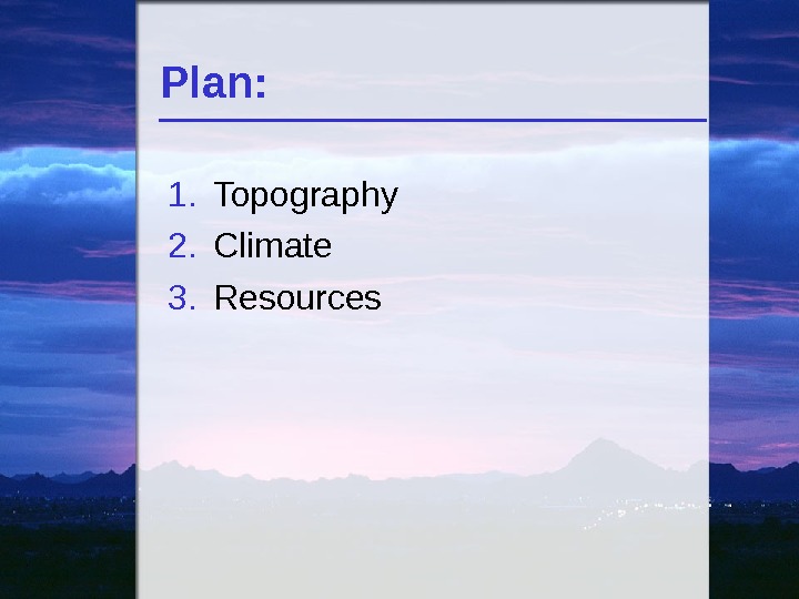
Plan: 1. Topography 2. Climate 3. Resources

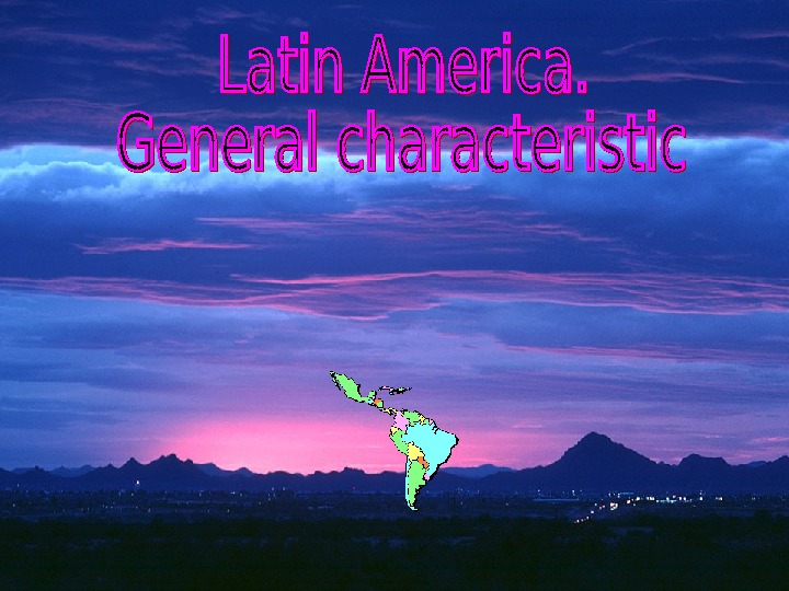


latin_america._general_characteristic.ppt
- Размер: 9.1 Mегабайта
- Количество слайдов: 63
Описание презентации Plan: 1. Topography 2. Climate 3. Resources по слайдам
Plan: 1. Topography 2. Climate 3. Resources
Latin America • 19, 1 million square km • 12, 6% of the earth’s surface • Historical roots: Spain and Portugal • Spanish and Portuguese based on Latin: Latin America • Population – about 590 million
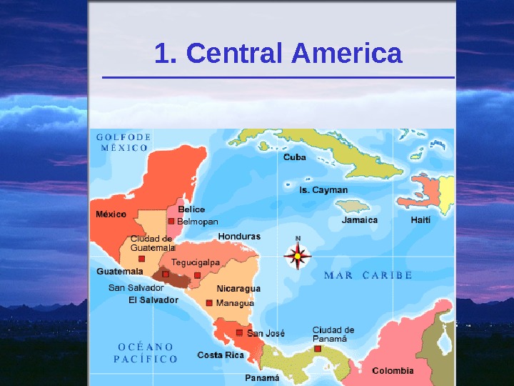
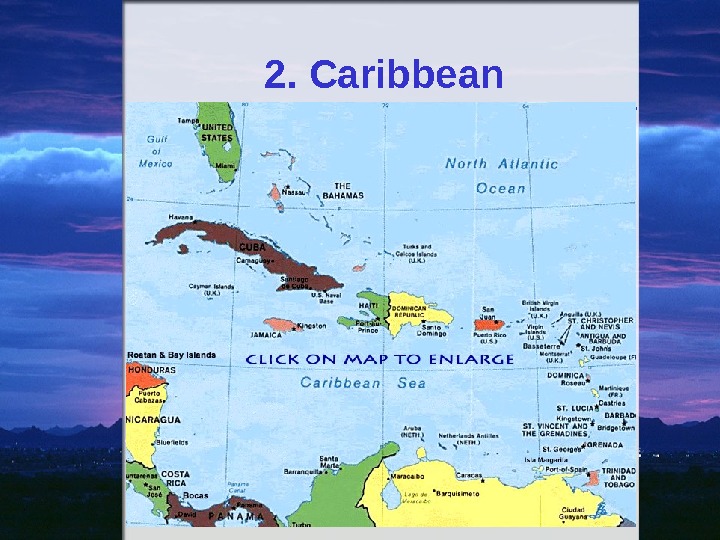
Regions of Latin America 1. Middle America a. Mexico b. Central America 2. Caribbean • a. Bahamas: • b. Greater Antilles (Cuba, Jamaica, Puerto Rico, Haiti, and the Dominican Republic) • c. Lesser Antilles 3. South America Central America The Caribbean South America
1. Central America
2. Caribbean
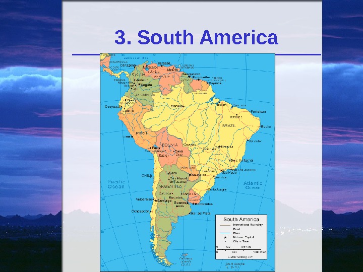
3. South America
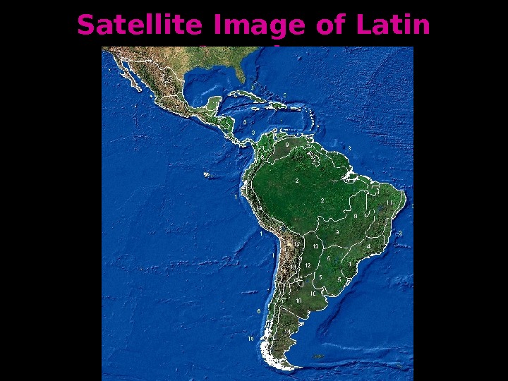
Satellite Image of Latin America
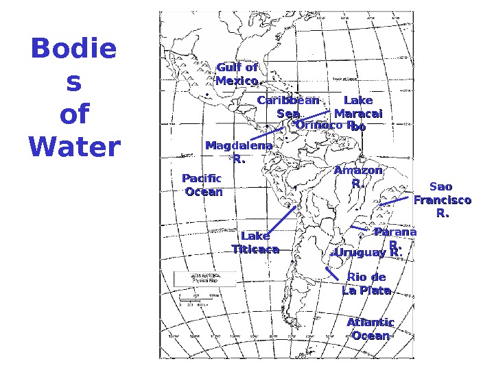
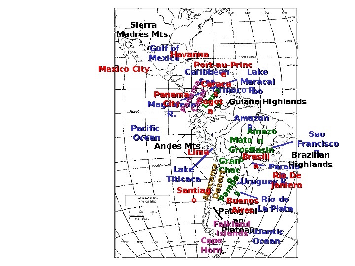
Bodie s of Water Atlantic Ocean. Pacific Ocean Gulf of Mexico Caribbean Sea Amazon R. R. Orinoco R. Uruguay R. Magdalena R. R. Sao Francisco R. R. Lake Titicaca Lake Maracai bobo Rio de La Plata Parana R. R.
Lake Titicaca: World’s highest lake ( 3812 m above sea level, depth — 304 m. , the largest fresh water basin, 8290 sq. km)
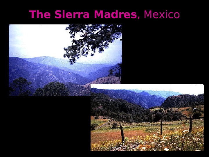
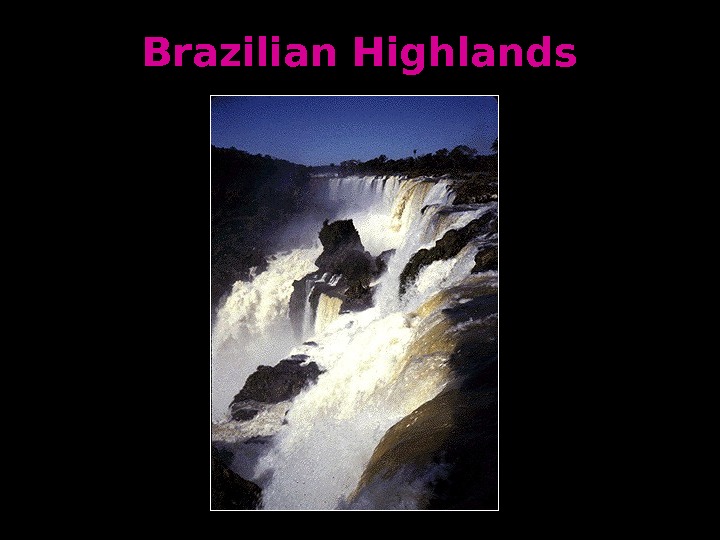
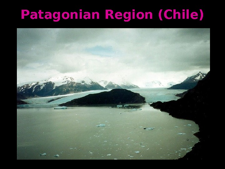
Mountain s and Peaks Andes Mts. Sierra Madres Mts. Guiana Highland ss Brazilian Highland ss Patagoni an an Plateau
Andes Mountains (Peru)
The Eastern Flank of the Andes
Llamas in the Andes
The Sierra Madres , Mexico
Guianan Highlands, Venezuela
Brazilian Highlands
Patagonian Region (Chile)
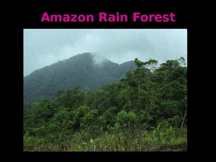
Valley s Plains and Basin s Amazo n n Basin. Pam pa ss. Mato Gross oo Gran Chac oo Llano ss
Amazon Rain Forest
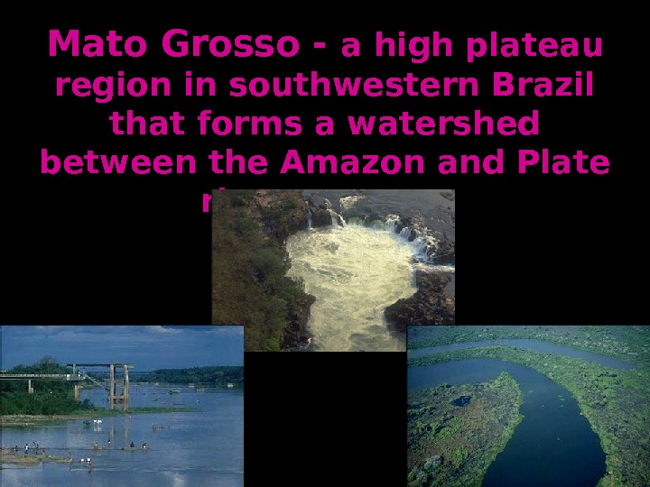
Mato Grosso — a high plateau region in southwestern Brazil that forms a watershed between the Amazon and Plate river systems
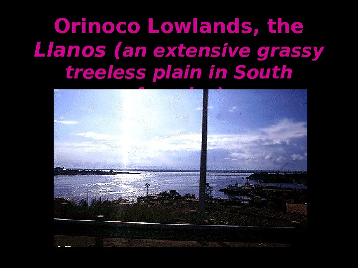
Orinoco Lowlands, the Llanos ( an extensive grassy treeless plain in South America)
Cattle Ranching on the Pampas (large treeless plains in South America)
Desert s. A ta ca m a D e se rt
Atacama Desert
Cities Mexico City Havanna Port-au-Princ ee Panama City Santiag oo. Lima Buenos Aires. Brasili aa Rio De Janiero. Caraca ss Bogot aa
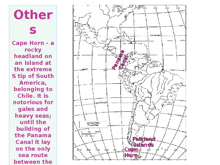
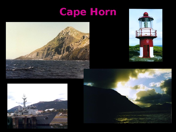
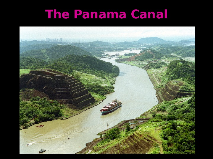
Other s Cape Horn — a rocky headland on an island at the extreme S tip of South America, belonging to Chile. It is notorious for gales and heavy seas; until the building of the Panama Canal it lay on the only sea route between the Atlantic and the Pacific Falkland Islands Cape Horn. Pan am a C an al
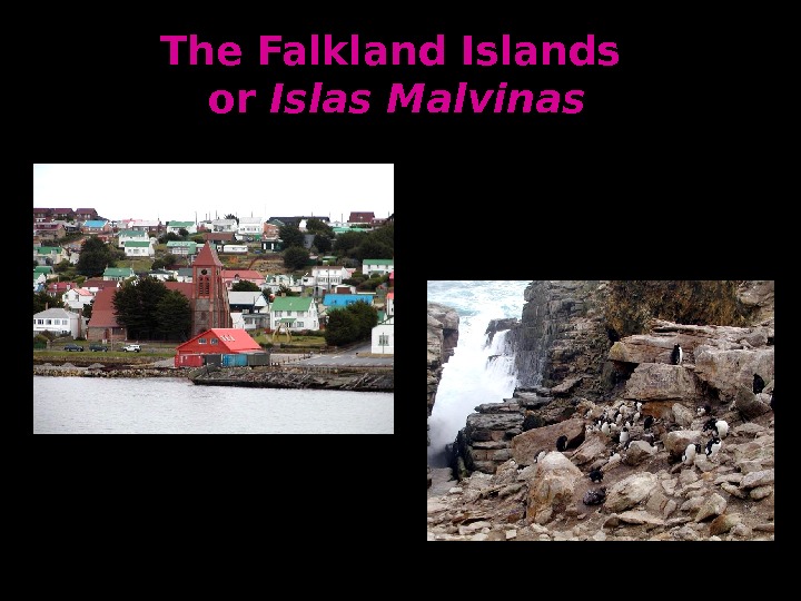
The Falkland Islands or or Islas Malvinas
Cape Horn
The Panama Canal
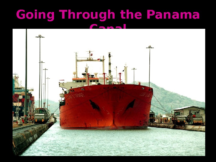
Going Through the Panama Canal
Atlantic Ocean. Pacific Ocean Gulf of Mexico Caribbean Sea Amazon R. R. Orinoco R. Uruguay R. Magdalena R. R. Sao Francisco R. R. Lake Titicaca Lake Maracai bobo Rio de La Plata Parana R. R. Andes Mts. Sierra Madres Mts. Guiana Highlands Brazilian Highlands Patagoni an an Plateau Amazo n n Basin. Pam pa ss. Mato Gross oo Gran Chac oo Llano ss A ta ca m a D e se rt. Mexico City Havanna Port-au-Princ ee Panama City Santiag oo. Lima Buenos Aires Brasili aa Rio De Janiero. Caraca ss Bogot aa Falkland Islands Cape Horn Pan am a C an al
Active Volcanoes
Latin America nn Climatic Zones
Very Varied Climate Zones
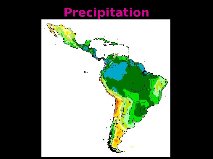
Precipitation
Amazon Rain Forest
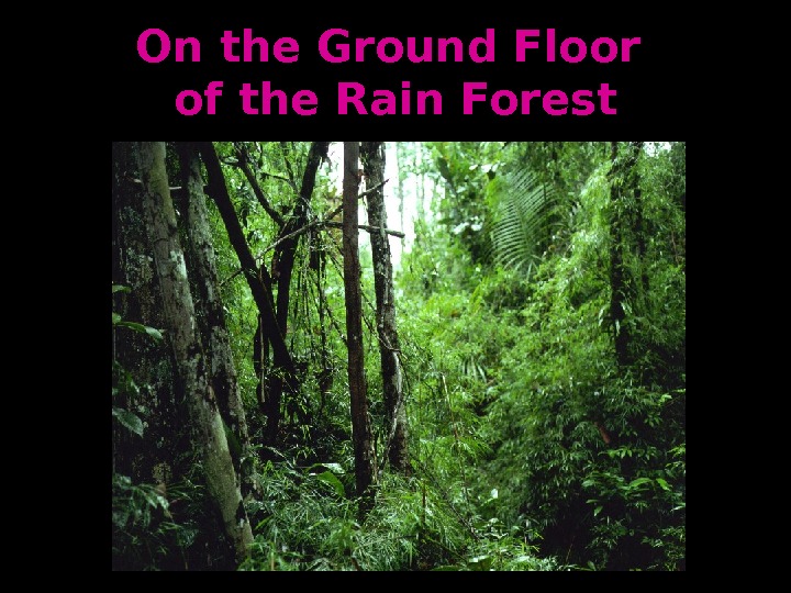
On the Ground Floor of the Rain Forest
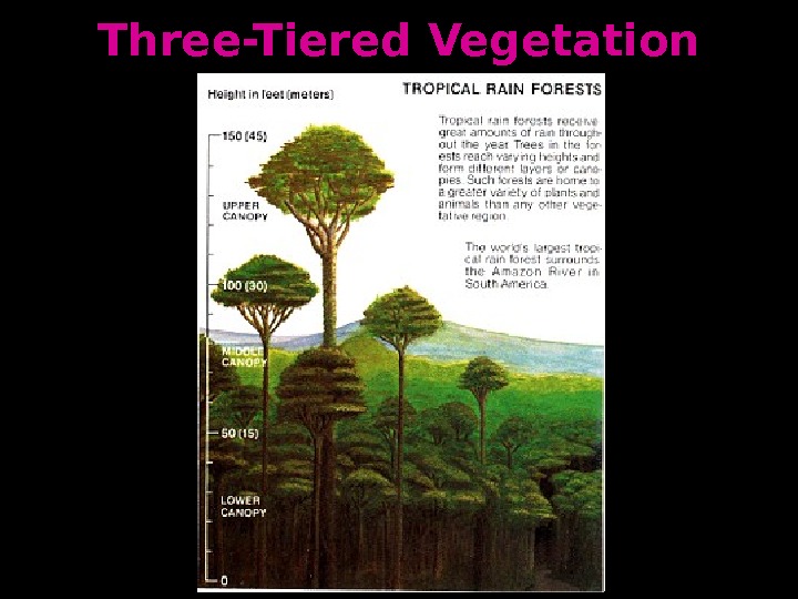
Three-Tiered Vegetation
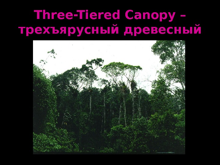
Three-Tiered Canopy – трехъярусный древесный полог
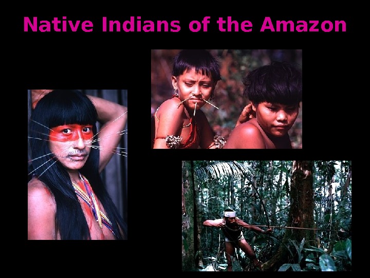
Native Indians of the Amazon
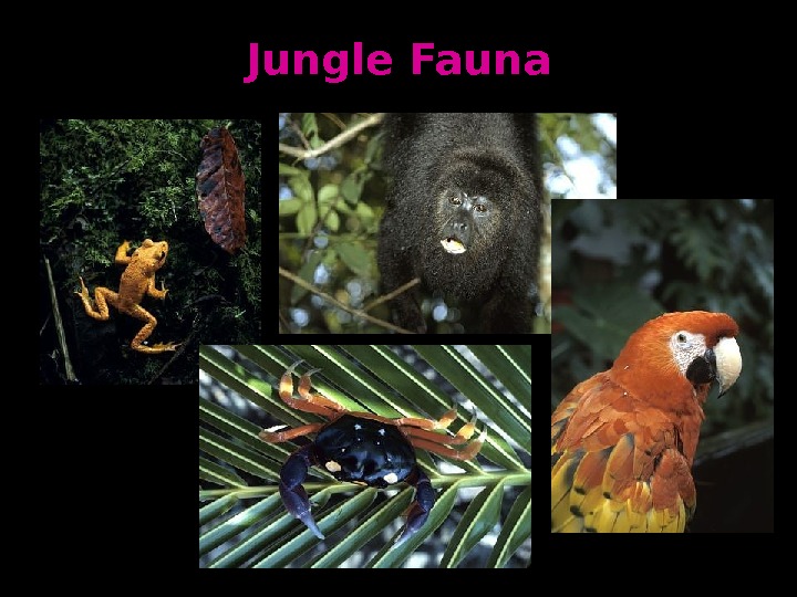
Jungle Fauna
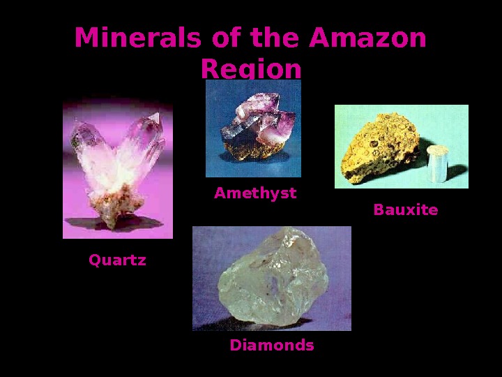
Minerals of the Amazon Region Diamonds. Amethyst Quartz Bauxite
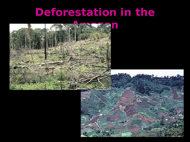
Deforestation in the Amazon
Original Forest Cover Future Forest Cover Current Forest Cover
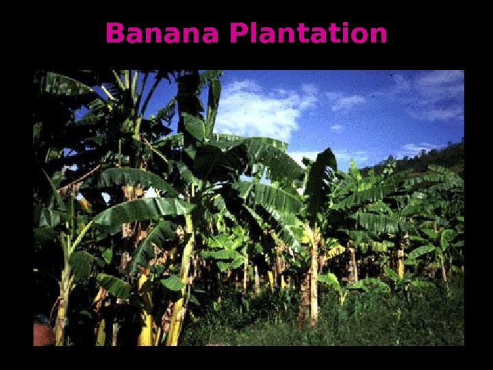
Agriculture and Fishing
Banana Plantation
Harvesting Sugar Cane
Growing Coffee
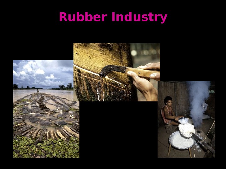
Rubber Industry
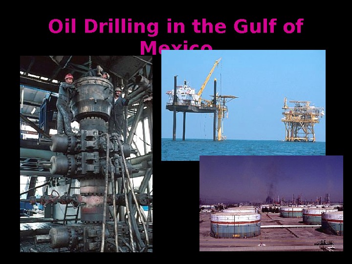
Oil Drilling in the Gulf of Mexico
Eco-Tourism
Drug Trafiking Routes
Latin America’s Populatio nn Distributi onon
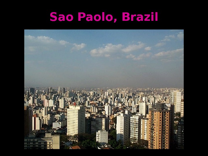
Sao Paolo, Brazil
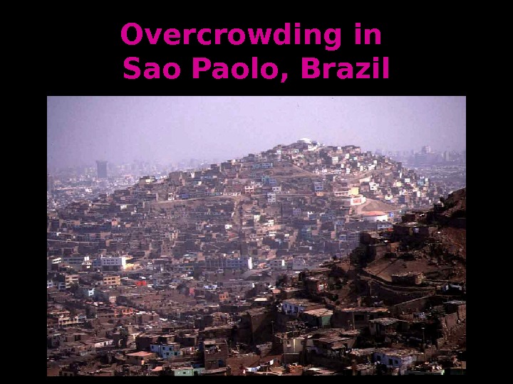
Overcrowding in Sao Paolo, Brazil
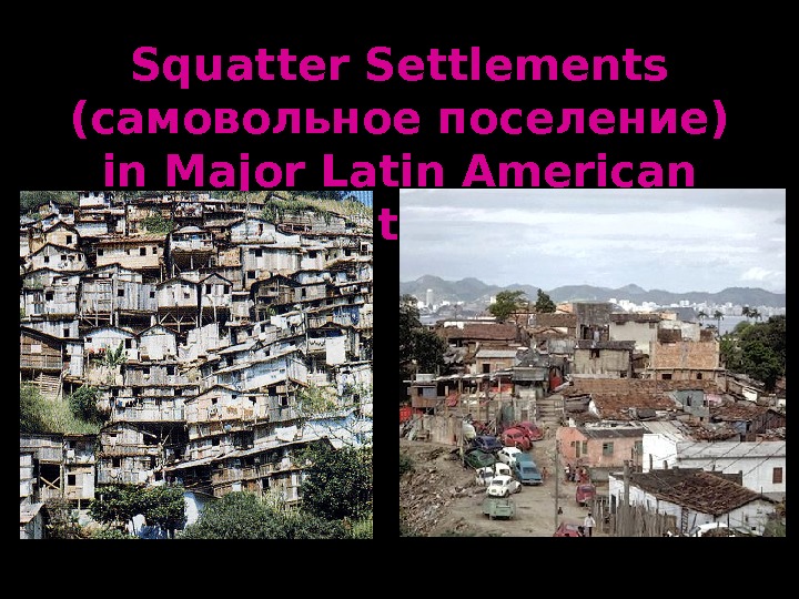
Squatter Settlements (самовольное поселение) in Major Latin American Cities