58b3bfe4b7ece974f1b030b8c21934e1.ppt
- Количество слайдов: 20
 OSSE at NCEP and JCSDA More Data or a Better Model Michiko Masutani RSIS at EMC/NOAA/NWS/NCEP http: //www. emc. noaa. gov/research/osse
 Authors and Contributors Michiko Masutani 1#, John S. Woollen 1 +, Yucheng Song 1@ , Zoltan Toth 1, Russ Treadon 1, John Le. Marshal 4, Stephen J. Lord 1, Haibing Sun 2 %, Thomas J. Kleespies 2 , G. David Emmitt 3, Sidney A. Wood 3 , Steven Greco 3, Chris O’Handley 3, Many other people of EMC, SWA, NESDIS, NASA/GSFC, JCSDA, and ECMWF Acknowledgement: Jim Yoe, Wayman Baker, Collaboration: Ron Errico and Runhua Yang (GMAO) OSSEs: Observing Systems Simulation Experiments
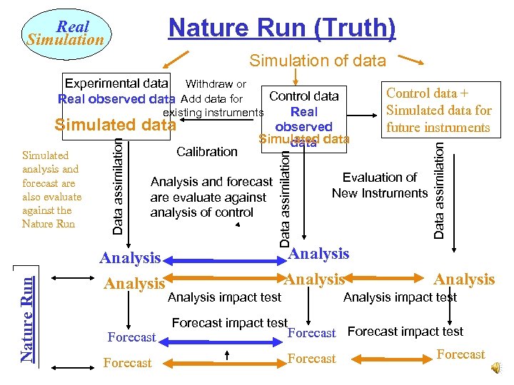 Nature Run (Truth) Real Simulation of data Nature Run Analysis and forecast are evaluate against analysis of control Analysis Forecast Data assimilation analysis and forecast are also evaluate against the Nature Run Data assimilation Control data Real existing instruments Simulated data observed Simulated data Calibration Simulated Evaluation of New Instruments Analysis impact test Analysis impact test Forecast impact test Control data + Simulated data for future instruments Data assimilation Experimental data Withdraw or Real observed data Add data for Forecast impact test Forecast
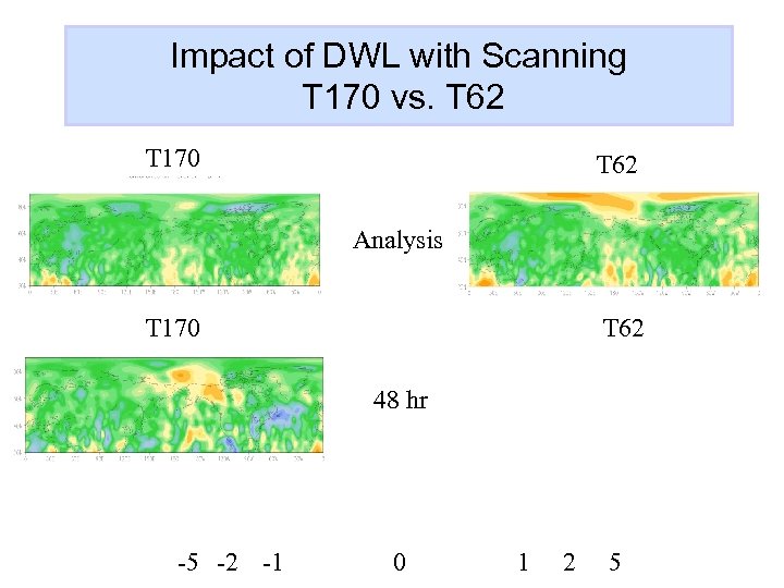
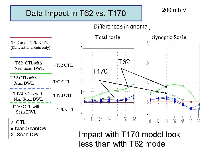
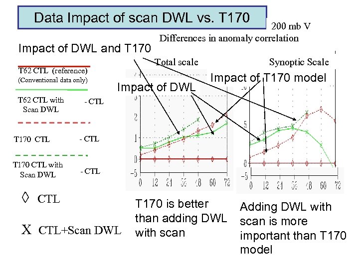
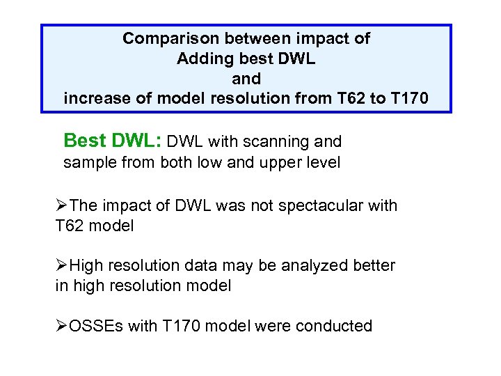 Comparison between impact of Adding best DWL and increase of model resolution from T 62 to T 170 Best DWL: DWL with scanning and sample from both low and upper level ØThe impact of DWL was not spectacular with T 62 model ØHigh resolution data may be analyzed better in high resolution model ØOSSEs with T 170 model were conducted
 Impact of DWL with Scanning T 170 vs. T 62 T 170 T 62 Analysis T 170 T 62 48 hr -5 -2 -1 0 1 2 5
 Data Impact in T 62 vs. T 170 200 mb V Differences in anomaly correlation Total scale T 62 and T 170 CTL Synoptic Scale (Conventional data only) T 62 CTLwith Non Scan DWL T 62 CTL with Scan DWL T 170 CTL with Non Scan DWL T 170 CTL with Scan DWL ◊ CTL ● Non-Scan. DWL X Scan DWL -T 62 CTL T 62 T 170 -T 62 CTL -T 170 CTL Impact with T 170 model look less than with T 62 model
 Data Impact of scan DWL vs. T 170 Impact of DWL and T 170 Total scale T 62 CTL (reference) (Conventional data only) T 62 CTL with Scan DWL 200 mb V Differences in anomaly correlation Impact of DWL Synoptic Scale Impact of T 170 model - CTL T 170 CTL with Scan DWL - CTL ◊ CTL X CTL+Scan DWL T 170 is better than adding DWL with scan Adding DWL with scan is more important than T 170 model
 Summary of NCEP OSSE The current NCEP system has shown that OSSEs can provide critical information for assessing observational data impacts. The results also showed that theoretical explanations will not be satisfactory when designing future observing systems. OSSE will be also used to design an ensemble system. Extended international collaboration within the Meteorological community is essential for timely and reliable OSSEs • Operational Test Center OTC – Joint THORPEX/JCSDA • JCSDA (NCEP, NESDIS, NASA), ESA, EUMETSAT • THORPEX, NPOESS A new nature run is needed for use by many OSSEs.
 Nature Run (Truth) Real Simulation of data Nature Run Analysis and forecast are evaluate against analysis of control Analysis Forecast Data assimilation analysis and forecast are also evaluate against the Nature Run Data assimilation Control data Real existing instruments Simulated data observed Simulated data Calibration Simulated Evaluation of New Instruments Analysis impact test Analysis impact test Forecast impact test Control data + Simulated data for future instruments Data assimilation Experimental data Withdraw or Real observed data Add data for Forecast impact test Forecast
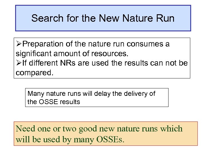 Search for the New Nature Run ØPreparation of the nature run consumes a significant amount of resources. ØIf different NRs are used the results can not be compared. Many nature runs will delay the delivery of the OSSE results Need one or two good new nature runs which will be used by many OSSEs.
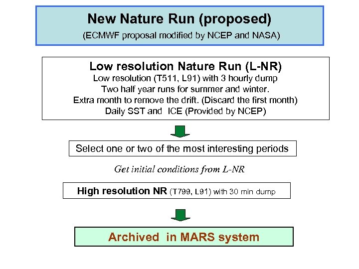 New Nature Run (proposed) (ECMWF proposal modified by NCEP and NASA) Low resolution Nature Run (L-NR) Low resolution (T 511, L 91) with 3 hourly dump Two half year runs for summer and winter. Extra month to remove the drift. (Discard the first month) Daily SST and ICE (Provided by NCEP) Select one or two of the most interesting periods Get initial conditions from L-NR High resolution NR (T 799, L 91) with 30 min dump Archived in MARS system
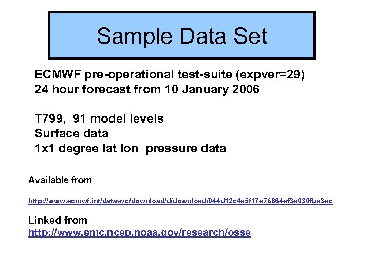 Sample Data Set ECMWF pre-operational test-suite (expver=29) 24 hour forecast from 10 January 2006 T 799, 91 model levels Surface data 1 x 1 degree lat lon pressure data Available from http: //www. ecmwf. int/datasvc/download/d/download/044 d 12 c 4 e 5 f 17 e 76864 ef 3 e 030 fba 3 ec Linked from http: //www. emc. ncep. noaa. gov/research/osse
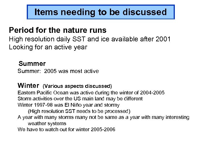 Items needing to be discussed Period for the nature runs High resolution daily SST and ice available after 2001 Looking for an active year Summer: 2005 was most active Winter (Various aspects discussed) Eastern Pacific Ocean was active during the winter of 2004 -2005 Storm activities over the US main land may be different Winter 1997 -98 was El Niño year and stormy (High resolution SST needs to be processed) A year with many storms many not be same as a year with many interesting weather systems We have to watch out for winter 2005 -2006
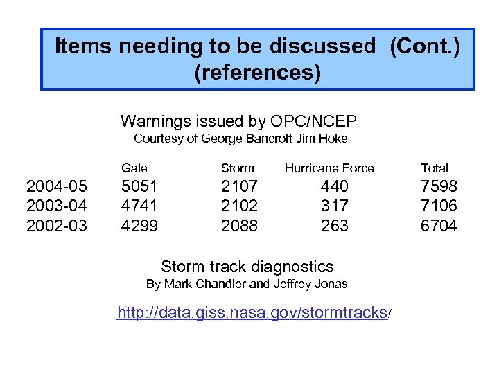 Items needing to be discussed (Cont. ) (references) Warnings issued by OPC/NCEP Courtesy of George Bancroft Jim Hoke Gale 2004 -05 2003 -04 2002 -03 Storm 5051 4741 4299 2107 2102 2088 Hurricane Force 440 317 263 Storm track diagnostics By Mark Chandler and Jeffrey Jonas http: //data. giss. nasa. gov/stormtracks/ Total 7598 7106 6704
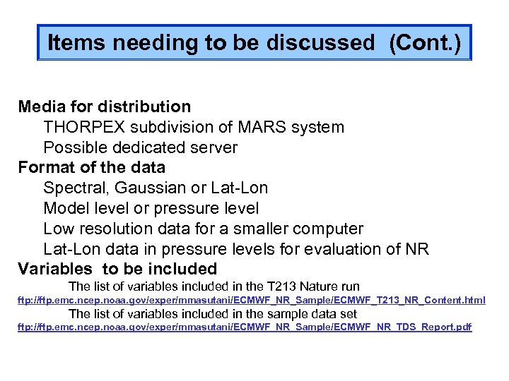 Items needing to be discussed (Cont. ) Media for distribution THORPEX subdivision of MARS system Possible dedicated server Format of the data Spectral, Gaussian or Lat-Lon Model level or pressure level Low resolution data for a smaller computer Lat-Lon data in pressure levels for evaluation of NR Variables to be included The list of variables included in the T 213 Nature run ftp: //ftp. emc. ncep. noaa. gov/exper/mmasutani/ECMWF_NR_Sample/ECMWF_T 213_NR_Content. html The list of variables included in the sample data set ftp: //ftp. emc. ncep. noaa. gov/exper/mmasutani/ECMWF_NR_Sample/ECMWF_NR_TDS_Report. pdf
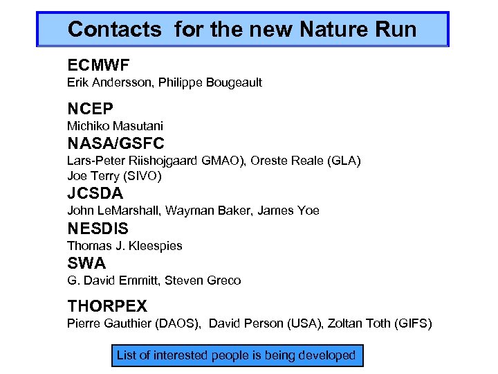 Contacts for the new Nature Run ECMWF Erik Andersson, Philippe Bougeault NCEP Michiko Masutani NASA/GSFC Lars-Peter Riishojgaard GMAO), Oreste Reale (GLA) Joe Terry (SIVO) JCSDA John Le. Marshall, Wayman Baker, James Yoe NESDIS Thomas J. Kleespies SWA G. David Emmitt, Steven Greco THORPEX Pierre Gauthier (DAOS), David Person (USA), Zoltan Toth (GIFS) List of interested people is being developed
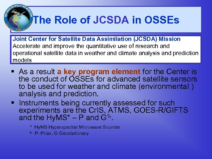 The Role of JCSDA in OSSEs Joint Center for Satellite Data Assimilation (JCSDA) Mission Accelerate and improve the quantitative use of research and operational satellite data in weather and climate analysis and prediction models As a result a key program element for the Center is the conduct of OSSEs for advanced satellite sensors to be used for weather and climate (environmental ) analysis and prediction. Instruments being currently assessed for such experiments are the Cr. IS, ATMS, GOES-R/GIFTS and the Hy. MS* – P and G%. * Hy. MS Hyperspectral Microwave Sounder % P- Polar, G Geostationary
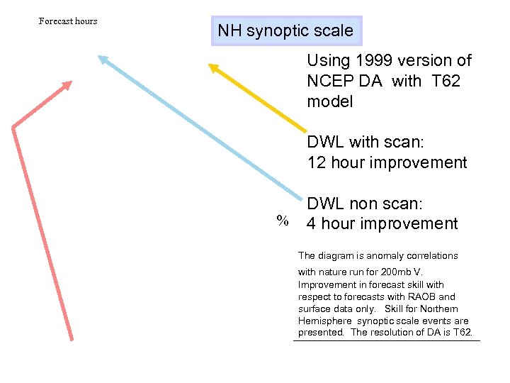 Forecast hours NH synoptic scale Using 1999 version of NCEP DA with T 62 model DWL with scan: 12 hour improvement % DWL non scan: 4 hour improvement The diagram is anomaly correlations with nature run for 200 mb V. Improvement in forecast skill with respect to forecasts with RAOB and surface data only. Skill for Northern Hemisphere synoptic scale events are presented. The resolution of DA is T 62.
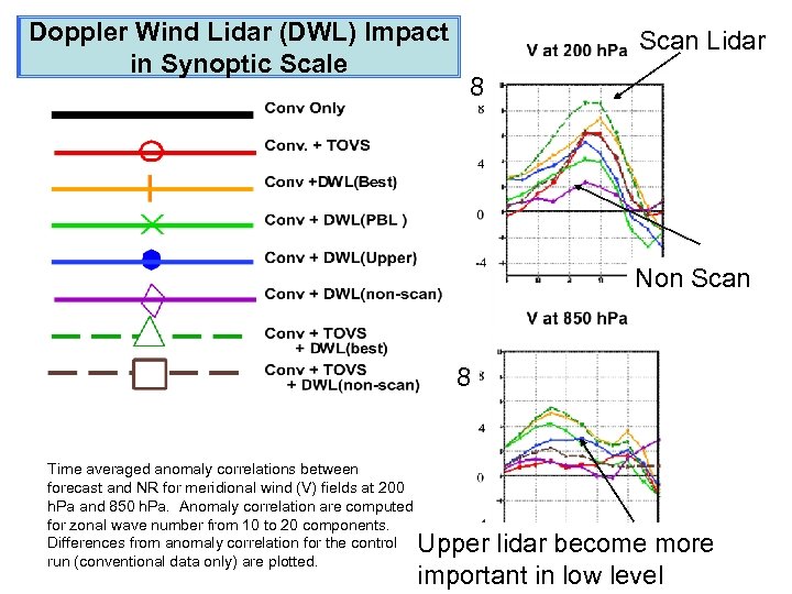 Doppler Wind Lidar (DWL) Impact in Synoptic Scale Scan Lidar 8 Non Scan 8 Time averaged anomaly correlations between forecast and NR for meridional wind (V) fields at 200 h. Pa and 850 h. Pa. Anomaly correlation are computed for zonal wave number from 10 to 20 components. Differences from anomaly correlation for the control run (conventional data only) are plotted. Upper lidar become more Forecast hour important in low level
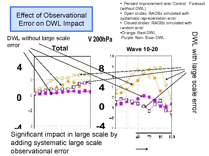 Effect of Observational Error on DWL Impact Total Significant impact in large scale by adding systematic Forecast length large scale observational error Wave 10 -20 DWL with large scale error DWL without large scale error • Percent improvement over Control Forecast (without DWL) • Open circles: RAOBs simulated with systematic representation error • Closed circles: RAOBs simulated with random error • Orange: Best DWL Purple: Non- Scan DWL


