

4d6d92c6c57fed54d4ab9ef7aec732d0.ppt
- Количество слайдов: 90
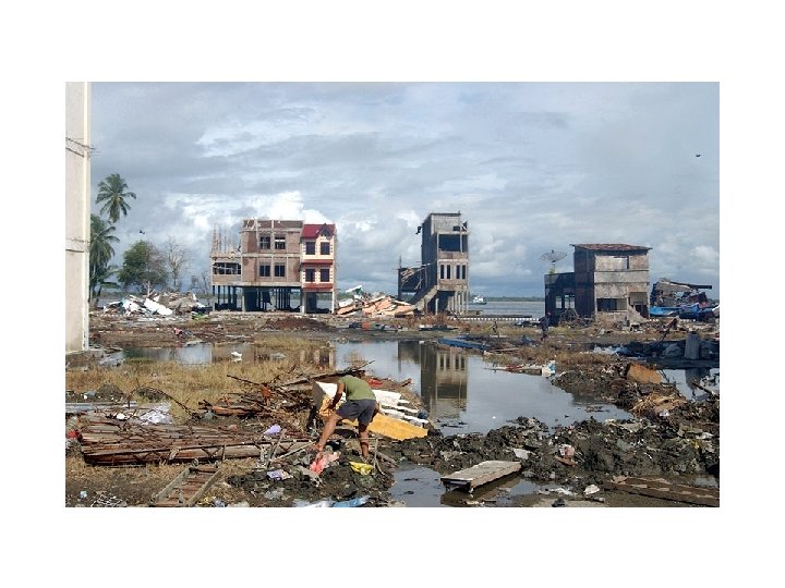
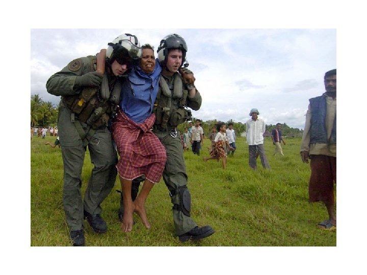
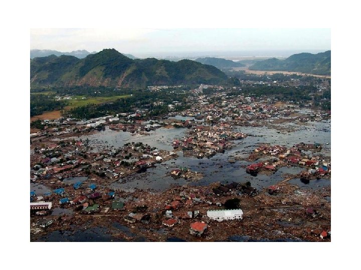
 On Dec. 26, 2004, a magnitude-9. 0 earthquake off Indonesia's Sumatra island unleashed giant waves that fanned out across the Indian Ocean at jetliner speeds, leaving at least 230, 000 dead and millions of homeless in its wake.
 Solomon
 World’s Largest Magnitude Earthquakes Earthquake Magnitude Year Approx. casualties 1. Chile 9. 5 1960 >2000 2. Prince William Sound, Alaska 9. 2 1964 125 3. Andreanof Islands, Alaska 9. 1 1957 Not reported 4. Kamchatka Peninsula 9. 0 1952 Not reported 5. Sumatra 9. 0 2004 >283, 100 (>173, 000 in Indonesia)
 Ø A tsunami is series of traveling ocean waves of extremely long length generated primarily by earthquakes occurring below or near the ocean floor. Ø Tsunami waves propagate across the deep ocean with a speed exceeding 800 km/h ( 500 mph) and a wave height of only a few tens of centimeters or less. Ø As they reach the shallow waters of the coast, the waves slow down and their height increases up to tens of meters (30 ft) or more.
 Earthquake and Tsunami Not all earthquakes generate tsunamis. An earthquake must have certain characteristics in order to generate a tsunami: 1. Epicenter is underneath or near the ocean. 2. Fault causes vertical movement of the sea floor (up to several meters) over a large area (up to 100, 000 km 2). 3. Large magnitude ( > 7. 5 ) AND shallow focus ( < 70 km). Source: Earthquakes by Bruce A. Bolt
 “The 26 th December 2004 Sumatra-Andaman earthquake is the fourth largest earthquake in the world since 1900 and is the largest since the 1964 Prince William Sound, Alaska earthquake. ” United States Geological Survey (USGS) “The tsunami that struck Southeast Asia on December 26, 2004 has been confirmed as the most devastating in modern history. ” Guinness Book of World Records
 Kuril Island, 8. 1 M Earthquake Jan 13, 2007
 The Jan 13, 2007, Saturday quake struck at about 1: 24 p. m. local time, almost 500 kilometres east of Etorofu, the largest in a chain of four disputed islands known as the Northern Territories in Japan, and the Kuril islands in Russia.
 Tsunami
 Indonesian seacoast, 1800 s.
 A tsunami is generated on the Convergent Boundary at a Subduction Zone by a large seafloor earthquake, 7 M Zone Earthquakes of magnitude 7 are generally classified as major earthquakes, capable of widespread, heavy damage.
 Tsunami Warning
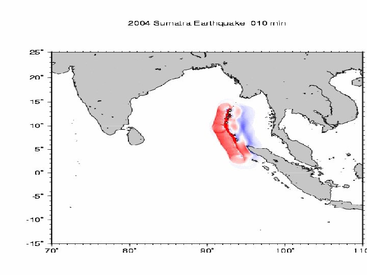
 Sumatra Earthquake 9. 2 magnitude on 26 Tsunami 26 december December, 2004, triggered a transoceanic Indian Ocean Tsunami
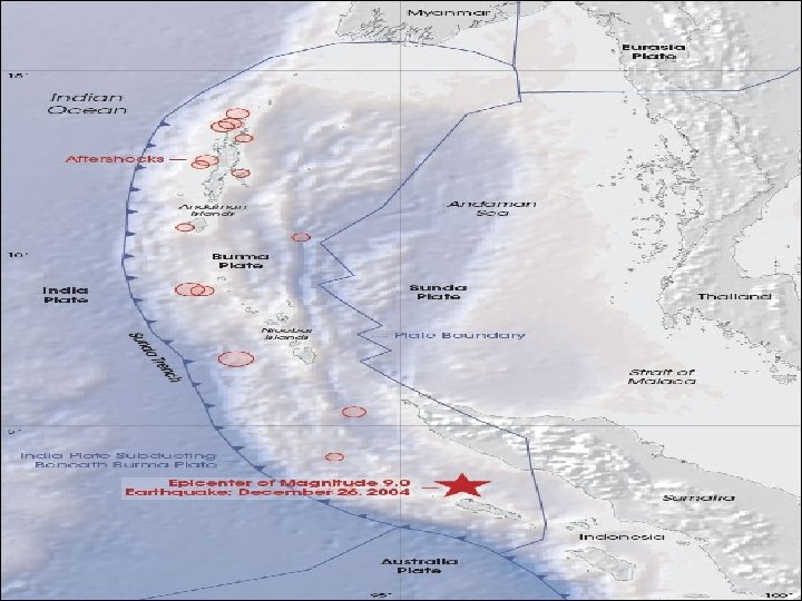
 The 2004 Asian Earthquake-Magnitude 9. 3 Location: OFF THE WEST COAST OF NORTHERN SUMATRA The devastating megathrust earthquake of December 26 th, 2004 occurred on the interface of the India and Burma plates and was caused by the release of stresses that develop as the India plate subducts beneath the overriding Burma plate. The India plate begins its descent into the mantle at the Sunda trench which lies to the west of the earthquake's epicenter. The trench is the surface expression of the plate interface between the Australia and India plates, situated to the southwest of the trench, and the Burma and Sunda plates, situated to the northeast Distances: 250 km (155 miles) SSE of Banda Aceh, Sumatra, Indonesia 310 km (195 miles) W of Medan, Sumatra, Indonesia 1260 km (780 miles) SSW of BANGKOK, Thailand 1605 km (990 miles) NW of JAKARTA, Java, Indonesia
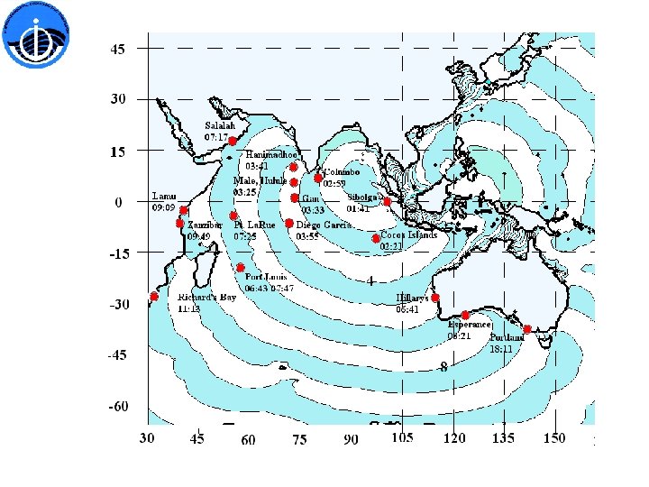
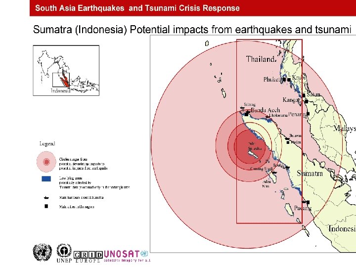
 Figure 2. Maximum tsunami amplitudes in meter predicted in Boussinesq model simulations for the Bay of Bengal (x-long E; y-lat. N). Maximum run-ups up to 24 m were predicted on the upper NW coast of Banda Aceh, Indonesia.
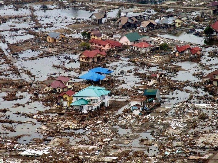
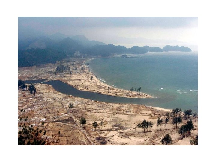
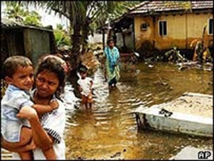
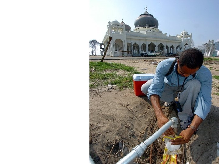
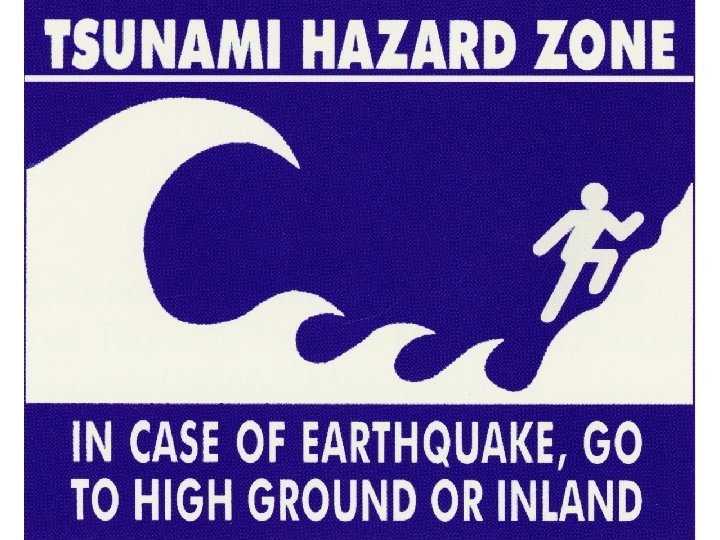
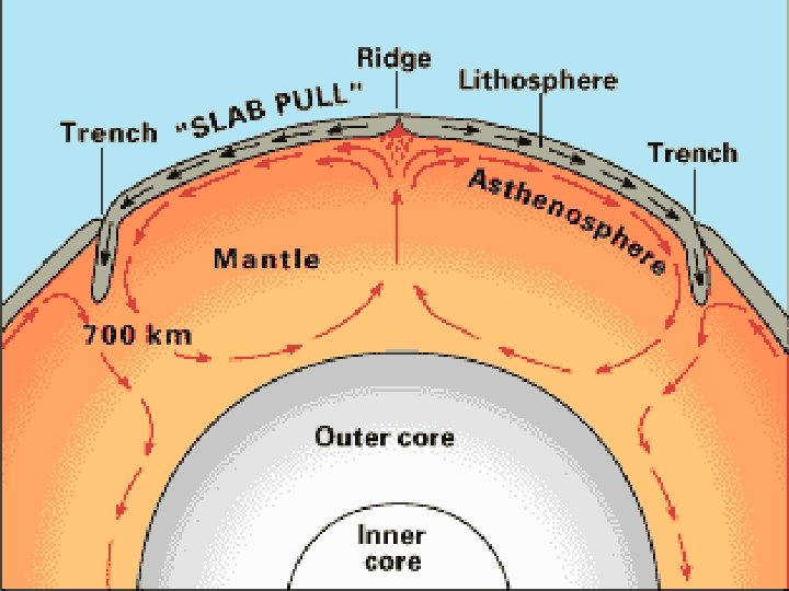
 Plate Tectonics: Trying to understand how the Earth evolved is one of the fundamental problems we have in science. On Earth's crust, continental landmasses, upon which we live, may be thought of as ships drifting upon a sea (oceanic crust), propelled wherever the currents take them. This slow voyage of the continents has reshaped the face of the Earth throughout its history driven by internal heat of the core.
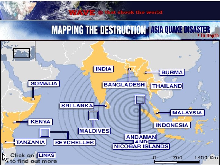
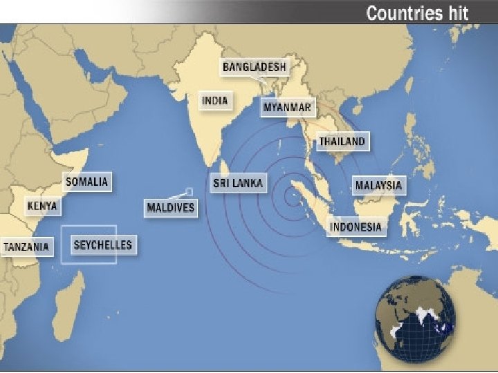
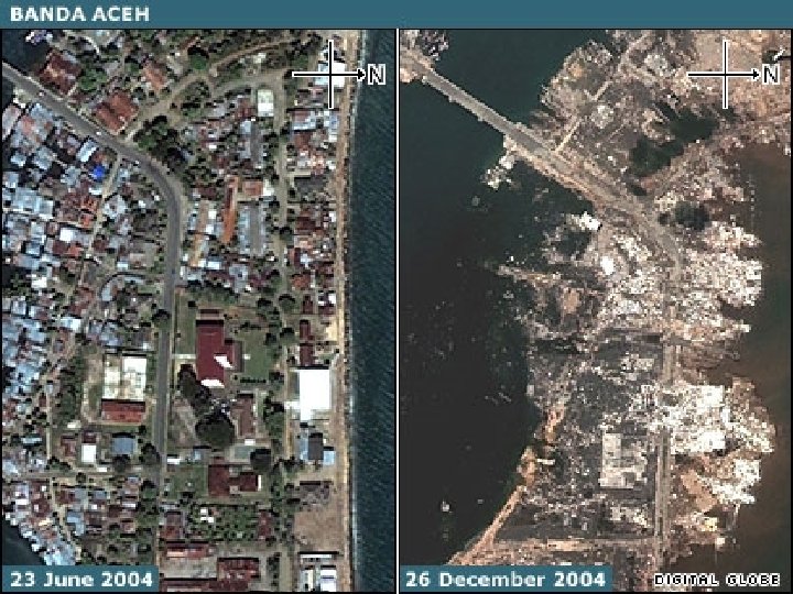
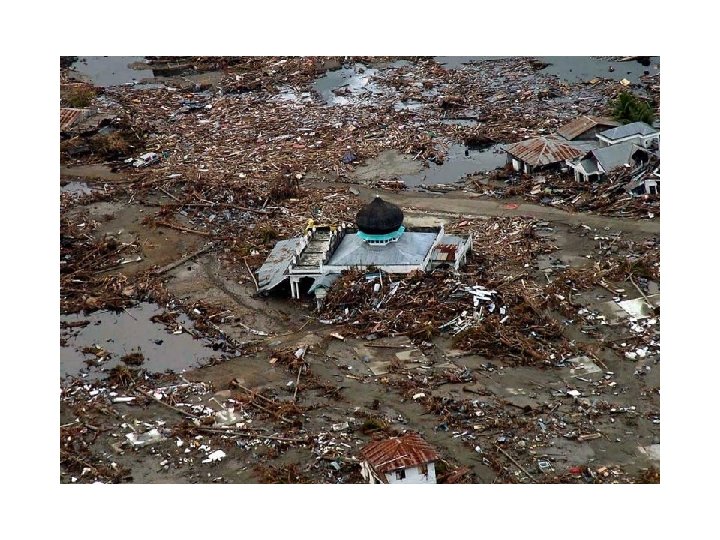
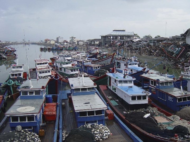
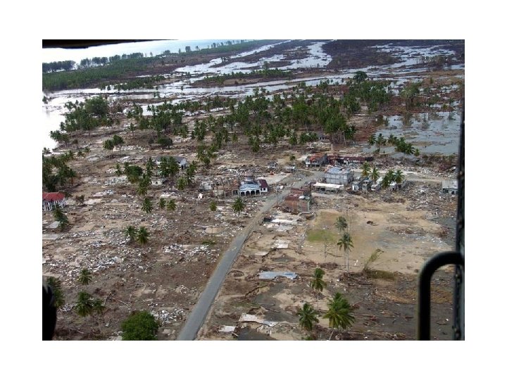
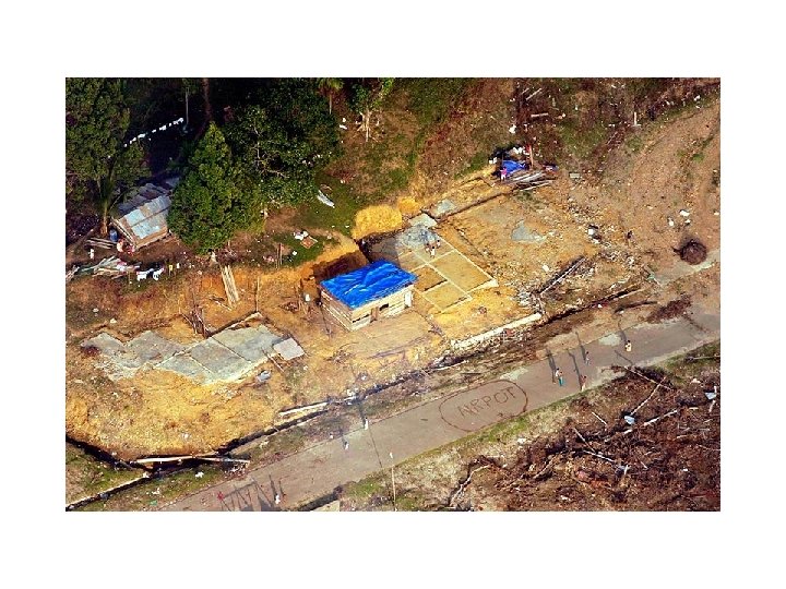
 Indonesia At least 100, 000 people are believed dead in Aceh and Northern Sumatra, while some 500, 000 people are sheltering in scattered refugee camps across the province, the UN estimates. Large swathes of Banda Aceh, Meulaboh and Calang and their outlying districts are completely destroyed. To speed up aid delivery, the Australian Air Force has assisted in improving air traffic control at Banda Aceh airport. The UN is moving supplies by truck along the road from the regional capital Medan. Other agencies are shipping relief by sea to outlying islands. The ports of Belawan and Lhokseumawe are the nearest harbours undamaged by the tsunami. http: //news. bbc. co. uk/1/shared/spl/hi/wor ld/04/asia_quake/quake_maps/html/1. stm
 Thailand Worst affected districts are Phang Na, Ranong, Trang, Phuket and Krabi where more than 5, 000 people are believed to have died. These provinces form the heart of Thailand's tourist industry. Some 27 hotel complexes in Phuket alone have been destroyed, the Thailand government reports. At least 2, 400 fishing boats have been destroyed and 54, 000 farm animals killed, according to official Thai estimates. Some 6, 000 houses, 50 schools and 19 government buildings are also reported to be damaged or destroyed. http: //news. bbc. co. uk/1/shared/spl/hi/ world/04/asia_quake/quake_maps/ht ml/2. stm
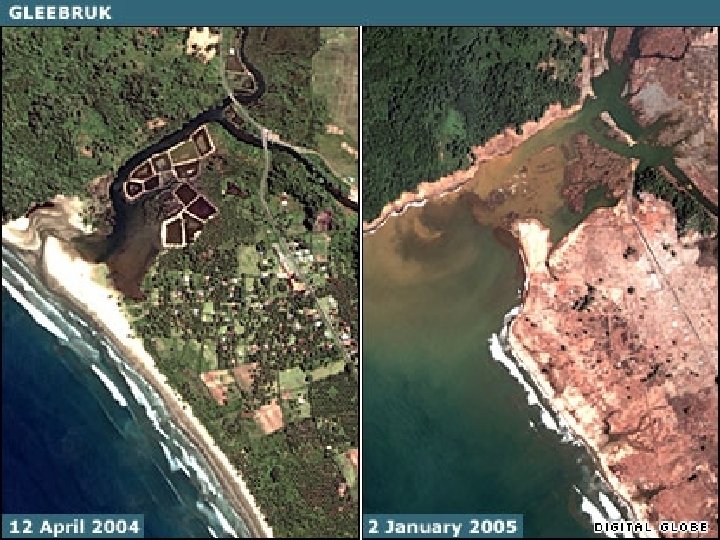
 Image acquired and processed by CRISP/National University of Singapore
 Image acquired and processed by CRISP/National University of Singapore
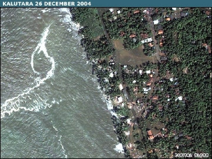
 Sri Lanka More than 30, 000 people have been killed and 835, 000 have been made homeless mainly in the southern and eastern coastal regions. Worst affected districts are Jaffna, Kuchaveli, Mullativu, Trincomalee, Batticaloa, Ampara, Hambantota, Matara and Galle. Some 49, 000 people are living in refugee camps in Galle alone. The United Nations and other agencies are working to distribute food, shelter and supplies in these districts. Tensions between the government and Tamil Tiger rebels are hampering aid distribution to some parts of the north east of the country. http: //news. bbc. co. uk/1/shared/sp l/hi/world/04/asia_quake/quake_ maps/html/3. stm
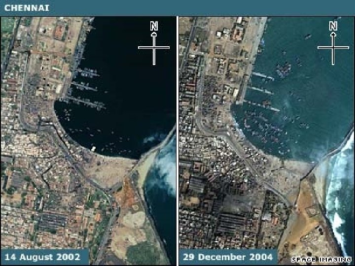
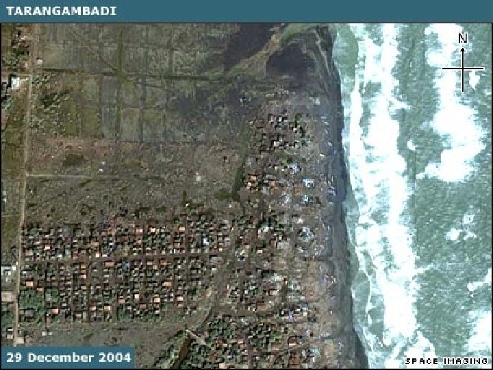
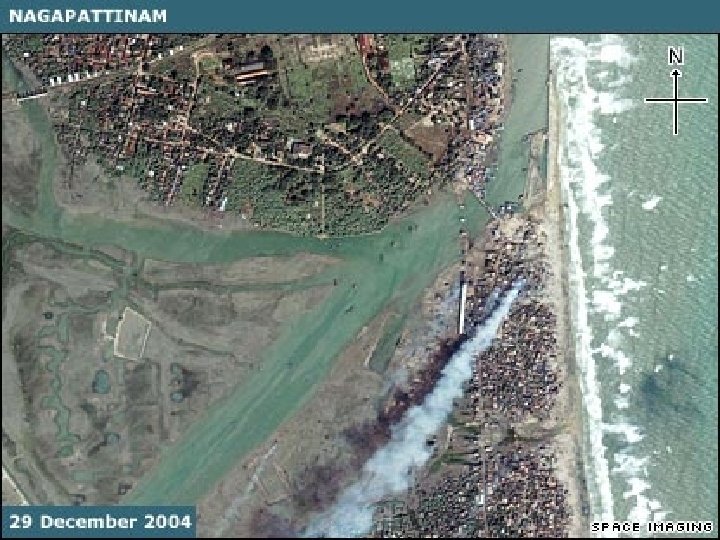
 India Hundreds of coastal communities in India's southern states of Kerala, Tamil Nadu and Andhra Pradesh have been devastated. At least 9, 000 people are believed to have died. Fishermen have been hit hard with many losing the boats on which they depend for their livelihoods. Around 140, 000 people are sheltering in relief centres. The Indian government has estimated reconstruction costs at around $1. 6 bn and has said it will seek international aid for long term reconstruction. http: //news. bbc. co. uk/1/shared/ spl/hi/world/04/asia_quake/qua ke_maps/html/4. stm
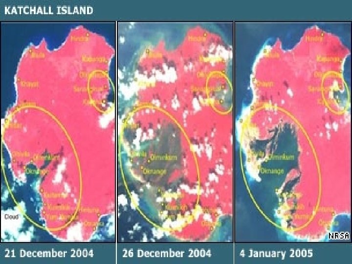
 Andaman and Nicobar Islands India's Andaman and Nicobar Islands lie close to the epicentre of the earthquake. It is unclear how many people died on these remote, partly-tribal islands but 5, 600 are missing – the vast majority of India's missing total. The islands' capital Port Blair has continued to flood because of the change in the sea level and scientists said the earthquake's impact was so tremendous that the Andamans could have tilted or even shifted. Six of the 38 inhabited islands have been evacuated. http: //news. bbc. co. uk/1/shared/spl /hi/world/04/asia_quake/quake_m aps/html/5. stm
 Burma Plate Indian Plate A. Between Earthquakes ‘Locked’ to the subducting mobile Indian plate, the overriding Burma plate gets squeezed. Its leading edge is dragged down, while an area behind bulges upward. This movement goes on for decades or centuries, slowly building up stress. The time is 250 years as the Indian Plate is mobile and its movement has thrust
 B. During an Earthquake An earthquake along a subduction zone happens when the leading edge of the overriding plate breaks free and springs seaward, raising the sea floor and the water above it. This uplift starts a tsunami. Meanwhile, the bulge behind the leading edge collapses, thinning the plate and lowering coastal areas.
 During a serious Earthquake An earthquake along a subduction zone happens when the leading edge of the overriding plate breaks free and springs seaward, raising the sea floor and the water above it. This uplift starts a tsunami. Meanwhile, the bulge behind the leading edge collapses, thinning the plate and lowering coastal areas.
 C. Minutes Later Part of the tsunami races toward nearby land, growing taller as it comes in to shore. This local tsunami has no or very short warning time for the residents to away from the shore to higher ground. Depending on the sea floor topography, another part heads across the ocean toward distant shores.
 Diagram showing how part of the energy from a seafloor earthquake is converted into sound that travels through the ocean (as a T-wave). Oceanic earthquakes are detected more easily by hydrophones than by seismometers on land
 1. Recorder on sea bed measures water pressure every 15 mins - an unusual result triggers a reading every 15 secs. 2. Buoy measures surface conditions and sends this plus data from sea bed to satellite 3. Satellite receives data and relays it to ground stations
 1. Float in a "stilling well" tube measures sea level 2. Data is processed and sent to satellite 3. Satellite transmits data to alert centres
 To detect and pinpoint earthquakes, the Warning Center relies on data from a network of seismic stations. But not all earthquakes spawn tsunamis, so they use coastal tide gauges and deep ocean pressure sensors to figure out if one has formed. Located on the ocean floor, these sensors monitor the depth of the water above them. A change could mean a deadly tsunami is passing overhead. Data is relayed to a buoy on the surface, up to a satellite, and down to the Warning Center. There are six of these sensors in the Pacific Ocean.
 Sunda Strait: Nov 2005, a German buoy is anchored for monitoring tsunams
 Indian Ocean Sea Level Stationa: Map showing location of GLOSS sea level stations and when they are to be upgraded.
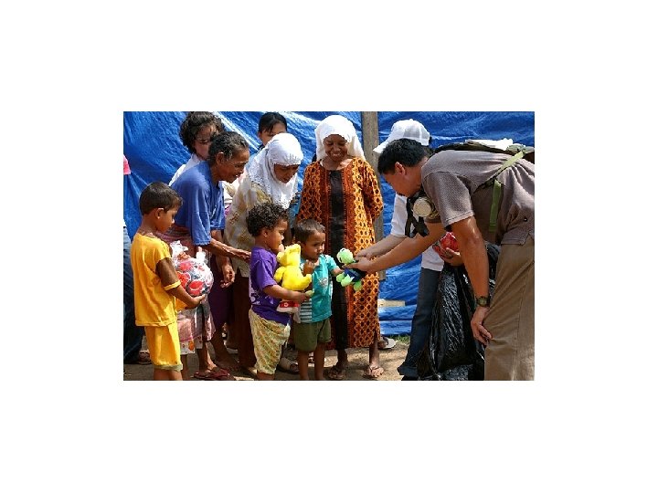
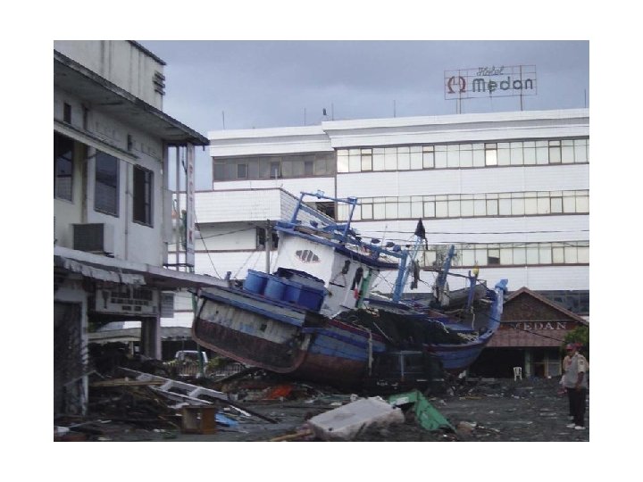
 The whole world watched in horror as the tsunami disaster in the Indian Ocean coastal areas unfolded. Large amounts of money have been donated and pledged, and enormous logistical operations have been set up. We are, however, only just scratching the surface of this task. U. S. Navy photo by Photographer’s Mate 3 rd Class Jacob J. Kirk

 On land, seismometers are used to measure the shaking of the ground from nearby earthquakes, but small earthquakes in the oceans are usually too far away to be detected. In the ocean, hydrophones are used instead to detect the faint rumbling sounds from oceanic earthquakes. Hydrophones are better for detecting oceanic earthquakes because sound waves (T-waves) travel much more efficiently in water than P- or S- waves do in the solid earth. In addition, the difference in travel time between P- and S- waves can give the distance to an earthquake epicenter on land. In the ocean, however, only the acoustic T-wave is recorded so the travel time and earthquake epicenter must be calculated in a more complicated fashion from many observations. Hydrophone arrays can also give the direction to the epicenter, but cannot give any depth information
 Tsunami Warning Path Earthquake observation Check SL data if tsunami generated If yes Calculate epicenter and magnitude If>6. 5

 IOC GLOSS
 3 integral components
 Objective of the System • Develop national and regional capacity to: – Assess national tsunami risk (Hazard assessment) – Promote preparedness and risk reduction against tsunami hazard (Mitigation and Public Awareness) – Establish a national and regional warning system against local and regional tsunamis (Warning guidance)
 WARNING CENTER OPERATORS Pacific, Indian Ocean, Caribbean, Mediterranean Tsunami Warning Centers GLOBAL EMERGENCY MANAGERS Civil Defense Local Authorities REGIONAL NATIONAL TSUNAMI SCIENTISTS University and Govt Researchers Comprehensive Tsunami Risk Reduction Stakeholders build Tsunami Resilient Community
 SEISMOGRAPHIC NETWORK
 IOC ICG/ITSU


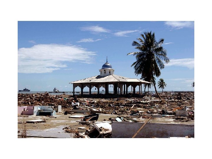
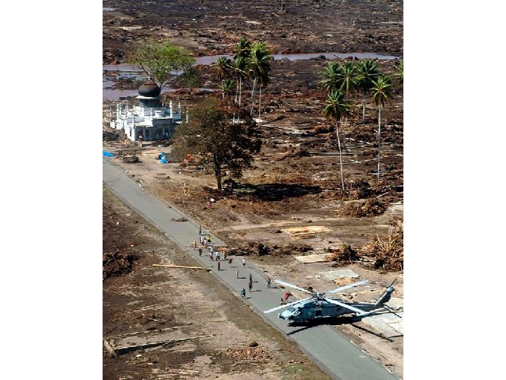
 Mosque at Jantang. This mosque was one of the few structures in the surrounding area that survived the tsunami inundation. Villagers climbed onto the upper floors to escape wave inundation. Again the concrete open framework that vented water played a role in allowing the structure to
 The amplifying wave can have a curious side effect. Before hitting land, it draws water from the leading edge, exposing the seafloor for as much as a mile.
 The 1960 tsunami caused major damage in Hilo and killed 61 people.