2cc2f1e2ee2b46914da78a20f5acb1f0.ppt
- Количество слайдов: 23
Nowcasting Trends Past and Future By Jim Wilson NCAR 8 Feb 2011 Geneva Switzerland
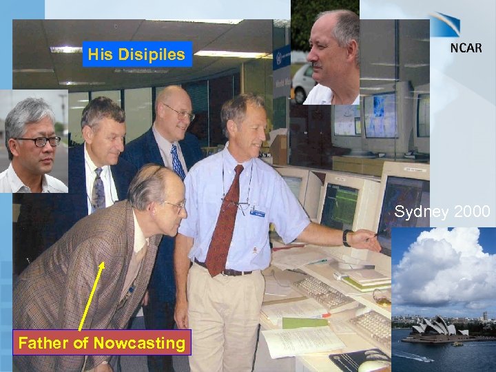
His Disipiles Sydney 2000 Father of Nowcasting
WHAT IS NOWCASTING Originally defined by Browning for the 1 st Nowcasting Conference in 1981 as: Nowcasting definition – description of the current state of the weather in detail and the prediction of changes in a few hours O-6 hr forecasting by any method spatial scale of no more than a few kilometers (1 -3 km) with frequent updates (5 -10 min) Heavy emphasis on observations
Original Objectives of Nowcasting Working Group § Promote nowcasting (Forecast Demonstration Projects) § Encourage numerical modelers to work on the nowcasting time and space scales § Train forecasters in nowcasting techniques.
The following discussion relates to nowcasting convective storms
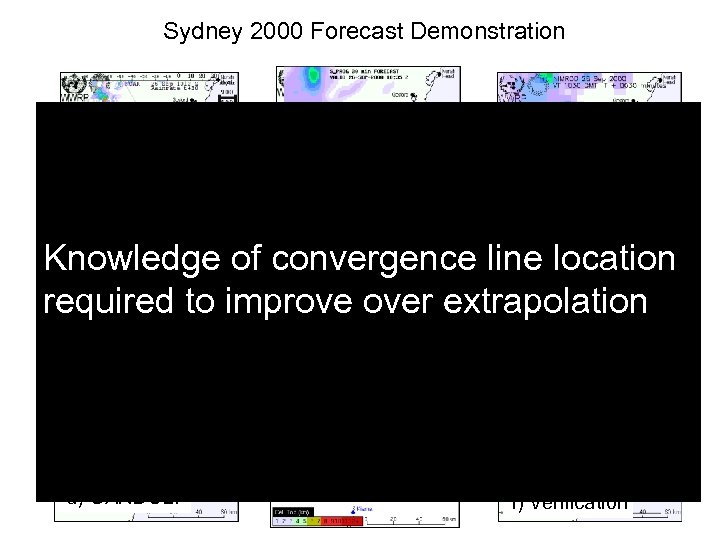
Sydney 2000 Forecast Demonstration § Extrapolation Knowledge of convergence line location § Blending required to improve over extrapolation § Expert System § Verification a) Auto. Nowcaster d) GANDOLF b) SPROG e) TITAN c) NIMROD f) Verification
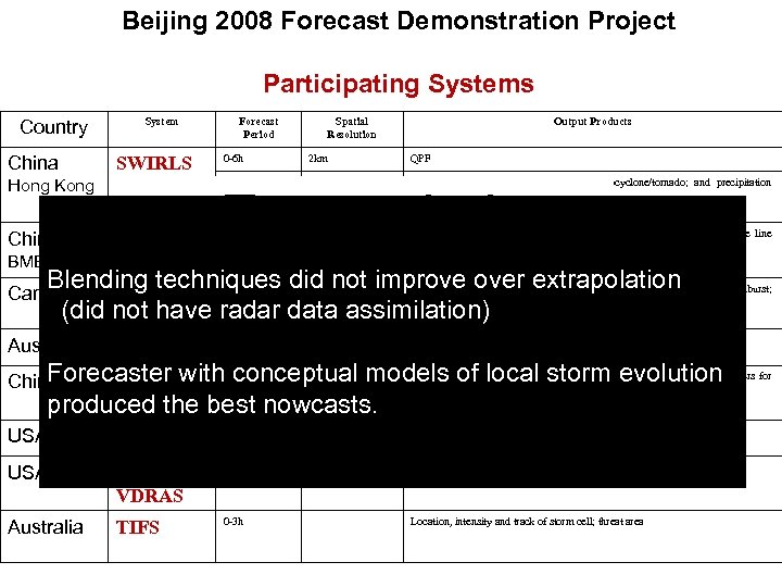
Beijing 2008 Forecast Demonstration Project Participating Systems Country China System SWIRLS Hong Kong Forecast Period 0 -6 h Spatial Resolution 2 km 0 -1 h Output Products QPF Lightning; hail; downburst/wind gust; mesocyclone/tornado; and precipitation probability § Extrapolation Blending techniques did not improve over extrapolation § Blending (did not have radar data assimilation) Forecaster § Expert System evolution with conceptual models of local storm produced the best nowcasts. § Verification Beijing. ANC 30 and 60 min Canada CARDS 0 -6 h Australia STEPS 0 -6 h 2 km QPF and precipitation probability China GRAPES 0 -6 h 1 km Precipitation; wind; temperature; humidity; and various diagnostic parameters for severe weathers (wind gust, hail, tornadoes, flash-flood, etc. ). USA NIWOT 1 -6 h 1 km Instantaneous reflectivity, (considering QPF) USA Forecast VDRAS 0 -2 h 4 km Wind, temp? Australia TIFS 0 -3 h China BMB 1 km Instantaneous reflectivity, likelihood of initiation > 35 d. BZ, convergence line location and forecast position, (considering a wind fx product for venues) Location, intensity and track of storm cell; QPF; hail size; gust; downburst; mesocyclone Location, intensity and track of storm cell; threat area
There is now some evidence that high resolution numerical models that assimilate radar data can improve over extrapolation in the 3 -6 hr time period
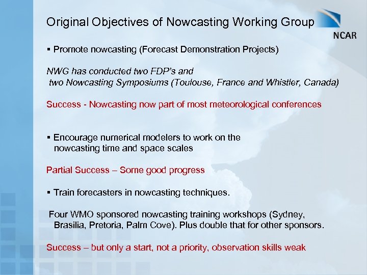
Original Objectives of Nowcasting Working Group § Promote nowcasting (Forecast Demonstration Projects) NWG has conducted two FDP’s and two Nowcasting Symposiums (Toulouse, France and Whistler, Canada) Success - Nowcasting now part of most meteorological conferences § Encourage numerical modelers to work on the nowcasting time and space scales Partial Success – Some good progress § Train forecasters in nowcasting techniques. Four WMO sponsored nowcasting training workshops (Sydney, Brasilia, Pretoria, Palm Cove). Plus double that for other sponsors. Success – but only a start, not a priority, observation skills weak
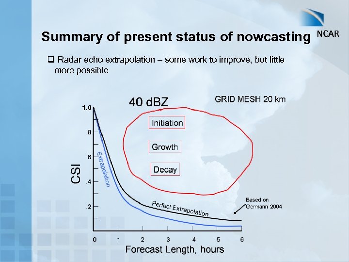
Summary of present status of nowcasting q Radar echo extrapolation – some work to improve, but little more possible 1. 0
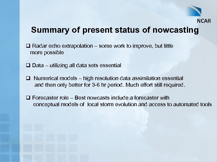
Summary of present status of nowcasting q Radar echo extrapolation – some work to improve, but little more possible q Data – utilizing all data sets essential q Numerical models – high resolution data assimilation essential and then only better for 3 -6 hr period. Much effort still required. q Forecaster role – Best nowcasts include a forecaster with conceptual models of local storm evolution and access to automated tools
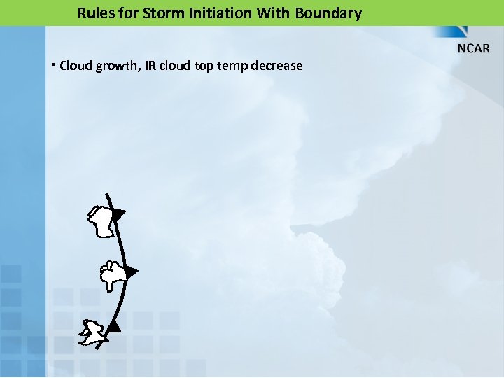
Rules for Storm Initiation With Boundary • Cloud growth, IR cloud top temp decrease
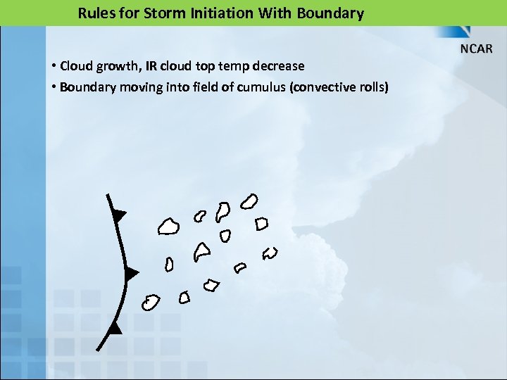
Rules for Storm Initiation With Boundary • Cloud growth, IR cloud top temp decrease • Boundary moving into field of cumulus (convective rolls)
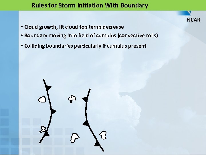
Rules for Storm Initiation With Boundary • Cloud growth, IR cloud top temp decrease • Boundary moving into field of cumulus (convective rolls) • Colliding boundaries particularly if cumulus present
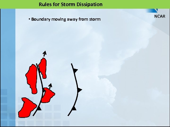
Rules for Storm Dissipation • Boundary moving away from storm
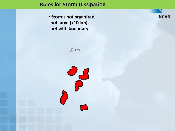
Rules for Storm Dissipation • Storms not organized, not large (<10 km), not with boundary 10 km
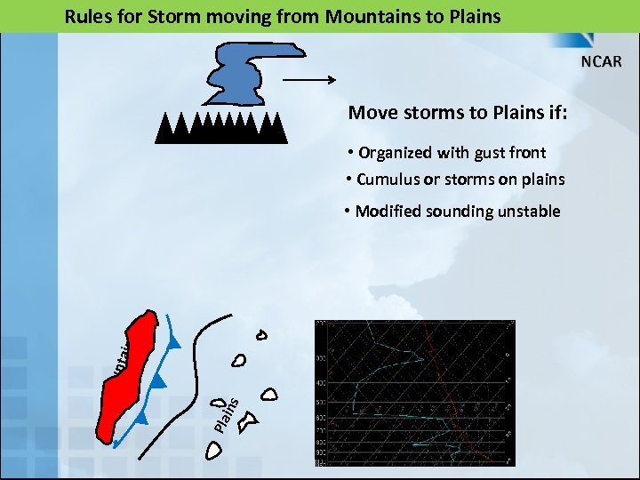
Rules for Storm moving from Mountains to Plains Move storms to Plains if: • Organized with gust front • Cumulus or storms on plains Pla ins Mo unt ains • Modified sounding unstable
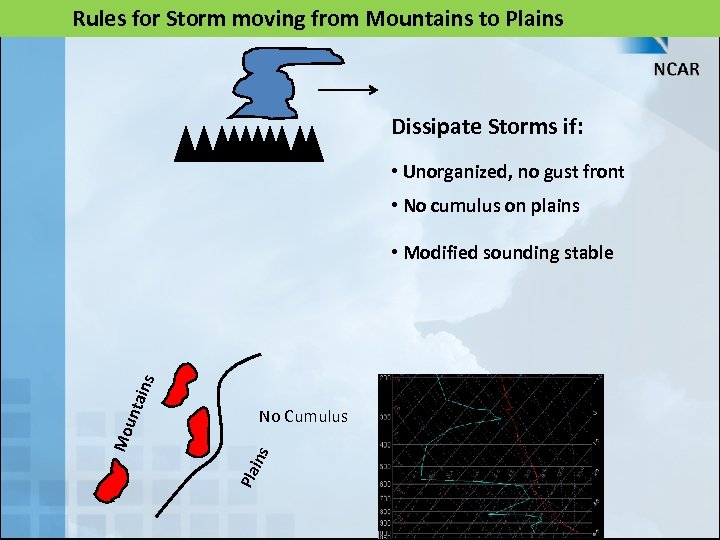
Rules for Storm moving from Mountains to Plains Dissipate Storms if: • Unorganized, no gust front • No cumulus on plains No Cumulus Pla ins Mo unt ains • Modified sounding stable
What is needed to improve nowcasts 1) Improved understanding of physical processes on the micro- and mesoscales 2) High resolution observations of boundary layer winds and three-dimensional temperature and moisture fields
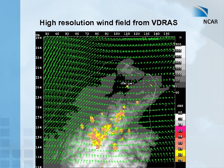
High resolution wind field from VDRAS
What is needed to improve nowcasts 1) Improved understanding of physical processes on the micro- and mesoscales 2) High resolution observations of boundary layer winds and three-dimensional temperature and moisture fields 3) Major improvements in numerical models on the nowcast time and space scales
Future: Require commitment of weather services or private companies to provide nowcasts. In U. S. see a trend toward private companies. Aggressive training of forecasters. 0 -2 hr – Expert System with human input (possible exception is blending for strongly forced synoptic situations blending) Need to develop local conceptual nowcast rules 2 -4 hr – blending (extrapolation, expert system and models) 4 -6 hr – blending with heavy weight toward the model
THANK YOU
2cc2f1e2ee2b46914da78a20f5acb1f0.ppt