38e5e2cc0ae720404addac68bacffc9f.ppt
- Количество слайдов: 19


Neighborhood Form, Traffic and Congestion Presented at Tackling Traffic Congestion UCLA Conf. Center, Lake Arrowhead CA, 21 October 2002 Dr. John Holtzclaw Chair, Sierra Club Transportation Committee Consultant: Transportation and Land Use Research john. holtzclaw@sierraclub. org
")
3 Hh/Res Acre (Courtesy City of Portland)

Community Transformation courtesy Steve Price http: //www. sierraclub. org/sprawl/community/transformations/index. asp Transform only main street - San Pablo Ave in El Cerrito, CA No Parking Surface Parking As Shown Census Tract Avg. 60 hh/res ac 15 hh/res ac 30 hh/res ac 12 hh/res ac C T Before Transf. 9 hh/res ac (census tract is 8 x 10 blocks)

San Francisco North Beach Paul and Tira 90 Hh/Res Acre Backyard, No parking

San Francisco - North Beach 90 Hh/Res Ac Underground parking

San Francisco West of Union Square x 4 block zone 3 7 live theatres, fine hotels, cafes and markets 1 to 36 stories, mostly 4 - 16 stories 467 - 536 Hh/Res Ac 15% of land residential limited parking

San Francisco West of Union Square 3 x 4 block zone 7 live theatres, fine hotels, cafes and markets 1 to 36 stories, mostly 4 - 16 stories 467 - 536 Hh/Res Ac 15% of land residential limited parking
")
Location Efficient Mortgage LEM research Institute for Location Efficiency Center for Neighborhood Technology (Chicago) Natural Resources Defense Council Surface Transportation Policy Project
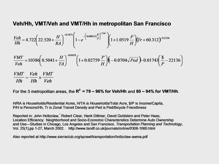
 Chicago, LA and San Francisco metro areas How")
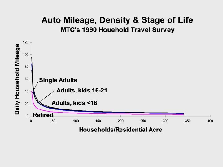
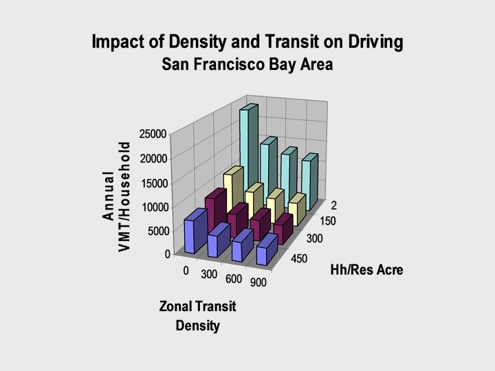
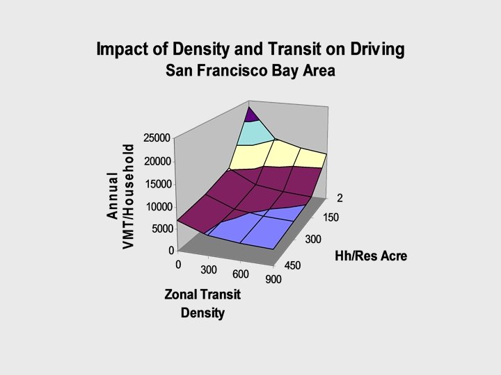
LEM Research Nearly 3000 neighborhoods (TAZs) Chicago, LA and San Francisco metro areas How do: densities (3 measures) shopping proximity public transit ped/bike (grid, short, narrow, sidewalks, setbacks) family income family size affect: vehicles (census data)? VMT (odometer readings from smog checks -- total driving, not just commutes)?


38e5e2cc0ae720404addac68bacffc9f.ppt