9c9b713ff8c2866b215fece82644ce05.ppt
- Количество слайдов: 33
 National Weather Service San Diego WRF Leveraging Operational WRF Runs Brandt Maxwell Meteorologist National Weather Service Forecast Office San Diego, California USA Web: weather. gov/sandiego Email: Brandt. maxwell@noaa. gov
 Today’s Presentation • History of the WRF at NWS San Diego • Info about our WRF • How our WRF is Used • Positives/Negatives of our WRF • “Show and Tell” – The Best Part!
 Short History of Numerical Modeling at NWS San Diego • First ran Workstation-ETA in 2001 – Predecessor to the WRF-EMS • As name suggests, ability to run a model with ETA physics on a Linux PC or workstation • Developed by COMET (UCAR) – Original intent: view terrain effects on wind, precipitation and temperature for operational forecasting – Original grid-spacing: approx. 8 km – Non-hydrostatic – Original computer had only 2 processors – No concurrent post-processing
 Upgrade to WRF-EMS • First ran WRF-EMS in 2006 – Originally used the WRF-NMM for the dynamic core • WRF-EMS had 2 options (NMM vs. ARW) – Grid spacing was 4 -km (but in diagonal/Arakawa-E grid) – Had better computer, with 4 cores – Separate post-processing computer let us generate the Grib files for AWIPS while the WRF was running • No waiting until the end of the run
 Further Improvements • Big improvement in 2009 – New 8 core system (2. 83 GHz each) with 12 GB memory (DDR) – Switched from WRF-NMM to WRF-ARW – 3. 7 -km grid spacing (non-diagonal) – 45 vertical (sigma) levels • Heavier distribution towards surface (marine layer) – Around this time, self-implemented e-mail notification of when the disk was full (due to a few WRF crashes due to disk-full errors)
 Current WRF for NWS San Diego • We still use the WRF-EMS – We actually have 2 runs every 6 hours • One run is on our local machine (from 2010) • Alternate run is on the Triton system at the San Diego Supercomputer Center (since 2012) on space rented by SDG&E • Both runs use NAM for boundary conditions. . . but. . . • Different initial conditions (one uses NAM, one uses RAP) • NAM-init run gives 84 -hours of output (takes approx. 3 ½ hours to run) • RAP-init run gives 48 -hours of output (takes approx. 2 ½ hours to run)
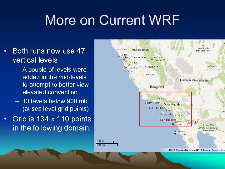 More on Current WRF • Both runs now use 47 vertical levels – A couple of levels were added in the mid-levels to attempt to better view elevated convection – 13 levels below 900 mb (at sea level grid points) • Grid is 134 x 110 points in the following domain:
 Normal Time Step • For WRF-ARW, time step (in seconds) should normally be about 6 times the grid spacing (in kilometers) – Allows one to usually satisfy the Courant, Friedrichs and Lewy (CFL) condition: • The time step must be less than the time it takes the fastest moving wave in the model to travel one grid space • Violation of this creates noise and/or a crash – In our case: 3. 7 -km grid spacing x 6 = 22 seconds – Normal operating mode until 2012
 Adaptive Time Step • A way to speed up the model – If no fast-moving waves are threatening to violate the CFL condition: • The adaptive time step will increase and “speed up” the WRF • WRF allows as high as a 45 -sec. time step for 3. 7 -km grid spacing – We began using this in April 2012 • Worked very reliably in late spring and summer with runs 30% faster than before • We started having crashes in autumn though
 Adaptive Time Step Issue • What messed up the WRF? – CFL was violated • Happened when WRF was running at longer time steps (4045 seconds) and a wave suddenly appeared • It has been suggested that due to our small domain, the adaptive time step does not work as well as with a large domain – Time step adjusts (by getting smaller) better with a larger domain when there are waves propagating really fast
 Solution • Only run WRF with adaptive time step in late spring/summer/early fall • We run the main (84 -hour NAM-init) WRF on our local machine with adaptive time step then • When we can’t run the WRF with adaptive time step, we run it (NAM-init WRF) on faster Triton and swap the WRF RAPinit to our local machine (since it’s only through 48 hours) – Computer power is limited, so can’t have a larger domain without sacrificing resolution – Other note: RAP-init WRF runs without adaptive time step to prevent both WRFs from crashing
 Why can’t we just always run 84 -hour NAM-init WRF on Triton? • A couple disadvantages of Triton: • Difficult to set up concurrent post-processing due to WRF being allocated to different processors each model run on Triton – When we can run WRF on our own computer, we can view the 24 -hour prognosis when the later hours of the WRF are still running • Internet bandwidth is tight at NWS San Diego, and large post-processed Grib files can take 15 -30 minutes to download
 Other “specs” • For both NAM-init and RAP-init runs: – No convective parameterization • We’ve tried Kain-Fritsch and Grell 3 D in the past – – Microphysics: Thompson PBL: Yonsei Land-Surface: Noah Long/Shortwave Radiation: Dudhia • Part of deciding the “specs” is computational times
 Why do we use the WRF-EMS versus the NCAR version of WRF ARW? • Easy (and relatively fast) to install and configure – No compilers required • Access to COMET’s personal tiles for boundary and initial conditions – Only downloads data (Grib) for your domain – Can also access other Grib data sources, such as NOMADS (which now have geographic constraints on the data) – COMET has archived data (including offline NAM/GFS data) • Good network of support – WRF-EMS listserv – NWS offices are #1 on the COMET support priority list – Most other NWS offices use WRF-EMS
 How Does NWS San Diego Use the WRF • First of all, WRF is *the* #1 model of choice at NWS San Diego • General Weather Forecasting – We mostly view WRF in AWIPS – Heavily used for IFPS grids • Need high-res model here especially for terrain and coastal effects • 84 -hour WRF run means we can use it to populate 3 days worth of grids • Most often used for winds, temperatures, dew points • Bias-corrected grids are an option which takes into account WRF biases from past 30 days
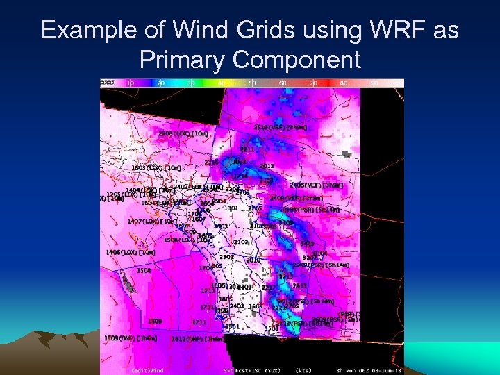 Example of Wind Grids using WRF as Primary Component
 WRF: Aviation Forecasting • Used frequently for aviation forecasting (TAFs) – We view them in AWIPS and BUFKIT – AWIPS has interpolated vertical levels (due to Grib files) every 3 hours, BUFKIT has *all* vertical model levels every hour • Specific uses: – Used for depth of marine layer (cloud heights; can impact visibility) – Used for locations of low clouds (low-level RH fields) – Used for winds at TAF sites – Used for wind shear (especially in BUFKIT soundings which show every WRF model level at every hour) – Used for pilot briefings (including winds aloft)
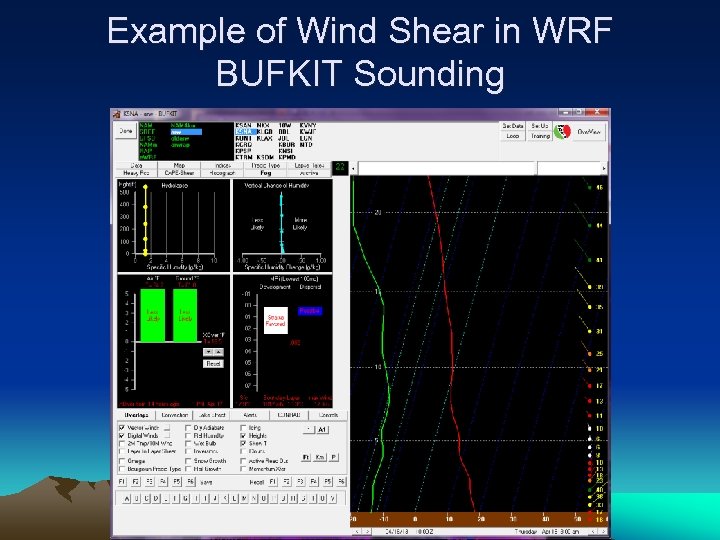 Example of Wind Shear in WRF BUFKIT Sounding
 Fire Weather Forecasting • WRF inclusion in IFPS grids helps with – Fire weather forecasts – Spot forecasts • WRF is a major tool for deciding whether or not to issue a red flag warning • Excellent for verbal briefings
 Marine Forecasting • Useful for winds over coastal waters – Especially when waves from the islands (or from offshore flow) impact surface winds • Useful for short-period, locally generated swell – Especially for WNW swells with a wind fetch south of Point Conception/through the Channel Islands • WRF low-level shear/instability can assist with waterspout forecasting
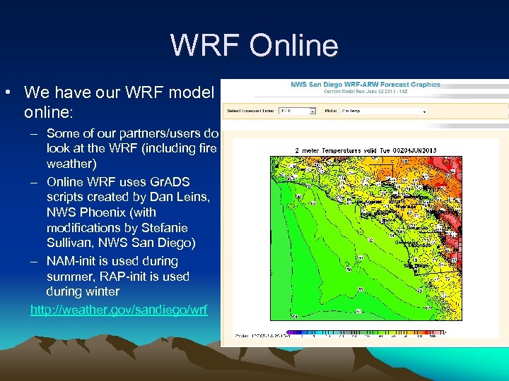 WRF Online • We have our WRF model online: – Some of our partners/users do look at the WRF (including fire weather) – Online WRF uses Gr. ADS scripts created by Dan Leins, NWS Phoenix (with modifications by Stefanie Sullivan, NWS San Diego) – NAM-init is used during summer, RAP-init is used during winter http: //weather. gov/sandiego/wrf
 Research • WRF is used for case studies – All NWS San Diego WRF runs are archived back to 2010 – For older dates (or if other boundary/initial conditions are desired), other sources of data can be used as input to the WRF • If high-res nested domain is desired, output Grib files from the WRF can be used as input to the high-res run – Mixed results here, probably because domain can be too small
 What the WRF does well • Winds: Does well in most cases – Gap winds perform well in places like San Gorgonio Pass, Cajon Pass – Mountain wave winds do moderately well • But. . . WRF has a tendency to go too high here – In “weak Santa Anas”, WRF sometimes erroneously predicts strong winds at 850 mb near Cajon Pass to reach the valley floor – Rotors (such as near Palm Springs) appear with some accuracy – Sea breeze winds are well modeled
 What the WRF does well, cont. • Relative humidity: – Boundary layer RH is an accurate indicator of marine layer stratus (especially at night) – Good for showing marine layer depth (timeheight cross sections) – Moderately good for fire weather • Temperature: – Performs well with bias correction for IFPS
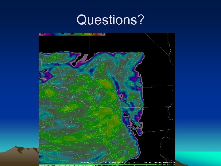
 Weaknesses of the WRF • Precipitation, especially convective – Stratiform precip is OK, though usually with values too high – Convective precip is difficult to predict in So-Cal • One problem is that a lot of our thunderstorms are very small core in summer – Convective parameterization has not helped enough to justify the extra model time needed • However, WRF is at least moderately good with predicting indicators for convection (instability, convergence, etc. ) – Visibility values (aviation) are not good
 “Self-Inflicted” Negative Impact on our WRF • Our domain is too small – Despite buffer of more than 5 grid points beyond our County Warning & Forecast Area (CWFA), a COMET study showed that the ideal domain should be much larger—perhaps double your forecast area! – Seems to impact precipitation (especially convective) the most – Likely impacts our adaptive time step • However. . . larger domain needs larger more expensive computer
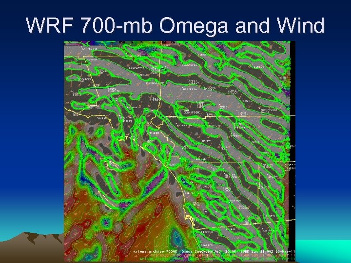
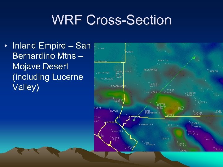
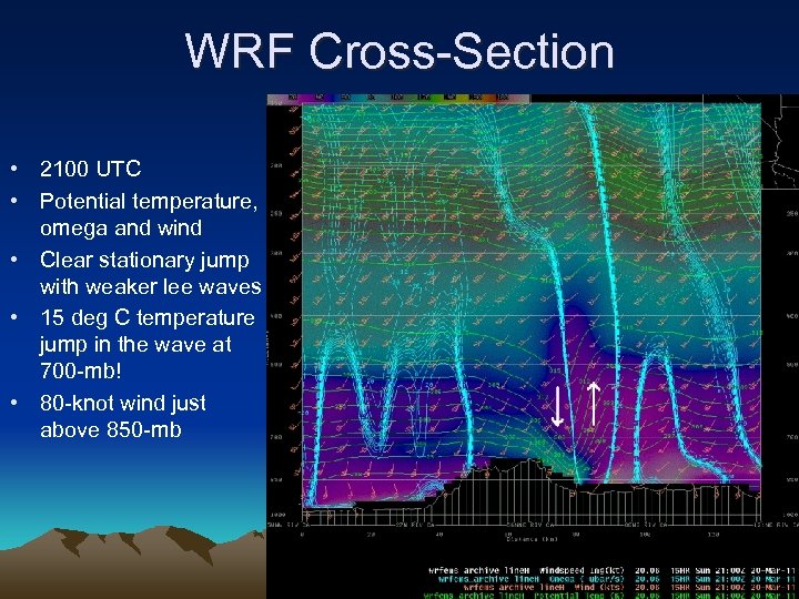
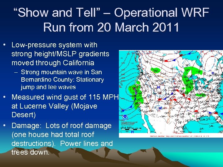 “Show and Tell” – Operational WRF Run from 20 March 2011 • Low-pressure system with strong height/MSLP gradients moved through California – Strong mountain wave in San Bernardino County: Stationary jump and lee waves • Measured wind gust of 115 MPH at Lucerne Valley (Mojave Desert) • Damage: Lots of roof damage (one house had total roof destructions). Power lines and trees down.
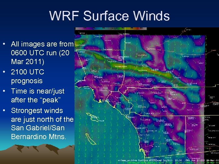 WRF Surface Winds • All images are from 0600 UTC run (20 Mar 2011) • 2100 UTC prognosis • Time is near/just after the “peak” • Strongest winds are just north of the San Gabriel/San Bernardino Mtns.
 WRF 700 -mb Omega and Wind
 WRF Cross-Section • Inland Empire – San Bernardino Mtns – Mojave Desert (including Lucerne Valley)
 WRF Cross-Section • 2100 UTC • Potential temperature, omega and wind • Clear stationary jump with weaker lee waves • 15 deg C temperature jump in the wave at 700 -mb! • 80 -knot wind just above 850 -mb
 Summary • WRF is a big part of the forecast operations for NWS San Diego (#1 model) – IFPS would be difficult without it given our terrain/coastline • WRF does well with wind, temperature and dew point in So-Cal, not as well with precipitation (especially convective) • Great model for case studies – 20 March 2011 • Our WRF is online: http: //weather. gov/sandiego/wrf
 Questions?


