c4d4f15623fe1133cd63faf37c411f67.ppt
- Количество слайдов: 59
 National Weather Service Gray/Portland, ME Winter SKYWARN Presentation presented by: Mike Kistner Gray, ME Forecast Office
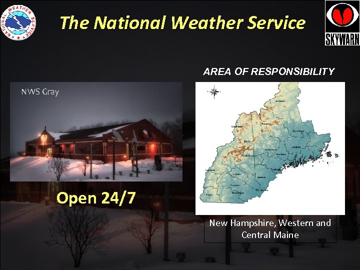 The National Weather Service AREA OF RESPONSIBILITY NWS Gray National Weather Service Binghamton Open 24/7 New Hampshire, Western and Central Maine
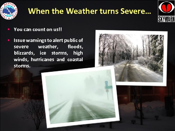 When the Weather turns Severe… • You can count on us!! • Issue warnings to alert public of severe weather, floods, blizzards, ice storms, high winds, hurricanes and coastal storms.
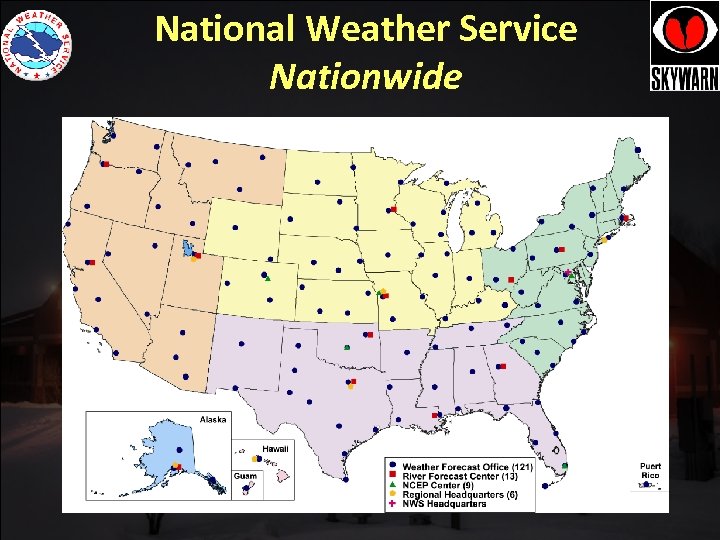 National Weather Service Nationwide
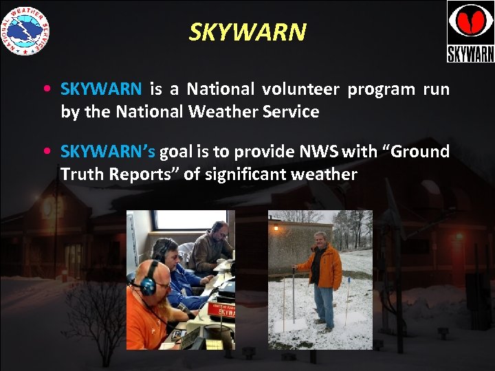 SKYWARN • SKYWARN is a National volunteer program run by the National Weather Service • SKYWARN’s goal is to provide NWS with “Ground Truth Reports” of significant weather
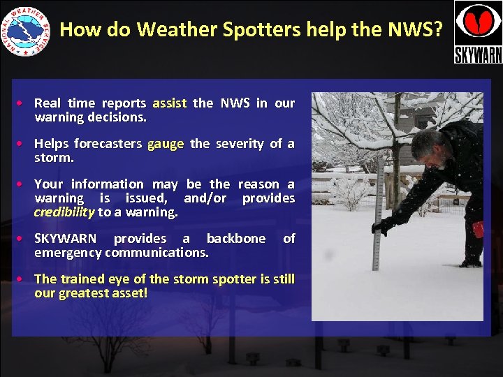 How do Weather Spotters help the NWS? • Real time reports assist the NWS in our warning decisions. • Helps forecasters gauge the severity of a storm. • Your information may be the reason a warning is issued, and/or provides credibility to a warning. • SKYWARN provides a backbone emergency communications. of • The trained eye of the storm spotter is still our greatest asset!
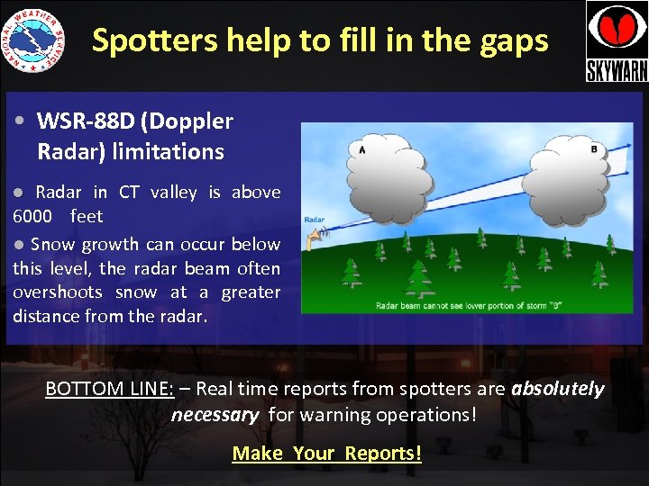 Spotters help to fill in the gaps • WSR-88 D (Doppler Radar) limitations Radar in CT valley is above 6000 feet l Snow growth can occur below this level, the radar beam often overshoots snow at a greater distance from the radar. l BOTTOM LINE: – Real time reports from spotters are absolutely necessary for warning operations! Make Your Reports!
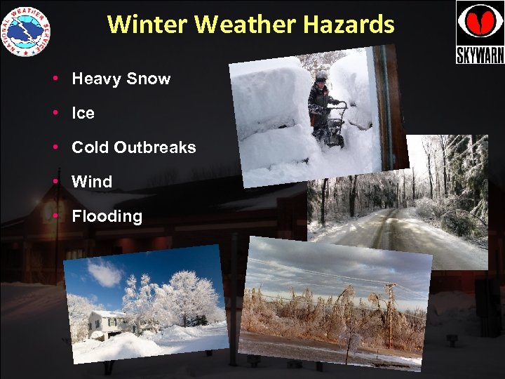 Winter Weather Hazards • Heavy Snow • Ice • Cold Outbreaks • Wind • Flooding
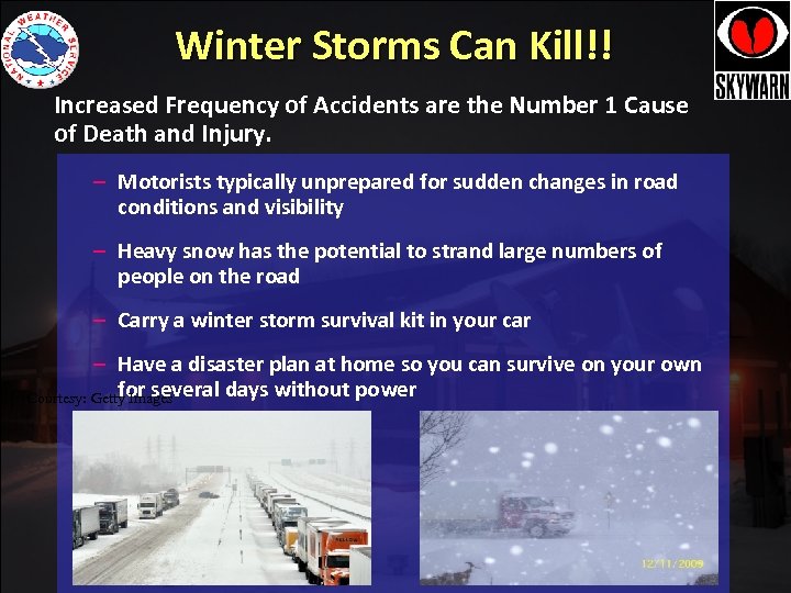 Winter Storms Can Kill!! Increased Frequency of Accidents are the Number 1 Cause of Death and Injury. – Motorists typically unprepared for sudden changes in road conditions and visibility – Heavy snow has the potential to strand large numbers of people on the road – Carry a winter storm survival kit in your car – Have a disaster plan at home so you can survive on your own for several days without power Courtesy: Getty Images
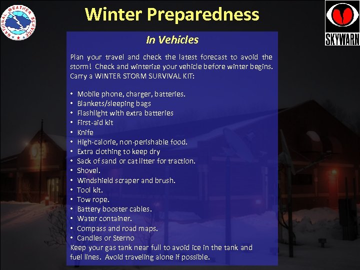 Winter Preparedness In Vehicles Plan your travel and check the latest forecast to avoid the storm! Check and winterize your vehicle before winter begins. Carry a WINTER STORM SURVIVAL KIT: • Mobile phone, charger, batteries. • Blankets/sleeping bags • Flashlight with extra batteries • First-aid kit • Knife • High-calorie, non-perishable food. • Extra clothing to keep dry • Sack of sand or cat litter for traction. • Shovel. • Windshield scraper and brush. • Tool kit. • Tow rope. • Battery booster cables. • Water container. • Compass and road maps. • Candles or Sterno Keep your gas tank near full to avoid ice in the tank and fuel lines. Avoid traveling alone if possible.
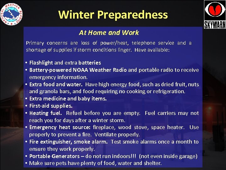 Winter Preparedness At Home and Work Primary concerns are loss of power/heat, telephone service and a shortage of supplies if storm conditions linger. Have available: • Flashlight and extra batteries • Battery-powered NOAA Weather Radio and portable radio to receive emergency information. • Extra food and water. Have high energy food, such as dried fruit, nuts and granola bars, and food requiring no cooking or refrigeration. • Extra medicine and baby items. • First-aid supplies. • Heating fuel. Refuel before you are empty. Fuel carriers may not reach you for days after a winter storm. • Emergency heat source: fireplace, wood stove, space heater. Use properly to prevent a fire. Ventilate properly. • Fire extinguisher, smoke alarm. Test smoke alarms once a month to ensure they work properly. • Portable Generators – do not run indoors!!! (not even inside garage) • Make sure pets have plenty of food, water and shelter.
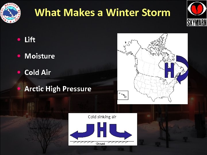 What Makes a Winter Storm • Lift • Moisture • Cold Air • Arctic High Pressure Cold sinking air Source: USA Today Ground
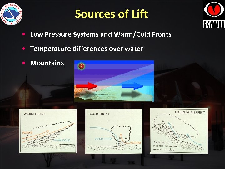 Sources of Lift • Low Pressure Systems and Warm/Cold Fronts • Temperature differences over water • Mountains Source: USA Today
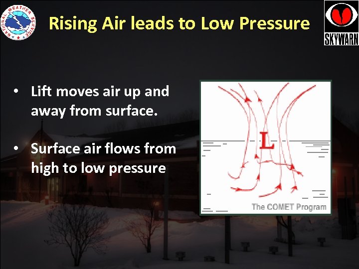 Rising Air leads to Low Pressure • Lift moves air up and away from surface. • Surface air flows from high to low pressure
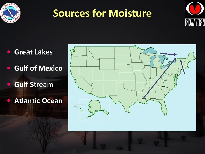 Sources for Moisture • Great Lakes • Gulf of Mexico • Gulf Stream • Atlantic Ocean
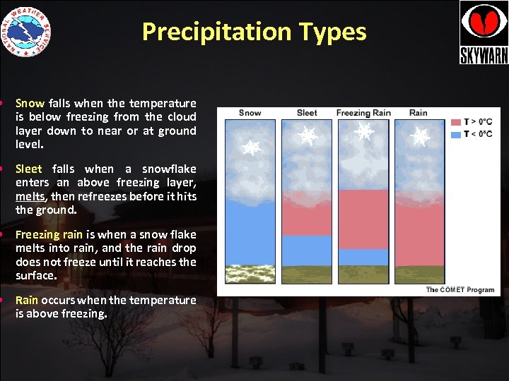 Precipitation Types • Snow falls when the temperature is below freezing from the cloud layer down to near or at ground level. • Sleet falls when a snowflake enters an above freezing layer, melts, then refreezes before it hits the ground. • Freezing rain is when a snow flake melts into rain, and the rain drop does not freeze until it reaches the surface. • Rain occurs when the temperature is above freezing.
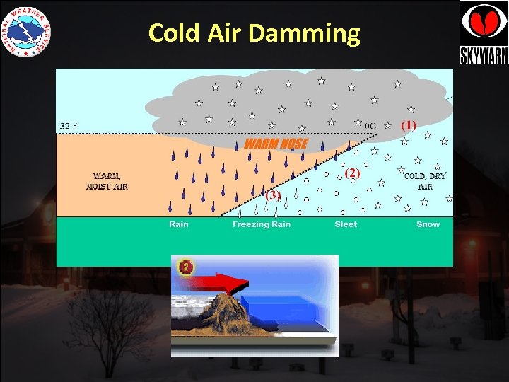 Cold Air Damming
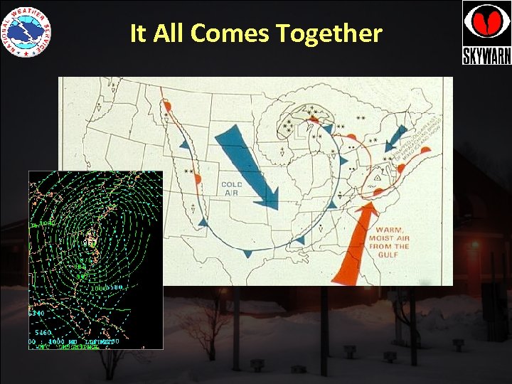 It All Comes Together
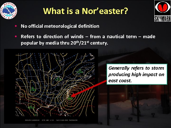 What is a Nor’easter? • No official meteorological definition • Refers to direction of winds – from a nautical term – made popular by media thru 20 th/21 st century. Generally refers to storm producing high impact on east coast.
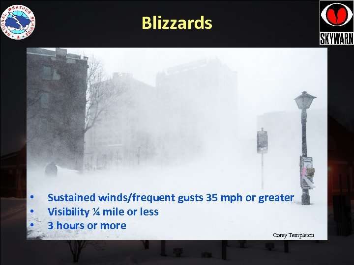 Blizzards • • • Sustained winds/frequent gusts 35 mph or greater Visibility ¼ mile or less 3 hours or more Corey Templeton
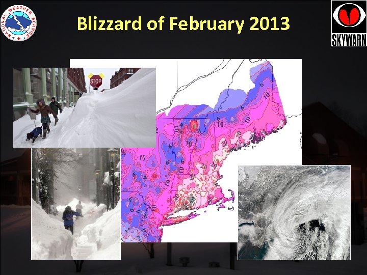 Blizzard of February 2013 • Blizzard of 2013
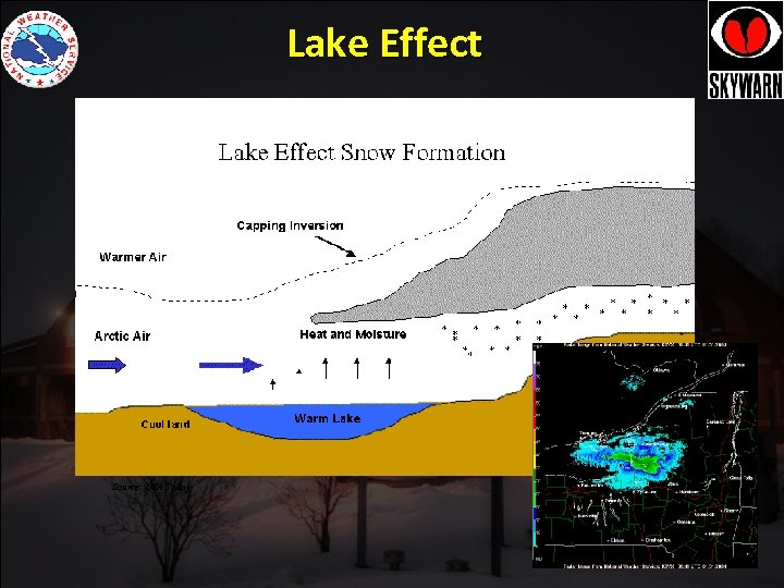 Lake Effect Source: USA Today
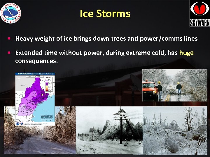 Ice Storms • Heavy weight of ice brings down trees and power/comms lines • Extended time without power, during extreme cold, has huge consequences.
 Winter and Spring Flooding • Typical snowpack water equivalents can exceed 6 inches some winters! • Many places typically have 2 to 6 inches of water locked up in the snowpack by late winter • And… • We know it is going to melt eventually. • With heavy rain and warm temperatures, which can happen in late winter/early spring…. big flooding can result!
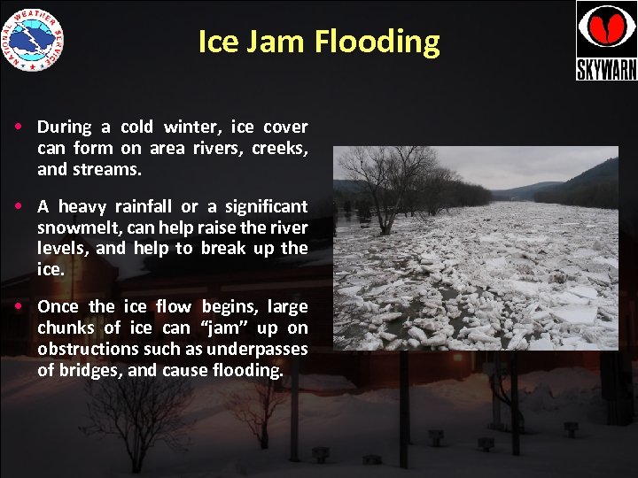 Ice Jam Flooding • During a cold winter, ice cover can form on area rivers, creeks, and streams. • A heavy rainfall or a significant snowmelt, can help raise the river levels, and help to break up the ice. • Once the ice flow begins, large chunks of ice can “jam” up on obstructions such as underpasses of bridges, and cause flooding.
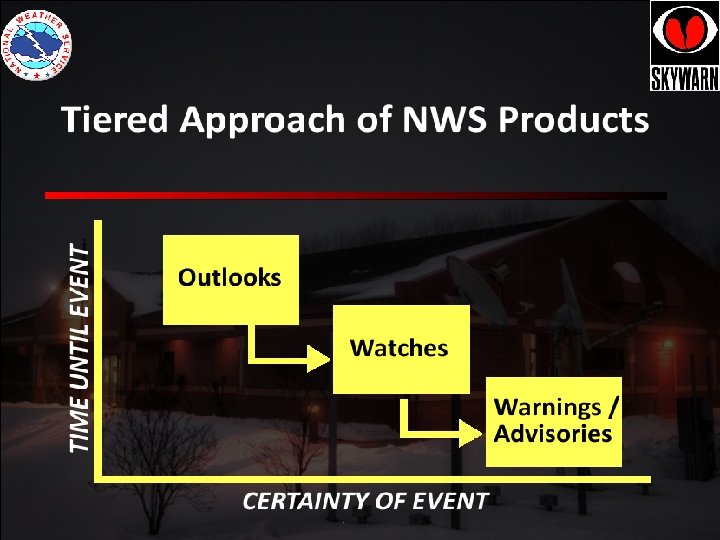
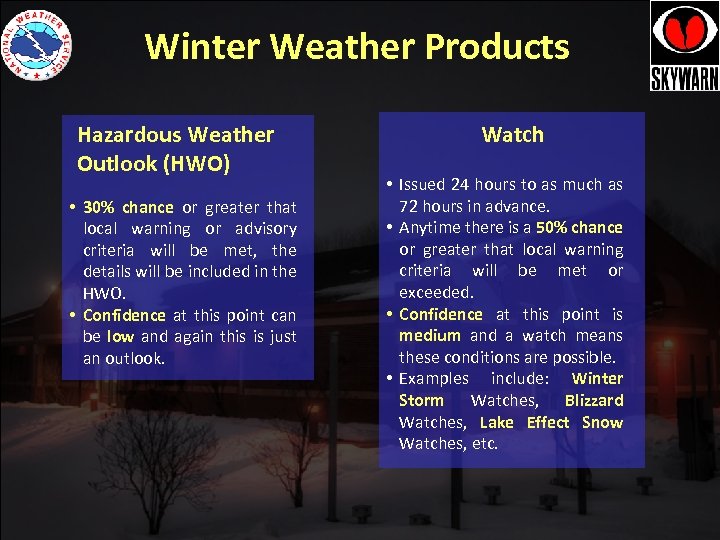 Winter Weather Products Hazardous Weather Outlook (HWO) • 30% chance or greater that local warning or advisory criteria will be met, the details will be included in the HWO. • Confidence at this point can be low and again this is just an outlook. Watch • Issued 24 hours to as much as 72 hours in advance. • Anytime there is a 50% chance or greater that local warning criteria will be met or exceeded. • Confidence at this point is medium and a watch means these conditions are possible. • Examples include: Winter Storm Watches, Blizzard Watches, Lake Effect Snow Watches, etc.
 Winter Weather Products Warning • Issued 12 hours to as much as 36 hours in advance. • Anytime there is a 80% chance or greater that local warning criteria will be met. • Potential for life threatening, confidence is high. • Examples include Winter Storm Warnings, Blizzard Warnings, Wind Chill Warnings. Advisory • Issued 12 hours to as much as 36 hours in advance. • Anytime there is a 80% chance or greater that local advisory criteria will be met or exceeded. • More of a nuisance, confidence is high. • Examples include Winter Weather Advisory, Freezing Rain Advisory, and Wind Chill Advisories.
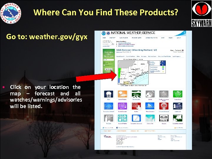 Where Can You Find These Products? Go to: weather. gov/gyx • Click on your location the map – forecast and all watches/warnings/advisories will be listed.
 Reporting Winter Weather Measuring Snow • Most concerned with newly fallen snow (storm total). • Where, what, and how to best measure. • Best measurement practices. • How to make snowfall reports. • Other observations such as, ice accumulation, flooding, etc.
 Measuring Snow • Snowfall measurement is typically more difficult than rainfall • Snowfall measurement takes a little more time Accurate and timely snowfall measurements can be extremely important to the local National Weather Service office, public works departments, media outlets, climatologists, and other scientists
 Selecting A Good Location - Best area to measure snow will vary depending on your location. - Best site will be 1) relatively open ground and 2) protected but unobstructed by vegetation. - You want to minimize drifting as much as possible! - Not all sites will be perfect. Do the best you can.
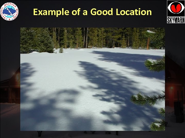 Example of a Good Location
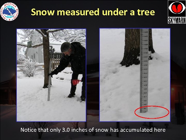 Snow measured under a tree Notice that only 3. 0 inches of snow has accumulated here
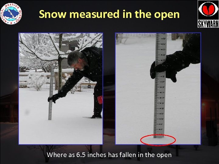 Snow measured in the open Where as 6. 5 inches has fallen in the open
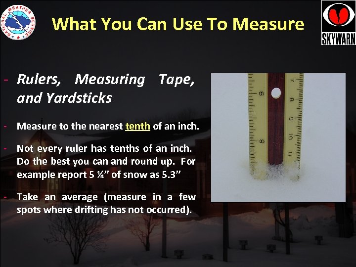 What You Can Use To Measure - Rulers, Measuring Tape, and Yardsticks - Measure to the nearest tenth of an inch. - Not every ruler has tenths of an inch. Do the best you can and round up. For example report 5 ¼” of snow as 5. 3” - Take an average (measure in a few spots where drifting has not occurred).
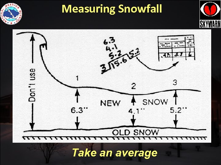 Measuring Snowfall Take an average
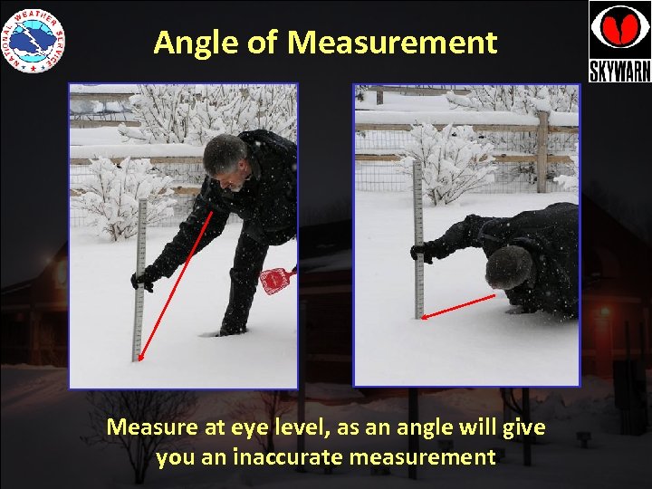 Angle of Measurement Measure at eye level, as an angle will give you an inaccurate measurement
 What You Can Measure On • Measuring on the grass or an elevated surface such as a deck is fine. • Remember to avoid measuring right next to your house, or close to a driveway or road. • Measurements made on a snow board are best. • You want to measure in a few different locations, to get the best average.
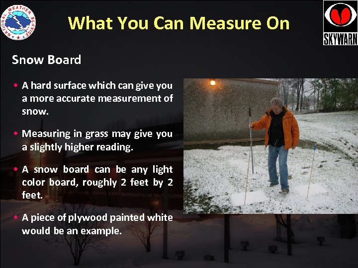 What You Can Measure On Snow Board • A hard surface which can give you a more accurate measurement of snow. • Measuring in grass may give you a slightly higher reading. • A snow board can be any light color board, roughly 2 feet by 2 feet. • A piece of plywood painted white would be an example.
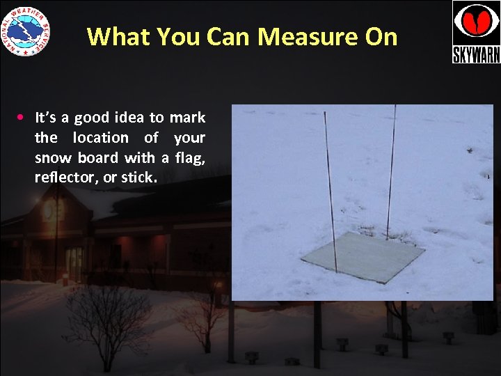 What You Can Measure On • It’s a good idea to mark the location of your snow board with a flag, reflector, or stick.
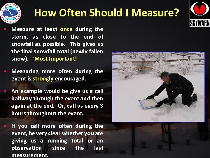 How Often Should I Measure? • Measure at least once during the storm, as close to the end of snowfall as possible. This gives us the final snowfall total (newly fallen snow). *Most Important! • Measuring more often during the event is strongly encouraged. • An example would be give us a call halfway through the event and then again at the end. Or, call us every 3 hours throughout the event. • If you call more often during the event, be very clear whether you are giving us a running total or an observation since the last measurement.
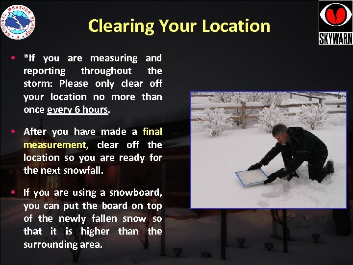 Clearing Your Location • *If you are measuring and reporting throughout the storm: Please only clear off your location no more than once every 6 hours. • After you have made a final measurement, clear off the location so you are ready for the next snowfall. • If you are using a snowboard, you can put the board on top of the newly fallen snow so that it is higher than the surrounding area.
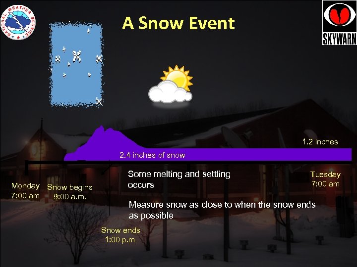 A Snow Event 1. 2 inches 2. 4 inches of snow Monday Snow begins 7: 00 am 9: 00 a. m. Some melting and settling occurs Tuesday 7: 00 am Measure snow as close to when the snow ends as possible Snow ends 1: 00 p. m.
 Call the Spotter Hotline: REPOR S TS ORT P RE Y! 1 -800 -482 -0913 ONLY! ONL This is a special number only for spotters and rings directly to us! 1. Who you are: Trained Skywarn Spotter and Spotter ID. 2. Where you live (if away from home, let us know) 3. Your observation (3. 7” of new snow last 3 hours. 5. 0” total ) 4.
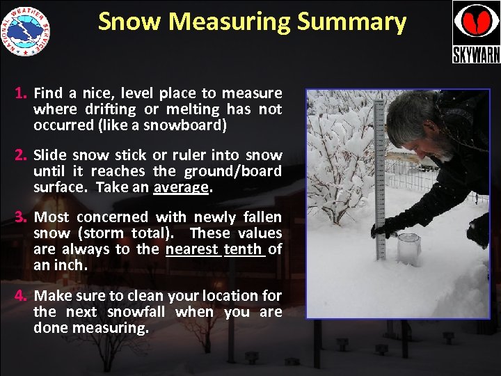 Snow Measuring Summary 1. Find a nice, level place to measure where drifting or melting has not occurred (like a snowboard) 2. Slide snow stick or ruler into snow until it reaches the ground/board surface. Take an average. 3. Most concerned with newly fallen snow (storm total). These values are always to the nearest tenth of an inch. 4. Make sure to clean your location for the next snowfall when you are done measuring.
 RTS EPO ! R NLY O REPOR TS ONLY! Email: gyx. skywarn@noaa. gov 1. Spotter ID 2. Location 3. Your observation (8. 7” of new snow @ 7: 20 PM) 4. Storm total snow, if different
 Measuring Snow A major snowstorm hits on the weekend when you are home. You decide to report throughout the storm. We already have 2” on the ground prior to the storm but your snow measuring area is free of snow. The snow starts at 9 AM and by 2 PM you have 5. 3”. You call the office. The snow continues and you pick up another 5 inches when it ends at 10 PM. -What is the newly fallen snowfall at 2 PM? -What is the final snowfall total at 10 PM?
 Amateur Radio Check in and send reports directly to WX 1 GYX via the following methods: 1. 2 meter net on the KQ 1 L Repeater System (Primary repeater: 146. 880 – 100 Hz PL) 2. HF on 7. 277 Mhz (Day), 3. 965 MHz (Night) & 3. 960 (Alt. Night) 3. Echolink via the *NEW-ENG* Node
 Measuring Snow • Answer #2 • When you call the office at 2 PM you report 5. 3”. • When you call the office at 10 PM tell them you have measured 10. 3” and this is a final total. • No need to say 5” more fell. Different people may answer. Just give a running total, and be sure to give the final total at the end.
 When to Report? • Snowfall Minimum Request: Try to call as close to the end of the event as possible (newly fallen, snowfall total). Extra Mile: Knowing how much has fallen at the end of the event is important, but knowing it as it is happening helps our warning decision process. Call us with updates as possible, every 3 hours throughout the event. If you are getting over an inch of snow per hour, this is critical info, and we would like to hear from you.
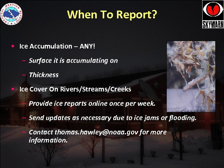 When To Report? • Ice Accumulation – ANY! – Surface it is accumulating on – Thickness • Ice Cover On Rivers/Streams/Creeks – Provide ice reports online once per week. – Send updates as necessary due to ice jams or flooding. – Contact thomas. hawley@noaa. gov for more information.
 http: //www. facebook. com/NWSGray @NWSGray Be sure to identify yourself as a trained spotter! Post a picture! 1. Spotter ID and location. 2. What you saw (we are just starting to see freezing rain) Photo copyright Bobby Eddies
 Future Classes • We also hold SKYWARN classes in the spring that focus on thunderstorms and flash flooding. • We will always post future class information on our website weather. gov/gyx at the top of the page and on our Skywarn page. Also, we will post it on Facebook. • Our goal is that you report to us year round (snow, hail, high winds, etc).
 What to Else To Report • Tornado or Funnel cloud (confirm rotation) • Hail (any size) • Wind damage- trees down, structural • Flooding (closed roads, streams close to bankful) • Heavy rainfall (generally amounts of 2 inches or more in less than 6 hours or rates of 1 inch or more an hour). • Use the toll free number for urgent weather reports such as these. • More information in our Spring Class (at end).
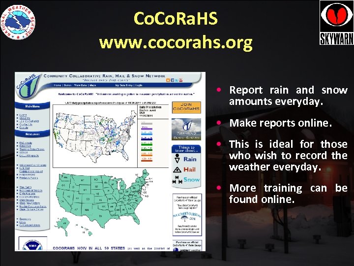 Co. Ra. HS www. cocorahs. org • Report rain and snow amounts everyday. • Make reports online. • This is ideal for those who wish to record the weather everyday. • More training can be found online.
 Reporting Procedures 1. Toll Free Number: 1 -800 -482 -0913 2. E-mail: gyx. skywarn@noaa. gov 3. Amateur Radio (HF, VHF, and Echolink) www. wx 1 gyx. org 4. Facebook 5. Twitter @NWSGray #nhwx #mewx 6. Co. RAHS
 Mike Kistner Meteorologist NWS Gray/Portland ME • Email: michael. kistner@noaa. gov • Web page: http: //weather. gov/gyx • Facebook: US National Weather Service, Gray ME • Twitter: @NWS Gray


