160a254cd13bcb75e29ac37e18950a64.ppt
- Количество слайдов: 23


Monitoring Global Crop Production from NASA Satellites Source: USDA/FAS’ WMO Station Explorer http: //gis. pecad. fas. usda. gov/Wmo. Station. Explorer/ Curt. Reynolds@fas. usda. gov USDA’s Foreign Agricultural Service (FAS) Office of Global Analysis (OGA) International Production Assessment Division (IPAD) USDA/FAS/OGA/IPAD
 of USDA Create economic opportunity for American agriculture by expanding")
Foreign Agricultural Service (FAS) of USDA Create economic opportunity for American agriculture by expanding global markets……… • FAS is primarily responsible for USDA’s: – Overseas activities with attachés located at 75 posts – Market development & information, – International trade agreements and negotiations, – Collection and analysis of crop production and trade statistics. (PSD Online) USDA/FAS/OGA/IPAD
 Joint Agricultural Weather Facility (JAWF)")
USDA’s Economic Information System National Agricultural Statistics Service (NASS) Joint Agricultural Weather Facility (JAWF) Foreign Agricultural Service (FAS) Economic Research Service (ERS) Farm Service Agency (FSA) World Agricultural Outlook Board Domestic Production and Stocks Estimates FAS Commodity Circulars World Agricultural Supply and Demand Estimates (WASDE) USDA/FAS/IPAD PSD (Production, Supply and Distribution) Online Data
 since 1973 PSD")
USDA’s Economic Intelligence System World Agricultural Supply and Demand Estimates (WASDE) since 1973 PSD (Production, Supply & Distribution) Online Archive from 1960 -current PSD Online stores historical estimates for crop production, imports, exports, consumption, & stocks for most commodities and countries. USDA/FAS Economic Analysis Chicago Board of Trade (CBOT) & other commodity markets Trade Policy Exporter Assistance & Export Programs Food Aid & Export Credit Programs UMR (Usual Marketing Requirements) USDA/FAS/IPAD USDA Publications USDA decision-makers U. S. Ag Producers & Traders Commodity Price Discovery Commodity Price Adjustments

USDA’s Economic Intelligence System • USDA monthly crop estimates and trade reports are released at specific times to commodity markets: – WASDE Circular from WAOB released on the 9 -12 th day of each month at 12: 00 noon. http: //www. usda. gov/oce/commodity/wasde/ – Monthly World Production, Market and Trade Reports http: //www. fas. usda. gov/currwmt. asp – PSD Online (historical archive from 1960 -present) http: //www. fas. usda. gov/psdonline/ USDA/FAS/OGA/IPAD

Wheat, corn, and soybean prices continue to rise June 9, 2015 $5. 28 $9. 44 $3. 65 2007 price hike from low global stocks, record droughts & US corn ethanol demand 1970’s price hike Landsat-1 launched on July 23, 1972 and first predecessor WASDE report (10/14/80) released on Sept. 17, 1973.

Low stocks raise prices. 0. 13 *365 = 49 -days of stock

USDA/FAS/OGA/IPAD

Soybeans from Brazil to China is largest market 2015/16 China Imports = 77. 5 MMT Sources: ERS; USDA Agricultural Projections to 2024 http: //www. ers. usda. gov/media/1776011/oce 151 c. pdf WASDE (May 12, 2015) http: //www. usda. gov/oce/commodity/wasde/ PSD Online http: //apps. fas. usda. gov/psdonline/psdquery. aspx USDA/FAS/OGA/IPAD 2015/16 US exports = 48. 3 MMT 2015/16 Brazil exports =49. 8 MMT
 International Production Assessment Division (IPAD) IPAD’s Mission Statement:")
FAS Office of Global Analysis (OGA) International Production Assessment Division (IPAD) IPAD’s Mission Statement: Produce the most objective & accurate assessment of global agricultural production outlook and conditions affecting global food security. • USDA’s “Production and Supply Database” (PSD Online) is used for market intelligence (http: //www. fas. usda. gov/psd/) • IPAD’s Heritage- Joint USDA/NASA/NOAA remote sensing programs from 1975 -1988. – LACIE (mid-1970’s): researched how to monitor agriculture with Landsat & NOAA satellite series. – AGRISTARS (1980’s): developed automated applications using Landsat, NOAA/AVHRR, and weather data from WMO and U. S. Air Force Weather Agency (AFWA). USDA/FAS/OGA/IPAD
")
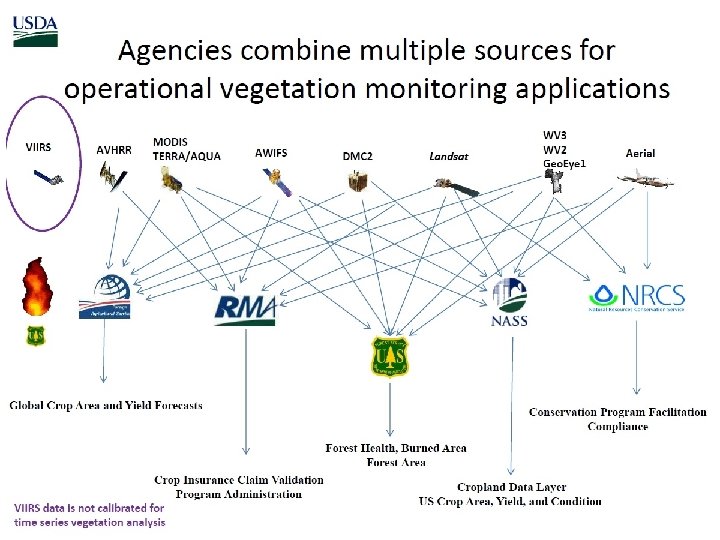
IPAD Data Sources & Strategic Intelligence from Satellites • Weather Data (stations & satellites) • FAS Field Travel • Crop models (stations & satellites) • Official Country Reports • Vegetation Data (satellites) • News Wire Services • FAS Attaché Reports (http: //www. fas. usda. gov/) 10 Regional Analysts • Medium-resolution & temporal coverage n. NOAA-AVHRR (8 -km) n. SPOT-VEG (1 -km) n. MODIS (250 -meters) n. Fine-resolution satellites n. Landsat-7 (30 -meters with 185 -km swath width) n. DMC (22 -m with 625 -km swath width) Crop Production Estimates Released Each Month • World Agricultural Supply & Demand Estimates (WASDE) • World Agricultural Production (WAP) Circular • Production & Supply Database (PSD Online) USDA/FAS/OGA/IPAD
 (Joint USDA/NASA project to produce quantitative crop area &")
Global Agricultural Monitoring System (GLAM) (Joint USDA/NASA project to produce quantitative crop area & yield estimates from remote sensing data) Production = Area * Yield Crop Area Landsat-7/8 (30 -m) (8 -day overpass) Crop Yield MODIS-NDVI (250 -m) (daily AM/PM overpass) (Data free & open to public) Area Estimates & Specific Crop Masks Yield Estimates & Yield Maps 2013 Crop Mask for Brazil, Argentina & Paraguay Source: http: //www. gdacorp. com/ Source http: //glam 1. gsfc. nasa. gov/ USDA/FAS/OGA/IPAD
 in early January (or approx. two months")
USDA/NASS Releases Annual CDL (Crop Data Layer) in early January (or approx. two months after harvest in November) http: //nassgeodata. gmu. edu/Crop. Scape/ 2013 L 8 Imagery with 2008 L 7 Prices = 4864 L 8 scenes* $650/L 7 scene = $3. 16 Million Annual Cropland Data Layers (CDL) 4864 L 8 scenes= 2013 CDL 3972 L 5 scenes= 2011 CDL Source: USDA/NASS Crop. Scape http: //nassgeodata. gmu. edu/Crop. Scape/
 2013 Crop Mask for Brazil,")
Mapping Crop Type with Landsat Imagery (30 -m resolution) 2013 Crop Mask for Brazil, Argentina & Paraguay Source: http: //www. gdacorp. com/ Source: Fritz et. al. 2015. Mapping global cropland field size. Global Change Biology. http: //onlinelibrary. wiley. com/doi/10. 1111/gcb. 12838/abstract USDA/FAS/OGA/IPAD

Crop Explorer (Every 10 days displays weather, soil moisture & time series graphs over major crop regions) Maps and time-series graphs for: ● Precipitation & Min/Max Temperature – – – • WMO Station (global) AFWA- USAF 557 th Weather Wing NOAA/CMORPH NASA-TMPA-RT = to be replace with GPM Nex. RAD (USA Only) Dekad (10 -day) precipitation & temperatures compared to climate normals ● Soil Moisture & Crop Models • • Modified two-layer Palmer soil moisture Behind firewall: Crop calendars for wheat, corn, & sorghum and hazard/alarm models. ● NDVI 10 -day (8 -day) Composites Explore by Crop • • Source: USDA/FAS Crop Explorer http: //www. pecad. fas. usda. gov/cropexplorer/ USDA/FAS/OGA/IPAD • • • AVHRR/GAC (8 -km)-10 -days composite Proba-V/SPOT-VEG (1 -km)-10 -days MODIS-Aqua/Terra (250 -m)-8 -days Daily MODIS • Aqua and Terra (250 -m) Lake/Reservoir Water Heights • TOPOX/Poseidon, Jason-1, OSTM/Jason-2
 Station")
Operational Weather, Soil Moisture & Process Crop Yield Models (from Ag. RISTARS, 1982) Station Data (with DSSAT crop models): World Meteorological Organization (WMO) Daily Data Loaded Next Day: – 24 -hour precipitation – Max Temp – Min Temp – Snow Coverage “Yesterday’s Weather Delivered Today” IPAD Automatically Processes: – Average Daily Temperature – Cumulative precipitation – Potential ET – Soil Moisture – Crop Calendars (DSSAT v 2. 3) for 4 crops (DSSAT v 4. 6~30 crops) – Corn Hazard (Alarm) Model – Relative Yield Reduction – Winterkill Model Daily weather data provided by approximately 7800 WMO ground stations USDA/FAS/OGA/IPAD
 Satellite-derived Weather")
Operational Weather, Soil Moisture & Process Crop Models (from Ag. RISTARS, 1982) Satellite-derived Weather Data (LIS grid cells): Air Force Weather Data (AFWA) now called USAF 557 th Weather Wing Daily AFWA Data Loaded Next Day: – – – 24 -hour precipitation Max Temp Min Temp Snow Coverage Actual and Potential ET Solar and IR Radiation IPAD Automatically Processes: – – – – Average Daily Temperature Cumulative precipitation Potential ET Soil Moisture Crop Calendar (DSSAT v 2. 3) Corn Hazard (Alarm) Model Relative Yield Reduction Winterkill Model
 USAF 557 th WW")
Precipitation Data Displayed on Crop Explorer (May 21 -31, 2015) USAF 557 th WW WMO NASA TMPA-RT NOAA CMORPH Source: USDA/FAS Crop Explorer NWS Nex. RAD

USDA’s WMO Station Explorer Source: USDA/FAS’ WMO Station Explorer http: //gis. pecad. fas. usda. gov/Wmo. Station. Explorer/ USDA/FAS/OGA/IPAD
 Source:")
2014 Daily Reports from 7880 WMO Stations (% daily reports in 365 -days) Source: USDA/FAS’ WMO Station Explorer http: //gis. pecad. fas. usda. gov/Wmo. Station. Explorer/ USDA/FAS/OGA/IPAD

TMPA-RT =< 50 o North Latitude Wheat Production Source: TMPA-RT/Crop Explorer (May 21 -31, 2015) Wheat Production at 60 o N. Latitude (Sweden)

Summary Global Agriculture Applications • NASA Satellites Currently Used? – Landsat-7/8 - Crop area mapping, ET from thermal band – MODIS (250 -m)-Terra/Aqua- Crop yield from NDVI time series, ET – OSTM/Jason-2 - Water elevation heights for inland water bodies – TMPA-RT precipitation (display only, WMO/AFWA still core) • Limitations with NASA/TRMM products (i. e. , TMPA-RT)? – TRMM Coverage = 50 o. N but needed 58 o. N coverage – Resolution (0. 25 -degree too coarse) – Orographic effects (Ethiopia highlands/Rift Valley good test) – Station gauge correction delayed • NASA satellites helpful? – Landsat-7/8 and MODIS-Terra/Aqua serve as our left & right arms – OSTM/Jason-2 -Global Lakes/Reservoirs Monitor very useful to pubic users with large water withdrawals (Aral sea, Lake Victoria, Lake Turkana, etc. ) • Near-future uses for NASA satellites? – Transition from TMPA-RT to GPM-IMERGE – SMAP assimilation to correct soil moisture estimates caused by errors from satellite-derived precipitation products USDA/FAS/OGA/IPAD
160a254cd13bcb75e29ac37e18950a64.ppt