98fdb70b501eaa41e71e35a2f5ee631f.ppt
- Количество слайдов: 39


Mitigation: Sustainable Programs Ohio Emergency Management Agency Director’s Conference April 16, 2009 Beth Nevel, Clermont County

Clermont County Demographics Population is 198, 000 Urban to Rural - 468 square miles I-275 eastern beltway around Cincinnati, Ohio River, navigational waterway/lock & dam, CSX rail, County Airport Farm crops: Tobacco, soybeans, hay, corn, cattle One Hospital, One mall, University of Cincinnati Steeped in history/Under ground railroad International Headquarters: International Paper, Midland, Tata, TQL, etc. Strong Economic Development Program
")
Power Plants x 2 (coal)

Lessons from the past, warnings of the future Local citizens request/assistance monitored 9 -1 -1 53, 461 calls received via 9 -1 -1 120, 849 Dispatches Law enforcement Fire/EMS 205, 713 calls received via seven digit Administrative Calls; injured animal, road debris, etc. Emergency Management Agency Weapons of Mass Destruction War on drugs Increased disasters More requests for services Less self sufficient What can you do for me…. .

Common Dominator People and their welfare Drought, Potable water Rain, Flash Flooding, Ohio& Little Miami River Flooding Tornados, Wind damages Snow, Ice, Blizzards Land slides, wash outs Earthquakes

Project Impact: Building Disaster Resistant Communities FY 2000 Award Community Kickoff with Stakeholders/Partners Industry Business Insurance Schools Public Safety Services Volunteers Building Official Elected Officials

Hazards Analysis was easy! History 1996 Ohio River Flood 1997 Ohio River Flood 8 Million in damages 3 Million in mitigation projects 1997 Tornado 80 homes, 20 plus destroyed

1996 Flood

1997 Flood

Flooding Probability

Repetitive Flooding-15 years

Tornado-1997

Ice Storms

P I Programs = education Safe room construction model Mobile Home Park-Churches as Partner Shelters BCP/BEPA with ARC USGS mapping a portion of Little Miami River EOC upgrade to Web EOC All Hazard Alert Radio - MOU with NOAA Storm Ready Preparation GPS validation of flood levels GIS: Integration of hazard info; flood levels, EHS, sirens, nursing homes, schools, hydrants, etc.

Public Education: Purchased display in 2000 and still used today
")
Safe Room Construction: Vo Tech students built on a trailer. Displayed for five (5) years

53 Sirens: Community owned. Plotted in GIS and used today to ID new locations.

Mobile Home Sheltering LEAD Clermont 2000 Class project Identified mobile home parks Looked for public/private facility MOU with Churches/schools to open shelters when sirens activated. Designed and printed flyer Passed to all current residents Provided to Park managers PI funds purchased signage

BEPA with ARC: Seed $$ and Charter member of BEPA Committee

Business Continuity Planning: NFPA 1600 Elected Officials: County, Township, Villages Council on Aging Board of Education-Schools Department of Job and Families First TASC/Treatment Alternatives for Street Crimes Health District Building Official Senior Services

EOC Changes 1997 River Flood 2002 Technology/Web EOC

Weather Family Hobby Awareness

Storm Ready: 2004 Guidelines Population Greater than 40, 000 Guideline 1: Communication Established 24 hr Warning Point (WP) Establish Emergency Operations Center Guideline 2: NWS Information Reception Number of ways for EOC/WP to receive NWS warning, Guideline 3: Hydro-meteorological Monitoring Number of ways to monitor hydro-meterological data Guideline 4: Local Warning Dissemination Number of ways for EOC/WP to disseminate warnings 1 NWR - SAME receivers in public facilities Guideline 5: Community Preparedness Number of annual weather safety talks Train spotters and dispatchers biennially Host/co-host annual NWS spotter training Guideline 6: Administrative Formal hazardous weather operations plan Biennial visits by emergency manager to NWS Annual visits by NWS official to community

NOAA All Hazards MOU Funding 40 radios per year Public Schools Nursing Homes State Parks x 2 Fair Grounds Seniors homes along River/digital coverages Door prizes Gift baskets for raffles Parks Cinemas

Regional Siren Policy Out Door Warning Sirens Tri-State of Kentucky, Indiana, Ohio Take Cover Tune In Take Action

Success to continuing programs All Hazards approach Common Denominator is PEOPLE Those that are prepared to help and, Those that need help Planning, Training, Equipment, Exercises Administrative Support staff has been critical Preparedness is a moving target, always changing 26

Leverage change in Clermont County 1997 Mitigation Committee 1998 WMD Committee 1999 Project Impact Committee 2000 OSCAR with 110 participants from communities 2006 Mitigation Planning Committee Citizens educating Citizens Medical Reserve Corp Community Emergency Response Teams Volunteer Reception Centers County Animal Rescue Teams RACES
 UASI")
Regional Planning Regional EMA Directors meet monthly Regional Emergency Planning Commission Tri-State: (SOSINK) UASI Region 6 Southern Ohio Southern Indiana Northern Kentucky includes 12 counties: 8 in Ohio, 3 in Kentucky, 1 in Indiana Sirens: Take Cover, Tune In, Take Action
 #1. Residential program included Buy-outs Elevations Flood Proofing")
Mitigation Project(s) #1. Residential program included Buy-outs Elevations Flood Proofing

Buy out of home-green space

Elevation Project

Elevator

All Natural Hazard Mitigation Plan #2. Mitigation Planning Storm Water Management Flooding/flash flood protection/education Stream clearance of debris Tornado/wind protection/education Landslide terrain identification Subdivision regulations Land Used Planning Mixture of Programs and Projects

People:

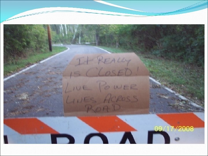
Wind Storm September 2008

25 Year Volunteer Civil Defense EMA RACES CERT

2009 Tent City in Flood Plain – Ca.

For an electronic copy/email, please leave your card. Thank you for all you do! bnevel@co. clermont. oh. us Clermont County EMA (513)732 -7777
98fdb70b501eaa41e71e35a2f5ee631f.ppt