c6fe2e074433d58cd07d12d254c081cb.ppt
- Количество слайдов: 97
 Meteorological Concepts for Soaring in the Western U. S. Dan Gudgel Meteorologist/Towpilot/CFIG
 Presentation Points 1. Weather Information Sources 2. 3. 4. 5. Meteorology Points Synoptic Scale Weather Patterns A Forecast Funnel Miscellaneous Info
 1. Weather Information Sources Weather Data • Internet (use “search engines”) • Site addresses change frequently for this medium • Customize access list for efficient data retrieval • Review AC-006, Aviation Weather • Review AC-45 E, Aviation Weather Services • Other Information Sources
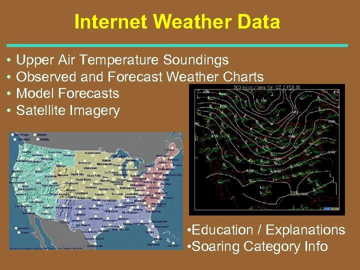 Internet Weather Data • • Upper Air Temperature Soundings Observed and Forecast Weather Charts Model Forecasts Satellite Imagery • Education / Explanations • Soaring Category Info
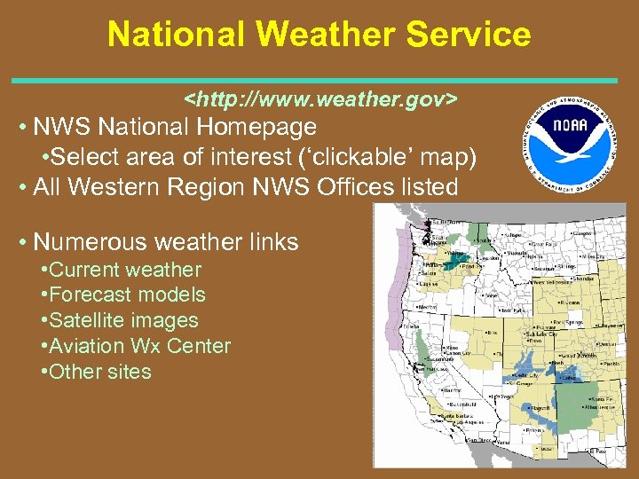 National Weather Service
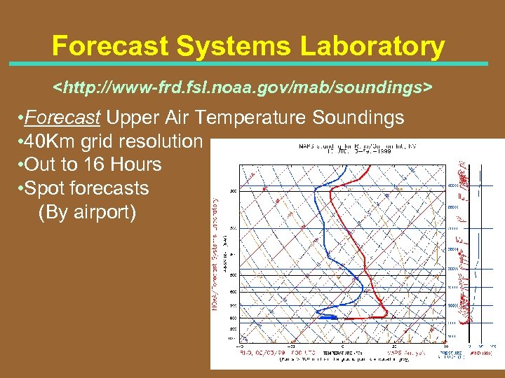 Forecast Systems Laboratory
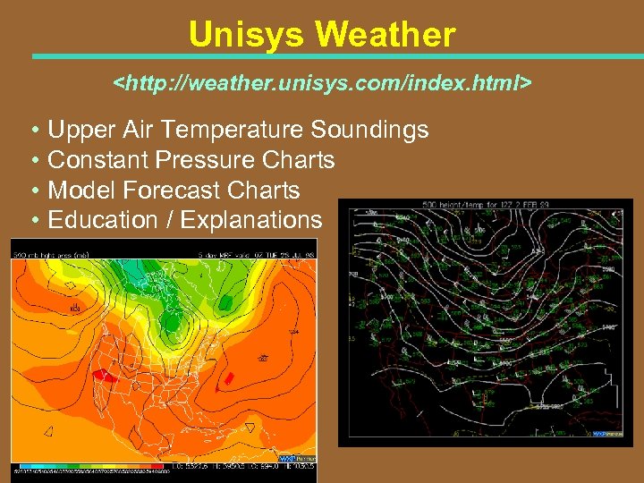 Unisys Weather
![National Center for Atmospheric Research (NCAR) [et al. ] <http: //www. rap. ucar. edu/weather/> National Center for Atmospheric Research (NCAR) [et al. ] <http: //www. rap. ucar. edu/weather/>](https://present5.com/presentation/c6fe2e074433d58cd07d12d254c081cb/image-8.jpg) National Center for Atmospheric Research (NCAR) [et al. ]
National Center for Atmospheric Research (NCAR) [et al. ]
 Other Weather Info Sources For the Aircraft Category • Fixed base operators • Soaring Society of America • Associated sites • Other Sources • Newspapers • NWS Weather Radio • FAA DUATS
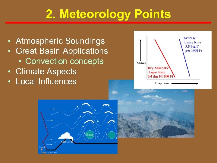 2. Meteorology Points • Atmospheric Soundings • Great Basin Applications • Convection concepts • Climate Aspects • Local Influences
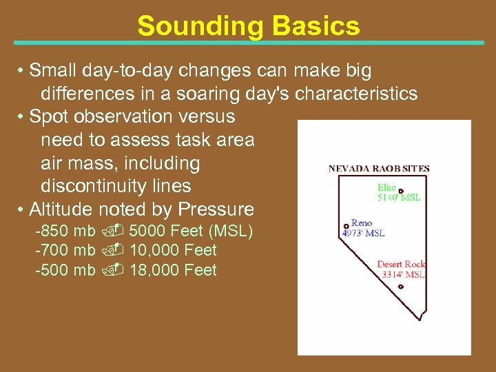 Sounding Basics • Small day to day changes can make big differences in a soaring day's characteristics • Spot observation versus need to assess task area air mass, including discontinuity lines • Altitude noted by Pressure 850 mb. 5000 Feet (MSL) 700 mb. 10, 000 Feet 500 mb. 18, 000 Feet
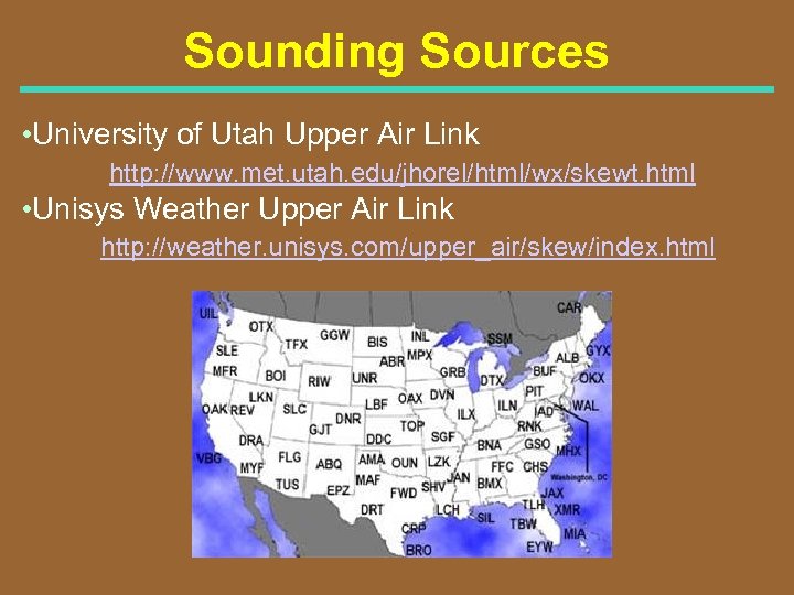 Sounding Sources • University of Utah Upper Air Link http: //www. met. utah. edu/jhorel/html/wx/skewt. html • Unisys Weather Upper Air Link http: //weather. unisys. com/upper_air/skew/index. html
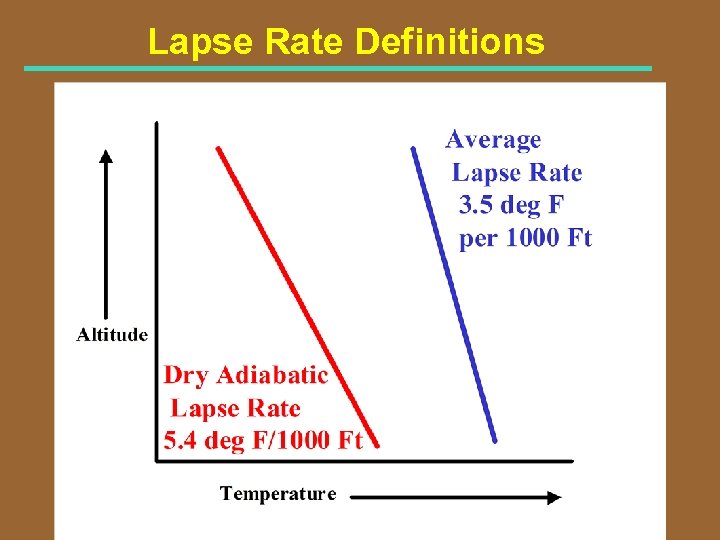 Lapse Rate Definitions
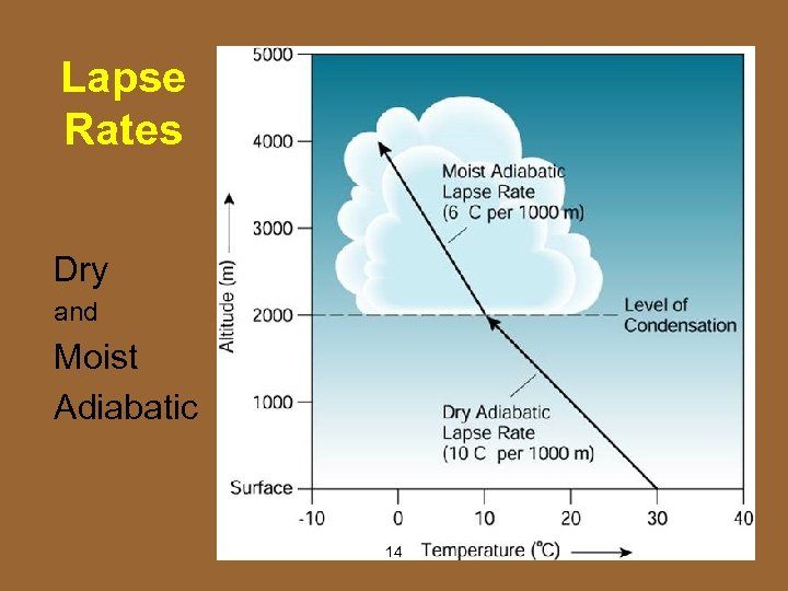 Lapse Rates Dry and Moist Adiabatic 14
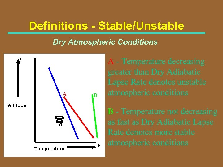 Definitions - Stable/Unstable Dry Atmospheric Conditions + A B Altitude d Temperature + A - Temperature decreasing greater than Dry Adiabatic Lapse Rate denotes unstable atmospheric conditions B - Temperature not decreasing as fast as Dry Adiabatic Lapse Rate denotes more stable atmospheric conditions
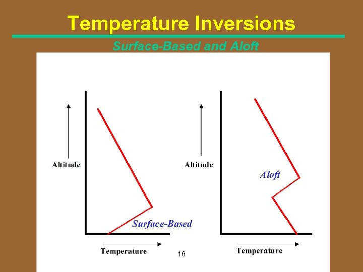 Temperature Inversions Surface-Based and Aloft 16
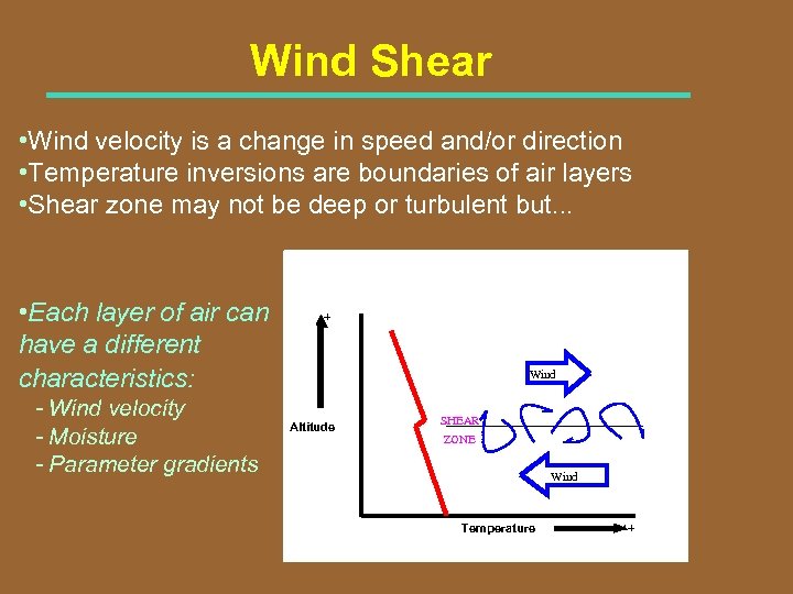 Wind Shear • Wind velocity is a change in speed and/or direction • Temperature inversions are boundaries of air layers • Shear zone may not be deep or turbulent but. . . • Each layer of air can have a different characteristics: - Wind velocity - Moisture - Parameter gradients + Wind Altitude SHEAR ZONE Wind Temperature +
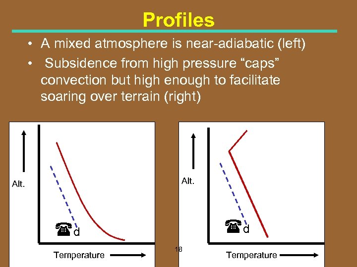 Profiles • A mixed atmosphere is near adiabatic (left) • Subsidence from high pressure “caps” convection but high enough to facilitate soaring over terrain (right) Alt. d d Temperature 18 Temperature
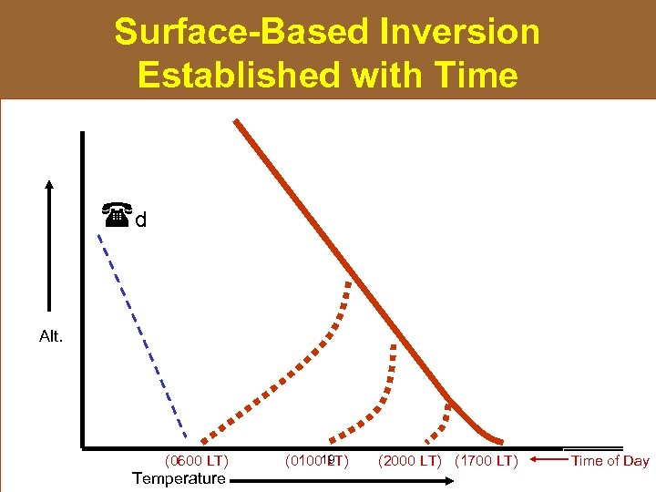 Surface-Based Inversion Established with Time d Alt. (0600 LT) Temperature (010019 LT) (2000 LT) (1700 LT) Time of Day
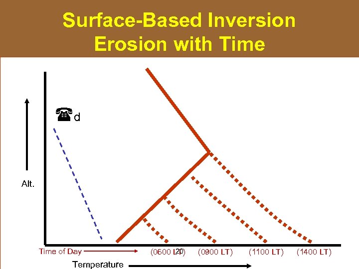 Surface-Based Inversion Erosion with Time d Alt. Time of Day Temperature 20 (0600 LT) (0900 LT) (1100 LT) (1400 LT)
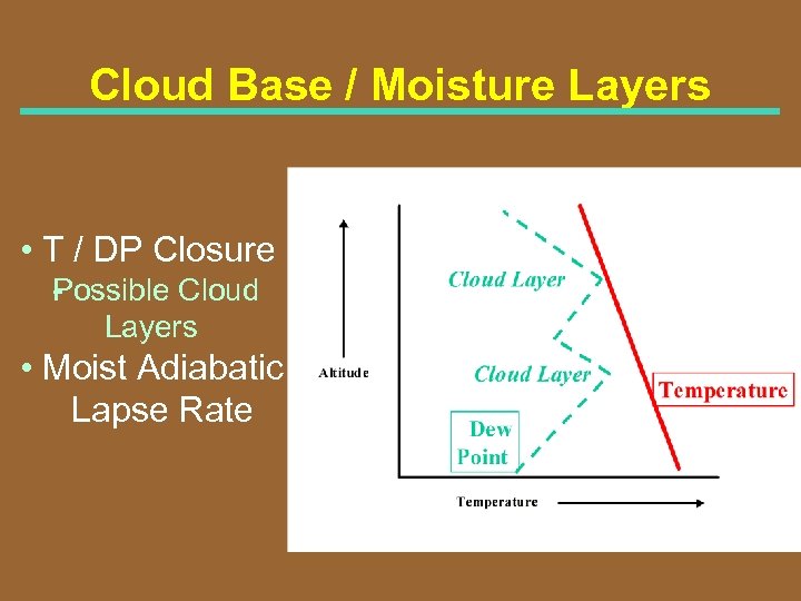 Cloud Base / Moisture Layers • T / DP Closure P ossible Cloud Layers • Moist Adiabatic Lapse Rate
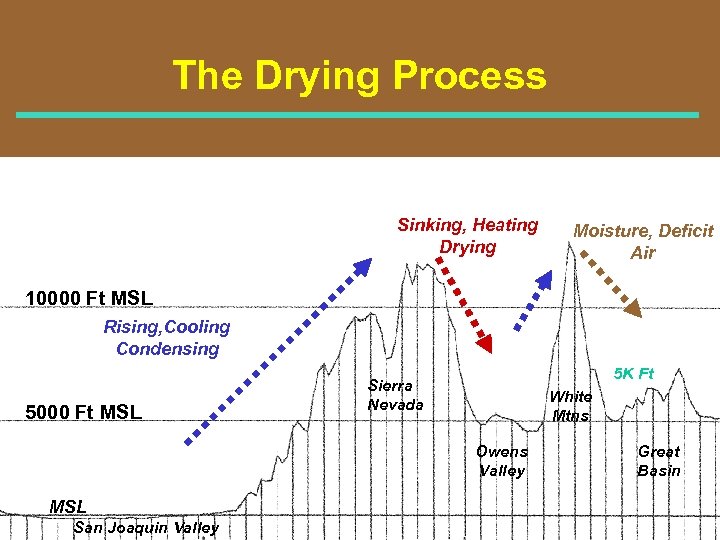 The Drying Process Sinking, Heating Drying Moisture, Deficit Air 10000 Ft MSL Rising, Cooling Condensing 5000 Ft MSL 5 K Ft Sierra Nevada White Mtns Owens Valley MSL San Joaquin Valley Great Basin
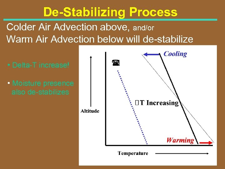 De-Stabilizing Process Colder Air Advection above, and/or Warm Air Advection below will de stabilize • Delta T increase! • Moisture presence also de stabilizes
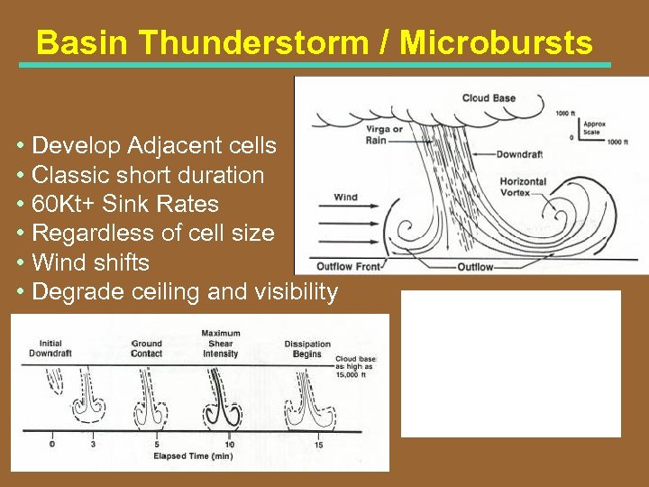 Basin Thunderstorm / Microbursts • Develop Adjacent cells • Classic short duration • 60 Kt+ Sink Rates • Regardless of cell size • Wind shifts • Degrade ceiling and visibility
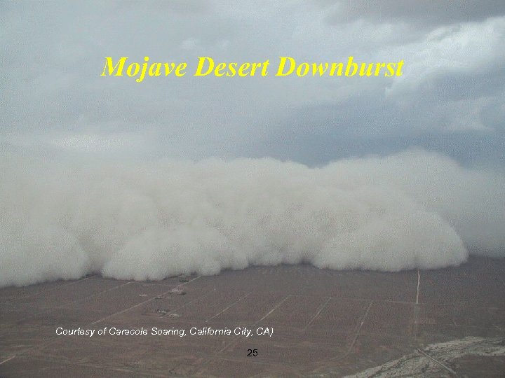 Mojave Desert Downburst Courtesy of Caracole Soaring, California City, CA) 25
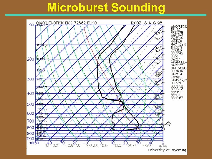 Microburst Sounding
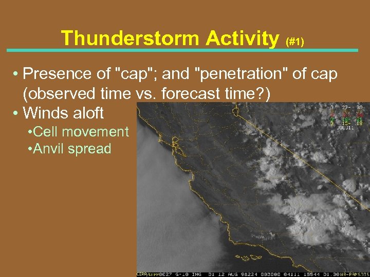 Thunderstorm Activity (#1) • Presence of "cap"; and "penetration" of cap (observed time vs. forecast time? ) • Winds aloft • Cell movement • Anvil spread
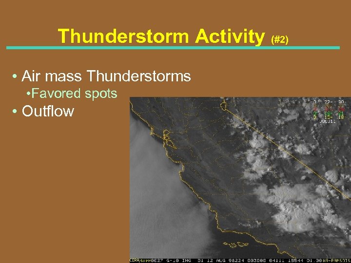 Thunderstorm Activity (#2) • Air mass Thunderstorms • Favored spots • Outflow
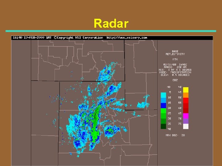 Radar
Radar
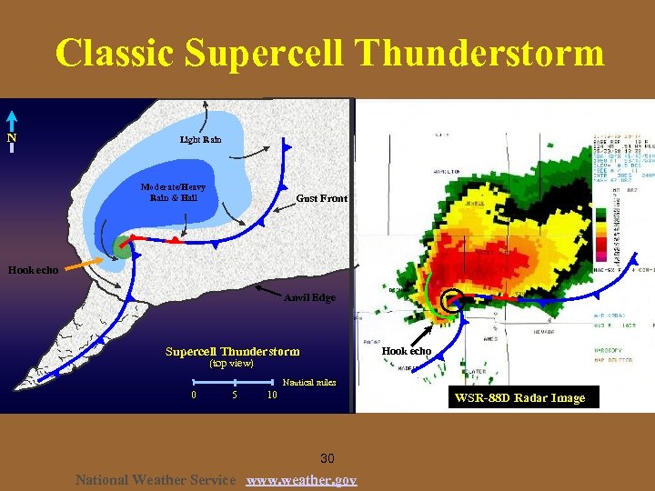 Classic Supercell Thunderstorm N Light Rain Moderate/Heavy Rain & Hail Gust Front Hook echo Anvil Edge Supercell Thunderstorm Hook echo (top view) Nautical miles 0 5 10 WSR-88 D Radar Image 30 National Weather Service www. weather. gov
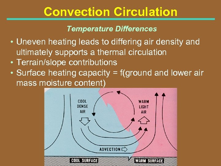 Convection Circulation Temperature Differences • Uneven heating leads to differing air density and ultimately supports a thermal circulation • Terrain/slope contributions • Surface heating capacity = f(ground and lower air mass moisture content)
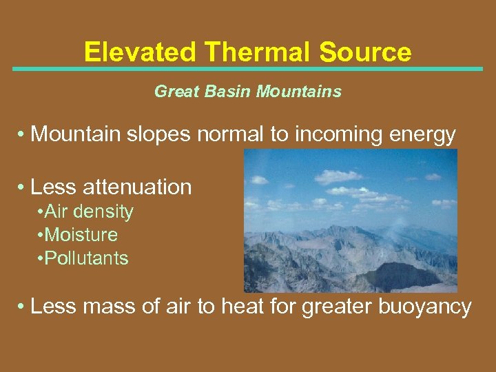 Elevated Thermal Source Great Basin Mountains • Mountain slopes normal to incoming energy • Less attenuation • Air density • Moisture • Pollutants • Less mass of air to heat for greater buoyancy
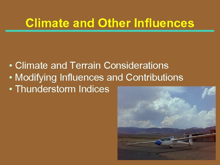 Climate and Other Influences • Climate and Terrain Considerations • Modifying Influences and Contributions • Thunderstorm Indices
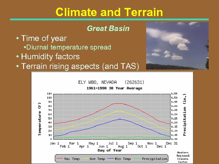 Climate and Terrain Great Basin • Time of year • Diurnal temperature spread • Humidity factors • Terrain rising aspects (and TAS)
 Sunset / Sunrise / Normal Temps Reno, NV • Sunrise / Sunset • June 1 • July 1 • Aug 1 • Sep 1 5: 34 AM PDT / 8: 20 PM PDT 5: 35 AM PDT / 8: 30 PM PDT 5: 58 AM PDT / 8: 12 PM PDT 6: 27 AM PDT / 7: 30 PM PDT • Normal Maximum/Minimum Temperatures • June 81. 5 / 44. 3 ()T=37. 2 F) • July 91. 0 / 49. 3 ()T=41. 7 F) • Aug 89. 7 / 47. 2 ()T=42. 5 F)
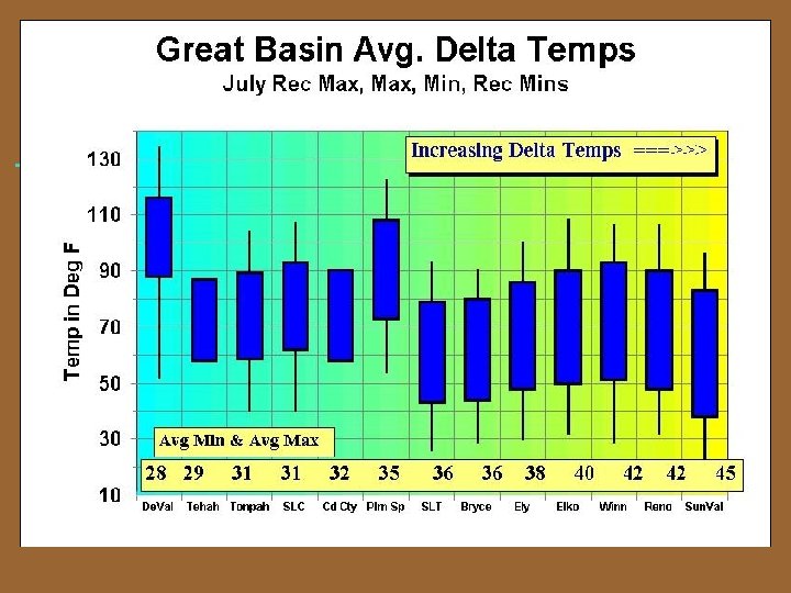 Great Basin Temps
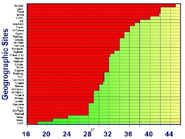 37
37
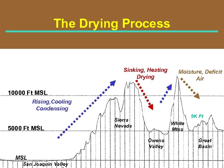 The Drying Process Sinking, Heating Drying Moisture, Deficit Air 10000 Ft MSL Rising, Cooling Condensing 5000 Ft MSL 5 K Ft Sierra Nevada White Mtns Owens Valley MSL San Joaquin Valley Great Basin
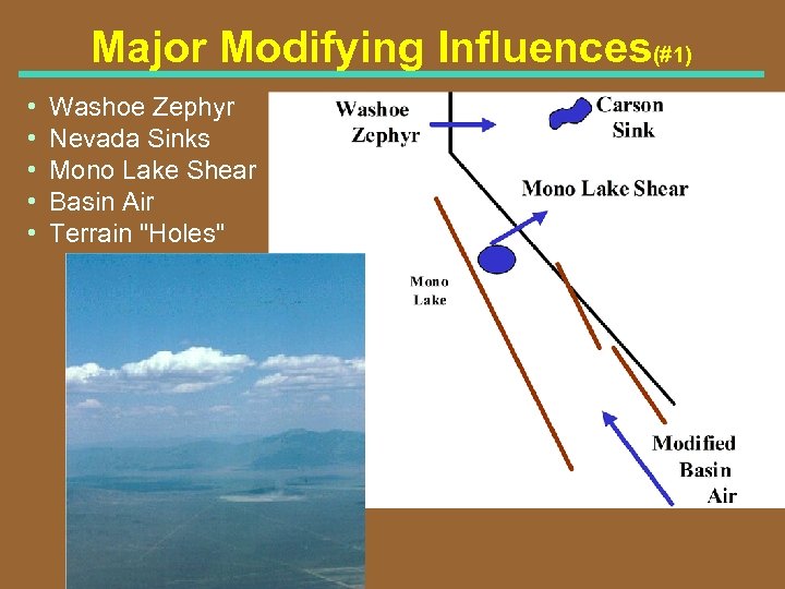 Major Modifying Influences(#1) • • • Washoe Zephyr Nevada Sinks Mono Lake Shear Basin Air Terrain "Holes"
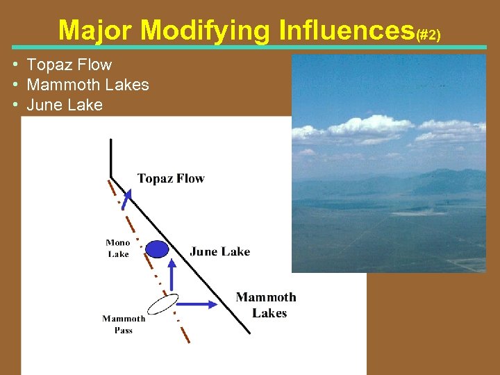 Major Modifying Influences(#2) • Topaz Flow • Mammoth Lakes • June Lake
 Pressure Patterns Favorable for Great Basin Soaring • High location (aloft) Ridge aloft east of task area (or far west) • Low pressure (aloft) Not strong or close enough to bring strong gradient wind • De stabilizing Influences Split flow in the upper wind field with weak trough • Allows for Instability aloft but good surface heating • Thermal Trough (surface) Through interior CA (better if along the coast!)
 Pressure Gradients(#1) Stable Air Movement to the Western Great Basin • Great Basin to Interior California * 4 mb Reno to Sacramento delta P inhibits Washoe Zephyr development
 Pressure Gradients(#2) Stable Air Movement to the Western Great Basin • South CA Coast to Desert Interior * Depth of marine layer greater than 1500' MSL * 3+ mb Los Angeles (LAX) to Daggett (DAG) • Central CA Coast to Desert Interior * 6+ mb San Francisco to Las Vegas * Depth of marine layer greater than 2000' MSL
 Thermal Detractors Macro-scale Level
 Thermal Enhancers Great Basin
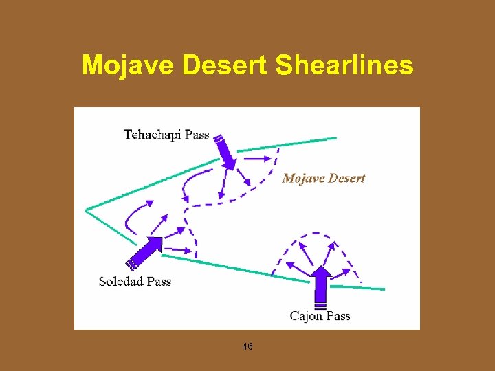 Mojave Desert Shearlines 46
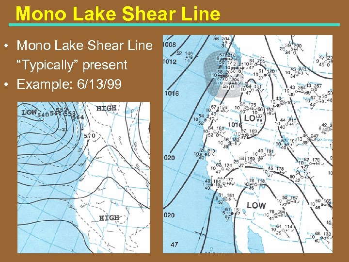 Mono Lake Shear Line • Mono Lake Shear Line “Typically” present • Example: 6/13/99 47
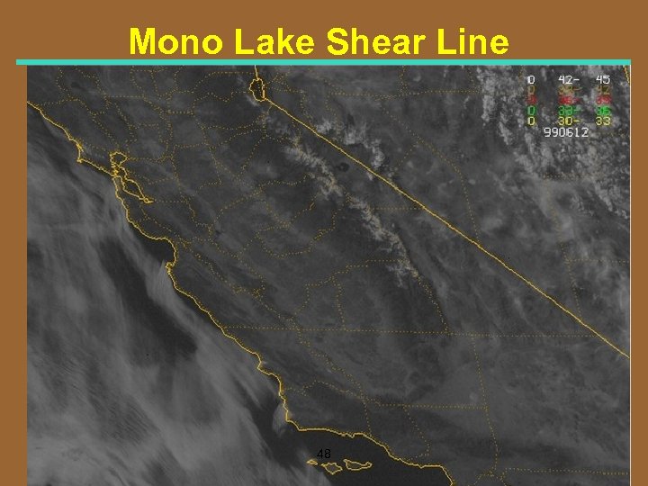 Mono Lake Shear Line 48
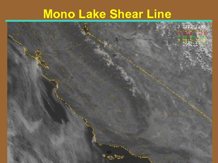 Mono Lake Shear Line 49
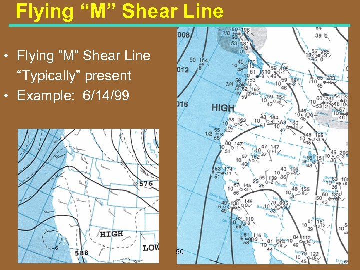 Flying “M” Shear Line • Flying “M” Shear Line “Typically” present • Example: 6/14/99 50
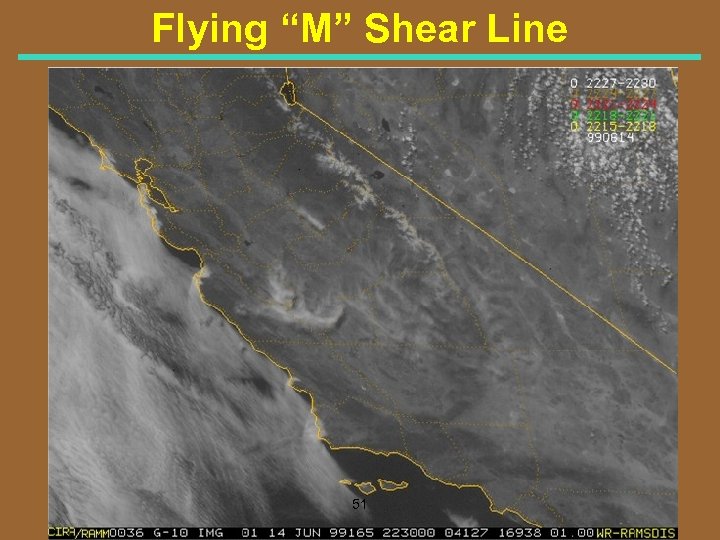 Flying “M” Shear Line 51
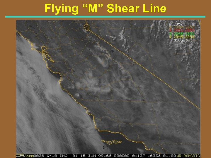 Flying “M” Shear Line 52
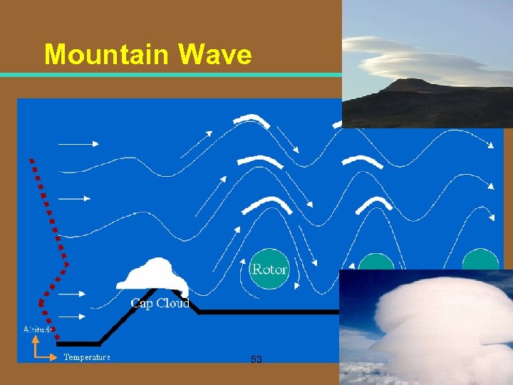 Mountain Wave 53
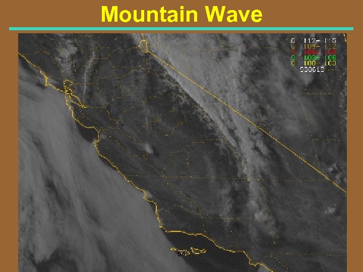 Mountain Wave 54
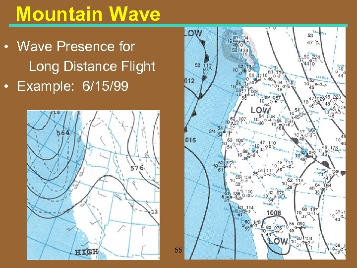 Mountain Wave • Wave Presence for Long Distance Flight • Example: 6/15/99 55
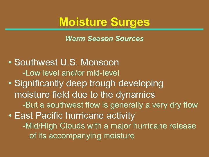 Moisture Surges Warm Season Sources • Southwest U. S. Monsoon Low level and/or mid level • Significantly deep trough developing moisture field due to the dynamics But a southwest flow is generally a very dry flow • East Pacific hurricane activity Mid/High Clouds with a major hurricane release of its accompanying moisture
 East vs. West Great Basin • Time of Year Sub Tropical Moisture Progression – Parawon UT (Late June/Early July) – East NV (Mid Late July) – West NV (Late July/Early August) • Slower Thermal Processes – Dry west; Slower start per moisture deficit – More attenuation; CA and local “Haze” – West NV, slightly lower terrain • West Great Basin Enhancements – Shear line influences prevalent within 50 s. m. of the Sierra Nevada Front 57
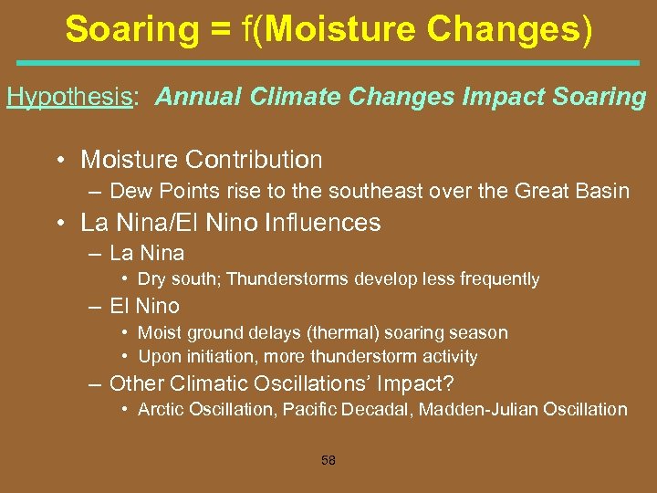 Soaring = f(Moisture Changes) Hypothesis: Annual Climate Changes Impact Soaring • Moisture Contribution – Dew Points rise to the southeast over the Great Basin • La Nina/El Nino Influences – La Nina • Dry south; Thunderstorms develop less frequently – El Nino • Moist ground delays (thermal) soaring season • Upon initiation, more thunderstorm activity – Other Climatic Oscillations’ Impact? • Arctic Oscillation, Pacific Decadal, Madden Julian Oscillation 58
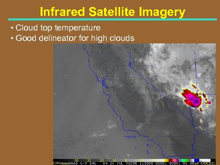 Infrared Satellite Imagery • Cloud top temperature • Good delineator for high clouds
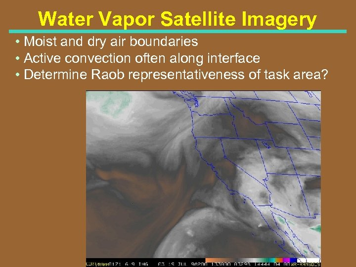 Water Vapor Satellite Imagery • Moist and dry air boundaries • Active convection often along interface • Determine Raob representativeness of task area?
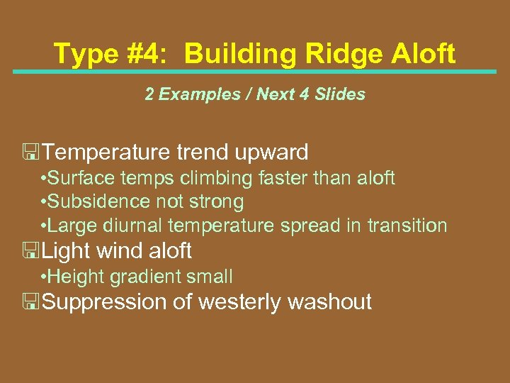
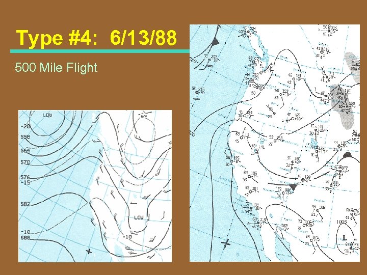
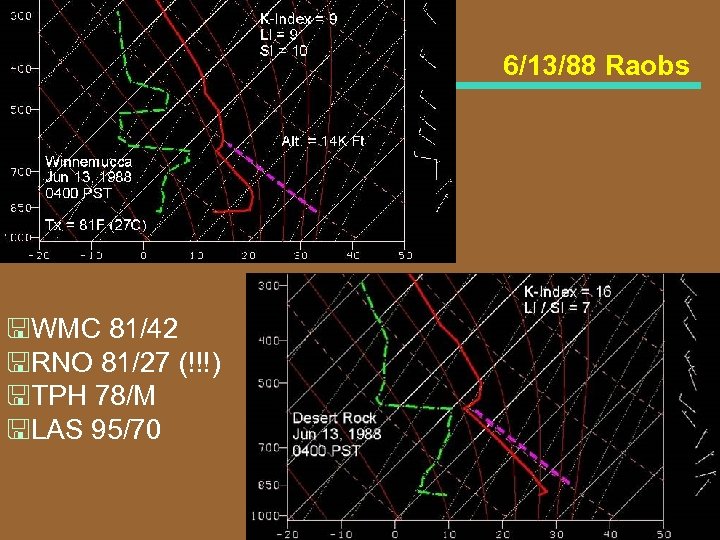
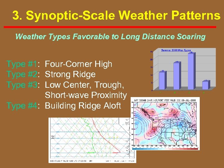 3. Synoptic-Scale Weather Patterns Weather Types Favorable to Long Distance Soaring Type #1: Four Corner High Type #2: Strong Ridge Type #3: Low Center, Trough, Short wave Proximity Type #4: Building Ridge Aloft
 Type #1: The Four-Corner High • High pressure centered aloft near the Four Corner area of the Southwest U. S. • Most recognized, "Classic" long flight pattern • Good low level heating de stabilizes the air mass Light surface wind Lower layer warm air advection • Monsoon moisture tap. . . therefore usually not a long lived pattern • Good soaring. . . but days get truncated with afternoon TSTMs. . . often widespread
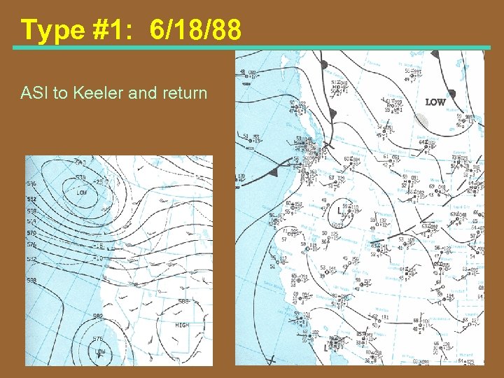 Type #1: 6/18/88 ASI to Keeler and return
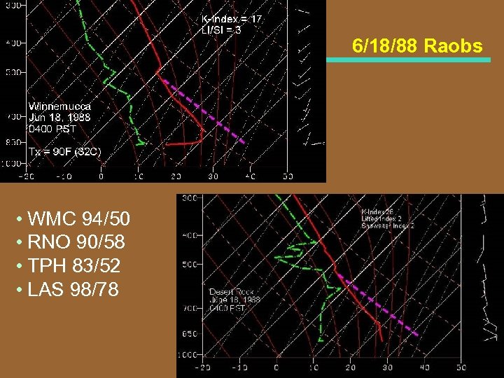 6/18/88 Raobs • WMC 94/50 • RNO 90/58 • TPH 83/52 • LAS 98/78
 Type #2: Strong Ridge • Light wind • Low level heating • Thermal trough well to the west of task area • Impulse aloft over ridge axis; or, • Ridge axis aloft east of the task area
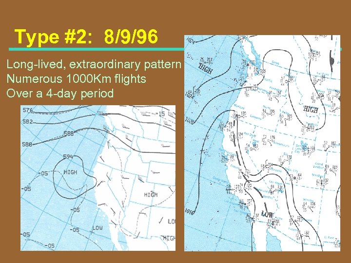 Type #2: 8/9/96 Long lived, extraordinary pattern Numerous 1000 Km flights Over a 4 day period
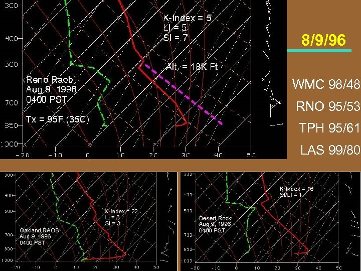 8/9/96 WMC 98/48 RNO 95/53 TPH 95/61 LAS 99/80
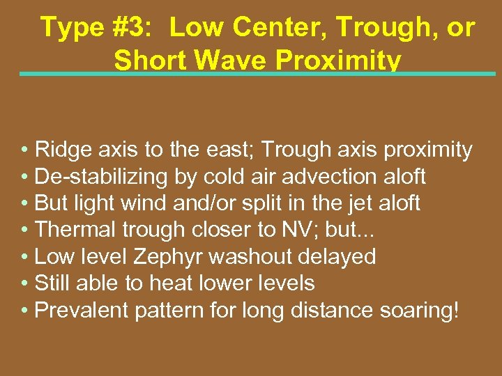 Type #3: Low Center, Trough, or Short Wave Proximity • Ridge axis to the east; Trough axis proximity • De stabilizing by cold air advection aloft • But light wind and/or split in the jet aloft • Thermal trough closer to NV; but. . . • Low level Zephyr washout delayed • Still able to heat lower levels • Prevalent pattern for long distance soaring!
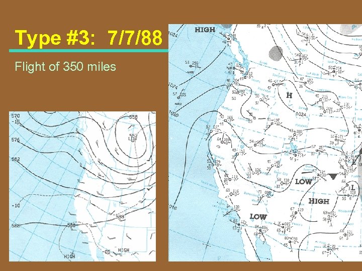 Type #3: 7/7/88 Flight of 350 miles
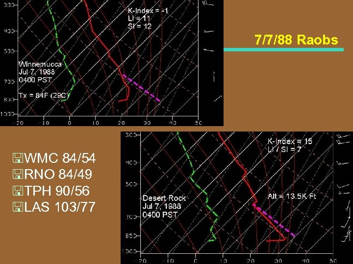 7/7/88 Raobs
 Type #3(a): Proximity of Low Pressure Center
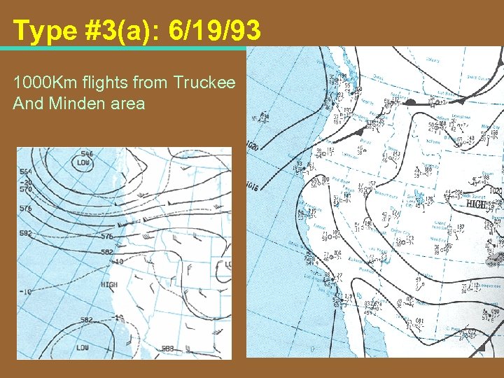 Type #3(a): 6/19/93 1000 Km flights from Truckee And Minden area
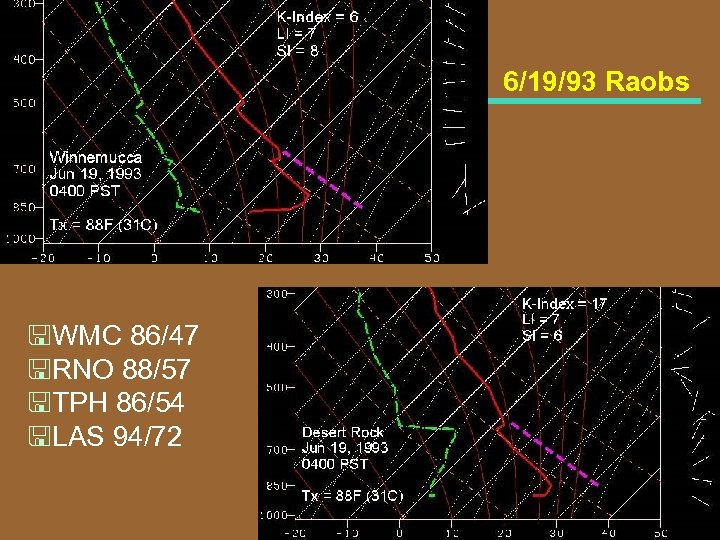 6/19/93 Raobs
 Type #4: Building Ridge Aloft 2 Examples / Next 4 Slides
 Type #4: 6/13/88 500 Mile Flight
 6/13/88 Raobs
 Map Types also varied as season passed! 77
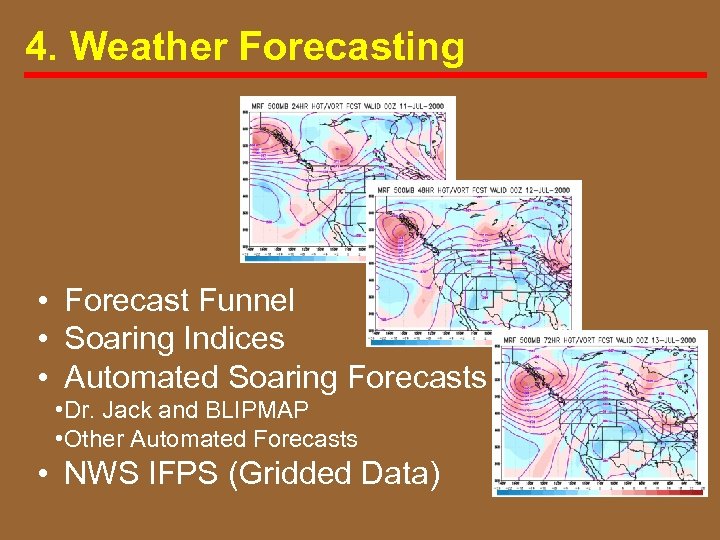 4. Weather Forecasting • Forecast Funnel • Soaring Indices • Automated Soaring Forecasts • Dr. Jack and BLIPMAP • Other Automated Forecasts • NWS IFPS (Gridded Data)
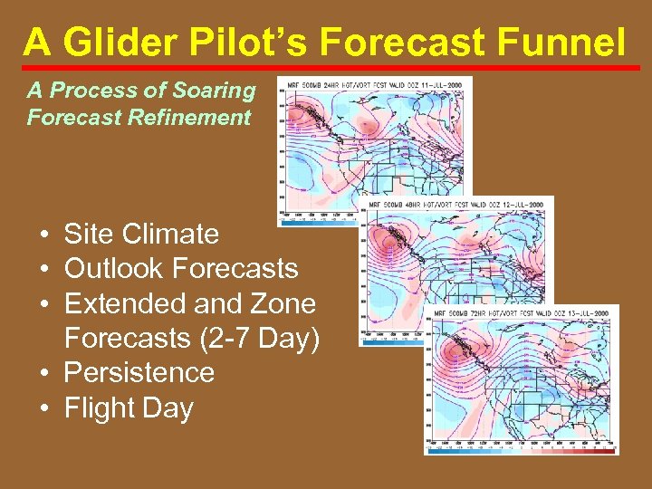 A Glider Pilot’s Forecast Funnel A Process of Soaring Forecast Refinement • Site Climate • Outlook Forecasts • Extended and Zone Forecasts (2 7 Day) • Persistence • Flight Day
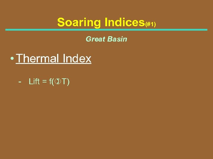 Soaring Indices(#1) Great Basin • Thermal Index Lift = f()T)
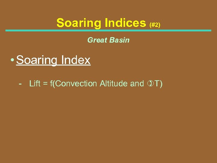 Soaring Indices (#2) Great Basin • Soaring Index Lift = f(Convection Altitude and )T)
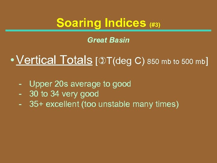 Soaring Indices (#3) Great Basin • Vertical Totals [)T(deg C) 850 mb to 500 mb] Upper 20 s average to good 30 to 34 very good 35+ excellent (too unstable many times)
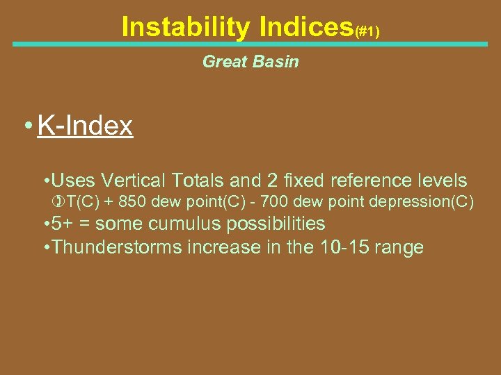 Instability Indices(#1) Great Basin • K Index • Uses Vertical Totals and 2 fixed reference levels )T(C) + 850 dew point(C) 700 dew point depression(C) • 5+ = some cumulus possibilities • Thunderstorms increase in the 10 15 range
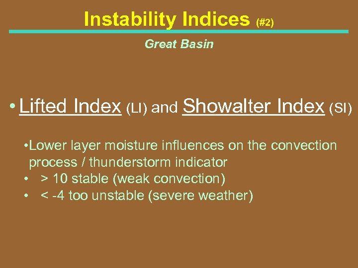 Instability Indices (#2) Great Basin • Lifted Index (LI) and Showalter Index (SI) • Lower layer moisture influences on the convection process / thunderstorm indicator • > 10 stable (weak convection) • < 4 too unstable (severe weather)
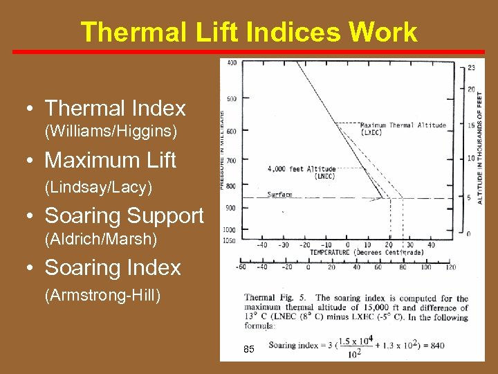 Thermal Lift Indices Work • Thermal Index (Williams/Higgins) • Maximum Lift (Lindsay/Lacy) • Soaring Support (Aldrich/Marsh) • Soaring Index (Armstrong Hill) 85
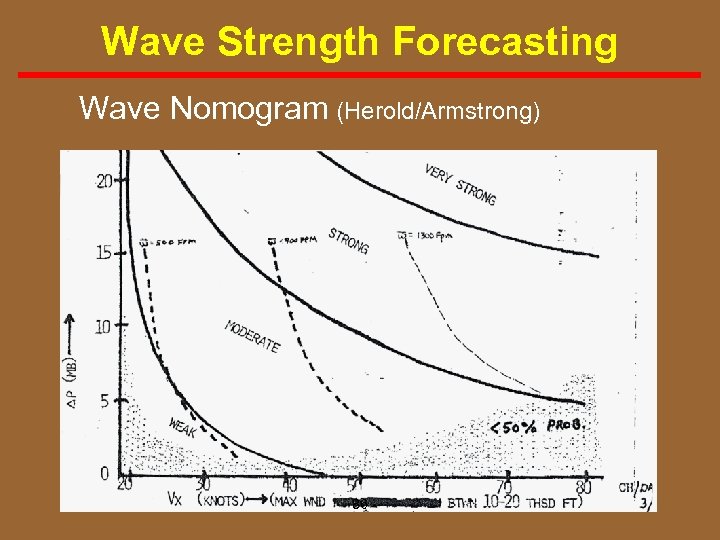 Wave Strength Forecasting Wave Nomogram (Herold/Armstrong) 86
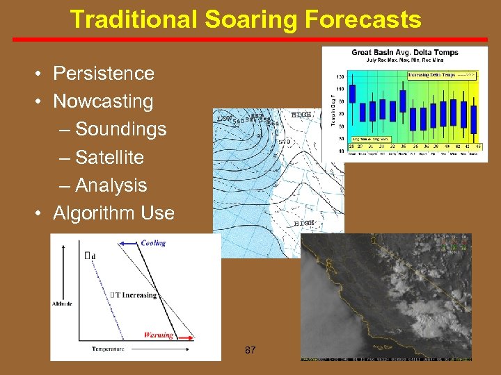 Traditional Soaring Forecasts • Persistence • Nowcasting – Soundings – Satellite – Analysis • Algorithm Use 87
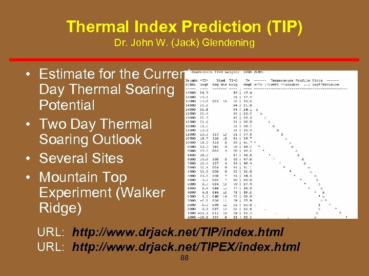 Thermal Index Prediction (TIP) Dr. John W. (Jack) Glendening • Estimate for the Current Day Thermal Soaring Potential • Two Day Thermal Soaring Outlook • Several Sites • Mountain Top Experiment (Walker Ridge) URL: http: //www. drjack. net/TIP/index. html URL: http: //www. drjack. net/TIPEX/index. html 88
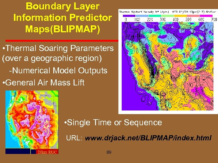 Boundary Layer Information Predictor Maps(BLIPMAP) • Thermal Soaring Parameters (over a geographic region) Numerical Model Outputs • General Air Mass Lift • Single Time or Sequence URL: www. drjack. net/BLIPMAP/index. html 89
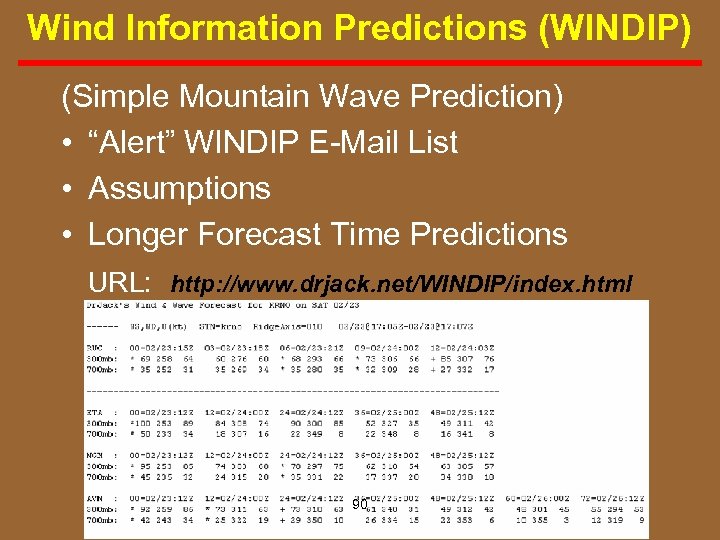 Wind Information Predictions (WINDIP) (Simple Mountain Wave Prediction) • “Alert” WINDIP E Mail List • Assumptions • Longer Forecast Time Predictions URL: http: //www. drjack. net/WINDIP/index. html 90
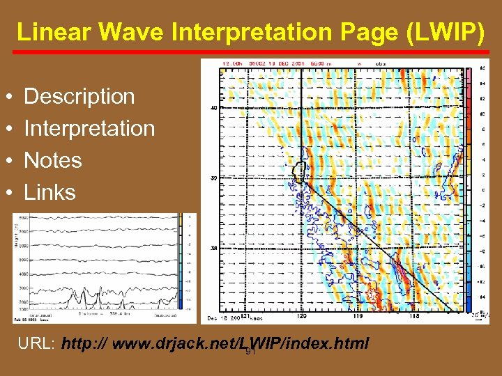 Linear Wave Interpretation Page (LWIP) • • Description Interpretation Notes Links URL: http: // www. drjack. net/LWIP/index. html 91
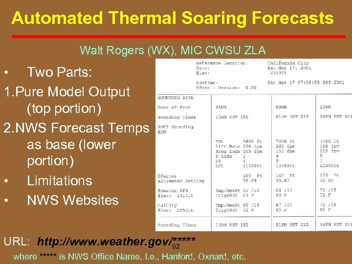 Automated Thermal Soaring Forecasts Walt Rogers (WX), MIC CWSU ZLA • Two Parts: 1. Pure Model Output (top portion) 2. NWS Forecast Temps as base (lower portion) • Limitations • NWS Websites URL: http: //www. weather. gov/***** 92 where ***** is NWS Office Name, I. e. , Hanford, Oxnard, etc.
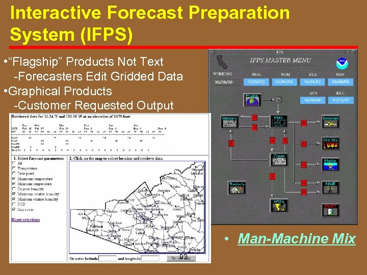 Interactive Forecast Preparation System (IFPS) • “Flagship” Products Not Text Forecasters Edit Gridded Data • Graphical Products Customer Requested Output • Man-Machine Mix 93
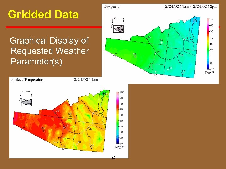 Gridded Data Graphical Display of Requested Weather Parameter(s) 94
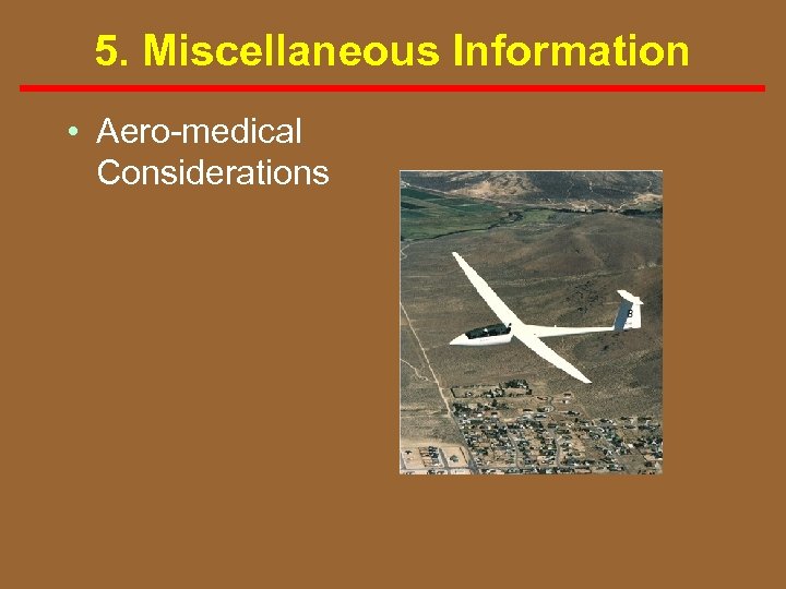 5. Miscellaneous Information • Aero medical Considerations
 Aeromedical Considerations Soaring good enough that. . .
 Meteorological Concepts for Soaring in the Western U. S. Dan Gudgel Meteorologist/Towpilot/CFIG 134 South Olive Street Lemoore, CA 93245 (w)559 -584 -3752 ext. 223 (h)559 -924 -7134


