3ccf05623390e6c3c607bd5a2d1a2547.ppt
- Количество слайдов: 16

Mesoscale Objective Analysis: An Analysis of Record? John Horel NOAA Cooperative Institute for Regional Prediction Department of Meteorology University of Utah jhorel@met. utah. edu Brad Colman Seattle Weather Forecast Office brad. colman@noaa. gov Co-Chairs Mesoscale Analysis Committee NWS Office of Science and Technology http: //www. met. utah. edu/jhorel/homepages/jhorel/mac. htm

Context • Admiral Lautenbacher – “Observations alone are often meaningless without the actions that provide economic and societal benefit” • Comprehensive weather and climate observing system requires integration and synthesis of observations into gridded analyses of current and past states of atmosphere • NWS has critical need to produce real-time and retrospective analyses at high resolution to help create and verify gridded forecasts as part of NWS Digital Services Program (L. Spayd IIPS Thursday)
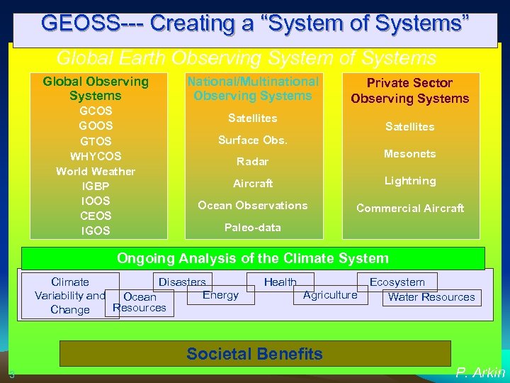
GEOSS--- Creating a “System of Systems” Global Earth Observing System of Systems Global Observing Systems GCOS GOOS GTOS WHYCOS World Weather IGBP IOOS CEOS IGOS National/Multinational Observing Systems Private Sector Observing Systems Satellites Surface Obs. Mesonets Radar Aircraft Lightning Ocean Observations Commercial Aircraft Paleo-data Ongoing Analysis of the Climate System Climate Disasters Energy Variability and Ocean Resources Change Health Agriculture Ecosystem Water Resources Societal Benefits 3 P. Arkin

Proposed Ongoing Analysis of the Climate System Workshop 18 -20 August 2003, Boulder, Colorado (http: //www. joss. ucar. edu/joss_psg/meetings/climatesystem/) for pdf version of report and background information from the workshop. • Integrate and analyze global observations • Describe and monitor climate variations and their causes as they occur • Understand model climate changes and their origins • Assess impacts regionally: on environment, human activities and sectors such as agriculture, energy, fisheries, water resources, etc. See also Trenberth et al. (2002) BAMS P. Arkin

NWS Traditional Forecasting Process – Schedule Driven – Product Oriented – Labor Intensive National Centers Model Guidance Field Offices National Centers Type Text Products Generate Graphical Products TODAY. . . RAIN LIKELY. SNOW LIKELY ABOVE 2500 FEET. SNOW ACCUMULATION BY LATE AFTERNOON 1 TO 2 INCHES ABOVE 2500 FEET. COLDER WITH HIGHS 35 TO 40. SOUTHEAST WIND 5 TO 10 MPH SHIFTING TO THE SOUTHWESTEARLY THIS AFTERNOON. MARYLAND EASTERN SHORE CHANCE OF PRECIPITATION 70%. EASTON PTCLDY CLOUDY PTCLDY SUNNY PTCLDY 60/52 63/54 65/47 55/40 55/37 50/33 POP 20 POP 10 » » » » » » » » » » » » » » » » » » » » » U. S. Drought Monitor Threats Assessments Excessive Heat Products
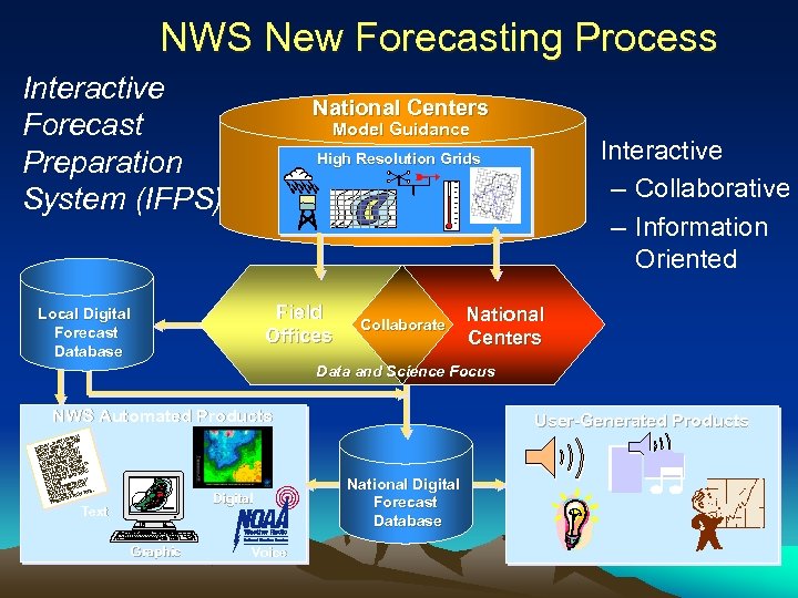
NWS New Forecasting Process Interactive Forecast Preparation System (IFPS) National Centers Model Guidance • Interactive – Collaborative – Information Oriented High Resolution Grids Field Offices Local Digital Forecast Database Collaborate National Centers Data and Science Focus NWS Automated Products LY. LIKE VE. RAIN ABO LY AY. . TOD W LIKE SNOWBY. SNO FEET ATION N 1 0 250 CUMULERNOOOVE AC E AFT ES AB DER LAT 2 INCH. COL TO 40. O FEET S 35 D 5 T 0 250 H HIGH T WIN ING S WITUTHEAH SHIFT SO 10 MP Y ARL TO THE STE N. TO UTHWE RNOO SO IS AFTE F %. H NCE O TION 70 T A CH ECIPITA PR Digital Text Graphic Voice User-Generated Products National Digital Forecast Database

How Do We Know if the Interactive Forecast Preparation System (IFPS) Approach Will Be Better? Concerns raised: – C. Mass (2003) WAF – WR SOO/DOH IFPS white paper provided recommendations: • • Develop a national real-time, gridded verification system Provide full-resolution NCEP model grids Objectively produce bias-corrected model grids for WFO use Implement methods to objectively downscale forecast grids Incorporate climatology grids into the GFE process Deliver short and medium-range ensemble grids Modify the GFE software to ingest real-time data Optimize ways to tap forecaster expertise

Analysis of Record • Best possible analyses of the atmosphere at high spatial and temporal resolution with particular attention placed on weather and climate conditions near the surface
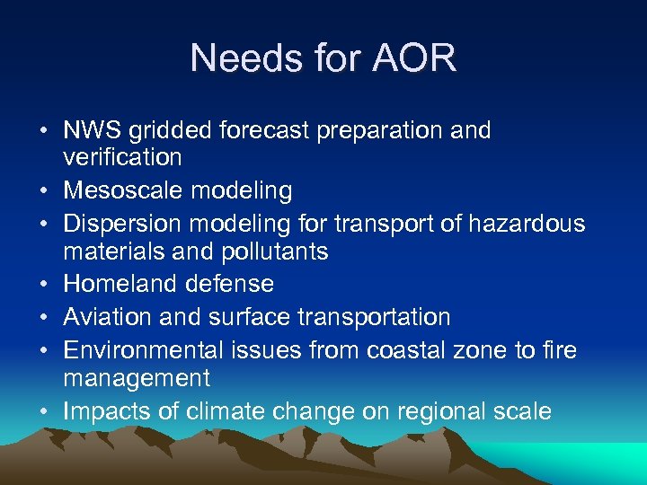
Needs for AOR • NWS gridded forecast preparation and verification • Mesoscale modeling • Dispersion modeling for transport of hazardous materials and pollutants • Homeland defense • Aviation and surface transportation • Environmental issues from coastal zone to fire management • Impacts of climate change on regional scale

A Community Meeting on Real-time and Retrospective Mesoscale Objective Analysis: An Analysis of Record Summit June 2004 Co-chairs: Brad Colman and John Horel • Can research and operations work together to define approaches for an analysis of record? • Are there clearly definable requirements and objectives? • Can we make a compelling business case to fund the R&D, testing, and implementation?

Issues • Real time vs. retrospective needs • How can AOR resolve detailed microclimates, synoptic and mesoscale weather & localized severe weather? • NDFD verification needs vs. other needs • 2 -dimensional surface analysis approaches, statistical & dynamical downscaling vs. 3 -dimensional data assimilation strategies? • How can biases of underlying modeling system be minimized? • How can uncertainty be quantified and expressed to the end user? • What is possible now vs. what might be possible in a few years?
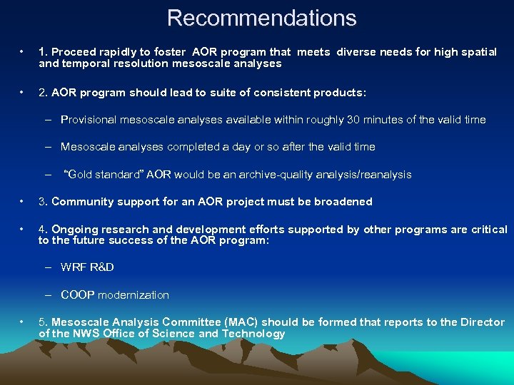
Recommendations • 1. Proceed rapidly to foster AOR program that meets diverse needs for high spatial and temporal resolution mesoscale analyses • 2. AOR program should lead to suite of consistent products: – Provisional mesoscale analyses available within roughly 30 minutes of the valid time – Mesoscale analyses completed a day or so after the valid time – “Gold standard” AOR would be an archive-quality analysis/reanalysis • 3. Community support for an AOR project must be broadened • 4. Ongoing research and development efforts supported by other programs are critical to the future success of the AOR program: – WRF R&D – COOP modernization • 5. Mesoscale Analysis Committee (MAC) should be formed that reports to the Director of the NWS Office of Science and Technology
Mesoscale Analysis Committee Meeting October 13 -14, 2004 • Recommendations for a prototype Real Time Mesoscale Analysis (RTMA): – Available hourly within 30 min of valid time – Prototype products on NDFD 5 km grid must be available for testing by WFOs and other within 6 months – Analysis products for moisture, temperature, wind – Coordination with OHD and NESDIS for ppt and sky cover – Quality assurance and estimates of analysis uncertainty must be incorporated into analysis system

Mesoscale Analysis Committee Meeting October 13 -14, 2004 • Proposed plan for a prototype Real Time Mesoscale Analysis (RTMA) : – GFS/Eta model used for initial and lateral boundary conditions for hourly 20 km RUC – FSL will modify RUC postprocessing to downscale RUC 20 km grid to 5 km grid – EMC will continue development and implementation of 2 DVAR for temperature, moisture and wind – Quality assurance efforts will include cross validation and estimate of analysis uncertainty – Separate univariate analyses for ppt and sky cover. OHD and NESDIS lead efforts

Making Progress? • Coordination between NCEP and FSL efforts beginning • QPE working group meeting in San Diego • Placeholder in budget planning process for FY 06 -11 • See http: //www. met. utah. edu/jhorel/homepages/jhorel/mac. htm for updates

Comments? Send email to mac_chairs@met. utah. edu MAC Committee: • Robert Aune, NOAA/NESDIS University of Wisconsin Space Sciences and Engineering Center • Stanley Benjmain, Forecast Systems Laboratory • Craig Bishop, Naval Research Laboratory • Keith A. Brewster, Center for Analysis and Prediction of Storms The University of Oklahoma • Brad Colman, Committee Co-chair NOAA/National Weather Service • Christopher Daly, Spatial Climate Analysis Climate Service Oregon State University • Geoff Di. Mego, NOAA/ National Weather Service National Centers for Environmental Prediction • Joshua P. Hacker, National Center for Atmospheric Research • John Horel, Committee Co-chair Department of Meteorology University of Utah • Steven Koch, Forecast Systems Laboratory • Steven Lazarus, Florida Institute of Technology • Jennifer Mahoney, Aviation Division Forecast Systems Laboratory • David Sharp, National Weather Service Melbourne Weather Forecast Office • John Roads, Scripps Institution of Oceanography Ex Officio • Andy Edman. Science & Technology Committee representative • Le. Roy Spayd. Meteorological Services Division representative • Gary Carter. Office of Hydrology representative • Kenneth Crawford. COOP/ISOS representative
3ccf05623390e6c3c607bd5a2d1a2547.ppt