039fe7748b8267c31a4ea99d78567d81.ppt
- Количество слайдов: 16


Law School for Journalists Colorado Bar Association Ken Knox Division of Water Resources March 13, 2007
 329, 200 BLUE 219, 800 4")
COLORADO HISTORIC AVERAGE ANNUAL STREAM FLOWS (acre feet) 329, 200 BLUE 219, 800 4 LOS PINOS PI ED RA SA N JU AN 47, 020 IS RG IDA HUERFANO 18, 970 ND E CONEJOS MA ANIMAS & FL OR 164, 200 26, 930 GR A HA 173, 700 89, 820 AS 49, 640 322, 100 -C 670, 100 268, 600 446, 900 + 291, 200 ARK ANS N 25, 580 699, 200 A JU 36, 890 291, 200 N MANCOS 152, 600 SA 31, 890 LA PLAT A Mc. ELMO 593, 600 SO FO UT RK H RIO 7 24, 933 653, 300 153, 000 96, 300 313, 200 3 394, 300 RE L 2 69, 750 AP AHG UE At Benkelman, NE PU M GRAPE MP CO N 125, 100 TOMICHI UN 172, 000 SA GUNNISON R FO 28, 750 KR 63, 038 E 528, 200 TH U SO 126, 800 U EP IR 279, 700 ORK O. F N 330, 500 547, 300 943, 000 IG 37, 100 58, 146 88, 051 2, 799, 000 1, 872, 000 505, 600 K ROARING FORK 4, 500, 000 N ICA BL 270, 500 NO. FOR 879, 800 COLORADO 1 33, 760 BEAR EAGLE 5 204, 400 50, 050 413, 200 31, 680 NORTH FORK REPUBLICAN EAST TOWARD ATLANTIC OCEAN 1, 373, 000 af DER BOUL 185, 200 634, 500 PA 27, 700 229, 200 OU O PICEANCE 555, 200 45, 590 54, 760 476, 300 AP DR E 158, 800 E ATT ST. V H PL RAIN OUT S 404, 400 85, 540 334, 400 6 875, 600 EL FOUNTAIN WHITE CA CH 99, 500 AT YAMPA 265, 800 HA K EL 1, 127, 000 LIT NO. PLATTE E NA K TL ES 404, 600 MIE RA 1, 531, 000 111, 800 LA 414, 300 DOLORES WEST TOWARD PACIFIC OCEAN 8, 867, 450 af 311, 100 403, 400 235, 800 94, 180 Prepared by the Hydrographic Branch (2003 Revision) Historic averages obtained from USGS Water-Data Report CO-02 TOTAL LEAVING COLORADO 10, 240, 500 af OFFICE OF THE STATE ENGINEER COLORADO DIVISION OF WATER RESOURCES

2000 Population Irrigated Acres and Flows 1, 530, 000 YAMP 560, 000 4, 500, 000 A 400, 000 310, 000 110, 000 N. LARAM PLATTE IE SOUTH PLATTE WHIT E COLORAD O G UN NI SO N 510, 000 SAN JUAN E DOLORE DO S WEST SLOPE Population: 467, 000 1, 780, 000 Irrigated Acres: 880, 000 ARK ANS A S RIO GR AND E 320, 000 164, 000 EAST SLOPE Population: 3, 869, 000 Irrigated Acres: 2, 270, 000

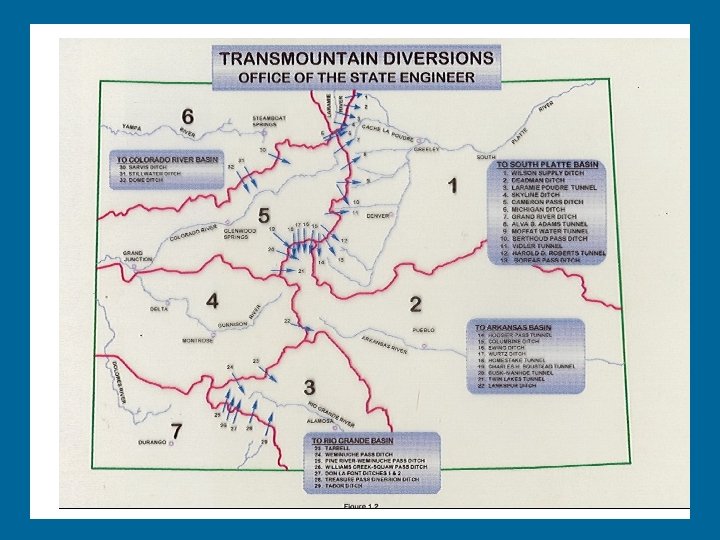
Water Management and Allocation Water Rights – Surface water rights from rivers and streams – Reservoir storage rights – Ground water rights Interstate River Compacts

Colorado’s Water Right System Colorado uses the Prior Appropriation Doctrine which means those that first put water to use are entitled to get their water first during periods of water shortage. In Colorado water is a separate property right - that is it can be sold separately from the land. This is in contrast to the Riparian Doctrine that exists in the eastern part of the United States which recognizes water rights as being attached to the land.

Water Administration • Water Allocation – – – – 173, 000 Water Rights 105, 000 Structures 400, 000 observations 30, 000 water diversions and storage records 1500 court consultations 50 court litigation 420 subdivision review 217 Substitute Water Supply Plans

In 1879, Colorado established Water Commissioners to distribute water rights in priority based upon principle of “First In Time. . . First In Right”
 Restricted Storage* Total acre-feet (# Dams) Division 1 1,")
Reservoir Storage Current Storage (acre-feet) Restricted Storage* Total acre-feet (# Dams) Division 1 1, 787, 810 33, 900 (99) Division 2 893, 544 89, 200 (31) Division 3 297, 261 9, 700 (3) Division 4 1, 447, 948 4, 200 (28) Division 5 1, 166, 040 2, 990 (19) Division 6 165, 387 1, 400 (11) Division 7 665, 356 1, 460 (7) 6, 423, 345 142, 850 (198) Total * August 20, 2002 • • 1990 – 2001: 49 new dams with a combined storage of 120, 000 acrefeet Division 2: Two Buttes 31, 500 AF and Cucharas 33, 000 AF; very expensive reconstruction necessary

Major Aquifer Systems
 Denver Basin 80, 000 South Platte")
GROUND WATER USE AQUIFER AVERAGE ANNUAL SUPPLY (Acre-Feet) Denver Basin 80, 000 South Platte Alluvium 600, 000 Arkansas River Alluvium 150, 000 San Luis Valley Aquifers 800, 000 High Plains – Ogallala Bedrock Aquifers – Mountains TOTAL 1, 000 70, 000 2, 700, 000

18 States Rely on Colorado Water

Interstate Compacts Colorado River Compact - 1922 La Plata River Compact - 1922 South Platte River Compact - 1923 Rio Grande River Compact - 1938 Republican River Compact - 1942 Costilla Creek Compact - 1944 (Rev. 1963) Upper Colorado River Compact - 1948 Arkansas River Compact - 1948 Animas-La Plata Project Compact - 1969 U. S. Supreme Court Cases Nebraska v. Wyoming - 325 U. S. 589 (1945) Wyoming v. Colorado - 353 U. S. 953 (1957)

INTERNATIONAL AND INTERSTATE DOCUMENTS AFFECTING COLORADO’S USE OF WATER International Treaties Mexican Treaty on Rio Grande, Tijuana, and Colorado’s Rivers – 1945 1906 Convention with Mexico on the Rio Grande above Ft. Quitman, Texas

STATE OF COLORADO INTERSTATE COMPACTS Methods of Allocating Water Among States 1 Allocation of a portion of the long-term undepleted basin water supply to each state on the basis of consumptive use (man-made depletions) a Colorado River Compact - Acre-feet per year of depletions b Republican River Compact - Acre-feet per year of depletions 2 Delivery of a portion of an indexed supply to the stateline a Rio Grande Compact - Variable index and delivery obligation for calendar year b La Plata River Compact - One-half of indexed flow to stateline the next day 3 Application of Doctrine of Prior Appropriation across stateline a Costilla Creek Compact b South Platte River Compact

Thank You http: //www. water. state. co. us/
039fe7748b8267c31a4ea99d78567d81.ppt