899aa001c56023b1be47ffbc189ebdb0.ppt
- Количество слайдов: 37


Interactions: atmosphere EG 2234 Earth Observation
 l Cloud")
Topics Historical Overview l Demands and Characteristics l Routine analysis (weather/climate work) l Cloud Motion Vectors l METEOSAT l References l

Historical Overview Atmospheric RS has mostly been performed with geostationary satellites l In 1960 s NASA developed the ATS-1 with a cloud camera l Later ATS-3 was equipped with a colour cloud camera – but no real multispectral capabilities l

ATS-1 Source: NASA/GSFC, 2008
 was launched in 1974 l")
Historical Overview First truly geosynchronous SMS (Synchronous Meteorological Satellite) was launched in 1974 l First real multispectral satellite launched in mid 1970 s was the Geostationary Operational Environmental Satellite (GOES) launched in the late 1970 s l

Source: NASA/GSFC, 2008

Demands & Characteristics A geostationary orbit requires the satellite to move at the same rate as the Earth l The orbit of the satellite must follow the equatorial plane of Earth l Changes to satellite orbit uses hydrazine propulsion system l Ground to satellite telemetry allows orbital adjustment instructions to be sent l

Geosynchronous orbital parameters By season Adapted from Chen, 2001

Demands & Characteristics The type of data required is determined by altitude of target phenomena l Some satellites are better equipped to analyse specific types of phenomena l Key requirements are those that deal with atmospheric threats (e. g. hurricanes) or atmospheric column water vapour content for cloud seeding l

Adapted from Chen, 2001 atmosphere

Demands & Characteristics In order to escape Earth’s gravitational field – geostationary satellites MUST be at least 35, 800 km from surface l Due to synchronous orbit, images can be updated every 15 minutes l Due to long distance from Earth, images are of a poorer spatial resolution (less detail) than polar orbiting satellites l

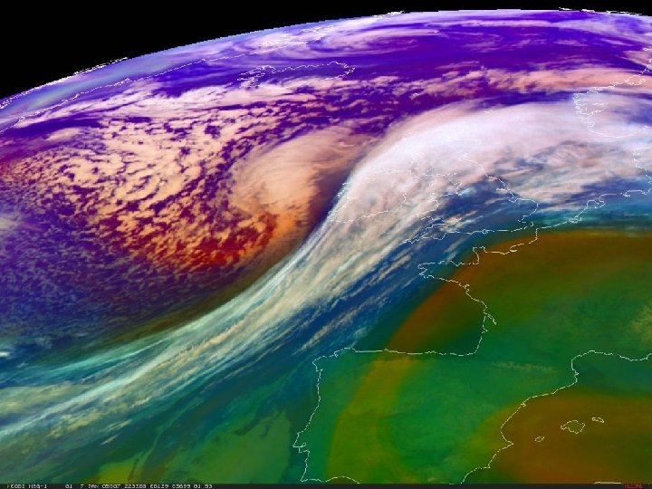
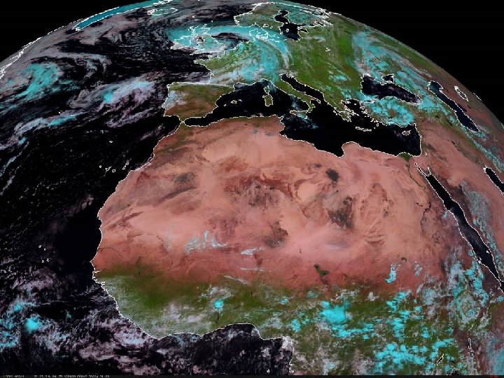
Routine Analysis Use of visible images to determine positions of cloud formations and storm systems (based on albedo) l Use of thermal infrared images to determine cloud temperatures and probability of rainfall l Use of water vapour images to ascertain tropospheric water vapour content l
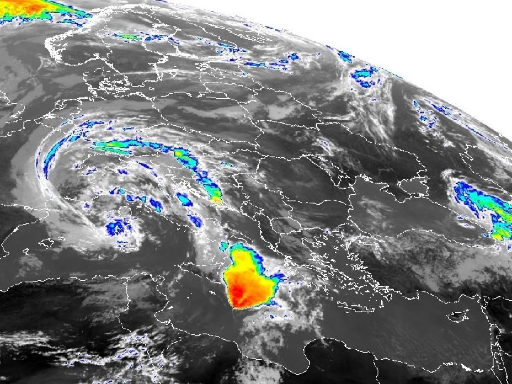

Cloud Motion Vectors CMVs allow windspeed to be determined l Usually, IR-WV images are used to track a specific cloud formation l Sequence of images allows cloud formation to be tracked so that speed and direction can be calculated l Final map shows streamlines over a region l

Step 1: Isolate a cloud formation

Step 2: New position in 60 mins gives speed and direction

e. g 22 degrees and 35 metres per second

Allows us to create a streamline

METEOSAT Primary European weather satellite l Meteosat-1 first launched in 1977 l Latest version is MSG (Meteosat Second Generation) l Controlled by Eumetsat (originally by the European Space Agency) l High degree of continuity since 1977 to 2007 l

Eumetsat HQ in Darmstadt, Germany

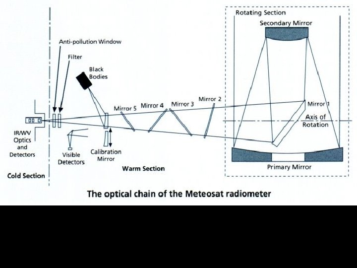
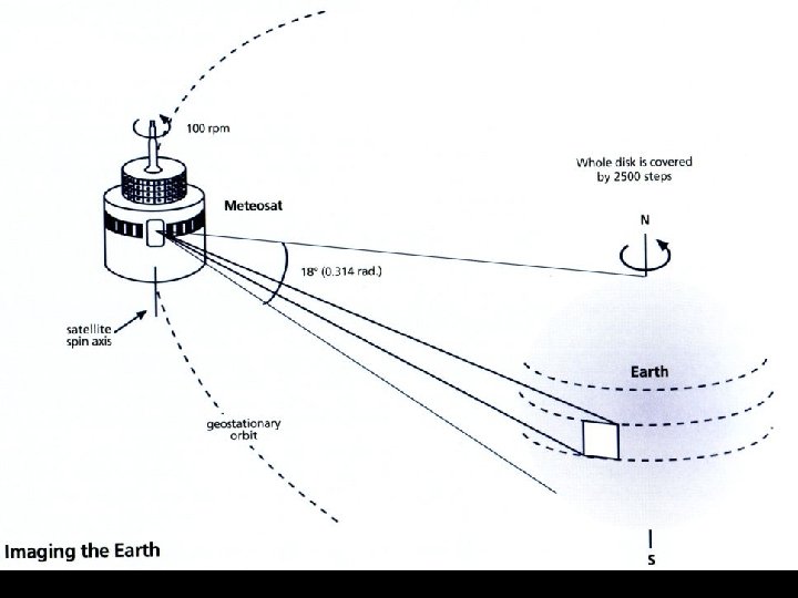
Overview of Meteosat system

Classic Meteosat Satellite VISIBLE: 0. 5 -0. 9μm IR-WV: 5. 7 -7. 1μm IR-THERMAL: 10. 5 -12. 5μm

Primary ground segment antennas in Fucino

Mission Control Pre-processing

Main system data flows

2 D Image Histogram

Histogram Interpretation

Automated cloud motion vector winds

Cloud analysis

Eumetsat Post-processing For meteorological Analysis

Dissemination of products

Global coverage of geostationary satellite systems
, Published by Eumetsat. Pub Ref: EUM TD 05 l")
References The Meteosat System (1996), Published by Eumetsat. Pub Ref: EUM TD 05 l Geostationary weather remote sensing systems (2001) By Chen H. S. Published by Xlibris, US. l Eumetsat website: l l http: //www. eumetsat. de
899aa001c56023b1be47ffbc189ebdb0.ppt