a4f9d31ef78f316968abd2d29e7d2e0c.ppt
- Количество слайдов: 68


Huntsville Hamfest Aug 16, 2014 Presented by: Tim Cunningham - N 8 DEU Alabama APRS Coordinator HUNTSPAC Chairman AMSAT Area Coordinator n 8 deu@arrl. net

Storm Seasons come and go… Things happen every day. . . Are you Equipped for Situational Awareness?

APRS - What is it ? Alabama Packet Radio System • APRS = Automatic Packet Reporting System • Created by Bob Bruninga, WB 4 APR, early 1990’s • Local Tactical data communications system • Adds value to HAM radio in emergency situations or public service events • Provides Situational Awareness • Delivers Messaging Capabilities • It is a mobile information network

APRS - What is it ? • Delivers instant NWS weather bulletins and coordinates • Informs you how close you are to the Area of Maximum Concern • See where everybody is located without asking, especially SKYWARN weather spotters (GPS not required) • Virtually any 2 M or HF radio can be used for APRS • more than just a simple tracking system…
 • 10. 151")
National APRS Frequencies • 144. 39 MHz 2 m FM (primary) • 10. 151 MHz LSB

The New n-N Pardigm • • • It Is not new anymore We are 9 years into the plan (2005) Still a number of non-compliant digi's TRACE is obsolete RELAY was replaced with WIDE 1 -1 WIDE was replaced by WIDEn-N – • WIDEn-N traceable using UITRACE SSn-N state, section, or regional routing – SSn-N used with UIFLOOD

Generic Digipeater Routing IGATE No need to know any Call Signs N 8 DEU > APRS, WIDE 1 -1, WIDE 2 -1 WIDE 1 -1 WIDEn-n N 8 DEU WIDEn-n WIDE 1 -1 WIDEn-n N 8 DEU > APRS, DIGI 1, WIDE 1*, WIDE 2 -1: WIDE 1 -1, WIDE 2 -1: DIGI 1, WIDE 1, DIGI 2 , WIDE 2*:

Generic Digipeater Routing IGATE No need to know any Call Signs N 8 DEU > APRS, WIDE 2 -2 WIDE 1 -1 WIDEn-n N 8 DEU WIDEn-n WIDEn-n N 8 DEU > APRS, WIDE 2 -2: DIGI 1*, WIDE 2 -1: DIGI 1, DIGI 2, WIDE 2*:

Generic Digipeater Routing IGATE No need to know any Call Signs N 8 DEU > APRS, AL 2 -2 ALn-n N 8 DEU ALn-n WIDEn-n State Boundary WIDEn-n ALn-n N 8 DEU > APRS, AL 2 -2: AL 2 -1: AL 2*: ALn-n

Local Suggested APRS paths • Mobile • WIDE 1 -1, WIDE 2 -1 • Home • WIDE 2 -2 • Use common sense or whatever it takes to reach an IGATE or intended station in your area or the application requires

WIDE 1 -1 fill-in digipeaters • Be a part of the solution • If your home station still supports an obsolete RELAY alias, please change it to WIDE 1 -1 • That is all there is to it • Your home station is a WIDE 1 -1 (fill-in digi) • If your area is already covered by a digipeater or another WIDE 1 -1, your WIDE 1 -1 is not necessary
 § Voice Alert is effectively a 3")
APRS Voice Alert! (For all APRS mobiles!) § Voice Alert is effectively a 3 rd Radio channel for the APRS equipped radios § By setting the APRS Band, A, to PL-100, § but keeping the volume turned up: § § § You wont hear any packets on 144. 39 * You will hear a voice call using PL-100 on 144. 39 And you will hear* an occasional Ping packet if another APRS equipped comes in line-of-site to you, like a proximity radar alerting you to local presence. § Great for long haul traveling and meeting other APRS users.

Local Frequency Info Initiative Information for the local area Objects created to inform everybody Voice Repeater freq, tone, range SKYWARN net announcement Echolink and IRLP nodes Hamfest objects Local on the air Nets Kenwood D 710 and Yaesu FTM-350 R can autotune a repeater object Great for out of town travelers

APRS – IS - Local Info! Last 100 stations! Mobiles and HT are 100% compatible Direction & Distance Frequency and Tone

APRS – IS - Local Info!

APRS – IS - Local Info!

APRS – IS - Local Info!

APRS – IS - Local Info!

Send E-Mail from APRS Send messages from APRS to Internet EMAIL. The EMAIL (Open. APRS) Method The EMAIL-2 (jav. APRSEmail) Method Send a message address to EMAIL or EMAIL-2 instead of a callsign. In the message field, the Internet Email address should appear first followed by a space and the message you wish to send. Address: EMAIL or EMAIL-2 Message: n 8 deu@qsl. net Hello Huntsville The EMAIL server will acknowledge receipt of the message and it will return a message, "Email message delivered OK", in response if the message was delivered properly.

WHO-IS Callbook Server • Send message to WHO-IS • Message just needs to contain a callsign or “f callsign” for full details • Callbook server will return details • Great for those stations you know, but have a senior moment – – Send a quick message to WHO-IS Nobody will know you forgot their name

NWS Weather Bulletins • NWS messages are generated by Pete Loveall, AE 5 PL • NWS message format can be found at: – http: //www. aprs-is. net/Wx • WX county watch boxes can be hi-lighted with Red, Yellow, or Green colors to visibly indicate WX activity type • Findu. U Server collects WX station data via APRS-IS • Find. U Server dumps WX data every 15 minutes to MADIS Server • Meso. West gets data from MADIS Server

NWS Weather Bulletins

APRS is Clear and Concise • The Severe Weather Warning is immediate on APRS • The message is clear and concise • Relativity is crystal clear – Maximum area of concern is immediately transmitted on the APRS network – Location of spotters is known • Nothing is ambiguous! • No repeats required!

• APRS displays everything • Spotter Locations • NWS Bulletins • WX Stations • Digipeaters • Repeaters plus frequency and tone • Even non-APRS stations

• APRS users can add objects or other observers to the map • Data is transmitted for all stations to see any object or non-APRS user on the map • K 4 QF is added by N 8 DEU when his location is given on the Voice Net • Objects can be added for flooded areas • Objects can be added for downed power lines • Objects can be added for house fires • Everyone on the APRS networks gets the information with no ambiguity

APRS - 06 -MAY-09 Alabama Packet Radio System • The weather net was activated around 6: 30 am on 06 -MAY-09 • Every county in the HUN NWS area in North Alabama had pending warnings except for 2 that had watches posted • As the net became active some of the pending bulletins were announced • With APRS we have a full view of what was active instantly to augment the Voice Net • It was a busy morning • All those on the Voice Net did an outstanding job

N 4 JDB requests how long it will be before the storm reaches Lawrence County. Net control does not have this information and things are getting busier.

Remember Sonny, N 4 JDB, who requested how soon the storm would reach Lawrence County. His home APRS weather station is right in the path of the NWS bulletin at 1213 z, but Sonny does not know it yet and things are so busy nobody remembers his request. With APRS the message is clear and concise. This is information Sonny needs immediately. With APRS we know it immediately!

A spotter reports a Tornado heard near Browns Ferry Rd and Balch Rd. An object is placed on the map titled TOR_SPOTD. Just click on the location, select Object Editor from the Action menu, and enter the data and the symbol type. If we know the course and speed of the Object we can make it move and update automatically. This is what APRS does when a beacon is not heard from a moving mobile station if enabled. A new post puts it back on course.

The storm spotter report results in immediate action by the NWS to issue a Tornado Warning at 1405 z. Now we visibly see what is potentially in the path of the box. It is clear, concise, and immediate on APRS.

A Tornado sighting in the sky is reported at Moores Mill Rd and Winchester Rd on the Voice Net. This report is intercepted by an APRS user and placed on the map. The path starts to visibly take shape. The third damage report comes in on the Voice Net and intercepted by an APRS users who places object DAMAGE 3 on the display for everybody on the APRS network to see. It is tagged with WB 8 ELK voice report of trees and out-buildings down.

APRS – Get the Picture? • It should be clear APRS delivers real time information • We know where the NWS bulletins are located • We know where the spotters are located • We know where damage has been reported • The picture of danger is clear and concise • APRS fills in the missing gaps of the picture • Messages can be sent via the APRS data network when the voice repeater is out of range for some spotters • APRS augments the SKYWARN Voice Net • A Voice Net can be up an running quickly with all the NWS bulletins at their fingertips with APRS • Why wait until somebody staffs the NWS station • The time between danger and death is too short

APRS – Get the Picture? • Situational awareness is key to precise and timely information • What happens when an area is so devastated and there are no street signs – With APRS we know where you are – Reports can be plotted easily – Information is immediate • Want NWS bulletins with more meaning to situational awareness? • Get on the APRS tactical communication data network

The Balloon Chase using APRS

Space Applications International Space Station • APRS digipeater is active on the International Space Station • Frequencies – Packet: 145. 825 MHz – Packet uplink : 145. 990 MHz – Voice uplink : 144. 490 MHz • ISS ground station Internet Gateways are feeding APRServe with ISS digipeated signals

Space Applications PCSat • Designed for: – – country travelers sea travelers in remote areas of the world mobile or handheld users equipped with GPS • Frequencies – 145. 825 MHz downlink – 145. 825 MHz uplink for HT’s (1200 baud) – 435. 250 MHz uplink for mobiles (9600 baud) • Launched on 30 -SEP-01 from Kodiak Alaska Launch Complex

Alinco DR-135 T with T 2 -135

Next Step? • Who needs a radio when you have the Internet ? • No Radio required with a computer and the Internet • What about Software Requirements ? • What about Hardware Requirements ?

Watch APRS live on the Web at: http: //www. aprs. fi

APRSISCE • • It is FREE ! Yahoo GROUPS Developed by Lynn, KJ 4 ERJ Windows Mobile Phone Wi. Fi Internet enabled phone Will not support Windows Phone 8 Moving to Android

APRSIS 32

What were all those symbols ? • Map Symbols – – – – Automobiles Emergency Vehicles Satellite Stations Weather Stations Houses Red Cross Ham Store too many to list. . .

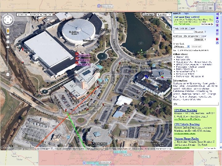
How active is APRS ? APRS MAP CELL MAP
 APRS is a Network intended for real-time Tactical INFORMATION exchange.")
Various APRS Stations (two-way) APRS is a Network intended for real-time Tactical INFORMATION exchange. This means TWO-WAY.
 One-way APRS is not normally recommended. APRS is a Network. We want")
TRACKERS (two-way) One-way APRS is not normally recommended. APRS is a Network. We want good communications among all participants for maximum utility. Trackers have no APRS data display. So the receiver should be tuned to a beaconed Voice frequency so the operator can be involved in the Net! The only value for these units are tracking some non-manned assets at large movement events such as marathons, bike-a-thons, parades and other community events, and maybe search & rescue teams.

Mobile/Portable Satellite Terminals Kenwood TM-D 700 A Dual band 144/440 MHz 50/35 Watts Built-in 1200/9600 bps TNC including digipeater Built-in screen display of other APRS stations and front-panel send/receive messaging. Other APRS station locations are sent to the attached GPS map for display. TM-D 710 Adds operation Freq to every posit ! Auto tunes to others with Freq! Shows local Voice Repeaters ! Kenwood TH-D 7 A(G)

• Supports APRS • 2 serial ports for computer and GPS • No message display • Works as basic tracker • 1200/9600 baud built-in TNC option (Argent makes a T 3 -135 drop in TNC to add functionality)

Alinco DR-135 T/EJ-41 U Basic 2 M Radio with optional TNC. (Argent makes a T 2 -135 drop in TNC) Allows direct input from any standard GPS. Basic 1200/9600 bps TNC Unlike the Kenwood radios, it requires a PC to set it up, and there is no APRS display directly on the radio.

Argent Data Systems Tracker 2/3 https: //www. argentdata. com • • • KISS Support WX Station support Free Firmware updates Advanced APRS features Intelligent digipeater support Smart beaconing Remote Configuration Built-in voltage and temp monitor Small 5 -watt VHF transceiver with integrated Tracker 2 available

Byonics Tiny Trak III Plus http: //www. byonics. com • • • $33 kit / $42 built Adjustable TX rate Based on PIC 16 F 628 Carrier detect to avoid collisions Normal APRS or MIC-E operation Time slotted reporting or Smart. Beaconing • Can power a 5 V GPS (Byonics GPS 1, Garmin GPS 18 or a Deluo GPS WAAS) • $98 kit or $107 built with Byonics GPS 2 GPS small

Byonics Tiny Trak 4 http: //www. byonics. com/tinytrak 4 • • • $65 kit / $75 built Field upgradeable TX and RX packet data Analog telemetry support Supports NMEA, MIC-E, and Tracker modes • Based on ATMEGA 324 P 20 U (40 pin DIP) microcontroller • • • Time slotted reporting or Smart. Beaconing Can power a GPS DSP Packet Decoding – 300/1200/9600 baud packet, DTMF, and new demodulation techniques can be added since it is not hardware based Most of Tiny. Trak 3 functions added •

Byonics WX Trak http: //www. byonics. com • $33 kit / $42 built • Based on Tiny Trak III design • Supports connected WX Stations – Radio Shack WX 200 – Oregon Scientiic WM-918 – Peet Brothers U 100, U 800, U 2000, U 2100 – Davis WX station with Weather. Link APRS adapter
 http: //n 1 vg. net/opentracker • Kit $32 or assembled $46")
Open. Tracker+ (OT+) http: //n 1 vg. net/opentracker • Kit $32 or assembled $46 • Based on the Freescale MC 908 JL 16 CSPE microcontroller • Supports the following features: – Free firmware upgrades – RX capability – Analog inputs – APRS Telemetry output – Supports 1 -wire and Peet Bros WX station – Smart. Beaconing – PSK 31 support for Prop. Net^31 Operation – On-board temperature and voltage sensors

TNC-X KISS only TNC http: //www. tnc-x. com/ • $48 kit • Based on Microchip PIC 16 F 628 A and a CML MX 614 Bell 202 modem • Supports the following options: – u. Smart. Digi – X-Track – Rasbery Pi – Bleak Beagle • TNC can be powered by the USB port • Blue. Tooth now available

• Supports APRS • 1200 / 9600 built-in TNC • Displays symbol and distance from other stations • Display up to 40 messages • 2 serial ports for computer and GPS to display waypoints
 • 1200")
• APRS® ready (position / message / operation frequency etc. ) • 1200 / 9600 built-in TNC AX. 25 • Dual receive on same band (Vx. V, Ux. U) • 1, 000 memory channels • Support for Echo. Link system • Decay algorithm when sitting still • NMEA 0183 GPS port • APRS weather station ready • Smart. Beaconing implemented • Auto Tune Repeater Objects (freq, tone, offset)

• Add Kenwood TM-D 710 APRS like capabilities to virtually any 2 M FM radio • APRS® ready (position / message / etc. ) • 1200 / 9600 TNC AX. 25 • Provides full control of TM-D 700 A and TM -V 71 A • Replaces TM-V 71 A control head • Decay algorithm when sitting still • NMEA 0183 GPS port • APRS weather station ready • Requires PG-5 J cable interface or equivalent

• Supports APRS • 1200 / 9600 built-in TNC • Displays symbol and distance from other stations • Display up to 40 messages • 2 serial ports for computer and GPS to display waypoints

• Quad Band HT 6 m, 220, 70 cm 5 W, 1. 2 W on 222 MHz • Slimmer than the VX-7 R • Dual receive (V+V or U+U) • AM/FM broadcast receiver • Supports APRS 1200/9600 baud (B band only) • Weather Alert receiving • High-rez spectrum analyzer +/- 60 channels • Optional Accessories – – Bluetooth headset support GPS unit and antenna

• Dubbed a devoted APRS user version of the VX-8 R • Smart beaconing added • Updated digi path settings from 1 to 7 • Updated message buffer from 20 to 30 • Updated station list from 40 to 50 • Added digi path route indiaction • Optional Accessories – Bluetooth headset support – GPS unit and antenna

• • An excellent competitor of the Kenwood D-710 GPS/APRS Bluetooth features Dual band 144 (220) / 430 MHz 50 W Built-in barometric pressure sensor 500 independent memory channels Smartbeaconing Cross band repeat 12000 / 9600 baud

APRS WEB Sites • • www. aprs. org www. openaprs. net www. aprs. fi www. findu. com www. tapr. org www. qsl. net/n 8 deu www. sv 2 agw. com/ham/default. htm www. xastir. org • www. eskimo. com/~archer/aprs_capabilities. html • www. ui-view. org

News Groups Sign up at http: //www. tapr. org • • • APRS News APRS SIG APRS HT APRS Spec APRS Sat
")
Software for APRS Software downloadable from the Web • • APRSdos Mac. APRS (old) Win. APRS (old) jav. APRS palm. APRS (old) Waypoint (old) APRS Plus (old) • • APRSdigi UIView (old) APRSPoint AGWTracker PPC XASTIR APRSISCE

APRS Coordinators Commissioned by WB 4 APR State Name Call Alabama Tim N 8 DEU Arkansas Richard KB 4 YTM Steve N 5 JPL Travis KB 5 ILY Florida NA NA Georgia NA NA Mississippi (north) Jeff KB 5 NMB Richard KB 4 YTM Tennessee (east) William KI 4 HDU Tennessee (west) Richard KB 4 YTM

How can APRS Help ? • • It is clear and concise Repeat of information not required once heard No words need to be spoken or repeated Response time is immediate – Beats NOAA WX radio alert every time – Beats Voice Net Alert every time • Relativity is always known – – – How far am I from the storm Key spotters are instantly identified Non-APRS users can be placed on the map Every APRS user views the same data (RF or Internet) Nothing compares to the speed of information – Tactical Communications Network • Augments a Voice Net with critical Real Time Information

Presented by: Tim Cunningham – N 8 DEU Alabama APRS Coordinator AMSAT Area Coordinator n 8 deu@amsat. org n 8 deu@arrl. net
a4f9d31ef78f316968abd2d29e7d2e0c.ppt