a7ae26738b2c64ca2d8294d35e1173b1.ppt
- Количество слайдов: 37
Hourly RUC Convective Probability Forecasts using Ensembles and Radar Assimilation Steve Weygandt Stan Benjamin Forecast Systems Laboratory NOAA
AUTOMATED CONVECTIVE WEATHER GUIDANCE PRESENT • 0 -2 h forecasts from radar extrapolation with growth and decay (nowcasting techniques) • Beyond 2 h guidance from model output helpful FUTURE A seamless convective guidance product utilizing a variety of inputs including nowcasts and model ensemble information to provide guidance to humans and automated decision support systems
Model-based Probability Forecasts for Convective Weather Principle: Convective forecasts at specific model grid points from a single deterministic model run less likely to be correct than averages of model outputs. Procedure: Aggregate model convective information to larger time/space scales (~1 -2 h, 80 -100 km) • Scales should increase with increasing lead time • Scales will decrease as models get better
Ensembles provide technique for aggregating forecast information Types of ensembles • • • Multi-model ensembles Initial/boundary condition ensembles Model physics ensembles Time-lagged model ensembles (2004) Model gridpoint ensembles (2003)
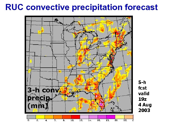
RUC convective precipitation forecast 3 -h conv. precip. (mm) 5 -h fcst valid 19 z 4 Aug 2003
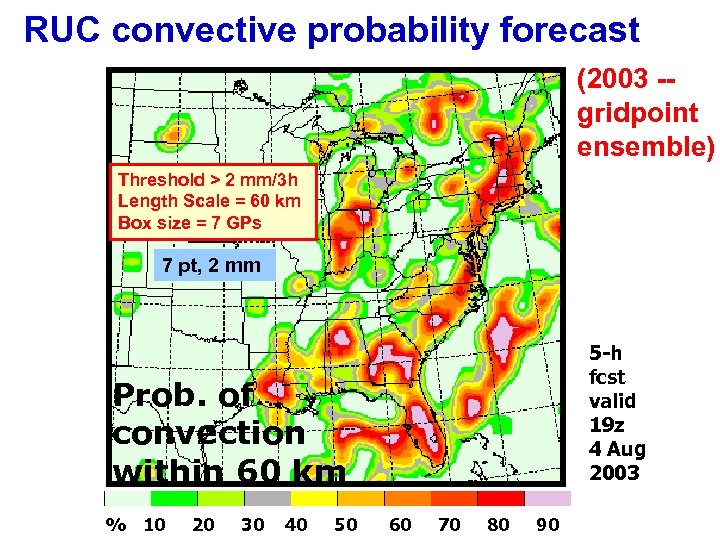
RUC convective probability forecast (2003 -gridpoint ensemble) Threshold > 2 mm/3 h Length Scale = 60 km Box size = 7 GPs 7 pt, 2 mm 5 -h fcst valid 19 z 4 Aug 2003 Prob. of convection within 60 km % 10 20 30 40 50 60 70 80 90
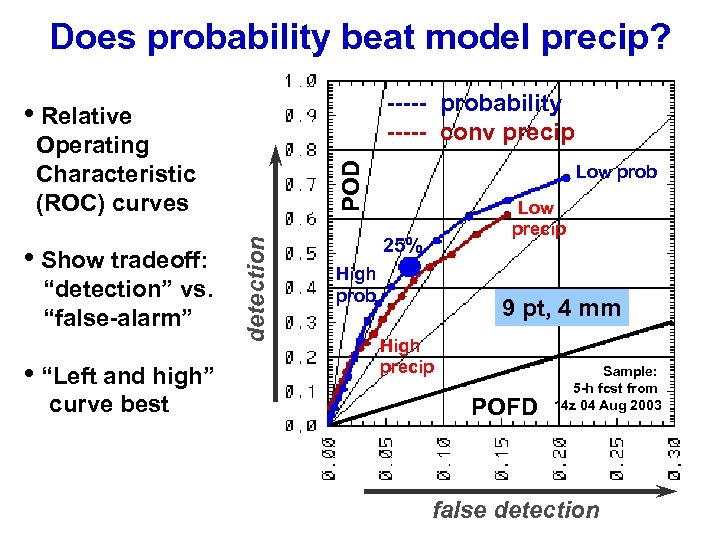
Does probability beat model precip? ----- probability ----- conv precip • Relative “detection” vs. “false-alarm” • “Left and high” curve best detection • Show tradeoff: POD Operating Characteristic (ROC) curves Low prob Low precip 25% High prob 9 pt, 4 mm High precip POFD Sample: 5 -h fcst from 14 z 04 Aug 2003 false detection
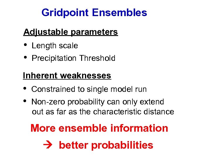
Gridpoint Ensembles Adjustable parameters • • Length scale Precipitation Threshold Inherent weaknesses • • Constrained to single model run Non-zero probability can only extend out as far as the characteristic distance More ensemble information better probabilities
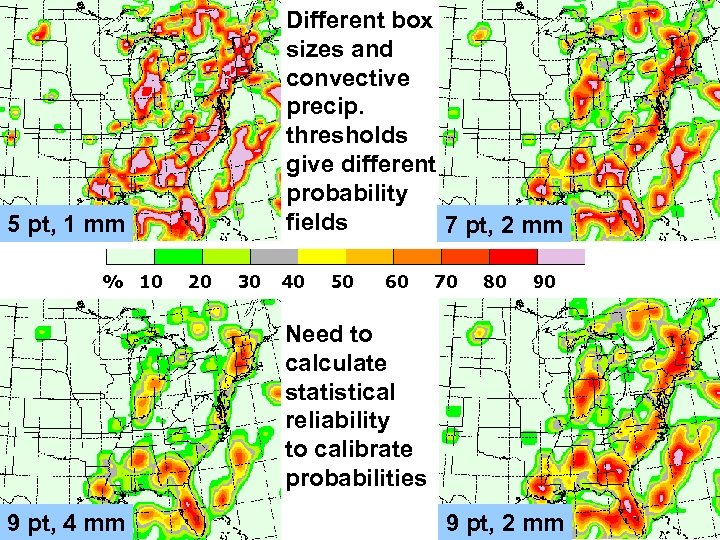
Different box sizes and convective precip. thresholds give different probability fields 7 pt, 2 mm 5 pt, 1 mm % 10 20 30 40 50 60 70 80 90 Need to calculate statistical reliability to calibrate probabilities 9 pt, 4 mm 9 pt, 2 mm
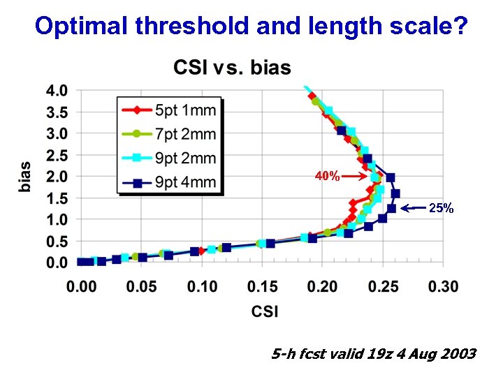
Optimal threshold and length scale? 40% 25% 5 -h fcst valid 19 z 4 Aug 2003
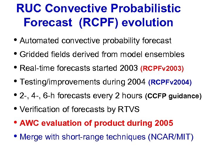
RUC Convective Probabilistic Forecast (RCPF) evolution • Automated convective probability forecast • Gridded fields derived from model ensembles • Real-time forecasts started 2003 (RCPFv 2003) • Testing/improvements during 2004 (RCPFv 2004) • 2 -, 4 -, 6 -h forecasts every 2 hours (CCFP guidance) • Verification of forecasts by RTVS • AWC evaluation of product during 2005 • Merge with short-range techniques (NCAR/MIT)
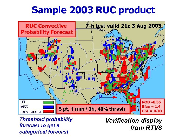
Sample 2003 RUC product RUC Convective Probability Forecast 7 -h fcst valid 21 z 3 Aug 2003 5 pt, 1 mm / 3 h, 40% thresh Threshold probability forecast to get a categorical forecast POD=0. 55 Bias = 1. 4 CSI = 0. 30 Verification display from RTVS
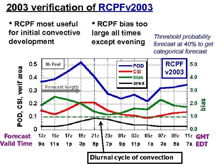
2003 verification of RCPFv 2003 • RCPF most useful • RCPF bias too for initial convective development large all times except evening 6 h Fcst Threshold probability forecast at 40% to get categorical forecast RCPF v 2003 Forecast length Forecast Valid Time GMT EDT Diurnal cycle of convection
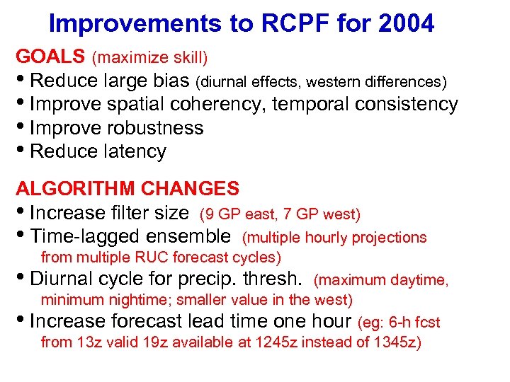
Improvements to RCPF for 2004 GOALS (maximize skill) • Reduce large bias (diurnal effects, western differences) • Improve spatial coherency, temporal consistency • Improve robustness • Reduce latency ALGORITHM CHANGES • Increase filter size (9 GP east, 7 GP west) • Time-lagged ensemble (multiple hourly projections from multiple RUC forecast cycles) • Diurnal cycle for precip. thresh. • (maximum daytime, minimum nightime; smaller value in the west) Increase forecast lead time one hour (eg: 6 -h fcst from 13 z valid 19 z available at 1245 z instead of 1345 z)
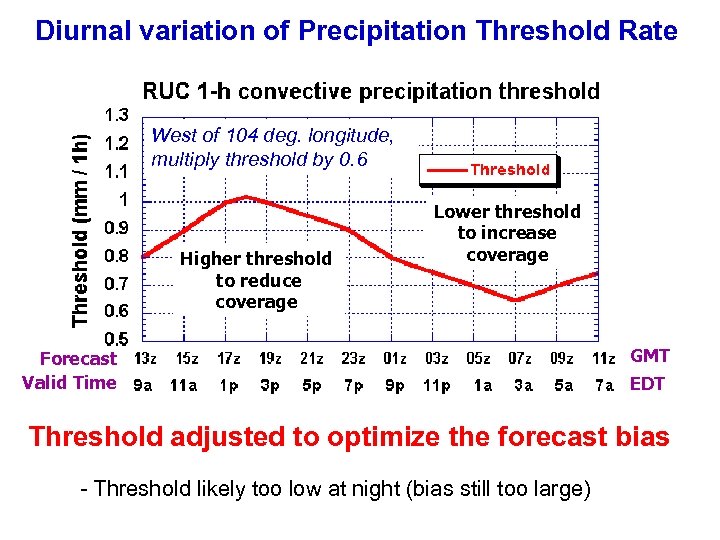
Diurnal variation of Precipitation Threshold Rate West of 104 deg. longitude, multiply threshold by 0. 6 Higher threshold to reduce coverage Lower threshold to increase coverage Forecast Valid Time GMT EDT Threshold adjusted to optimize the forecast bias - Threshold likely too low at night (bias still too large)
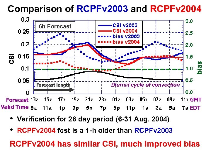
Comparison of RCPFv 2003 and RCPFv 2004 6 h Forecast length Diurnal cycle of convection Forecast Valid Time • • GMT EDT Verification for 26 day period (6 -31 Aug. 2004) RCPFv 2004 fcst is a 1 -h older than RCPFv 2003 RCPFv 2004 has similar CSI, much improved bias
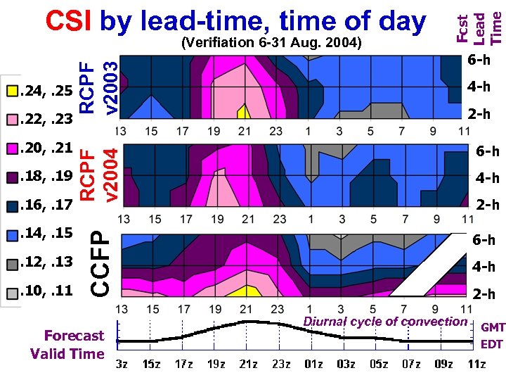
. 20, . 21. 18, . 19. 16, . 17. 14, . 15. 12, . 13. 10, . 11 4 -h 2 -h 6 -h CCFP . 22, . 23 6 -h RCPF v 2004 . 24, . 25 RCPF v 2003 (Verifiation 6 -31 Aug. 2004) Fcst Lead Time CSI by lead-time, time of day 6 -h Forecast Valid Time 4 -h 2 -h Diurnal cycle of convection GMT EDT
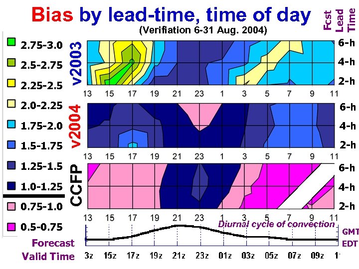
2. 5 -2. 75 2. 25 -2. 5 2. 0 -2. 25 1. 75 -2. 0 1. 5 -1. 75 1. 25 -1. 5 1. 0 -1. 25 0. 75 -1. 0 v 2003 2. 75 -3. 0 6 -h CCFP v 2004 (Verifiation 6 -31 Aug. 2004) Fcst Lead Time Bias by lead-time, time of day 6 -h 0. 5 -0. 75 Forecast Valid Time 4 -h 2 -h 6 -h 4 -h 2 -h Diurnal cycle of convection GMT EDT
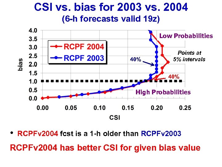
CSI vs. bias for 2003 vs. 2004 (6 -h forecasts valid 19 z) Low Probabilities 40% Points at 5% intervals 40% High Probabilities • RCPFv 2004 fcst is a 1 -h older than RCPFv 2003 RCPFv 2004 has better CSI for given bias value
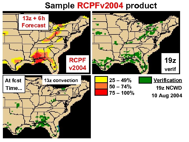
Sample RCPFv 2004 product 13 z + 6 h Forecast 19 z RCPF v 2004 At fcst Time. . . 13 z convection verif 25 – 49% 50 – 74% 75 – 100% Verification 19 z NCWD 10 Aug 2004
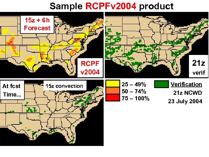
Sample RCPFv 2004 product 15 z + 6 h Forecast 21 z RCPF v 2004 At fcst Time. . . 15 z convection verif 25 – 49% 50 – 74% 75 – 100% Verification 21 z NCWD 23 July 2004
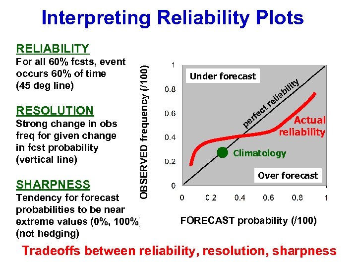
Interpreting Reliability Plots For all 60% fcsts, event occurs 60% of time (45 deg line) RESOLUTION Strong change in obs freq for given change in fcst probability (vertical line) SHARPNESS OBSERVED frequency (/100) RELIABILITY Tendency forecast probabilities to be near extreme values (0%, 100%) (not hedging) Under forecast y t ili b t ec f er p r ia el Actual reliability Climatology Over forecast FORECAST probability (/100) Tradeoffs between reliability, resolution, sharpness
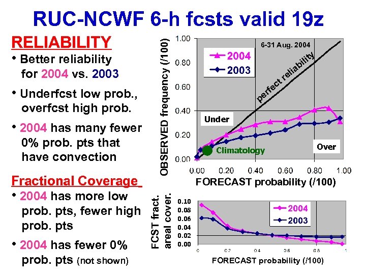
• Better reliability for 2004 vs. 2003 • Underfcst low prob. , overfcst high prob. • 2004 has many fewer 0% prob. pts that have convection Fractional Coverage • 2004 has more low prob. pts, fewer high prob. pts • 2004 has fewer 0% prob. pts (not shown) FCST fract. areal cover. RELIABILITY OBSERVED frequency (/100) RUC-NCWF 6 -h fcsts valid 19 z 6 -31 Aug. 2004 y t ili b tr c ia el rfe e p Under Climatology Over FORECAST probability (/100) 0. 10 0. 08 0. 06 0. 04 0. 02 0. 00 FORECAST probability (/100)
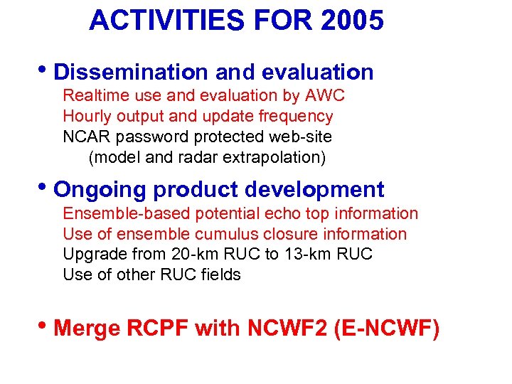
ACTIVITIES FOR 2005 • Dissemination and evaluation Realtime use and evaluation by AWC Hourly output and update frequency NCAR password protected web-site (model and radar extrapolation) • Ongoing product development Ensemble-based potential echo top information Use of ensemble cumulus closure information Upgrade from 20 -km RUC to 13 -km RUC Use of other RUC fields • Merge RCPF with NCWF 2 (E-NCWF)
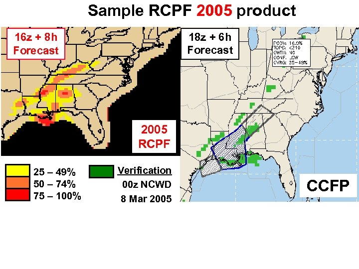
Sample RCPF 2005 product 18 z + 6 h Forecast 16 z + 8 h Forecast 2005 RCPF 25 – 49% 50 – 74% 75 – 100% Verification 00 z NCWD 8 Mar 2005 CCFP
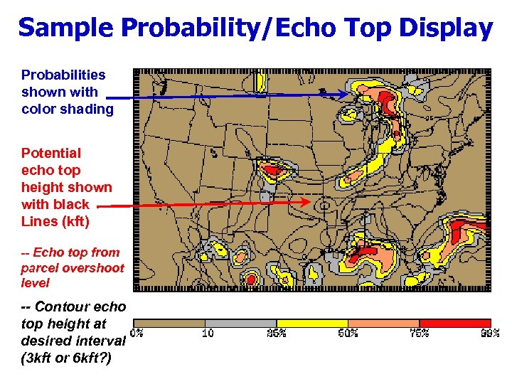
Sample Probability/Echo Top Display Probabilities shown with color shading Potential echo top height shown with black Lines (kft) -- Echo top from parcel overshoot level -- Contour echo top height at desired interval (3 kft or 6 kft? )
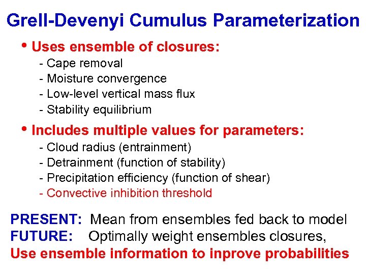
Grell-Devenyi Cumulus Parameterization • Uses ensemble of closures: - Cape removal - Moisture convergence - Low-level vertical mass flux - Stability equilibrium • Includes multiple values for parameters: - Cloud radius (entrainment) - Detrainment (function of stability) - Precipitation efficiency (function of shear) - Convective inhibition threshold PRESENT: Mean from ensembles fed back to model FUTURE: Optimally weight ensembles closures, Use ensemble information to inprove probabilities
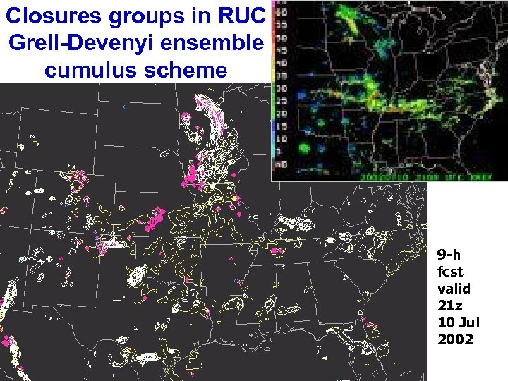
2 hr Nowcast (scale - 60 km) Performance Forecast Closures groups in RUC Grell-Devenyi ensemble cumulus scheme Radar 2100 UTC 10 July, 2002 9 -h fcst valid 21 z 10 Jul 2002
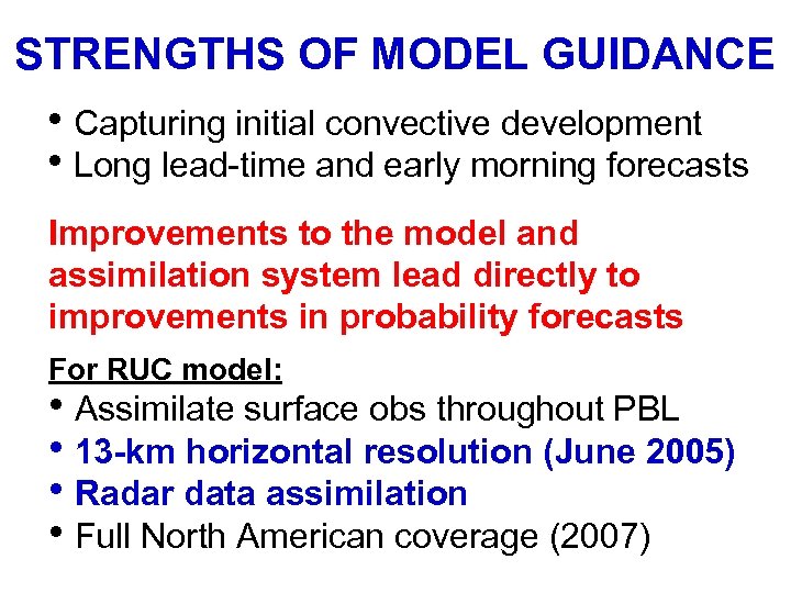
STRENGTHS OF MODEL GUIDANCE • Capturing initial convective development • Long lead-time and early morning forecasts Improvements to the model and assimilation system lead directly to improvements in probability forecasts For RUC model: • Assimilate surface obs throughout PBL • 13 -km horizontal resolution (June 2005) • Radar data assimilation • Full North American coverage (2007)
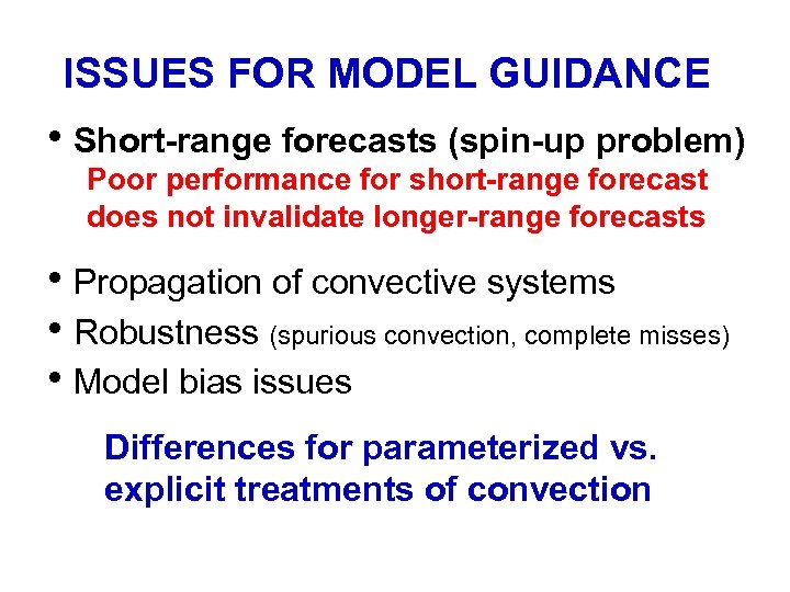
ISSUES FOR MODEL GUIDANCE • Short-range forecasts (spin-up problem) Poor performance for short-range forecast does not invalidate longer-range forecasts • Propagation of convective systems • Robustness (spurious convection, complete misses) • Model bias issues Differences for parameterized vs. explicit treatments of convection
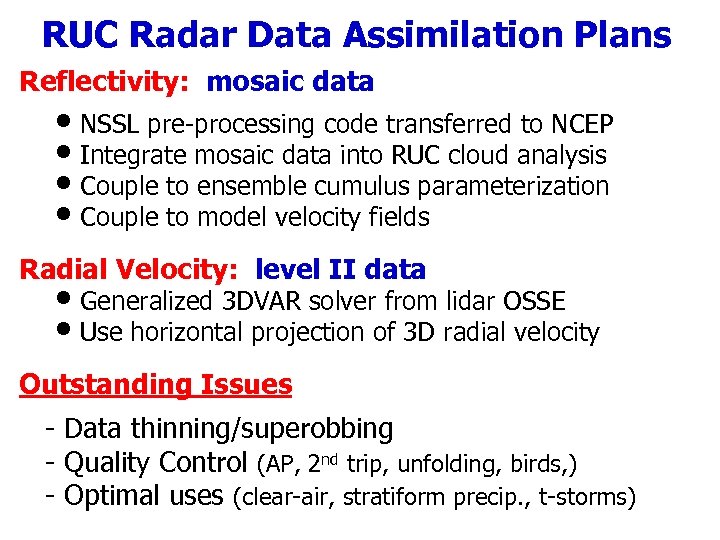
RUC Radar Data Assimilation Plans Reflectivity: mosaic data • NSSL pre-processing code transferred to NCEP • Integrate mosaic data into RUC cloud analysis • Couple to ensemble cumulus parameterization • Couple to model velocity fields Radial Velocity: level II data • Generalized 3 DVAR solver from lidar OSSE • Use horizontal projection of 3 D radial velocity Outstanding Issues - Data thinning/superobbing - Quality Control (AP, 2 nd trip, unfolding, birds, ) - Optimal uses (clear-air, stratiform precip. , t-storms)
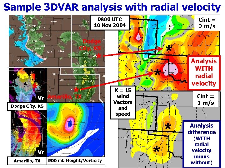
Sample 3 DVAR analysis with radial velocity Cint = 2 m/s 0800 UTC 10 Nov 2004 Dodge City, KS * * * Vr Amarillo, TX Dodge City, KS * * * K = 15 wind Vectors and speed Cint = 1 m/s * Vr Amarillo, TX 500 mb Height/Vorticity Analysis WITH radial velocity * Analysis difference (WITH radial velocity minus without)

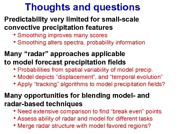
Thoughts and questions Predictability very limited for small-scale convective precipitation features • Smoothing improves many scores • Smoothing alters spectra, probability information Many “radar” approaches applicable to model forecast precipitation fields • Probabilities from spatial variability of model precip. • Model depicts “displacement”, and “temporal evolution” • Apply “tracking” algorithms to model precipitation fields? Many opportunities for blending model- and radar-based techniques • Need extensive comparison to find “break even” points • Assess ability of radar and model for different tasks • Merge radar structure with model favored regions?
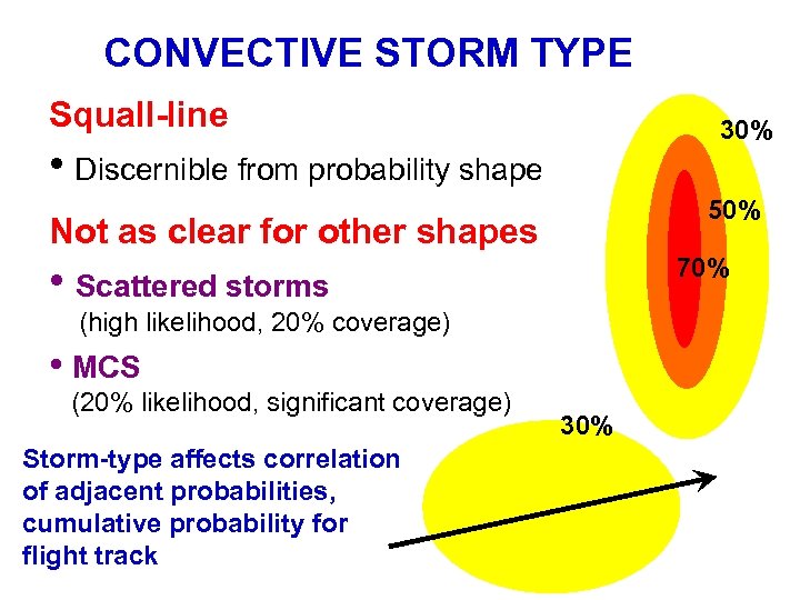
CONVECTIVE STORM TYPE Squall-line 30% • Discernible from probability shape 50% Not as clear for other shapes 70% • Scattered storms (high likelihood, 20% coverage) • MCS (20% likelihood, significant coverage) Storm-type affects correlation of adjacent probabilities, cumulative probability for flight track 30%
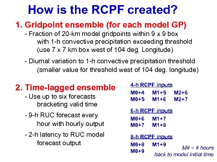
How is the RCPF created? 1. Gridpoint ensemble (for each model GP) - Fraction of 20 -km model gridpoints within 9 x 9 box with 1 -h convective precipitation exceeding threshold (use 7 x 7 km box west of 104 deg. Longitude) - Diurnal variation to 1 -h convective precipitation threshold (smaller value for threshold west of 104 deg. longitude) 2. Time-lagged ensemble - Use up to six forecasts bracketing valid time - 9 -h RUC forecast every hour with hourly output - 2 -h latency to RUC model forecast output 4 -h RCPF inputs M 0+4 M 1+5 M 2+6 M 0+5 M 1+6 M 2+7 6 -h RCPF inputs M 0+6 M 1+7 M 0+7 M 1+8 8 -h RCPF inputs M 0+8 M 1+9 M# = # hours M 0+9 back to model initial time
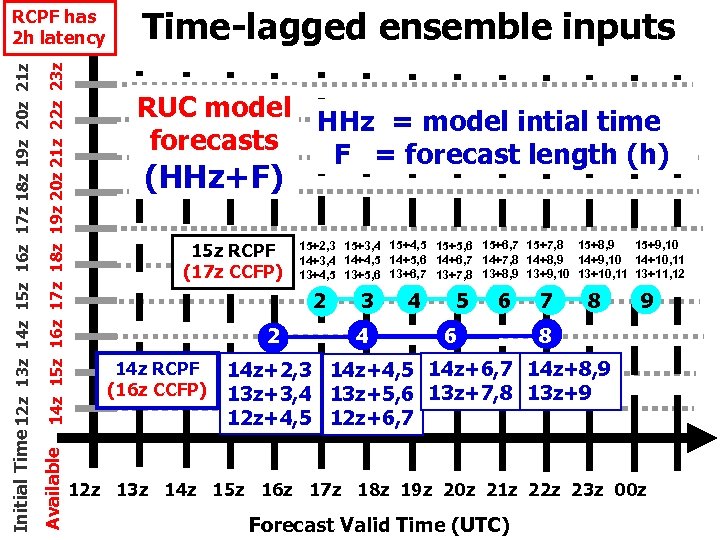
14 z 15 z 16 z 17 z 18 z 19 z 20 z 21 z 22 z 23 z Available Initial Time 12 z 13 z 14 z 15 z 16 z 17 z 18 z 19 z 20 z 21 z RCPF has 2 h latency Time-lagged ensemble inputs RUC model HHz = model intial time forecasts F = forecast length (h) (HHz+F) 15 z RCPF (17 z CCFP) 15+9, 10 15+2, 3 15+3, 4 15+4, 5 15+5, 6 15+6, 7 15+7, 8 15+8, 9 14+5, 6 14+6, 7 14+7, 8 14+8, 9 14+9, 10 14+10, 11 14+3, 4 14+4, 5 13+5, 6 13+6, 7 13+7, 8 13+8, 9 13+9, 10 13+10, 11 13+11, 12 2 2 14 z RCPF (16 z CCFP) 3 4 4 5 6 6 7 8 9 8 14 z+2, 3 14 z+4, 5 14 z+6, 7 14 z+8, 9 13 z+3, 4 13 z+5, 6 13 z+7, 8 13 z+9 12 z+4, 5 12 z+6, 7 12 z 13 z 14 z 15 z 16 z 17 z 18 z 19 z 20 z 21 z 22 z 23 z 00 z Forecast Valid Time (UTC)
a7ae26738b2c64ca2d8294d35e1173b1.ppt