d8036cca8ba619b368ecfe16c8f6b9aa.ppt
- Количество слайдов: 19
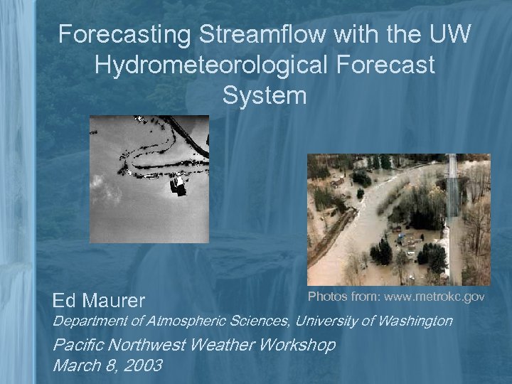 Forecasting Streamflow with the UW Hydrometeorological Forecast System Ed Maurer Photos from: www. metrokc. gov Department of Atmospheric Sciences, University of Washington Pacific Northwest Weather Workshop March 8, 2003
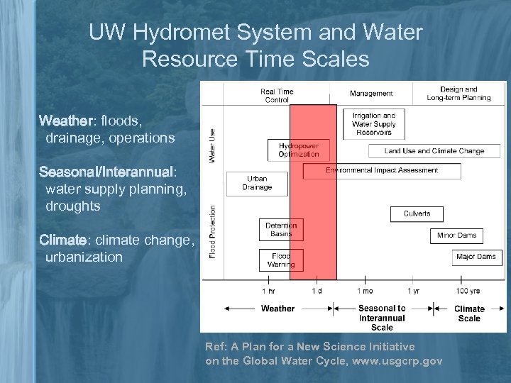 UW Hydromet System and Water Resource Time Scales Weather: floods, drainage, operations Seasonal/Interannual: water supply planning, droughts Climate: climate change, urbanization Ref: A Plan for a New Science Initiative on the Global Water Cycle, www. usgcrp. gov
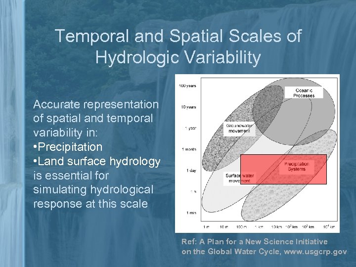 Temporal and Spatial Scales of Hydrologic Variability Accurate representation of spatial and temporal variability in: • Precipitation • Land surface hydrology is essential for simulating hydrological response at this scale Ref: A Plan for a New Science Initiative on the Global Water Cycle, www. usgcrp. gov
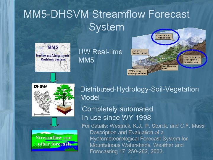 MM 5 -DHSVM Streamflow Forecast System UW Real-time MM 5 DHSVM Distributed-Hydrology-Soil-Vegetation Model Completely automated In use since WY 1998 Streamflow and other forecasts For details: Westrick, K. J. , P. Storck, and C. F. Mass, Description and Evaluation of a Hydrometeorological Forecast System for Mountainous Watersheds, Weather and Forecasting 17: 250 -262, 2002.
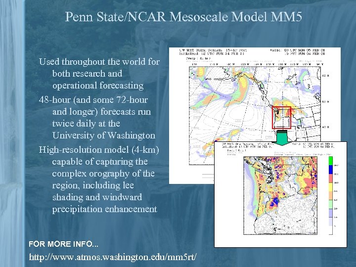 Penn State/NCAR Mesoscale Model MM 5 Used throughout the world for both research and operational forecasting 48 -hour (and some 72 -hour and longer) forecasts run twice daily at the University of Washington High-resolution model (4 -km) capable of capturing the complex orography of the region, including lee shading and windward precipitation enhancement FOR MORE INFO. . . http: //www. atmos. washington. edu/mm 5 rt/
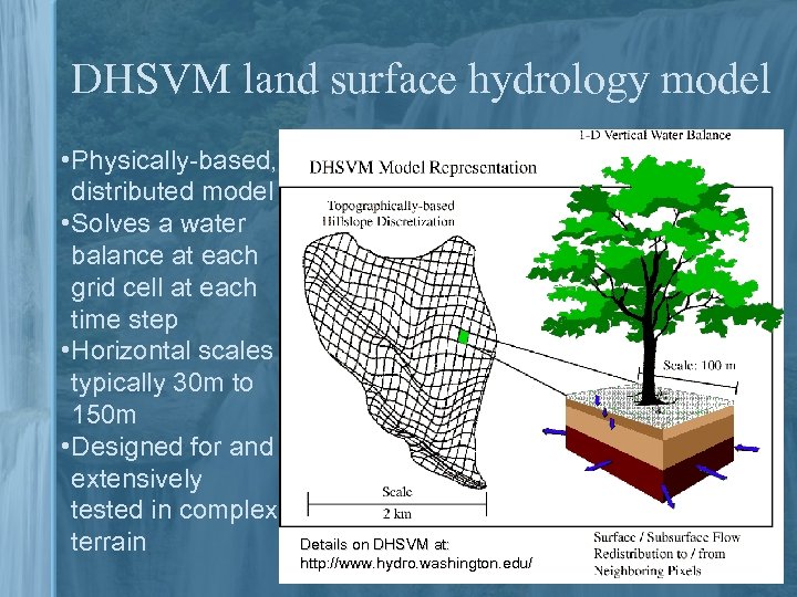 DHSVM land surface hydrology model • Physically-based, distributed model • Solves a water balance at each grid cell at each time step • Horizontal scales typically 30 m to 150 m • Designed for and extensively tested in complex terrain Details on DHSVM at: http: //www. hydro. washington. edu/
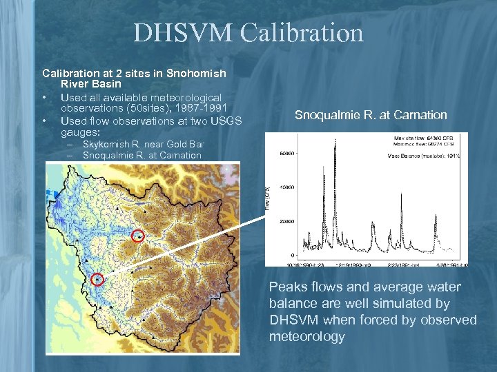 DHSVM Calibration at 2 sites in Snohomish River Basin • Used all available meteorological observations (50 sites), 1987 -1991 • Used flow observations at two USGS gauges: Snoqualmie R. at Carnation – Skykomish R. near Gold Bar – Snoqualmie R. at Carnation Peaks flows and average water balance are well simulated by DHSVM when forced by observed meteorology
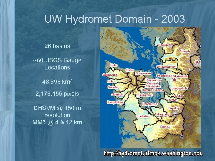 UW Hydromet Domain - 2003 26 basins ~60 USGS Gauge Locations 48, 896 km 2 2, 173, 155 pixels DHSVM @ 150 m resolution MM 5 @ 4 & 12 km
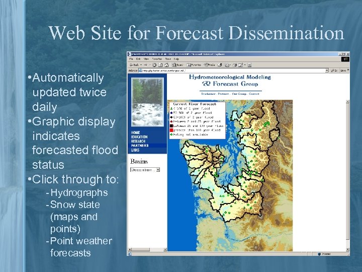 Web Site for Forecast Dissemination • Automatically updated twice daily • Graphic display indicates forecasted flood status • Click through to: ‑ Hydrographs ‑ Snow state (maps and points) ‑ Point weather forecasts
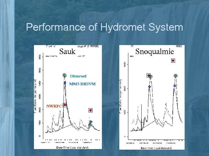 Performance of Hydromet System Sauk Observed MM 5 -DHSVM NWRFC Snoqualmie
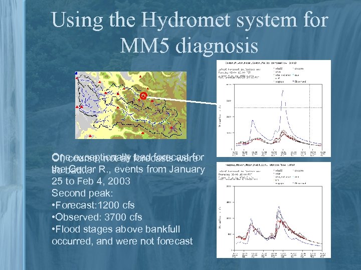 Using the Hydromet system for MM 5 diagnosis One exceptionally forecasts were Of, course, not all bad forecast for thebad… R. , events from January so Cedar 25 to Feb 4, 2003 Second peak: • Forecast: 1200 cfs • Observed: 3700 cfs • Flood stages above bankfull occurred, and were not forecast
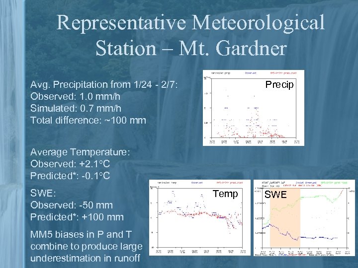 Representative Meteorological Station – Mt. Gardner Precip Avg. Precipitation from 1/24 - 2/7: Observed: 1. 0 mm/h Simulated: 0. 7 mm/h Total difference: ~100 mm Average Temperature: Observed: +2. 1 C Predicted*: -0. 1 C SWE: Observed: -50 mm Predicted*: +100 mm MM 5 biases in P and T combine to produce large underestimation in runoff Temp SWE
 Opportunity for Improving UW Hydromet Forecasts 1 – Precipitation/Temperature Bias Correction Remove systematic biases in P, T, at land surface 2 – IMPROVE-2 Take advantage of the IMPROVE-2 experiment to examine the interplay between observation density and bias correction performance 3 – Initial State Updating Assimilation of snow and soil moisture information from an observationally constrained data set.
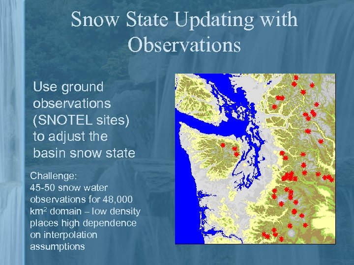 Snow State Updating with Observations Use ground observations (SNOTEL sites) to adjust the basin snow state Challenge: 45 -50 snow water observations for 48, 000 km 2 domain – low density places high dependence on interpolation assumptions
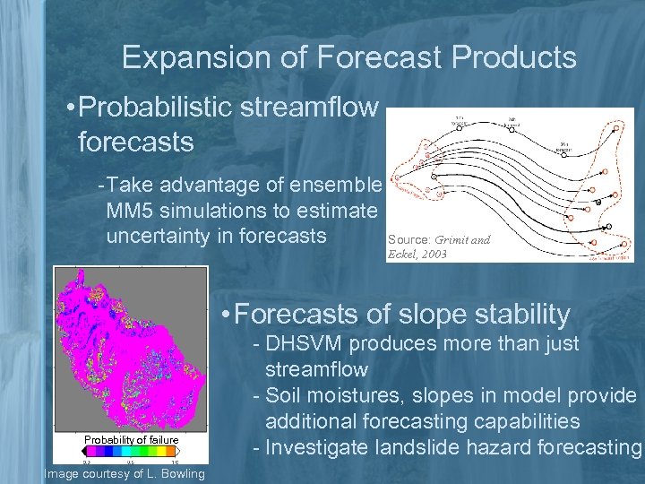 Expansion of Forecast Products • Probabilistic streamflow forecasts ‑Take advantage of ensemble MM 5 simulations to estimate uncertainty in forecasts Source: Grimit and Eckel, 2003 • Forecasts of slope stability Probability of failure Image courtesy of L. Bowling ‑ DHSVM produces more than just streamflow ‑ Soil moistures, slopes in model provide additional forecasting capabilities ‑ Investigate landslide hazard forecasting
 Summary • UW Hydrometeorological Forecast System provides accurate streamflow and snowpack predictions when forced with accurate meteorology and when properly initialized • Improvements in both initialization and meteorological forecasts are ongoing, by analyzing current flood events and retrospective analysis • The capabilities of the system are being expanded to include both probabilistic forecasts using ensembles, and to include landslide hazard evaluation
 Acknowledgments
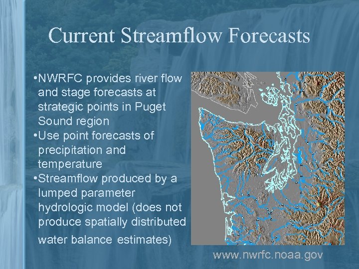 Current Streamflow Forecasts • NWRFC provides river flow and stage forecasts at strategic points in Puget Sound region • Use point forecasts of precipitation and temperature • Streamflow produced by a lumped parameter hydrologic model (does not produce spatially distributed water balance estimates) www. nwrfc. noaa. gov
 Original Motivation for Developing UW Hydromet System • Integrated modeling over a variety of spatial and temporal scales to examine: – Regionally consistent modeling of weather and land surface hydrology, avoid site-specific calibration – Capture topographically-driven spatial variation in precipitation, temperature, and wind fields – Produce experimental streamflow forecasts to investigate skill in a coupled model setting • Use hydrometeorological forecasts as a diagnostic tool for mesoscale atmospheric model


