

d043de0a607e7a817a117e2f52622f1d.ppt
- Количество слайдов: 42
 Fire. CAMMS Fire Consortia for Advanced Modeling of Meteorology and Smoke www. fs. fed. us/fcamms
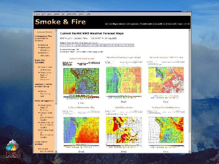
 www. atmos. washington. edu/pnw_environ Smoke and Fire Weather observations/forecasts, fire danger, and smoke dispersion for the Northwest.
 Ready Access to High Resolution Weather Predictions
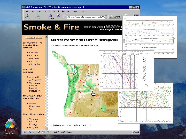
 Ready Access to High Resolution Weather Predictions
 Smoke Predictions MM 5 36 -km MM 5 12 -km UW Server Blue. Sky NFSpuff Personal PC SFSL “Beowulf” Cluster
 Ready Access to High Resolution Weather Predictions
 www. Blue. Sky. RAINS. org
 Blue. Sky Smoke Modeling Framework What can it do? Wildfire Wildland Fire Use - Quartz Complex - Potential 500 ac/day
 Blue. Sky Smoke Modeling Framework What can it do? Biscuit Fire
 www. Blue. Sky. RAINS. org
 Blue. Sky Smoke Modeling Framework What can it do? Prescribed Fires
 Blue. Sky Smoke Modeling Framework What can it do? Prescribed Fires
 Blue. Sky Smoke Modeling Framework What can it do? Prescribed Fires
 Blue. Sky Smoke Modeling Framework What is it? • Daily Emission tracking • Real-time Smoke predictions • Quantitative Verification • Automated, centralized processing • Community model development
 Blue. Sky Development Community Federal Land Managers - USDA Forest Service (PNW, R 6, R 1, RMRS) - Bureau of Land Management (WA, OR, MT) - National Park Service - Fish and Wildlife Service Federal Air Agencies - NOAA (NWS, ARL) - Environmental Protection Service (R 10) Tribal Nations - Colville - Quinault - Nez Perce States - Oregon (ODF, DEQ) - Washington (DNR, DE) - Idaho (DEQ) - Montana (DEQ) Universities - U. of Washington - Washington State U. - U. of Montana Local Air Agencies - Missoula City-County Health Department - Puget Sound Clean Air Agency Private - CH 2 MHill - Air Sciences - 3 -Tier
 Blue. Sky Smoke Modeling Framework How does it work? Source Characteristics MM 5 FASTRACS CALMM 5/CALMET Emissions EPM/CONSUME v 1. 02 MM 52 ARL CALMET 2 net. CDF EPM 2 BAEM CALPUFF HYSPLIT CALPUFF 2 net. CDF PAVE Animations Preliminary Blue. Sky web page Blue. Sky Linux System Burn Report Display Dispersion Time Series Display Arc. IMS (SDE, SQLserver) Blue. Sky. RAINS Windows System CALPUFF/Arc. IMS Linkage (net. CDF 2 SHP (? )) TRAJREAD Output Products Weather
 Blue. Sky Smoke Modeling Framework Source Characteristics Prescribed Fire • Planned for next day • Planned for 2 nd day • Accomplished today Wildfire • MM 5 -FARSITE-Burn. Up • Diurnal-Consume-EPM • Theoretical Scenario
 Blue. Sky Smoke Modeling Framework Input Requirements 1. 2. 3. 4. 5. 6. 7. Date of burn Location Time of ignition Ignition duration Burn area Preburn fuel load Predicted fuel moisture
 Blue. Sky Smoke Modeling Framework Input Requirements 1. 2. 3. 4. 5. 6. 7. a. b. c. d. e. Date of burn Location Time of ignition Ignition duration Burn area Preburn fuel load Predicted fuel moisture - MM 5 -NFDRS MT/ID Airshed Reports Wash. Ag. Reports PFIRS National Event Reports Remote Sensing a. CRB FCC b. NFDRS-FM + Cond. Class c. Land. Sum FCC
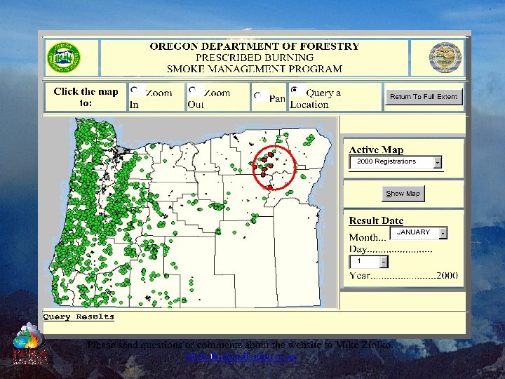
 Blue. Sky MODIS Observed Burns 24 April 2002 Wei Min Hao Missoula Fire Lab Accomplished Burns 24 April 2002 Mike Ziolko Oregon Dept. of Forestry
 Blue. Sky & Mesoscale Weather Pretty pictures. So what!
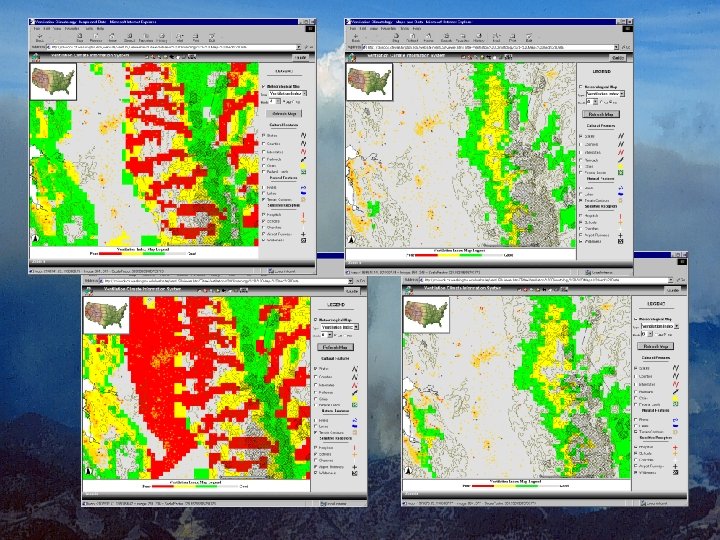
 Blue. Sky RAINS
 Blue. Sky. RAINS
 Blue. Sky. RAINS
 Blue. Sky. RAINS
 Blue. Sky. RAINS Verification Model output matched with observations Tethersonde measurements of particle and gas concentrations in a smoldering plume.
 www. Blue. Sky. RAINS. org www. fs. fed. us/Blue. Sky www. atmos. washington. edu/pnw_environ www. fs. fed. us/FCAMMS
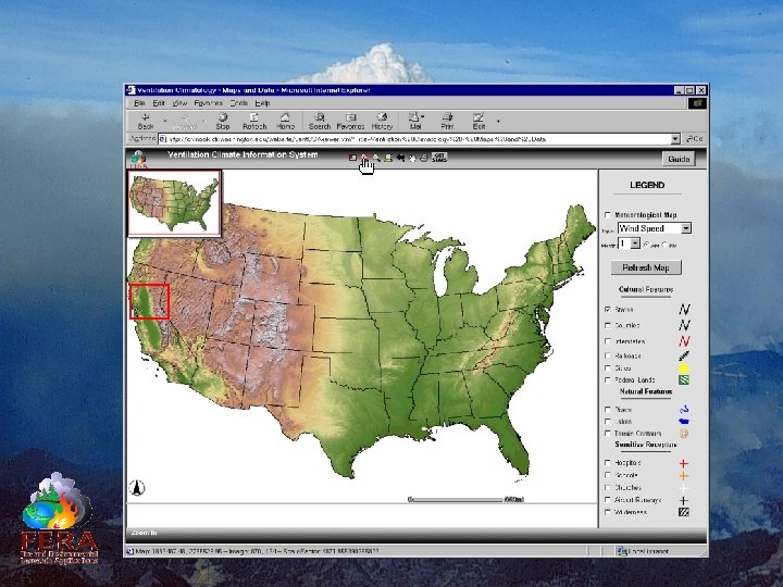
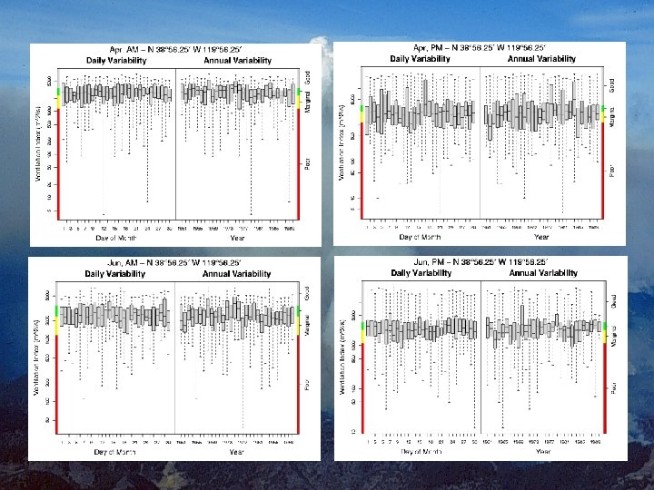
 0 -1175 -2350") Ventilation Climate Information System Mixing Height Ventilation Index Classification (m 2/s) 0 -1175 -2350 2351 -3525 > 3525 Poor Marginal Fair Good x Wind
Ventilation Climate Information System Mixing Height Ventilation Index Classification (m 2/s) 0 -1175 -2350 2351 -3525 > 3525 Poor Marginal Fair Good x Wind
 www. fs. fed. us/pnw/fera/vent
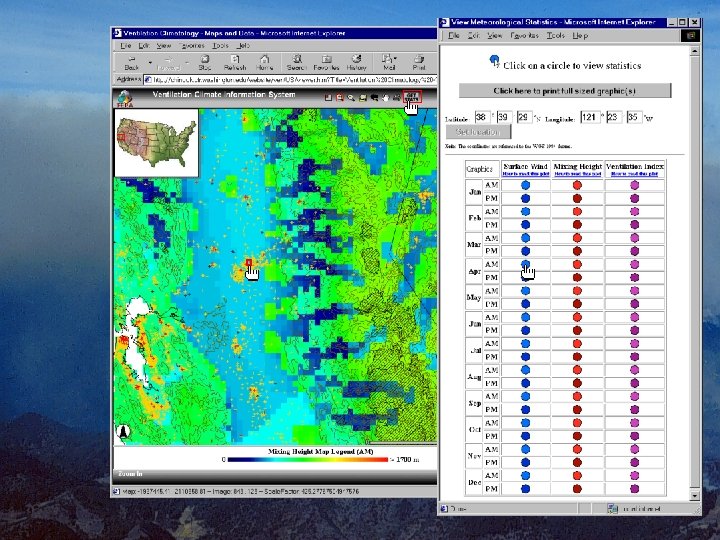
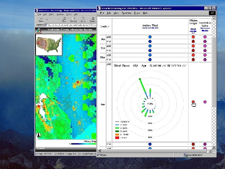
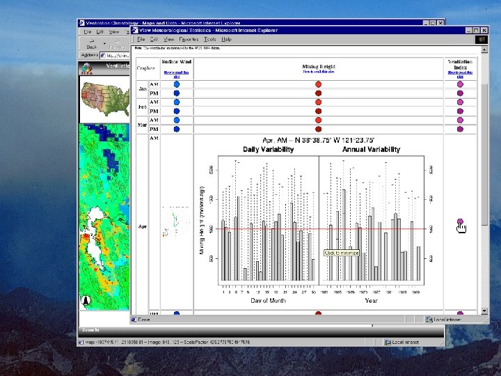
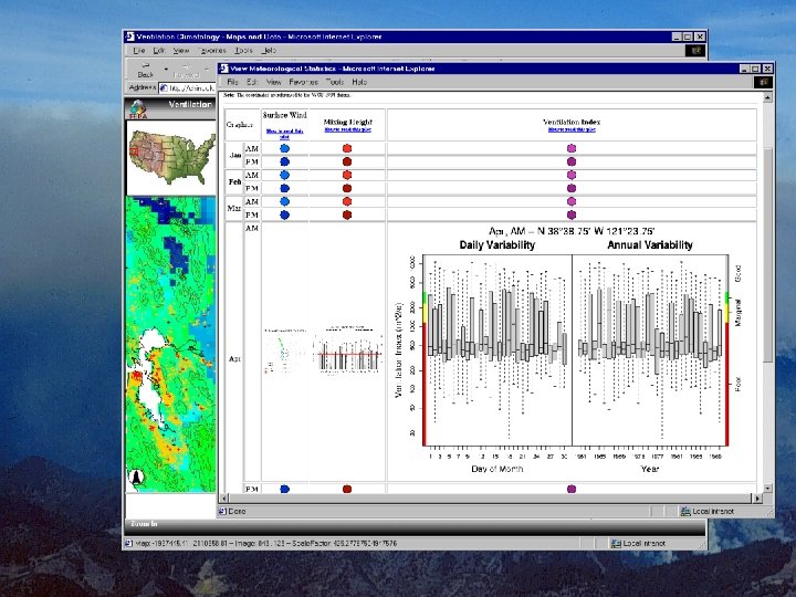
 Maps & Graphs

 Mesoscale Weather www. atmos. washington. edu/pnw_environ A “go/no-go/go-slow” operations tool. Blue. Sky. RAINS www. Blue. Sky. RAINS. org A “go/no-go/go-slow” operations tool. Ventilation Climate Information System www. fs. fed. us/pnw/fera/vent A probabilistic planning tool.