e2da61df1bfbf4dd040bf67d97df7b71.ppt
- Количество слайдов: 79

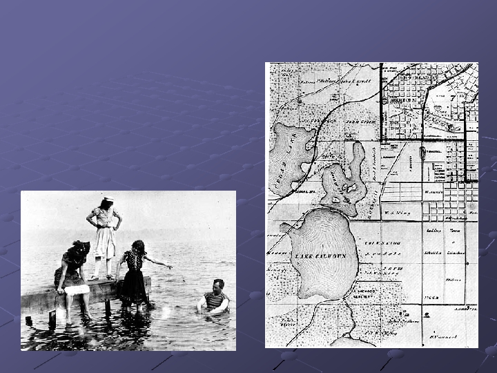
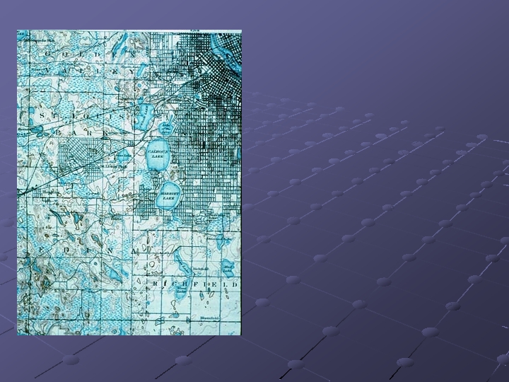
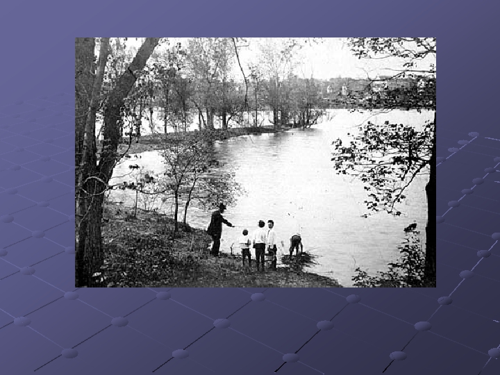
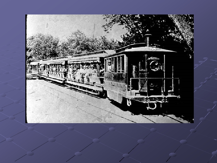
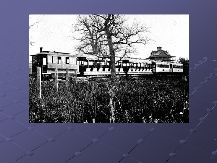
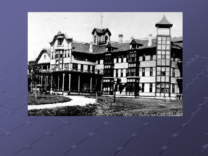
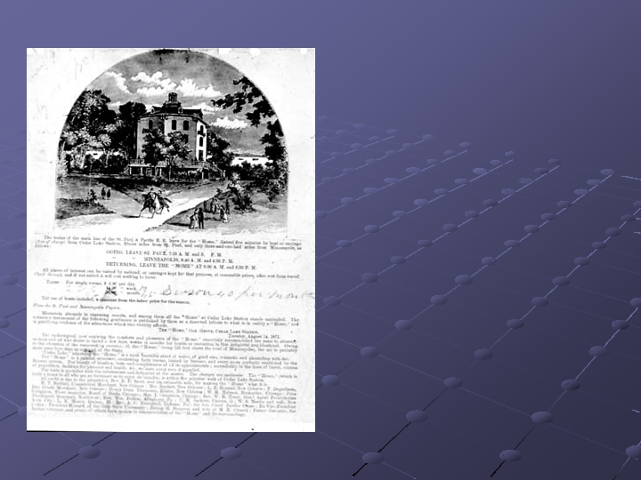
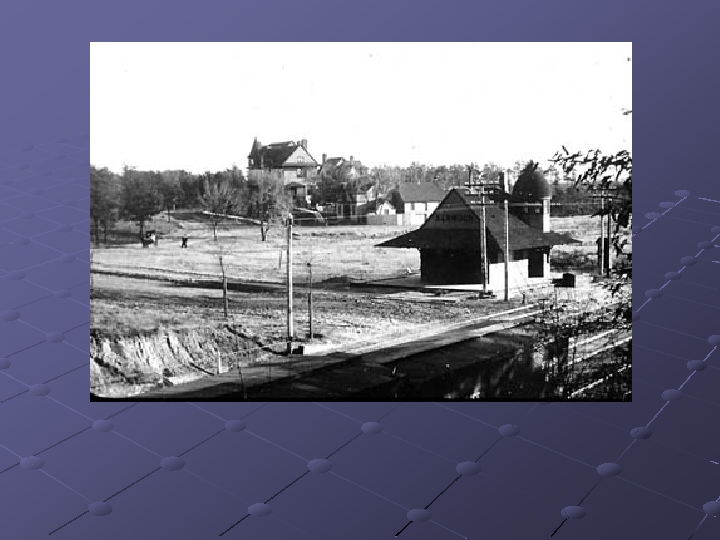
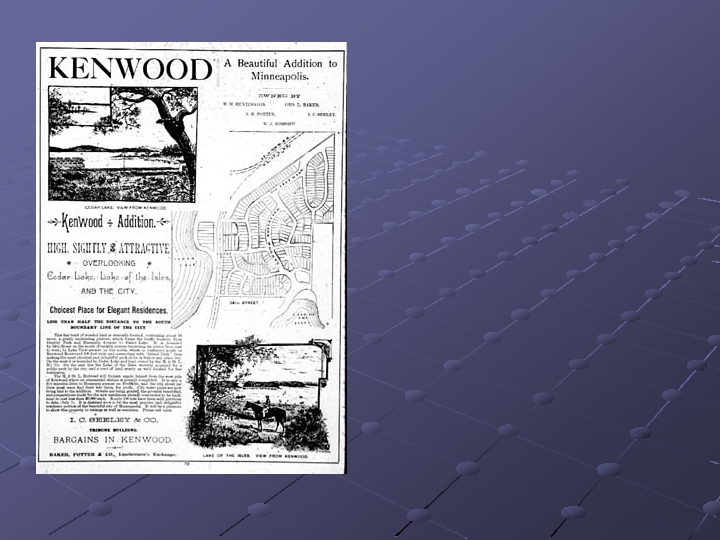
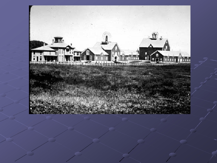
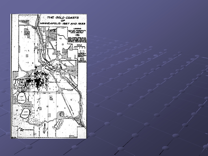
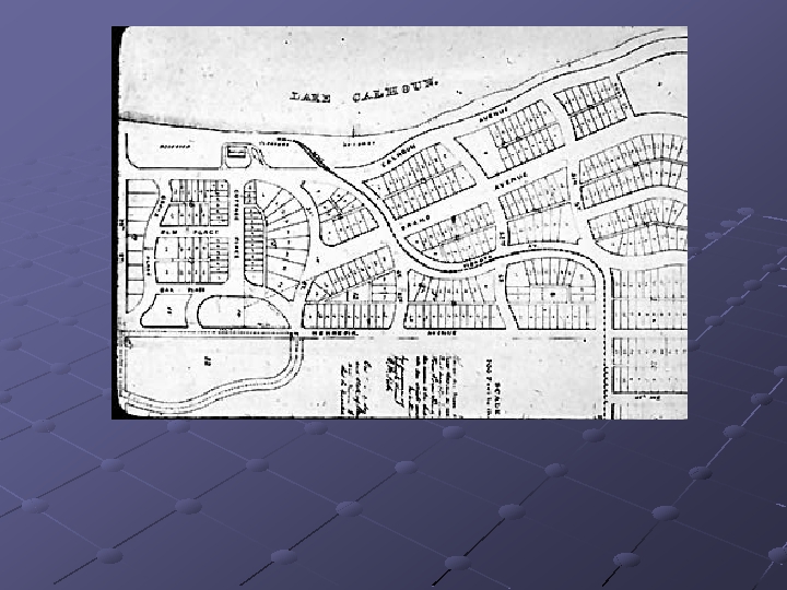
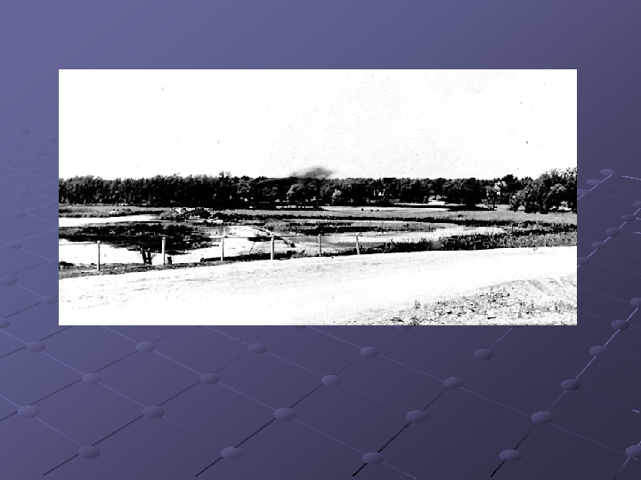
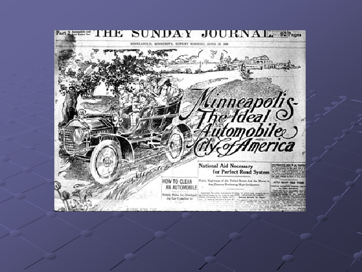
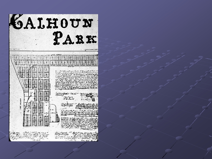
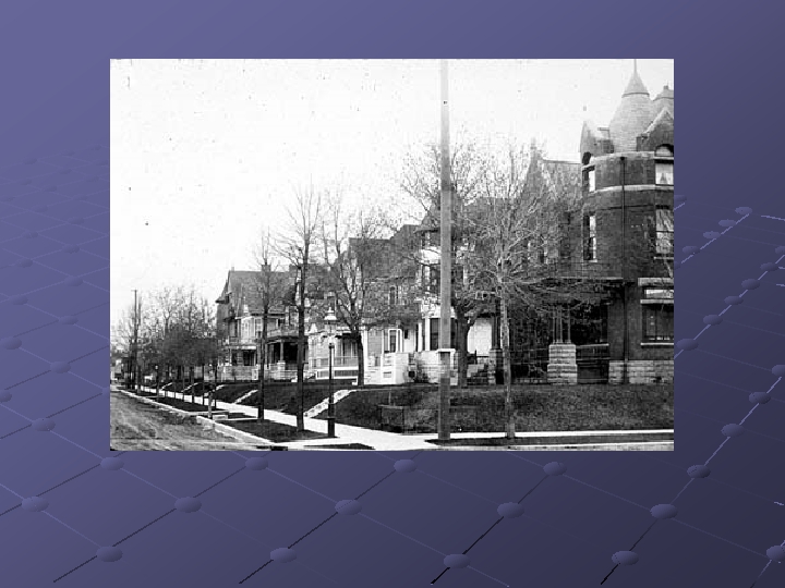
 Farmers and speculators purchased all the land in the Lake District during the years before the Civil War. Developers opened the northern and eastern sections of the district for middle class residents during the late 1860 s, but as the this map indicates, more of the land in the area was divided into large parcels owned by farmers and speculators. Many of the city's most famous early settlers engaged in land speculation in the district. John Green farmed land near the hill formerly called the Devil's Backbone. The large place to the west of Green's was owned by J. C. Goodrich, who was apparently a speculator. Thomas Lowery, founder of the Twin Cities' Streetcar system, owned land directly on the Devil's Backbone - later to be called Lowry Hill - along with his father-in-law C. G. Goodrich. The land fronting on Hennepin Avenue was divided into small parcels, but the large block fronting on the east side of Lake of Isles was owned by C. G. Goodrich in partnership with another. The southeastern shore of Lake of the Isles was owned by R. P. Russell, a New Englander who came west to seek his fortune in 1839. An active merchant and politician, Russell dabbled in many financial matters including lumber, milling, land developing and farming. The primary path of development in the city during the period was in the vicinity of the Washburns' estates south of Franklin and west of Portland Avenue. This growth pattern influenced other developers to plat "out lots" or suburban tracts beyond the city limits. Most of the area on Lyndale between Franklin and Lake was divided into lots at this time, and developments were established between Hennepin and Lyndale just north of the lake. However, this subdivision was well beyond the zone of active residential building. Most of the land in the district was owned by Colonel William S. King. His Lyndale Farm was the largest solely owned property in the history of Minneapolis. The west side of Lake Calhoun was owned by Louis Menage, so it is easy to see why he was willing to buy up King's debt and foreclose on the farm. We can also see the Cedar Lake station on the railroad, which brought tourists to the resort hotels on the lake. The Lakewood Cemetery is also indicated on the map, but was not yet established. Actually, planning had just begun on the cemetery when this map was published.