

e98bd284e03fe4c7f5ba2c7ddb240db2.ppt
- Количество слайдов: 86
 Extending GIS into the Humanities Karen K. Kemp University of Redlands kkkemp@earthlink. net
 The Information Technology Future “Information Technology will be one of the key factors driving progress in the 21 st century—it will transform the way we live, learn, work, and play” (PITAC Report - President's Information Technology Advisory Committee 1999) “I don’t think science, however, will be where we see the most dramatic impact. … Instead, I believe that a more dramatic transformation is about to shake the foundations of scholarship in the liberal arts. Humanists more than scientists will lead the way to innovative applications of the technology in the university. ” (William Wulf, President of US National Academy of Engineering, 1995)
 What is GIS? Geographic Information System an information system for geographic information an organized collection of computer hardware, software, data, and personnel designed to efficiently capture, store, update, manipulate, analyze, display all forms of geographically referenced information
 Geographic Information?
 Geographic Information?
 Geographic Information?
 Geographic Information?
 1. The LORD said") Numbers 34 The Bible Gateway. TM (http: //bible. gospel. com) 1. The LORD said to Moses, 2. "Command the Israelites and say to them: `When you enter Canaan, the land that will be allotted to you as an inheritance will have these boundaries: 3. "`Your southern side will include some of the Desert of Zin along the border of Edom. On the east, your southern boundary will start from the end of the Salt Sea, 4. cross south of Scorpion Pass, continue on to Zin and go south of Kadesh Barnea. Then it will go to Hazar Addar and over to Azmon, 5. where it will turn, join the Wadi of Egypt and end at the Sea. 6. "`Your western boundary will be the coast of the Great Sea. This will be your boundary on the west. 7. "`For your northern boundary, run a line from the Great Sea to Mount Hor 8. and from Mount Hor to Lebo Hamath. Then the boundary will go to Zedad, 9. continue to Ziphron and end at Hazar Enan. This will be your Geographic Information?
Numbers 34 The Bible Gateway. TM (http: //bible. gospel. com) 1. The LORD said to Moses, 2. "Command the Israelites and say to them: `When you enter Canaan, the land that will be allotted to you as an inheritance will have these boundaries: 3. "`Your southern side will include some of the Desert of Zin along the border of Edom. On the east, your southern boundary will start from the end of the Salt Sea, 4. cross south of Scorpion Pass, continue on to Zin and go south of Kadesh Barnea. Then it will go to Hazar Addar and over to Azmon, 5. where it will turn, join the Wadi of Egypt and end at the Sea. 6. "`Your western boundary will be the coast of the Great Sea. This will be your boundary on the west. 7. "`For your northern boundary, run a line from the Great Sea to Mount Hor 8. and from Mount Hor to Lebo Hamath. Then the boundary will go to Zedad, 9. continue to Ziphron and end at Hazar Enan. This will be your Geographic Information?
 Geographic Information in the Humanities Maps, including sketch maps Records about objects collected at archaeological sites referenced to a grid imposed over the area Business records from a trading company Traveler’s diary Agricultural land inventories …
 Is geographic information different? geographic data are spatially dependent locations are distributed over the curved surface of the earth geographic data has a spatial key with at least two continuous dimensions computers are discrete so data must be represented using discrete data models location is a universal integrator.
 Integration through location What’s here? Building – United Center District - xxx City – Hong Kong Land Parcel – CF 5403 Country - China Air temperature - 26 Elevation - 100 Wind speed - 5 Subtrate – fluvial deposits # people/sq m. average bags of oranges …
 Integration through location
 Geographic relationships Proximity Distance Adjacency Overlap Direction Scale Clusters Boundaries Neighborhoods …
 Distance
 Scale
Scale
 Proximity
 Neighborhoods
 Clusters
 Patterns
 Boundaries
 GIS application areas Environmental Management Archaeology Agriculture Forestry Transportation Utilities Banking and Insurance Real Estate Retail and Commercial Business Defense and Intelligence Telecommunications Education Pipeline Engineering Health and Human Services National Government State and Local Government Law Enforcement Public Safety International Development Humanitarian Relief
 The Humanities Art Religious Studies English Philosophy Asian Studies History Buddhist Studies Music History of Architecture Classics Literature Medieval Studies History of Cartography
 The Humanities focus on the preservation, transmission, and interpretation of the human record through study of historic documents and cultural objects WHEN is more important than WHERE but PLACE matters!
 Scholarship in the Humanities Traditionally solitary and reflective Rely on multiple sources Primitives of Humanists’ methods Discovering Annotating Comparing Referring Sampling Illustrating Representing The Scientific Method • Observe • Build hypothesis and make predictions • Confirm predictions with experiment • Collect and analyse data • Repeatability • Teamwork Serendipity is important
 How can IT help Humanities Scholarship? Provide global access to unique artifacts and other cultural resources Searchable transcripts plus images of any and all documents, letters, diaries, etc. Searchable databases which maintain the identities of individuals comprising entire populations rather than samples Virtually bring together related artifacts which now exist in dispersed archives Relate artifacts and evidence of many different types (textual, visual and numeric) through common keys such as time and geography
 What does GIS offer? CONTEXT! “GIS heightens awareness of the physical impact of places and regions on the structure of human society” But is it: GIS or Geographic Information or Geography?
 “GIS” uses in the Humanities Geography as a means of indexing archives Geography as a means of structuring data collection Geography as a means of integrating artifacts, ideas, texts, etc. Geography as context Spatial relationships in the Humanities Spatial analysis for the Humanities Virtual worlds for the Humanities GIScience in the Humanities research process
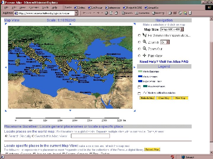
 Geography as a means of indexing archives The Perseus Project www. perseus. tufts. edu
 Geography as a means of structuring data collection Plain of Jars, UNESCO Mapping Genocide, UNSW Change in S. India, Curtin Uni.
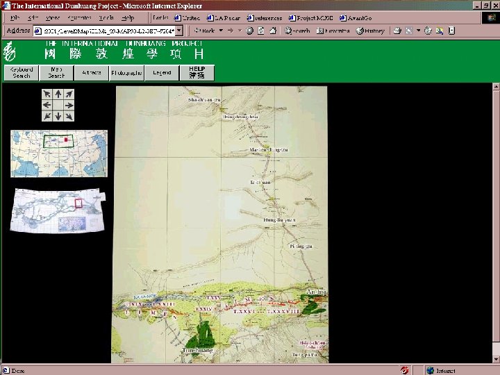
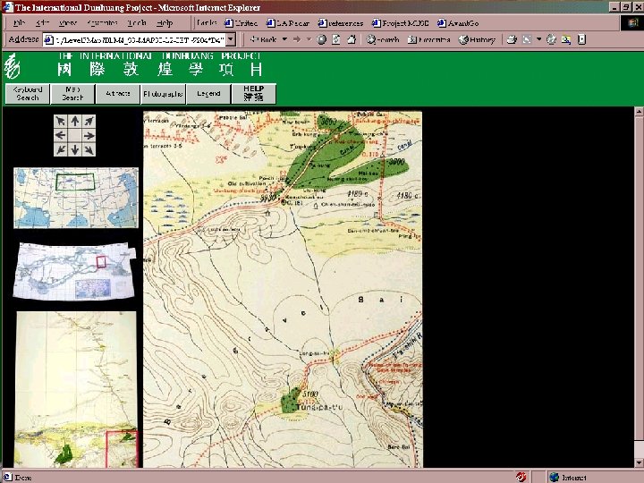
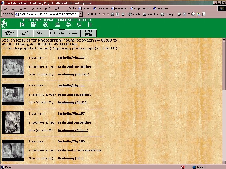
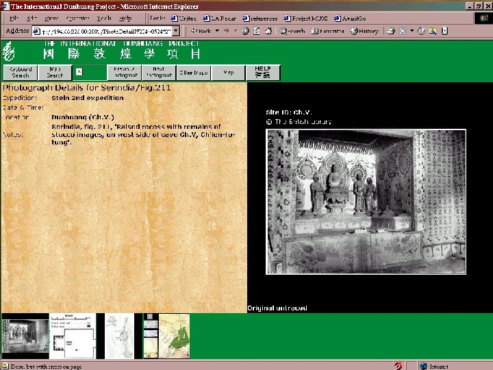
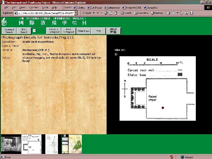
 Geography as a means of integrating artifacts, ideas, texts, etc. The International Dunhuang Project The British Library idp. bl. uk
 Dunhuang Project
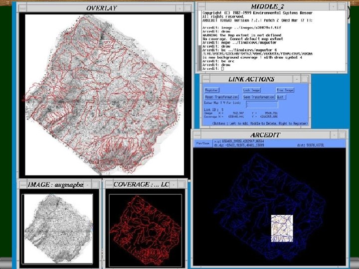
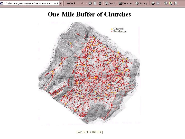
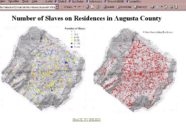
 Geography as context Valley of the Shadow Project University of Virginia jefferson. village. virginia. edu/vshadow 2
 Valley of the Shadow
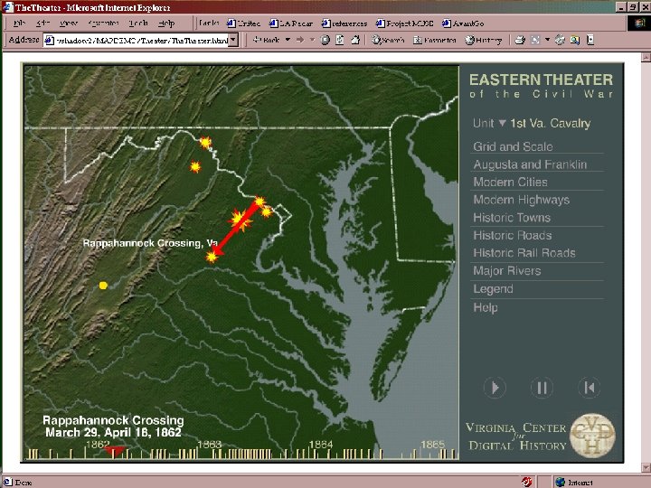
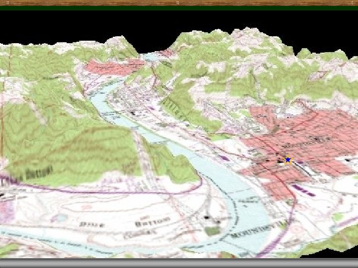
 The Valley of the Shadow Project a hypermedia archive of thousands of sources for the period before, during, and after the Civil War for Augusta County, Virginia, and Franklin County, Pennsylvania sources include newspapers, letters, diaries, photographs, maps, church records, population census, agricultural census, and military records. all integrated into a single spatial framework “the Valley's GIS project puts the people back into their houses and businesses”.
 Spatial Framework for the Valley Project Hotchkiss map contains c. 2000 named dwellings, places associated with family names locates people in the county, not simply treats them as undifferentiated residents of the county
 The Dwelling of Cease Magnus Occupant: Cease Magnus Owner: Robert G. Bickle Fire Insurance Policy Number and Building: 21006 A Location: South Side of Main St. Border: Gabriel Hirsh on West; Kelly on East Building Value: $1800 Total Policy Value: $1800 Building Type: Dwelling and Confectionary House Description: Brick walls, tin roof, 41 x 21, 2 stories Add newspapers, letters, diaries, photographs, maps, church records, population census, agricultural census, military records, …
 Spatial relationships in the Humanities Hartwell Database, Harvard Print Culture Studies Fiona Black, Dalhousie University, Canada
 The Hartwell database Robert M. Hartwell, Harvard University, was the first influential social historian of middle period Chinese history. Worked for many years to create a database detailing the careers and kinship networks of 25, 000 mainly Song dynasty officials Also devised a geographic framework for this data based on modern “counties” and produced an early GIS-style viewer.
 - the household population in") Shows: - the seven counties of Wu (mod. Jinhua) - the household population in 1290 as a dotmap, and - color scaled representation of the Song through mid. Qing jinshi degree holders by county
Shows: - the seven counties of Wu (mod. Jinhua) - the household population in 1290 as a dotmap, and - color scaled representation of the Song through mid. Qing jinshi degree holders by county
 Print Culture Studies moving “from examining a relatively static geography of book production to investigating the dynamic spatial history of the multifaceted concept of print culture” spatio-temporal factors include massive migrations advancements in transportation major strides in education and rise in literacy levels mobility of agents of print culture (printers, sellers, etc. ) spread of newspapers affecting political opinion

 Spatial Questions for Book Culture
 Spatial Analysis for the Humanities
 What is spatial analysis? A set of techniques whose results are dependent on the locations of the objects being analyzed Move the objects, the results change E. g. move the people, the US Center of Population moves E. g. move the people, the average income does not change In contrast, most traditional statistical techniques are invariant under changes in location SAS, SPSS, etc.
 A few spatial analysis techniques Point pattern analysis Spatial interpolation Cluster analysis Least-cost path Multiple criteria evaluation for site selection Inverse distance weighted Probability surface generation Kriging Space-time autoregressive moving average Gap analysis Cellular automata Spatial autocorrelation indices Visibility analysis
 Viewsheds
 Boundaries
 Boundaries
 Interpolation
 Spatial Analysis for the Humanities Spatio-temporal analysis?
 Spatio-temporal interpolation Archaeology Computing Lab University of Sydney
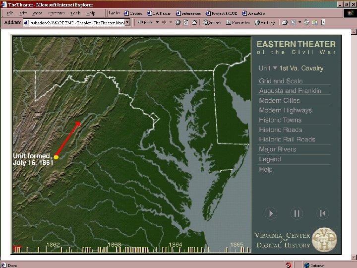
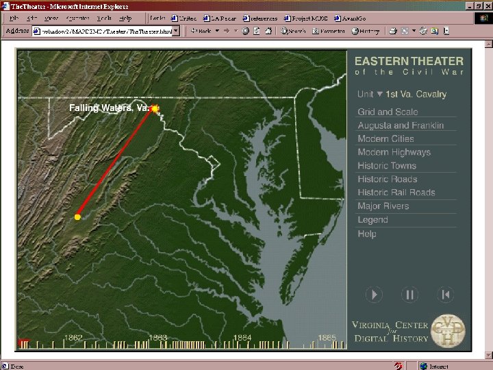
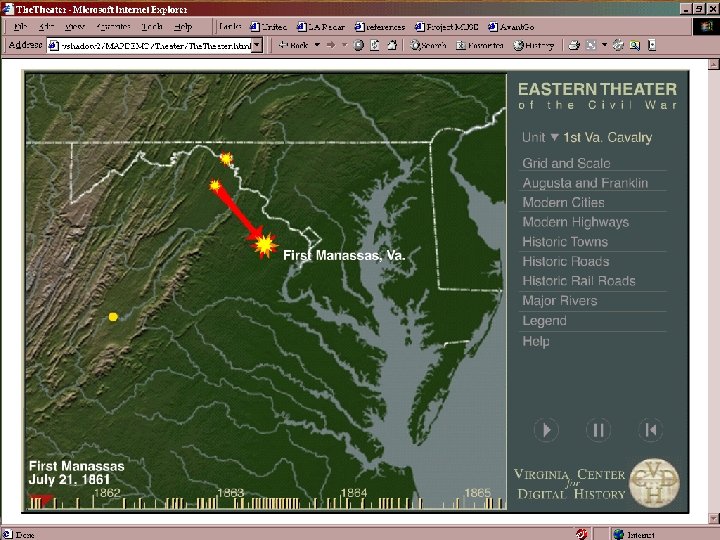
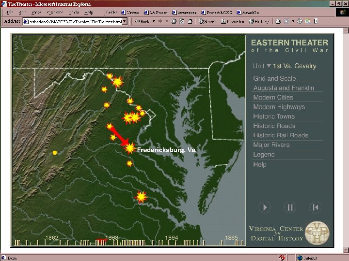
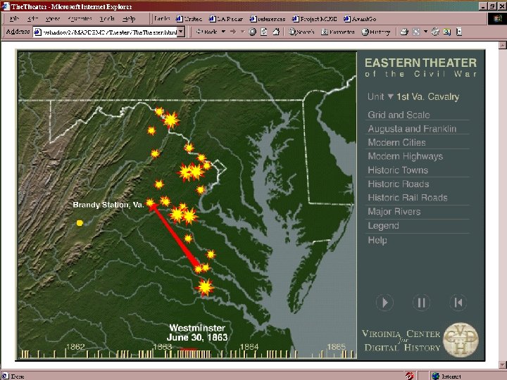
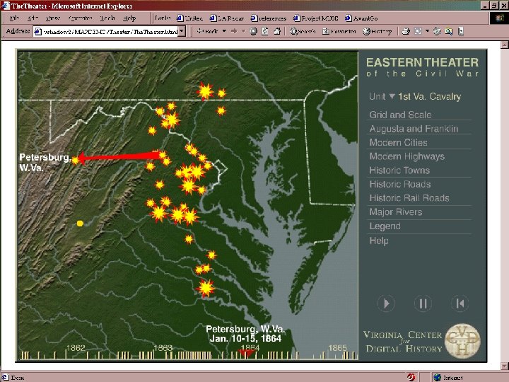
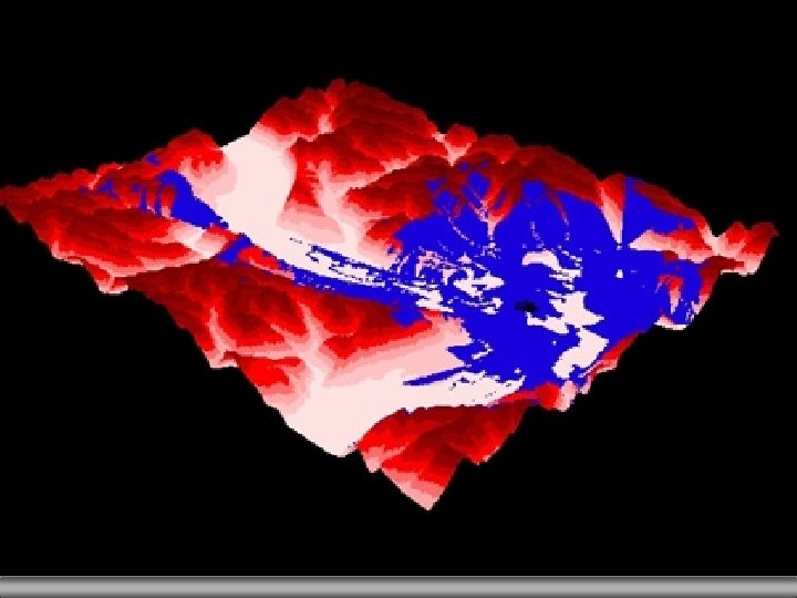
 Geo. Visualization Virginia Center for Visual History University of Virginia jefferson. village. virginia. edu/vshadow 2

 Virtual worlds for the Humanities Grave Creek Mound Study West Virginia University
 GIScience in Humanities research Examining the role of place and geographic context Seeing one’s own discipline from a new perspective Merging and modifying formal methods
 What does a geographic perspective offer? maps reveal dimensions no other mode of analysis does growing general awareness of the importance of geography in constraining and enabling social structures maps and geographic references in text are largely unmined historical data the geographic perspective: challenges old assumptions suggests new alternatives to traditional methodologies promotes exploitation and understanding of new kinds of evidence
 What does Geography/GIS/GI give? “The electronic ordering of data with GIS software accordingly arms the researcher with a weapon with which to resist the obedience commanded by established traditions of historiography, or anthropological debate, or kindred traditions which, because of their volume and gravity, relentlessly pull the trajectory of scholarly investigations into themselves and, like death stars, inexorably consume their light. ” Dr. John Corrigan, PNC conference, January 2001
 “GIS” uses in the Humanities Geography as a means of indexing archives Geography as a means of structuring data collection Geography as a means of integrating artifacts, ideas, texts, etc. Geography as context Spatial relationships in the Humanities Spatial analysis for the Humanities Virtual worlds for the Humanities GIScience in the Humanities research process
 BUT what does it take to extend GIS to the Humanities? ? ?
 Problems for the Humanities using GIS is fundamentally quantitative, but the Humanities are traditionally qualitative “if quantitative data is privileged, facts rather than understanding may dominate” Culturally-defined conceptions of space and place are rich in meaning centers, peripheries and parallel worlds non-Euclidian realities
 “Adding” GIS to the Humanities Is there “data” in the Humanities? Is there “spatially referenced data” in the Humanities? What kind of “geography” do these scholars use? What does “where” mean to them?
 Humanities Data Challenges Making qualitative information quantitative Place Relating places to geography - Gazetteers Multiple relevant locations, multiple representations Mythical or conceptual space Time Locations and names of places change, boundaries move Movement of people, ideas, goods, values, power, class Spatio-temporal gazetteers
 Problems for GIS in the Humanities Specifying location Creating a stable spatio-temporal framework for the world Building spatio-temporal analysis tools for the Humanities.
 Uncertainty in Humanities data Arise from Different observers Variable accuracy and type of measurements Levels of detail Conceptual frameworks Incomplete and missing information
 used in the Humanities essentially different") Interesting questions Are the conceptual data models (ontologies) used in the Humanities essentially different from the Sciences? Does the computer interface change the way Humanities scholars do research, understand the world? How can the visualization, data storage and computation capabilities of GIS change scholarship in the Humanities? How can the emerging “object technology” be used to represent spatio-temporal objects?
Interesting questions Are the conceptual data models (ontologies) used in the Humanities essentially different from the Sciences? Does the computer interface change the way Humanities scholars do research, understand the world? How can the visualization, data storage and computation capabilities of GIS change scholarship in the Humanities? How can the emerging “object technology” be used to represent spatio-temporal objects?
 What’s needed to make this work? ? Education! Collaboration International and interdisciplinary collaboration Building bridges between the Humanities and the Sciences Infrastructure Best practices, standards, education Initiatives such as The Electronic Cultural Atlas Initiative (www. ecai. org)
 The moral of the story Keep the Humanity in the Humanities Use GIS to develop new insights and knowledge, as a tool for exploration But do not lose sight of the old methods Do not make “work arounds”—work hard to understand resolve incompatibilities between the traditions and the technology.
 Extending GIS into the Humanities Karen K. Kemp University of Redlands kkkemp@earthlink. net