b237dda49da3d6ab357c8876ce279cba.ppt
- Количество слайдов: 29


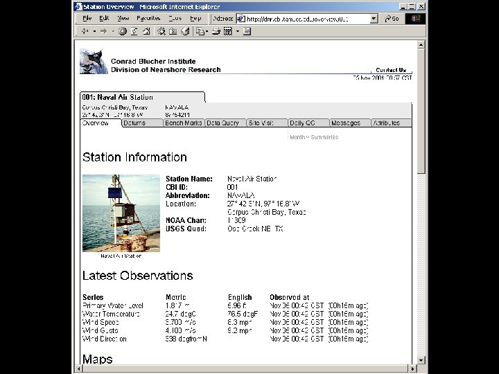
Division of Nearshore Research Texas Coastal Ocean Observation Network Dr. Gary Jeffress Mr. James Rizzo October 2003

Division of Nearshore Research Projects n Texas Coastal Ocean Observation Network n n n n NOAA/NOS Natl Water Level Obs Network Houston/Galveston PORTS National/Global Ocean Observing System TWDB Intensive Surveys Nueces Bay Salinity Project Corpus Christi Real-Time Navigation System CMP - Neural-Network Forecasting CMP - Waves

TCOON Overview n n n Started 1988 Over 50 stations Primary Sponsors n n General Land Office Water Devel. Board US Corps of Eng Nat'l Ocean Service Gulf of Mexico

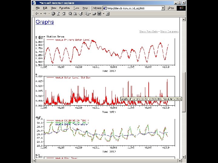
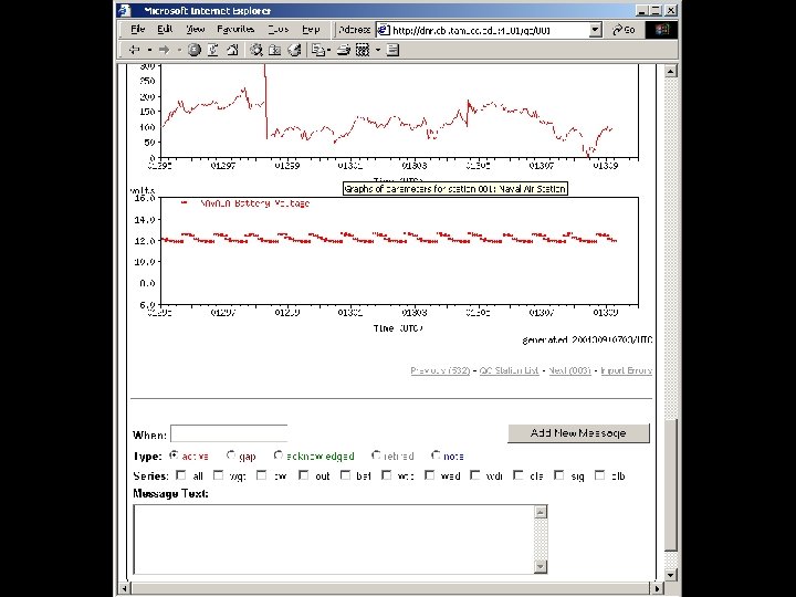
TCOON Overview n Measurements n n n Precise water levels Wind Temperature Barometric pressure Follows NOAA/NOS standards Real-time, online database

Typical TCOON Station n n n n Wind anemometer Radio antenna Satellite transmitter Solar panels Data collector Water level sensor Water quality sensor Current meter

Nueces Bay Salinity Project n n n Started 1991 Informs data management officials of opportunities to avoid water releases Water quality data collected every 30 minutes

Other Real-time Systems n Real-time navigation n n Port of Corpus Christi Port Freeport NOAA PORTS Offshore weather

Data Collection Paths

Uses of DNR/TCOON Data n n n n Tidal datums Littoral boundaries Oil-spill response Navigation Storm preparation/ response Water quality studies Research

Tidal Datums n Used for n n n Coastal property boundaries Nautical charts Bridge and engineering structures

Tidal Datum Schematic

Research n n n Real-time automated data processing Tidal datum processing Web-based visualization and manipulation of coastal data Neural network based forecasts from realtime observations Specialized sensor and data acquisition system development Support for other research efforts
enter the Gulf… …what will happen next?")
Water Level Forecasting Isidore begins to (re-)enter the Gulf… …what will happen next?

Tide Predictions Tide The periodic rise and fall of a body of water resulting from gravitational interactions between Sun, Moon, and Earth. Tide and Current Glossary, National Ocean Service, 2000 According to NOS, changes in water level from non-gravitational forces are not “tides”.

Prediction vs. Observation It’s nice when it works…

Prediction vs. Observation …but it often doesn’t work in Texas

Water Level != Tide In Texas, meteorological factors have a significant effect on water elevations.

Uses of Harmonic Predictions However, harmonic predictions can still be useful! Consider… Isidore begins to (re-)enter the Gulf… …what will happen next?

Uses of Harmonic Predictions If we add harmonic prediction… …what will happen next?

Uses of Harmonic Predictions landfall

Harmonic Water Level Predictions Present Capabilities n n Automated system for computing harmonic constituent values from observations database Harmonic predictions available via query page for many TCOON stations
 Future Capabilities n Persistent model forecast n n Apply difference")
Water Level Prediction (Near) Future Capabilities n Persistent model forecast n n Apply difference between latest observation and harmonic prediction to future predictions Forecasts page on DNR web site n Obtain forecasts from different models n n n n Harmonic predictions Persistent model Neural-network model Linear-regression/statistical model Hybrid models Information about water-level forecasting methods Statistics on previous forecasts

Neural Network Forecasting n n Use neural network to model non-tidal component of water level Reliable short-term predictions CCNAS ANN 24 -hour Forecasts for 1997 (ANN trained over 2001 Data Set)

Forecasts in Storm Events CCNAS ANN 12 -hour Forecasts During 1998 Tropical Storm Frances (ANN trained over 2001 Data Set)

Harmonic Analysis NN Model, 24 Hr prediction

Conclusions n n n Long-term, data-rich observation network Web-based infrastructure for automated collection and processing of marine data Research in datum computation and coastal forecasting
b237dda49da3d6ab357c8876ce279cba.ppt