c995cdb528d5825c1d171f8a346c4769.ppt
- Количество слайдов: 14
 Cooperative Research Program Ingrid Guch Co. RP Symposium August 2006
 NOAA/NESDIS Cooperative Research Program • NOAA’s Center for Satellite Applications and Research (STAR) has teamed with academic partners across the country via four Cooperative Institutes and one Cooperative Center. • CIRA @ Colorado State University • CIMSS @ University of Wisconsin • CIOSS @ Oregon State University • CICS @ University of Maryland • CREST – consortium of universities managed by CUNY • Three branches of STAR are in the Cooperative Research Program and collocated with a Cooperative Institute • The Regional and Mesoscale Meteorology Branch at CIRA/CSU • The Advanced Satellite Products Branch at CIMSS/UW • The Satellite Climate Studies Branch at CICS/UM
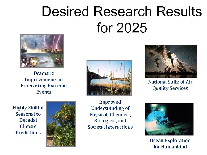 Desired Research Results for 2025 Dramatic Improvements in Forecasting Extreme Events Highly Skillful Seasonal to Decadal Climate Predictions National Suite of Air Quality Services Improved Understanding of Physical, Chemical, Biological, and Societal Interactions Ocean Exploration for Humankind
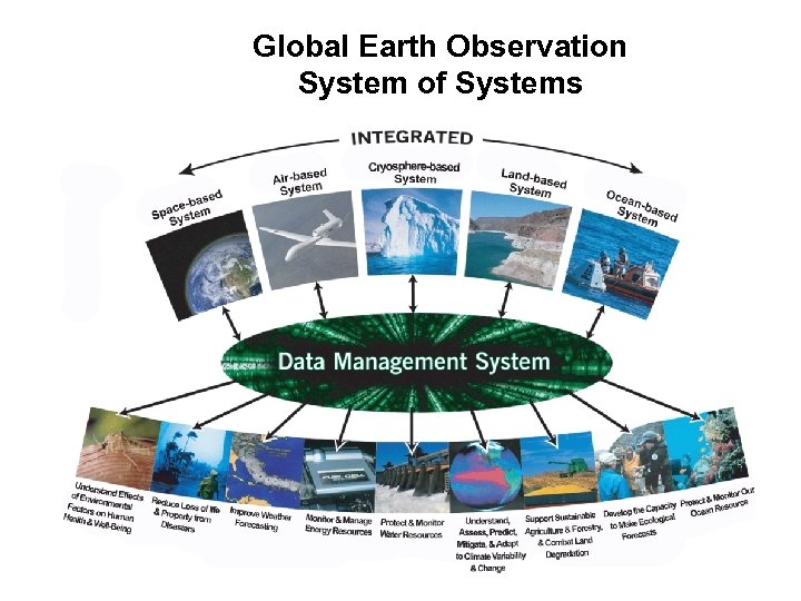 Global Earth Observation System of Systems
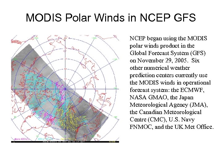 MODIS Polar Winds in NCEP GFS NCEP began using the MODIS polar winds product in the Global Forecast System (GFS) on November 29, 2005. Six other numerical weather prediction centers currently use the MODIS winds in operational forecast system: the ECMWF, NASA GMAO, the Japan Meteorological Agency (JMA), the Canadian Meteorological Centre (CMC), U. S. Navy FNMOC, and the UK Met Office.
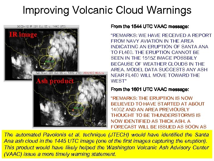 Improving Volcanic Cloud Warnings From the 1544 UTC VAAC message: IR image Ash product “REMARKS: WE HAVE RECEIVED A REPORT FROM NAVY AVIATION IN THE AREA INDICATING AN ERUPTION OF SANTA ANA TO FL 460. THE ERUPTION CANNOT BE SEEN IN THE 1515 Z IMAGE POSSBILY BECAUSE OF WEATHER CLOUDS IN THE AREA. MODEL DATA SUGGESTS ANY ASH NEAR FL 460 WILL MOVE TOWARD THE WEST” From the 1601 UTC VAAC message: “REMARKS: THE ERUPTION IS NOW BELIEVED TO HAVE STARTED AT ABOUT 1400 Z AND AN AREA PREVIOUSLY THOUGHT TO BE THUNDERSTORMS IS NOW IDENTIFIED AS THICK ASH. A FORECAST WILL BE ISSUED AS SOON AS POSSIBLE” The automated Pavolonis et al. technique (JTECH) would have identified the Santa Ana ash cloud in the 1445 UTC image (one of the first images capturing the eruption). This product would have likely helped the Washington Volcanic Ash Advisory Center (VAAC) issue a more timely warning statement.
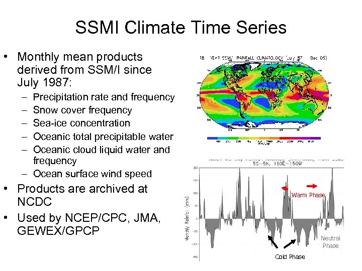 SSMI Climate Time Series • Monthly mean products derived from SSM/I since July 1987: – – – Precipitation rate and frequency Snow cover frequency Sea-ice concentration Oceanic total precipitable water Oceanic cloud liquid water and frequency – Ocean surface wind speed • Products are archived at NCDC • Used by NCEP/CPC, JMA, GEWEX/GPCP Warm Phase Neutral Phase Cold Phase
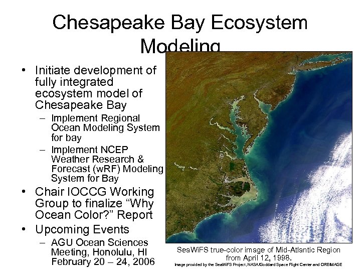 Chesapeake Bay Ecosystem Modeling • Initiate development of fully integrated ecosystem model of Chesapeake Bay – Implement Regional Ocean Modeling System for bay – Implement NCEP Weather Research & Forecast (w. RF) Modeling System for Bay • Chair IOCCG Working Group to finalize “Why Ocean Color? ” Report • Upcoming Events – AGU Ocean Sciences Meeting, Honolulu, HI February 20 – 24, 2006 Sea. Wi. FS true-color image of Mid-Atlantic Region from April 12, 1998. Image provided by the Sea. Wi. FS Project, NASA/Goddard Space Flight Center and ORBIMAGE
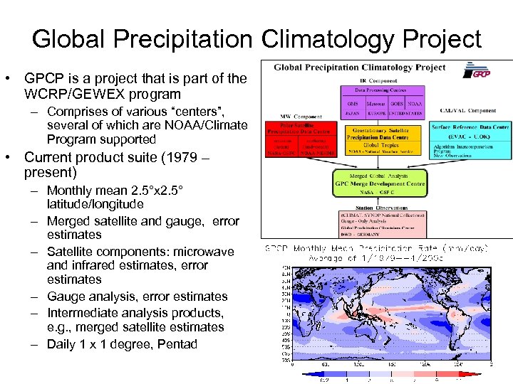 Global Precipitation Climatology Project • GPCP is a project that is part of the WCRP/GEWEX program – Comprises of various “centers”, several of which are NOAA/Climate Program supported • Current product suite (1979 – present) – Monthly mean 2. 5°x 2. 5° latitude/longitude – Merged satellite and gauge, error estimates – Satellite components: microwave and infrared estimates, error estimates – Gauge analysis, error estimates – Intermediate analysis products, e. g. , merged satellite estimates – Daily 1 x 1 degree, Pentad
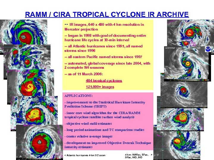 RAMM / CIRA TROPICAL CYCLONE IR ARCHIVE -- IR images, 640 x 480 with 4 km resolution in Mercator projection -- began in 1998 with goal of documenting entire hurricane life cycles at 30 -min interval -- all Atlantic hurricanes since 1995, all named storms since 1996 -- all eastern Pacific named storms since 1997 -- automated, global coverage since late 2004, with 2 complete SH seasons -- as of 15 March 2006: 464 tropical cyclones 125, 000+ images APPLICATIONS: - improvements to the Statistical Hurricane Intensity Prediction Scheme (SHIPS) - inner core wind algorithm for the CIRA/RAMM tropical cyclone satellite surface wind analysis - objective wind radii estimates - long period animations and TC comparison studies - center relative average images - development on improved Objective Dvorak Technique intensity estimates < Atlantic hurricanes 4 -km X 2 zoom 4 -km: NWPac, EPac, SPac, NIO, SIO >
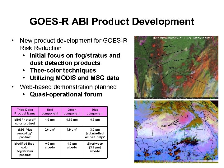 GOES-R ABI Product Development • New product development for GOES-R Risk Reduction • Initial focus on fog/stratus and dust detection products • Thee-color techniques • Utilizing MODIS and MSG data • Web-based demonstration planned • Quasi-operational forum Thee-Color Product Name Red component Green component Blue component MSG “natural” color product 1. 6 µm 0. 86 µm 0. 6 µm MSG “day snow-fog” product 0. 8 µm* 1. 6 µm* 3. 9 µm (solar/reflect ed part only)* Modified theecolor fog/stratus product 0. 6 µm albedo 1. 6 µm albedo Shortwave (3. 9 µm) albedo
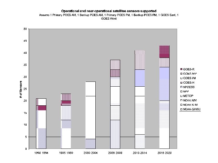
 Expected Data Growth


