af3528ea939ba35d6409d00ff2e89c89.ppt
- Количество слайдов: 41
 Chapter 10: Atmospheric Dynamics
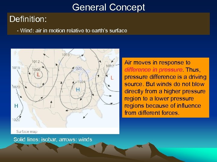 General Concept Definition: - Wind: air in motion relative to earth’s surface Air moves in response to difference in pressure. Thus, pressure difference is a driving source. But winds do not blow directly from a higher pressure region to a lower pressure regions because of influence from different forces. Solid lines: isobar, arrows: winds
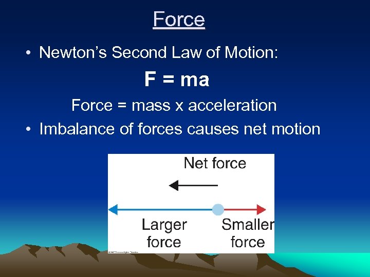 Force • Newton’s Second Law of Motion: F = ma Force = mass x acceleration • Imbalance of forces causes net motion
 Forces We Will Consider • Gravity • Pressure Gradient Force • Coriolis Force • Centrifugal Force / Centripetal Acceleration • Friction
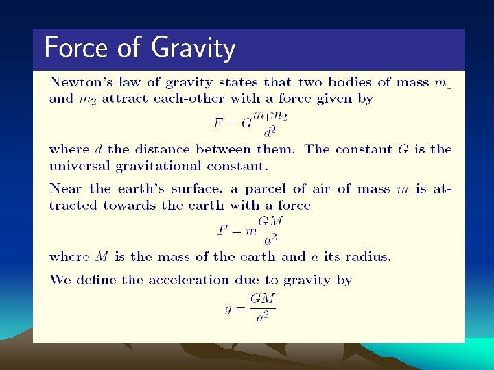 1. Gravitational Force

 2. Pressure Gradient Force • Gradient – the change in a quantity over a distance • Pressure gradient – the change in atmospheric pressure over a distance • Pressure gradient – the resultant net force due to the change in atmospheric pressure over a distance
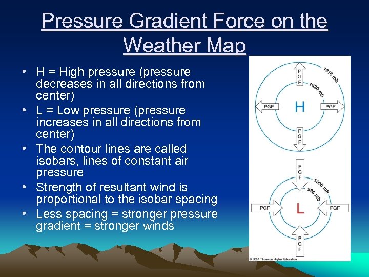 Pressure Gradient Force on the Weather Map • H = High pressure (pressure decreases in all directions from center) • L = Low pressure (pressure increases in all directions from center) • The contour lines are called isobars, lines of constant air pressure • Strength of resultant wind is proportional to the isobar spacing • Less spacing = stronger pressure gradient = stronger winds
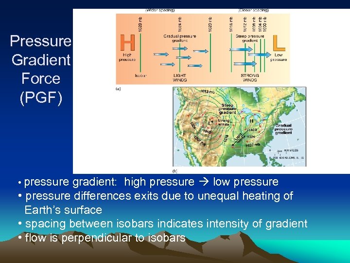 Pressure Gradient Force (PGF) • pressure gradient: high pressure low pressure • pressure differences exits due to unequal heating of Earth’s surface • spacing between isobars indicates intensity of gradient • flow is perpendicular to isobars
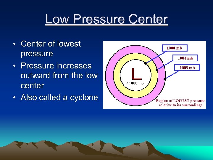 Low Pressure Center • Center of lowest pressure • Pressure increases outward from the low center • Also called a cyclone
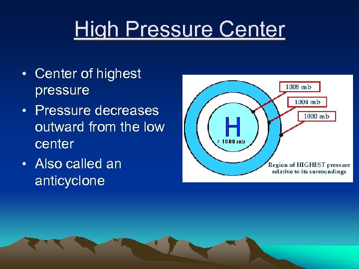 High Pressure Center • Center of highest pressure • Pressure decreases outward from the low center • Also called an anticyclone
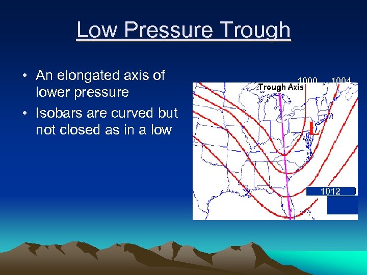 Low Pressure Trough • An elongated axis of lower pressure • Isobars are curved but not closed as in a low 1000 1004 1008 1012
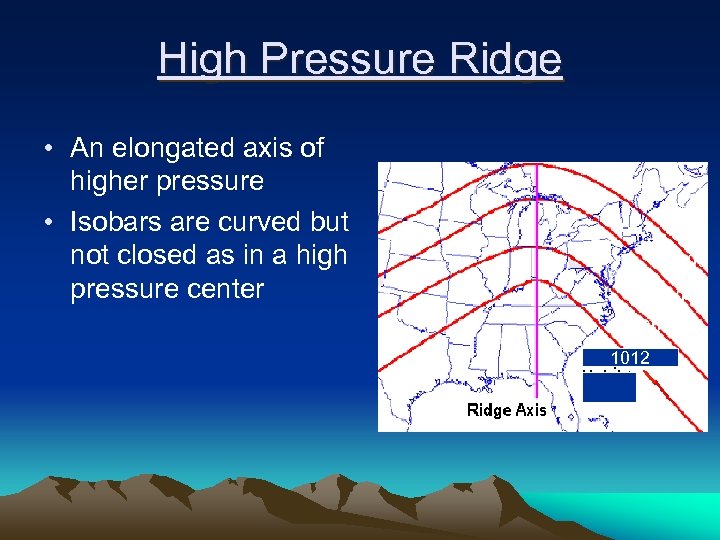 High Pressure Ridge • An elongated axis of higher pressure • Isobars are curved but not closed as in a high pressure center 1000 1004 1008 1012
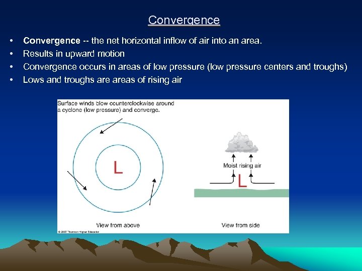 Convergence • • Convergence -- the net horizontal inflow of air into an area. Results in upward motion Convergence occurs in areas of low pressure (low pressure centers and troughs) Lows and troughs areas of rising air
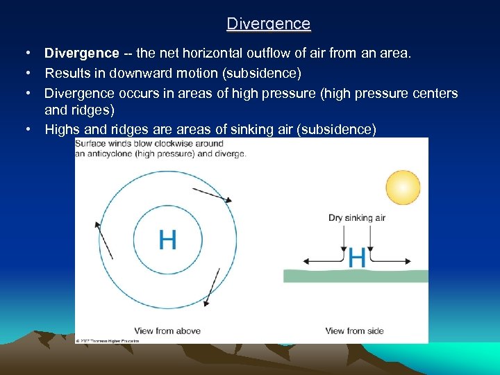 Divergence • Divergence -- the net horizontal outflow of air from an area. • Results in downward motion (subsidence) • Divergence occurs in areas of high pressure (high pressure centers and ridges) • Highs and ridges areas of sinking air (subsidence)
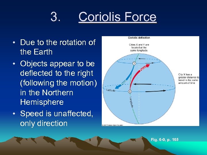 3. Coriolis Force • Due to the rotation of the Earth • Objects appear to be deflected to the right (following the motion) in the Northern Hemisphere • Speed is unaffected, only direction Fig. 6 -9, p. 165
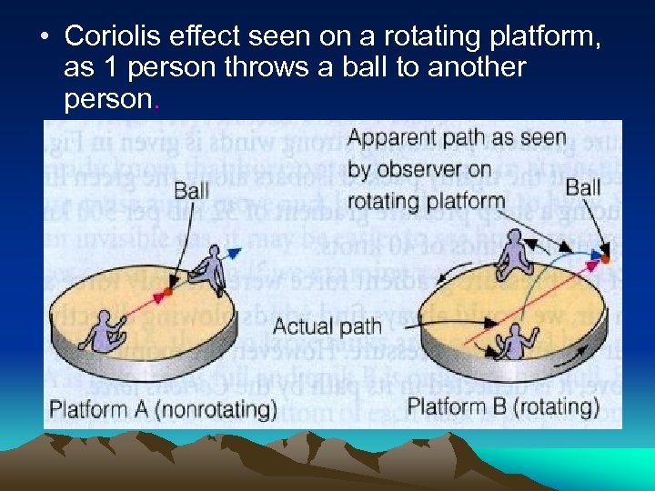 • Coriolis effect seen on a rotating platform, as 1 person throws a ball to another person.
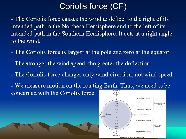 Coriolis force (CF) - The Coriolis force causes the wind to deflect to the right of its intended path in the Northern Hemisphere and to the left of its intended path in the Southern Hemisphere. It acts at a right angle to the wind. - The Coriolis force is largest at the pole and zero at the equator - The stronger the wind speed, the greater the deflection - The Coriolis force changes only wind direction, not wind speed. - We measure motion on the rotating Earth. Thus, we need to be concerned with the Coriolis force
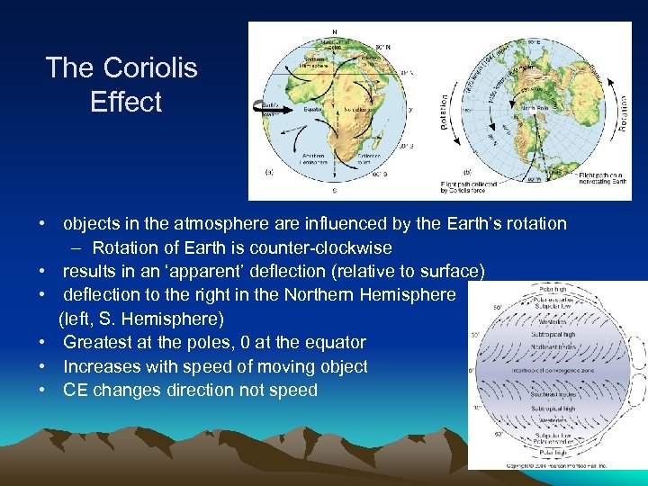 The Coriolis Effect • objects in the atmosphere are influenced by the Earth’s rotation – Rotation of Earth is counter-clockwise • results in an ‘apparent’ deflection (relative to surface) • deflection to the right in the Northern Hemisphere (left, S. Hemisphere) • Greatest at the poles, 0 at the equator • Increases with speed of moving object • CE changes direction not speed
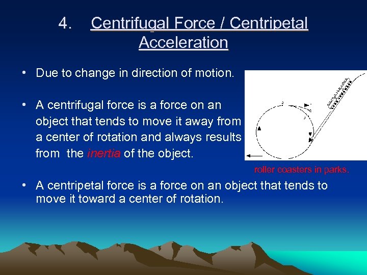 4. Centrifugal Force / Centripetal Acceleration • Due to change in direction of motion. • A centrifugal force is a force on an object that tends to move it away from a center of rotation and always results from the inertia of the object. roller coasters in parks. • A centripetal force is a force on an object that tends to move it toward a center of rotation.
 5. Friction • factor at Earth’s surface slows wind • Loss of momentum during travel due to roughness of surface • varies with surface texture, wind speed, time of day/year and atmospheric conditions • Important for air within ~1. 5 km of the surface, the planetary boundary layer • Because friction reduces wind speed it also reduces Coriolis deflection • Friction above 1. 5 km is negligible – Above 1. 5 km = the free atmosphere
 Atmospheric Force Balances • First, MUST have a pressure gradient force (PGF) for the wind to blow. • Otherwise, all other forces are irrelevant. • Already discussed hydrostatic balance, a balance between the vertical PGF and gravity. There are many others that describe atmospheric flow…
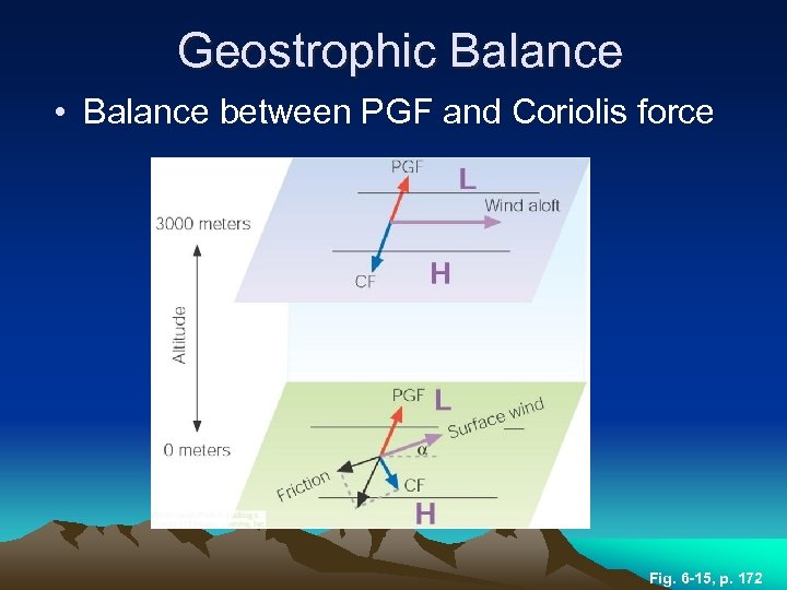 Geostrophic Balance • Balance between PGF and Coriolis force Fig. 6 -15, p. 172
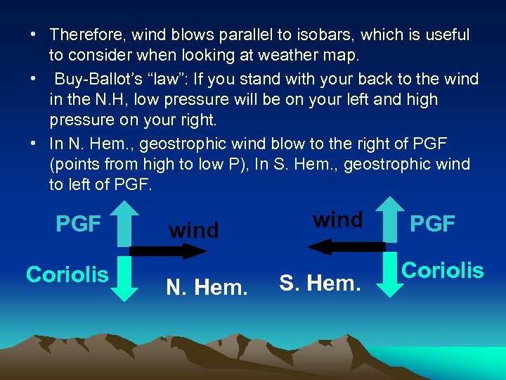 • Therefore, wind blows parallel to isobars, which is useful to consider when looking at weather map. • Buy-Ballot’s “law”: If you stand with your back to the wind in the N. H, low pressure will be on your left and high pressure on your right. • In N. Hem. , geostrophic wind blow to the right of PGF (points from high to low P), In S. Hem. , geostrophic wind to left of PGF Coriolis wind N. Hem. wind S. Hem. PGF Coriolis
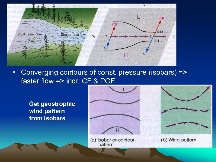 • Converging contours of const. pressure (isobars) => faster flow => incr. CF & PGF Get geostrophic wind pattern from isobars
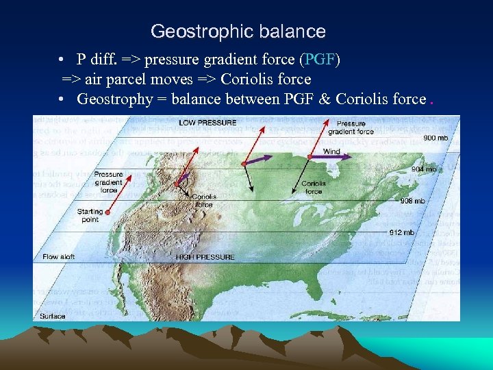 Geostrophic balance • P diff. => pressure gradient force (PGF) => air parcel moves => Coriolis force • Geostrophy = balance between PGF & Coriolis force.
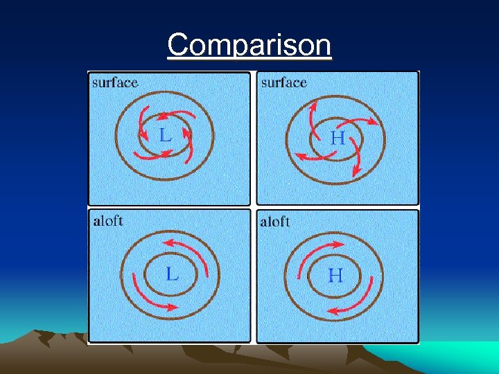
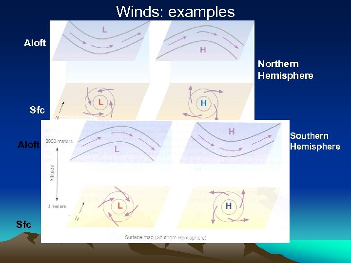
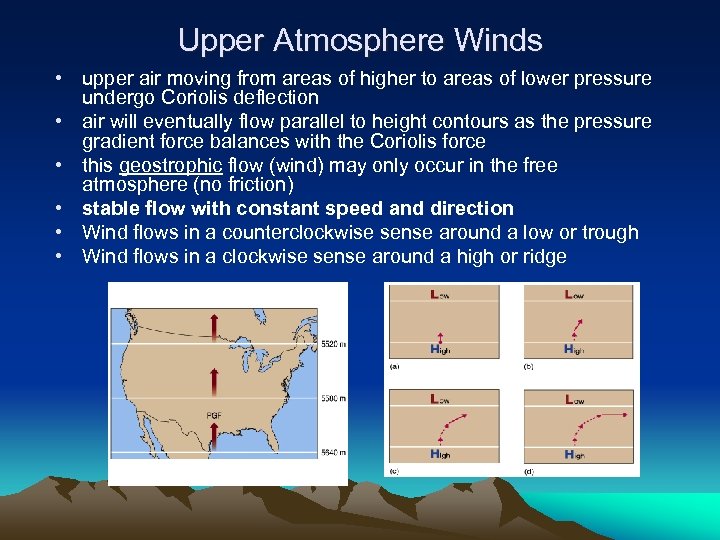 Upper Atmosphere Winds • upper air moving from areas of higher to areas of lower pressure undergo Coriolis deflection • air will eventually flow parallel to height contours as the pressure gradient force balances with the Coriolis force • this geostrophic flow (wind) may only occur in the free atmosphere (no friction) • stable flow with constant speed and direction • Wind flows in a counterclockwise sense around a low or trough • Wind flows in a clockwise sense around a high or ridge
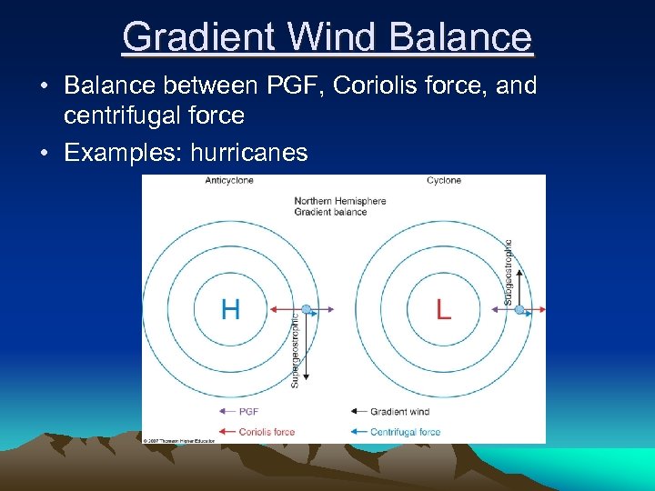 Gradient Wind Balance • Balance between PGF, Coriolis force, and centrifugal force • Examples: hurricanes
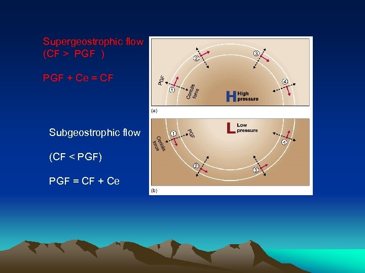 Supergeostrophic flow (CF > PGF ) PGF + Ce = CF Subgeostrophic flow (CF < PGF) PGF = CF + Ce
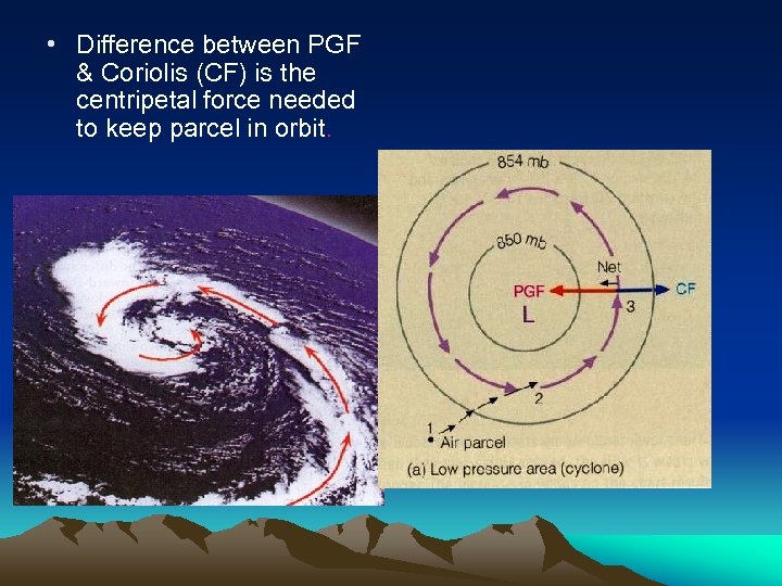 • Difference between PGF & Coriolis (CF) is the centripetal force needed to keep parcel in orbit.
 • Geostrophic flow too simplistic PGF is rarely uniform, height contours curve and vary in distance • wind still flows parallel to contours HOWEVER continuously changing direction (and experiencing acceleration) • for parallel flow to occur pressure imbalance must exist between the PGF and CE Gradient Flow • Two specific types of gradient flow: – Supergeostrophic: High pressure systems, CE > PGF (to enable wind to turn), air accelerates – Subgeostrophic: Low pressure systems, PGF > CE, air decelerates • supergeostrophic and subgeostrophic conditions lead to airflow parallel to curved height contours
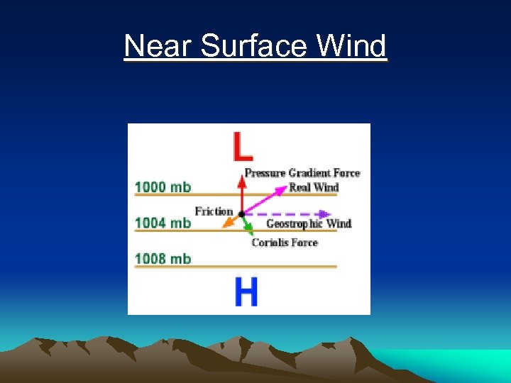
 Surface Winds • Friction slows the wind • Coriolis force (dependent on wind speed) is therefore reduced • Pressure gradient force now exceeds Coriolis force • Wind flows across the isobars toward lower pressure
 Near Surface Wind
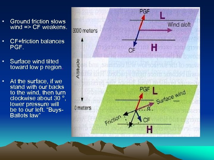 • Ground friction slows wind => CF weakens. • CF+friction balances PGF. • Surface wind tilted toward low p region. • At the surface, if we stand with our backs to the wind, then turn clockwise about 30 °, lower pressure will be to our left. “Buys. Ballots law” Friction
 Comparison
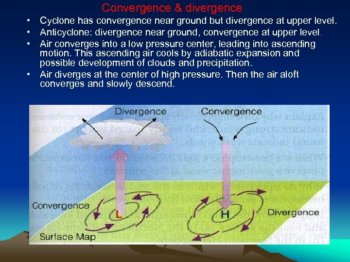 Convergence & divergence • Cyclone has convergence near ground but divergence at upper level. • Anticyclone: divergence near ground, convergence at upper level. • Air converges into a low pressure center, leading into ascending motion. This ascending air cools by adiabatic expansion and possible development of clouds and precipitation. • Air diverges at the center of high pressure. Then the air aloft converges and slowly descend.
 Winds: examples Aloft Northern Hemisphere Sfc Aloft Sfc Southern Hemisphere
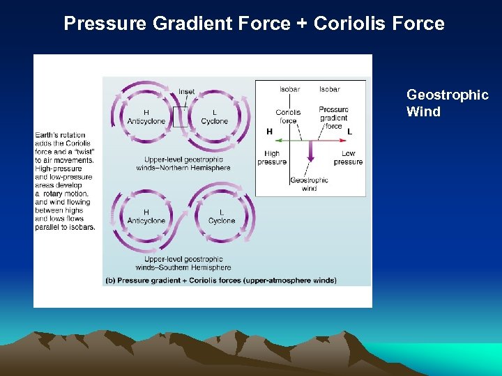 Pressure Gradient Force + Coriolis Force Geostrophic Wind
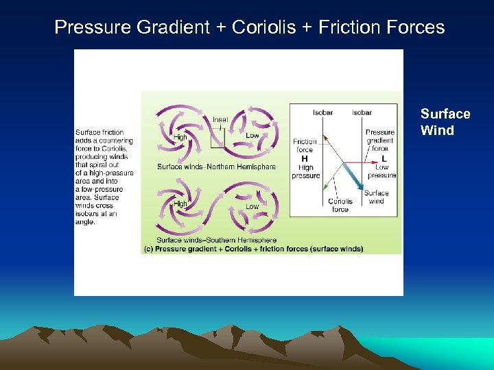 Pressure Gradient + Coriolis + Friction Forces Surface Wind
 Cyclones, Anticyclones, Troughs and Ridges • High pressure areas (anticyclones) clockwise airflow in the Northern Hemisphere (opposite flow direction in S. Hemisphere) – Characterized by descending air which warms creating clear skies • Low pressure areas (cyclones) counterclockwise airflow in N. Hemisphere (opposite flow in S. Hemisphere) – Air converges toward low pressure centers, cyclones are characterized by ascending air which cools to form clouds and possibly precipitation • In the upper atmosphere, ridges correspond to surface anticyclones while troughs correspond to surface cyclones


