f0aaf7be17293aa2d8f0035213f0f2df.ppt
- Количество слайдов: 31


")
Census 2000: The Redistricting Summary Data (Public Law 94 -171)

Redistricting Data Program • Public Law 94 -171 enacted in 1975 • Outgrowth of 1960’s court decisions on “One-Person/One-Vote” and 1965 Voting Rights Act • State legislatures can receive data according to local definitions to ease planning new district boundaries • First look at racial/ethnic profile of local community

Data Items Included – Total Population – Hispanic/Latino Origin – Race – Voting Age Population
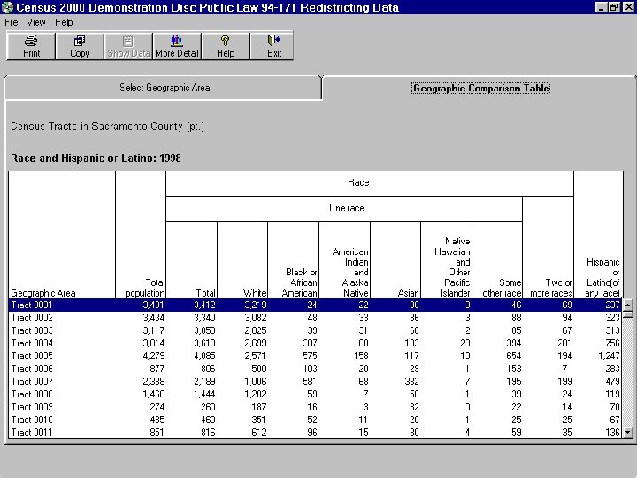
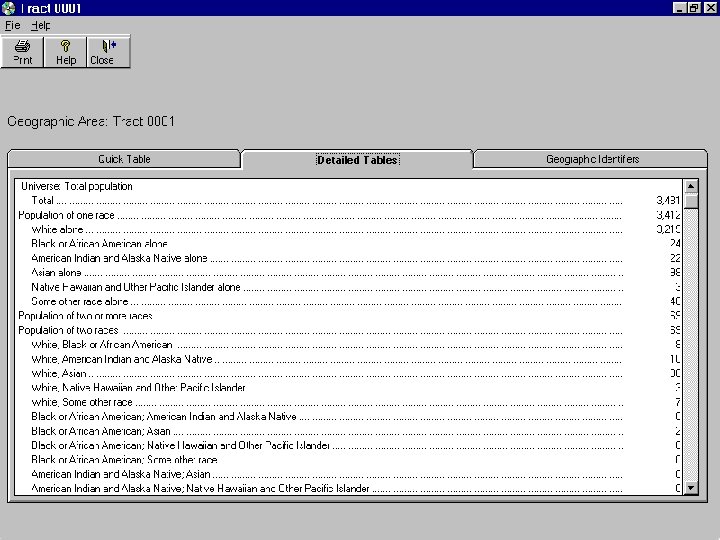
 Data Table: Race")
Public Law 1 (PL 1) Data Table: Race
 Data Table: Hispanic or Latino, and Not Hispanic or")
Public Law 2 (PL 2) Data Table: Hispanic or Latino, and Not Hispanic or Latino by Race
 Data Table: Race for the Population 18 Years and")
Public Law 3 (PL 3) Data Table: Race for the Population 18 Years and Over
 Data Table: Hispanic or Latino, and Not Hispanic or")
Public Law 4 (PL 4) Data Table: Hispanic or Latino, and Not Hispanic or Latino by Race for the Population 18 Years and Over

Office of Management and Budget Race Categories • • American Indian or Alaska Native Asian Black or African American Native Hawaiian or Other Pacific Islander • White • Some other Race ------ • Two or More Races

Race Items of Interest • Respondents could choose more than one category • Total possibility of 63 racial categories • Hispanic/Latino origin cross-tabulation equals 126 possible racial/ethnic categories • In a National Content Survey on Race in 1996, 1. 2% reported multiracial • In 1998 Dress Rehearsal, 5. 4% of Sacramento, Ca. respondents were of multiple races

Maximum Combination of Six Racial Categories 6 racial categories +57 combinations of two or more races 63 Possible combinations

“Two or More Races” • Category where all multiple-race responses are grouped together • This category, together with the 6 single-race alone categories, will add up to 100% of the population • The result is that direct comparisons back to 1990 racial categories CANNOT be made

Population Data Summary Levels In Public Law 94 -171 File – Counties – County subdivisions – Places (incorporated and census designated) – Census tracts – Census block groups – Census blocks – Voting districts* – State house and state senate districts* * - where provided

Census Geography Overview

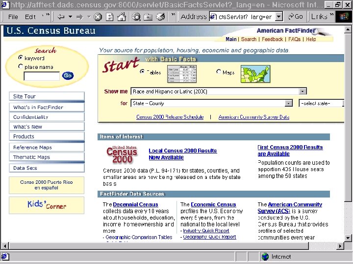
Data Accessibility • Data provided to states on CD-ROM, with software to view, print, download items • Delivered by April 1, 2001 to governor, majority/minority legislative leaders • Census Maps /TIGER/Line files delivered to state officials prior to March 1, 2001 • P. L. 94 -171 redistricting data publicly accessible on www. census. gov
 – For downloading complete dataset files –")
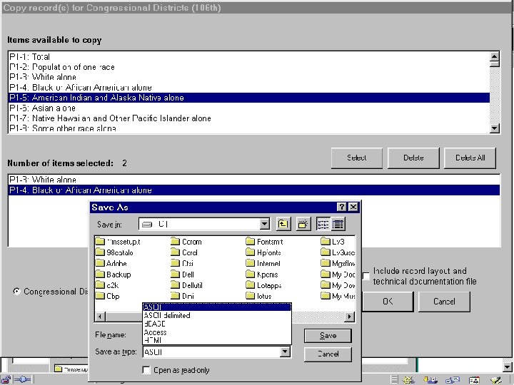
Accessibility Methods • File Transfer Protocol (FTP) – For downloading complete dataset files – Will be available at http: //ftp 2. census. gov • American Fact. Finder – Quick Tables – Geographic Comparison Tables – Detailed Tables • CD-ROMs • Maps, TIGER/Line

Media Type: FTP vs AFF vs CD-ROM Difficulty Cost User Level Speed Connect Issues Download limits Graphical User Interface FTP High No High Variable Possible None AFF Low No All Variable Possible 5 megs Yes CD Low Yes All High Unlikely CD size Yes

http: //ftp 2. census. gov Begin by selecting the file you want to download Then save the file down to your PC

Using your Windows Explorer open the zipped files Use unzip software available for free at www. winzip. com or www. pkunzip. com

Geographic Comparison Tables Quick Tables Data Sets

Downloading Data in American Fact. Finder

Redistricting Summary Data CD-ROM Census 2000 Demonstration Disc Public Law 94 -171 Redistricting Data This CD-ROM contains summary data files, documentation, and software to display information for the city of Sacramento, California To install: click “My Computer”, click the CD-ROM icon, then click the “Install” button and follow the instructions. For additional information go to: http: //tier 2. census. gov/Demo. Disc. htm USCENSUSBUREAU Helping You Make Informed Decisions 1998 Issued December 2000 United States Census 2000

Maps and TIGER/Line • Three map types in three formats – Census Tract Outline • Paper (8. 5” x 11”), PDF off the web, HPGL on demand – Voting District Outline Maps • Voting district outline (no state legislative district) on Paper, PDF off the web, and HPGL on demand – County Block Maps • Includes voting district and legislative district boundaries and codes • Paper, PDF off the web, and HPGL on demand

Census Tract Outline Maps

Voting district/state legislative district outline maps

County Block Maps

TIGER/Line Files First TIGER/Line File to contain final Census 2000 tabulation geography • Legal areas with January 1, 2000 boundaries • Census 2000 statistical areas (tracts, CDPs) • Voting districts/legislative districts • Tabulation census blocks

For More Information • www. census. gov • “Strength in Numbers: Your Guide to Census 2000 Redistricting Data From the U. S. Census Bureau” - brochure • “What You Should Know About the Apportionment Counts” - brochure • Customer Service Center – (301) 457 -4100 – webmaster@census. gov
f0aaf7be17293aa2d8f0035213f0f2df.ppt