49072a6e8af292f818514ccab309dc53.ppt
- Количество слайдов: 43


Case Study: Two Connecticut Towns and the Benefits of Master Planning

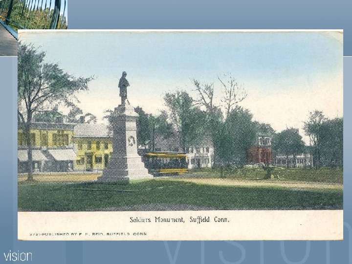
Main Street has traditionally been considered the center of town activity, and this continued up through the early to mid 1900’s when stores, apartments, and offices faced all along the green.

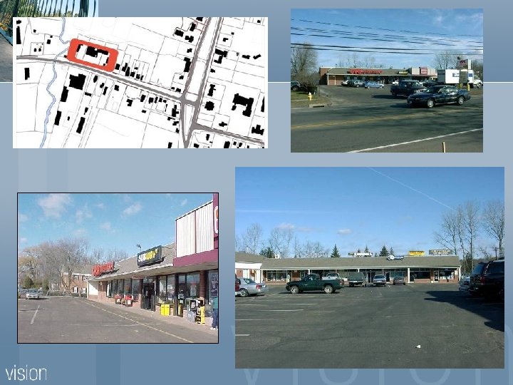
Gas Station Site Redevelopment

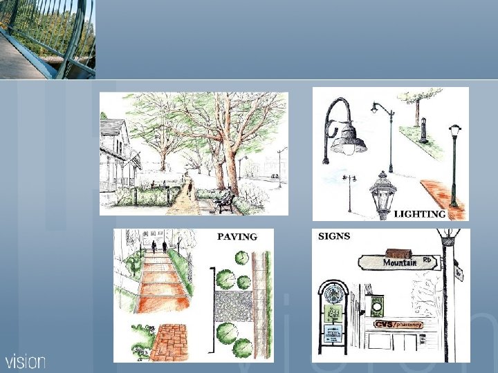
Sidewalks

Signage

Sitting Areas

Other Amenities n n n Outdoor Dining Decorative Street Signs and Lighting Decorative Street Clock Farmers Market Town Green improvements

Bed & Breakfasts

Visitors Center

New Development

Marketing
 n Community Vision Workshops (2001) n")
Master Planning Activities Visual Preference Survey (2000 -2001) n Community Vision Workshops (2001) n UMass Landscape Architecture Class (2002) n Adoption of TCVD Regulation and Design Review Board (2003 -2004) n Streetscape Efforts (2003 -2008) n Parking Analysis (2007 -2008) n

What is VPS? n n A survey tool that uses a combination of images and words. A means to convey concepts that are not as clear with just words. A means to discern differences in public opinion on development when shown images rather than responding to words alone. A means by which we can start a dialogue about what development lo

The Visual Preference Survey is based on the premise that: Everyone reacts to places all the time… By measuring their reaction we can determine acceptability.

Responses to the images were based on: “How appropriate or inappropriate is an image, both now and in the future, for …. . Rural, Suburban and Urban areas in the Hartford Region? ” -10 to +10

Rural Urban +8. 1 Urban +8. 0 Urban +7. 8

Rural Urban -4. 4 -2. 7 Rural Urban -2. 5 -2. 1

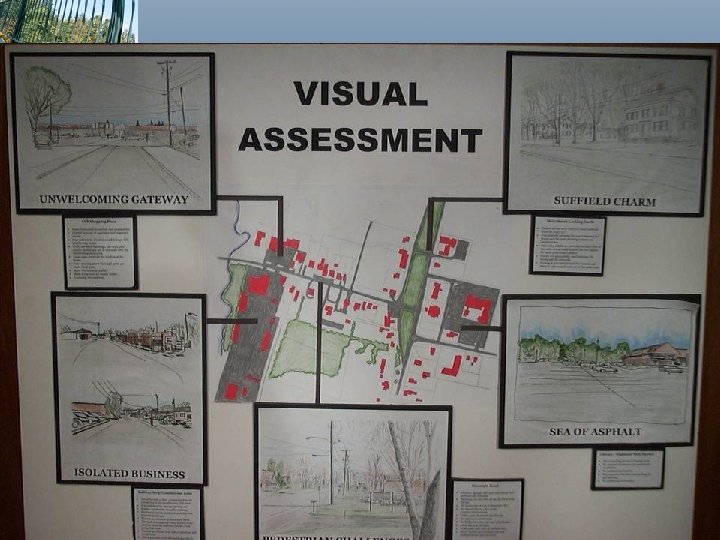
Recommendations for Rural Areas 1 Suffield, a rural /agricultural town zoned for suburban growth.

Workshop Introduction • There will be two mapping exercises in the workshop. The first tasks in this workshop will use the existing base map of the entire town. The second portion of the workshop will focus on the town center. • These maps will include the following data: Existing roads, streets, and highways Existing Zoning Topography Environmental constraints Water Wetlands Steep slopes/rock out cropping Some existing building footprints and land uses • There are several tasks to be completed by the group. Each task is related to a series of rated images from the survey.

Applying the Results

The hope and dreams of Suffield! t d o e N w o l l a Fill this in with trees +4. 3 +4. 8 (sd 5. 2) (sd 5. 0) +4. 5 +4. 2 (sd 5. 0)

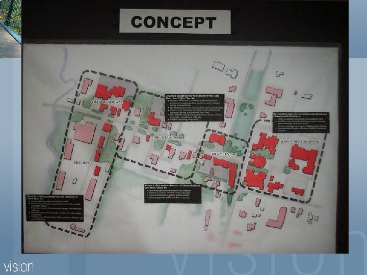
Town Center Design Options – Existing Conditions

Town Center Design Options – Scheme 1/4

UMass Study Landscape Architecture Program n Class project with Professor Supervision n Community Workshop n Models and Power Point Presentations n
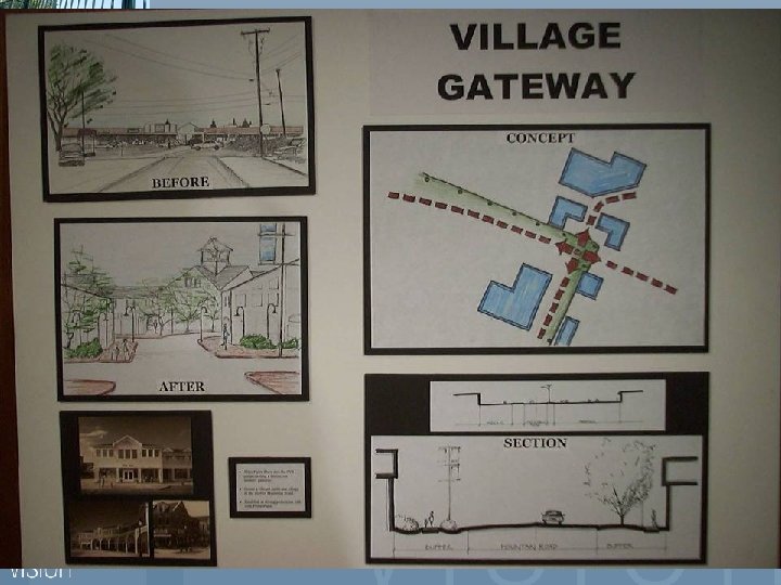

Town Center Village District Legislation n Village District has design standards n Encourage mixed use n Relax set-backs n Shared parking n n Design Review Board

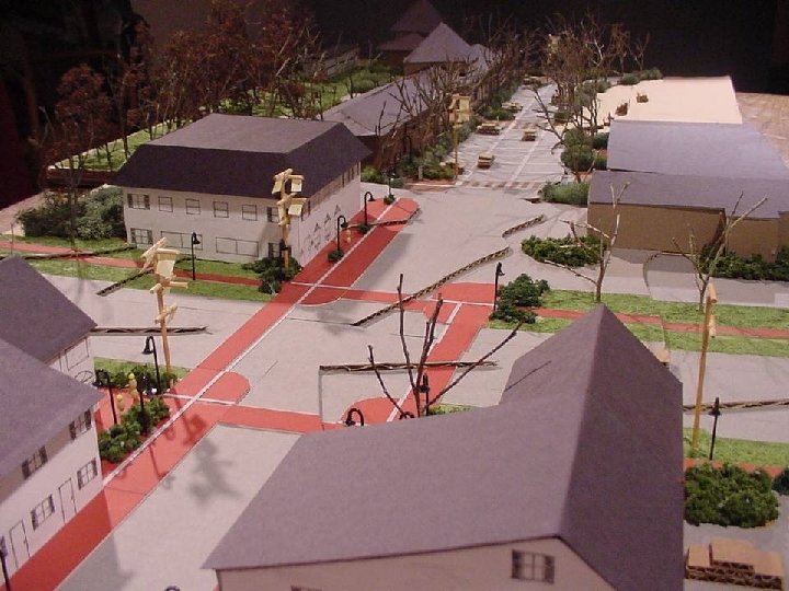
Streetscape Efforts $1. 1 million dollar project n Multi-year n Goals n New traffic signal n Safer crosswalks n Complete pedestrian network n Traffic calming n More attractive landscaping n On-street parking n

Streetscape Efforts

Streetscape Challenges $$$ n Consensus n DOT issues n Appropriate Oversight/Inspection n Keeping the businesses afloat n

Parking Analysis Wesley Marshall, P. E. , UConn n Base mapping n Site tour/photo log n Review of Suffield Zoning Regs n Comparison to traditional and contemporary business areas n Recommendations for Suffield n

Suffield Town Center Village Avg. Usage

Managed & Organized Parking Traditional Sites > 55% Shared Municipal Parking Vs. Contemporary Sites > 95% Privately Owned Parking

Parking Used, Provided, & Required Traditional Sites Contemporary Sites Suffield

Next Steps

What We’ve Learned Importance of photo documentation n Marketing efforts n Staffing n On-going source of funds n Implementation framework n Buy-in from Officials n Continuous process n
49072a6e8af292f818514ccab309dc53.ppt