24e8b7025bbd22ef209b4e12dfb675d5.ppt
- Количество слайдов: 35
 Aviation Weather Center: Products & Services Overview Utility of Ensemble Model Guidance Andy Fischer, Pat Murphy, & David Bright Chicago Aviation Weather Workshop February 25, 2011
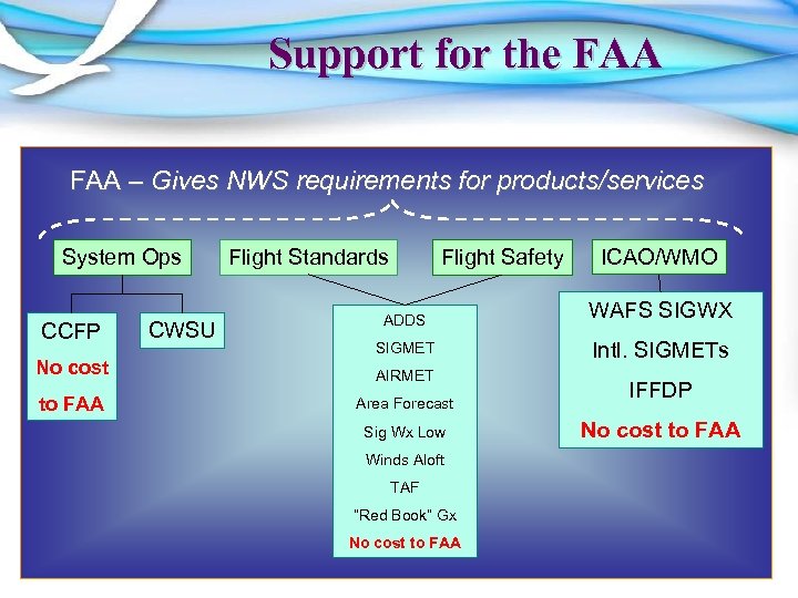 Support for the FAA – Gives NWS requirements for products/services System Ops CCFP CWSU Flight Standards Flight Safety ICAO/WMO ADDS WAFS SIGWX SIGMET Intl. SIGMETs No cost AIRMET to FAA Area Forecast Sig Wx Low Winds Aloft TAF “Red Book” Gx No cost to FAA IFFDP No cost to FAA
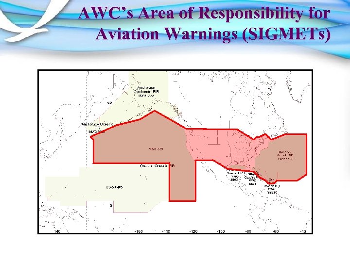 AWC’s Area of Responsibility for Aviation Warnings (SIGMETs)
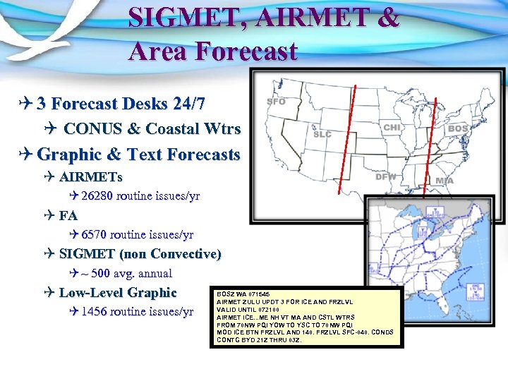 SIGMET, AIRMET & Area Forecast Q 3 Forecast Desks 24/7 Q CONUS & Coastal Wtrs Q Graphic & Text Forecasts Q AIRMETs Q 26280 routine issues/yr Q FA Q 6570 routine issues/yr Q SIGMET (non Convective) Q ~ 500 avg. annual Q Low-Level Graphic Q 1456 routine issues/yr BOSZ WA 071545 AIRMET ZULU UPDT 3 FOR ICE AND FRZLVL VALID UNTIL 072100 AIRMET ICE. . . ME NH VT MA AND CSTL WTRS FROM 70 NW PQI YOW TO YSC TO 70 NW PQI MOD ICE BTN FRZLVL AND 140. FRZLVL SFC-040. CONDS CONTG BYD 21 Z THRU 03 Z.
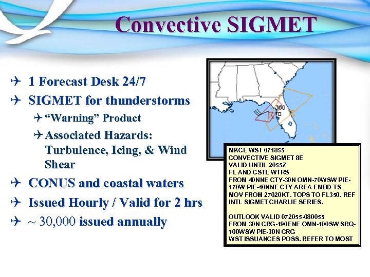 Convective SIGMET Q 1 Forecast Desk 24/7 Q SIGMET for thunderstorms Q “Warning” Product Q Associated Hazards: Turbulence, Icing, & Wind Shear Q CONUS and coastal waters Q Issued Hourly / Valid for 2 hrs Q ~ 30, 000 issued annually MKCE WST 071855 CONVECTIVE SIGMET 8 E VALID UNTIL 2055 Z FL AND CSTL WTRS FROM 40 NNE CTY-30 N OMN-70 WSW PIE 170 W PIE-40 NNE CTY AREA EMBD TS MOV FROM 27020 KT. TOPS TO FL 350. REF INTL SIGMET CHARLIE SERIES. OUTLOOK VALID 072055 -080055 FROM 30 N CRG-190 ENE OMN-100 SW SRQ 100 WSW PIE-30 N CRG WST ISSUANCES POSS. REFER TO MOST
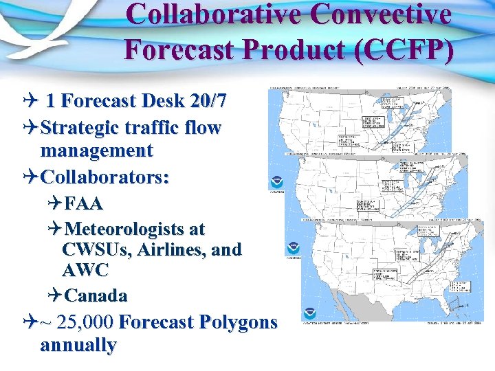 Collaborative Convective Forecast Product (CCFP) Q 1 Forecast Desk 20/7 QStrategic traffic flow management QCollaborators: QFAA QMeteorologists at CWSUs, Airlines, and AWC QCanada Q~ 25, 000 Forecast Polygons annually
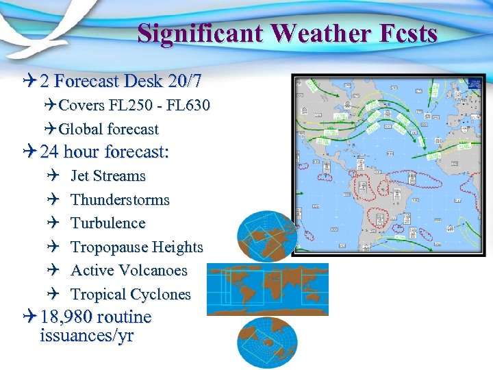 Significant Weather Fcsts Q 2 Forecast Desk 20/7 QCovers FL 250 - FL 630 QGlobal forecast Q 24 hour forecast: Q Q Q Jet Streams Thunderstorms Turbulence Tropopause Heights Active Volcanoes Tropical Cyclones Q 18, 980 routine issuances/yr
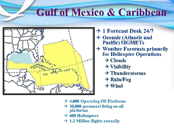 Gulf of Mexico & Caribbean Q 1 Forecast Desk 24/7 Q Oceanic (Atlantic and Pacific) SIGMETs Q Weather Forecasts primarily for Helicopter Operations Q Clouds Q Visibility Q Thunderstorms Q Rain/Fog Q Wind Q 4, 000 Operating Oil Platforms Q 30, 000 personnel living on oil platforms Q 600 Helicopters Q 1. 3 Million flights annually
 World Area Forecast Center Q World Area Forecast System (WAFS) Q Formulated by International Civil Aviation Organization and the WMO Q Improve the quality and consistency of enroute guidance provided for international aircraft operations Q World Area Forecast Centers (WAFC) Q WAFC – Washington QAWC provides Significant Weather Forecasts QNCEP Central Operations Provides Wind and Temperature Grids Charts QNWS Telecommunications Gateway supports satellite data broadcasts Q WAFC – London QMet Office – Exeter
 AWC Product Issuances Product #/Year Convective SIGMET ~30, 000 Non-Convective SIGMET 500 Collaborative Convective Forecast Product (CCFP) AIRMETs 25, 000 Area Forecasts (FA) 6, 570 Significant Weather Low 1, 456 Significant Weather High 18, 890 26, 280
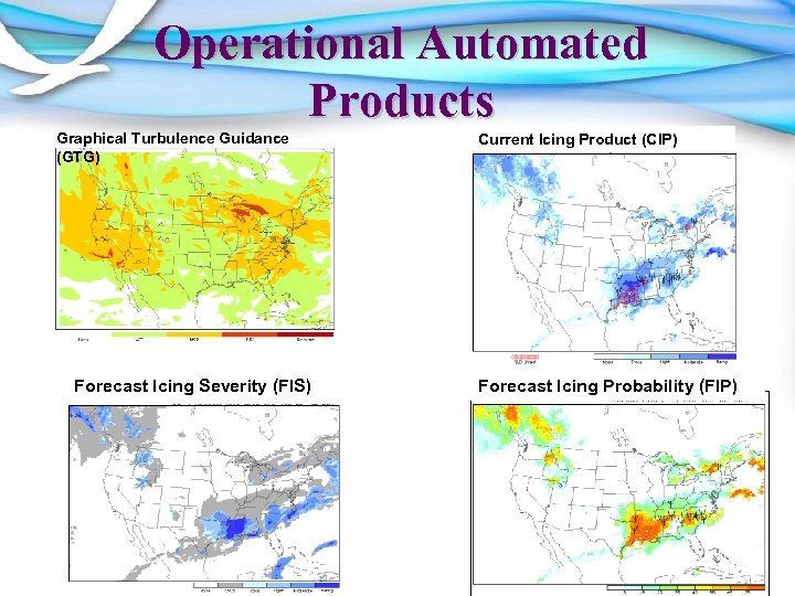 Operational Automated Products Graphical Turbulence Guidance (GTG) Forecast Icing Severity (FIS) Current Icing Product (CIP) Forecast Icing Probability (FIP)
 Q Aviation Digital Data Service (ADDS) makes available to the aviation community text, digital and graphical forecasts, analyses, and observations of aviation-related weather information Q Meets FAA requirements for “Qualified Internet Communications Provider” Q Allows operational use by part 121/135 operators (airlines) Q Not just a web display Q Is a dynamic database Q Already has many NEXTGEN data service capabilities Q ADDS joint developed Q Operational Since 2003 Q Averaging Q 9 million hits per month Q 100 GB per day Q NCAR, GSD, and AWC 12
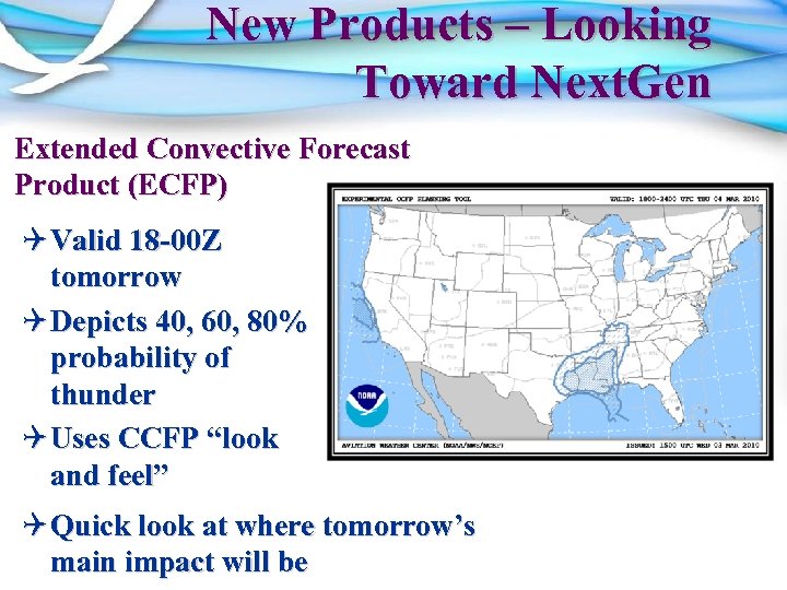 New Products – Looking Toward Next. Gen Extended Convective Forecast Product (ECFP) Q Valid 18 -00 Z tomorrow Q Depicts 40, 60, 80% probability of thunder Q Uses CCFP “look and feel” Q Quick look at where tomorrow’s main impact will be
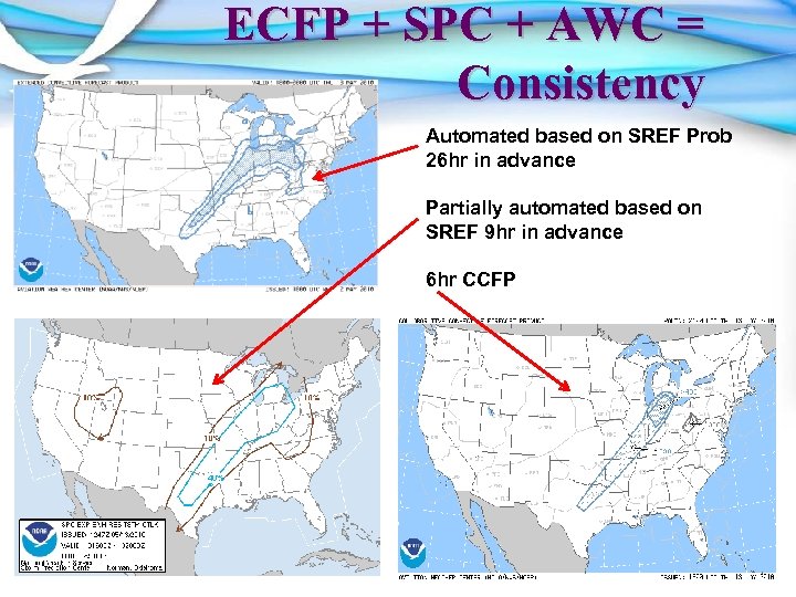 ECFP + SPC + AWC = Consistency Automated based on SREF Prob 26 hr in advance Partially automated based on SREF 9 hr in advance 6 hr CCFP
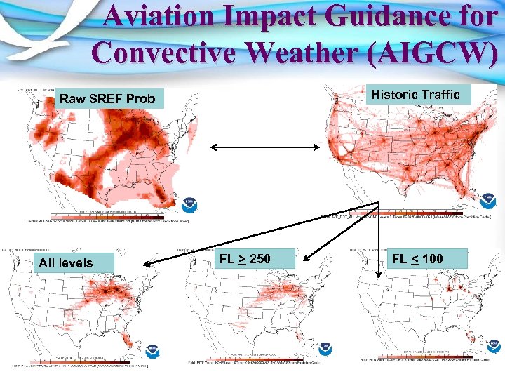 Aviation Impact Guidance for Convective Weather (AIGCW) Historic Traffic Raw SREF Prob All levels FL > 250 FL < 100
 Ensemble Guidance at AWC Q Develop specialized guidance for the specific application (convection and other aviation weather hazards) Q Design guidance that… Q Help blend deterministic and ensemble approaches Q Provide guidance for uncertainty/probabilistic forecasts Q Provide guidance that aids confidence (i. e. , better deterministic forecasts) Q Illustrates plausible scenarios Q Allows for diagnostic analysis – not just a statistical black-box
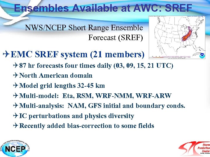 Ensembles Available at AWC: SREF NWS/NCEP Short Range Ensemble Forecast (SREF) QEMC SREF system (21 members) Q 87 hr forecasts four times daily (03, 09, 15, 21 UTC) Q North American domain Q Model grid lengths 32 -45 km Q Multi-model: Eta, RSM, WRF-NMM, WRF-ARW Q Multi-analysis: NAM, GFS initial and boundary conds. Q IC perturbations and physics diversity Q Recently added bias-correction to some fields
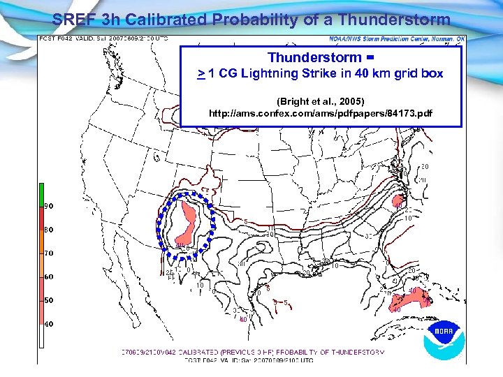 SREF 3 h Calibrated Probability of a Thunderstorm = > 1 CG Lightning Strike in 40 km grid box (Bright et al. , 2005) http: //ams. confex. com/ams/pdfpapers/84173. pdf
![Calibrated SREF Thunder Reliability Frequency [0%, 5%, …] Perfect Forecast No Skill Climatology Calibrated Calibrated SREF Thunder Reliability Frequency [0%, 5%, …] Perfect Forecast No Skill Climatology Calibrated](https://present5.com/presentation/24e8b7025bbd22ef209b4e12dfb675d5/image-19.jpg) Calibrated SREF Thunder Reliability Frequency [0%, 5%, …] Perfect Forecast No Skill Climatology Calibrated Thunder Probability
Calibrated SREF Thunder Reliability Frequency [0%, 5%, …] Perfect Forecast No Skill Climatology Calibrated Thunder Probability
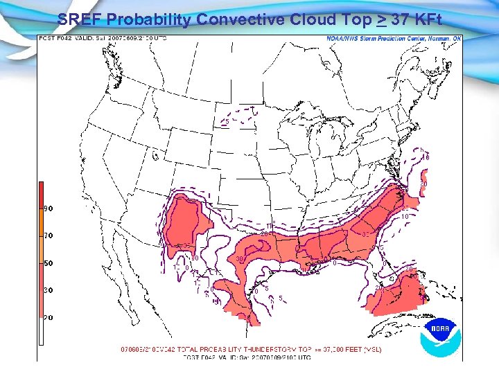 SREF Probability Convective Cloud Top > 37 KFt
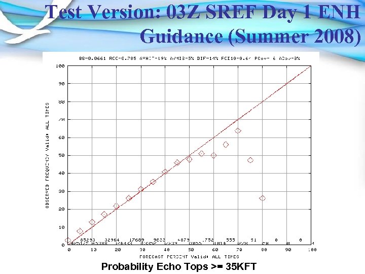 Test Version: 03 Z SREF Day 1 ENH Guidance (Summer 2008) Probability Echo Tops >= 35 KFT
 Outline Q Introduction Q Short Range Ensemble Forecasts (SREF) Q Future Aviation Ensemble Applications Q Applications and calibration under development QOne hourly SREF thunderstorm guidance (through F 036) * QCalibration of potential impacts of convection in SREF ^ QRapid Refresh Ensemble Forecast (RREF) – 1 hr updates, RUC based * QStorm scale (e. g. , supercells, squall lines) applications being evaluated * Not discussed today ^ Collaborating with John Huhn, Mitre Corp.
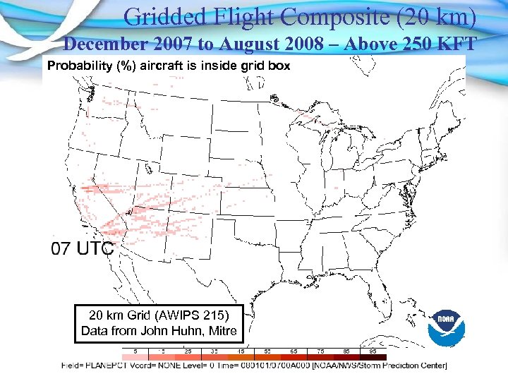 Gridded Flight Composite (20 km) December 2007 to August 2008 – Above 250 KFT Probability (%) aircraft is inside grid box 20 km Grid (AWIPS 215) Data from John Huhn, Mitre
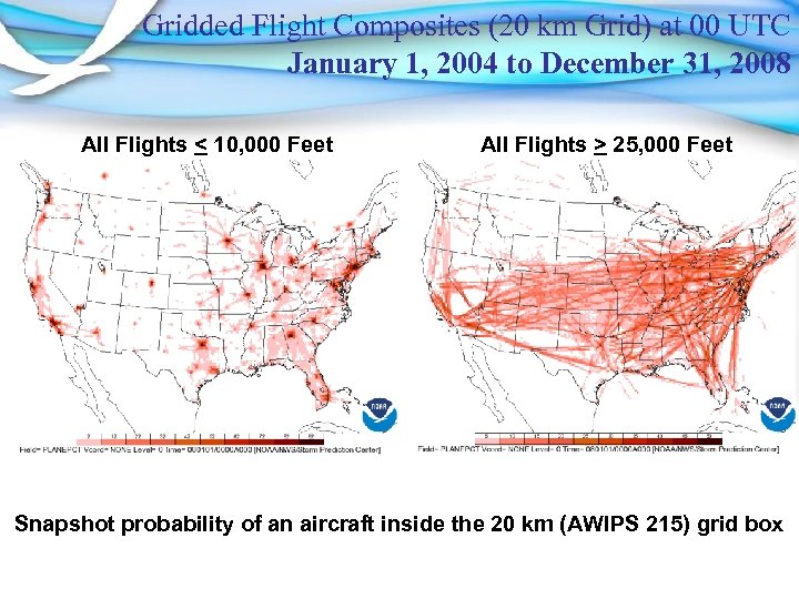 Gridded Flight Composites (20 km Grid) at 00 UTC January 1, 2004 to December 31, 2008 All Flights < 10, 000 Feet All Flights > 25, 000 Feet Snapshot probability of an aircraft inside the 20 km (AWIPS 215) grid box
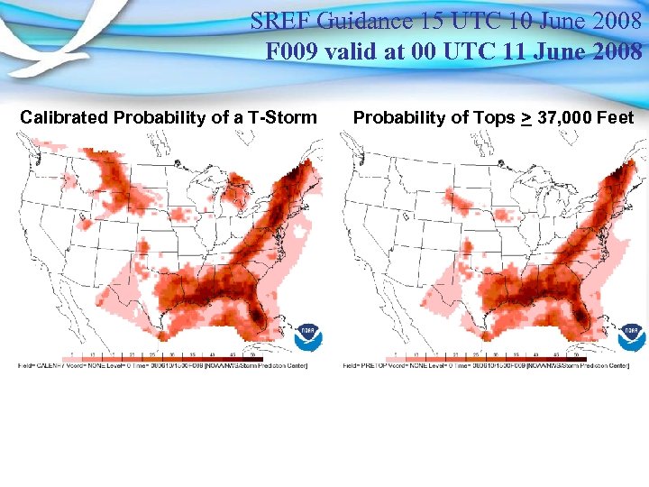 SREF Guidance 15 UTC 10 June 2008 F 009 valid at 00 UTC 11 June 2008 Calibrated Probability of a T-Storm Probability of Tops > 37, 000 Feet
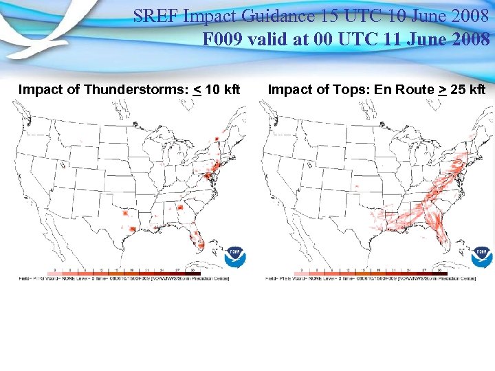 SREF Impact Guidance 15 UTC 10 June 2008 F 009 valid at 00 UTC 11 June 2008 Impact of Thunderstorms: < 10 kft Impact of Tops: En Route > 25 kft
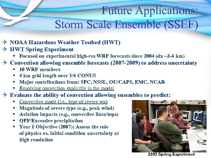 Future Applications: Storm Scale Ensemble (SSEF) Q NOAA Hazardous Weather Testbed (HWT) Q HWT Spring Experiment § Focused on experimental high-res WRF forecasts since 2004 (dx ~2 -4 km) Q Convection allowing ensemble forecasts (2007 -2009) to address uncertainty § § 10 WRF members 4 km grid length over 3/4 CONUS Major contributions from: SPC, NSSL, OU/CAPS, EMC, NCAR Resolving convection explicitly in the model Q Evaluate the ability of convection allowing ensembles to predict: § § § Convective mode (i. e. , type of severe wx) Magnitude of severe type (e. g. , peak wind) Aviation impacts (e. g. , convective lines/tops) QPF/Excessive precipitation Year 1 Objective (2007): Assess the role of physics vs. initial condition uncertainty at high resolution 2003 Spring Experiment
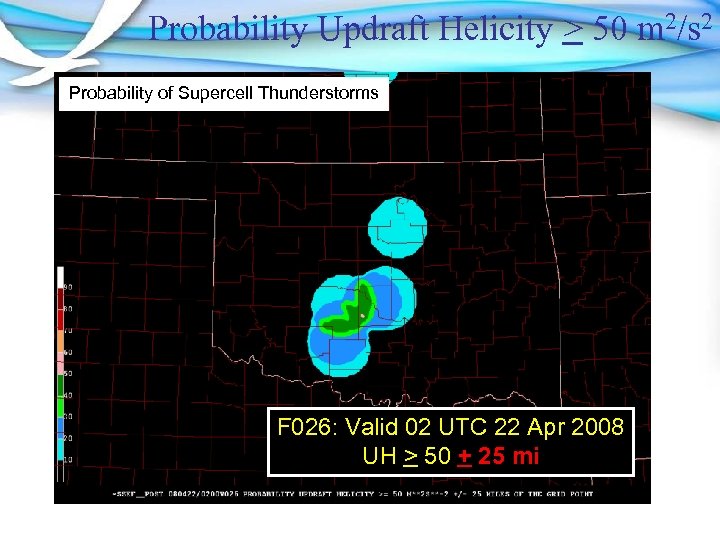 Probability Updraft Helicity > 50 m 2/s 2 Probability of Supercell Thunderstorms F 026: Valid 02 UTC 22 Apr 2008 UH > 50 + 25 mi
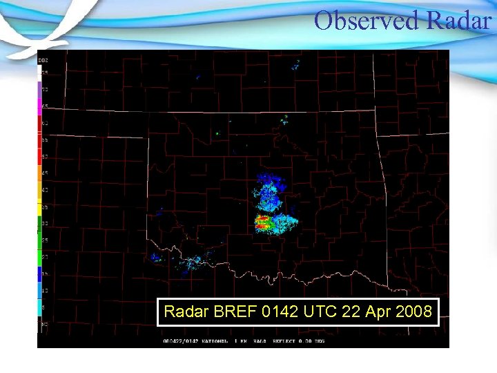 Observed Radar BREF 0142 UTC 22 Apr 2008
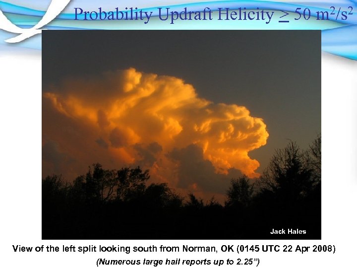 Probability Updraft Helicity > 50 m 2/s 2 Jack Hales View of the left split looking south from Norman, OK (0145 UTC 22 Apr 2008) (Numerous large hail reports up to 2. 25”)
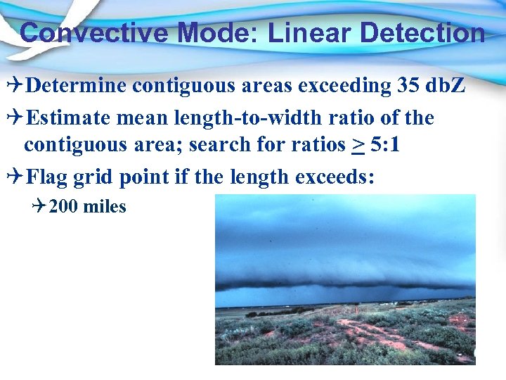 Convective Mode: Linear Detection QDetermine contiguous areas exceeding 35 db. Z QEstimate mean length-to-width ratio of the contiguous area; search for ratios > 5: 1 QFlag grid point if the length exceeds: Q 200 miles
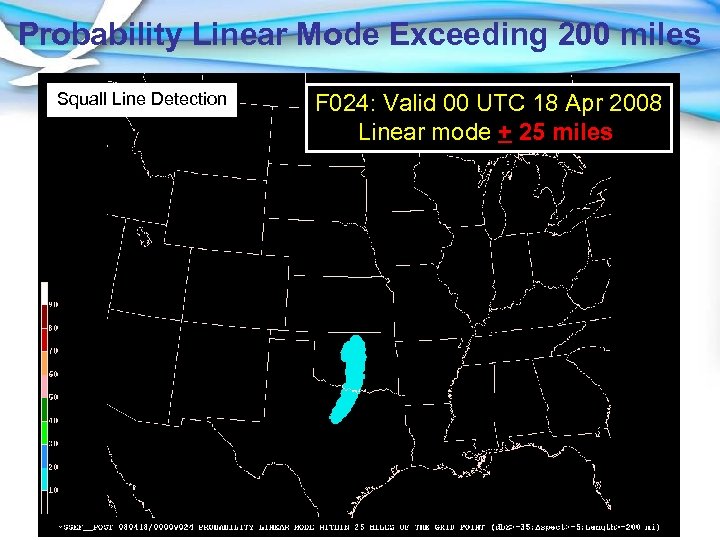 Probability Linear Mode Exceeding 200 miles Squall Line Detection F 024: Valid 00 UTC 18 Apr 2008 Linear mode + 25 miles
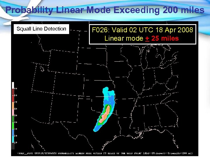 Probability Linear Mode Exceeding 200 miles Squall Line Detection F 026: Valid 02 UTC 18 Apr 2008 Linear mode + 25 miles
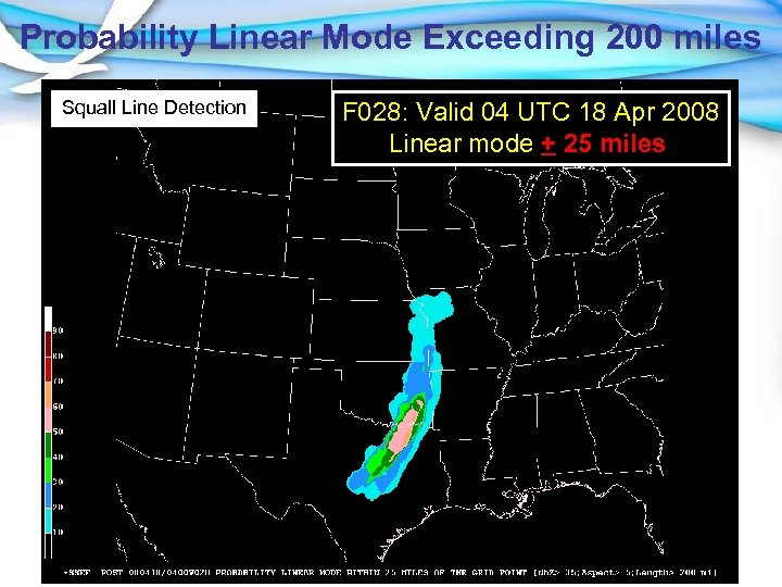 Probability Linear Mode Exceeding 200 miles Squall Line Detection F 028: Valid 04 UTC 18 Apr 2008 Linear mode + 25 miles
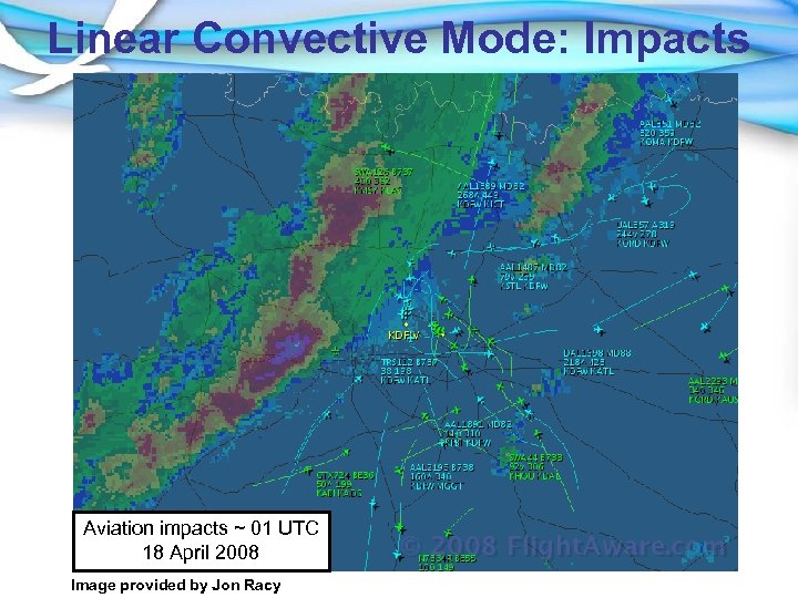 Linear Convective Mode: Impacts Aviation impacts ~ 01 UTC 18 April 2008 Image provided by Jon Racy


