edd8c09dfcd33a17e13f253913cd52f8.ppt
- Количество слайдов: 53
 Augmentation of Early Intensity Forecasting in Tropical Cyclones Teams: UA: Elizabeth A. Ritchie, J. Scott Tyo, Kim Wood, Oscar Rodriguez, Wiley Black, Kelly Ryan, Miguel F. Piñeros, G. Valliere-Kelley, Ivan Dario Hernandez, Brian La. Casse NRL: Jeffrey Hawkins , Richard Blankert, and Kim Richardson JTWC: Ed Fukada, Matthew E. Kucas, and James W. E. Darlow NHC: James Franklin NOPP Review March 2012 1
 Overview 1. Project Background • Data and Methods • Intensity Estimation • Genesis Detection 2. Improvements to DAV Technique • Using expert centers • Additional parameters for West. Pac • Application to Microwave Data 3. Extension to other basins • Intensity and genesis in West. Pac • Stitching GOES-E/GOES-W in East. Pac 4. Modelling and Atmospheric Studies 5. Upcoming Work 6. (Time Permitting) Development of a web-based tool for disseminating DAV 2
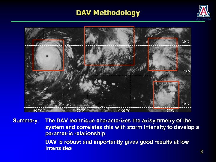 DAV Methodology 30 N 20 N 10 N 90 W Summary: 75 W 60 W 45 W The DAV technique characterizes the axisymmetry of the system and correlates this with storm intensity to develop a parametric relationship. DAV is robust and importantly gives good results at low intensities 3
 Data Atlantic and Gulf of Mexico: Eastern North Pacific: Infrared Imagery (GOES-E) Infrared Imagery (Stitched GOES-E • 2004 -2010 • Spatial resolution: 10 km/pixel • Temporal resolution: 30 min • 10. 7 μm /GOES-W) • 2005 -2010 • Spatial resolution: 10 km/pixel • Temporal resolution: 30 min • 10. 7 μm Western North Pacific: Infrared Imagery (MTSAT) • 2007 – 2010 (07 -09 Intensity/09 -10 Genesis) • Spatial resolution: 10 km/pixel • Temporal resolution: 30 min • 10. 7 μm 2011 saw the successful adaptation of the DAV-T to the West Pac Basin for both Intensity and Genesis Applications and in the East Pac for Intensity (Genesis Ongoing) 4
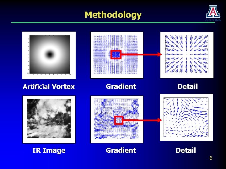 Methodology Artificial Vortex Gradient Detail IR Image Gradient Detail 5
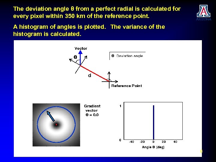 The deviation angle θ from a perfect radial is calculated for every pixel within 350 km of the reference point. A histogram of angles is plotted. The variance of the histogram is calculated. 6
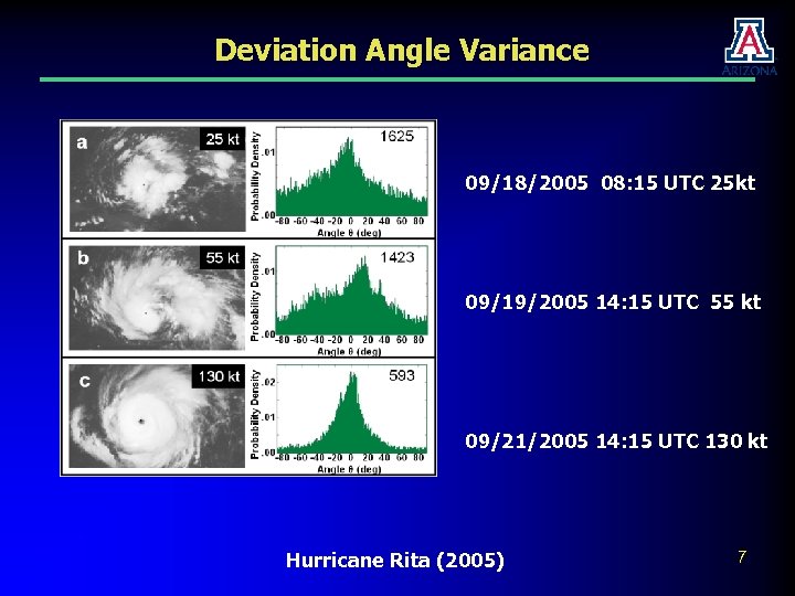 Deviation Angle Variance 09/18/2005 08: 15 UTC 25 kt 09/19/2005 14: 15 UTC 55 kt 09/21/2005 14: 15 UTC 130 kt Hurricane Rita (2005) 7
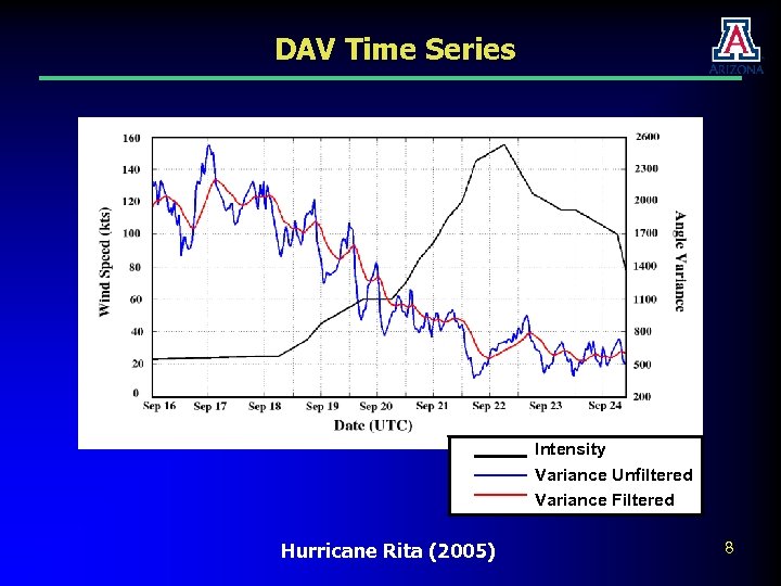 DAV Time Series Intensity Variance Unfiltered Intensity Variance Filtered Hurricane Rita (2005) 8
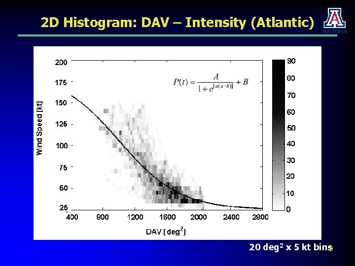 2 D Histogram: DAV – Intensity (Atlantic) 20 deg 2 x 5 kt bins 9
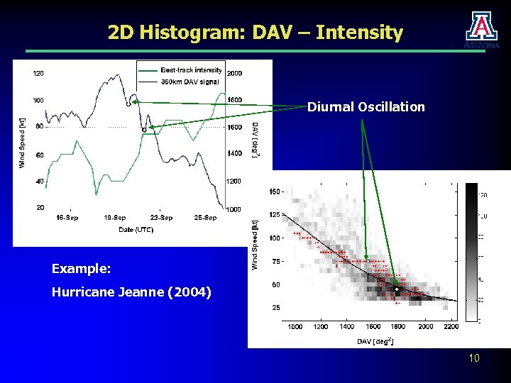 2 D Histogram: DAV – Intensity Diurnal Oscillation Example: Hurricane Jeanne (2004) 10
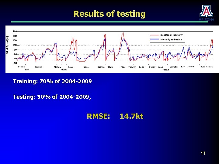 Results of testing Training: 70% of 2004 -2009 Testing: 30% of 2004 -2009, RMSE: 14. 7 kt 11
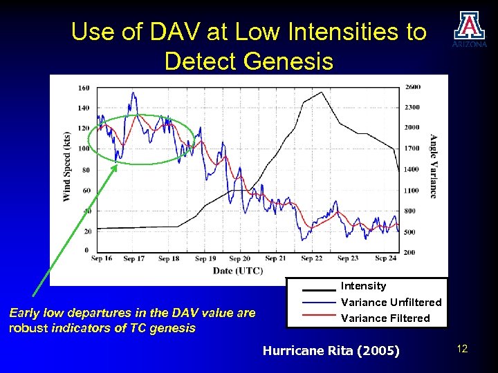 Use of DAV at Low Intensities to Detect Genesis Early low departures in the DAV value are robust indicators of TC genesis Intensity Variance Unfiltered Intensity Variance Filtered Hurricane Rita (2005) 12
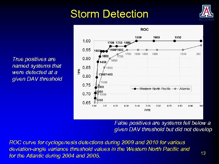 Storm Detection True positives are named systems that were detected at a given DAV threshold False positives are systems fell below a given DAV threshold but did not develop ROC curve for cyclogenesis detections during 2009 and 2010 for various deviation-angle variance threshold values in the Western North Pacific and for the Atlantic during 2004 and 2005. 13
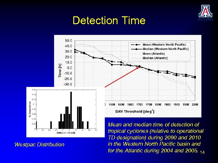 Detection Time Westpac Distribution Mean and median time of detection of tropical cyclones (relative to operational TD designation) during 2090 and 2010 in the Western North Pacific basin and for the Atlantic during 2004 and 2005. 14
 Methodology Improvements to DAV • Use of subjective center locations to improve estimates • Application of DAV technique to microwave data • Multiple parameter fits to data to improve intensity estimation 15
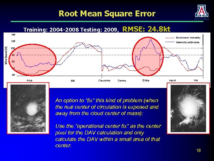 Root Mean Square Error Training: 2004 -2008 Testing: 2009, RMSE: 24. 8 kt An option to “fix” this kind of problem (when the real center of circulation is exposed and away from the cloud center of mass): Use the “operational center fix” as the center pixel for the DAV calculation and only calculate the DAV within a small area of that center. 16
 Use of Expert Centers (Gen Kelley) • In discussion with our operational partners, we were asked if knowledge of the centers could be used to improve DAV estimates. • We noted in analyzing the 2009 Atlantic season we found that inaccurate automated center estimates in weak, sheared cases can lead to gross over-estimation • We revisited the Atlantic data (2004 – 2010) to assess the use of subjective centers. • The optimum estimation radius reduced from 350 km to 200 -250 km. 17
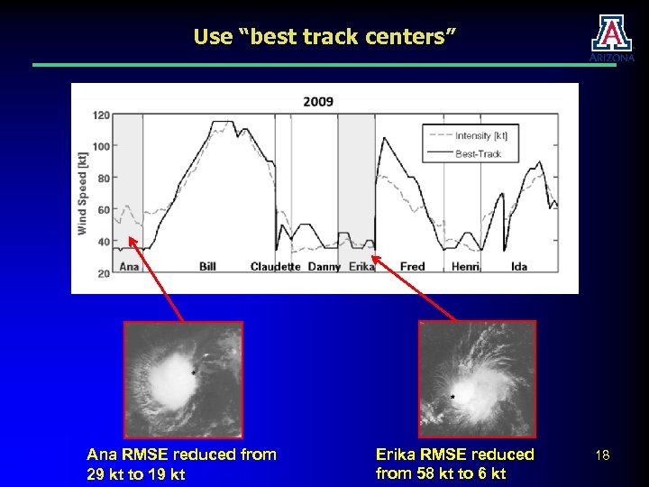 Use “best track centers” Ana RMSE reduced from 29 kt to 19 kt Erika RMSE reduced from 58 kt to 6 kt 18
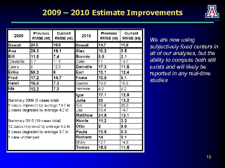 2009 – 2010 Estimate Improvements We are now using subjectively fixed centers in all of our analyses, but the ability to compute both still exists and will likely be reported in any real-time studies 19
 3 -D Surface Intensity Estimation • In our investigations in the Western North Pacific, we found that the data set bifurcated into cases that were better estimated with a large radius (>450 km) and cases that were better estimated with a small radius (250 km) • Generally larger radii work better for weaker systems, but we were unable to develop an objective method to choose an estimation radius • We are working on a new system that considers DAV calculations at two radii to develop a parametric surface 20
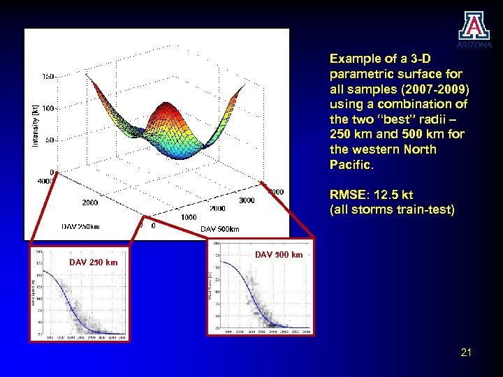 Example of a 3 -D parametric surface for all samples (2007 -2009) using a combination of the two “best” radii – 250 km and 500 km for the western North Pacific. RMSE: 12. 5 kt (all storms train-test) DAV 250 km DAV 500 km 21
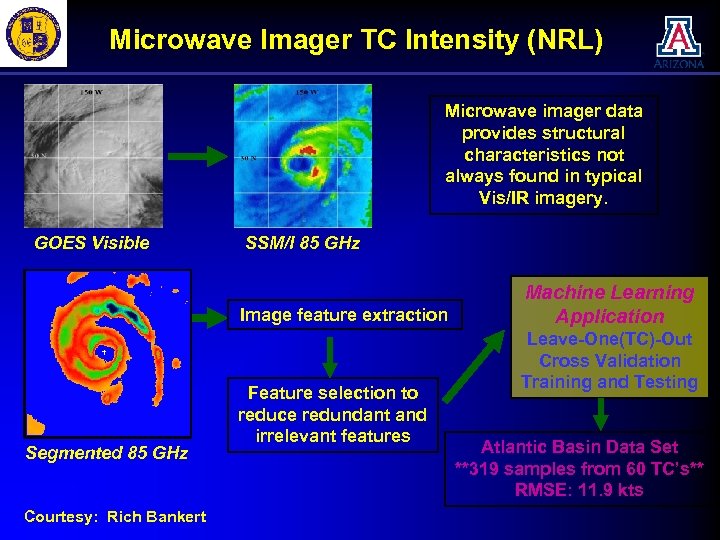 Microwave Imager TC Intensity (NRL) Microwave imager data provides structural characteristics not always found in typical Vis/IR imagery. GOES Visible SSM/I 85 GHz Image feature extraction Segmented 85 GHz Courtesy: Rich Bankert Feature selection to reduce redundant and irrelevant features Machine Learning Application Leave-One(TC)-Out Cross Validation Training and Testing Atlantic Basin Data Set **319 samples from 60 TC’s** RMSE: 11. 9 kts
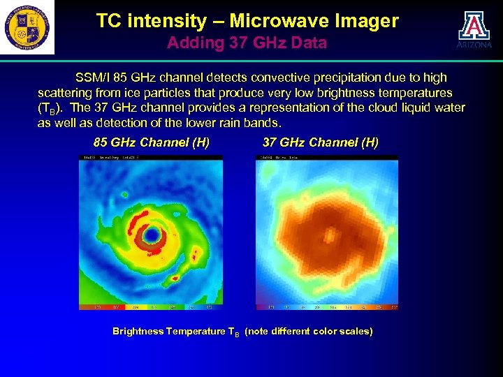 TC intensity – Microwave Imager Adding 37 GHz Data SSM/I 85 GHz channel detects convective precipitation due to high scattering from ice particles that produce very low brightness temperatures (TB). The 37 GHz channel provides a representation of the cloud liquid water as well as detection of the lower rain bands. 85 GHz Channel (H) 37 GHz Channel (H) Brightness Temperature TB (note different color scales)
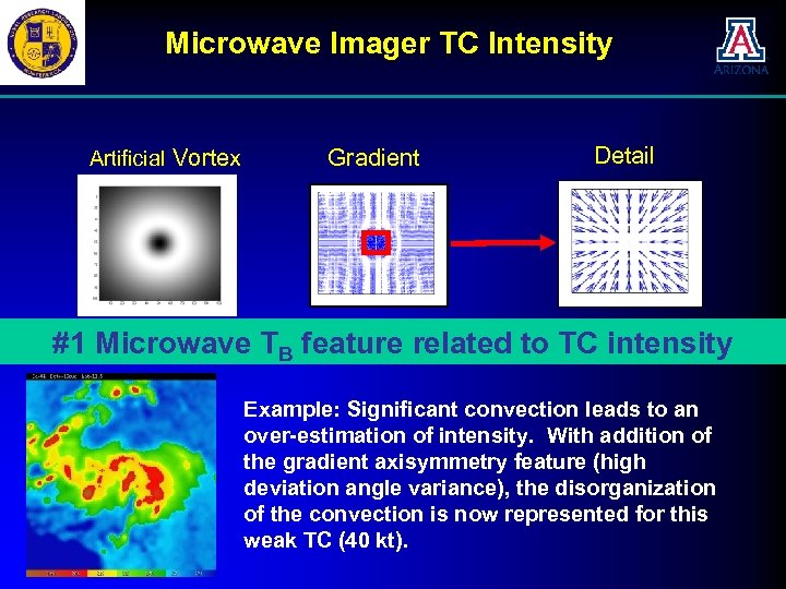 Microwave Imager TC Intensity Artificial Vortex Gradient Detail Idealized Case: Low #1 Microwave Tdeviation angle variance –to TC intensity feature related High axisymmetry B Example: Significant convection leads to an over-estimation of intensity. With addition of the gradient axisymmetry feature (high deviation angle variance), the disorganization of the convection is now represented for this weak TC (40 kt).
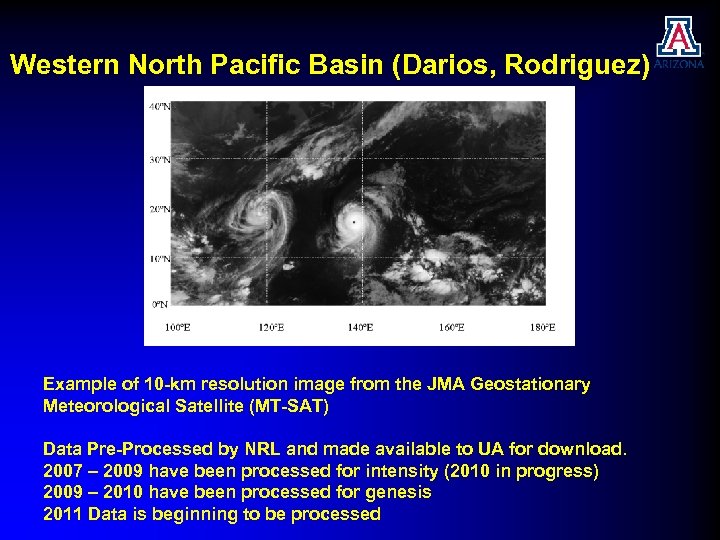 Western North Pacific Basin (Darios, Rodriguez) Example of 10 -km resolution image from the JMA Geostationary Meteorological Satellite (MT-SAT) Data Pre-Processed by NRL and made available to UA for download. 2007 – 2009 have been processed for intensity (2010 in progress) 2009 – 2010 have been processed for genesis 2011 Data is beginning to be processed
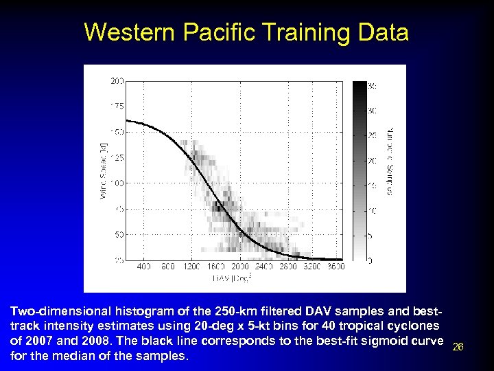 Western Pacific Training Data Two-dimensional histogram of the 250 -km filtered DAV samples and besttrack intensity estimates using 20 -deg x 5 -kt bins for 40 tropical cyclones of 2007 and 2008. The black line corresponds to the best-fit sigmoid curve 26 for the median of the samples.
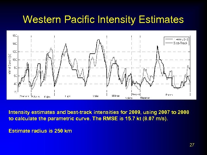 Western Pacific Intensity Estimates Intensity estimates and best-track intensities for 2009, using 2007 to 2008 to calculate the parametric curve. The RMSE is 15. 7 kt (8. 07 m/s). Estimate radius is 250 km 27
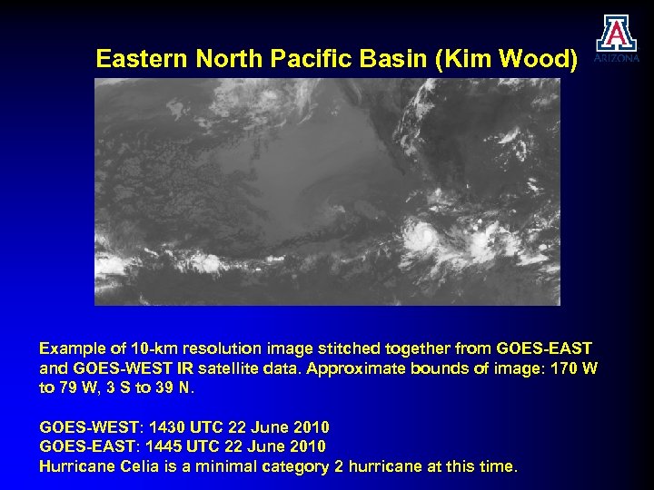 Eastern North Pacific Basin (Kim Wood) Example of 10 -km resolution image stitched together from GOES-EAST and GOES-WEST IR satellite data. Approximate bounds of image: 170 W to 79 W, 3 S to 39 N. GOES-WEST: 1430 UTC 22 June 2010 GOES-EAST: 1445 UTC 22 June 2010 Hurricane Celia is a minimal category 2 hurricane at this time.
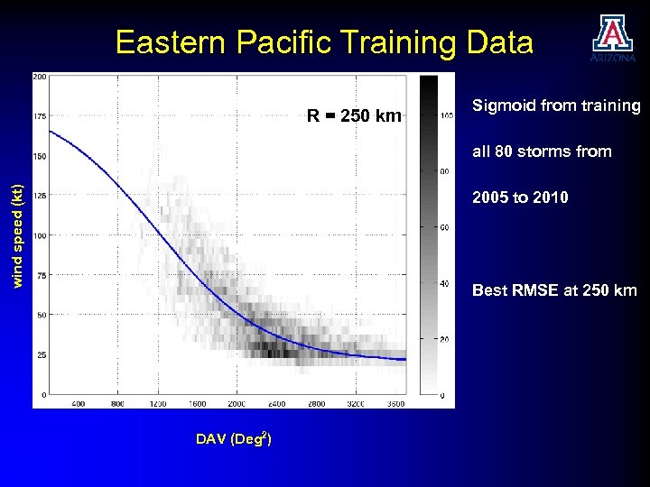 Eastern Pacific Training Data R = 250 km Sigmoid from training wind speed (kt) all 80 storms from 2005 to 2010 Best RMSE at 250 km DAV (Deg 2)
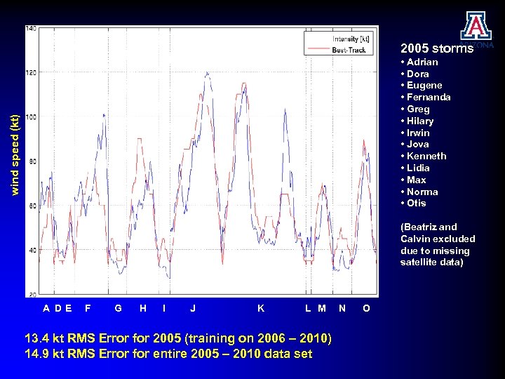 2005 storms 2005 RMSE: 13. 3 kt at 200 km wind speed (kt) • Adrian • Dora • Eugene • Fernanda • Greg • Hilary • Irwin • Jova • Kenneth • Lidia • Max • Norma • Otis (Beatriz and Calvin excluded due to missing satellite data) A DE F G H I J K L M 13. 4 kt RMS Error for 2005 (training on 2006 – 2010) 14. 9 kt RMS Error for entire 2005 – 2010 data set N O
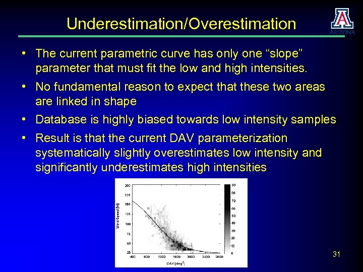 Underestimation/Overestimation • The current parametric curve has only one “slope” parameter that must fit the low and high intensities. • No fundamental reason to expect that these two areas are linked in shape • Database is highly biased towards low intensity samples • Result is that the current DAV parameterization systematically slightly overestimates low intensity and significantly underestimates high intensities 31
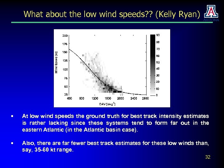 What about the low wind speeds? ? (Kelly Ryan) • At low wind speeds the ground truth for best track intensity estimates is rather lacking since these systems tend to form far out in the eastern Atlantic (in the Atlantic basin case). • Also, there are far fewer best track estimates for these low winds than, say, 35 -60 kt range. 32
 What about the low wind speeds? ? • This means that the spread in DAV to best track estimates for the low wind speeds is much higher, giving low confidence in the validity of the parametric DAV-intensity curve at these low wind speeds. • Two methodologies we are pursuing to mitigate this problem: 1. run realizations of real cases using a high-resolution mesoscale model from which we can build our own “best track intensity” database and match it to simulated DAV values. This has the advantage that we will obtain 30 -min intensity estimates to match the 30 -min DAV calculations – already started on 2010 cases. 2. use the subset of observations where there aircraft reconnaissance intensities at the low wind speeds to build the relationship. Will there be enough for the parametric curve to be robust? We will see! 33
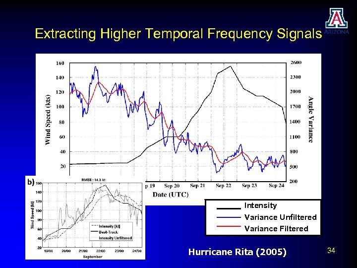 Extracting Higher Temporal Frequency Signals Intensity Variance Unfiltered Intensity Variance Filtered Hurricane Rita (2005) 34
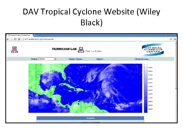
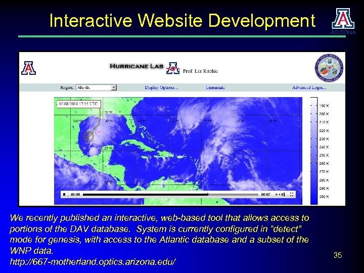 Interactive Website Development We recently published an interactive, web-based tool that allows access to portions of the DAV database. System is currently configured in “detect” mode for genesis, with access to the Atlantic database and a subset of the WNP data. http: //667 -motherland. optics. arizona. edu/ 35
 7. Summary • DAV Technique objectively characterizes axisymmetry from IR images (and other data) in way that is robustly correlated with intensity • DAV has good accuracy at low intensities, and is a reliable indicator of genesis • Several recent improvements in DAV method: o Use of subjective centers provides greater accuracy o Addition of a second parameter helps resolve low/high intensity issues o Application of DAV to microwave data has been shown to be promising • Extended the analysis to the North Pacific Ocean basins o Westpac using MTSAT data provided and preprocessed by NRL, Genesis (2007 – 2009); Intensity (2009 – 2010) o East Pac using stitched GOES-E/GOES-W data (Intensity, 2005 – 2010) • Ongoing Science Issues o Systematic Under/Over Estimation Issues associated with training set o High temporal frequency signals at low intensities • Data dissemination through Interactive Web Tool 36
 Ongoing and Future Work • Modeling studies to investigate high temporal frequency signals and their relationship to atmospheric dynamics • Development (with NRL and JTWC) of a real-time protocol for accessing and processing MTSAT data for WNP forecast use in 2012 • Creation of a method to provide DAV intensity time series through the website • Adapt parametric curve to allow better simultaneous fitting at the low and high intensities 37
 Thank you Piñeros, M. F. , E. A. Ritchie, and J. S. Tyo 2008: Objective measures of tropical cyclone structure and intensity change from remotely-sensed infrared image data. IEEE Trans. Geosciences and remote sensing. 46, 3574 – 3580. Piñeros, M. F. , E. A. Ritchie, and J. S. Tyo 2010: Detecting tropical cyclone genesis from remotely-sensed infrared image data. IEEE Trans. Geosciences and Remote Sensing Letters, 7: 826 – 830. Piñeros, M. F. , E. A. Ritchie, and J. S. Tyo 2011: Estimating tropical cyclone intensity from infrared image data. Wea. Forecasting, 26: 690 – 698 Ritchie, E. A. , G. Valiere-Kelly, M. F. Piñeros, and J. S. Tyo, “Tropical cyclone intensity estimation in the North Atlantic basin using an improved deviation angle variance technique, ” Submitted to Weather & Forecasting, December 2011 Piñeros, M. F. , I. Darios Hernandez, E. A. Ritchie, and J. S. Tyo, “Deviation Angle Variance Technique for Tropical Cyclones Intensity and Genesis in the Western North Pacific, ” in preparation for submission to Weather & Forecasting Wood, K. W. , M. F. Piñeros, E. A. Ritchie, and J. S. Tyo, “Estimating Tropical Cyclone Intensity in the Eastern North Pacific from GOES-E/GOES-W Infrared Data, ” in preparation for submission to Weather & Forecasting 38
 Upcoming Talks & Posters Elizabeth A. Ritchie, Wiley Black, J. Scott Tyo, M. F. Pineros, Kimberly M. Wood, Oscar Rodriguez-Herrera, Matthew E. Kucas, and James W. E. Darlow, “A Web-based Interactive Interface for Researching and Forecasting Tropical Cyclone Genesis and Intensity using the Deviation Angle Variance Technique, ” submitted to the 2012 Interdepartmental Hurricane Conference, Charleston, SC, March 2012 – MONDAY EVENING POSTER SESSION E. A. Ritchie, M. F. Piñeros, J. Scott Tyo, Kimberly M. Wood, Genevieve Valliere-Kelley, Wiley Black, Oscar Rodriguez-Herrera, and Ivan Arias Hernández, “Tropical Cyclone Intensity Estimation and Formation Detection using the Deviation Angle Variance Technique, ” submitted to the 2012 Interdepartmental Hurricane Conference, Charleston, SC, March 2012 – TUESDAY 3: 45 PM Miguel F. Piñeros, Elizabeth A. Ritchie, J. Scott Tyo, Kim M. Wood, Genevieve Valliere. Kelley, Ivan Arias Hernández, Wiley Black, and Oscar Dominguez , “Tropical Cyclone Intensity Estimation and Formation Detection using the Deviation Angle Variance Technique, ” submitted to the American Meteorological Socitey 30 th Conference on Hurricanes and Tropical Meteorology, April 15 -20, Ponte Vedra Beach, FL, USA. 39
 DAV Tropical Cyclone Website (Wiley Black)
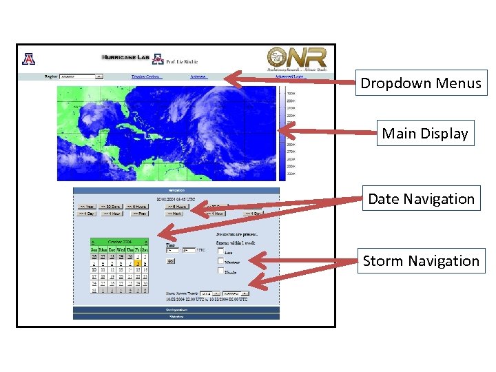 Dropdown Menus Main Display Date Navigation Storm Navigation
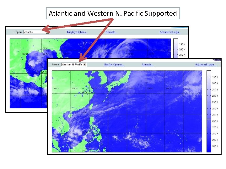 Atlantic and Western N. Pacific Supported
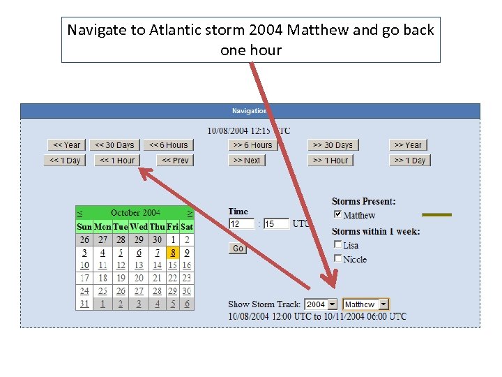 Navigate to Atlantic storm 2004 Matthew and go back one hour
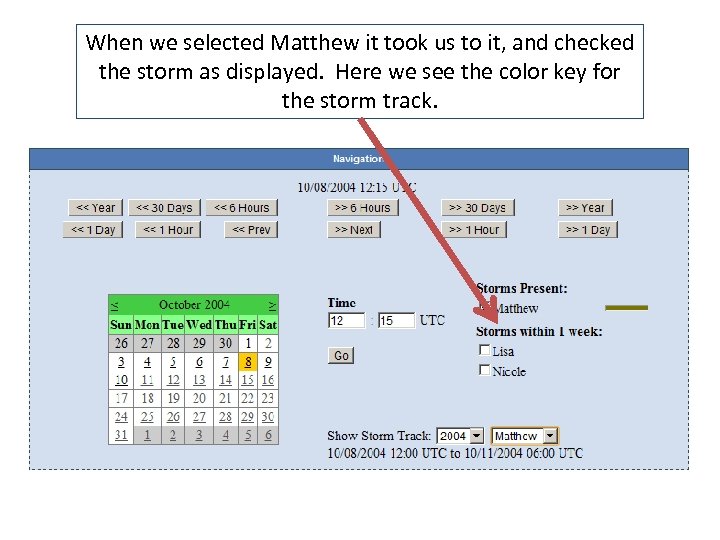 When we selected Matthew it took us to it, and checked the storm as displayed. Here we see the color key for the storm track.
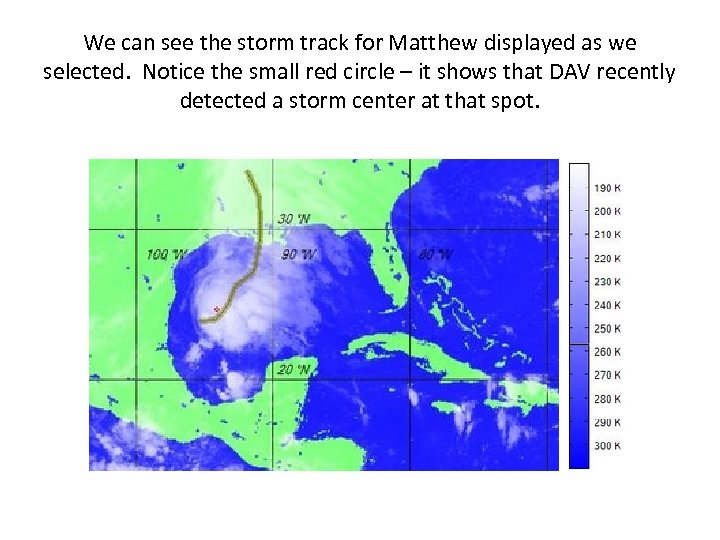 We can see the storm track for Matthew displayed as we selected. Notice the small red circle – it shows that DAV recently detected a storm center at that spot.
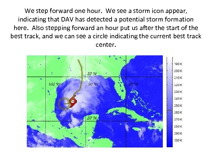 We step forward one hour. We see a storm icon appear, indicating that DAV has detected a potential storm formation here. Also stepping forward an hour put us after the start of the best track, and we can see a circle indicating the current best track center.
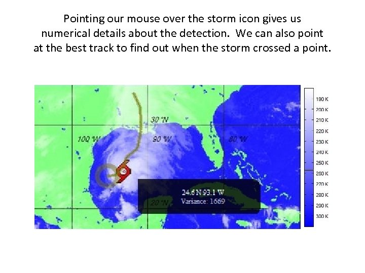 Pointing our mouse over the storm icon gives us numerical details about the detection. We can also point at the best track to find out when the storm crossed a point.
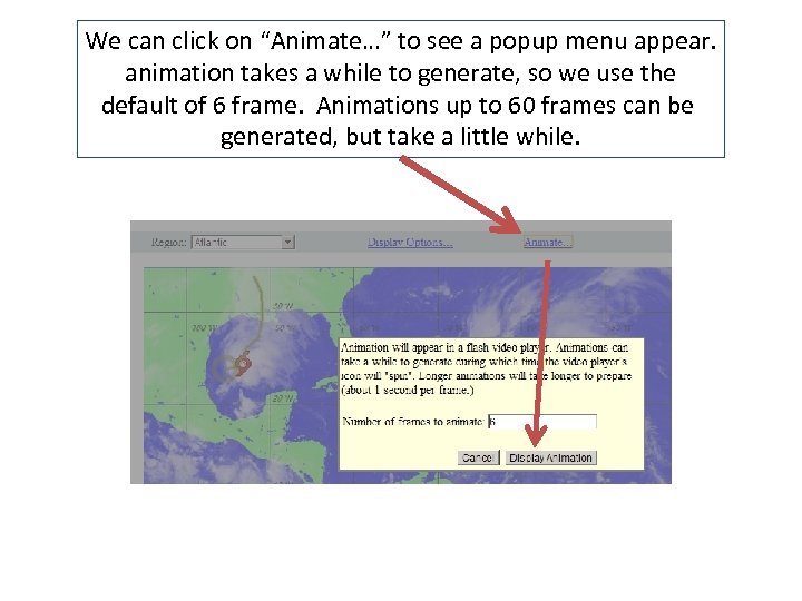 We can click on “Animate…” to see a popup menu appear. animation takes a while to generate, so we use the default of 6 frame. Animations up to 60 frames can be generated, but take a little while.
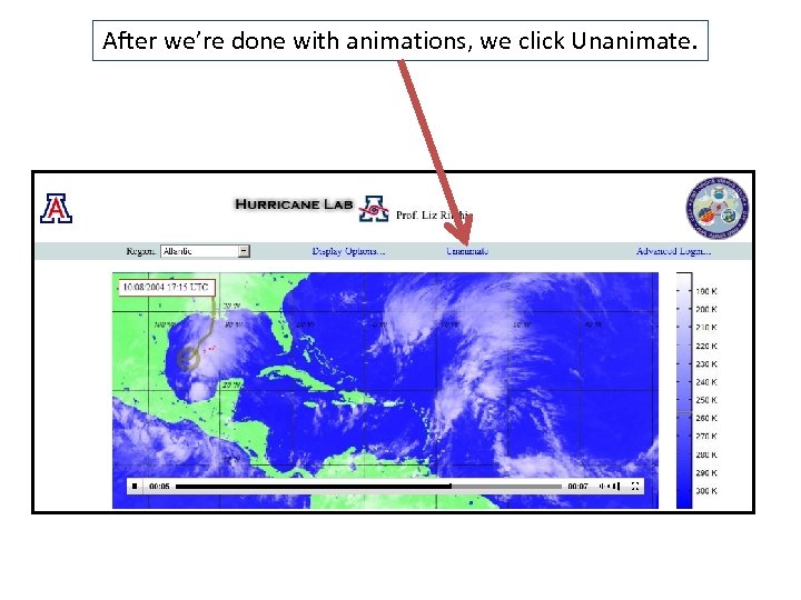 After we’re done with animations, we click Unanimate.
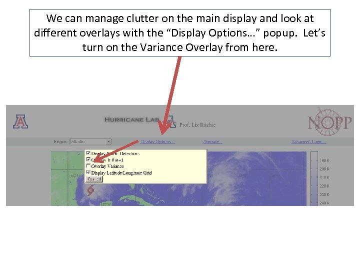 We can manage clutter on the main display and look at different overlays with the “Display Options…” popup. Let’s turn on the Variance Overlay from here.
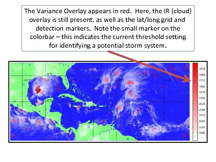 The Variance Overlay appears in red. Here, the IR (cloud) overlay is still present, as well as the lat/long grid and detection markers. Note the small marker on the colorbar – this indicates the current threshold setting for identifying a potential storm system.
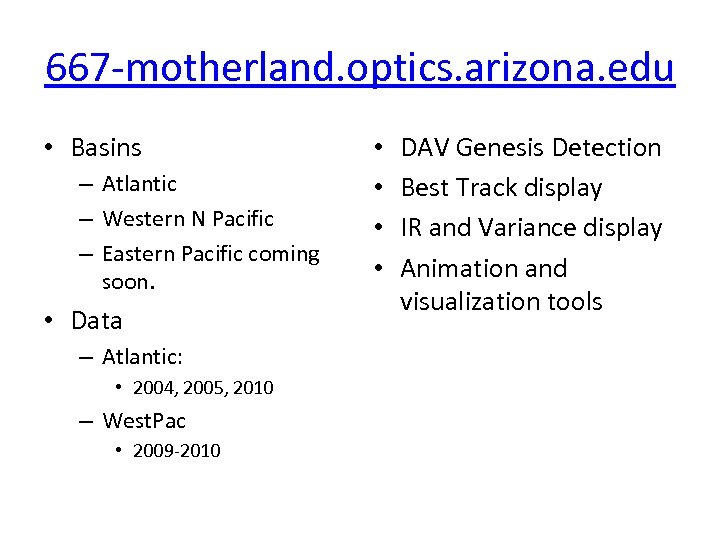 667 -motherland. optics. arizona. edu • Basins – Atlantic – Western N Pacific – Eastern Pacific coming soon. • Data – Atlantic: • 2004, 2005, 2010 – West. Pac • 2009 -2010 • • DAV Genesis Detection Best Track display IR and Variance display Animation and visualization tools
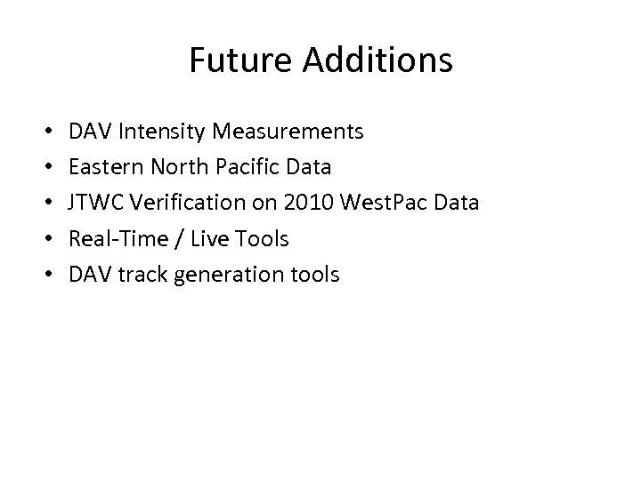 Future Additions • • • DAV Intensity Measurements Eastern North Pacific Data JTWC Verification on 2010 West. Pac Data Real-Time / Live Tools DAV track generation tools


