

b658d27976eafeec50883e23f3068fbd.ppt
- Количество слайдов: 80
 Application Studies using GRAM++ GIS
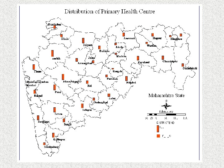
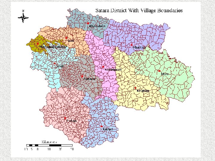
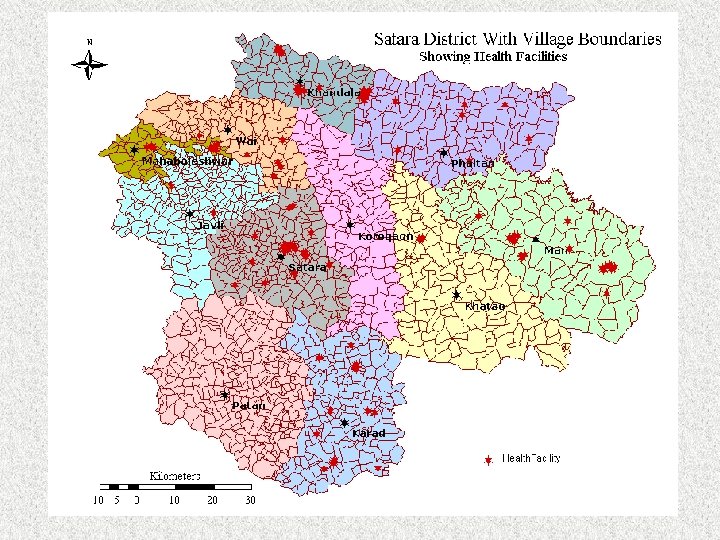
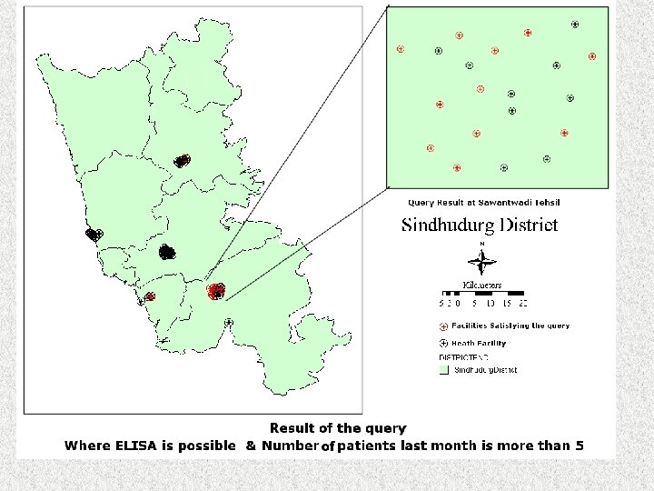
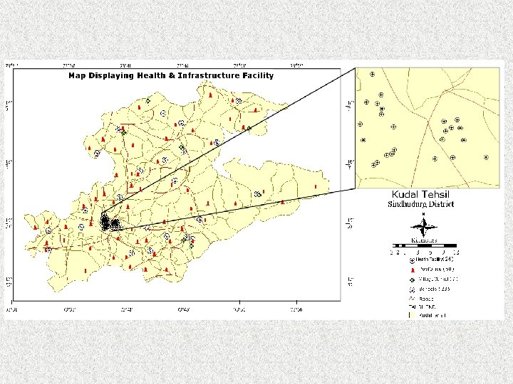
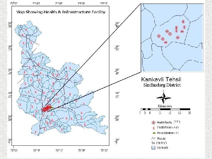
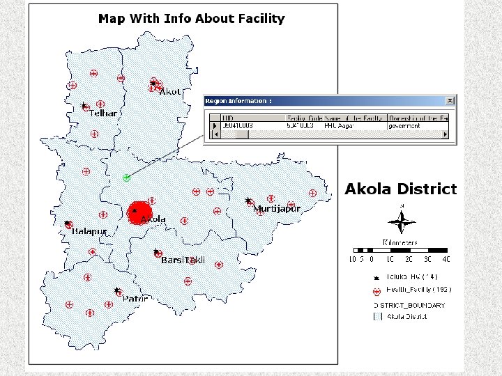
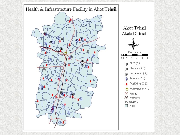
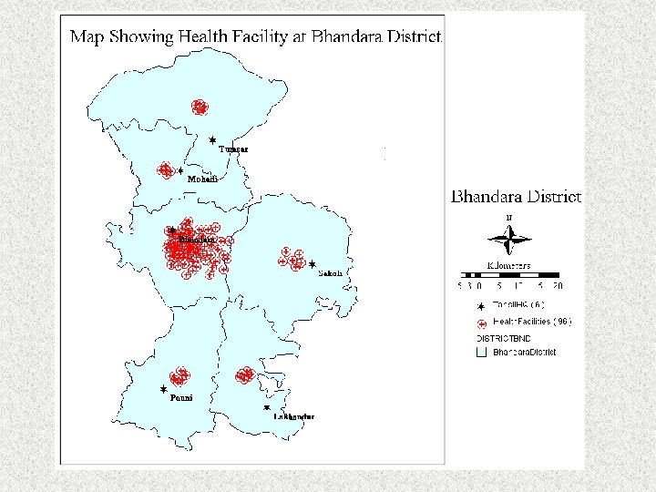
 GIS And Its Application In Health Sector A Health GIS For Directorate Of Health Maharashtra Service Availability Mapping of HIV/AIDS in Maharashtra State
 Project Objectives • Creation Of Spatial Database For District And Tehsil Level • Linking Of Spatial Database With Field Survey Data • Devoloping Health GIS using GRAM++ GIS • Generation Of Interactive Maps • Training District Level Officials On Use Of GRAM++ Health GIS
 Map of Maharashtra State
 Screenshot of Database showing different Tables
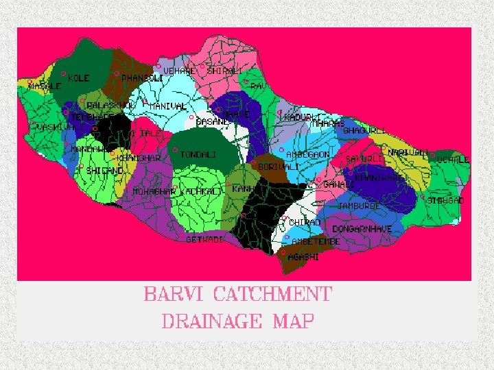
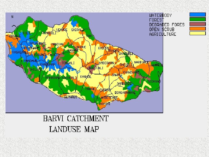
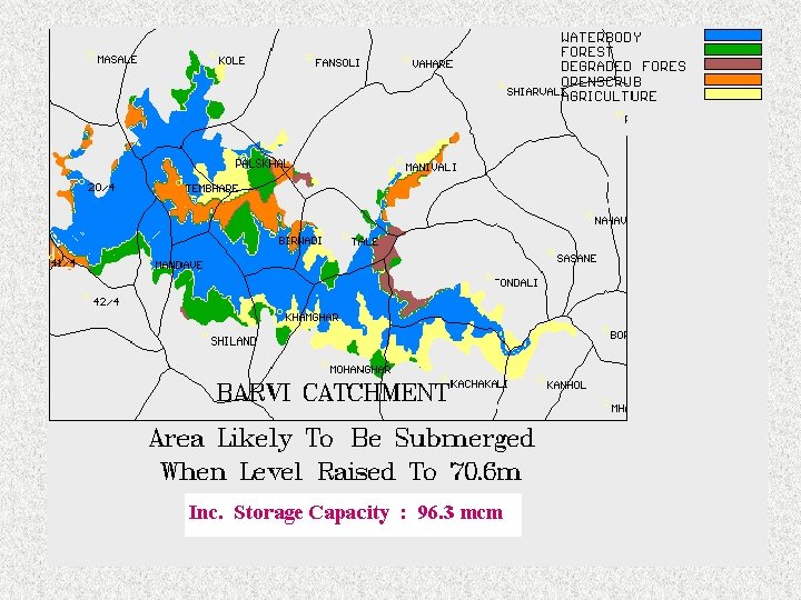
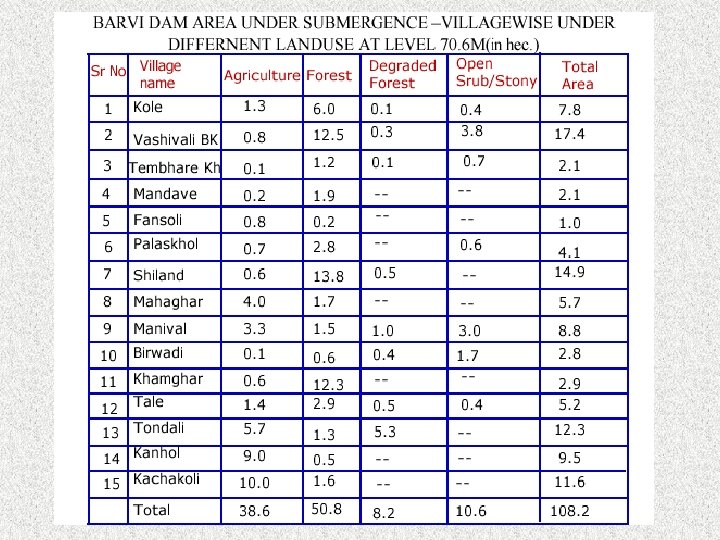
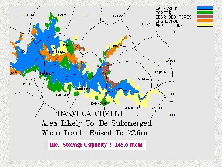
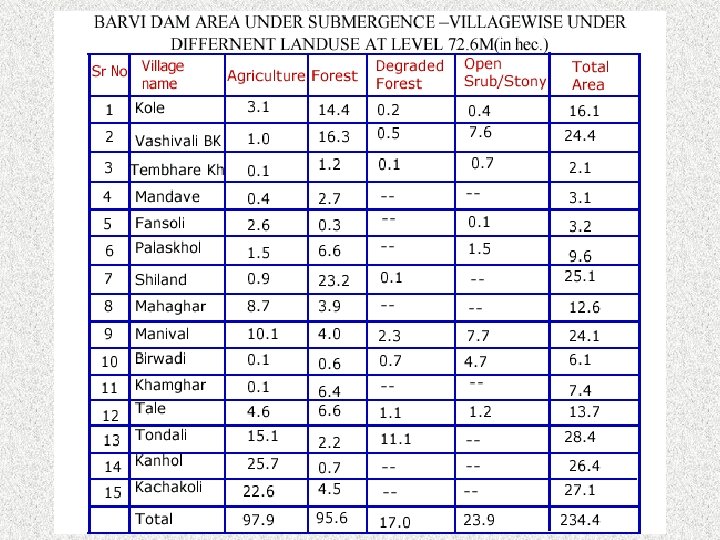
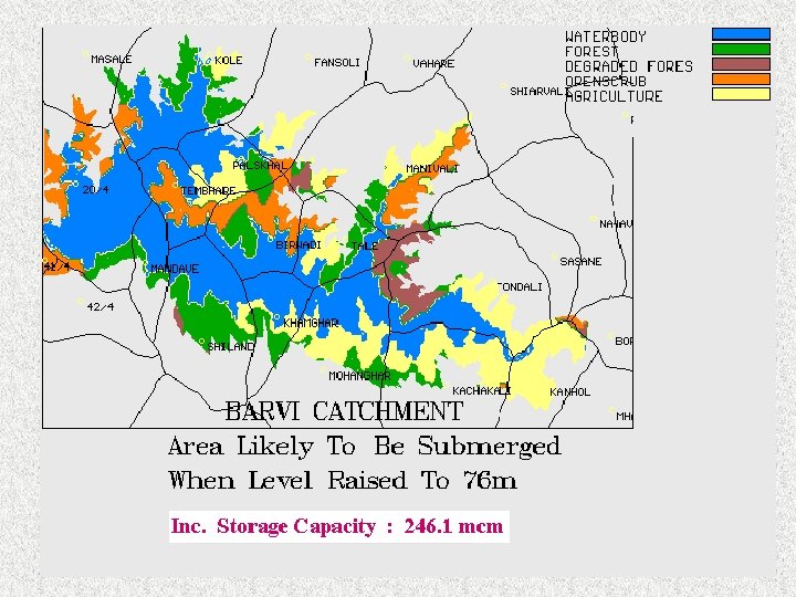
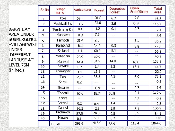
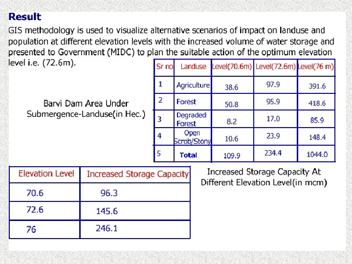
 Environmental Study for Barvi Reservoir, Maharashtra.
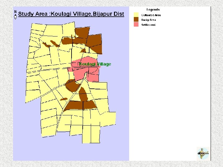
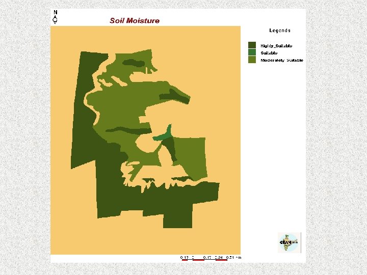
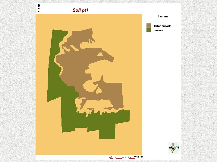
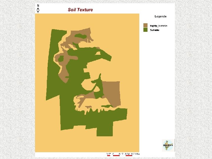
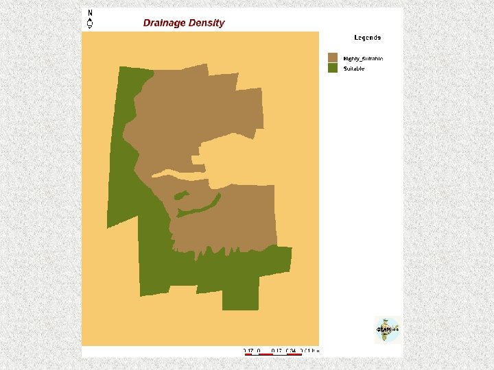
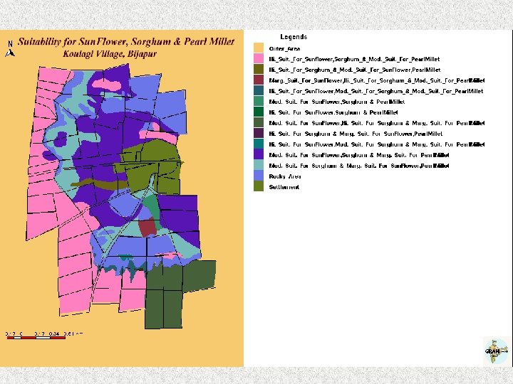
 Crop Suitability Study for Koulagi Village, Bijapur District, Karnataka Regional Agriculture Research Station, Bijapur.

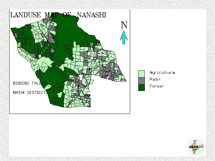
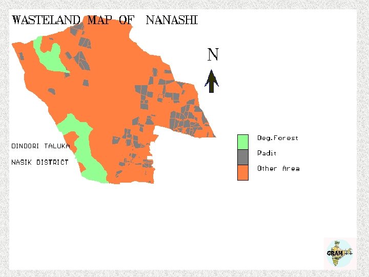
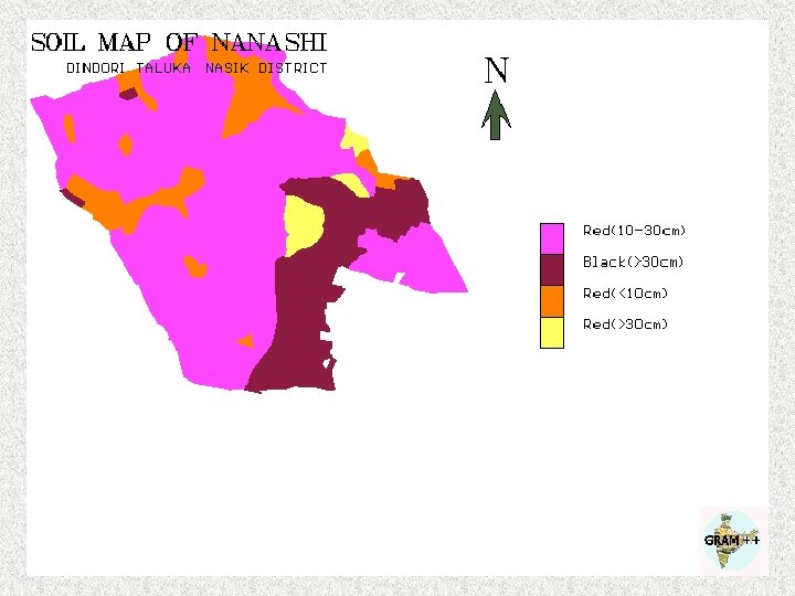
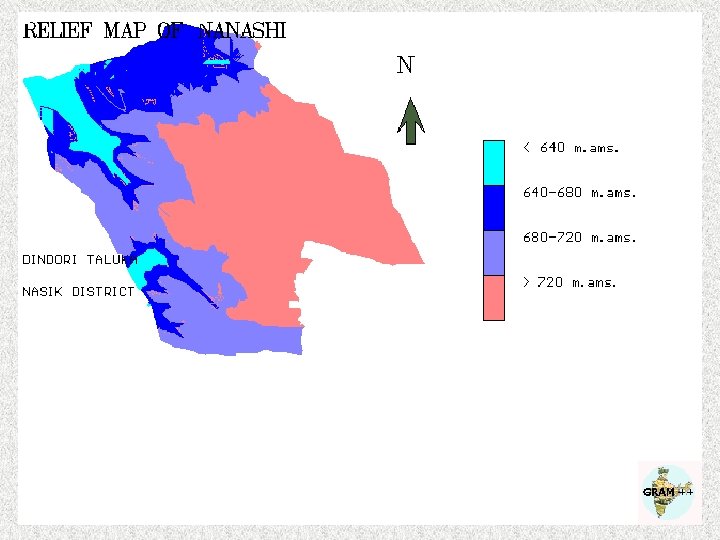
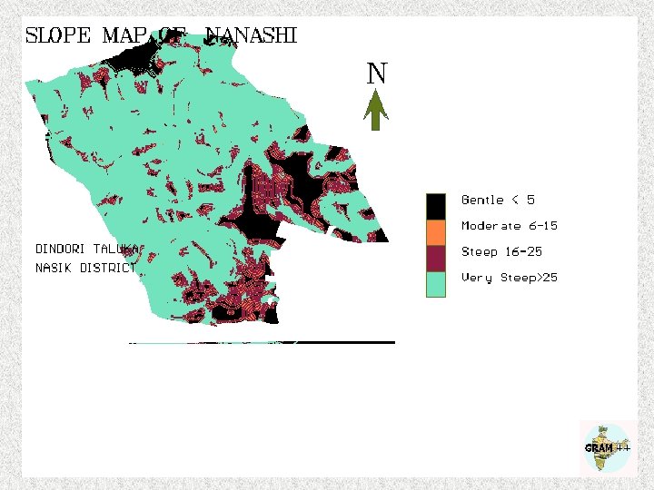
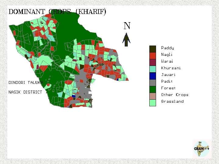
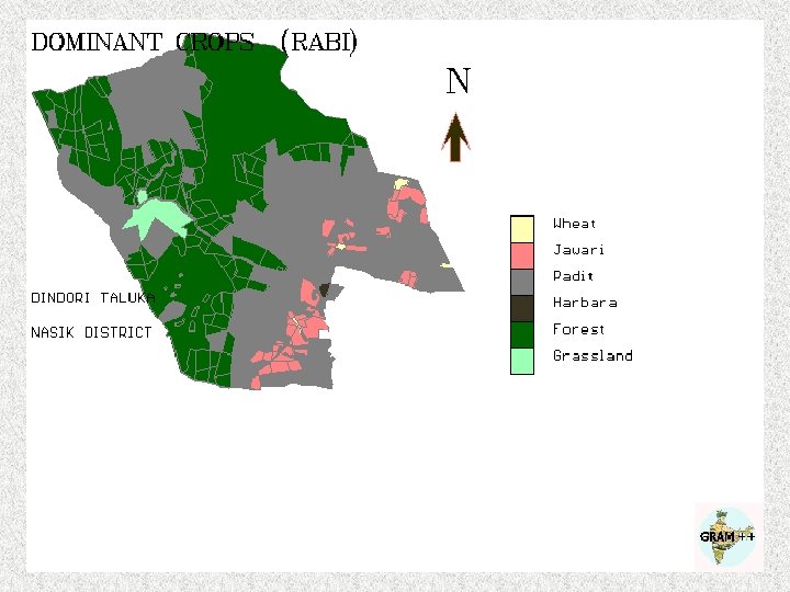
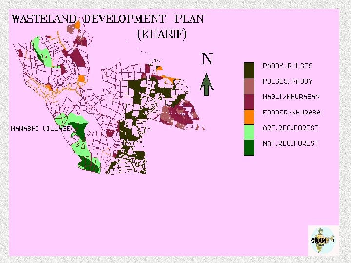
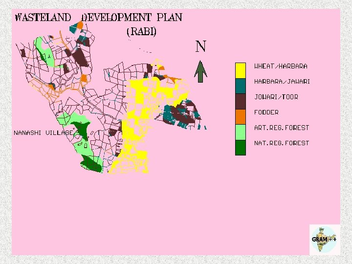
 Wasteland Development Plan Nanashi Village, Dindori Taluka, Nashik District
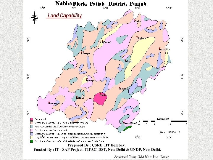
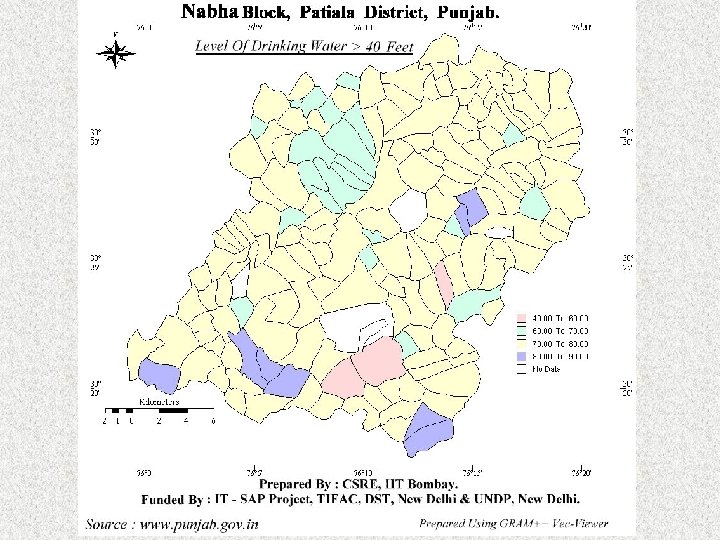
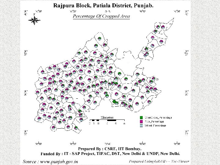
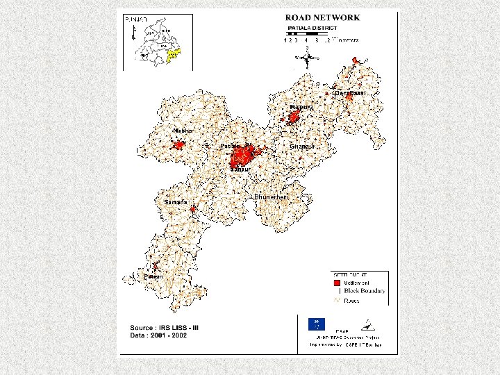
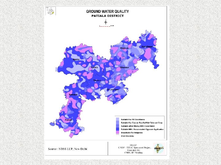
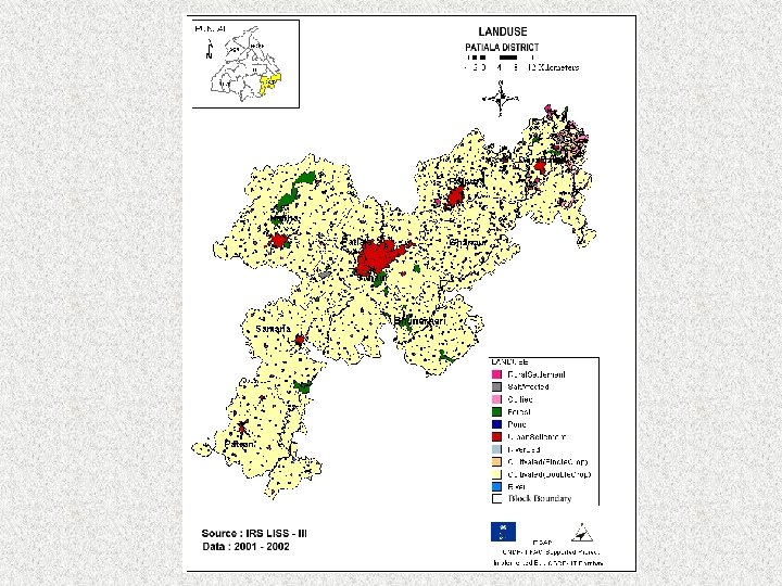
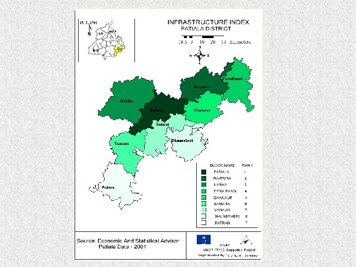
 Development of Spatial Resources Profile for Patiala District Data Used Ø Ø Ø Ø IRS LISS III 2 Seasons FCC (1: 50000) and IRSLISS III and PAN Toposheets (SOI) Village Boundary, Soil, Hydrogeomorphology (PRSC) Land Capability, Land Irrigability, Physiography, Saline and Alkaline land Crop Combination (NBSS & LUP) Groundwater data (CGWB, Dept. of Water Resources, Punjab) Census Handbook and Gazetteer Education Dept. – Data CD Socio Economic and Infrastructure Data – URL - www. punjab. gov. in
 Spatial Data Layers Prepared For All Blocks Block Boundary, Panchayat Boundary, Village Boundary, Land use, Physiography, Hydrogeomorphology, Soil, Land Capability, Land Irrigability, Salt Affected Areas, Crop Combination, Settlement Patterns, Drainage, Canal, Depth to Water (June, October), Roads Railway Lines, Imp Locations. Associated Database 1991 Census Data (Village wise): Education, Drinking Water, Communication, Postal Facility, Medical Facility, Irrigated Area, Agricultural Implements, Area under different crops, Educational Facilities, Infrastructure, Health Institution, Industry, Loans, Livestock, Self-Employment.
 AN APPLICATION OF GRAM++ FOR RURAL DEVELOPMENT
 at various blocks of Madhya Pradesh and Chattisgargh states") Background: §Technology Resource Centers (TRC) at various blocks of Madhya Pradesh and Chattisgargh states are operating under an UNDP-DST subprogramme on TDC-TRC Network. §Under the sub-programme a detailed house-tohouse surveys were conducted to understand the human development status in all the houses (2, 28, 850) of the all the ten blocks. §Simultaneously each village (1, 611) of all the blocks is mapped at cadastral level (1: 4, 000) to assess the natural resource potential.
Background: §Technology Resource Centers (TRC) at various blocks of Madhya Pradesh and Chattisgargh states are operating under an UNDP-DST subprogramme on TDC-TRC Network. §Under the sub-programme a detailed house-tohouse surveys were conducted to understand the human development status in all the houses (2, 28, 850) of the all the ten blocks. §Simultaneously each village (1, 611) of all the blocks is mapped at cadastral level (1: 4, 000) to assess the natural resource potential.
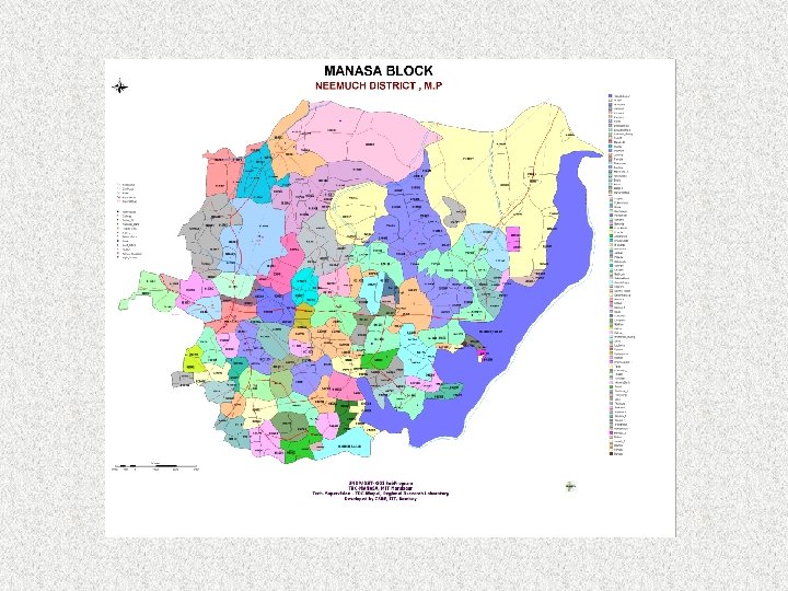
 Location:
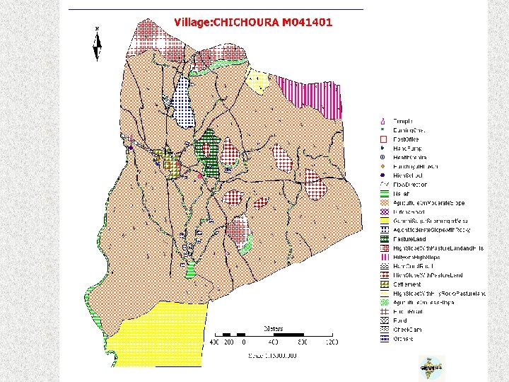
 Methodology: v. Assigning typical ID for each village. Ex. : M 010101 v. Converting house-hold survey schedules as database records Parameters for house hold survey: 1. Demographic Details 2. Income Generation 3. House Hold Inventory 4. Expenditure Pattern 5. Marketing Ability 6. Medical Background 7. Social Linkages 8. Migration Attitude 9. Transportation Linkages 10. Technological Experience 11. Unemployment Details
 Creation of Spatial Database in GRAM ++ environment Elements of") Methodology (Contd. . ) Creation of Spatial Database in GRAM ++ environment Elements of Database: Point Layers 30 Items : Ex. Wells, Schools, Post Office Segment Layers 17 Items: Ex. Road, Electricity, Drainage Polygon Layers 5 Items: Ex. Village Boundary, Land use, Water Bodies
Methodology (Contd. . ) Creation of Spatial Database in GRAM ++ environment Elements of Database: Point Layers 30 Items : Ex. Wells, Schools, Post Office Segment Layers 17 Items: Ex. Road, Electricity, Drainage Polygon Layers 5 Items: Ex. Village Boundary, Land use, Water Bodies
 Integration of Elements: v. Estimation of aggregates for each village") Methodology (Contd. . ) Integration of Elements: v. Estimation of aggregates for each village from house hold data v. Linking of non-spatial data sets to spatial objects v. Cross validation of data sets from census data v. Creation of mosaic from village level maps to block level map v. Transfer of village level aggregate features to block level map
Methodology (Contd. . ) Integration of Elements: v. Estimation of aggregates for each village from house hold data v. Linking of non-spatial data sets to spatial objects v. Cross validation of data sets from census data v. Creation of mosaic from village level maps to block level map v. Transfer of village level aggregate features to block level map
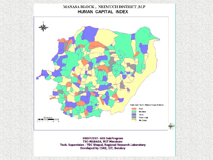
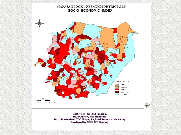
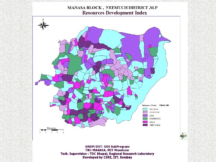
 Development of Indices Three Types: 1. Human-Capital Index 2. Socio-Economic Index 3. Agro-ecological Index The above indices are integrated to generate Resources Development Index Map
 Human Capital Index This is determined by estimation of : 1. Pressure on Working Class Index 2. Rural Female Literacy Rate Index 3. Sex Ratio Index
 Agro-ecological Index This is determined by : 1. Percentage of Crop area Index 2. Well Index 3. Total Agriculture Income Index
 Agro-ecological Index
 Socio Economic Index Determined by the estimation of : 1. Type of House Hold Index 2. Electrified Household Index 3. Kerosene Lighted Household Index 4. Wood Fueled Household Index 5. Kerosene Fueled Household Index 6. Household Income Index 7. Live Stock Index 8. Road Index 9. Tractors Index
 Conclusion: ØThis project illustrates effective usage of IT including GIS for identifying developmental programs based on local human and natural resources available. ØBased on the inputs from the needs assessment and identification of high stress regions through indexing, the programme is oriented in proper direction. ØThe suggestions made based on the assessment done above to improve income generation for the local population. ØIndigenous GRAM++ GIS tools were effectively used for the purpose.