

935c7049af5ec772af8d8ddc9a7b555f.ppt
- Количество слайдов: 25
 A Partnership Approach to Data Access in Minnesota Chris Cialek Land Management Information Center chris. cialek@state. mn. us Minnesota GIS/LIS Consortium Conference October 3, 2002
 Topics n Data access challenges n Solutions developed n Policies and procedures required n Future considerations
 Data Access Challenges n A unique role for LMIC n Not mandated to gather specific data, but to: foster integration of environmental information & provide services in computer mapping & graphics, environmental analysis, & small systems development n Historic role led to many collaborations & lots of new data: Enhancements to EPPL software n GIS projects for other state agencies n Coordination of large data collections n Archive and distribute those data n
 Data Access Challenges n A unique role for LMIC n Constituents Customers for applications development services n State’s GIS users looking for data n Schools & educators looking for GIS assistance n
 Data Access Challenges n Problem n By the late 1980’s: Quantity of data increasing dramatically n Demand increasing n Growing expectation that it was out there. . . somewhere n n At the same time: Organization of data was in disarray n Casual development & distribution creating confusion. Expectations not in sync with reality n
 Data Access Challenges n Issues Data models n Data formats n Accuracy n Nomenclature n Content standards n Portable data storage n Distribution policies n The Internet! n
 Data Access Solutions n Library Model
 Electronic Card Catalog n Databases of library resources Rely on structured cataloging rules n Metadata, in a format called Dublin Core n n Users query that database n n Title, author, subject, keywords Results identify availability of resources At that facility n And at others, in town or across the country n
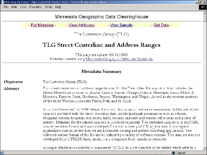
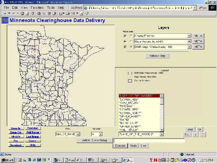
 Data Access Solution
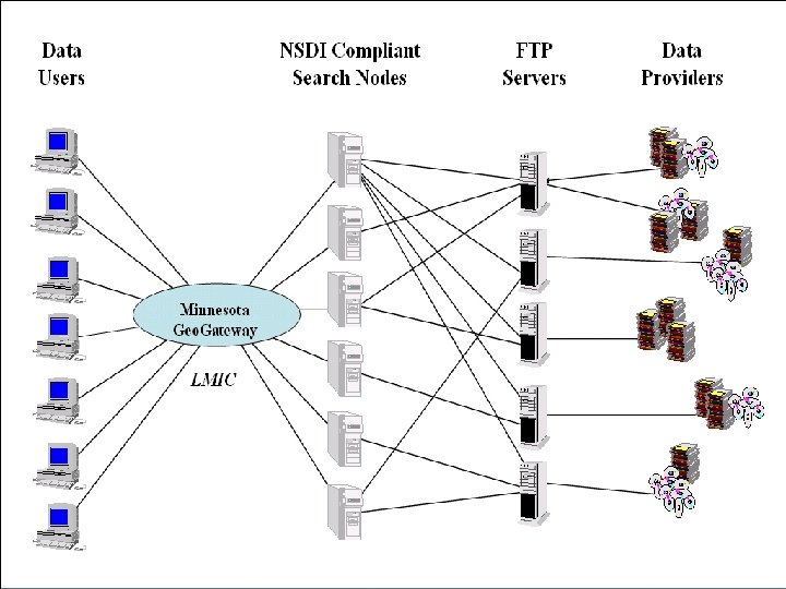
 Adaptations of the Geo. Gateway
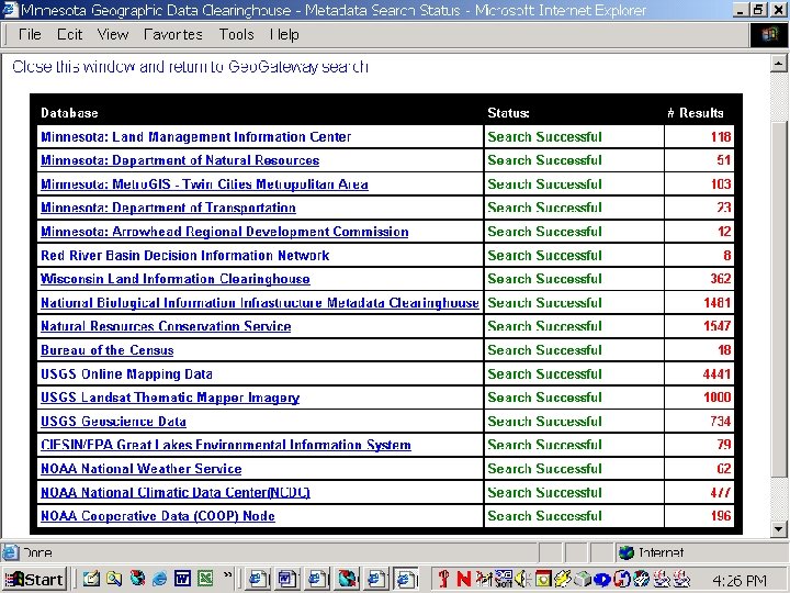
 How the Geo. Gateway Works Modeled after the Federal Clearinghouse n Spatial search engine Relies on metadata n Query on keywords, dates, geography, source n n Distributed searches n n Search many different sources simultaneously Data distribution controlled by provider Provide a phone number or download directly n New web mapping applications enhance options n
 Data Delivery is on the Rise Web technology has dramatically increased data delivery from LMIC’s web site. The DNR, Metro. GIS, Mn/DOT and other Minnesota providers have experienced similar growth.
 Policies and Procedures n Standards Based Sound documentation practices - metadata n Map projection/datum guidelines n Coding standards for common features n Accuracy n Communication protocols n
 Policies and Procedures n Software Tools Data. Logr n Arc. Catalog n n Training and Promotion 2002: Nine metadata training classes n Metadata identity program n n Partnerships n Over 50 organizations today
 The Future n Enhanced web access n Metro. GIS Data. Finder Café Begins integrating map service technologies n Provides user selected regions & format n Honors distribution policies of contributors n
 The Future n Enhanced web access n New Technology grant: Geo. Integrator Extends scope: statewide n Builds library-style search option n Includes more output formats n Projection/coordinate conversions on-the-fly n Implements new OGC standards n Begins to establish a statewide architecture n Can provide portal & data streaming services for applications developers n
 Geo. Integrator Architectural Diagram Web Browser Requests Standardized Metadata Records Geo. Integrator Distribution Client can browse and download data. Geo. Integrator Extract and Map client can extract data from native formats, translate data, and produce a map for viewing or printing. Security Module [Future] Data Warehouse Arc. IMS Instance [Met Council] Data Warehouse Arc. IMS Instances [Others] Geo. Integrator Cascading & Extracting Web Map Service Data Warehouse Arc. IMS Instance [Mn/DOT] Geo. Integrator Data Distribution Client Arc. IMS Instance [LMIC] Data Warehouses WMS Instance [DNR] Data Warehouse WMS Instances [Others] Data Warehouses
 The Future n Technical training: Federal grant Metadata – “train the trainer” program n Accelerate use of metadata for Arc. GIS users (Arc. Catalog) n Seed money for new data libraries n Investigations into international standards n
 The Future n Increased partnerships Focus on non-metro counties & local governments n Data producing state agencies not historically involved n Governor’s Council I-Team initiative n