ad8801d6160dc08a99ad2a1838bccee4.ppt
- Количество слайдов: 40
 A Historical Perspective on the Role of NWP Models in the Prediction of Severe Local Storms Steven J. Weiss and Joseph T. Schaefer steven. j. weiss@noaa. gov Where Americas Climate and Weather Services Begin
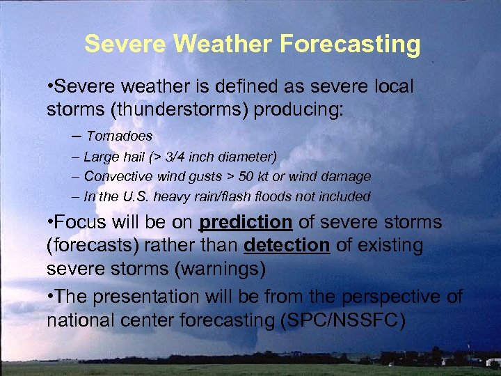 Severe Weather Forecasting • Severe weather is defined as severe local storms (thunderstorms) producing: – Tornadoes – Large hail (> 3/4 inch diameter) – Convective wind gusts > 50 kt or wind damage – In the U. S. heavy rain/flash floods not included • Focus will be on prediction of severe storms (forecasts) rather than detection of existing severe storms (warnings) • The presentation will be from the perspective of national center forecasting (SPC/NSSFC)
 The Beginning of Modern Severe Weather Forecasting • NWP and tornado forecasting activities both began in the middle of the 20 th century – NWP focused on synoptic scale prediction – Tornado prediction focused on mesoscale and storm scale phenomena – Despite having similar origins in time, it would take several decades before the paths of NWP and severe weather forecasting would become closely aligned
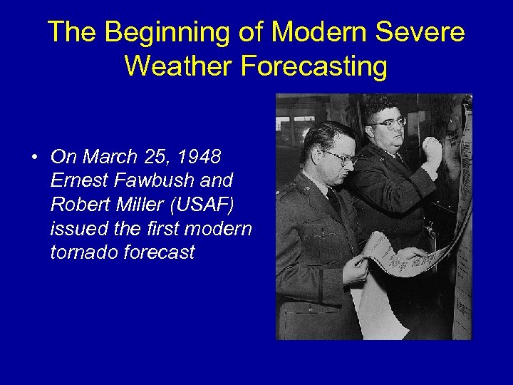 The Beginning of Modern Severe Weather Forecasting • On March 25, 1948 Ernest Fawbush and Robert Miller (USAF) issued the first modern tornado forecast
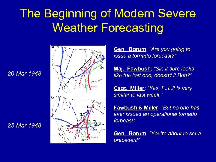 The Beginning of Modern Severe Weather Forecasting Gen. Borum: “Are you going to issue a tornado forecast? ” 20 Mar 1948 Maj. Fawbush: “Sir, it sure looks like the last one, doesn’t it Bob? ” Capt. Miller: “Yes, E. J. , it is very similar to last week. ” 25 Mar 1948 Fawbush & Miller: “But no one has ever issued an operational tornado forecast” Gen. Borum: “You’re about to set a precedent”
 US Weather Bureau Tornado Forecasts • Based on their success March 25, 1948, Fawbush and Miller were assigned to issue USAF tornado forecasts • By early 1952 complaints from public and media, and Congressional pressure forced Weather Bureau to issue tornado forecasts • A temporary group of research forecasters and supervising analysts at the Washington DC Analysis Center formed initial Severe Weather Unit (SWU) • The first public tornado forecast was issued March 17 1952 (it did not verify)
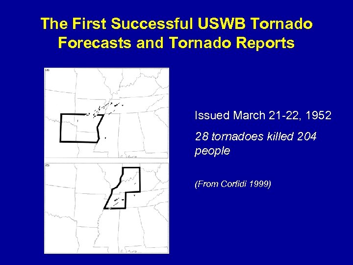 The First Successful USWB Tornado Forecasts and Tornado Reports Issued March 21 -22, 1952 28 tornadoes killed 204 people (From Corfidi 1999)
 US Weather Bureau Tornado Forecasts • The first tornado forecasts were similar to current tornado and severe thunderstorm watches in time/space – Short-term forecasts (0 -8 hours) covering parts of states – Based entirely on observational data (hourly surface data, 4 times daily raobs and PIBAL data) and detailed manual analyses • Dynamic and thermodynamic considerations guided the forecast process – Moisture, instability, and lift sufficient for parcels to reach LFC – Upper level jet dynamics, interaction of low and upper jets – Application of basic concepts: climatology, pattern recognition, parameter evaluation • Forecasters focused on understanding and predicting the synoptic scale / mesoscale environment and its relationship to thunderstorms
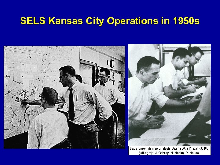 SELS Kansas City Operations in 1950 s
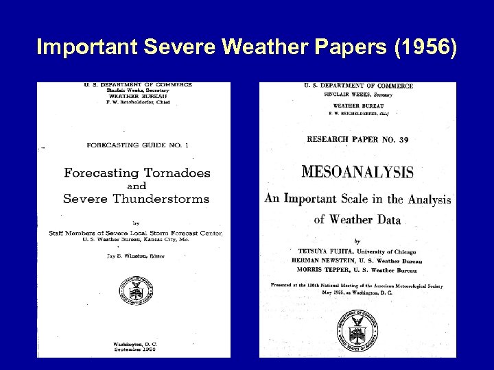 Important Severe Weather Papers (1956)
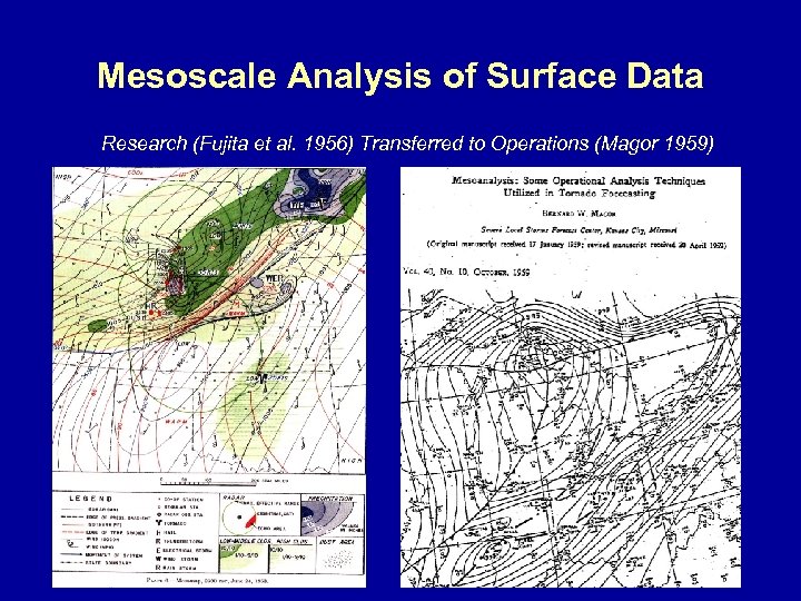 Mesoscale Analysis of Surface Data Research (Fujita et al. 1956) Transferred to Operations (Magor 1959)
 Introduction of Digital Computers – 1960 s • IBM 1620 computer installed at SELS in 1963 • System upgraded to CDC 3100 computer in 1965 – Used to automate plotting of surface and upper air charts (analysis still done by hand) – Allowed computation of fields such as vorticity and divergence from upper air data – Automated sounding plots and calculation of stability indices • Local computers used to increase forecaster efficiency, and provide new diagnostic information
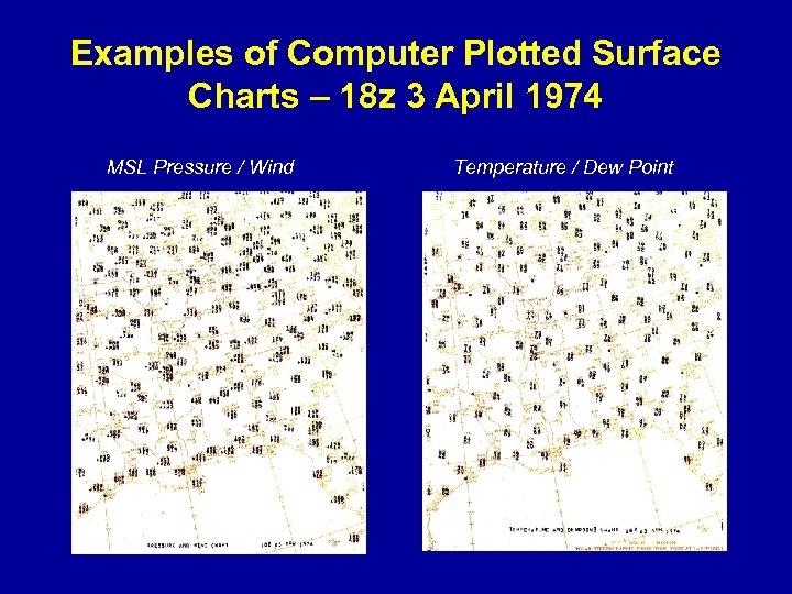 Examples of Computer Plotted Surface Charts – 18 z 3 April 1974 MSL Pressure / Wind Temperature / Dew Point
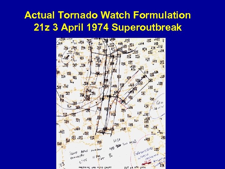 Actual Tornado Watch Formulation 21 z 3 April 1974 Superoutbreak
 Early Use of NWP at SELS • By the late 1960 s NMC was running an operational 6 -layer Primitive Equation model – Basic large scale fields (e. g. , 500 mb height/vorticity, MSL pressure/thickness) available via facsimile – Used by SELS forecasters to provide guidance on synoptic scale features - upper troughs, surface lows, fronts – First time that NWP model data was used as part of Convective Outlook preparation process – No direct impact on formulation of Tornado and Severe Thunderstorm Watches • Very coarse model resolution and limited output fields (North American domain at 12 hr intervals)
 The LFM Model Plays a Larger Role in Severe Weather Forecasting • Limited-area Fine Mesh (LFM) model introduced in 1971 – First regional model at NMC – Similar to PE with half the grid spacing (190. 5 km) and run over smaller domain – More output fields and increased resolution provided improved guidance for Convective Outlook preparation – First time SELS forecasters produced forecast composite charts based on model data • provided more structured basis for Convective Outlook – Again, relatively coarse resolution and inability to resolve convective systems provided little short-term (watch) guidance
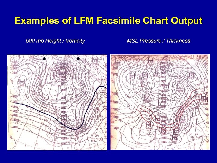 Examples of LFM Facsimile Chart Output 500 mb Height / Vorticity MSL Pressure / Thickness
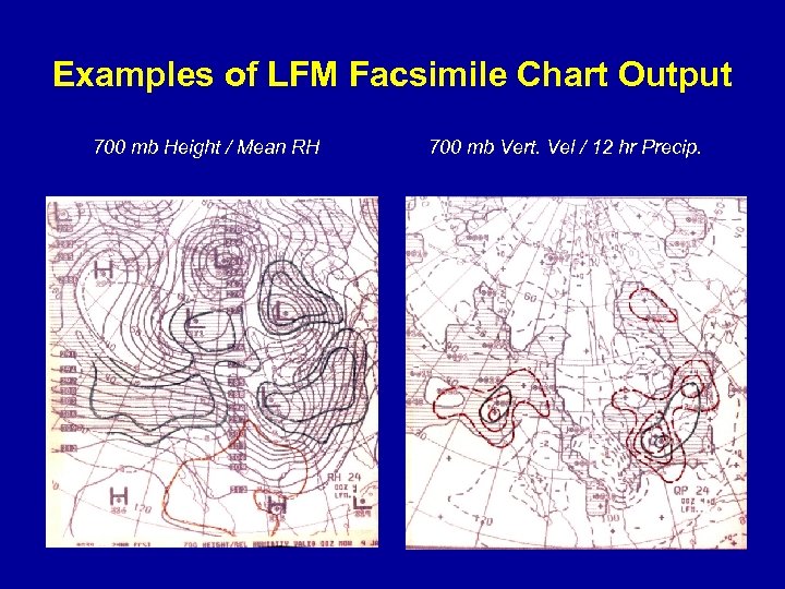 Examples of LFM Facsimile Chart Output 700 mb Height / Mean RH 700 mb Vert. Vel / 12 hr Precip.
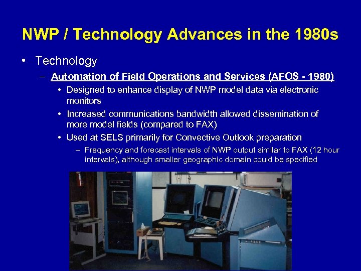 NWP / Technology Advances in the 1980 s • Technology – Automation of Field Operations and Services (AFOS - 1980) • Designed to enhance display of NWP model data via electronic monitors • Increased communications bandwidth allowed dissemination of more model fields (compared to FAX) • Used at SELS primarily for Convective Outlook preparation – Frequency and forecast intervals of NWP output similar to FAX (12 hour intervals), although smaller geographic domain could be specified
 NWP / Technology Advances in the 1980 s • Technology – Centralized Storm Information System (CSIS - 1982) • Mc. IDAS-based interactive workstations specifically designed for severe weather forecasting at SELS • Unique advantage was integrated display of observational data sets – Satellite, radar, surface and upper air • Objective analysis of hourly derived fields (lifted index, mstr convg. ) • Facilitated better application of traditional forecasting procedures developed in 1950 s-1970 s • Revolutionized short-term severe weather forecasting through access to real-time data – Resulted in more accurate timing and placement of severe weather watches • Had limited utility for NWP output display => less impact on forecasts beyond ~6 hours (such as Convective Outlooks)
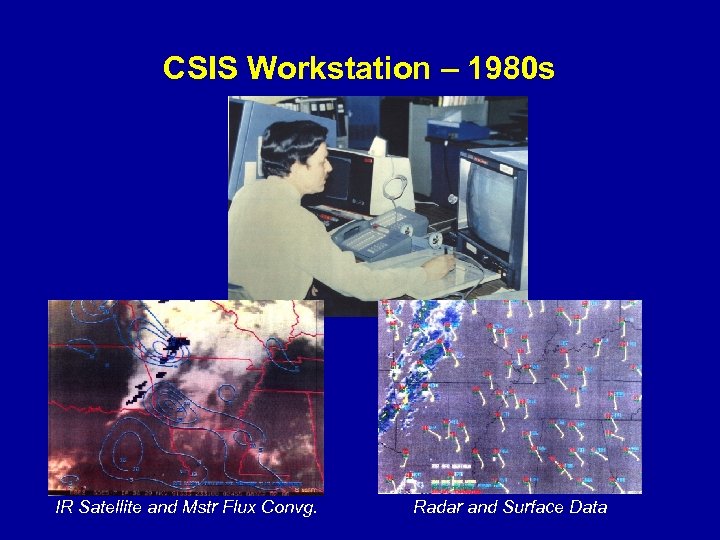 CSIS Workstation – 1980 s IR Satellite and Mstr Flux Convg. Radar and Surface Data
 NWP / Technology Advances in the 1980 s • NWP – Nested Grid Model (NGM - 1985) • Triple nested model with 80 km grid spacing inner domain and 16 vertical levels and forecasts to 48 hrs • Increased resolution resulted in overall improved forecast skill compared to LFM • Allowed extension of SELS Convective Outlook product into the Day 2 time period (1986) • Instability (lifted index) forecasts introduced concept of “Best” lifted index to account for elevated instability (good news), but… – NGM LI’s were often less accurate than LFM, particularly when extreme instability considered – Caused by systematic errors in temperature / dew point profiles • SELS forecasters still focused on synoptic scale environment
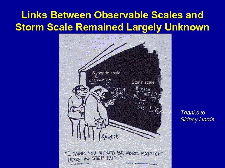 Links Between Observable Scales and Storm Scale Remained Largely Unknown Synoptic scale Storm scale Thanks to Sidney Harris
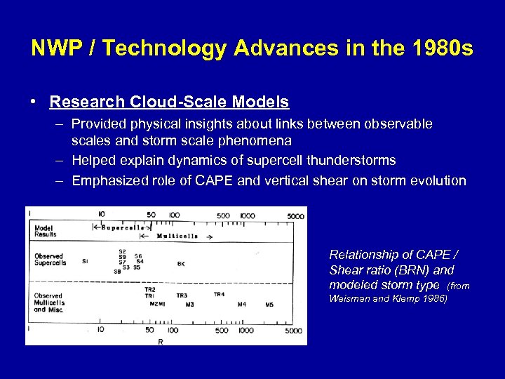 NWP / Technology Advances in the 1980 s • Research Cloud-Scale Models – Provided physical insights about links between observable scales and storm scale phenomena – Helped explain dynamics of supercell thunderstorms – Emphasized role of CAPE and vertical shear on storm evolution Relationship of CAPE / Shear ratio (BRN) and modeled storm type (from Weisman and Klemp 1986)
 NWP / Technology Advances in the 1990 s • NWP and Computer Workstations – Eta and RUC Models • Rapid increases in model resolution, physics complexity, model frequency, amount of output, and skill levels • For the first time, models became useful sources of information for short-term convective forecasting (severe storm watches) – Output complemented real-time observational data • Model forecasts of key convective parameters such as CAPE, vertical shear, and helicity – Forecasters could more directly identify synoptic / mesoscale environments favorable for supercell development – Advanced Operational Workstations • National-center AWIPS (NAWIPS) • Designed to display gridded model data plus observational data
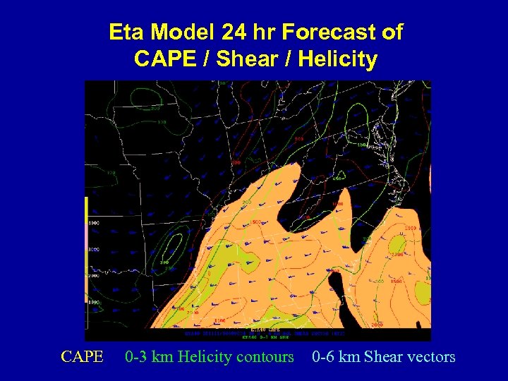 Eta Model 24 hr Forecast of CAPE / Shear / Helicity CAPE 0 -3 km Helicity contours 0 -6 km Shear vectors
 NWP / Science &Technology Advances in the 1990 s • Improvements in scientific understanding of severe storms through field programs such as VORTEX, coupled with better NWP guidance, resulted in improvements to SPC product suite – Eta Model • Issuance of Probabilistic Severe Storm Outlooks to complement traditional Categorical (Slight, Moderate, High Risk) Outlooks • Extension of Convective Outlooks to Day 3 Time Period – RUC Model • Real-time 3 D hourly analyses by combining surface data and RUC data • Objective analyses of hundreds of convective parameters • Extensively used at SPC for short-term severe weather forecasting and shared with WFOs via SPC web page
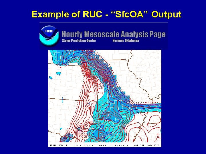 Example of RUC - “Sfc. OA” Output
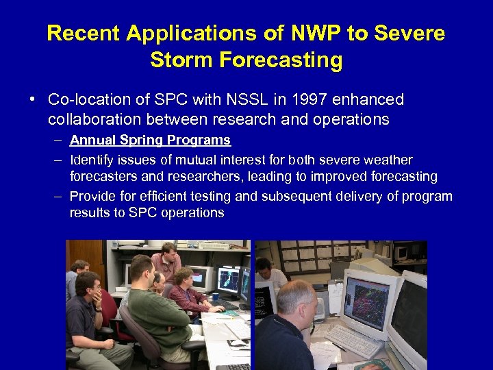 Recent Applications of NWP to Severe Storm Forecasting • Co-location of SPC with NSSL in 1997 enhanced collaboration between research and operations – Annual Spring Programs – Identify issues of mutual interest for both severe weather forecasters and researchers, leading to improved forecasting – Provide for efficient testing and subsequent delivery of program results to SPC operations
 Spring Programs 2003 and 2004 – Focused on two current approaches to NWP development, with emphasis on operational application of both modeling concepts – Examined High Resolution WRF Model predictions of short-term convective initiation/evolution/mode (Watch Scale Guidance) – Explored ability of SREF systems to aid severe weather forecasting (Outlook Scale Guidance) • Help define range of forecast possibilities • Help quantify forecast uncertainty
 Spring Program 2003 • SREF Applications at SPC – Assessed impact of using traditional deterministic models plus new SREF systems in severe weather forecasting – Small but positive improvement in experimental Day 2 outlooks when using SREF information • Forecast linkage between SREF and high resolution deterministic NWP must be improved • Quantity of information can be overwhelming – Resulted in development of numerous (~300) special SREF products for SPC forecasting
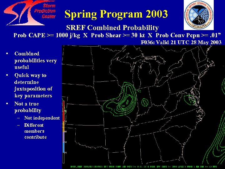 Spring Program 2003 SREF Combined Probability Prob CAPE >= 1000 j/kg X Prob Shear >= 30 kt X Prob Conv Pcpn >=. 01” F 036: Valid 21 UTC 28 May 2003 • • • Combined probabilities very useful Quick way to determine juxtaposition of key parameters Not a true probability – Not independent – Different members contribute
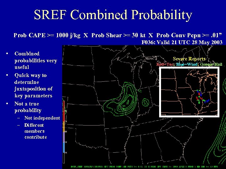 SREF Combined Probability Prob CAPE >= 1000 j/kg X Prob Shear >= 30 kt X Prob Conv Pcpn >=. 01” F 036: Valid 21 UTC 28 May 2003 • • • Combined probabilities very useful Quick way to determine juxtaposition of key parameters Not a true probability – Not independent – Different members contribute Severe Reports Red=Tor; Blue=Wind; Green=Hail
 Spring Program 2004 • Primary focus on Weather Research and Forecast (WRF) model as it relates to severe weather forecasting • Collaboration expanded to include NCAR and OU/CAPS • Mesoscale (dx~10 km) and near stormscale (dx~4 km) versions of the WRF examined (EMC, NCAR, OU/CAPS) – Determine impacts of grid resolution, parameterized convection versus explicit microphysics, and data assimiliation • Experimental severe storm forecasts addressed initiation, intensity, evolution, and mode (discrete cells, lines, etc. ) • Key goal - determine usefulness of very high resolution WRF output to severe storm forecasters – Provide guidance to model developers on future development efforts
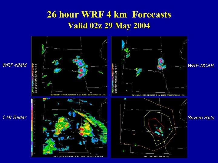 26 hour WRF 4 km Forecasts Valid 02 z 29 May 2004 WRF-NMM WRF-NCAR 1 -Hr Radar Severe Rpts
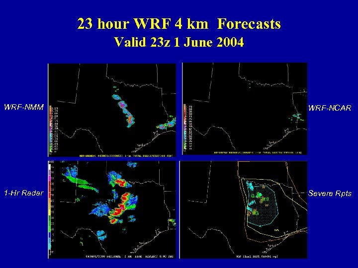 23 hour WRF 4 km Forecasts Valid 23 z 1 June 2004 WRF-NMM WRF-NCAR 1 -Hr Radar Severe Rpts
 Spring Program 2004 • Preliminary Impressions – On some days 00 z “cold start” WRF models with explicit precipitation physics were remarkably accurate predicting details of next day convective initiation, evolution, and mode – The NCAR Mass Core, and to a lesser extent the WRF-NMM, exhibited a tendency to produce bowing structures more often than observed – The low level moisture and instability fields differed strongly between different versions of the WRF • Suggests a strong sensitivity to PBL or surface parameterizations – All WRF’s often had difficulty predicting evolution of significant nocturnal convection during 1 st 12 hours of the 00 z forecast – Operational SPC forecasters are continuing to view the WRF-NMM and NCAR WRF after conclusion of the Spring Program
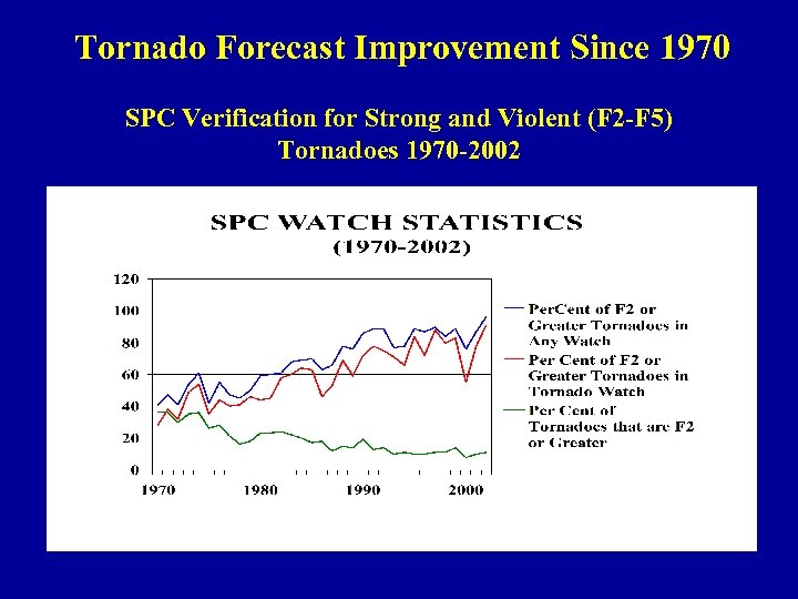 Tornado Forecast Improvement Since 1970 SPC Verification for Strong and Violent (F 2 -F 5) Tornadoes 1970 -2002
 Concluding Comments • Over the last 50 years, improvements in severe weather forecasting have resulted from: – Better scientific understanding of convection – More accurate NWP models – Advanced technology / workstation achievements • However, our knowledge of the mesoscale and storm scale remains substantially less than for the synoptic scale – Mesoscale environment is not well sampled • 4 -D distribution of water vapor is not resolved adequately – Deep convective processes are extremely complex and poorly understood • Better observational data / data assimilation (IC uncertainties), model physics, and computational capabilities will all play increasing roles to further improvements in severe weather forecasting
 Thank You


