

bc41a3d03f7f7463bb4d6c9279110505.ppt
- Количество слайдов: 186
 2012 - 2013 Social Science Project On The Incredible India A RISING STAR IN THE NEW MILLENNIUM Submitted By: Gaurav Goswami (IX-A) Submitted To: Mr. Shiv Kumar Tyagi
 • • • • • Contents Acknowledgement Introduction India : An Overview Geography India’s Map Andaman & Nicobar Islands Andhra Pradesh Arunachal Pradesh Assam (Asom) Bihar Chandigarh Chattisgarh Dadra and Nagar Haveli Daman & Diu Islands Delhi Goa Gujarat Haryana • • • • • Himachal Pradesh Jammu & Kashmir Jharkhand Karnataka Kerala Lakshadweep Madhya Pradesh Maharashtra Manipur Meghalaya • Tamil Nadu Mizoram • Tripura Nagaland • Uttrakhand (Uttranchal) Orissa • Uttar Pradesh Pondicherry • West Bengal Punjab • Bibliography Rajasthan • About Me Sikkim
 Acknowledgement • I acknowledge the valuable suggestions given by my honorable teacher Mr. Shiv Kumar Tyagi who helped me to make this project more informative & attractive. • I also acknowledge the efforts of my brother in shaping this project. • The contribution of all Social Science Department is also duly acknowledged.
 Introduction The aim for making this presentation is to enable some Geography weak students to understand whole concept of India properly and to practice each and every section of that chapter easily. So, that they can perform well in examinations (Formative Assessment – 1) which are going to be held from 8 th of May in 2012.
 India : An Overview India, a Union of States , is a Sovereign Socialist Secular Democratic Republic with a Parliamentary System of government. The Republic is governed in terms of the constitution, which was adopted by Constituent Assembly on 26 November 1949 and came into force on 26 January 1950. India comprises of 28 states and seven union territories. The States Reorganization Act of 1956 was a primary force in reorganizing the boundaries of India's states along linguistic lines, and bringing an amendment in the Indian Constitution whereby the three types of states, known as Parts A, B, and C states, were amended with a single type of state. Though additional changes have occurred in the state boundaries since 1947, the Act is still considered as an undisputed player in providing the present shapes and contours of the Indian states. In November 2000, India gained three new states Chattisgarh was carved out of Madhya Pradesh , Uttaranchal out of Uttar Pradesh , and Jharkhand out of Bihar. The Constitution distributes legislative powers between the Parliament and state legislatures. The Parliament is bicameral - the lower house is known as the Lok Sabha (House of the People) and the upper house is known as the Rajya Sabha (Council of States). At state level some legislatures are bicameral and are run along the lines of the two houses of the national Parliament.
 The Indus Valley civilization, one of the oldest in the world, goes back at least 5, 000 years. Aryan tribes from the northwest invaded about 1500 B. C. ; their merger with the earlier inhabitants created classical Indian culture. Arab incursions starting in the 8 th century and Turkish in 12 th were followed by European traders beginning in the late 15 th century. By the 19 th century, Britain had assumed political control of virtually all Indian lands. Nonviolent resistance to British colonialism under Mohandas Gandhi and Jawaharlal Nehru led to independence in 1947. The subcontinent was divided into the secular state of India and the smaller Muslim state of Pakistan. A third war between the two countries in 1971 resulted in East Pakistan becoming the separate nation of Bangladesh. Fundamental concerns in India include the ongoing dispute with Pakistan over Kashmir, massive overpopulation, environmental degradation, extensive poverty, and ethnic strife, all this despite impressive gains in economic investment and output.
 Geography Ø Location: Southern Asia, bordering the Arabian Sea and the Bay of Bengal, between Burma and Pakistan Ø Geographic coordinates: 20 00 N, 77 00 E Ø Map references: Asia Ø Area: 3, 287, 590 sq km Ø Land: 2, 973, 190 sq km Ø Water: 314, 400 sq km Ø Area (comparative): slightly more than one-third the size of the US Ø Land boundaries: 14, 103 km Ø Border countries: Bangladesh 4, 053 km, Bhutan 605 km, Burma 1, 463 km, China 3, 380 km, Nepal 1, 690 km, Pakistan 2, 912 km Ø Coastline: 7, 000 km Ø Maritime claims (contiguous zone): 24 NM Ø Continental shelf: 200 NM or to the edge of the continental margin Ø Exclusive economic zone: 200 NM Ø Territorial sea: 12 NM Ø Climate: varies from tropical monsoon in south to temperate in north
 in south, flat to rolling plain along the") Ø Terrain: upland plain (Deccan Plateau) in south, flat to rolling plain along the Ganges, deserts in west, Himalayas in north Ø Elevation extremes : lowest point- Indian Ocean 0 m ; highest point. Kanchenjunga 8, 598 m Ø Natural resources: Coal (fourth-largest reserves in the world), iron ore, manganese, mica, bauxite, titanium ore, chromite, natural gas, diamonds, petroleum, limestone, arable land Ø Land use: Arable land: 56% , Permanent crops: 1%, Permanent pastures: 4%, Forests and woodland: 23% , Other: 16% (1993 est. ) Ø Irrigated land: 535, 100 sq km (1995/96 EST. ) Ø Natural hazards: droughts, flash floods, severe thunderstorms common – earthquakes Ø Environment - current issues: Deforestation; soil erosion; overgrazing; desertification; air pollution from industrial effluents and vehicle emissions; water pollution from raw sewage and runoff of agricultural pesticides; tap water is not potable throughout the country; huge and growing population is overstraining natural resources Ø Environment - international agreements: Party to: Antarctic-Environmental Protocol, Antarctic-Marine Living Resources, Antarctic Treaty, Biodiversity, Climate Change, Desertification, Endangered Species, Environmental Modification, Hazardous Wastes, Law of the Sea, Nuclear Test Ban, Ozone Layer Protection, Ship Pollution, Tropical Timber 83, Tropical Timber 94, Wetlands, Whaling signed, but not ratified: none of the selected agreements.
Ø Terrain: upland plain (Deccan Plateau) in south, flat to rolling plain along the Ganges, deserts in west, Himalayas in north Ø Elevation extremes : lowest point- Indian Ocean 0 m ; highest point. Kanchenjunga 8, 598 m Ø Natural resources: Coal (fourth-largest reserves in the world), iron ore, manganese, mica, bauxite, titanium ore, chromite, natural gas, diamonds, petroleum, limestone, arable land Ø Land use: Arable land: 56% , Permanent crops: 1%, Permanent pastures: 4%, Forests and woodland: 23% , Other: 16% (1993 est. ) Ø Irrigated land: 535, 100 sq km (1995/96 EST. ) Ø Natural hazards: droughts, flash floods, severe thunderstorms common – earthquakes Ø Environment - current issues: Deforestation; soil erosion; overgrazing; desertification; air pollution from industrial effluents and vehicle emissions; water pollution from raw sewage and runoff of agricultural pesticides; tap water is not potable throughout the country; huge and growing population is overstraining natural resources Ø Environment - international agreements: Party to: Antarctic-Environmental Protocol, Antarctic-Marine Living Resources, Antarctic Treaty, Biodiversity, Climate Change, Desertification, Endangered Species, Environmental Modification, Hazardous Wastes, Law of the Sea, Nuclear Test Ban, Ozone Layer Protection, Ship Pollution, Tropical Timber 83, Tropical Timber 94, Wetlands, Whaling signed, but not ratified: none of the selected agreements.
 U. K. HR J & K –") J&K Pakistan PJB H. P. China (Tibet) U. K. HR J & K – Jammu & Kashmir PJB – Punjab H. P. – Himachal Pradesh U. K. – Uttrakhand W. B. – West Bengal A. P. – Arunachal Pradesh S. L. – Sri Lanka Delhi Ch ha tti sg ar h Sikkim A. P. Nep al Bhutan Rajasthan am Manipur Uttar Pradesh ss A Bihar h Nagaland s nd glade ha Ban Gujarat Madhya Pradesh hark J W. B. Mizoram Maharashtra Ka rna tak a a a ral Ke Ke Lakshadweep Islands (India) Andhra Pradesh Tamil Nadu Orissa Meghalaya Myanmar Tripura Andaman & Nicobar Islands (India) S. L.
J&K Pakistan PJB H. P. China (Tibet) U. K. HR J & K – Jammu & Kashmir PJB – Punjab H. P. – Himachal Pradesh U. K. – Uttrakhand W. B. – West Bengal A. P. – Arunachal Pradesh S. L. – Sri Lanka Delhi Ch ha tti sg ar h Sikkim A. P. Nep al Bhutan Rajasthan am Manipur Uttar Pradesh ss A Bihar h Nagaland s nd glade ha Ban Gujarat Madhya Pradesh hark J W. B. Mizoram Maharashtra Ka rna tak a a a ral Ke Ke Lakshadweep Islands (India) Andhra Pradesh Tamil Nadu Orissa Meghalaya Myanmar Tripura Andaman & Nicobar Islands (India) S. L.

 Andaman and Nicobar Islands is a union territory of India, with Port Blair as its capital. It is located in The Indian Ocean, and has over 570 islands, out of which only 38 are permanently inhabited. Earlier British used them as an isolated prison for the fighters of Indian Independence, but now these 'Emerald Islands' are a famous tourist destination. It has various hotels to cater to the demands of tourists. Some of the islands in Andaman and Nicobar are hilly in places, covered with tropical jungle and with flat stretches of beaches. Adventure tourism like trekking, Island camping, snorkeling, SCUBA diving are the real attractions. The places of interest include Cellular Jail, Mahatma Gandhi Marine National Park, Water Sports Complex, Fisheries Museum, Chidiya Tapu, Mount Harriet and Samudrika Museum. It is also famous for its only active volcano, Barren Island. It also has many state of the art hotels to cater to its ever-booming tourism industry. Spectacular mix of nature's most prized delights; the Andaman & Nicobar Islands are a once in a lifetime holiday experience.
 Avatars, Gods of people of Andaman & Nicobar Islands Durga, Goddess of people of Andaman & Nicobar Islands

 Andhra Pradesh is a state located in Southern India. It shares its boundaries with Chhattisgarh, Maharashtra, and Orissa to the north, Tamil Nadu in the south, the Bay of Bengal to the east, and Karnataka in the west. The state of Andhra Pradesh forms a part of the famous Deccan plateau. Two major rivers traversing this plateau are the Krishna and Godavari Rivers. While running across the state, the two rivers create huge deltas prior to pouring into the Bay of Bengal. The capital city of Andhra Pradesh is Hyderabad. The city is famous for its rich cultural heritage. Vijayawada and Warangal are two cities that bear testimony to the existence of old age Buddhist and Hindu civilizations and historical monuments. Puttaparthi and Tirumala are two holy religious hubs in the southern area of the state. Andhra Pradesh is quite rich in minerals and holds the 2 nd position in the nation in terms of its mineral resources. The important industries in Andhra Pradesh include Biotechnology, Information Technology, Business Management, Pharmaceuticals, and Construction and Real Estate.
 (km� Total Female Total Male Adilabad 16105 1370774 1366964 4083315 Anantapur") Area (km� ) (km� Total Female Total Male Adilabad 16105 1370774 1366964 4083315 Anantapur 19130 2018387 2064928 CH 4170468 Chittoor 15152 2086963 2083505 East Godavari EG 5151549 Kakinada 10807 2582130 2569419 Guntur GU 4889230 Guntur 11391 2448102 2441128 Hyderabad HY 4010238 Hyderabad 16988 1945879 2064359 Kadapa CU 2884524 Kadapa 15359 1430388 1454136 Karimnagar KA 3811738 Karimnagar 11823 1914670 1897068 Khammam KH 2798214 Khammam 16029 1406278 1391936 Krishna KR 4529009 Machilipatnam 8727 2268312 2260697 Kurnool KU 4046601 Kurnool 17658 2006500 2040101 Mahbubnagar MA 4042191 Mahabubnagar 18432 1995944 2046247 Medak (Sangareddi) ME 3031877 Sangareddi 9699 1507690 1524187 Nalgonda NA 3483648 Nalgonda 14240 1725587 1758061 Nellore NE 2966082 Nellore 13076 1472828 1493254 Nizamabad NI 2552073 Nizamabad 7956 1299882 1252191 Prakasam PR 3392764 Ongole 17626 1680029 1712735 Rangareddi RA 5296396 Hyderabad 7493 2587702 2708694 Srikakulam SR 2699471 Srikakulam 5837 1359041 1340430 Vishakhapatnam VS 4288113 Vishakhapatnam 11161 2147241 2140872 Vizianagaram VZ 2342868 Vizianagaram 6539 1180955 1161913 Warangal WA 3522644 Warangal 12846 1756387 1766257 West Godavari WG 3934782 Eluru 7742 1971598 1963184 District Code Population (2011) Adilabad AD 2737738 Anantapur AN Chittoor Headquarters
Area (km� ) (km� Total Female Total Male Adilabad 16105 1370774 1366964 4083315 Anantapur 19130 2018387 2064928 CH 4170468 Chittoor 15152 2086963 2083505 East Godavari EG 5151549 Kakinada 10807 2582130 2569419 Guntur GU 4889230 Guntur 11391 2448102 2441128 Hyderabad HY 4010238 Hyderabad 16988 1945879 2064359 Kadapa CU 2884524 Kadapa 15359 1430388 1454136 Karimnagar KA 3811738 Karimnagar 11823 1914670 1897068 Khammam KH 2798214 Khammam 16029 1406278 1391936 Krishna KR 4529009 Machilipatnam 8727 2268312 2260697 Kurnool KU 4046601 Kurnool 17658 2006500 2040101 Mahbubnagar MA 4042191 Mahabubnagar 18432 1995944 2046247 Medak (Sangareddi) ME 3031877 Sangareddi 9699 1507690 1524187 Nalgonda NA 3483648 Nalgonda 14240 1725587 1758061 Nellore NE 2966082 Nellore 13076 1472828 1493254 Nizamabad NI 2552073 Nizamabad 7956 1299882 1252191 Prakasam PR 3392764 Ongole 17626 1680029 1712735 Rangareddi RA 5296396 Hyderabad 7493 2587702 2708694 Srikakulam SR 2699471 Srikakulam 5837 1359041 1340430 Vishakhapatnam VS 4288113 Vishakhapatnam 11161 2147241 2140872 Vizianagaram VZ 2342868 Vizianagaram 6539 1180955 1161913 Warangal WA 3522644 Warangal 12846 1756387 1766257 West Godavari WG 3934782 Eluru 7742 1971598 1963184 District Code Population (2011) Adilabad AD 2737738 Anantapur AN Chittoor Headquarters
 Cuisine of Andhra Pradesh Ritual of Andhra Pradesh

 Arunachal Pradesh located in north eastern India has fifteen districts and is called "Land of the Rising Sun". The literary meaning of the "Land of the Rising Sun" is "the land of the dawn lit mountains. " The state has its capital in Itanagar, which is also its largest city. The state, known for its natural beauty is backed by a strong agricultural economy- pulses, sugarcane, rice, wheat, maize being its main crops. It has a considerable amount of forest cover which ensures that the forest products also contribute to its economy. The tourism sector of the state, however, has not been fully utilized. The total area covered by Arunachal Pradesh is 83743 sq km. The incumbent Chief Minister of Arunachal Pradesh is Nabam Tuki. The governor of the state is Joginder Jaswant Singh. There around 1, 091, 117 inhabitants in the state, with a 54. 74% literacy rate. The major rivers flowing through the state are Subansiri, Lohit, Siang, Kameng, and Tirap. These rivers are snow fed, originating from the Himalayas and splitting the state into five river valleys.
 Arunachal Pradesh Geography Covering an area of 83743 sq km, Arunachal Pradesh extends from the snow covered Himalayas to the Brahmaputra plains. It is located between 26° 30' and 29° 30' North latitude and 91° 30' and 97° 30' East longitude. Lying at the country's north eastern tip, the state is surrounded by Tibet in the north and north east, Bhutan in the west and Assam and Nagaland in the south. The Himalayan range, besides the Himalayan foothills and Patkai hills, covers the majority of the state.
 Arunachal Pradesh Climate The presence of Himalayas has affected the climate of Arunachal Pradesh to a large extent. The climate of the state varies in accordance with the altitude. The upper regions of the state experience alpine or tundra climate, while the middle Himalayan portions have temperate climate. Humid conditions prevail in the lower regions of the state.
 Economy of Arunachal Pradesh is primarily an agricultural state. The main crops here are rice, pulses, sugarcane, wheat, millets, oilseeds and ginger. The farmers of the state employ various devices to increase their agricultural yield- the Jhum farming and terrace farming are two of these methods. In Jhum cultivation the farmers prepare the land by setting on fire or cutting down the unwanted cultivation. Terrace farming involves the shaping of hilly agricultural lands into multiple terraces in a bid to check soil erosion. The forest cover of Arunachal Pradesh is fairly well exploited. The state boasts of a number of rice mills, fruit preservation departments, horticulture units, and handloom handicrafts.
 Tourism Sector of Arunachal Pradesh and Important Tourist Destinations The snow capped mountains and the beautiful valleys of the state add to the scenic beauty of Arunachal Pradesh, already famous for its natural beauty. These features can serve as major tourist draws if its tourism is fully explored. However there are some places in the state which can draw tourists: Tawang: It is located at a height of 12, 000 feet above sea level. The hill station with some high altitude but inaccessible lakes is a major draw for adventure lovers. Itanagar: the largest city of Arunachal Pradesh has places like Jawaharlal Nehru State Museum, Ganga Lake (Gyakar Siny) and Buddhist Temple which are worth visiting. Aside from these, there are seven wildlife sanctuaries and four National parks in the state. Wild Life Sanctuaries in Arunachal Pradesh Dr. D. Ering Memorial Wildlife Sanctuary Itanagar Wild life Sanctuary Pakhui Wildlife Sanctuary National Parks of Arunachal Pradesh Mouling National Park in Jengging Namdhapa National Park in Miao
 People of Arunachal Pradesh Dance of Arunachal Pradesh

 Assam, a northeastern state of India has Dispur as its capital. It is divided into 23 districts and consists of northern Brahmaputra valley, the middle Karbi and Cachar hills and the southern Barak Valley. Assam is a multi-etnic society. Forty Five different languages are spoken by various communities of Assam. The flora, fauna, wildlife and rivers of Assam have great natural beauty to offer to tourists. There also many lodging facilities and hotels. It is also famous for its finest and some of the most expensive teas in the world. It is also an important producer of natural gas and crude oil. Real estate and Tourism also lend their share in its economy.
 Main Occupation in Assam Dance of Assam

 Bihar is divided into 9 divisions and 37 districts, and has Patna as its capital. It has a very rich history, and is also an attraction for travelers and tourists. There are various hotels to cater to the needs of tourists. The economy is mainly based on agricultural and trading activities. There have been some attempts to industrialize the state as well. An oil refinery in Barauni, a scooter plant at Fatuha, a power plant at Muzaffarpur and some agriculture-based industries such as sugar and vegetable oil, have been established in Bihar. It is also known for its famous mines at Dhanbad. The service sector comprises of Real estate, Mortgage and Insurance. Bodh Gaya, Nalanda, Rajgir Vaishali, Bhagalpur, Vikramsila and Sutanganj are a must visit for Buddhist pilgrims. All of these are very popular historical sites as well. Other admired historical sites are Pawapuri, Champaran and Sasaram.
 Painting of Bihar Cuisine of Bihar

 This city serves as a capital of two states, Punjab and Haryana. But it is administered by a federal government and is classified as a Union Territory. Chandigarh has two satellite cities located in Punjab and Haryana that are built on the lines of Chandigarh: Panchkula and Mohali. Both these cities are virtually the parts of Chandigarh and house a major population operating in Chandigarh Technology Park is the city's entry gate to the world of information technology. Chandigarh is also famous for its Rock Garden, Rose Garden, Sukhna Lake and its famous market in Sector 17. These spots are very popular with both locals and tourists. It also has state of the art lodging facilities to cater to the flourishing tourism industry. The service sector, which comprises of educational institutes, consultancies, tourism industry, real estate and insurance companies, make considerable contribution to the state economy.
 Guru Hargovind Singh, God of people in Chandigarh People of Chandigarh

 The economy of this state benefits from its Bhilai Steel Plant, S. E. C. Railway Zone, BALCO Aluminum Plant, S. E. Coal Ltd. and National Thermal Power Corporation Ltd. To add to it all Chattisgarh is a mineral rich state. The service sector boasts of Real estate, Consultancies and Insurance. This state is also enriched with natural beauty and pleasant atmosphere. It is surrounded with dense forests, hilly mountains, streams, waterfalls, natural caves, parks etc. Bastar, also called Kashmir of Chattisgarh, attracts many foreign tourists. Mahanadi, one of the largest rivers in India originates from this state. It has some very good hotels to offer to tourists.
 Festival of Chattisgarh Cuisine of Chattisgarh

 Dadra and Nagar Haveli is a Union Territory in western India. Run by a Lieutenant Governor, it has Silvasa as its capital. It lies on the north bank of the Daman Ganga River. The major language of this union territory is Gujarati. The main economy in Dadra and Nagar Haveli is manufacturing. The taxes are very low here as there is no excise duty. In the service sector, Real Estate, Mortgage and consultancies are major contributors to the state economy.
 People of Dadra & Nagar Haveli Dance of Dadra & Nagar Haveli

 This Union Territory of the Indian sub-continent was ruled by the Portuguese for more than 450 years. This place, along with Dadra and Nagar Haveli as well as Goa, was included in the Indian Republic on 19 th December of the year 1961. The region is said to have one of the perfect blends of culture, belief, good idea and ancient civilization. The official languages of this Union Territory are as follows: Ø Ø Marathi Hindi Gujarati English
 Location of Daman and Diu With its geographical location at the latitude of 20° 25' N and the longitude of 72° 50' E, this Indian Union Territory accounts for approximately 112 sq. km. of the total land surface of the country as well as the earth. Located on the coastal area of the Arabian Sea, this Union Territory of India is comprised of the following 2 districts: • Daman District: This district of the territory of Daman and Diu covers a land area of around 40 sq. km. The major settlement of this district is based in the town. • Diu District: Spread over an area of about 72 sq. km. , the main dwellings of this district are based in the Daman city.
 How to Reach Daman and Diu? This territory of India is well connected to the rest of the nation through the following modes of transportation: • By Airways: The nearest airports to this city are the ones, which are located in the city of Mumbai such as the Santa Cruz Domestic Airport and the Chattrapathi Shivaji International Airport. Flights plying from these 2 Mumbai airports connect the region to a number of national as well as international destinations. • By Railways: The nearby railway station to this Indian Territory is based at Vapi that is around 12 km from the heart of the territory. Situated on the main line, in between the major Indian cities of Mumbai and Delhi, this is among the busiest railway station in the place. Almost all the mail trains, the express trains as well as the local trains on this line of the Indian Railways stop at this station. The other railway station that serves the area is the Valsad Junction, which is about 35 km away from the territory. • By Roadways: Proximity to the National Highway - 8 that runs in between Ahmedabad in Gujarat and Mumbai in Maharashtra helps the territory maintain a good road link with some of the important cities, which are located towards the western part of the country. However, most of the routes go through Vapi. Let us have a quick glance at the distance in between Daman and Diu and some major cities in the nation as provided in the next slide:
 Sl. No. Name of the city Distance from Daman and Diu 1 Ahmedabad 367 Km 2 Diu 763 Km 3 Mumbai 193 Km 4 Panaji in Goa (Via Mumbai) 787 Km
 Places to Visit in Daman and Diu The different hill stations along with their natural beauty make the place worth visiting. This territory of west India has not got innumerable places to see though. However, to name a few of the tourist attractions, which are located in and around it, are categorized below: Amusement Parks in Daman and Diu • Jetty Garden at Nani Daman • Lake Garden of Kadaiya • Mirasol Water Park • Tourist Complex of Daman Ganga Historical Places in Daman and Diu • Diu Fort • Forte do Mar • Gupta Prayag in Delwada • Moti Daman Fort (Including Light House) • Nani Daman Fort
 Places of Worship in Daman and Diu • Bom Jesus Church • Gangeshwar Temple • Our Lady of Rosary Chapel (Within the premises of the Moti Daman Fort) • Our Lady of Sea Church (Within Nani Daman Fort) • Somnath Temple Sea Beaches in Daman and Diu • Devka Beach • Jampore Beach • Nagao Beach Other Tourist Attractions in Daman and Diu • Bridge Side Garden • Children Park • Girnar Hill • Hathi Park • Hilsa Aquarium • Kachigam Water Tank • Shaking Tower in Delwada
 Dance of Daman & Diu Island Lady of Daman & Diu Islands
 Capital of our country, INDIA

 History Delhi bears the stamp of a rich historical background. It is home to many ancient empires like the Mauryan Empire and renowned dynasties like the Tomara dynasty, Slave dynasty, Tughluq dynasty, Khilji dynasty etc. It is believed that Delhi is the land of Indrapastha, the capital seat of the Pandavas in Mahabharata. Delhi was also an important place for Sufism. After India's independence, Delhi was declared the capital of India.
 Geographical Area and Location Delhi at present covers an area of more than 1484 sq. km. It is situated in North India at 28. 61°N 77. 23°E. It is bordered in the East by Uttar Pradesh, in the West, South and North by Haryana.
 Demographics According to the census of 2001, the population of Delhi is 13, 850, 507 and the number of females per 1000 males is 821. The literacy rate of Delhi is 81. 82%. As per the area, Delhi is the largest metropolis and according to the population, it holds the second position in the list of largest metropolises.
 Government & Administration Delhi is officially known as the National Capital Territory of Delhi (NCT). It has always been an important cultural, commercial and political hub of the country. Presently Delhi has 9 districts. Delhi is divided into the New Delhi Municipal Committee (NDMC), the Municipal Corporation of Delhi (MCD) and the Delhi Cantonment Board (DCB). The capital has four important satellite cities namely, Gurgaon, Noida, Ghaziabad and Faridabad. Delhi has 7 Lok Sabha constituencies and 70 assembly constituencies. The Rashtrapati Bhavan, the Parliament of India, The Supreme Court of India are all situated in Delhi.
 Education Over the past few years, Delhi has developed tremendously in the field of education. New colleges and institutes have emerged with top quality education. It is home to more than 160 colleges of all kinds, and some of India's leading universities like the Jawaharlal Nehru University, Delhi University, Jamia Milia University, to name a few. Besides these there also a large number of private, Government, primary and higher secondary schools imparting education to more than 20 lakh students.
 Culture Delhi has a rich cultural background. It consists of large number of significant monuments, heritage buildings and other famous architectural buildings like the Red Fort, Jama Masjid, India Gate, Qutub Minar, Jantar Mantar, Laxminarayan Temple, Akshardham to name some. These are also the major tourist spots in Delhi that you can visit and enjoy. All the major events like the Republic Day, Independence Day etc and festivals of all religion are celebrated in Delhi with great zeal and excitement. In Delhi, one can enjoy all types of Indian and international cuisines and delicacies besides the typical mouth watering local fast food collection like Dahi Papri and Chaat. Delhi offers a wide variety to shop till you drop. From jewelry, to saris to all sorts of electrical gadgets to all other different variety of products, Delhi has it all.
 Upcoming Events in Delhi, 2010 Delhi, the capital of India, is always full of life and zeal with wide range of shows and events every year. With large number of theatres, stadiums, playgrounds, shopping malls, concert halls, multiplexes to boast off, every year Delhi has a varied range of events lined up and the year 2010 is not lagging behind. The most important and major event of Delhi and so of India is the prestigious upcoming 2010 Commonwealth Games. It will take place in Delhi from 3 rd October to 14 th October 2010. The Queen's Baton Relay will reach India on October 3 rd, 2010. The Commonwealth Games will take place in India for the first time and second time in Asia. The opening ceremony will be held in the Jawaharlal Nehru Stadium, Delhi which bears a capacity of 75, 000 spectators. The total amount of budget to be incurred to host the Games is supposed to be more than US$ 1. 6 billion, thereby making it the most costly Commonwealth Games of all times. The different venues selected for this purpose are Jawaharlal Nehru Stadium, Indira Gandhi Arena, Dhyan Chand national Stadium, Delhi University Sports Complex, RK Khanna Tennis Complex, to list a few.
 26 new and upgraded stadiums will also be used for this purpose. One of the unique aspects of the Commonwealth Games 2010, in Delhi is the "Green Games" following which the organizers along with the United Nations Environment Programme have signed a "Memorandum of Understanding" (Mo. U) to conduct a "Sustainable games" thereby taking care of the environment while preparing for the Games. Some of the other major events to showcase in Delhi, this year are as follows: • Various exhibitions like Art Work by Gauri Gill, Times International Childrens Exhibition, Jewellery Wonder, Sugar Asia , Media Expo - Delhi, Commonwealth Games 2010 - Delhi • International Trade fair like the Medifest India, 2010 Workshops and seminars like Hardware India 2010, Zak Glasstech International, Infra Educa - New Delhi, Metro Rail Asia, Pen World Delhi, Hospital Build India Exhibition & Congress. • If you are a music lover then Delhi offers you good variety of music concerts and festivals like Rock Festivals, Jazz festivals, Sufi, Western Classical, Indian Classical, DJ nights, etc • Music without Dance is incomplete. If you are passionate about dance then you can enjoy the various dance concerts that will take place in Delhi this year like Kathak, Sufi Dance, Salsa, Bharatnatyam etc. • When we speak of entertainment, options in Delhi are huge. Various film festivals like the Osian's Film Festival, Wildlife Film Festival, Mexican Film Festivals, and Spanish Film Festivals etc take place every year in Delhi.
 • Theatre festivals like Puppet Theatre Festival, Bharat Rang Mahotsav by NSD are also organized in Delhi from time to time. • Every year popular fashion shows like the Lakme Fashion Week also take place.
 Dance of Delhi Cuisine of Delhi

 Situated on the Konkan region Goa is the smallest state in India. Synonymous with tourism in India Goa is the favorite tourist destination for millions across the globe. Bordered by the Arabian Sea on its west Goa is blessed in terms of topographical beauty. The state of Goa is divided into two districts North Goa and South Goa is situated on the western coastal region of the Indian Peninsula. Geographically Goa bears a striking resemblance to Maharashtra and Karnataka. The state of Goa lies between 15° 48'00" north to 14° 53'54" north latitudes and 74° 20'13" east to 73° 40'33" east longitudes. The one unique feature about the geography of Goa is that it is a seamless concoction of Mountainous, Plateau Regions and coastal plains. Goa is also flooded with numerous historical monuments and eye engaging sights. For the historically inclined Goa is just ethereal. There are several Churches in Goa that testify the rich historical past of the city. Some of the popular Churches in Goa are; Mary Immaculate Conception, Reis Magos Church, St. Anne Church, Church of St. Augustine, St. Paul Church etc. Goa is also home to numerous forts and museums that offer glimpses of a culturally rich state. Goa is situated on the South Western part of India. It is the smallest state in India spreading over an area of 3, 702 sq km. A perfect blend of the colonial and modern charm Goa simply manages to take your heart away. Reputed for its infrastructure, cuisine, historical monuments and unique culture Goa has become a one stop tourist spot for millions of foreign and domestic travelers. Blessed in terms of natural beauty the beaches in Goa cover almost 83 percent of its total coastline. Goa City is just not restricted to fun and enjoyment it is also a one stop pilgrimage center for millions of Christians across the globe.
 The weather in Goa is summed up in one word can be termed as moderate. Since Goa lies in the tropical zone and is also bordered by the Arabian Sea on the West it experiences hot and humid weather throughout the year. Although the climate is hot and humid the one good thing about the state is that the temperature in Goa is always under control. Neither do the summers get very hot nor do the winters get extremely cold. However the best time to visit Goa would be the Monsoons. Goa should be avoided in May as this is the hottest month with the mercury shooting upto 35 °C. Goa is one of the Indian states that remained under colonial rule for a period of 451 years. The history of Goa traces back to the 3 rd century. According to history Goa was first ruled by the Mauryas, then the Satvahanas, Chalukyas and finally the Shilharas and Kadambas. Goa passed into the hands of the Mughals in 1312 and then lastly the Portuguese captured Goa in 1510. It was in 1962 that Goa attained freedom from the Portuguese and in 1987 it was pronounced an independent state in India. Goa by far is among the most frequented tourist's destinations in India. Considered as the hottest tourist destination in the country this beach island witnesses huge influx of travelers from Indian and abroad alike. In order to facilitate proper lodging Goa has numerous hotels that range from the luxury to the budget. The Goa hotels have managed to establish an unmatched reputation for themselves over the years. Most of the Goa hotels are situated close to the major beaches that offer panoramic views of the city. Some of the well known Goa hotels are; Park Hyatt Goa Resort and Spa Dona Alcina Resort Hotel Park Plaza, The Majestic Hotels Goa, Coconut Grove Hotel Goa etc.
 Goa is connected by a broad network of roads. Traveling to Goa is extremely easy as it is connected with a number of National and state highways. The roads in Goa are pretty decent which make traveling a lot easier. The best way to travel to Goa is by bus from Mumbai or Pune. The journey is very smooth and offers some of the most enthralling visual sights. In India Goa has become synonymous with beaches. Goa is home to some of the finest beaches in the world. One of the major reasons behind the charm of the city is its sun kissed beaches. The Goa beaches are just not restricted to clear waters and shimmering sands but flea markets, open shacks that sell mouthwatering Goan cuisine and a whole lot of music and dance. Since Goa is divided into North and South the beaches are also divided accordingly. The beaches in North Goa are meant for the party lovers whereas the South Goa beaches are more serene and tranquil and act as ideal spots for couples in search of privacy. Some of the most stunning beaches in Goa are; Candolim Beach, Baga, Arambol, Vagator Benaulim Beach and Palolem Beach. Panaji literally means Land that never floods. It is the capital and most popular city in Goa. Spanning across an area of 36 km sq Panaji is located on the Mandovi estuary of North Goa. It is the third largest city in Goa which is home to a population of about 65, 000 people. A quaint little city that is built perfectly in Latin style Panaji City in Goa is for all those who enjoy the English charm and feel. Named after the famous explorer Vasco da Gama, Vasco is the largest city in Goa Lying on the western edge of the Mormugao peninsula, the Vasco da Gama City dates back to 1543. It is located in South Goa at a distance of almost 30 km from Panaji. It is a major port in the state that serves as an important commercial point for numerous vessels to and from Goa.
 Goa is excellently connected to the other parts of the country by rail. Cities like Mumbai, Chennai and Pune share a strong railway network with Goa. There are numerous trains that travel to Goa almost daily from these cities. Some of the trains that travel frequently to Goa include; the Mas Vasco Express, Cstm Karwar Spl and the Eranakulam Express. Trains from Mumbai generally take about 9 hours to Goa has two major railway stations situated at Margao and Vasco-da-gama. The best way to travel to Goa is by flight. Almost all the important cities in India share a good air network with Goa. Most of the domestic and international flights fly to and fro Goa. Some of the popular flights to Goa include; Kingfisher, Air India, Spicejet, Jet Airways, Indian Airlines, Indigo, Air Deccan, and GO Air.
 Dance of Goa Painting of Goa

 The capital of Gujarat is Gandhinagar with Ahmedabad as the largest city. The population of Gujarat State is 50, 671, 017 (2001 census). Gujarat covers an area of 1, 96, 024 sq km and shares its border with states of Rajasthan, Madhya Pradesh and Maharashtra. The state has a literacy rate of 79. 8 percent. Gujarat is the 7 th largest state in India in terms of area. The 196, 024 sq kms of area in the state is divided into 26 districts at present. The state of Gujarat had 17 districts when it was formed in the year 1960. All the northern districts of the Bombay, which was a state in its own till then, were a part of Gujarat after 1960. The 26 districts of Gujarat are: Ahmedabad, Amreli, Anand, Banaskantha, Bharuch, Bhavnagar, Dahod, Dang, Gandhinagar, Jamnagar, Junagadh, Kheda, Kutch, Mehsana, Narmada, Navsari, Panchmahal, Patan, Porbandar, Rajkot, Sabarkantha, Surat, Surendranagar, Tapi, Vadodara and Valsad.
 Gujarat Districts Facts The biggest district in the State of Gujarat in terms of area is Kutch District which has Bhuj as its city headquarters. The district covers 45, 652 sq kms of the total area in the state and the population density in the district is that of 33. Gandhinagar is the smallest district in terms of area in Gujarat. The total area covered by the district is merely 649 sq kms. This added to the presence of Gandhinagar, the state capital after which the district is named makes it, the district with most population density. Total population in the district is 1, 387, 478. The most populated of all the districts in the state is the Ahmedabad District which also is the 8 th most populous district in India. The district shares its borders with Mehsana in the North, Surendranagar in the West, Kheda in the East and Bhavnagar in the South. Dang district is the least populated district in the state. Around 226, 769 people live in the district as per the census 2011. The district extends to 1764 sq km in area. Valsad district is located to the Southern most end of the state of Gujarat and it has covers an area of around 3034 sq km in the state of Gujarat. The Valsad district shares its border with Navsari District to the North. Navsari district is located in an area of 2211 sq km.
 Jamnagar district located on the Southern Coast of the state of Gujarat covers an area of around 14125 sq km. The district map of Gujarat will show you the all the districts demarcated clearly in grey dotted lines and all the district headquarters are marked in grey circles.
 Painting of dancing couples of Gujarat Dance of Gujarat
 Haryana is a state in Northern India. The state shares its boundaries with Rajasthan in the south and west, Himachal Pradesh and Punjab in the north, and the territory of Delhi in the east. The capital of Haryana is Chandigarh and it is also the capital of the neighboring state of Punjab. However, the biggest city of the state is Faridabad. The state was formed on November 1, 1966.
 Area and population of Haryana The total area of the state is 17, 070 sq miles or 44, 212 sq km which makes it the 20 th biggest state in India by area. As laid down by the census performed in 2011, the population of the state is 25, 353, 081, making it the 16 th most populated state in India. The density of population in Haryana is 1, 485. 212/sq miles or 573. 443/sq km.
 Geographical features of Haryana is a non-coastal, interior state. It is located at an altitude of 200 meters to 1200 meters or 700 -3600 feet over sea surface. Geographically, the state can be divided into the following regions: • The Shivalik mountain range in the northeast • The Yamuna-Ghaggar basin, creating the biggest portion of the state • The Aravalli mountain range to the south • Semi-arid sandy plateaus in the southwest Rivers of Haryana The major rivers of the state are as follows: Yamuna, Sarasvati, Ghaggar, Markanda, and the Tangri river. Flora and fauna of Haryana Woodlands cover a total area of 1, 553 km 2 of the state. The variety of flora in the state includes eucalyptus, mulberry, kikar, pine, babul and shisham. A wide variety of fauna is seen in Haryana comprising nilgai, blackbuck, fox, panther, jackal, mongoose, and wild dog. Over 300 varieties of birds are seen in the state.
 Demographic features of Haryana The literacy rate of the state is 71. 4% and the state occupies the 17 th position in India in terms of literacy. About 90% of the population of the state are Hindus, 6. 2% are Sikhs, 0. 10% Christians, and 4. 05% are Muslims. In addition, there a small number of Jains living in the state. The official language of the state is Hindi. Other languages spoken in the state include Haryanvi, Sanskrit, English, Punjabi and Ahirwati.
, manufacturing, retail and agriculture are") Economy of Haryana Industries like business process outsourcing (BPO), manufacturing, retail and agriculture are the backbone of the state's economy. Service industries also make a significant contribution to the economic development of the state.
Economy of Haryana Industries like business process outsourcing (BPO), manufacturing, retail and agriculture are the backbone of the state's economy. Service industries also make a significant contribution to the economic development of the state.
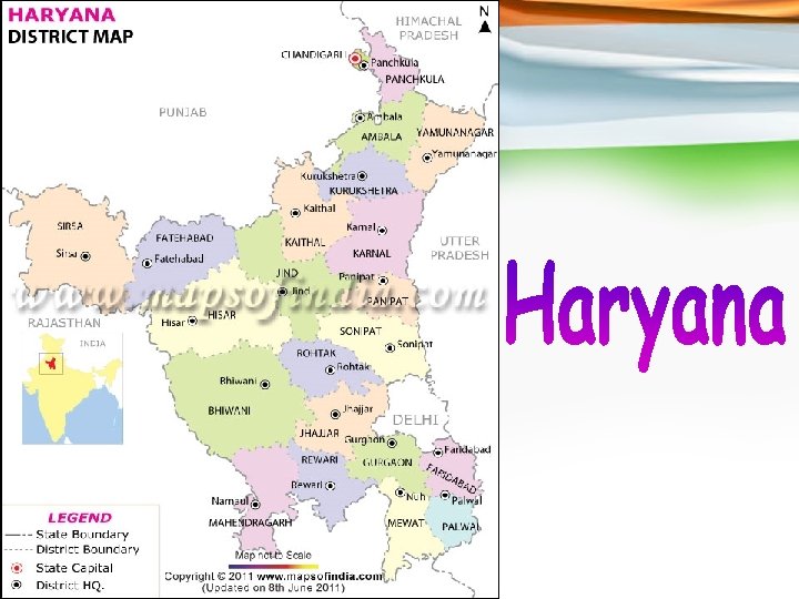
 Districts in Haryana There are 21 districts that make up the state of Haryana and they are as follows: Gurgaon Division Palwal District, Faridabad District, Mahendragarh District, Gurgaon District, Mewat District, and Rewari District Ambala Division Kaithal District, Ambala District, Panchkula District, Kurukshetra District, and Yamuna Nagar District Rohtak Division Karnal District, Jhajjar District, Rohtak District, Panipat District, and Sonipat District Hisar Division Fatehabad District, Bhiwani District, Jind District, Hisar District, and Sirsa District.
 Government of Haryana Currently, the Governor of the state is Shri Jagannath Pahadia. The Chief Minister of Haryana is Shri Bhoopinder Singh Hooda who represents the Indian National Congress. The legislative assembly of the state is unicameral in nature and houses 90 assembly seats in all. The apex court of the state is the Punjab and Haryana High Court.
 Educational institutes in Haryana Given below are the names of the well-known educational institutes in the state: Haryana Agricultural University, Hissar, YMCA University of Science and Technology, NIT Kurukshetra, University Institute of Engineering and Technology, Kurukshetra University, Deenbandhu Chhotu Ram University of Science and Technology, Manav Rachna College of Engineering, The Technological Institute of Textile & Sciences, Bhiwani, Maharishi Dayanand University at Rohtak University Institute of Engineering & Technology, University Campus (UIET, Rohtak), ITM University at Gurgaon, Manav Rachna International University at Faridabad, Kurukshetra University at Kurukshetra, Chaudhary Devi Lal University at Sirsa, Guru Jambheshwar University of Science & Technology at Hisar, Chaudhary Charan Singh Haryana Agricultural University, Maharishi Markandeshwar University, Mullana, National Dairy Research Institute, Pandit Bhagwat Dayal Sharma PGIMS (Post Graduate Institute of Medical Sciences ) Rohtak, and Management Development Institute (MDI) in Gurgaon.
 Tourist attractions in Haryana The state of Haryana is famous for housing the following tourist attractions: Kurukshetra, Chandigarh, Sultanpur National Park, Panchkula, Dumdama Lake, Taliyar, Surajkund, Panipat, Badhkal Lake, Rohtak, Bahadurgarh, Jyotisar, Thanesar, Mahendragarh, Panipat, Sonepat, Hissar, Bhiwani, Banwasa, Jhajjar, and Morni Hills.
 Dance of Haryana Lady of Haryana

 Himachal Pradesh bordering Jammu and Kashmir to the North and North. West, Punjab to the South. West, Haryana and Uttar Pradesh to the South and Uttaranchal to the Southeast is spread in the area of 55, 653 sq km. Shimla is the state capital and other major towns are Dharamshala, Kangra, Mandi, Kullu, Chamba, Hamirpur, Dalhousie and Manali. The state boasts of numerous picturesque tourist destinations, which are responsible for generating much of the revenue for the state. Agriculture, textile and burgeoning hydroelectric power export industry are the other sources of income for the state. A state in North India, Himachal Pradesh literally means a 'region of snowy mountains'. It is also sometimes referred as 'Dev Bhumi' meaning Abode of Gods. In the year 1950 Himachal Pradesh was declared as one of the Union Territories of India. Later on however, with the passing of Himachal Pradesh Act of 1971, it emerged as the eighteenth state of India. The word 'Hima' actually means snow in Sanskrit terminology. Acharya Diwakar Datt Sharma, an eminent Sanskrit Scholar from Himachal Pradesh named the state. Himachal Pradesh is among those states in India, which has a very per capita income. The state sells hydro electricity power to Punjab, Delhi and Rajasthan. The economy of Himachal Pradesh depends greatly on tourism, hydroelectric power and agriculture. Shimla serves as the state capital that was earlier the summer capital of the British.
 The head of each of the Districts in Himachal Pradesh is a Deputy Commissioner also known as Deputy Magistrate. For administrative purposes, the districts are further divided into sub-divisions, which are controlled by the sub-divisional magistrates. The sub-divisions are further divided into blocks. Blocks comprise panchayats that is the village councils and town municipalities. The law and order in the district is maintained by the Superintendent of Police.
 The twelve Districts of Himachal Pradesh are listed as below: A number of pilgrimage centers and Hindu temples are situated in Himachal Pradesh. There are more than two thousand Temples in Himachal Pradesh. These Himachal Pradesh Temples are also magnificent works of architecture. The temples are the centers of attraction for the visitors and tourists. Many of them are also associated with ancient legends.
 Cuisine of Himachal Pradesh Dancing couples of Himachal Pradesh

 Jammu and Kashmir, the northernmost state of the Indian union consists of three divisions -Jammu, Kashmir Valley and Ladakh. It has two capitals. Jammu, the winter capital and Srinagar, the summer capital. The state is almost mountainous with stretches of valleys and some mountain lakes. Jammu and Kashmir has been famous for its natural beauty since time immemorial and has been aptly described as "heaven on earth". The state has some of the best tourist spots in the entire country. Tourists from not only India but also the world over come to enjoy the scenic beauty of the state. The tourism industry has greatly benefited the state economy. Some of the major tourist attractions in the state are Gulmarg, Pahalgam, Leh, Patnitop, and Ladakh. The city of Jammu is popularly known as the City of temples. Srinagar is famous for its lakes and houseboats while Kashmir, known for its scenic natural beauty and rich cuisine is quite popular among tourists. The Dal Lake houseboats are one of the major attractions of Kashmir. Another major tourist attraction is the Mughal Gardens of Srinagar. While on a visit to Kashmir one should also not miss some of the various adventure prospects available, like trekking, rafting and skiing. Kashmir also has some of the best handicrafts in the entire country. Srinagar is known for its traditional crafts. Some of the major pilgrimage centers of the nation are located in the state, the two most important being the Amarnath Caves and the Vaishnodevi Shrine. Jammu and Kashmir has some of the best hotels to cater to its ever-growing tourism industry. There are hotels of various ranges. Even the Dal Lake houseboats are of all categories, like deluxe and economy.
 Cattle rearing and Farming are the major contributors to the economy of Jammu and Kashmir. Real Estate and Mortgage also constitute a considerable part of the service sector.
 People boating in a river of Jammu Lady of Kashmir

 Carved out from the state of Bihar, on 15 November 2000, Jharkhand has Ranchi as its capital. It is located on Chota Nagpur Plateau. It is surrounded by Bihar to the north, Orissa to the south, West Bengal to the east, and Uttar Pradesh and Chhattisgarh to the west. The state has country's two biggest steel plants, one at Bokaro and TISCO at Jamshedpur. It is also known for its mineral wealth and forestry products. The state is rich in copper, coal, iron, manganese, mica, chromite, bauxite, etc. , and has the potential of becoming one of the most prosperous states of India. The tourism industry of this state is slowly flourishing and some luxurious hotels have now started opening in the state.
 Dance of Jharkhand Goddesses of people of Jharkhand
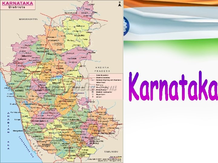
 In terms of area, Karnataka is the eighth biggest state in India. The capital of Karnataka is Bangalore or Bengaluru which is dubbed as the information technology capital of India. The state forms a part of the Deccan Plateau. It shares its borders with the Arabian Sea in the west, Maharashtra in the north, Kerala in the southwest, Goa in the northwest, Tamil Nadu to the southeast and Andhra Pradesh to the east. The economy of the state is dependent on manganese, gold, coffee, oilseed, sandalwood and silk manufacturing. More than 90% of the gold produced in the country is produced in the southern part of the state. Hospet and Bellary are the two districts in the state where manganese ore are predominantly excavated. Karnataka holds the top rank in producing raw silk, coffee, and sandalwood oriented goods. The service sector of the state comprises Consultancies, Real Estate, Academic Institutions, Travel and Tourism, Insurance and Hotel Industry.
 Karnataka Map A map of Karnataka shows that there are 30 districts in the state and they are as follows: Bangalore Rural, Bagalkote, Belgaum, Bangalore Urban, Bidar, Bellary, Chamarajanagar, Bijapur, Chikkamagaluru, Chikkaballapur, Dakshina Kannada, Chitradurga, Dharwad, Davanagere, Gulbarga, Gadag, Haveri, Hassan, Kolar, Kodagu, Mandya, Koppal, Raichur, Mysore, Shimoga, Ramanagara, Udupi, Tumkur, Yadgir, and Uttara Kannada. All these districts come under four divisions and they are as follows: Belgaum Division, Bangalore Division, Mysore Division, and Gulbarga Division. Bangalore Division Bangalore Rural, Bangalore Urban, Chitradurga, Chikkaballapur, Kolar, Davanagere, Shimoga, Ramanagara, and Tumkur districts Belgaum division Belgaum, Bagalkot, Dharwad, Bijapur, Haveri, Gadag, and Uttara Kannada districts. Districts
 Gulbarga Division Bidar, Bellary, Koppal, Gulbarga, Yadgir, and Raichur districts. Mysore Division Chikamagalur, Chamarajanagar, Hassan, Dakshina Kannada, Mandya, Kodagu, Udupi, and Mysore districts.
 Dance of Karnataka God of people of Karnataka

 Kerala is the most popular state in South India. Kerala was founded by merging the numerous Malayam speaking regions in south India on 1 November 1956. Spreading across an area of 38, 863 km sq Kerala shares its borders with Karnataka in the north, Tamil Nadu in the south and the Lakshadweep in the west. Thiruvananthapuram serves as the capital of the state. Also known as Gods Own Country Kerala is the favorite tourist spot of many Indian and foreign travelers. There are 14 districts in Kerala. Based on certain cultural, historical and geographical similarities the districts of Kerala are grouped into; Malabar Region North Kerala), Kochi Region (South Kerala) and Travancore (Central). Kerala over the years has evolved to become the hottest tourist place in India. Both domestic and foreign travelers flock to this beautiful place known as Gods own country to witness the charms of nature. Kerala Travel and Tourism offers Kerala travel packages, backwater tours, wildlife tours, hill Station tours, beach tours, heritage tours, houseboat cruises and hotel reservations. Characterized by undulating topography varied cultures, religious diversity, interesting history, ancient medical practices, numerous languages, distinct cuisine and captivating landscapes Kerala has it all. Synonymous with the backwaters Kerala is truly blessed in terms of natural beauty. The vibrant state offers something for everyone.
 Previously known as Cochin, Kochi is an important port city in Kerala. Located on the western banks of the Arabian Sea. Kochi is the second largest city in the state. Also known as the Queen of the Arabian Sea Kochi shares its borders with Karnataka on the East and Tamil Nadu on the South. Engulfed in large expansions of greenery this enthralling city in Kerala has been a major trade center since times immemorial. Travelling to Kerala by train is extremely easy. Kerala is connected to the other states and cities in India. Kerala Railway Network consists of almost 200 stations spread throughout the state. Kerala connects extremely well with major cities like Bangalore, Mumbai, Chennai, Kolkata, and Delhi and by 13 different railway routes. Traveling by train to Kerala can be said to be the most inexpensive and quick means of transpirations. Thiruvananthapuram serves as the capital of the Kerala. It is located on the extreme south of the state. Engulfed in natural greenery Thiruvananthapuram happens to be the largest most populous city in Kerala. Also known as the IT hub of the state this city is the most popular tourist places in Kerala Malappuram is a quaint little city situated in the Malappuram District of Kerala. Malappuram serves as eye candy for the wildlife enthusiasts as this city is sprinkled with forests, meandering rivers, cascading hillocks and the evergreen backwaters. There are various Telecom Circle Offices in Kerala. Access important circle office telephone numbers, customer care telephone numbers and mobile service enquiry numbers.
 Munnar is located in the Idukki district of Kerala. It is by far one of the most important hill stations in south India. Situated on the banks of the Nallathanni Muthirappuzha and Kundaly rivers Munnar rightly gets its name from the Tamil words Munnu meaning Three and Aaru meaning River. Covering an area of 557 km sq this mesmerizing hill resort is one of the major causes behind the successful tourism in Kerala. Kollam is the other gem in the crown of Kerala. It is a small city located on the boundaries of the Astamudi Lake. Kollam is also a famous tourist hub in Kerala. It is situated at a distance of 71 km from Thiruvananthapuram. Kollam serves as the southern gateway to the backwaters of Kerala. It is also the fourth largest city in Kerala and is also a major commercial hub of the state. Kottayam is an important industrial town in Kerala. It is situated at a distance of 150 km from Thiruvananthapuram, the state capital. This was the first municipality of India to achieve the 100 percent literacy mark. It also became the first Indian state district to ban tobacco. Although Kerala is a part of India but Kerala Culture and Festivals are quite unique and different. The major cause for its extraordinary culture is that Kerala has been a place where people from different religious beliefs and cultures have mingled and co existed in harmony since centuries. Even the states geographical location contributes to a large extent to its culture.
 A Kathakali of Kerala Cuisine of Kerala

 Lakshwadeep is the smallest Union Territory of India and is located in The Arabian Sea. It consists of twelve coral atolls, three coral reefs, five banks, and numerous islets, and is under the jurisdiction of Kerala High Court. The capital of this union territory is Kavaratti. It is a famous tourist destination and has many state of the art hotels. Tall green coconut palms offer spectacular beauty and turn this land into a tropical paradise. The calm waters of the lagoons are home for an exotic underwater marine life that amazes viewers with a play of colors and underwater antics. Out in the open sea, Dolphins, Turtles, Tuna, Rays and Flying fish can be sighted. The main islands are Kavaratti, Agatti, Amini and Minicoy.
 A sea beach in Lakshadweep Islands People of Lakshadweep Islands
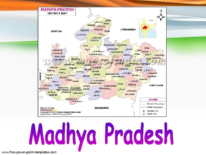
 Madhya Pradesh, a state in central India, borders Uttar Pradesh , Chhattisgarh , Maharashtra , Gujarat and Rajasthan. The state is made up of 48 districts, which are grouped into eight divisions: Bhopal, Chambal, Gwalior, Indore, Jabalpur, Rewa, Sagar, and Ujjain. The state capital Bhopal is home to industries such as electrical goods, cotton, chemicals and jewelry. There are several places of tourist interest in the state such as the Khajuraho Group of Monuments, Rock Shelters of Bhimbetka, lakes, National Parks, natural preserves etc.
 Sculptures in Madhya Pradesh People of Madhya Pradesh

 Maharashtra, situated in the western part of India, is the third largest state of India. It is bordered by the states of Gujarat, Madhya Pradesh, Chhattisgarh, Andhra Pradesh, Karnataka, Goa and the union territory of Dadra and Nagar Haveli. Divided into thirty five districts, it has cities such as Mumbai, Pune, Aurangabad, Kolhapur, Solapur, Nagpur, Thane, Jalgaon and Amravati which have a distinct place on the map of the world. All the districts of Maharashtra are grouped into six divisions: Aurangabad Division, Amravati Division, Konkan Division, Nagpur Division, Nashik Division and Pune Division. The state which is home to one of the largest film industries of the world i. e. Bollywood, also boasts of being the largest contributor in India's national industrial output. With places such as Lonavala, Khandala, Matheran, Panchgani, Mahabaleshwar, and UNESCO World Heritage Sites of Ajanta and Ellora, Elephanta Caves and Chhatrapati Shivaji Terminus, it is one of the most sought after tourist destinations in India.
 Cuisine of Maharashtra Dance of Maharashtra

 Manipur, surrounded by Nagaland, Mizoram, Assam and Mynamar, has Imphal as its capital. As it is a sensitive border area, Tourists who want to travel to Manipur require a Restricted Area Permit, which is valid for 10 days. Literally meaning "the jeweled land", Manipur is richly endowed with natural splendor and grandeur. It has 9 districts: Bishnupur, Chandel, Churachandpur, Imphal East, Imphal West, Senapati, Tamenglong, Thoubal and Ukhrul. Agriculture is the single largest source of livelihood, for a majority of the rural masses, and the state economy also depends on it. Industry in Manipur is not very well developed. However, the state is striving towards industrialization, with the setting up of many large and small-scale industrial units. The main industries of Manipur are pharmaceuticals, steel re-rolling, plywood, bamboo chipping, cement, vanaspati and electronics and the service sector comprises of Real estate, Consultancies, Travel and Tourism, Hotel Industry and Insurance.
 Festival of Manipur Dance of Manipur
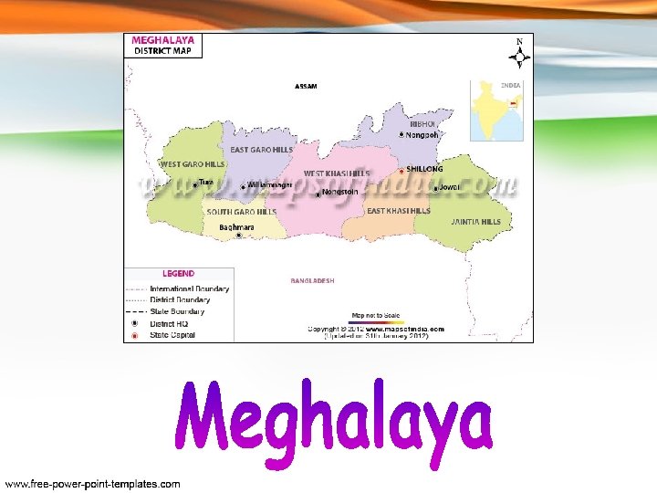
 Meghalaya, a hilly strip in eastern India, covers a total area of just 22, 429 sq km. It was originally part of Assam, but on 21 st January 1972, the districts of Khasi, Garo and Jaintia hills became the new state of Meghalaya is predominantly an agrarian economy. The important crops of the state are potato, rice, maize, pineapple, banana etc. The service sector comprises of Real estate and Insurance companies. Meghalaya's gross state domestic product for 2004 is estimated at $1. 6 billion in current prices. Shillong the capital of the state is a popular hill station. There are several falls in and around Shillong. The Shillong peak is highest in the state and is good for trekking. It is also known as the 'abode of the gods' and has excellent views. If one is not in a mood for camping, the state also offers many good hotels and lodging facilities.
 People of Meghalaya A Waterfall of Meghalaya
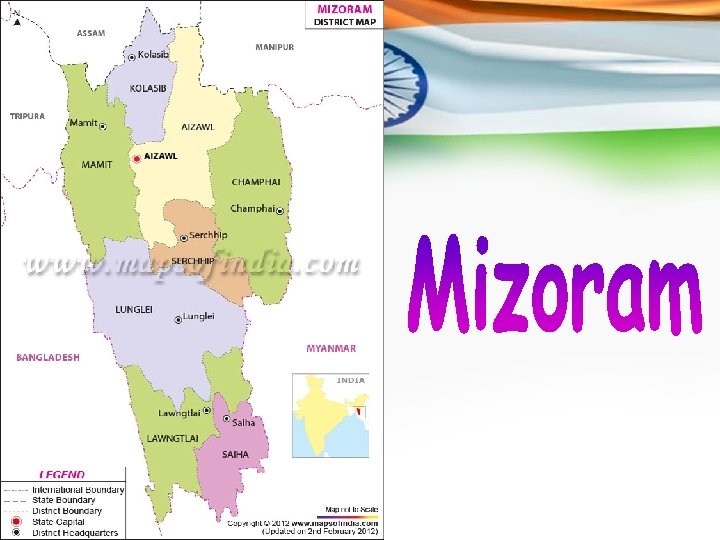
 Mizoram is one of the seven northeastern states of India and is enclosed by Myanmar, Bangladesh, Manipur, Assam, and Tripura. In the local language, Mizoram means "Land of the Highlanders". The Mizo Hills, which dominate the state's topography, rise to more than 6560 ft near the Myanmar border. Aizawl, the state capital, is 4000 ft above sea level. About three-fourths of the population earns their livelihood from agriculture. Paddy, maize, mustard, sugarcane, sesame, fiber less ginger and potatoes are the other prominent crops grown in this area. Small-scale irrigation projects are being developed to increase the crop yield. There are no major industries in the state. Small-scale industries include sericulture, handloom and handicrafts industries, sawmills and furniture workshops, oil refining, grain milling, and ginger processing. The service sector comprises of Tourism, Real Estate and Insurance.
 Festival of Mizoram Dance of Mizoram

 This farthest lying state in northeast, Nagaland, was born on 1 st December 1963. The state is divided into seven districts: Kohima, Phek, Mokokchung, Wokha, Zunheloto, Twensang and Mon. It is a largely mountainous state. Agriculture is the most important economic activity in Nagaland. Principal crops include rice, corn, millets, pulses, tobacco, oilseeds, sugarcane, potatoes and fibres. Other economy boosters are Forestry, Cottage industries, Insurance, Real estate and Tourism.
 Couples of Nagaland Black Magic in Nagaland

 Orissa is one of the 28 states of India. The capital of Orissa or Odisha is Bhubaneswar. The contemporary state was formed on April 1, 1936. Till 1948, the city of Cuttack served as the capital of the state. Bhubaneswar is also dubbed as the Temple City.
 Area and population of Orissa The total area of the state is 60, 160 sq miles or 155, 820 sq km. According to the census conducted in 2011, the population of Orissa is 41, 947, 358. In terms of population, the state is the eleventh biggest state in India and in terms of area, it holds the ninth rank.
 Demographic features of Orissa About 50. 54% of the population of the state are male (21, 201, 678) and 49. 46% of the population are female (20, 745, 680). The density of population in the state is 269/ km 2. About 94. 35% of the population are Hindus, 2. 07% are Muslims, 2. 44% are Christians, and only 1. 14% is represented by other communities. The official language of the state is Oriya. Other languages spoken in the state are Hindi, Bengali, Santali, and Telugu. The literacy rate is 73. 45% (as per 2011 census. )
 Districts of Orissa The districts of the state are as follows: Angul, Boudh, Bhadrak, Bolangir, Bargarh, Balasore, Cuttack (Kataka), Debagarh, Dhenkanal, Ganjam, Gajapati, Jharsuguda, Jajpur, Jagatsinghpur, Khordha, Keonjhar, Kalahandi, Kandhamal, Koraput, Kendrapara, Malkangiri, Mayurbhanj, Nabarangpur, Nuapada, Nayagarh, Puri, Rayagada, Sambalpur, Subarnapur, and Sundargarh.
 Major cities in Orissa Other than Bhubaneswar and Cuttack, the major cities in Orissa are Rourkela, Brahmapur, Bolangir, Sambalpur, Kendrapara, Balasore, and Puri.
 Government of Orissa At present, the Chief Minister of the state is Shri Naveen Patnaik. He represents the BJD (Biju Janata Dal) Party. The Governor of the state is Shri Murlidhar Chandrakant Bhandare and there are 147 seats in the Legislative Assembly (Vidhan Sabha) of the state. The Legislative Assembly of the state is unicameral in nature. The apex court of the state is the Orissa High Court in Cuttack.
 Geographical features of Orissa The state forms a part of the eastern seacoast of India. The shoreline of the state is comparatively uninterrupted and the length of this shoreline is approximately 480 km. Physiographically, the state can be divided into the following areas: • • • The hilly and upland areas in the center The shoreline flatlands to the east The undulating highlands to the west The flat terrains in the middle The important flood basins
 Rivers of Orissa The major rivers of Orissa are as follows: Mahanadi (the longest river of the state), Kathajodi, Brahmani, Baitarani, Budhabalanga, Rushikulya, Vanshadhara, Bahuda, Nagavali, Kolab, Indravati, Salandi, and Tel Rivers. In addition, there a number of scenic lakes in the state that are top tourist draws like the Chilka Lake, Pata Lake, Anshupa Lake, Indravati Dam, and Hirakud Dam.
 Economy of Orissa The state houses a strong economy with plenty of natural resources and an extensive shoreline. The state is rich in natural resources like coal, bauxite, iron ore, and chromite. Steel manufacturing is a major industry in the state. Other industries include transportation, oil refinery, power, information technology and aluminum.
 Educational institutes in Orissa Given below are the names of the popular educational institutes in the state of Orissa: Biju Patnaik University of Technology at Rourkela, Berhampur University at Berhampur, C. V. Raman College of Engineering, Bhubaneshwar, Central University of Orissa, Koraput, IIT Bhubaneshwar at Bhubaneshwar, Fakir Mohan University at Balasore, National Institute of Science and Technology at Berhampur, KIIT University in Bhubaneshwar, National Institute of Technology Rourkela at Rourkela, National Institute of Science Education and Research, Bhubaneswar, North Orissa University at Baripada, National Law University, Orissa in Cuttack, Ravenshaw University in Cuttack, Orissa University of Agriculture and Technology (OUAT) at Bhubaneshwar, Siksha O Anusandhan University, Sambalpur, Sri Jagannatha Sanskrit University, Puri, Silicon Institute of Technology, M. K. C. G. Medical College, Berhampur, Government Ayurvedic College, Bolangir, SCB Dental College in Cuttack, SCB Medical College in Cuttack, Veer Surendra Sai Medical College, Burla, Sri University in Cuttack, Utkal University of Culture at Bhubaneshwar, Utkal University (at Bhubaneshwar), Veer Surendra Sai University of Technology, Burla and Vedanta University.
 Tourist attractions in Orissa The top tourist attractions in Orissa are as follows: The Lingaraj Temple at Bhubaneshwar, Chilka Lake, Daringbadi (Darjeeling of Odisha), Pipli, the Sun Temple at Konark, Jagannath Temple (Puri), Udayagiri and Khandagiri Caves, Gharial Sanctuary at Tikarpada, Ambapani Wildlife Sanctuary, Bhitar Kanika National Park, Nandan Kanan National Park, Sunabeda Wildlife Sanctuary, Belghar Wildlife Sanctuary, Chandka Elephant Reserve, Ushakothi or Badarama Wildlife Sanctuary, Chilika Wildlife Sanctuary, Satkosia Gorge Wildlife Sanctuary, Gahirmatha Turtle Sanctuary and Simlipal National Park. The well-known Shiva Temple is closely located to Dhenkanal. The famous sea beaches in the state are also popular tourist attractions and include Gopalpur-on-Sea, Puri, Ramachandi, Chandipur, Astarang, Balighai, and Paradeep Beach.
 Dance of Orissa People of Orissa

 As Pondicherry was earlier a French Colony, the french influence can be traced even today. It has neat sectors and perpendicular streets. The entire town is divided into two sections: the French quarter and the Indian quarter. Many streets still have their French names. The buildings are an ideal mix of french colonial style that has long compounds and stately walls and the Indian style of houses lined with verandas, and large doors and grills. Some of these buildings have turned in guest houses and hotels. The state economy boasts of its agriculture and fisheries. Crops like paddy, coconuts, arcanuts, condiments, spices, pulses, groundnut and chilies are cultivated here. Fishing is an important occupation as the Union Territory has a coastline of 45 kms. There are 23 large, 79 medium scale and 5, 400 small scale industries. The service sector comprises of mainly Tourism and Real Estate.
 Goddess of people of Pondicherry Islands A Sea beach in Pondicherry

 Punjab is situated in the northwestern corner of the country. It is bound on the north by the Indian state of Jammu and Kashmir , on the east by Himachal Pradesh and the Union Territory of Chandigarh , on the south by Haryana and Rajasthan, and on the west by Pakistan. The city of Chandigarh is the administrative capital of Punjab. Agriculture is the main occupation of the people of Punjab and forms the backbone of the State economy. The principal industries include the manufacture of textiles, sewing machines, sporting goods, starch, fertilizers, bicycles, scientific instruments, electrical goods, and machine tools, and the processing of sugar and pine oil. Punjab is one of the most prosperous states in the country. The state of Punjab is known as the home of Sikhism. The state of Punjab has as many as 22 districts. The largest district in Punjab in terms of area is Firozepur covering an area of 5865 sq km and Nawan Shehar with an area of 1258 sq km is the smallest district in the state of Punjab. The district map of Punjab will aid you to understand the city in a better way and improve your knowledge of the geography of Punjab. The other districts of Punjab are Amritsar where the Golden temple is located, Barnala, Bathinda, Firozpur, Fatehgarh Sahib, Faridkot, Gurdaspur, Hoshiarpur, Jalandhar, kapurthala, Ludhiana, Mansa, Moga, Mohali, Muktsar, Patiala, Pathankot, Rupnagar, Sangrur, Shaheed Bhagat Singh Nagar and Tarn Taran.
 Punjab is divided into three regions namely Malwa, Majha and Doaba. Malwa region of Punjab covers as many as 11 districts. The major districts under this region are Ludhiana, Bhatinda, Mohali, Sangrur and Patiala. Districts like Amritsar, Pathankot, Gurdaspur and Tarn Taran constitute the Majha District of Punjab. Doaba region of Punjab include districts like Jalandhar, Hoshiarpur, Nawanshahar and Kapurthala.
 Person of Punjab Dance of Punjab

 Rajasthan, the largest state of India, has Jaipur as its capital. It has 32 districts. The Aravali Range runs across the state from Mount Abu, which is 1, 722 m in height to Khetri. Most of the region of Rajasthan is covered by the Thar Desert. The state economy is mainly agricultural and pastoral. Sugarcane, pulses, oilseeds, cotton and tobacco are the major crops of the region. The Indira Gandhi Canal irrigates the northwest Rajasthan. It is also the largest producer of marble and sandstone. These minerals are excavated at Makrana near Jodhpur. It has rich salt deposits at Sambhar and copper mines at Khetri and Dariba. The service sector comprises industries like tourism and real estate. Because of its natural beauty and great history, Rajasthan also has a flourishing tourism industry. Many old and neglected palaces and forts in Rajasthan have been converted into heritage hotels. The palaces of Jaipur, lakes of Udaipur, temples of Bikaner and desert forts of Jaisalmer are the favorite spots for tourists, both Indian and foreign. Mount Abu is the only hill station of this state. The famous Thar Desert is also located here. Districts
 A Rajasthan map shows that there are 33 districts in Rajasthan and they are categorized into seven divisions: • • • Ajmer Division: Ajmer, Nagaur, Bhilwara, Tonk. Bikaner Division: Churu, Bikaner, Hanumangarh, Sri. Ganganagar Bharatpur Division: Dholpur, Bharatpur, Sawai Madhopur and Karauli. Jodhpur Division: Jaisalmer, Barmer, Jodhpur, Jalore, Sirohi, and Pali. Jaipur Division: Alwar, Jaipur, Sikar, Jhunjhunu, Dausa. Udaipur Division: Chittorgarh, Banswara, Dungarpur, Pratapgarh, Rajsamand, Udaipur • Kota Division: Bundi, Baran, Kota, Jhalawar.
 Demographic features of Rajasthan The population of the state is mostly Rajasthani. The various religions or faiths representing the population are as follows: Hindus - 88. 8% Muslims - 8. 5% Jains - 1. 2% Sikhs - 1. 4% In addition, there are some Sindhi people who live in the state. They arrived to the territory from the Sindh area (currently a part of Pakistan) at the time of the partition of the two countries in 1947. The first language of the most of the population in the state is Rajasthani. Hindi and Rajasthani are the two most significantly spoken languages in the state. In a number of schools, the Rajasthani language is utilized as a medium of teaching together with English and Hindi. Sindhi, Gujarati, and Punjabi are the other languages in the state.
 Dance of Rajasthan People of Rajasthan

 Sikkim is the second smallest state of India. This landlocked state is least populated and has Gangtok as its capital. The world's third highest peak, Kanchenjunga, is located here. The state has twenty-eight mountain peaks, twenty-one glaciers, 227 high altitude lakes, five hot springs, and over 100 rivers and streams, including the famous Teesta, which is also called "lifeline of Sikkim". Sikkim's economy is mainly agrarian. It produce crops of rice, cardamom, oranges, apples and tea. It is also a mineral rich state and have mines of copper, dolomite, limestone, graphite, mica, iron, and coal. The state also has a vast tourism potential. There are many hotels and guest houses to cater to the flourishing tourism industry. Apart from the major contribution from tourism, the service sector also boasts of its real estate.
 People of Sikkim Dance of Sikkim

 Tamil Nadu, a state in southern India is bordered with Pondicherry, Kerala, Karnataka and Andhra Pradesh. It is regarded as the cradle of Dravidian culture with its cultural paraphernalia speckled all across the state in the form of magnificent temples, gateways, intricate carvings, and the society seeped in tradition. Tamil Nadu is the most urbanized state in India. The key industries of the state are heavy engineering and manufacturing-based companies and textiles. Tamil Nadu covers total land area of 130, 058 km 2 and is divided into 32 districts which are: Ariyalur, Chennai, Coimbatore, Cuddalore, Dharmapuri, Dindigul, Erode, Kancheepuram, Kanyakumari, Karur, Krishnagiri, Madurai, Nagapattinam, Namakkal, Perambalur, Pudukottai, Ramanathapuram, Salem, Sivaganga, Thanjavur, The Nilgiris, Theni, Thiruvallur, Thiruvannamalai, Thiruvarur, Thirunelveli, Tiruppur, Trichirappalli, uticorin, Vellore, Villupuram and Virudhunagar.
 Lady of Tamil Nadu Dance of Tamil Nadu

 Tripura is a state in northeast India and has Agartala as its capital. With an area of 10, 486 kms, it is divided into three districts. The principle hill ranges of Tripura are Sakham Tlang, Langtarai, Athara Mura and Bara Mura. The chief occupation of the population in the state is agriculture. The principal crops are paddy, wheat, jute, sugar cane, potato, turmeric, coconut and oil seeds. Handloom weaving is the single largest industry in Tripura. Bamboo Handicrafts also make a major contribution to the state economy. Some quality timber like Sal, Garjan, Teak, Gamar are found abundantly in the forests of the State. The service sector comprises only real estate, insurance and tourism industry.
 People of Tripura Dance of Tripura

 Uttaranchal/ Uttarakhand is a state situated in northern India. Formerly known as Uttaranchal, this state was formed out of the north-western districts of Uttar Pradesh and the Himalayas on 9 November 2000. Also refereed to as the Land of Gods, Uttaranchal is believed to be one of the most naturally bestowed states in India. Uttaranchal shares its borders with Tibet in the north, Uttar Pradesh in the south, Nepal in the east, Haryana in the west and Himachal Pradesh in the North West. Uttaranchal is home to some of the finest Hindu temples and religious destinations in India. In the year 2007 Uttaranchal was renamed Uttarakhand which means part of the North. The state stretches over an area of 20, 682 sq mi of land. Dehradun serves as the capital of state. While traveling to Uttarakhand it is always advisable to carry a map of the state. There are many different maps of Uttaranchal/Uttarakhand in India that provide complete information about the important roads, hotels, tourists spots, hospitals etc in the state.
 Demographics of Uttarakhand has 13 districts which are grouped into two divisions namely Garhwal division and Kumaon division. The Garhwal division includes seven districts. • Dehradun • Uttarkashi • Tehri Garhwal • Rudraprayag • Haridwar • Pauri Garhwal • Chamoli • The Kumaon division includes six districts. • Almora • Pithoragarh • Nainital • Bageshwar • Champawat • Udham Singh Nagar Country India State Uttaranchal District 13 districts Area 20, 682 sq mi Population 10, 116, 752 Coordinates 30° 20'N 78° 04'E? / ? 30. 33°N 78. 06°E
 Tourist Attractions in Uttarakhand Below is a list of the important Tourist Attractions in Uttaranchal: • Kedarnath The Kedarnath Temple is one of the most important religious centers in Uttaranchal/Uttarakhand. It is located at an elevation of 11, 500 feet above sea level near the Mandakini River. Kedarnath is among the holiest Hindu temples in India dedicated to Lord Shiva. Devotees travel from different corners of the country every year mostly during the month of April to pay their homage to the God of the region. • Rishikesh This is another popular tourist destination in Uttaranchal. Nestled in the foothills of the Himalayas Rishikesh is also a one stop pilgrimage center for many Hindu's. According to Hindu Mythology this city was one of the favorite places of Lord Shiva. Apart from its religious significance Rishikesh is among the most naturally beautiful cities in India. • Nainital is among the most frequented tourist destinations in Uttaranchal Situated in the Kumaon hills, Nainital is famous for its enthralling landscapes. Nainital is situated at a height e of 1, 938 meters Nainital offers several tourist destinations that are unique to the region.
 • Ranikhet A haven for restoration and the peace loving traveler Ranikhet promises a calm that is not found anywhere else in India. Known as a unique hill station for its clean and pollution free environment, tall coniferous trees, serene surroundings Ranikhet promises to take you far from the maddening crowd. • The Corbett National Park Known as paradise for the animal lover the Corbett National Park is undoubtedly the most prized possession of Uttarakhand. Counted as one of the best animal habitats in the country the Corbett National Park is located in the Himalayan foothills. Stretching over an area of 1318. 54 sq meters this national park in India is made up of a rich eco system.
 Travel to Uttarakhand in India is easily accessible by air, rail and road. • • • How to Reach Uttarakhand by Air Uttaranchal is easily accessible by air. The Jolly Grant airport near Dehradun is the most popular airport in the region. Almost all the domestic airlines operate regular flights to and from Dehradun. There almost daily flights from Delhi to Dehradun by Indian Airlines. How to Reach Uttarakhand by Rail Uttaranchal shares an excellent railway network with most of the Indian cities and towns. The major railway stations that connect the state to the other parts of the country are; the Dehradun Railway Station, the Haridwar Railway Station, and the Kathgodam Railway Station. How to Reach Uttarakhand by Road Uttaranchal is well connected to most of the cities in India by a strong network of National Highways such as 58, 73, 74, and 87. However during the winters it sometimes becomes difficult to travel to Uttaranchal by road.
 Dance of Uttrakhand People of Uttrakhand

 Uttar Pradesh is India's most populous state with a population of over 190 million people. It is divided into 70 districts with Lucknow as its capital. Uttar Pradesh is bounded by Nepal on the North, Himachal Pradesh on the northwest, Madhya Pradesh on the south, Haryana on the west, Rajasthan on the southwest, and Bihar on the east. Wheat, rice, sugar cane, apples, mango, pulses, oil seeds and potatoes are the main crops of Uttar Pradesh. The service sector comprises of travel and tourism, hotel industry, real estate, insurance and financial consultancies. Uttar Pradesh attracts a large number of tourists. The famous Taj Mahal of Agra is located in this state. It also hosts the world famous 'Kumbh Mela'. It has many state of the art hotels to cater to the lodging needs of visitors, both national and international. Other important cities in Uttar Pradesh are Allahabad, Varanasi, Ayodhya and Mathura.
 Dance of Uttar Pradesh Cuisine of Uttar Pradesh
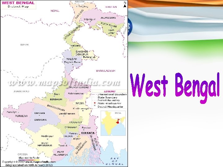
 West Bengal is a state which is located in eastern India. The state extends from Bay of Bengal in the south to the Himalayan mountain ranges in the north. The capital of the state of West Bengal is Kolkata and it is the biggest city of the state as well. In Bengali language, it is referred to as Paschim Banga.
 West Bengal: An Overview In terms of population, West Bengal ranks as the fourth most populated state in India.
 Districts of West Bengal There are 19 districts in the state and they are as follows: Darjeeling, Cooch Behar, Malda, Jalpaiguri, South Dinajpur (Dakshin Dinajpur), North Dinajpur (Uttar Dinajpur), Bardhaman, Bankura, East Midnapore (Purba Medinipur), Birbhum, Purulia, Hooghly, Howrah, West Midnapore (Paschim Medinipur), Murshidabad, Kolkata, North 24 Parganas (Uttar 24 Parganas), Nadia, and South 24 Parganas (Dakshin 24 Parganas).
 Divisions of West Bengal There are three divisions in the state and they are the Jalpaiguri division, Burdwan division, and Presidency division.
 Area of West Bengal The state covers a total area of 34, 267. 3 sq miles or 88, 752 square km.
 Population of West Bengal According to the census performed in 2011, the population of the state is 91, 347, 736.
 Tourist Attractions in West Bengal The state is known all over the globe for the Sunderbans. It has nineteen districts and the major cities are Kolkata, Siliguri, Burdwan, Durgapur, Kharagpur, Darjeeling and Malda. The state of West Bengal is home to two very big natural zones and they are the sub-Himalayan and Himalayan region to the north and the Gangetic Plain to the south.
 Neighboring states and countries The neighboring states of West Bengal are Jharkhand, Orissa, Sikkim, Bihar, and Assam. The state shares its international boundaries with Bhutan, Nepal, and Bangladesh.
 Economy The principal occupation of the people of the state is farming. West Bengal makes the sixth highest contribution to the Gross Domestic Product of the country.
 Education in West Bengal The state is a pioneer in bringing modern education in India. Given below are the names of the famous educational institutes in the state: Bengal Engineering and Science University, Shibpur, Aliah University, Jadavpur University, Bidhan Chandra Krishi Viswavidyalaya Haringhata, Presidency University, Kolkata, Netaji Subhas Open University, Ramakrishna Mission Vivekananda University, Rabindra Bharati University, University of Burdwan, University of Calcutta, Sidho Kanho Birsha University, University of Kalyani, University of North Bengal, University of Gour Banga, Vidyasagar University, Uttar Banga Krishi Vishwavidyalaya, West Bengal State University, Visva-Bharati University, West Bengal University of Health Sciences, West Bengal University of Animal and Fishery Sciences, West Bengal National University of Juridical Sciences and West Bengal University of Technology.
 Government of West Bengal At present, the Governor of the state is Mr. M. K. Narayanan. He is appointed by the President of India for a term of five years and acts as the constitutional head of the state. The Chief Minister of West Bengal is Smt. Mamata Banerjee who represents the Trinamool Congress party. The Legislative Assembly or Vidhan Sabha of the state is unicameral in nature and contains 295 seats.
 Geography of West Bengal The state has diverse geographical features which include towering summits of the Himalayan Mountain Range, flat terrain, rivers, and sea. The state shares its boundaries with the Himalayas in the north and the Bay of Bengal to the south. To the west, it is bordered by the states of Jharkhand Bihar. To the east, it is edged by Bangladesh. To the northeast, it is bordered by Assam, Sikkim and Bhutan. The territory of Nepal lies to the northwest. The state of Orissa is situated to the southwest of the state.
 Landforms of West Bengal The state is made up of the following varieties of landforms: • • Darjeeling Himalayan hill region Terai region North Bengal plains Rarh region Coastal plain Sunderbans Western plateau and high lands Ganges delta
 Agro-climatic regions The state can be divided into the following agro-climatic regions: • The Teesta and Terai alluvial areas of North Bengal • The mountainous areas in the north • The shoreline alluvial areas in the south • The red, laterectic, and severely rolling areas to the west • The Vindhya alluvial area in the middle • The Gangetic alluvial area in the west
 A Kathakali of West Bengal Godess of people of West Bengal
") Bibliography • Contemporary India – I (NCERT S. St Book for Class – IX) • Google Images (Pictures) (http: //www. google. com/imghp) Maps Of India (Official Website) (http: //www. mapsofindia. com)
Bibliography • Contemporary India – I (NCERT S. St Book for Class – IX) • Google Images (Pictures) (http: //www. google. com/imghp) Maps Of India (Official Website) (http: //www. mapsofindia. com)
 About Me I’m a very simple student of class IX-A. You can contact me at following points: Phone No. – 8755529881, 9412834538, 9808242381, 9548688621. E-Mail Id (s) – gaurav. goswami. cool@live. com, gouravgoswami 48@gmail. com, gourav. coolboy@rediffmail. com, gaurav_goswami@india. com. Accounts on Social Networking Sites – Gaurav Goswami @ Facebook, Gaurav Goswami @ Google +. Own Websites – www. coolricbuddy. webs. com (not perfectly built)
 That was all. Thank you for giving your precious time and heed to my presentation.