the “Land of the Maple Leaf” Geographical position

38220-canada.ppt
- Количество слайдов: 20
 the “Land of the Maple Leaf”
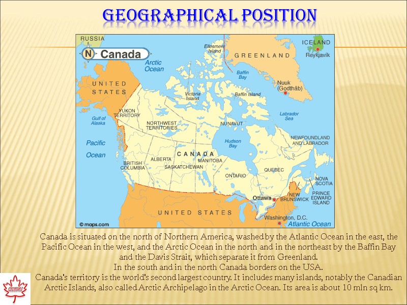
 Geographical position Canada is situated on the north of Northern America, washed by the Atlantic Ocean in the east, the Pacific Ocean in the west, and the Arctic Ocean in the north and in the northeast by the Baffin Bay and the Davis Strait, which separate it from Greenland. In the south and in the north Canada borders on the USA. Canada's territory is the world's second largest country. It includes many islands, notably the Canadian Arctic Islands, also called Arctic Archipelago in the Arctic Ocean. Its area is about 10 mln sq km.
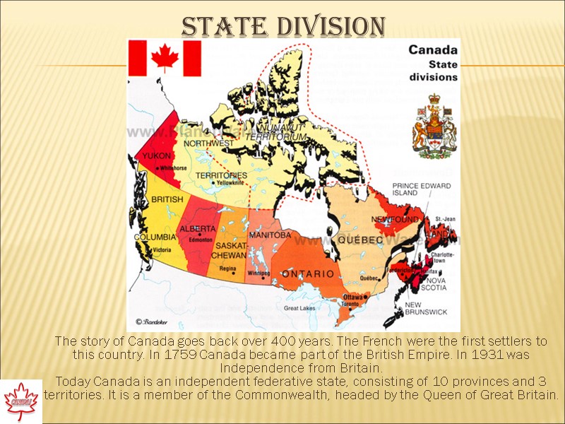
 State division The story of Canada goes back over 400 years. The French were the first settlers to this country. In 1759 Canada became part of the British Empire. In 1931 was Independence from Britain. Today Canada is an independent federative state, consisting of 10 provinces and 3 territories. It is a member of the Commonwealth, headed by the Queen of Great Britain.
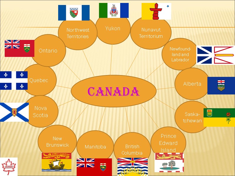
 Yukon Northwest Territories Quebec Nunavut Territorium New Brunswick British Columbia Saska-tchewan Newfound-land and Labrador Nova Scotia Manitoba Prince Edward Island Alberta CANADA Ontario
 Languages spoken in Canada The official languages are English and French. Nearly 60 percent of the population speak English and 27 percent speak French. But many other languages are spoken: Italian, Chinese, German, Polish and Greek.
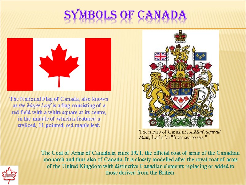
 Symbols of Canada The National Flag of Canada, also known as the Maple Leaf is a flag consisting of a red field with a white square at its centre, in the middle of which is featured a stylized, 11-pointed, red maple leaf. The Coat of Arms of Canada is, since 1921, the official coat of arms of the Canadian monarch and thus also of Canada. It is closely modelled after the royal coat of arms of the United Kingdom with distinctive Canadian elements replacing or added to those derived from the British. The motto of Canada is A Mari usque ad Mare, Latin for "from sea to sea."
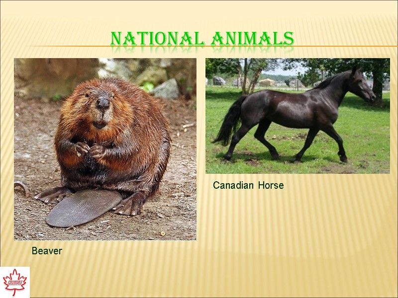
 National animals Beaver Canadian Horse
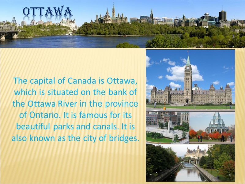
 Ottawa The capital of Canada is Ottawa, which is situated on the bank of the Ottawa River in the province of Ontario. It is famous for its beautiful parks and canals. It is also known as the city of bridges.
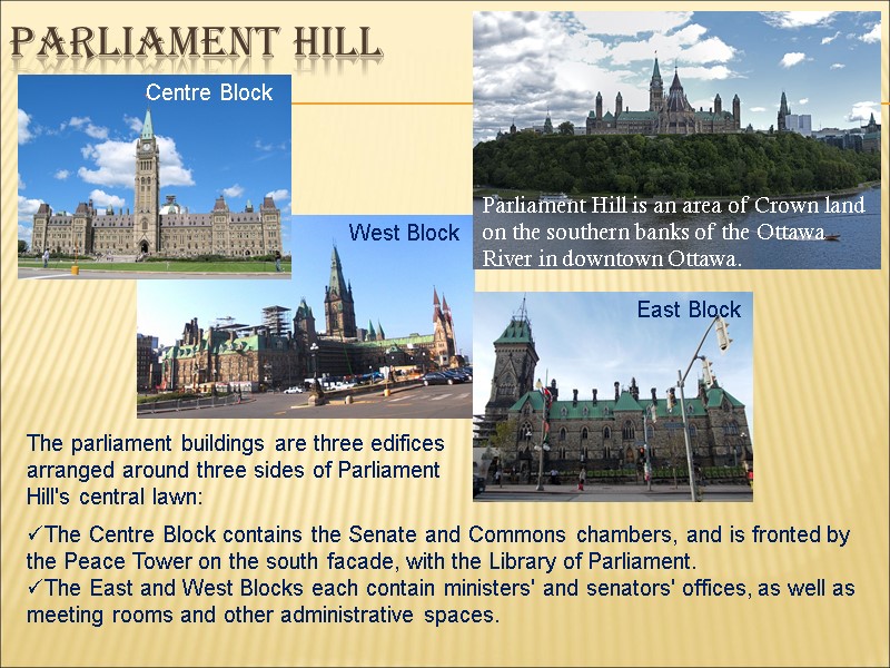
 Parliament hill Parliament Hill is an area of Crown land on the southern banks of the Ottawa River in downtown Ottawa. The Centre Block contains the Senate and Commons chambers, and is fronted by the Peace Tower on the south facade, with the Library of Parliament. The East and West Blocks each contain ministers' and senators' offices, as well as meeting rooms and other administrative spaces. Centre Block West Block East Block The parliament buildings are three edifices arranged around three sides of Parliament Hill's central lawn:
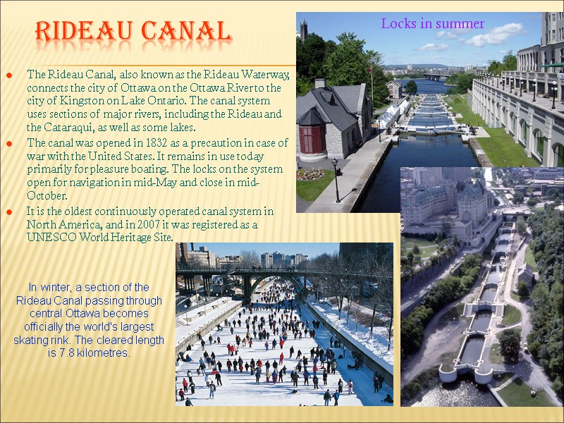
 Rideau Canal The Rideau Canal, also known as the Rideau Waterway, connects the city of Ottawa on the Ottawa River to the city of Kingston on Lake Ontario. The canal system uses sections of major rivers, including the Rideau and the Cataraqui, as well as some lakes. The canal was opened in 1832 as a precaution in case of war with the United States. It remains in use today primarily for pleasure boating. The locks on the system open for navigation in mid-May and close in mid-October. It is the oldest continuously operated canal system in North America, and in 2007 it was registered as a UNESCO World Heritage Site. Locks in summer In winter, a section of the Rideau Canal passing through central Ottawa becomes officially the world's largest skating rink. The cleared length is 7.8 kilometres.
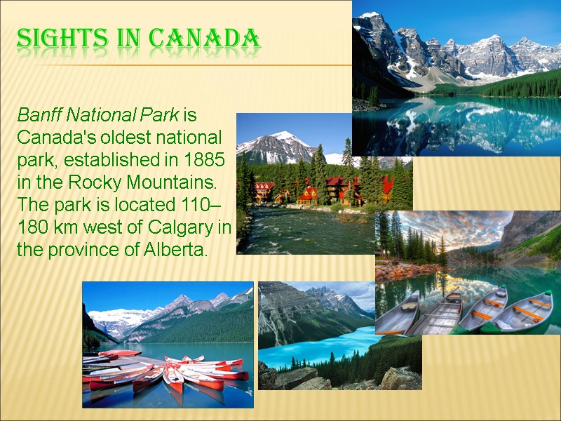
 Sights in canada Banff National Park is Canada's oldest national park, established in 1885 in the Rocky Mountains. The park is located 110–180 km west of Calgary in the province of Alberta.
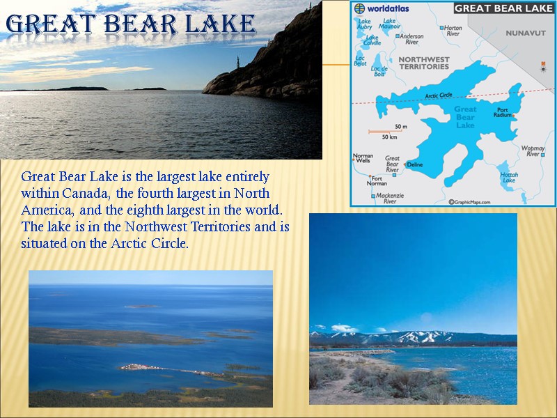
 Great Bear Lake Great Bear Lake is the largest lake entirely within Canada, the fourth largest in North America, and the eighth largest in the world. The lake is in the Northwest Territories and is situated on the Arctic Circle.
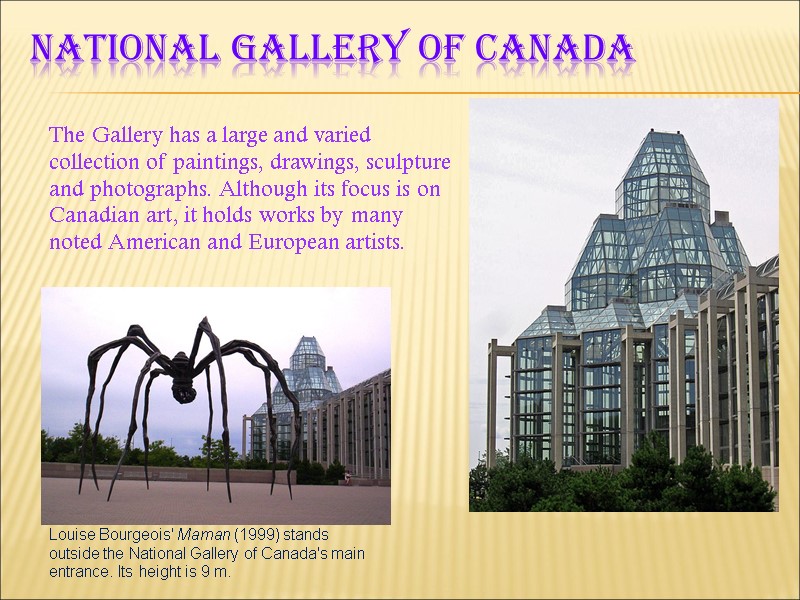
 National Gallery of Canada The Gallery has a large and varied collection of paintings, drawings, sculpture and photographs. Although its focus is on Canadian art, it holds works by many noted American and European artists. Louise Bourgeois' Maman (1999) stands outside the National Gallery of Canada's main entrance. Its height is 9 m.
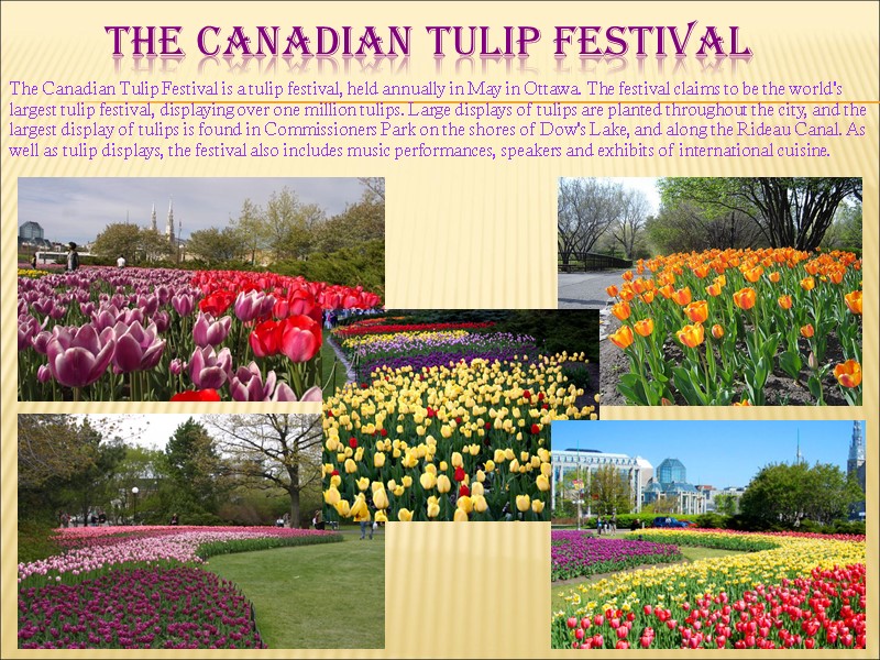
 The Canadian Tulip Festival The Canadian Tulip Festival is a tulip festival, held annually in May in Ottawa. The festival claims to be the world's largest tulip festival, displaying over one million tulips. Large displays of tulips are planted throughout the city, and the largest display of tulips is found in Commissioners Park on the shores of Dow's Lake, and along the Rideau Canal. As well as tulip displays, the festival also includes music performances, speakers and exhibits of international cuisine.
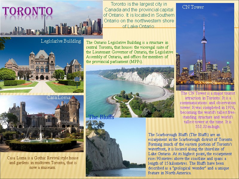
 toronto The CN Tower is a major tourist attraction in Toronto. It is a communications and observation tower. It was completed in 1976, becoming the world's tallest free-standing structure and world's tallest tower at the time. It is 553.33 m-high. Toronto is the largest city in Canada and the provincial capital of Ontario. It is located in Southern Ontario on the northwestern shore of Lake Ontario. The Ontario Legislative Building is a structure in central Toronto, that houses the viceregal suite of the Lieutenant Governor of Ontario, the Legislative Assembly of Ontario, and offices for members of the provincial parliament (MPPs). Casa Loma is a Gothic Revival style house and gardens in midtown Toronto, that is now a museum. Legislative Building CN Tower Casa Loma Scarborough Bluffs The Scarborough Bluffs (The Bluffs) are an escarpment in the Scarborough district of Toronto. Forming much of the eastern portion of Toronto's waterfront, it is located along the shoreline of Lake Ontario. At its highest point, the escarpment rises 90 metres above the coastline and spans a length of 15 kilometres. The Bluffs have been described as a "geological wonder" and a unique feature in North America. The Bluffs
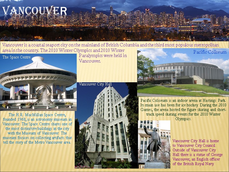
 Vancouver Vancouver is a coastal seaport city on the mainland of British Columbia and the third most populous metropolitan area in the country. The 2010 Winter Olympics and 2010 Winter The H.R. MacMillan Space Centre, founded 1968, is an astronomy museum in Vancouver. The Space Centre shares one of the most distinctive buildings in the city with the Museum of Vancouver. The museum focuses on collecting artifacts that tell the story of the Metro Vancouver area. Pacific Coliseum is an indoor arena at Hastings Park. Its main use has been for ice hockey. During the 2010 Games, the arena hosted the figure skating and short-track speed skating events for the 2010 Winter Olympics. Pacific Coliseum The Space Centre Vancouver City Hall is home to Vancouver City Council. Outside of Vancouver City Hall there is a statue of George Vancouver, an English officer of the British Royal Navy. Vancouver City Hall Paralympics were held in Vancouver.
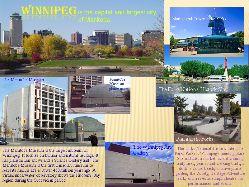
 Winnipeg is the capital and largest city of Manitoba. The Manitoba Museum is the largest museum in Winnipeg. It focuses on human and natural heritage. It has planetarium shows and a Science Gallery hall. The Manitoba Museum is the first Canadian museum to recreate marine life as it was 450 million years ago. A virtual underwater observatory shows the Hudson’s Bay region during the Ordovician period. The Manitoba Museum Manitoba Museum planetarium The Forks National Historic Site (The Forks Park) is Winnipeg’s meeting place. Site includes a market, award-winning sculptures, year-round walking trails, a dock, a canoe beach, a native prarie garden, the Variety, Heritage Adventure Park, and a riverside amphitheatre for performances and events. The Forks National Historic Site Market and Tower at the Forks Plaza at the Forks The Winnipeg Art Gallery
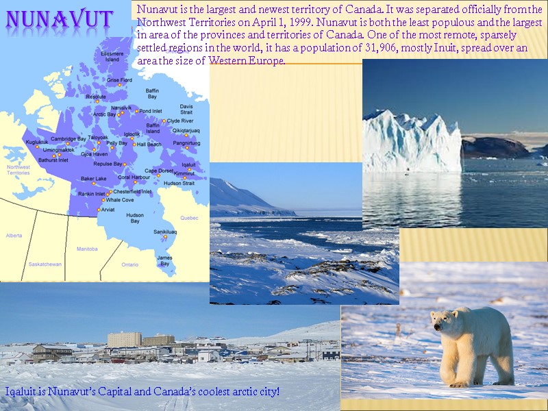
 Nunavut Nunavut is the largest and newest territory of Canada. It was separated officially from the Northwest Territories on April 1, 1999. Nunavut is both the least populous and the largest in area of the provinces and territories of Canada. One of the most remote, sparsely settled regions in the world, it has a population of 31,906, mostly Inuit, spread over an area the size of Western Europe. Iqaluit is Nunavut’s Capital and Canada’s coolest arctic city!
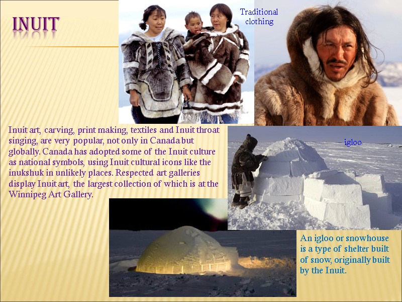
 Inuit igloo An igloo or snowhouse is a type of shelter built of snow, originally built by the Inuit. Traditional clothing Inuit art, carving, print making, textiles and Inuit throat singing, are very popular, not only in Canada but globally. Canada has adopted some of the Inuit culture as national symbols, using Inuit cultural icons like the inukshuk in unlikely places. Respected art galleries display Inuit art, the largest collection of which is at the Winnipeg Art Gallery.
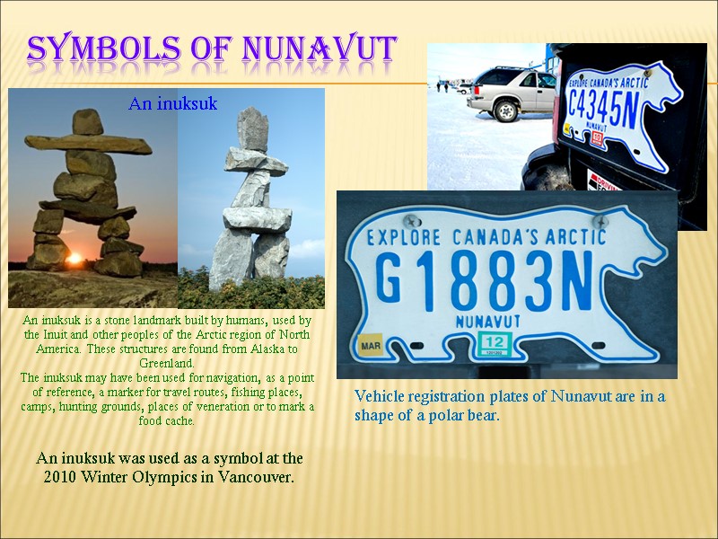
 Symbols of nunavut An inuksuk is a stone landmark built by humans, used by the Inuit and other peoples of the Arctic region of North America. These structures are found from Alaska to Greenland. The inuksuk may have been used for navigation, as a point of reference, a marker for travel routes, fishing places, camps, hunting grounds, places of veneration or to mark a food cache. An inuksuk Vehicle registration plates of Nunavut are in a shape of a polar bear. An inuksuk was used as a symbol at the 2010 Winter Olympics in Vancouver.
